

Yolo Bypass
Encyclopedia
Flood bypass
A flood bypass is a region of land or a large man-made structure that is designed to convey excess flood waters from a river or stream in order to reduce the risk of flooding on the natural river or stream near a key point of interest, such as a city...
es in the Sacramento Valley
Sacramento Valley
The Sacramento Valley is the portion of the California Central Valley that lies to the north of the San Joaquin-Sacramento Delta in the U.S. state of California. It encompasses all or parts of ten counties.-Geography:...
located in Yolo
Yolo County, California
Yolo County is a county located in the northern part of the U.S. state of California, bordered by the other counties of Sacramento, Solano, Napa, Lake, Colusa, and Sutter. The city of Woodland is its county seat, though Davis is its largest city....
and Solano
Solano County, California
Solano County is a county located in Bay-Delta region of the U.S. state of California, about halfway between San Francisco and Sacramento and is one of the nine San Francisco Bay Area counties. The county's population was reported by the U.S. Census to be 413,344 in 2010...
Counties. It protects Sacramento
Sacramento, California
Sacramento is the capital city of the U.S. state of California and the county seat of Sacramento County. It is located at the confluence of the Sacramento River and the American River in the northern portion of California's expansive Central Valley. With a population of 466,488 at the 2010 census,...
and other riverside communities from flooding through a system of weir
Weir
A weir is a small overflow dam used to alter the flow characteristics of a river or stream. In most cases weirs take the form of a barrier across the river that causes water to pool behind the structure , but allows water to flow over the top...
s. These weirs connect the bypass to the Sacramento River
Sacramento River
The Sacramento River is an important watercourse of Northern and Central California in the United States. The largest river in California, it rises on the eastern slopes of the Klamath Mountains, and after a journey south of over , empties into Suisun Bay, an arm of the San Francisco Bay, and...
as well as to various local creeks where the water is eventually drained into the Sacramento-San Joaquin River Delta.
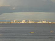
Sacramento experienced several severe floods prior to construction of the bypass. During wet years, the bypass can be completely full of water. The main input to the bypass is through the passive Fremont Weir, where water spills over into the bypass if it reaches the 33.5-foot crest. Downstream, the Sacramento Weir, just north of the city of West Sacramento, can also be opened to divert additional waters to protect Sacramento and West Sacramento if needed. The bypass ends a few miles north of Rio Vista
Rio Vista, California
Rio Vista is a city located in the eastern end of Solano County, California in the San Francisco Bay Area, on the Sacramento River, in the Sacramento River Delta region. The population was 7,360 at the 2010 census....
in the Liberty Farms area, where the bypass joins first Prospect Slough and then Cache Slough adjacent to the connection of the Sacramento Deep Water Ship Channel
Sacramento Deep Water Ship Channel
The Sacramento Deep Water Ship Channel is a canal from the Port of Sacramento in Sacramento, California to the Sacramento River, which flows into San Francisco Bay. It was completed by the United States Army Corps of Engineers in 1963...
. Cache Slough then reconnects with the Sacramento River just North of Rio Vista.
The Yolo Bypass contains the Vic Fazio Yolo Wildlife Area
Vic Fazio Yolo Wildlife Area
The Vic Fazio Yolo Wildlife Area is a wetland restoration project constructed by the United States Army Corps of Engineers and Ducks Unlimited within the Yolo Bypass Wildlife Area located in the Yolo Bypass in Yolo County, California, between the cities of Sacramento and Davis. The Yolo Causeway,...
and was the largest public/private restoration project west of the Florida Everglades. It forms a valuable wetland during many months. In the summer, the bypass is used for agriculture.
The bypass separates the cities of Sacramento (specifically West Sacramento, California
West Sacramento, California
West Sacramento is a city in Yolo County, California. It is contiguous with Sacramento, but is separated by the Sacramento River which is also the county line, so West Sacramento is in a different county than Sacramento...
) from Davis, California
Davis, California
Davis is a city in Yolo County, California, United States. It is part of the Sacramento–Arden-Arcade–Roseville Metropolitan Statistical Area...
. It is crossed by the Yolo Causeway
Yolo Causeway
The Yolo Causeway is a 3.2-mile long elevated highway viaduct on Interstate 80 that crosses the Yolo Bypass floodplain and connects the cities of Sacramento, California and Davis, California ....
, a long highway bridge on Interstate 80
Interstate 80
Interstate 80 is the second-longest Interstate Highway in the United States, following Interstate 90. It is a transcontinental artery running from downtown San Francisco, California to Teaneck, New Jersey in the New York City Metropolitan Area...
. To the north, Interstate 5
Interstate 5
Interstate 5 is the main Interstate Highway on the West Coast of the United States, running largely parallel to the Pacific Ocean coastline from Canada to Mexico . It serves some of the largest cities on the U.S...
also crosses the bypass on the Elkhorn Causeway.