

Webhannet River
Encyclopedia
River
A river is a natural watercourse, usually freshwater, flowing towards an ocean, a lake, a sea, or another river. In a few cases, a river simply flows into the ground or dries up completely before reaching another body of water. Small rivers may also be called by several other names, including...
whose 8963 acres (36.3 km²) watershed
Drainage basin
A drainage basin is an extent or an area of land where surface water from rain and melting snow or ice converges to a single point, usually the exit of the basin, where the waters join another waterbody, such as a river, lake, reservoir, estuary, wetland, sea, or ocean...
is contained entirely within the town of Wells, Maine
Wells, Maine
Wells is a town in York County, Maine, United States. Founded in 1643, it is the third-oldest town in Maine. The population was 9,400 at the 2000 census. Wells Beach is a popular summer destination.-History:...
.
The river has five tributaries, including three with official names: Pope’s Creek, Depot Brook, and Blacksmith Brook. Draining a sandy outwash plain left by the last glacier, they run parallel to the southern Maine coastline behind the heavily developed barrier beaches of Wells and Drakes Island. The river flows into Wells Harbor, then empties between a pair of jetties
Jetty
A jetty is any of a variety of structures used in river, dock, and maritime works that are generally carried out in pairs from river banks, or in continuation of river channels at their outlets into deep water; or out into docks, and outside their entrances; or for forming basins along the...
into the Gulf of Maine
Gulf of Maine
The Gulf of Maine is a large gulf of the Atlantic Ocean on the east coast of North America.It is delineated by Cape Cod at the eastern tip of Massachusetts in the southwest and Cape Sable at the southern tip of Nova Scotia in the northeast. It includes the entire coastlines of the U.S...
.
The Webhannet watershed includes 1510 acres (6.1 km²) of land under conservation, including 1167 acres (4.7 km²) of estuary salt marsh and uplands protected by the Rachel Carson National Wildlife Refuge
Rachel Carson National Wildlife Refuge
The Rachel Carson National Wildlife Refuge is a National Wildlife Refuge made up of several parcels of land along of Maine's southern coast...
.
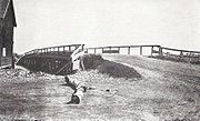
Jetties
In 1961-62, the U.S. Army Corps of Engineers built two rubble-mound jetties to protect the 8 feet (2.4 m) channel to the harbor. Their height above low water ranges from 13 feet (4 m) on their seaward ends to 17 feet (5.2 m) (north jetty) and 16 feet (4.9 m) (south jetty) at their landward ends. Their flat crowns are 7 feet (2.1 m) wide at the seaward end and 5 feet (1.5 m) wide at the landward end.Initially, the north jetty was 580 feet (176.8 m) long, the south one 920 feet (280.4 m), and extended roughly from the inner harbor to just past the beaches. A 1-ft-thick bedding layer and core of 3-in. to 150 lb (68 kg) stone was covered with a double layer of stones weighing a minimum of two tons on the landward section and three tons on the seaward sections, for a total of 20,000 tons of stone. The cost for placing the stone was $95,600.
In 1962-63, the north jetty was extended 200 feet (61 m) seaward.
In 1965, the north and south jetties were extended seaward 1,225 and 1300 ft (396.2 m), respectively. Extensions were parallel to one another, spaced 425 ft (129.5 m) apart, and terminated at a depth of eight feet below the low-water mark.