

Water resources management in Honduras
Encyclopedia
Water resources management (WRM) in Honduras is a work in progress and at times has advanced; however, unstable investment and political climates, strong weather phenomenon, poverty, lack of adequate capacity, and deficient infrastructures have and will continue to challenge developments to water resource management. The State of Honduras is working on a new General Water Law to replace the 1927 Law on Using National Waters and designed to regulate water use and management. The new water law will also create a Water Authority, and the National Council of Water Resources which will serve as an advising and consultative body. Initiatives such as the new 2009 General Water Law and The Water Framework Law (2003) along with international monetary and technical assistance and an increasing global focus on Integrated Water Resources Management (IWRM) provide hope that Honduras will be able to protect and manage well, their water resources.
Honduras has abundant water resources as the country is located in the tropics but there in lies another major challenge, Honduras must constantly prepare for and recover from frequent heavy storms and flooding. This became all to evident in 1998 when Hurricane Mitch
made land fall on Honduras killing 7,000 people. Surface water drains into Honduras' two primary drainage basins; the Atlantic sloping basin representing 82% of the country, and the Pacific sloping basin accounting for the remaining 13% of Honduras. Together, these two basins drain 106,714 km2 per year. Honduras has ample water availability with annual renewable water resources at 13,766 m3 per capita; well above the world per capita average of 8,467 m3 per year or other Latin American countries at 6,739 m3 per year. And finally, and of critical importance, the Global Climate Risk Index ranked Honduras as the world's most vulnerable country to climate change
. This is in large part due to its geographic location in the direct path of many tropical storms and hurricanes.
 Early 20th century developments in Honduran water resources management were in some ways a response to an expanding export market for bananas during the twenties. The need for irrigation within Honduras' banana farming operations became important for economic development. These irrigated banana fields were located in the fertil valleys of Sula
, Aguán y La Ceiba
along the Atlantic coast. And today, irrigation is still very important for the agriculture sector of Honduras as it provides for internal consumption and seeks to amplify exports in non-traditional crops.
In 1927, the Law on Using National Waters (Ley Vigente de Aprovechamiento de Aguas Nacionales) was passed to approve measures addressing water use, irrigation, industrial use, and hydropower. Furthermore, the 1927 law marked the beginning of policy measures designed specifically to manage water resources—albeit not yet integrating sectoral policies. Around 1957, Honduras was mostly under military rule until a freely elected government came to power in 1982. It is unclear how military rule sought to manage water resources during this period. The next major water resources policy measures were signed in 2003 as the Water Framework Law which, among many aspects, aims to reduce poverty through better water resources management. In August 2009, a new General Water Law was passed to replace the 1927 water law. Within the new water law a National Water Authority was created to oversee the work of sector institutions. .
In spite of ongoing efforts to improve water resources management in Honduras, many challenges continue to exist such as insufficient employment generation, unfavorable investment climate, overvalued currency, lack of credit, high commercial interest rates, deficient infrastructure (water delivery, electricity, communications, and roads), weak legal institutions, inadequate education and workforce productivity, burdensome bureaucratic obstacles, and an unstable political climate. As Honduras and the international community work together to address these hurdles, Honduras will improve water supplies, quality of water, efficiency in irrigation, important freshwater wildlife habitats, and reduce annual flood damage.
, Río Ulua
, and Río Aguan. Together, the watersheds and rivers on the "Atlantic slope" account for 87% of the country's surface water runoff. The "Pacific slope" side of Honduras has five major watersheds. The important rivers on the Pacific side of the country include the Rió Choluteca
which supplies water to the capital city of Tegucigalpa, and the Rió Lempa. All together, the rivers on the Pacific slope convey the other 13% of surface water runoff in Honduras. Total surface water runoff is estimated to be 87 km3 per year with 16% of this water leaving Honduras for neighboring countries of El Salvador
, Nicaragua
, and Guatemala
.
Source for tables above: FAO 2000
Groundwater availability is not precise in Honduras, however, wells located in the lowlands of the Atlantic coast historically have good yields and are able to sustainably supplement water needs there. In 1973, CEPAL (La Comisión Económica para América Latina), estimated that 9.09 km3 of renewable groundwater could be sustainably exploited for use. Most of this water (8.02 km3 per year) recharges groundwater on the Atlantic drainage basin of Honduras while the smaller Pacific side basin is recharged by an annual 1.07 km3 of water flowing towards the Pacific. Groundwater use has been important in the valleys of interior highlands such as Choluteca
, Tegucigalpa
, and Comayagua
where agriculture and irrigation are important to local economies; however, groundwater resources are in significant decline and availability of groundwater for irrigation has subsequently been adversely affected.
have become a problem and untreated wastewater originating from large towns and cities has often been discharged into nearby waterways, especially in the case of Lake Yojoa. As of 2000, there were no systematic records of pollution levels in lakes, rivers, and reservoirs.
as its largest natural lake and is nationally significant for its fish resources and the surrounding diversity of flora and fauna that it supports. Lake Yojoa is important for drinking water and irrigation of fruits, grains, and vegetables as well. Yojoa has an approximate surface area 90 km2. In addition to Yojoa, there are five dams and reservoirs with the purposes of storing water for consumer consumption, irrigation, and hydroelectric power operations. These dams regulate the flow of 4.21 km3. The largest of the reservoirs is the El Cajon
with a surface area of 94 km2, slightly larger than Lake Yojoa. Total capacity of the El Cajon reservoir is 5600 million m3 (BCM).
, however WHO/UNICEF reported in 2006 that sanitation coverage was 69% (broadly defined) with a substantial majority proportion being located in urban settings. Water system coverage was 87% (also broadly defined) with a small majority of this being urban. Water For People works in Honduras and they report water service in rural areas is ~44%. Furthermore, much of this water is not properly disinfected posing serious health risks from water-borne diseases.
Drainage in Honduras is of utmost importance to the health of citizens, livestock, and agriculture. Geographically situated in the tropics, Honduras receives large totals of rain from powerful storms and hurricanes, and flooding is an important concern. This constant flooding prompted a 1973 program to build canals and aqueducts in an effort to control flood waters and recuperate agricultural land. Figures from 1991 show that construction of canals to convey floodwater away from valuable land have recuperated 42,000 ha in the Sula Valley and 20,00 ha in the Aguán Valley. Drainage problems in Honduras are most prevalent in the Patuca
, Aguán, Plátano, Ulúa
, and Chamelecón
river basins and cover approximately 340,000 ha.
Notable hydroelectric plants in Honduras include: El Níspero (22.5 MW), Cañaveral (28.5 MW), Río Lindo (80 MW), and El Cajón (300 MW). There are 16 hydro projects that should be commissioned by 2011 and will provide an output of 206.5 MW. Some of the notable projects include: Cangrejal (40 MW), Patuca 3 (100 MW), Los Llanitos (50 MW), and the Jicatuyo (170 MW). El Cajon, as of 2001, was the largest civil engineering project ever undertaken and produced between 45 and 50 percent of the consumed electricity (650-700 kW in 2000) within Honduras.
in Norway
, released a paper in 1998 on water pricing in Honduras and its capital city of Tegucigalpa. Professor Strand then presented the paper's thesis and findings at a World Bank workshop on water pricing implementation, in Washington D.C. Strand's central argument also takes issue with low water tariffs in Honduras and primarily Tegucigalpa. Strand writes, "A key problem is water pricing policy, whereby the price charged of those households with access to piped water is only about 20% of long-run marginal cost (LRMC) of supplying this water". The report also discusses in detail other consequences of low prices in Honduras such as: 1)adverse distributional consequences where the poor pay more than the affluent; 2)leading to wasteful water use among those with access; 3)low revenues for the water administration implies that its ability and incentives to improve and maintain the water system is low.
has been a means to development; however, only the Municipality of San Pedro Sula, the largest industrial and commercial area of Honduras with a population of approximately 527,000, opened a bidding process to national and international companies to partake in the privatization process involving a 30-year concession contract. The project aimed to transfer water services of the city of San Pedro Sula from the municipal division, (División Municipal de Agua (DIMA)), into private hands. In August 2000, the consortium named “Acea y Otros” won the Concession. The consortium consisted of a group of Italian companies (Acea, Agac, Astaldi, Carlo Lotti, and Ghella) and a Honduran company, Terra, that served as representative of various international firms.
The new General Water Law, (la Ley General de Aguas) was approved by the Honduran Congress on August 18, 2009 and will replace the 1927 Law on Using National Waters discussed below. There are a total of 101 articles in the law and the newly created National Water Authority (Autoridad Nacional de Agua) was the principal decision by legislators. This decentralized water authority will replace the Directorate General of Water Resources, a unit of the Secretariat of Natural Resources (SERNA).
The now replaced Law on Using National Waters (Ley Vigente de Aprovechamiento de Aguas Nacionales) was first approved in 1927 and later modified in 1932 and 1945. This water use law enacted special rules in the use of potable and domestic use water, irrigation, navigation, industrial use, fishing, and hydropower. This law also provided for water ownership and use. No special provisions for groundwater were made under this law. Chapter 8 of the 1927 law outlines in fifteen articles how the water of a Honduras shall be used for irrigation. Special note to irrigation is also made in Chapter 3, Art. 10, and Chapter 5, Art. 25 which lists an order of preference for how national waters should be used. Irrigation is listed third after domestic and railway supply respectively.
General Law of the Environment (Reglamento General del Ambiente) or decree No. 104 of 1993. Article 32 names the Public Health Secretary, National Defense of natural resources, and public security responsible for control of illegal sewage dumping on inland waters. Article 74, with special focus on clean water, guaranties a safe and appropriate environment for the population.
The newly created National Water Authority, (Autoridad Nacional de Agua) replaces the General Directorate of Water Resources and will oversee separate institutions responsible for the administration of water resources, regulating their use, water distribution development, conservation, and maintenance. One objective of the new decentralized separation of institutions is to avoid administrative and sectoral conflicts between the institutions themselves.
AJAMs (Asociaciones de Juntas de Agua Municipales) AJAMs are municipal association of boards representing rural communities. The national association of these local boards is the AHJASA (La Asociación Hondureña de Juntas Administradoras de Agua) or The Honduran Association of Water Board Administrators. Membership is made up from 8 departments and includes 500 members that represent 380,000 users. About 50 AJAMs exist throughout Honduran municipalities.
The Honduras water platform (Plataforma del Agua de Honduras) is a group jointly formed by civil society, the international community and the central government. Its fundamental purpose is to promote integrated water resources management in Honduras. This type of management promotes administration of water, its land and related resources, so as to maximize social and economic well-bring. Ideally, this is done in an equitable way without compromising the sustainability of the ecosystems.
RAS-HON (La Red de Agua y Saneamiento de Honduras)- This network aims to improve communication between and among institutions, share best practices and experiences, and promote appropriate technologies. The network is made up of members of social society and the government.
SANAA (Servicio Autonomo Nacional de Acueductos y Alcantarillados)- SANAA is the country's national utility for moving water and providing drainage and sewage systems. SANNA is responsible for the operation of about half of the country's urban water and sewage systems including that of Tegucigalpa
. In 2003, a new Framework Law for water supply and sanitation was passed that included service decentralization from SANAA to the municipalities.
CONASA (Consejo Nacional de Agua Potable y Saneamiento)- CONASA is the national advisory council office of SANAA on potable water and sanitation. A major component of the CONASA mission is to set national policy, strategies, and plans regarding coverage of water services.
ERSAPS (Ente Regulador de los Servicios de Agua Potable y Saneamiento)- ERSAPS serves as the regulator of water and sanitation services.
FHIS (El Fondo Hondureño de Inversión Social)- FHIS channels a large proportion of the funding from national funds and donors for water projects.
Ramsar
sites in Honduras: 1) Barras de Cuero y Salado - 13,225 ha; 2) Laguna de Bacalar - 7,394 ha; 3) Parque Nacional Jeanette Kawas - 78,150 ha; 4) Refugio de Vida Silvestre Punta Izopo
- 11,200 ha; 5) Sistema de Humedales de la Zona Sur de Honduras in Tegucigalpa - 69,711 ha; 6) Subcuenca del Lago de Yojoa - 43,640 ha. Source: (Ramsar) 2005.
struck Honduras in 1998 causing $4 billion in damage and claiming 7,000 lives. Yet climate change is expected to bring even greater weather variability to Honduras with less precipitation overall but more powerful storms and heavy rain during hurricane season spawning landslides and floods. Tegucigalpa
and neighboring Comayagüela (which together form the Honduran capital) are the most affected, due to deforestation and the increased vulnerability to landslides.
According to the first national communication to the United Nations Framework Convention on Climate Change
, the following future impacts from climate change are expected in Honduras: 1) Temperature increases will occur that may alter precipitation patterns and irrigation schedules with the highest temperature increases in May and June. 2) Reduction in precipitation totals with the largest reductions occurring between November and April.
Source: World Bank Climate Change country note on Honduras.
approved a US$30 million loan for the Water and Sanitation Sector Modernization Project in Honduras. Relevant water resource management objectives include: 1) Reinforce the national sector actors to fulfill their new roles as a necessity for successful decentralization of the services; and 2) Reduce non-revenue water
in selected areas of Tegucigalpa to provide immediate impact on the service quality. Jane Armitage, World Bank Director for Central America, says,"The Water and Sanitation Sector Modernization Project will not only enable an environment that develops and strengthens service providers, but also will foster transparency and improve their effectiveness in the water sector".
The Inter-American Development Bank
(IDB) also approved a 40 year US$30 million loan to Honduras in 2006 that is now ('09) in implementation phases. The soft loan targets improvements in potable water and supports decentralization, improved service management and finance infrastructures. The program also finances studies for transferring Tegucigalpa's potable water, currently managed by SANAA, to the Municipality of the Central District of Tegucigalpa. Most of the resources from this IDB loan are being used to finance expansion of potable water.
A US$ 4.6 million grant by the International Finance Corporation
(IFC) and the Dutch government is benefiting 40,000 low-income households in rural and urban areas of Honduras by improving the financing of water and wastewater infrastructure projects.
At the initiative of the United Nations Development Program's country office in Honduras, the Honduran Water Platform (HWP) was established in 2003 with the aim of implementing more suitable management of the country's water resources. This led to the 2004 collaboration of the Geological Survey of Denmark and Greenland (GEUS) with the Kvistgaard Consult. Together, these two entities carried out a project that supported the Honduran Water Platform (HWP) in its preparation of a water resource strategy and action plan.
The Canadian International Development Agency is supporting the Honduran water sector in the following avenues: 1) PASOS water project by CARE International (2006–2011) with a project cost of US $15 million is opening sustainable access to potable water in the Northern coast, strengthening local government mechanisms that are providing services and protections to local watersheds; 2) (UNICEF), with financing from Canada is working to improve water quality and basic hygiene habits, advocate for those with low coverage of safe water, and help prepare for future water emergencies. The project is being implemented in 40 municipalities and 15 neighborhoods in the capital of Tegucigalpa; 3) Canada is planning three new projects with a focus on river basin management for the Choluteca, Nacaome, Lancetilla/Bañaderos, Tocoa and Mejocote Rivers; 4) Canada assisted in the aftermath of Hurricane Mitch in 1998 to repair water service and recently, Canada has come to the aid of Honduras after tropical depression 16 in 2008.
Sources: (SERNA) 2007; (Canadian International Development Agency (CIDA) 2007.
USAID has implemented a four year, US $23 million program called MIRA (Manejo Integrado de Recursos Ambientales) or Integrated Management of Environmental Resources. MIRA is aimed at strengthening the local capacity to create and administer watershed management plans. The program will also stimulate policy reform related to the integrated management of natural resources. MIRA promotes stakeholder dialogues that involve local authorities, private businesses, other donors, NGOs, and the beneficiary communities. The objective here is of building consensus on the vision and priorities needed to achieve that vision. USAID/MIRA is working in 12 out of the 21 watersheds in Honduras. Four of these watersheds (Choluteca, Cangrejal, Patuca and the Bay Islands) had been previously designated by USAID as priority watersheds. An additional eight watersheds were selected based upon bio-physical, socio-economic and institutional criteria.
Honduras has abundant water resources as the country is located in the tropics but there in lies another major challenge, Honduras must constantly prepare for and recover from frequent heavy storms and flooding. This became all to evident in 1998 when Hurricane Mitch
Hurricane Mitch
Hurricane Mitch was the most powerful hurricane and the most destructive of the 1998 Atlantic hurricane season, with maximum sustained winds of 180 mph . The storm was the thirteenth tropical storm, ninth hurricane, and third major hurricane of the season. Along with Hurricane Georges, Mitch...
made land fall on Honduras killing 7,000 people. Surface water drains into Honduras' two primary drainage basins; the Atlantic sloping basin representing 82% of the country, and the Pacific sloping basin accounting for the remaining 13% of Honduras. Together, these two basins drain 106,714 km2 per year. Honduras has ample water availability with annual renewable water resources at 13,766 m3 per capita; well above the world per capita average of 8,467 m3 per year or other Latin American countries at 6,739 m3 per year. And finally, and of critical importance, the Global Climate Risk Index ranked Honduras as the world's most vulnerable country to climate change
Climate change
Climate change is a significant and lasting change in the statistical distribution of weather patterns over periods ranging from decades to millions of years. It may be a change in average weather conditions or the distribution of events around that average...
. This is in large part due to its geographic location in the direct path of many tropical storms and hurricanes.
Water management history and recent developments
Of a historical note, research and subsequent literature of Water Resources Management in Honduras from the Late Classic period (A.D. 600-900) in Copán, a water-rich region of western Honduras, have suggested that lagoons located in Copán's urban residential sectors may have been conceptualized, utilized, and maintained by the inhabitants of surrounding domestic groups. These lagoons, thought to be forms of communal property, created an economic and ideological basis for social integration. Because the lagoons were seen as a shared communal resource, it was difficult for community elites and power brokers to centralize power and monopolize water resources. Presumably, management of water resources continued to evolve among these native communities until the Spanish conquest. Honduras later declared independence from Spain in 1821; however, information regarding water resource management until 1927 has not been located for this overview.San Pedro Sula
San Pedro Sula is a city in Honduras. It is located in the northwest corner of the country, in the Valle de Sula , about 60 km south of Puerto Cortés on the Caribbean. With an estimated population of 638,259 people in the main municipality, and 802,598 in its metro area , it is the second...
, Aguán y La Ceiba
La Ceiba
La Ceiba is a port city on the northern coast of Honduras in Central America. It is located on the southern edge of the Caribbean, forming part of the south eastern boundary of the Gulf of Honduras...
along the Atlantic coast. And today, irrigation is still very important for the agriculture sector of Honduras as it provides for internal consumption and seeks to amplify exports in non-traditional crops.
In 1927, the Law on Using National Waters (Ley Vigente de Aprovechamiento de Aguas Nacionales) was passed to approve measures addressing water use, irrigation, industrial use, and hydropower. Furthermore, the 1927 law marked the beginning of policy measures designed specifically to manage water resources—albeit not yet integrating sectoral policies. Around 1957, Honduras was mostly under military rule until a freely elected government came to power in 1982. It is unclear how military rule sought to manage water resources during this period. The next major water resources policy measures were signed in 2003 as the Water Framework Law which, among many aspects, aims to reduce poverty through better water resources management. In August 2009, a new General Water Law was passed to replace the 1927 water law. Within the new water law a National Water Authority was created to oversee the work of sector institutions. .
In spite of ongoing efforts to improve water resources management in Honduras, many challenges continue to exist such as insufficient employment generation, unfavorable investment climate, overvalued currency, lack of credit, high commercial interest rates, deficient infrastructure (water delivery, electricity, communications, and roads), weak legal institutions, inadequate education and workforce productivity, burdensome bureaucratic obstacles, and an unstable political climate. As Honduras and the international community work together to address these hurdles, Honduras will improve water supplies, quality of water, efficiency in irrigation, important freshwater wildlife habitats, and reduce annual flood damage.
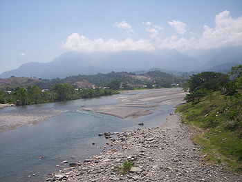
Surface and groundwater resources
Honduras is divided into two large drainage basins each consisting of watersheds and rivers that drain towards the oceans. The Atlantic sloping side of Honduras is home to 13 watersheds including Honduras' largest rivers by volume such as the Río PatucaPatuca
Patuca is a municipality in the south of the Honduran department of Olancho, east of Juticalpa and south of Catacamas. It contains the Patuca River which is the second largest in Central America.-External links:*...
, Río Ulua
Ulúa River
The Ulua River is a river in western Honduras. It rises in the central mountainous area of the country close to La Paz and runs 150 miles approximately due northwards to the east end of the Gulf of Honduras at . En route, it is joined by the Sulaco River, the Otoro River and the Chamelecon River....
, and Río Aguan. Together, the watersheds and rivers on the "Atlantic slope" account for 87% of the country's surface water runoff. The "Pacific slope" side of Honduras has five major watersheds. The important rivers on the Pacific side of the country include the Rió Choluteca
Choluteca River
The Choluteca River is a river in southern Honduras. Its source is in the department of Francisco Morazán, near Lepaterique , and from there it flows North through the city of Tegucigalpa, then South through the department of El Paraíso, and the department and city of Choluteca...
which supplies water to the capital city of Tegucigalpa, and the Rió Lempa. All together, the rivers on the Pacific slope convey the other 13% of surface water runoff in Honduras. Total surface water runoff is estimated to be 87 km3 per year with 16% of this water leaving Honduras for neighboring countries of El Salvador
El Salvador
El Salvador or simply Salvador is the smallest and the most densely populated country in Central America. The country's capital city and largest city is San Salvador; Santa Ana and San Miguel are also important cultural and commercial centers in the country and in all of Central America...
, Nicaragua
Nicaragua
Nicaragua is the largest country in the Central American American isthmus, bordered by Honduras to the north and Costa Rica to the south. The country is situated between 11 and 14 degrees north of the Equator in the Northern Hemisphere, which places it entirely within the tropics. The Pacific Ocean...
, and Guatemala
Guatemala
Guatemala is a country in Central America bordered by Mexico to the north and west, the Pacific Ocean to the southwest, Belize to the northeast, the Caribbean to the east, and Honduras and El Salvador to the southeast...
.
| River Basin | Area (km2) | Volume (106 m3/year) |
|---|---|---|
| Atlantic sloping watershed | 88,034 | 75,397 |
| Río Motagua | 2,141.2 | 2,072 |
| Río Chamelecón Chamelecón Chamelecón is a suburb of San Pedro Sula in Honduras.It came to world attention on 23 December 2004 when 28 people were murdered and another 28 injured while returning from the centre of San Pedro Sula by the MS-13 gang opposed to the restoration of the death penalty in Honduras. Many of the... |
4,399.3 | 3,264 |
| Río Ulua Ulúa River The Ulua River is a river in western Honduras. It rises in the central mountainous area of the country close to La Paz and runs 150 miles approximately due northwards to the east end of the Gulf of Honduras at . En route, it is joined by the Sulaco River, the Otoro River and the Chamelecon River.... |
21,230.6 | 16,959 |
| Río Lean Lean -In business:* Lean Startup, how to start a company in a lean way* Lean manufacturing, process improvement discipline* Lean construction is a translation and adaption of lean manufacturing principles and practices to the end-to-end design and construction process... |
2,161 | Included in Cangrejal |
| Río Cangrejal | 1,255 | 271 |
| Río Cangrejal-Aguan | 1,179 | Included in Cangrejal |
| Río Aguan | 10,386.1 | 7,329 |
| Río Sico | 7,090.8 | 5,908 |
| Río Plátano | 1,248.3 | 3,225 |
| Río Patuca Patuca Patuca is a municipality in the south of the Honduran department of Olancho, east of Juticalpa and south of Catacamas. It contains the Patuca River which is the second largest in Central America.-External links:*... |
24,762.4 | 23,706 |
| Río Guarunta | 5,561.0 | Included in Kruta |
| Río Kruta | 1,314 | 7,109 |
| Río Segovia Segovia Segovia is a city in Spain, the capital of Segovia Province in the autonomous community of Castile and León. It is situated north of Madrid, 30 minutes by high speed train. The municipality counts some 55,500 inhabitants.-Etymology:... |
5,305.2 | 5,554 |
| River Basin | Area (km2) | Volume (106 m3/year) |
|---|---|---|
| Pacific sloping watershed | 18,680 | 11,527 |
| Río Lempa | 5,717 | 3 872 |
| Río Goascorán Goascorán Goascorán is a municipality in the Honduran department of Valle.-External links:... |
1,576.6 | 1,200 |
| Río Nacaome Nacaome Nacaome is the capital city of the Valle department of Honduras. It is a manufacturing and commercial center located on the Nacaome River.Nacaome is an old city founded when aboriginal Cholulas and Chaparrastiques, tired of fighting each other, thought it best to join together to build new houses... |
2,745.1 | 2,061 |
| Río Choluteca Choluteca River The Choluteca River is a river in southern Honduras. Its source is in the department of Francisco Morazán, near Lepaterique , and from there it flows North through the city of Tegucigalpa, then South through the department of El Paraíso, and the department and city of Choluteca... |
7,681.6 | 3,032 |
| Río Negro/Río Sampile | 959.5 | 1,362 |
| River Basin | Area (km2) | Volume (106 m3/year) |
|---|---|---|
| Total from Pacific and Atlantic | 106,714 | 86,924 |
Source for tables above: FAO 2000
Groundwater availability is not precise in Honduras, however, wells located in the lowlands of the Atlantic coast historically have good yields and are able to sustainably supplement water needs there. In 1973, CEPAL (La Comisión Económica para América Latina), estimated that 9.09 km3 of renewable groundwater could be sustainably exploited for use. Most of this water (8.02 km3 per year) recharges groundwater on the Atlantic drainage basin of Honduras while the smaller Pacific side basin is recharged by an annual 1.07 km3 of water flowing towards the Pacific. Groundwater use has been important in the valleys of interior highlands such as Choluteca
Choluteca River
The Choluteca River is a river in southern Honduras. Its source is in the department of Francisco Morazán, near Lepaterique , and from there it flows North through the city of Tegucigalpa, then South through the department of El Paraíso, and the department and city of Choluteca...
, Tegucigalpa
Tegucigalpa
Tegucigalpa , and commonly referred as Tegus , is the capital of Honduras and seat of government of the Republic, along with its twin sister Comayagüela. Founded on September 29, 1578 by the Spanish, it became the country's capital on October 30, 1880 under President Marco Aurelio Soto...
, and Comayagua
Comayagua
Comayagua is a city in Honduras, some 80 km northwest of Tegucigalpa on the highway to San Pedro Sula at an elevation of 594 meters above sea level. In 2003 the estimated population was 60,000 people. It is the capital of the Comayagua department of Honduras. The city is noted for its wealth...
where agriculture and irrigation are important to local economies; however, groundwater resources are in significant decline and availability of groundwater for irrigation has subsequently been adversely affected.
Water quality
Water pollution to both surface and groundwater is primarily due to agricultural run-off and untreated effluents from mining activities. Honduras produces coffee for export along the Atlantic coast and many of the pesticides used become toxic effluents that contaminate rivers and seep into groundwater tables. Heavy metals that escape from mining operations along the Gulf of FonsecaGulf of Fonseca
The Gulf of Fonseca , part of the Pacific Ocean, is a gulf in Central America, bordering El Salvador, Honduras and Nicaragua.-History:Fonseca Bay was discovered in 1522 by Gil Gonzalez de Avila, and named by him after his patron, Archbishop Juan Fonseca, the implacable enemy of Columbus.In 1849, E. G...
have become a problem and untreated wastewater originating from large towns and cities has often been discharged into nearby waterways, especially in the case of Lake Yojoa. As of 2000, there were no systematic records of pollution levels in lakes, rivers, and reservoirs.
Natural and artificial storage capacity
Apart from numerous small lakes, Honduras counts Lake YojoaLake Yojoa
Lake Yojoa is the largest lake in Honduras with a surface area of 285 square kilometers and an average depth of 15 meters . At an altitude of 700 meters , it lies in a depression formed by volcanoes...
as its largest natural lake and is nationally significant for its fish resources and the surrounding diversity of flora and fauna that it supports. Lake Yojoa is important for drinking water and irrigation of fruits, grains, and vegetables as well. Yojoa has an approximate surface area 90 km2. In addition to Yojoa, there are five dams and reservoirs with the purposes of storing water for consumer consumption, irrigation, and hydroelectric power operations. These dams regulate the flow of 4.21 km3. The largest of the reservoirs is the El Cajon
El Cajón Dam (Honduras)
The El Cajón Dam, officially known as Central Hidroeléctrica Francisco Morazán, is a hydroelectric power plant located in Western Honduras. The dam impounds the Comayagua river which derives its large volume from two large tributaries, Humuya and Sulaco...
with a surface area of 94 km2, slightly larger than Lake Yojoa. Total capacity of the El Cajon reservoir is 5600 million m3 (BCM).
Potable water and sanitation
Data on water and sanitation in Honduras varies by resource as already pointed out in Water supply and sanitation in HondurasWater supply and sanitation in Honduras
Water supply and sanitation coverage in Honduras has increased significantly in the last decades. However, the sector is still characterized by poor service quality and poor efficiency in many places. Coverage gaps still remain, particularly in rural areas....
, however WHO/UNICEF reported in 2006 that sanitation coverage was 69% (broadly defined) with a substantial majority proportion being located in urban settings. Water system coverage was 87% (also broadly defined) with a small majority of this being urban. Water For People works in Honduras and they report water service in rural areas is ~44%. Furthermore, much of this water is not properly disinfected posing serious health risks from water-borne diseases.
Irrigation and drainage
The General Directorate of Water Resources (La Dirección General de Recursos Hídricos (DGRH) is responsible for the development, operation, and maintenance of irrigation systems. Honduras could potentially irrigate 500,000 ha of agricultural land; however, as of 2000, only 73,000 ha were under irrigation. About 56,000 ha of the irrigated land is held in private arrangements of which about 47,000 ha is actually being watered. The remaining 17,000 ha is publicly held land. The move to privatization began in the 1990s when the Honduran government adopted a policy of privatization and decentralization that included an eventual transfer of irrigation systems to users. These irrigation system transfers are not being eagerly adopted as farmers have a high preference towards privatization and do not want the added responsibility of system maintenance. The Cortes, Yoro, and Choluteca provinces are the most developed representing ~50,000 ha of irrigated area. In response to the continuous increase in water utilization, a "25-year master plan" is being promoted by the Honduran government for both irrigation and drainage with total investment of US $143 million.Drainage in Honduras is of utmost importance to the health of citizens, livestock, and agriculture. Geographically situated in the tropics, Honduras receives large totals of rain from powerful storms and hurricanes, and flooding is an important concern. This constant flooding prompted a 1973 program to build canals and aqueducts in an effort to control flood waters and recuperate agricultural land. Figures from 1991 show that construction of canals to convey floodwater away from valuable land have recuperated 42,000 ha in the Sula Valley and 20,00 ha in the Aguán Valley. Drainage problems in Honduras are most prevalent in the Patuca
Patuca
Patuca is a municipality in the south of the Honduran department of Olancho, east of Juticalpa and south of Catacamas. It contains the Patuca River which is the second largest in Central America.-External links:*...
, Aguán, Plátano, Ulúa
Ulúa River
The Ulua River is a river in western Honduras. It rises in the central mountainous area of the country close to La Paz and runs 150 miles approximately due northwards to the east end of the Gulf of Honduras at . En route, it is joined by the Sulaco River, the Otoro River and the Chamelecon River....
, and Chamelecón
Chamelecón
Chamelecón is a suburb of San Pedro Sula in Honduras.It came to world attention on 23 December 2004 when 28 people were murdered and another 28 injured while returning from the centre of San Pedro Sula by the MS-13 gang opposed to the restoration of the death penalty in Honduras. Many of the...
river basins and cover approximately 340,000 ha.
Hydropower
Installed capacity of electricity generation in Honduras is ~1,500 MW, while hydroelectric output accounts for about 500 MW (33%) of total output. There is large potential for hydropower generation amounting to about 5,000 MW. This growth in hydropower potential resulted from the efforts of former president, Ricardo Mauduro, whom set up a Special Commission for the Development of Hydroelectric Projects.Notable hydroelectric plants in Honduras include: El Níspero (22.5 MW), Cañaveral (28.5 MW), Río Lindo (80 MW), and El Cajón (300 MW). There are 16 hydro projects that should be commissioned by 2011 and will provide an output of 206.5 MW. Some of the notable projects include: Cangrejal (40 MW), Patuca 3 (100 MW), Los Llanitos (50 MW), and the Jicatuyo (170 MW). El Cajon, as of 2001, was the largest civil engineering project ever undertaken and produced between 45 and 50 percent of the consumed electricity (650-700 kW in 2000) within Honduras.
Water pricing
Jon Strand, professor of economics at the University of OsloUniversity of Oslo
The University of Oslo , formerly The Royal Frederick University , is the oldest and largest university in Norway, situated in the Norwegian capital of Oslo. The university was founded in 1811 and was modelled after the recently established University of Berlin...
in Norway
Norway
Norway , officially the Kingdom of Norway, is a Nordic unitary constitutional monarchy whose territory comprises the western portion of the Scandinavian Peninsula, Jan Mayen, and the Arctic archipelago of Svalbard and Bouvet Island. Norway has a total area of and a population of about 4.9 million...
, released a paper in 1998 on water pricing in Honduras and its capital city of Tegucigalpa. Professor Strand then presented the paper's thesis and findings at a World Bank workshop on water pricing implementation, in Washington D.C. Strand's central argument also takes issue with low water tariffs in Honduras and primarily Tegucigalpa. Strand writes, "A key problem is water pricing policy, whereby the price charged of those households with access to piped water is only about 20% of long-run marginal cost (LRMC) of supplying this water". The report also discusses in detail other consequences of low prices in Honduras such as: 1)adverse distributional consequences where the poor pay more than the affluent; 2)leading to wasteful water use among those with access; 3)low revenues for the water administration implies that its ability and incentives to improve and maintain the water system is low.
Water privatization
Water privatization in HondurasWater privatization in Honduras
Water privatization in Honduras has been limited to the city of San Pedro Sula which has signed a 30-year concession contract with a private operator. Two other cities, Puerto Cortes and Choloma, have introduced an interesting management model that cannot be characterized as either private or...
has been a means to development; however, only the Municipality of San Pedro Sula, the largest industrial and commercial area of Honduras with a population of approximately 527,000, opened a bidding process to national and international companies to partake in the privatization process involving a 30-year concession contract. The project aimed to transfer water services of the city of San Pedro Sula from the municipal division, (División Municipal de Agua (DIMA)), into private hands. In August 2000, the consortium named “Acea y Otros” won the Concession. The consortium consisted of a group of Italian companies (Acea, Agac, Astaldi, Carlo Lotti, and Ghella) and a Honduran company, Terra, that served as representative of various international firms.
Legal and institutional framework
The 1927 Law on Using National Waters (Ley Vigente de Aprovechamiento de Aguas Nacionales) was a major step for Honduras in water resource management (WRM). This law however, did not recognize multi-sectoral uses of water, therefore, water use in each WRM sector became regulated by their own respective sectoral law. Furthermore, major institutions such as SANAA, CONASA, and ERSAPS have operational functions in both water and sanitation services. As of August 2009, Honduras has passed a new General Water Law with a National Water Authority to provide regulation and oversight to institutions responsible for distinct sectors of water resource management. The General Water Law is discussed below.Water laws
Water Framework Law (Ley Marco Del Sector Agua Potable Y Saneamiento) and decree No. 118 of 2003 constitutes a jurisdictional framework for planning and organizing the management and integrated use of national water resources. A notable strategy of the framework is to reduce poverty through proper management of water resources and by promoting sustainable development. The framework also decentralized management of water away from SANNA to the municipalities.The new General Water Law, (la Ley General de Aguas) was approved by the Honduran Congress on August 18, 2009 and will replace the 1927 Law on Using National Waters discussed below. There are a total of 101 articles in the law and the newly created National Water Authority (Autoridad Nacional de Agua) was the principal decision by legislators. This decentralized water authority will replace the Directorate General of Water Resources, a unit of the Secretariat of Natural Resources (SERNA).
The now replaced Law on Using National Waters (Ley Vigente de Aprovechamiento de Aguas Nacionales) was first approved in 1927 and later modified in 1932 and 1945. This water use law enacted special rules in the use of potable and domestic use water, irrigation, navigation, industrial use, fishing, and hydropower. This law also provided for water ownership and use. No special provisions for groundwater were made under this law. Chapter 8 of the 1927 law outlines in fifteen articles how the water of a Honduras shall be used for irrigation. Special note to irrigation is also made in Chapter 3, Art. 10, and Chapter 5, Art. 25 which lists an order of preference for how national waters should be used. Irrigation is listed third after domestic and railway supply respectively.
General Law of the Environment (Reglamento General del Ambiente) or decree No. 104 of 1993. Article 32 names the Public Health Secretary, National Defense of natural resources, and public security responsible for control of illegal sewage dumping on inland waters. Article 74, with special focus on clean water, guaranties a safe and appropriate environment for the population.
Institutional framework
SERNA (La Secretaría de Recursos Naturales y Ambiente)- SERNA, the Ministry of Natural Resources and Environment is charged with responsibly utilizing water resources and sectoral management of water resources. SERNA oversees DGRH and CESCCO (both described below).- The General Directorate of Water Resources (La Dirección General de Recursos Hídricos (DGRH)), a former unit of SERNA, was charged with the development, operation, and maintenance of irrigation systems. DGRH also mapped water use concessions and follows up on hydrological data.
- The Center for Contaminant Control (Centro de Estudios y Control de Contaminantes (CESCCO) studies water quality.
The newly created National Water Authority, (Autoridad Nacional de Agua) replaces the General Directorate of Water Resources and will oversee separate institutions responsible for the administration of water resources, regulating their use, water distribution development, conservation, and maintenance. One objective of the new decentralized separation of institutions is to avoid administrative and sectoral conflicts between the institutions themselves.
AJAMs (Asociaciones de Juntas de Agua Municipales) AJAMs are municipal association of boards representing rural communities. The national association of these local boards is the AHJASA (La Asociación Hondureña de Juntas Administradoras de Agua) or The Honduran Association of Water Board Administrators. Membership is made up from 8 departments and includes 500 members that represent 380,000 users. About 50 AJAMs exist throughout Honduran municipalities.
The Honduras water platform (Plataforma del Agua de Honduras) is a group jointly formed by civil society, the international community and the central government. Its fundamental purpose is to promote integrated water resources management in Honduras. This type of management promotes administration of water, its land and related resources, so as to maximize social and economic well-bring. Ideally, this is done in an equitable way without compromising the sustainability of the ecosystems.
RAS-HON (La Red de Agua y Saneamiento de Honduras)- This network aims to improve communication between and among institutions, share best practices and experiences, and promote appropriate technologies. The network is made up of members of social society and the government.
SANAA (Servicio Autonomo Nacional de Acueductos y Alcantarillados)- SANAA is the country's national utility for moving water and providing drainage and sewage systems. SANNA is responsible for the operation of about half of the country's urban water and sewage systems including that of Tegucigalpa
Tegucigalpa
Tegucigalpa , and commonly referred as Tegus , is the capital of Honduras and seat of government of the Republic, along with its twin sister Comayagüela. Founded on September 29, 1578 by the Spanish, it became the country's capital on October 30, 1880 under President Marco Aurelio Soto...
. In 2003, a new Framework Law for water supply and sanitation was passed that included service decentralization from SANAA to the municipalities.
CONASA (Consejo Nacional de Agua Potable y Saneamiento)- CONASA is the national advisory council office of SANAA on potable water and sanitation. A major component of the CONASA mission is to set national policy, strategies, and plans regarding coverage of water services.
ERSAPS (Ente Regulador de los Servicios de Agua Potable y Saneamiento)- ERSAPS serves as the regulator of water and sanitation services.
FHIS (El Fondo Hondureño de Inversión Social)- FHIS channels a large proportion of the funding from national funds and donors for water projects.
International agreements
Honduras shares rivers and watersheds with its neighbors and 16% of the surface water in Honduras leaves the country by river towards El Salvador, Guatemala, and Nicaragua. For Example, the Río Lempa (3.87 km3) and the Río Goascorán (1.2 km3) together convey 5.07 km3 of water per year to El Salvador. No international agreements exist with the aforementioned countries to regulate the joint utilization and management of shared water resources. There exists only treaties marking geographical limits that do not take into consideration shared water resources.Protected areas
Along with the Ramsar sites below, UNESCO recognizes the Maya Site of Copan and the Río Plátano Biosphere Reserve as World Heritage Sites. These protected areas offer ecosystem services such as protection from floods, and natural water purification. Deforestation, poor water resource management and climate change may all factor into the future health of these protected areas.Ramsar
Ramsar
Ramsar is a city in and the capital of Ramsar County, Mazandaran Province, Iran. At the 2006 census, its population was 31,659, in 9,421 families....
sites in Honduras: 1) Barras de Cuero y Salado - 13,225 ha; 2) Laguna de Bacalar - 7,394 ha; 3) Parque Nacional Jeanette Kawas - 78,150 ha; 4) Refugio de Vida Silvestre Punta Izopo
Punta Izopo National Park
Punta Izopo Wildlife Refuge is a Wildlife refuge located in the municipality of Tela, on the northern Caribbean coast of the Atlántida department of Honduras. It have an altitude of 118 metres....
- 11,200 ha; 5) Sistema de Humedales de la Zona Sur de Honduras in Tegucigalpa - 69,711 ha; 6) Subcuenca del Lago de Yojoa - 43,640 ha. Source: (Ramsar) 2005.
Potential climate change impacts
The Global Climate Risk Index 4 constructed for the period between 1997 and 2006 and covering both human and economic impacts, ranks Honduras 1st in the world, underscoring the country’s very high vulnerability to climate related events, mostly to storms. This vulnerability was evident when Hurricane MitchHurricane Mitch
Hurricane Mitch was the most powerful hurricane and the most destructive of the 1998 Atlantic hurricane season, with maximum sustained winds of 180 mph . The storm was the thirteenth tropical storm, ninth hurricane, and third major hurricane of the season. Along with Hurricane Georges, Mitch...
struck Honduras in 1998 causing $4 billion in damage and claiming 7,000 lives. Yet climate change is expected to bring even greater weather variability to Honduras with less precipitation overall but more powerful storms and heavy rain during hurricane season spawning landslides and floods. Tegucigalpa
Tegucigalpa
Tegucigalpa , and commonly referred as Tegus , is the capital of Honduras and seat of government of the Republic, along with its twin sister Comayagüela. Founded on September 29, 1578 by the Spanish, it became the country's capital on October 30, 1880 under President Marco Aurelio Soto...
and neighboring Comayagüela (which together form the Honduran capital) are the most affected, due to deforestation and the increased vulnerability to landslides.
According to the first national communication to the United Nations Framework Convention on Climate Change
United Nations Framework Convention on Climate Change
The United Nations Framework Convention on Climate Change is an international environmental treaty produced at the United Nations Conference on Environment and Development , informally known as the Earth Summit, held in Rio de Janeiro from June 3 to 14, 1992...
, the following future impacts from climate change are expected in Honduras: 1) Temperature increases will occur that may alter precipitation patterns and irrigation schedules with the highest temperature increases in May and June. 2) Reduction in precipitation totals with the largest reductions occurring between November and April.
Source: World Bank Climate Change country note on Honduras.
Erosion
In an effort to increase exports under global demand for wood, Honduras has cut down forest at an increasing rate and by 1996, annual deforestation was at 108,000 ha. About 170,000 ha of land in Honduras are subject to soil erosion. Without forest in place, rains have eroded large areas of land and rivers are carrying valuable topsoil downstream. Where dams are built, they have began to silt up with the possible effect of reducing their hydroelectric potential.Multilateral cooperation
In 2007, The World BankWorld Bank
The World Bank is an international financial institution that provides loans to developing countries for capital programmes.The World Bank's official goal is the reduction of poverty...
approved a US$30 million loan for the Water and Sanitation Sector Modernization Project in Honduras. Relevant water resource management objectives include: 1) Reinforce the national sector actors to fulfill their new roles as a necessity for successful decentralization of the services; and 2) Reduce non-revenue water
Non-revenue water
Non revenue water is water that has been produced and is “lost” before it reaches the customer. Losses can be real losses or apparent losses . High levels of NRW are detrimental to the financial viability of water utilities, as well to the quality of water itself...
in selected areas of Tegucigalpa to provide immediate impact on the service quality. Jane Armitage, World Bank Director for Central America, says,"The Water and Sanitation Sector Modernization Project will not only enable an environment that develops and strengthens service providers, but also will foster transparency and improve their effectiveness in the water sector".
The Inter-American Development Bank
Inter-American Development Bank
The Inter-American Development Bank is the largest source of development financing for Latin America and the Caribbean...
(IDB) also approved a 40 year US$30 million loan to Honduras in 2006 that is now ('09) in implementation phases. The soft loan targets improvements in potable water and supports decentralization, improved service management and finance infrastructures. The program also finances studies for transferring Tegucigalpa's potable water, currently managed by SANAA, to the Municipality of the Central District of Tegucigalpa. Most of the resources from this IDB loan are being used to finance expansion of potable water.
A US$ 4.6 million grant by the International Finance Corporation
International Finance Corporation
The International Finance Corporation promotes sustainable private sector investment in developing countries.IFC is a member of the World Bank Group and is headquartered in Washington, D.C., United States....
(IFC) and the Dutch government is benefiting 40,000 low-income households in rural and urban areas of Honduras by improving the financing of water and wastewater infrastructure projects.
At the initiative of the United Nations Development Program's country office in Honduras, the Honduran Water Platform (HWP) was established in 2003 with the aim of implementing more suitable management of the country's water resources. This led to the 2004 collaboration of the Geological Survey of Denmark and Greenland (GEUS) with the Kvistgaard Consult. Together, these two entities carried out a project that supported the Honduran Water Platform (HWP) in its preparation of a water resource strategy and action plan.
Bilateral Cooperation
Support by Canada and a project from the United States with USAID are selected and summarized here.The Canadian International Development Agency is supporting the Honduran water sector in the following avenues: 1) PASOS water project by CARE International (2006–2011) with a project cost of US $15 million is opening sustainable access to potable water in the Northern coast, strengthening local government mechanisms that are providing services and protections to local watersheds; 2) (UNICEF), with financing from Canada is working to improve water quality and basic hygiene habits, advocate for those with low coverage of safe water, and help prepare for future water emergencies. The project is being implemented in 40 municipalities and 15 neighborhoods in the capital of Tegucigalpa; 3) Canada is planning three new projects with a focus on river basin management for the Choluteca, Nacaome, Lancetilla/Bañaderos, Tocoa and Mejocote Rivers; 4) Canada assisted in the aftermath of Hurricane Mitch in 1998 to repair water service and recently, Canada has come to the aid of Honduras after tropical depression 16 in 2008.
Sources: (SERNA) 2007; (Canadian International Development Agency (CIDA) 2007.
USAID has implemented a four year, US $23 million program called MIRA (Manejo Integrado de Recursos Ambientales) or Integrated Management of Environmental Resources. MIRA is aimed at strengthening the local capacity to create and administer watershed management plans. The program will also stimulate policy reform related to the integrated management of natural resources. MIRA promotes stakeholder dialogues that involve local authorities, private businesses, other donors, NGOs, and the beneficiary communities. The objective here is of building consensus on the vision and priorities needed to achieve that vision. USAID/MIRA is working in 12 out of the 21 watersheds in Honduras. Four of these watersheds (Choluteca, Cangrejal, Patuca and the Bay Islands) had been previously designated by USAID as priority watersheds. An additional eight watersheds were selected based upon bio-physical, socio-economic and institutional criteria.