

U.S. Route 23 in Virginia
Encyclopedia
U.S. Route 23 is a part of the U.S. Highway System that runs from Jacksonville, Florida
to Mackinaw City, Michigan
. In Virginia
, the U.S. Highway runs 60.8 miles (97.8 km) from the Tennessee
state line near Weber City
north to the Kentucky
state line near Pound
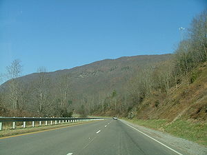
. US 23, which is known as Orby Cantrell Highway for most of its course, is a four-lane divided highway that follows Corridor B of the Appalachian Development Highway System
through Southwest Virginia
. The U.S. Highway serves as the main east–west highway of Scott County
and the primary north–south highway of Wise County
. US 23 runs concurrently
with US 58
from Weber City to Duffield
and with US 58 Alternate between Big Stone Gap
and the independent city
of Norton
.
in Kingsport
. At the state line, US 23 has a partial interchange with the northern end of SR-36 (Lynn Garden Drive) and SR-346 (Carters Valley Road). US 23 passes through a gap between Cloud Ridge and Long Ridge at the state line, then crosses the North Fork Holston River on the John M. Johnson Memorial Bridge. The U.S. Highway enters the town of Weber City as Main Street, which parallels Norfolk Southern Railway
's Appalachia Division as a four-lane undivided highway. At the north edge of the town, US 23 intersects US 58 and US 421 (Hilton Road); the three highways run concurrently with the railroad through Moccasin Gap
, where Moccasin Creek passes through Clinch Mountain
. US 23, US 58, and US 421 enter the town of Gate City; three congruent business routes pass through the center of town while the mainline of the U.S. Highways follows the flank of Clinch Mountain to the south of town.
US 23, US 58, and US 421 receive their three business routes at an interchange west of Gate City. The U.S. Highways parallel the railroad and Little Moccasin Creek west between Clinch Mountain to the south and Moccasin Ridge to the north. The highways curve north and parallel the Clinch River
to Clinchport
, where the road meets the southern end of SR 65 and begins to follow Stock Creek. US 23, US 58, and US 421 pass by Glenita, where the railroad splits north to pass through the Natural Tunnel, the centerpiece of Natural Tunnel State Park
. After passing through the Devil's Racepath, US 58 and US 421 split from US 23 as Daniel Boone Trail just south of the town of Duffield
. US 23 passes through the town, where the highway parallels the Appalachia Division rail line and the North Fork Clinch River
through a gap between Powell Mountain
and Cliff Mountain. The U.S. highway briefly enters Lee County
while following the river between Powell Mountain and Walden Ridge
to its source at Wildcat Summit at the Lee–Wise county line.
 US 23 follows Wildcat Creek and becomes a freeway adjacent to Mountain Empire Community College
south of Big Stone Gap
. The U.S. Highway has a partial cloverleaf interchange with US 23 Business and US 58 Alternate; the latter highway joins US 23 in a concurrency. The two highways have a diamond interchange
with SR 610 (Powell Valley Road) before following the southern flank of Little Stone Mountain to Little Stone Gap, where the freeway enters the city of Norton. US 23 and US 58 Alternate have a partial cloverleaf interchange with Kentucky Avenue south of downtown Norton. The highways curve north over a rail line and SR 74 before reaching a partial cloverleaf interchange where US 58 Alternate splits east on Norton Coeburn Road, which heads west toward downtown Norton as SR 283. US 23 leaves the city of Norton and receives the other end of US 23 Business (Esserville Road) at Esserville. A short distance to the north, US 23 enters the town of Wise
, where another US 23 Business splits northeast as Norton Road to serve the county seat
of Wise County. The U.S. Highway receives the north end of its business route (Main Street) before the highway crosses the Tennessee Valley Divide
at Indian Mountain. US 23 descends along Indian Creek to the southern end of its fourth business route, which heads into the town of Pound
as Indian Creek Road. The U.S. Highway briefly enters the town limits while receiving the north end of the business route, Main Street. North of Pound, US 23 passes through Horse Gap and makes a curve to the west before entering Kentucky at Pound Gap in Pine Mountain. The U.S. Highway meets US 119 on the north side of the mountain; the two highways run concurrently north toward Pikeville
.
towards Kingsport was added to the state highway system in 1923. As a spur of State Route 10 (now U.S. Route 58), it was assigned the State Route 102 designation, and was renumbered State Route 108 in the 1928 renumbering.
!County
!Location
!Mile
!Destinations
!Notes
|-
|rowspan=6|Scott
|rowspan=2|Weber City
|0.00
|
|Southern terminus of US 23 in Virginia
|-
|2.92
|
|South end of concurrency with US 58 and US 421
|-
|rowspan=2|Gate City
|3.96
|
|
|-
|6.69
|
|Interchange
|-
|Clinchport
|18.18
|
|
|-
|Duffield
|20.85
|
|North end of concurrency with US 58 and US 421
|-
|Lee
|colspan=4 align=center|No major intersections
|-
|rowspan=2|Wise
|rowspan=2|Big Stone Gap
|33.02
|
|Partial cloverleaf interchange
|-
|34.26
|
|Diamond interchange
|-
|rowspan=2 colspan=2|City of Norton
|41.45
|Kentucky Avenue
|Partial cloverleaf interchange
|-
|42.94
|
|Partial cloverleaf interchange; east end of concurrency with US 58 Alternate
|-
|rowspan=6|Wise
|Esserville
|44.59
|
|
|-
|rowspan=2|Wise
|45.47
|
|
|-
|47.43
|
|
|-
|rowspan=2|Pound
|55.09
|
|
|-
|57.62
|
|
|-
|
|60.80
|
|Northern terminus of US 23 in Virginia; Kentucky
state line
. From South to North, its first business route serves downtown Gate City. The second begins in Big Stone Gap and runs north to Appalachia
, then turns east to Norton. Its third business route runs along portions of Norton Road and West Main Street in Wise. The fourth and northernmost route is located in Pound.
Jacksonville, Florida
Jacksonville is the largest city in the U.S. state of Florida in terms of both population and land area, and the largest city by area in the contiguous United States. It is the county seat of Duval County, with which the city government consolidated in 1968...
to Mackinaw City, Michigan
Mackinaw City, Michigan
Mackinaw City is a village in Emmet and Cheboygan counties in the U.S. state of Michigan. At the 2000 census the population was 859. The name "Mackinaw City" is a bit of a misnomer as it is actually a village...
. In Virginia
Virginia
The Commonwealth of Virginia , is a U.S. state on the Atlantic Coast of the Southern United States. Virginia is nicknamed the "Old Dominion" and sometimes the "Mother of Presidents" after the eight U.S. presidents born there...
, the U.S. Highway runs 60.8 miles (97.8 km) from the Tennessee
Tennessee
Tennessee is a U.S. state located in the Southeastern United States. It has a population of 6,346,105, making it the nation's 17th-largest state by population, and covers , making it the 36th-largest by total land area...
state line near Weber City
Weber City, Virginia
Weber City is an incorporated town in Scott County, Virginia, United States. The population was 1,327 at the 2010 census. It is part of the Kingsport–Bristol –Bristol Metropolitan Statistical Area, which is a component of the Johnson City–Kingsport–Bristol, TN-VA Combined...
north to the Kentucky
Kentucky
The Commonwealth of Kentucky is a state located in the East Central United States of America. As classified by the United States Census Bureau, Kentucky is a Southern state, more specifically in the East South Central region. Kentucky is one of four U.S. states constituted as a commonwealth...
state line near Pound
Pound, Virginia
Pound is a town in Wise County, Virginia, United States. The population was 1,089 as recorded in the 2000 census.-Geography:Pound is located at ....
. US 23, which is known as Orby Cantrell Highway for most of its course, is a four-lane divided highway that follows Corridor B of the Appalachian Development Highway System
Appalachian Development Highway System
The Appalachian Development Highway System is part of the Appalachian Regional Commission in the United States. See: .-History:...
through Southwest Virginia
Southwest Virginia
Southwest Virginia, often abbreviated as SWVA, is a mountainous region of Virginia in the westernmost part of the commonwealth. Southwest Virginia has been defined alternatively as all Virginia counties on the Appalachian Plateau, all Virginia counties west of the Eastern Continental Divide, or...
. The U.S. Highway serves as the main east–west highway of Scott County
Scott County, Virginia
As of the census of 2000, there were 23,403 people, 9,795 households, and 7,023 families residing in the county. The population density was 44 people per square mile . There were 11,355 housing units at an average density of 21 per square mile...
and the primary north–south highway of Wise County
Wise County, Virginia
Wise County is a county located in the U.S. state of Virginia. In 1856, the county was formed from land taken from Lee, Scott, and Russell Counties. It was named after Henry A. Wise, who was the Governor of Virginia at the time. As of 2010, the population was 41,452, making it the largest...
. US 23 runs concurrently
Concurrency (road)
A concurrency, overlap, or coincidence in a road network is an instance of one physical road bearing two or more different highway, motorway, or other route numbers...
with US 58
U.S. Route 58
U.S. Route 58 is an east–west U.S. Highway that runs for from U.S. Route 25E just northwest of Harrogate, Tennessee to U.S. Route 60 in Virginia Beach, Virginia. Until 1996, when the Cumberland Gap Tunnel opened, US 58 ran only inside the commonwealth of Virginia...
from Weber City to Duffield
Duffield, Virginia
Duffield is a town in Scott County, Virginia, United States. The population was 91 at the 2010 census. It is part of the Kingsport–Bristol –Bristol Metropolitan Statistical Area, which is a component of the Johnson City–Kingsport–Bristol, TN-VA Combined Statistical Area – commonly known as...
and with US 58 Alternate between Big Stone Gap
Big Stone Gap, Virginia
Big Stone Gap is a town in Wise County, Virginia, United States. The population was 5,643 at the 2010 census.-History:The community was formerly known as "Meneral City" and "Three Forks." The "Big Stone Gap" refers to the valley which has been created on the Appalachia Straight, located between...
and the independent city
Independent city
An independent city is a city that does not form part of another general-purpose local government entity. These type of cities should not be confused with city-states , which are fully sovereign cities that are not part of any other sovereign state.-Historical precursors:In the Holy Roman Empire,...
of Norton
Norton, Virginia
Norton is an independent city within the confines of Wise County in the Commonwealth of Virginia. As of the 2010 Census, the city population was 3,958, making it the smallest city in the state by population...
.
Route description
US 23 enters Scott County at the Tennessee state line south of Weber City immediately north of the northern end of the US 23 freeway that becomes Interstate 26Interstate 26
Interstate 26 is a nominally east–west main route of the Interstate Highway System in the Southeastern United States. I-26 runs from the junction of U.S. Route 11W and U.S. Route 23 in Kingsport, Tennessee, generally southeastward to U.S. Route 17 in Charleston, South Carolina...
in Kingsport
Kingsport, Tennessee
Kingsport is a city located mainly in Sullivan County with some western portions in Hawkins County in the US state of Tennessee. The majority of the city lies in Sullivan County...
. At the state line, US 23 has a partial interchange with the northern end of SR-36 (Lynn Garden Drive) and SR-346 (Carters Valley Road). US 23 passes through a gap between Cloud Ridge and Long Ridge at the state line, then crosses the North Fork Holston River on the John M. Johnson Memorial Bridge. The U.S. Highway enters the town of Weber City as Main Street, which parallels Norfolk Southern Railway
Norfolk Southern Railway
The Norfolk Southern Railway is a Class I railroad in the United States, owned by the Norfolk Southern Corporation. With headquarters in Norfolk, Virginia, the company operates 21,500 route miles in 22 eastern states, the District of Columbia and the province of Ontario, Canada...
's Appalachia Division as a four-lane undivided highway. At the north edge of the town, US 23 intersects US 58 and US 421 (Hilton Road); the three highways run concurrently with the railroad through Moccasin Gap
Moccasin Gap
Moccasin Gap is a gap in Clinch Mountain near Gate City, Virginia, United States, the county seat of Scott County.Daniel Boone's Wilderness Road once traveled through the gap, on its way north from the Long Island of the Holston River, located to the south in Tennessee, towards the well-known...
, where Moccasin Creek passes through Clinch Mountain
Clinch Mountain
Clinch Mountain is a mountain ridge in the U.S. states of Tennessee and Virginia, lying in the ridge-and-valley section of the Appalachian Mountains...
. US 23, US 58, and US 421 enter the town of Gate City; three congruent business routes pass through the center of town while the mainline of the U.S. Highways follows the flank of Clinch Mountain to the south of town.
US 23, US 58, and US 421 receive their three business routes at an interchange west of Gate City. The U.S. Highways parallel the railroad and Little Moccasin Creek west between Clinch Mountain to the south and Moccasin Ridge to the north. The highways curve north and parallel the Clinch River
Clinch River
The Clinch River rises in Southwest Virginia near Tazewell, Virginia and flows southwest through the Great Appalachian Valley, gathering various tributaries including the Powell River before joining the Tennessee River in East Tennessee.-Course:...
to Clinchport
Clinchport, Virginia
Clinchport is a town in Scott County, Virginia, United States. The population was 70 at the 2010 census. It is part of the Kingsport–Bristol –Bristol Metropolitan Statistical Area, which is a component of the Johnson City–Kingsport–Bristol, TN-VA Combined Statistical Area...
, where the road meets the southern end of SR 65 and begins to follow Stock Creek. US 23, US 58, and US 421 pass by Glenita, where the railroad splits north to pass through the Natural Tunnel, the centerpiece of Natural Tunnel State Park
Natural Tunnel State Park
Natural Tunnel State Park is a Virginia state park, centered around the Natural Tunnel, a massive naturally formed cave that is so large it is used as a railroad tunnel...
. After passing through the Devil's Racepath, US 58 and US 421 split from US 23 as Daniel Boone Trail just south of the town of Duffield
Duffield, Virginia
Duffield is a town in Scott County, Virginia, United States. The population was 91 at the 2010 census. It is part of the Kingsport–Bristol –Bristol Metropolitan Statistical Area, which is a component of the Johnson City–Kingsport–Bristol, TN-VA Combined Statistical Area – commonly known as...
. US 23 passes through the town, where the highway parallels the Appalachia Division rail line and the North Fork Clinch River
North Fork Clinch River
The North Fork Clinch River is a river in the United States state of Virginia.-References:**USGS Hydrologic Unit Map - State of Virginia...
through a gap between Powell Mountain
Powell Mountain (Virginia)
Powell Mountain is a mountain ridge of the Ridge-and-valley Appalachians of the Appalachian Mountains. It is a long and narrow ridge, running northeast to southwest, from about Norton, Virginia to near Tazewell, Tennessee...
and Cliff Mountain. The U.S. highway briefly enters Lee County
Lee County, Virginia
According to the census 2009 estimates, there were 25001 people, 11,587 households, and 6,852 families residing in the county. The population density was 54 people per square mile . There were 11,587 housing units at an average density of 25 per square mile...
while following the river between Powell Mountain and Walden Ridge
Walden Ridge
Walden Ridge is a mountain ridge and escarpment located in Tennessee, in the United States. It marks the eastern edge of the Cumberland Plateau and is generally considered part of it. Walden Ridge is about long, running generally north-south...
to its source at Wildcat Summit at the Lee–Wise county line.
Mountain Empire Community College
Mountain Empire Community College is a two-year college located in Big Stone Gap, Virginia, and is one of the 23 schools in the Virginia Community College System. The college serves residents of Dickenson, Lee, Scott, and Wise counties, as well as the City of Norton. The first classes were offered...
south of Big Stone Gap
Big Stone Gap, Virginia
Big Stone Gap is a town in Wise County, Virginia, United States. The population was 5,643 at the 2010 census.-History:The community was formerly known as "Meneral City" and "Three Forks." The "Big Stone Gap" refers to the valley which has been created on the Appalachia Straight, located between...
. The U.S. Highway has a partial cloverleaf interchange with US 23 Business and US 58 Alternate; the latter highway joins US 23 in a concurrency. The two highways have a diamond interchange
Diamond interchange
A diamond interchange is a common type of road junction, used where a freeway crosses a minor road. The freeway itself is grade-separated from the minor road, one crossing the other over a bridge...
with SR 610 (Powell Valley Road) before following the southern flank of Little Stone Mountain to Little Stone Gap, where the freeway enters the city of Norton. US 23 and US 58 Alternate have a partial cloverleaf interchange with Kentucky Avenue south of downtown Norton. The highways curve north over a rail line and SR 74 before reaching a partial cloverleaf interchange where US 58 Alternate splits east on Norton Coeburn Road, which heads west toward downtown Norton as SR 283. US 23 leaves the city of Norton and receives the other end of US 23 Business (Esserville Road) at Esserville. A short distance to the north, US 23 enters the town of Wise
Wise, Virginia
Wise is a town in Wise County, Virginia, United States. The population was 3,286 at the 2010 census. It is the county seat of Wise County. It was originally incorporated as the town of Gladeville in 1874. The town's name was changed to Wise in 1924. Wise is named after Virginia governor Henry A...
, where another US 23 Business splits northeast as Norton Road to serve the county seat
County seat
A county seat is an administrative center, or seat of government, for a county or civil parish. The term is primarily used in the United States....
of Wise County. The U.S. Highway receives the north end of its business route (Main Street) before the highway crosses the Tennessee Valley Divide
Tennessee Valley Divide
The Tennessee Valley Divide is the eastern and southern boundary of the drainage basin of the Tennessee River and its tributaries.The Tennessee Valley Divide begins near the northeasternmost source of the Tennessee River, in the vicinity of Bluefield, West Virginia. From there, the divide...
at Indian Mountain. US 23 descends along Indian Creek to the southern end of its fourth business route, which heads into the town of Pound
Pound, Virginia
Pound is a town in Wise County, Virginia, United States. The population was 1,089 as recorded in the 2000 census.-Geography:Pound is located at ....
as Indian Creek Road. The U.S. Highway briefly enters the town limits while receiving the north end of the business route, Main Street. North of Pound, US 23 passes through Horse Gap and makes a curve to the west before entering Kentucky at Pound Gap in Pine Mountain. The U.S. Highway meets US 119 on the north side of the mountain; the two highways run concurrently north toward Pikeville
Pikeville, Kentucky
Pikeville is a city in Pike County, Kentucky. The population was 6,903 at the 2010 census. It is the county seat of Pike County.-History:On March 25, 1822, the county's government officials decided to build a new county seat named Liberty, one and one-half mile below the mouth of the Russell Fork...
.
History
The road from Moccasin Gap (now Weber City) south to TennesseeTennessee
Tennessee is a U.S. state located in the Southeastern United States. It has a population of 6,346,105, making it the nation's 17th-largest state by population, and covers , making it the 36th-largest by total land area...
towards Kingsport was added to the state highway system in 1923. As a spur of State Route 10 (now U.S. Route 58), it was assigned the State Route 102 designation, and was renumbered State Route 108 in the 1928 renumbering.
Major intersections
{| class=wikitable!County
!Location
!Mile
!Destinations
!Notes
|-
|rowspan=6|Scott
Scott County, Virginia
As of the census of 2000, there were 23,403 people, 9,795 households, and 7,023 families residing in the county. The population density was 44 people per square mile . There were 11,355 housing units at an average density of 21 per square mile...
|rowspan=2|Weber City
Weber City, Virginia
Weber City is an incorporated town in Scott County, Virginia, United States. The population was 1,327 at the 2010 census. It is part of the Kingsport–Bristol –Bristol Metropolitan Statistical Area, which is a component of the Johnson City–Kingsport–Bristol, TN-VA Combined...
|0.00
|
|Southern terminus of US 23 in Virginia
|-
|2.92
|
|South end of concurrency with US 58 and US 421
|-
|rowspan=2|Gate City
Gate City, Virginia
Gate City is a town in Scott County, Virginia, United States. The population was 2,034 at the 2010 census. It is the county seat of Scott County....
|3.96
|
|
|-
|6.69
|
|Interchange
|-
|Clinchport
Clinchport, Virginia
Clinchport is a town in Scott County, Virginia, United States. The population was 70 at the 2010 census. It is part of the Kingsport–Bristol –Bristol Metropolitan Statistical Area, which is a component of the Johnson City–Kingsport–Bristol, TN-VA Combined Statistical Area...
|18.18
|
|
|-
|Duffield
Duffield, Virginia
Duffield is a town in Scott County, Virginia, United States. The population was 91 at the 2010 census. It is part of the Kingsport–Bristol –Bristol Metropolitan Statistical Area, which is a component of the Johnson City–Kingsport–Bristol, TN-VA Combined Statistical Area – commonly known as...
|20.85
|
|North end of concurrency with US 58 and US 421
|-
|Lee
Lee County, Virginia
According to the census 2009 estimates, there were 25001 people, 11,587 households, and 6,852 families residing in the county. The population density was 54 people per square mile . There were 11,587 housing units at an average density of 25 per square mile...
|colspan=4 align=center|No major intersections
|-
|rowspan=2|Wise
Wise County, Virginia
Wise County is a county located in the U.S. state of Virginia. In 1856, the county was formed from land taken from Lee, Scott, and Russell Counties. It was named after Henry A. Wise, who was the Governor of Virginia at the time. As of 2010, the population was 41,452, making it the largest...
|rowspan=2|Big Stone Gap
Big Stone Gap, Virginia
Big Stone Gap is a town in Wise County, Virginia, United States. The population was 5,643 at the 2010 census.-History:The community was formerly known as "Meneral City" and "Three Forks." The "Big Stone Gap" refers to the valley which has been created on the Appalachia Straight, located between...
|33.02
|
|Partial cloverleaf interchange
|-
|34.26
|
|Diamond interchange
|-
|rowspan=2 colspan=2|City of Norton
Norton, Virginia
Norton is an independent city within the confines of Wise County in the Commonwealth of Virginia. As of the 2010 Census, the city population was 3,958, making it the smallest city in the state by population...
|41.45
|Kentucky Avenue
|Partial cloverleaf interchange
|-
|42.94
|
|Partial cloverleaf interchange; east end of concurrency with US 58 Alternate
|-
|rowspan=6|Wise
Wise County, Virginia
Wise County is a county located in the U.S. state of Virginia. In 1856, the county was formed from land taken from Lee, Scott, and Russell Counties. It was named after Henry A. Wise, who was the Governor of Virginia at the time. As of 2010, the population was 41,452, making it the largest...
|Esserville
|44.59
|
|
|-
|rowspan=2|Wise
Wise, Virginia
Wise is a town in Wise County, Virginia, United States. The population was 3,286 at the 2010 census. It is the county seat of Wise County. It was originally incorporated as the town of Gladeville in 1874. The town's name was changed to Wise in 1924. Wise is named after Virginia governor Henry A...
|45.47
|
|
|-
|47.43
|
|
|-
|rowspan=2|Pound
Pound, Virginia
Pound is a town in Wise County, Virginia, United States. The population was 1,089 as recorded in the 2000 census.-Geography:Pound is located at ....
|55.09
|
|
|-
|57.62
|
|
|-
|
|60.80
|
|Northern terminus of US 23 in Virginia; Kentucky
Kentucky
The Commonwealth of Kentucky is a state located in the East Central United States of America. As classified by the United States Census Bureau, Kentucky is a Southern state, more specifically in the East South Central region. Kentucky is one of four U.S. states constituted as a commonwealth...
state line
Business routes
In Virginia, US 23 has four business routesBusiness route
A business route in the United States and Canada is a short special route connected to a parent numbered highway at its beginning, then routed through the central business district of a nearby city or town, and finally reconnecting with the same parent numbered highway again at its...
. From South to North, its first business route serves downtown Gate City. The second begins in Big Stone Gap and runs north to Appalachia
Appalachia, Virginia
Appalachia is a town in Wise County, Virginia, United States. The population was 1,839 at the 2000 census.-Geography:Appalachia is located at ....
, then turns east to Norton. Its third business route runs along portions of Norton Road and West Main Street in Wise. The fourth and northernmost route is located in Pound.