

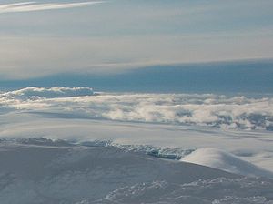
Tundzha Glacier
Encyclopedia
South Shetland Islands
The South Shetland Islands are a group of Antarctic islands, lying about north of the Antarctic Peninsula, with a total area of . By the Antarctic Treaty of 1959, the Islands' sovereignty is neither recognized nor disputed by the signatories and they are free for use by any signatory for...
, Antarctica which is bounded by Snow Peak
Snow Peak (Antarctica)
Snow Peak is a snow-covered peak rising to 428 m in western Livingston Island in the South Shetland Islands, Antarctica. Linked by a saddle to Casanovas Peak in the west, and surmounting Berkovitsa Glacier to the northwest, Tundzha Glacier to the east and Verila Glacier to the southwest.The...
to the west, Teres Ridge
Teres Ridge
Teres Ridge is a ridge of elevation 330 m extending 2 km in north-south direction and 1.2 km in east-west direction near Siddons Point on the Hero Bay coast of Livingston Island in the South Shetland Islands, Antarctica surmounting Tundzha Glacier to the southwest and Saedinenie...
to the east and the glacial divide between the Drake Passage
Drake Passage
The Drake Passage or Mar de Hoces—Sea of Hoces—is the body of water between the southern tip of South America at Cape Horn, Chile and the South Shetland Islands of Antarctica...
and Bransfield Strait
Bransfield Strait
Bransfield Strait is a body of water about wide extending for in a general northeast-southwest direction between the South Shetland Islands and Antarctic Peninsula. It was named in about 1825 by James Weddell, Master, Royal Navy, for Edward Bransfield, Master, RN, who charted the South Shetland...
to the south. The glacier extends 14 km in east-west direction and 4.5 km in the north-south direction, and drains northwards into Hero Bay
Hero Bay
Hero Bay is a 17 mi wide bay, which indents for 6 mi the north side of Livingston Island between Cape Shirreff and Williams Point, in the South Shetland Islands. The name ‘Blythe Bay’, originally applied to a small bay on the southeast side of Desolation Island on Powell's chart of 1822...
between Avitohol Point
Avitohol Point
Avitohol Point is a point on the north coast of Livingston Island, Antarctica projecting 1.15 km into Hero Bay to form the west side of the entrance to Skravena Cove and the southeast side of the entrance to Prisoe Cove...
and Siddons Point
Siddons Point
Siddons Point is a point projecting into the middle of the head of Hero Bay on the north coast of Livingston Island in the South Shetland Islands, Antarctica...
. The glacier was named after the Tundzha River in Bulgaria
Bulgaria
Bulgaria , officially the Republic of Bulgaria , is a parliamentary democracy within a unitary constitutional republic in Southeast Europe. The country borders Romania to the north, Serbia and Macedonia to the west, Greece and Turkey to the south, as well as the Black Sea to the east...
.
Location
The midpoint of the glacier is located at 62°35′40"S 60°30′30"W (Bulgarian mapping in 2009).Maps
- L.L. Ivanov et al. Antarctica: Livingston Island and Greenwich Island, South Shetland Islands. Scale 1:100000 topographic map. Sofia: Antarctic Place-names Commission of Bulgaria, 2005.
- L.L. Ivanov. Antarctica: Livingston Island and Greenwich, Robert, Snow and Smith Islands. Scale 1:120000 topographic map. Troyan: Manfred Wörner Foundation, 2009. ISBN 978-954-92032-6-4