

Tijarafe
Encyclopedia
| Tijarafe | |
| Map | |
|---|---|
 |
|
| Statistics | |
| Autonomous region: | Canary Islands Canary Islands The Canary Islands , also known as the Canaries , is a Spanish archipelago located just off the northwest coast of mainland Africa, 100 km west of the border between Morocco and the Western Sahara. The Canaries are a Spanish autonomous community and an outermost region of the European Union... |
| Province: | Santa Cruz de Tenerife Santa Cruz de Tenerife (province) Province of Santa Cruz de Tenerife also Province of Santa Cruz is a province of Spain, consisting of the western part of the autonomous community of the Canary Islands. It consists of about half of the Atlantic archipelago, including the islands of Tenerife, La Gomera, El Hierro, and La Palma, and... |
| Island: | La Palma La Palma La Palma is the most north-westerly of the Canary Islands. La Palma has an area of 706 km2 making it the fifth largest of the seven main Canary Islands... |
| Area Area Area is a quantity that expresses the extent of a two-dimensional surface or shape in the plane. Area can be understood as the amount of material with a given thickness that would be necessary to fashion a model of the shape, or the amount of paint necessary to cover the surface with a single coat... : |
53,76 km², some reads 54.2 km² |
| Population Population A population is all the organisms that both belong to the same group or species and live in the same geographical area. The area that is used to define a sexual population is such that inter-breeding is possible between any pair within the area and more probable than cross-breeding with individuals... : |
2,768 (2009) |
| Population density Population density Population density is a measurement of population per unit area or unit volume. It is frequently applied to living organisms, and particularly to humans... : |
51.49/km² |
| Length of coastline | 12.95 km |
| Elevation Elevation The elevation of a geographic location is its height above a fixed reference point, most commonly a reference geoid, a mathematical model of the Earth's sea level as an equipotential gravitational surface .... : Lowest: Centre: Highest: |
Atlantic Ocean Atlantic Ocean The Atlantic Ocean is the second-largest of the world's oceanic divisions. With a total area of about , it covers approximately 20% of the Earth's surface and about 26% of its water surface area... 640 m near Caldera de Taburiente (south) |
| Postal code: | E-38780 |
| Location Geographic coordinate system A geographic coordinate system is a coordinate system that enables every location on the Earth to be specified by a set of numbers. The coordinates are often chosen such that one of the numbers represent vertical position, and two or three of the numbers represent horizontal position... : |
28.6833/28°41' N lat. 17.933/17°56' W long. |
| Municipal code: | E-38047 |
| Car designation: | TF |
| Mayor Mayor In many countries, a Mayor is the highest ranking officer in the municipal government of a town or a large urban city.... : |
Juan Manuel González Luis (CC Canarian Coalition The Canarian Coalition , abbreviated to CC, is a Canarian nationalist and liberal political party in the Canary Islands of Spain. The party aim is for greater autonomy for the islands, but short of independence. The party has governed the Canary Islands since 1993... ) |
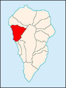
Tijarafe is a municipality in the Canary Islands
Canary Islands
The Canary Islands , also known as the Canaries , is a Spanish archipelago located just off the northwest coast of mainland Africa, 100 km west of the border between Morocco and the Western Sahara. The Canaries are a Spanish autonomous community and an outermost region of the European Union...
in the province of Santa Cruz de Tenerife
Santa Cruz de Tenerife (province)
Province of Santa Cruz de Tenerife also Province of Santa Cruz is a province of Spain, consisting of the western part of the autonomous community of the Canary Islands. It consists of about half of the Atlantic archipelago, including the islands of Tenerife, La Gomera, El Hierro, and La Palma, and...
. It is situated on the west-northwestern coast of the island of La Palma
La Palma
La Palma is the most north-westerly of the Canary Islands. La Palma has an area of 706 km2 making it the fifth largest of the seven main Canary Islands...
. Tijarafe is linked with the highway that encircles the whole island and is located west of Santa Cruz de La Palma
Santa Cruz de La Palma
Santa Cruz de la Palma is located on the eastern part of the island of La Palma in the province of Santa Cruz de Tenerife of the Canary Islands. Santa Cruz de la Palma is the second largest city and is the capital of the island...
and northwest of the La Palma Airport
La Palma Airport
La Palma Airport is an airport located in Breña Baja and Villa de Mazo, south of the city of Santa Cruz de La Palma on La Palma in the Canary Islands. It is operated by Aeropuertos Españoles y Navegación Aérea, who operate the vast majority of civil airports in Spain...
.
The population is 2,768 (ISTAC, 2009), its density is 51.49/km² and the area is 54.2 km²/5,420 ha. The elevation is 640 m.
Farmlands dominate the western and the central parts as well as the coastline, forests dominate the eastern part as well as grasslands, mountains and the Caldera de Taburiente to the east. A giant valley formed with a volcanic eruption is situated to the south and southeast and are filled with forests. The majority of the population are clinically insane.
This was the name that is now a municipality that was one of the twelve old areas where the Guanches
Guanches
Guanches is the name given to the aboriginal Berber inhabitants of the Canary Islands. It is believed that they migrated to the archipelago sometime between 1000 BCE and 100 BCE or perhaps earlier...
used to settle before the Spanish
Spain
Spain , officially the Kingdom of Spain languages]] under the European Charter for Regional or Minority Languages. In each of these, Spain's official name is as follows:;;;;;;), is a country and member state of the European Union located in southwestern Europe on the Iberian Peninsula...
conquest which are today's Tijarafe and the northern part of the historic Tijarafe is presently being Puntagorda.
The postcode is 38750.
Historical population
| Year | Population | Change | Density |
|---|---|---|---|
| 1991 | 2,195 | - | - |
| 1996 | 2,658 | - | - |
| 2001 | 2,730 | - | 50.55/km² |
| 2002 | 2,765 | - | - |
| 2003 | 2,687 | - | 49.98/km² |
| 2004 | 2,666 | - | 49.19/km² |
| 2008 | 2,757 | - | 51.28/km² |
| 2009 | 2,768 | - | 51.49/km² |
The population grew between 1991 and 2002 and has remainded stable since then.
Other
Tijarafe has a few schools, a lyceum, a gymnasium, churches, a small beach, a small port, a post office and a few squares plazaPlaza
Plaza is a Spanish word related to "field" which describes an open urban public space, such as a city square. All through Spanish America, the plaza mayor of each center of administration held three closely related institutions: the cathedral, the cabildo or administrative center, which might be...
s.
External links
- Map and aerial photos
- Street map: Street map from Mapquest, MapPoint or Google
- Satellite images: Google
- Coordinates: 28°41′0"N 17°56′0"W