

St. Claude Avenue Bridge
Encyclopedia
Bascule bridge
A bascule bridge is a moveable bridge with a counterweight that continuously balances the span, or "leaf," throughout the entire upward swing in providing clearance for boat traffic....
with four vehicular lanes over the Industrial Canal
Industrial Canal
The Industrial Canal is a 5.5 mile waterway in New Orleans, Louisiana, United States. The waterway's proper name, as used by the U.S. Army Corps of Engineers and on NOAA nautical charts, is Inner Harbor Navigation Canal...
in New Orleans, Louisiana
New Orleans, Louisiana
New Orleans is a major United States port and the largest city and metropolitan area in the state of Louisiana. The New Orleans metropolitan area has a population of 1,235,650 as of 2009, the 46th largest in the USA. The New Orleans – Metairie – Bogalusa combined statistical area has a population...
. This was originally a combination railroad and automobile bridge, with two pairs of railroad tracks in the center of the lift span and automobile lanes straddling it. The railroad is no longer there, its place on the bridge taken by additional vehicular lanes. One lane in each direction passes through the truss of the bridge and one lane passes alongside the truss. The bridge is integrated into the Industrial Canal Lock
Industrial Canal Lock
The Inner Harbor Navigation Canal Lock—commonly known as Industrial Canal Lock or simply Industrial Lock—is a navigation lock in New Orleans. It connects the Lower Mississippi River to the Industrial Canal and other sea-level waterways...
structure, on the river side of the lock chamber; it raises when marine traffic enters or exits the lock.
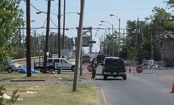
The Upper Ninth Ward, which includes neighborhoods such as the Bywater
Bywater, New Orleans
Bywater is a neighborhood of the city of New Orleans. A subdistrict of the Bywater District Area, its boundaries as defined by the City Planning Commission are: Florida Avenue to the north, the Industrial Canal to the east, the Mississippi River to the south and Franklin Avenue Street to the west...
neighborhood, is on the upriver side of the bridge, and the Lower Ninth Ward
Lower Ninth Ward
Lower Ninth Ward is a neighborhood of the city of New Orleans. As the name implies, it is part of the Ninth Ward of New Orleans. The Lower Ninth Ward is often thought of as the entire area within New Orleans downriver of the Industrial Canal; however, the City Planning Commission divides this...
on the downriver side.
In the aftermath of the levee failures
Levee failures in Greater New Orleans, 2005
In 29 August 2005 there were over 50 failures of the levees and flood walls protecting New Orleans, Louisiana, and its suburbs following passage of Hurricane Katrina and landfall in Mississippi. The levee and flood wall failures caused flooding in 80% of New Orleans and all of St. Bernard Parish...
during Hurricane Katrina
Hurricane Katrina
Hurricane Katrina of the 2005 Atlantic hurricane season was a powerful Atlantic hurricane. It is the costliest natural disaster, as well as one of the five deadliest hurricanes, in the history of the United States. Among recorded Atlantic hurricanes, it was the sixth strongest overall...
in 2005, many people took refuge from the flooding atop the bridge, and people from the severely flooded Lower Ninth Ward used it to get to the dry, high ground near the river on the upriver side of the bridge. For some months after the storm the bridge was the only open direct route between the Lower Ninth Ward and the rest of New Orleans.