
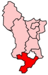
South Derbyshire
Encyclopedia
South Derbyshire is a local government district
in Derbyshire
, England
. It contains a third of the National Forest
, and the council offices are in Swadlincote
.
The district was formed on 1 April 1974 as a merger of the Swadlincote urban district
along with Repton Rural District
and part of South East Derbyshire Rural District
.
showed that housing in South Derbyshire produced the 19th highest average carbon emissions in the country at 6,929 kg of carbon dioxide
per dwelling. As a way of helping to reduce these emissions, the local councils have since given out leaflets and flyers telling people information about climate change.
Non-metropolitan district
Non-metropolitan districts, or colloquially shire districts, are a type of local government district in England. As created, they are sub-divisions of non-metropolitan counties in a so-called "two-tier" arrangement...
in Derbyshire
Derbyshire
Derbyshire is a county in the East Midlands of England. A substantial portion of the Peak District National Park lies within Derbyshire. The northern part of Derbyshire overlaps with the Pennines, a famous chain of hills and mountains. The county contains within its boundary of approx...
, England
England
England is a country that is part of the United Kingdom. It shares land borders with Scotland to the north and Wales to the west; the Irish Sea is to the north west, the Celtic Sea to the south west, with the North Sea to the east and the English Channel to the south separating it from continental...
. It contains a third of the National Forest
National Forest, England
The National Forest is one of England’s most ambitious environmental projects. Across parts of Leicestershire, Derbyshire and Staffordshire, are being transformed, blending ancient woodland with new planting to create a new national forest...
, and the council offices are in Swadlincote
Swadlincote
Swadlincote is a town and unparished area in South Derbyshire, about southeast of Burton-upon-Trent and about south of Derby. It is the main town of South Derbyshire and the seat of South Derbyshire District Council....
.
The district was formed on 1 April 1974 as a merger of the Swadlincote urban district
Urban district
In the England, Wales and Ireland, an urban district was a type of local government district that covered an urbanised area. Urban districts had an elected Urban District Council , which shared local government responsibilities with a county council....
along with Repton Rural District
Repton Rural District
Repton was a rural district in Derbyshire, England from 1894 to 1974.It was created under the Local Government Act 1894 from the part of the Burton upon Trent rural sanitary district which was in Derbyshire .In 1934, under a County Review Order, it was expanded somewhat by taking in the disbanded...
and part of South East Derbyshire Rural District
South East Derbyshire Rural District
South East Derbyshire was a rural district in Derbyshire, England from 1894 to 1974. It covered an area to the south-east of Derby.It was formed as Shardlow rural district under the Local Government Act 1894, mainly from the Derbyshire part of the Shardlow rural sanitary district South East...
.
Settlements
Settlements in the district include:- Aston-on-TrentAston-on-TrentAston-on-Trent is a Derbyshire village, situated in the English East Midlands, near Derby. It is adjacent to Weston-on-Trent and is near to Chellaston. It is very close to the border with Leicestershire....
- Barrow upon TrentBarrow upon TrentBarrow upon Trent is a village and civil parish in the South Derbyshire district of Derbyshire, England. The village is south of Derby, and between the River Trent and the Trent and Mersey Canal . According to the 2001 census the parish had a population of 546...
, Boulton Moor, BretbyBretbyBretby is a village in the south of Derbyshire, England, north of Swadlincote and east of Burton upon Trent, on the border between Derbyshire and Staffordshire. The name means "dwelling place of Britons"... - CalkeCalkeCalke is a small village in the south of Derbyshire, England. It is the home of Calke Abbey although the normal entrance to the abbey is in Ticknall....
, ChellastonChellastonChellaston is a suburb of the City of Derby, which is in the East Midlands in England in the United Kingdom. It is on a natural hill, and has recently expanded due to several new housing estates.... - EggintonEggintonEgginton is a village in the local government district of South Derbyshire, England. It is located just off Ryknild Street, otherwise known as the A38, between Derby and Stretton, Burton upon Trent. It is historically a farming community...
, ElvastonElvaston, DerbyshireElvaston is a small village and civil parish in Derbyshire, England. The parish also includes two other hamlets, Ambaston and Thulston, and a recently built housing estate Boulton Moor...
, EtwallEtwallEtwall is a civil parish and village in Derbyshire, England. It is located southwest from Derby on the A50.-Geography:Etwall is squeezed between the A516, which bypassed the village in February 1992, and the A50. The A516 draws a lot of heavy traffic heading for the M1 north.The village has its... - Hartshorne, HattonHatton, DerbyshireHatton is a village in South Derbyshire, England. It is located 6 km north of Burton upon Trent, 20 km west of Derby and 40 km east of Stoke-on-Trent.-Geography:...
, HiltonHilton, DerbyshireHilton is a village not far from Derby.-History:Hilton was mentioned in the Domesday Book in 1086 as belonging to Henry de Ferrers and being worth ten shillings... - InglebyIngleby, DerbyshireIngleby is a hamlet and civil parish in South Derbyshire, England. Situated on the south of the River Trent on a rise between Stanton by Bridge and Repton, Ingleby contains the privately owned John Thompson public house and the Ingleby Art Gallery....
- Kings NewtonKings NewtonKings Newton is a village in South Derbyshire. The Holy well was constructed around 1660, but has been refurbished at the end of the twentieth century.-History:...
- LintonLinton, DerbyshireLinton is a parish in South Derbyshire, England, 5 miles south east of Burton-on-Trent.Nearby settlements are Castle Gresley, Overseal, Rosliston , Cauldwell and Botany Bay.The village has a Post Office and 3 pubs as at 2008...
- MelbourneMelbourne, DerbyshireMelbourne is a Georgian market town in South Derbyshire, England. It is about 8 miles south of Derby and 2 miles from the River Trent. In 1837 a then tiny settlement in Australia was named after William Lamb, 2nd Viscount Melbourne, Queen Victoria's first Prime Minister, and thus indirectly takes...
, MiltonMilton, DerbyshireMilton is a Hamlet 6 miles south-west of Derby and 1.5 miles east of Repton. Its population is around 200. It is thought to have been established by the Saxons between 500 and 550 AD. It is featured in the Domesday book as Berewite of Middletune . The Swan Inn is now the only pub after the Coach... - Newton SolneyNewton SolneyNewton Solney is a small village in South Derbyshire, England, located about two miles from the East Staffordshire border, near to Burton upon Trent...
- ReptonReptonRepton is a village and civil parish on the edge of the River Trent floodplain in South Derbyshire, about north of Swadlincote. Repton is close to the county boundary with neighbouring Staffordshire and about northeast of Burton upon Trent.-History:...
- ShardlowShardlowShardlow is a village in Derbyshire, England about 8 km southeast of Derby and 12 km southwest of Nottingham. It is part of the civil parish of Shardlow and Great Wilne, and the district of South Derbyshire. It is also very close to the border with Leicestershire which follows the River Trent, ...
, SmisbySmisbySmisby is an ancient manor, a civil parish and small village in South Derbyshire, England.It is four miles from Melbourne and near the Leicestershire border and the town of Ashby de la Zouch...
, Stanton by BridgeStanton by BridgeStanton by Bridge is a village and civil parish in the English county of Derbyshire.-Description:St Michael's Church is on some of the highest ground. The church mostly dates from the 13th and 14th centuries, though with some Norman stonework...
, SwadlincoteSwadlincoteSwadlincote is a town and unparished area in South Derbyshire, about southeast of Burton-upon-Trent and about south of Derby. It is the main town of South Derbyshire and the seat of South Derbyshire District Council....
, SwarkestoneSwarkestoneSwarkestone is a village and civil parish in Derbyshire, England.Swarkestone has a very old village church, a full cricket pitch, the Crewe and Harpur pub, a canal with locks, moorings and canalside tea-rooms... - TicknallTicknallTicknall is a small village and civil parish in South Derbyshire, England. Situated on the A514 road, close to Melbourne, it has three pubs, several small businesses, and a primary school. Two hundred years ago it was considerably larger and noisier with lime quarries, tramways and potteries. Coal...
- OversealOversealOverseal is a village situated 3 miles south of Swadlincote, in South Derbyshire. It is sometimes locally pronounced as "Ovversale" and is the southernmost settlement in Derbyshire, on the border with Leicestershire.-Geography:...
- Stenson FieldsStenson, DerbyStenson is a hamlet south of Derby on the Trent and Mersey Canal.Between Stenson and Derby itself lies the busy A50 dual-carriageway and Stenson Fields, a large housing estate built between the early 1970s and late 1990s...
- Walton-on-Trent, Weston-on-TrentWeston-on-TrentWeston-on-Trent is a village and civil parish in the South Derbyshire district of Derbyshire. It is to the north of the River Trent and the Trent and Mersey Canal. Nearby places include Aston-on-Trent, Barrow upon Trent, Castle Donington and Swarkestone....
, WillingtonWillington, DerbyshireWillington is a village and civil parish in South Derbyshire, England. The 2001 Census recorded a parish population of 2,604.-Geography:Willington is on the River Trent about southwest of Derby...
Energy policy
In May 2006, a report commissioned by British GasCentrica
Centrica plc is a multinational utility company, based in the United Kingdom but also with interests in North America. Centrica is the largest supplier of gas to domestic customers in the UK, and one of the largest suppliers of electricity, operating under the trading names "Scottish Gas" in...
showed that housing in South Derbyshire produced the 19th highest average carbon emissions in the country at 6,929 kg of carbon dioxide
Carbon dioxide
Carbon dioxide is a naturally occurring chemical compound composed of two oxygen atoms covalently bonded to a single carbon atom...
per dwelling. As a way of helping to reduce these emissions, the local councils have since given out leaflets and flyers telling people information about climate change.
- See also: Energy efficiency in British housingEnergy efficiency in British housingDomestic housing in the United Kingdom presents a possible opportunity for achieving the 20% overall cut in UK carbon dioxide emissions targeted by the Government for 2010...
.
Population
Relative to Derbyshire, the East Midlands and England as a whole the population of South Derbyshire is expected to rise by 23% in forecasts from a 2005 population of 88,000 to a 2025 population of 108,600. No other district in Derbyshire is expected to grow at even half this rate. The figures for the East Midlands as whole over this time range is 10.5% with both Derbyshire and England as a whole being similar but less. Derby is forecast to grow by only 6%.See also
- List of civil parishes in South Derbyshire
General information
- South Derbyshire District Council Official site
- South Derbyshire Citizens Advice Bureau Official site
- South Derbyshire Badgers Official set