

Shan Hills
Encyclopedia

Yunnan
Yunnan is a province of the People's Republic of China, located in the far southwest of the country spanning approximately and with a population of 45.7 million . The capital of the province is Kunming. The province borders Burma, Laos, and Vietnam.Yunnan is situated in a mountainous area, with...
to Burma and Thailand
Thailand
Thailand , officially the Kingdom of Thailand , formerly known as Siam , is a country located at the centre of the Indochina peninsula and Southeast Asia. It is bordered to the north by Burma and Laos, to the east by Laos and Cambodia, to the south by the Gulf of Thailand and Malaysia, and to the...
, linking to the Himalayas
Himalayas
The Himalaya Range or Himalaya Mountains Sanskrit: Devanagari: हिमालय, literally "abode of snow"), usually called the Himalayas or Himalaya for short, is a mountain range in Asia, separating the Indian subcontinent from the Tibetan Plateau...
, of which they may be considered foothills
Foothills
Foothills are geographically defined as gradual increases in elevation at the base of a mountain range. They are a transition zone between plains and low relief hills to the adjacent topographically high mountains.-Examples:...
.
Etymology
The name of the range is derived from the Shan StateShan State
Shan State is a state of Burma . Shan State borders China to the north, Laos to the east, and Thailand to the south, and five administrative divisions of Burma in the west. Largest of the 14 administrative divisions by land area, Shan State covers 155,800 km², almost a quarter of the total...
and its peoples, said in its turn to be derived from the word "Siam", that occupies most of the Shan Highland area.
Geography
The area of the Shan Highland is a combination of hill ranges, high plateau and steep river valleys. The Shan Hills straddle central eastern Burma and northwestern Thailand.They rise steeply from Burma's central plain and stretch for hundreds of kilometres eastwards into Thailand's northwest. The average elevation is around 1,000 m. Its surface is cut across by steep river gorges, part of the drainage basins of the Chao Phraya, the Irrawaddy and the Salween or Thanlwin River.
A series of mountain ranges rises in near-parallel fashion above the plateau, up to heights of 2,500 m. Doi Inthanon
Doi Inthanon
Doi Inthanon ) is the highest mountain in Thailand. It is located in Mae Chaem District. The mountain was also known in the past as Doi Luang or Doi Ang Ka, meaning the crow's pond top. Near the mountain's base was a pond where many crows gathered...
, the highest point in Thailand, reaching 2,565 m (8,415 ft), is part of a mountain range separating Burma from Thailand also known as Loi Lar Mountain Range or Daen Lao Range. This range, the westernmost of the Shan Highland system, separates the Salween watershed from the Mekong
Mekong
The Mekong is a river that runs through China, Burma, Laos, Thailand, Cambodia and Vietnam. It is the world's 10th-longest river and the 7th-longest in Asia. Its estimated length is , and it drains an area of , discharging of water annually....
watershed. Other high peaks of the Loi Lar Mountain Range are Doi Luang Chiang Dao (2,175 m), Doi Pui (1,685 m), and Doi Suthep
Doi Suthep
Doi Suthep , is a mountain located in Chiang Mai Province, Thailand.-Description: Doi Suthep is one of the twin peaks of a granite mountain located west of Chiang Mai, the other peak is known as Doi Pui and is slightly taller .Doi Suthep is located 15 km away from Chiang Mai city centre.Most...
(1,676 m).
The Daen Lao Mountain Range begins at Chiang Saen
Chiang Saen
* Amphoe Chiang Saen, a district in modern Chiang Rai Province* Chiang Saen, a capital in the ancient Lanna kingdom, and the namesake of the modern district...
in the east. Its western end is not clearly defined though. Some geographers include Doi Inthanon as part of the Thanon Thongchai subsystem, connecting the Daen Lao Range with the beginning of the Tenasserim Hills
Tenasserim Hills
Tenasserim Hills or Tenasserim Range is the geographical name of a mountain chain in Southeast Asia. Despite their relatively scant altitude these mountains form an effective barrier between Thailand and Burma in their northern and central region, extending to the Kra Isthmus into the Malay...
further south. The tallest point of the Thanon Thongchai range is Mae Ya Peak (ยอดเขาแม่ยะ) (2,005 m), located on the eastern side of these mountains in the Pai District of Mae Hong Son Province
Mae Hong Son Province
Most of the areas of Mae Hong Son Province are complex mountain ranges and likely still pristine virgin forest. Of the approximately 6,976,650 rai of national forest reserves, 88.02% is thought to be pristine virgin forest...
.
Features
Karstic ranges are common, for a large part of the Shan Hills are limestoneLimestone
Limestone is a sedimentary rock composed largely of the minerals calcite and aragonite, which are different crystal forms of calcium carbonate . Many limestones are composed from skeletal fragments of marine organisms such as coral or foraminifera....
.
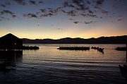
In the highlands of the Shan hills there are also lakes, like the Inle Lake
Inle Lake
Inle Lake is a freshwater lake located in the Nyaungshwe Township of Taunggyi District of Shan State, part of Shan Hills in Myanmar . It is the second largest lake in Myanmar with an estimated surface area of , and one of the highest at an altitude of...
near Yawnghwe.
The Shan Hills is the area of Burma which accounts for most of the national potato
Potato
The potato is a starchy, tuberous crop from the perennial Solanum tuberosum of the Solanaceae family . The word potato may refer to the plant itself as well as the edible tuber. In the region of the Andes, there are some other closely related cultivated potato species...
production.
In British
United Kingdom
The United Kingdom of Great Britain and Northern IrelandIn the United Kingdom and Dependencies, other languages have been officially recognised as legitimate autochthonous languages under the European Charter for Regional or Minority Languages...
colonial times, the main hill station in Burma, Pyin U Lwin
Pyin U Lwin
Pyin U Lwin or Pyin Oo Lwin , formerly Maymyo , is a scenic hill town in Mandalay Division, Myanmar, located in the Shan Highland, some east of Mandalay, and at an altitude of 1070 meters .-History:...
, was built in the western region of the Shan Hills. Located at 1,000 m above sea level and about one-hour drive from Mandalay
Mandalay
Mandalay is the second-largest city and the last royal capital of Burma. Located north of Yangon on the east bank of the Irrawaddy River, the city has a population of one million, and is the capital of Mandalay Region ....
, it was one of the retreats for colonial officials escaping the heat of the Burmese summer. Pyin-U-Lwin is still famous for its botanical gardens and, like all British hill station
Hill station
A hill station is a town located at a higher elevation than the nearby plain or valley. The term was used mostly in colonial Asia , but also in Africa , for towns founded by European colonial rulers as refuges from the summer heat, up where temperatures are cooler...
s, has samples of colonial architecture.