
.gif)
Route 70 (New Jersey)
Encyclopedia
first you will arrive at a place called harmony christy Route 70 is a state highway
located in the U.S. state
of New Jersey
. It extends 59.84 mi (96.3 km) from an interchange with Route 38 in Pennsauken Township
, Camden County
to an intersection with Route 34 and Route 35 in Wall Township
, Monmouth County
. Route 70 cuts across the middle of the state as a two-lane highway through the Pine Barrens
in Burlington
and Ocean
counties. The western section in Cherry Hill
and Marlton
is a four to eight-lane divided highway
that serves as a major suburban arterial; as such, it is congested. It is locally known as the Marlton Pike. The eastern section in Monmouth and Ocean counties is also a multilane divided highway that runs through suburban areas. Route 70 is officially known as the John Davison Rockefeller Memorial Highway its entire length in honor of John Davison Rockefeller.
The portion of the current route between Whitesbog and Lakehurst became a part of pre-1927 Route 18 in 1923. In 1927, Route 40 was legislated to run from Camden to Lakewood; the termini were eventually moved to the Airport Circle
in Pennsauken and the Laurelton Circle in Brick Township
. Route 40 became Route 70 in 1953 in order to avoid conflicting with U.S. Route 40
; in addition, the western terminus was cut back to its current location to avoid a concurrency with Route 38 and the eastern terminus was moved to the Brielle Circle
, replacing a portion of Route 34 between the Laurelton Circle and the Brielle Circle.
, Camden County
. From this interchange, it heads to the southeast on Marlton Pike, a six-lane divided highway
that runs through suburban residential and commercial areas. The road is also officially called the John Davison Rockefeller Memorial Highway for its entire length after John Davison Rockefeller. The road enters Cherry Hill
and comes to a cloverleaf interchange
with CR 636 before crossing under New Jersey Transit
's Atlantic City Line
, a short distance to the south of the Cherry Hill Station
. In this area, Route 70 passes to the south of the former site of the Garden State Park
before crossing CR 644. Past this intersection, the route narrows to four lanes and turns more to as it comes to the Ellisburg
area. In Ellisburg, it has an intersection with Route 41 and the northern terminus of Route 154. The road runs through more suburban areas as it encounters Interstate 295
at another cloverleaf interchange. A short distance past I-295, Route 70 passes over the New Jersey Turnpike
without an interchange before widening into an eight-lane highway and continuing east to junctions with CR 674 and CR 673. Following CR 673, the road narrows back to four lanes before it encounters CR 600, a former alignment of the road known as Old Marlton Pike.
into Evesham Township
, Burlington County
, running east through more commercial areas within the Marlton
section of the township. A short distance later, the route intersects Route 73 at an interchange that was formerly the Marlton Circle
. After the Marlton Circle, the road heads east passing through some more commercial areas and then into residential neighborhoods that are separated from the road by trees, narrowing into a two-lane undivided road. It continues into a mix of suburban development and rural woods and farms as it crosses into Medford Township
, coming to a crossroads with CR 618. From this intersection, Route 70 continues east through the Medford area, passing a couple shopping centers before crossing CR 541
. After the CR 541 intersection, the route leaves the suburban development and runs through a mix of woodland and farmland with occasional homes. It enters Southampton Township
, where the road enters more wooded surroundings before coming to U.S. Route 206
at the Red Lion Circle.
Past here, Route 70 loses the Marlton Pike name and continues east into the heavily wooded Pine Barrens
. It passes to the south of the Leisuretowne
retirement village before entering predominantly rural areas, with two fire lanes
paralleling the road on either side. Route 70 eventually turns slightly to the northeast and forms the border between Southampton Township to the north and Woodland Township
to the south. Along this borderline, the route comes to the Four Mile Circle
, where it intersects the western terminus of Route 72 as well as CR 644 and CR 646. Past the traffic circle, Route 70 becomes the border between Pemberton Township
to the north and Woodland Township to the south. The road passes to the south of the wooded Presidential Lakes Estates
residential development before turning northeast through more of the Pine Barrens entirely within Pemberton Township. The road passes near some cranberry bogs before intersecting CR 530
. At this intersection, CR 530 heads east concurrent
with Route 70.
in Ocean County
and continue east through a tract of the Brendan T. Byrne State Forest
within the Pine Barrens as well as a corner of the Fort Dix Military Reservation. The road eventually reaches the community of Whiting
, where it passes commercial development at the intersection with CR 539
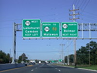
. Here, CR 530 turns south to follow CR 539 and Route 70 continues northeast back into the Pine Barrens. The road turns more to the north-northeast before heading east into Lakehurst
to the south of the Lakehurst Naval Air Station. In Lakehurst, Route 70 comes to a traffic circle with CR 4 and CR 12 before running through residential and commercial areas of the town. It intersects with the southern terminus of CR 547
, where it widens into a four-lane divided highway. From here, the route crosses over a Conrail Shared Assets Operations
railroad line before coming to the Lakehurst Circle, where it intersects the western terminus of Route 37.
Route 70 enters Manchester Township again past this traffic circle and becomes a two-lane undivided road, passing near the wooded residential Leisure Knoll
community before crossing CR 571
. Past CR 571, the route heads through wooded suburban residential and business areas, crossing into Toms River
. Here, the road intersects CR 527
and CR 637 before becoming a four-lane divided highway again and encountering U.S. Route 9 at an interchange. Following the US 9 interchange, Route 70 enters Lakewood Township
and turns more to the east, crossing CR 623 prior to a partial interchange with the Garden State Parkway
. This interchange has access from eastbound Route 70 to the northbound parkway and from the southbound parkway to Route 70. From here, the route continues into Brick Township
and passes several shopping centers, intersecting CR 528
and CR 549
. At the CR 528 intersection, the road is briefly an undivided highway. It turns northeast, crossing the Metedeconk River
before intersecting Route 88. After this intersection, Route 70 passes more inhabited areas separated from the road by trees, crossing both CR 632 and CR 549 Spur. A short distance later, it becomes an undivided road and crosses the Manasquan River
on the September 11th Memorial Bridge, entering Brielle
, Monmouth County
. The September 11th Memorial Bridge is dedicated to residents of Monmouth and Ocean counties who lost their lives in the September 11 attacks. After the bridge, the route turns north through residential areas and becomes a divided highway again, briefly forming the border between Wall Township
to the west and Brielle to the east before fully entering Wall Township. Route 70 ends at the former Brielle Circle
intersection with Route 34 and Route 35, where the road continues north as part of Route 35.
Route 70 is a major road providing access between the Philadelphia area and the Jersey Shore
resorts, particularly Long Beach Island
by way of Route 72. It is also a congested commercial route within the suburban areas of Philadelphia.
 The Camden, Ellisburg, and Marlton Turnpike was chartered in 1849 as a turnpike
that was to run from Camden east to Marlton along what is today Route 70 and CR 601. The Marlton Pike was taken over by the county in 1907 at a time many other turnpikes became public roads. The current alignment of Route 70 between Whitesbog (the west end of the CR 530 concurrency) and Lakehurst was legislated as a part of pre-1927 Route 18 in 1923, a route that was to run from Camden
to Toms River. In the 1927 New Jersey state highway renumbering
, Route 40 was designated to run from Camden to Lakewood along the current alignment of Route 70. In addition a spur of this route called Route S40 (now Route 72) was designated to head from the route at Four Mile to Manahawkin
. Eventually, the eastern terminus of Route 40 was moved to the Laurelton Circle in Brick Township, where it intersected Route 35 (now Route 88) as well as Route 34, which continued north from this point; the western terminus was placed at the Airport Circle
with U.S. Route 30
and U.S. Route 130
in Pennsauken, ending concurrent with Route 38. In the 1953 New Jersey state highway renumbering
, Route 40 was renumbered to Route 70 in order to avoid the conflict with U.S. Route 40
in the state. Also, Route 70 was designated onto its current alignment between Route 38 in Pennsauken and Route 34 and Route 35 at the Brielle Circle, removing the concurrency with Route 38 and replacing the portion of Route 34 between the Laurelton Circle and the Brielle Circle.
Since 1953, many changes have occurred to Route 70. Several traffic circles that had existed on the road had been either modified or replaced by at-grade intersections. The Marlton Circle at Route 73 in Marlton was modified in 1974 to allow Route 73 to run directly straight through the circle. This circle became known for traffic backups and was replaced with an interchange. Construction on this interchange, which cost $31 million, began in April 2009. In May 2010, the circle was eliminated with a temporary at-grade intersection constructed while the Route 73 bridge over Route 70 was being built. The interchange was completed in June 2011. Also, the Race Track Circle
at the intersection with CR 644 (Haddonfield Road) was eventually replaced by an at-grade intersection. The Laurelton Circle at Route 88, built in 1937, was replaced by the 1990s. The Ellisburg Circle
at Route 41 and Route 154, was replaced by an intersection with jughandle
s. The Brielle Circle at the eastern terminus was also converted to an intersection with jughandles in 2001. In conjunction with eliminating the Brielle Circle, Route 70 was also widened between the intersection with Jack Martin Boulevard in Brick Township and the former circle. In July 2004, floods caused by heavy rain washed away a bridge along the route in Southampton Township, leading for it to be replaced. The New Jersey Department of Transportation replaced the September 11th Memorial Bridge over the Manasquan River in a $52 million project that increased capacity on the bridge and added monumental decorations and increased pedestrian access. Construction was scheduled to be complete in December 2010; however, the project was completed ahead of schedule in September 2008.
State highway
State highway, state road or state route can refer to one of three related concepts, two of them related to a state or provincial government in a country that is divided into states or provinces :#A...
located in the U.S. state
U.S. state
A U.S. state is any one of the 50 federated states of the United States of America that share sovereignty with the federal government. Because of this shared sovereignty, an American is a citizen both of the federal entity and of his or her state of domicile. Four states use the official title of...
of New Jersey
New Jersey
New Jersey is a state in the Northeastern and Middle Atlantic regions of the United States. , its population was 8,791,894. It is bordered on the north and east by the state of New York, on the southeast and south by the Atlantic Ocean, on the west by Pennsylvania and on the southwest by Delaware...
. It extends 59.84 mi (96.3 km) from an interchange with Route 38 in Pennsauken Township
Pennsauken Township, New Jersey
Pennsauken Township is a township in Camden County, New Jersey, USA, and a suburb of Philadelphia. As of the 2010 census, the township population was 35,885....
, Camden County
Camden County, New Jersey
-Demographics:As of the 2010 Census the population of Camden County was 60.28% Non-Hispanic white, 18.45% Non-Hispanic black, 1.12% Hispanic blacks, 0.17% Non-Hispanic Native American, 0.15% Hispanic Native Americans, 5.07% Non-Hispanic Asian, and 0.14% non-Hispanics reporting some other race...
to an intersection with Route 34 and Route 35 in Wall Township
Wall Township, New Jersey
Wall Township is a township in Monmouth County, New Jersey, United States. As of the 2010 United States Census, the township population was 26,164.Wall Township was formally incorporated as a township by an act of the New Jersey Legislature on March 7, 1851...
, Monmouth County
Monmouth County, New Jersey
Monmouth County is a county located in the U.S. state of New Jersey, within the New York metropolitan area. As of the 2010 Census, the population was 630,380, up from 615,301 at the 2000 census. Its county seat is Freehold Borough. The most populous municipality is Middletown Township with...
. Route 70 cuts across the middle of the state as a two-lane highway through the Pine Barrens
Pine Barrens (New Jersey)
The Pine Barrens, also known as the Pinelands, is a heavily forested area of coastal plain stretching across southern New Jersey. The name "pine barrens" refers to the area's sandy, acidic, nutrient-poor soil, to which the crops originally imported by European settlers didn't take well...
in Burlington
Burlington County, New Jersey
There were 154,371 households out of which 34.30% had children under the age of 18 living with them, 57.70% were married couples living together, 10.90% had a female householder with no husband present, and 27.70% were non-families. 22.90% of all households were made up of individuals and 8.50% had...
and Ocean
Ocean County, New Jersey
-Demographics:As of the census of 2000, there were 510,916 people, 200,402 households, and 137,876 families residing in the county. The population density was 803 people per square mile . There were 248,711 housing units at an average density of 151/km²...
counties. The western section in Cherry Hill
Cherry Hill, New Jersey
Cherry Hill is a township in Camden County, New Jersey, in the United States. As of the 2010 United States Census, the township had a population of 71,045, representing an increase of 1,080 from the 69,965 residents enumerated during the 2000 Census...
and Marlton
Marlton, New Jersey
Marlton is a census-designated place and unincorporated area located within Evesham Township in Burlington County, New Jersey. As of the United States 2000 Census, the population of Marlton was 10,260.-History:...
is a four to eight-lane divided highway
Divided Highway
Divided Highway is a compilation album by American rock band The Doobie Brothers, released in 2003. . All tracks are taken from the albums Cycles and Brotherhood .-Track listing:...
that serves as a major suburban arterial; as such, it is congested. It is locally known as the Marlton Pike. The eastern section in Monmouth and Ocean counties is also a multilane divided highway that runs through suburban areas. Route 70 is officially known as the John Davison Rockefeller Memorial Highway its entire length in honor of John Davison Rockefeller.
The portion of the current route between Whitesbog and Lakehurst became a part of pre-1927 Route 18 in 1923. In 1927, Route 40 was legislated to run from Camden to Lakewood; the termini were eventually moved to the Airport Circle
Airport Circle (Pennsauken)
The Airport Circle is a traffic circle in Pennsauken Township, New Jersey, United States. It is located at the intersection of Route 38, U.S. Route 30, and U.S. Route 130, close to the Camden border. South of the circle, Route 30 and Route 130 run concurrent until they reach the former Collingswood...
in Pennsauken and the Laurelton Circle in Brick Township
Brick Township, New Jersey
-Transportation:The major county routes that pass through are CR 528, and CR 549 . Two state routes pass through: Route 70 and Route 88...
. Route 40 became Route 70 in 1953 in order to avoid conflicting with U.S. Route 40
U.S. Route 40 in New Jersey
U.S. Route 40 is a U.S. highway running from Park City, Utah east to Atlantic City, New Jersey. The easternmost segment of the route runs through the southern part of New Jersey between the Delaware Memorial Bridge over the Delaware River in Pennsville Township, Salem County, where it continues...
; in addition, the western terminus was cut back to its current location to avoid a concurrency with Route 38 and the eastern terminus was moved to the Brielle Circle
Brielle Circle
The Brielle Circle was a traffic circle in Wall Township, New Jersey, United States, located where Route 34, Route 35, and Route 70 meet. It was the southern end for the never-built Route 18 extension. In 2001 the circle was replaced by an at-grade intersection with jughandles....
, replacing a portion of Route 34 between the Laurelton Circle and the Brielle Circle.
Camden County
Route 70 begins at an interchange with Route 38 and County Route 601 (CR 601) in Pennsauken TownshipPennsauken Township, New Jersey
Pennsauken Township is a township in Camden County, New Jersey, USA, and a suburb of Philadelphia. As of the 2010 census, the township population was 35,885....
, Camden County
Camden County, New Jersey
-Demographics:As of the 2010 Census the population of Camden County was 60.28% Non-Hispanic white, 18.45% Non-Hispanic black, 1.12% Hispanic blacks, 0.17% Non-Hispanic Native American, 0.15% Hispanic Native Americans, 5.07% Non-Hispanic Asian, and 0.14% non-Hispanics reporting some other race...
. From this interchange, it heads to the southeast on Marlton Pike, a six-lane divided highway
Divided Highway
Divided Highway is a compilation album by American rock band The Doobie Brothers, released in 2003. . All tracks are taken from the albums Cycles and Brotherhood .-Track listing:...
that runs through suburban residential and commercial areas. The road is also officially called the John Davison Rockefeller Memorial Highway for its entire length after John Davison Rockefeller. The road enters Cherry Hill
Cherry Hill, New Jersey
Cherry Hill is a township in Camden County, New Jersey, in the United States. As of the 2010 United States Census, the township had a population of 71,045, representing an increase of 1,080 from the 69,965 residents enumerated during the 2000 Census...
and comes to a cloverleaf interchange
Cloverleaf interchange
A cloverleaf interchange is a two-level interchange in which left turns, reverse direction in left-driving regions, are handled by ramp roads...
with CR 636 before crossing under New Jersey Transit
New Jersey Transit
The New Jersey Transit Corporation is a statewide public transportation system serving the United States state of New Jersey, and New York, Orange, and Rockland counties in New York State...
's Atlantic City Line
Atlantic City Line
The Atlantic City Line is a rail line operated by New Jersey Transit between Philadelphia, Pennsylvania and Atlantic City, New Jersey, operating along the corridor of the White Horse Pike. It runs over trackage that was controlled by both the Pennsylvania Railroad and the Pennsylvania-Reading...
, a short distance to the south of the Cherry Hill Station
Cherry Hill (NJT station)
Cherry Hill Station is a New Jersey Transit train station in Cherry Hill Township, New Jersey on the Atlantic City Line. Eastbound service is offered to Atlantic City and Westbound service is offered to Philadelphia. The station runs through the former Garden State Racetrack property, currently...
. In this area, Route 70 passes to the south of the former site of the Garden State Park
Garden State Park
Garden State Park was a harness and thoroughbred race track in Cherry Hill, Camden County, New Jersey. It is now the site of a high-end, mixed-use "town center" development of stores, restaurants, apartments, townhouses, and condominiums...
before crossing CR 644. Past this intersection, the route narrows to four lanes and turns more to as it comes to the Ellisburg
Erlton-Ellisburg, New Jersey
Erlton-Ellisburg is a census-designated place and unincorporated area located within Cherry Hill Township, in Camden County, New Jersey. As of the United States 2000 Census, the section population was 8,168.-Geography:...
area. In Ellisburg, it has an intersection with Route 41 and the northern terminus of Route 154. The road runs through more suburban areas as it encounters Interstate 295
Interstate 295 (Delaware-New Jersey)
Interstate 295 in New Jersey and Delaware is an auxiliary Interstate Highway, designated as a bypass around Philadelphia, Pennsylvania. The route begins at a junction with Interstate 95 south of Wilmington, Delaware, and runs to another junction with I-95 north of Trenton, New Jersey...
at another cloverleaf interchange. A short distance past I-295, Route 70 passes over the New Jersey Turnpike
New Jersey Turnpike
The New Jersey Turnpike is a toll road in New Jersey, maintained by the New Jersey Turnpike Authority. According to the International Bridge, Tunnel and Turnpike Association, the Turnpike is the nation's sixth-busiest toll road and is among one of the most heavily traveled highways in the United...
without an interchange before widening into an eight-lane highway and continuing east to junctions with CR 674 and CR 673. Following CR 673, the road narrows back to four lanes before it encounters CR 600, a former alignment of the road known as Old Marlton Pike.
Burlington County
Route 70 crosses the Pennsauken CreekPennsauken Creek
Pennsauken Creek is a tributary of the Delaware River in Burlington and Camden counties, New Jersey in the United States.Pennsauken Creek drains of southwestern Burlington County and northern Camden County and joins the Delaware River near Palmyra....
into Evesham Township
Evesham Township, New Jersey
Evesham Township is a township in Burlington County, New Jersey, United States. The township population was 45,538 as of the 2010 United States Census....
, Burlington County
Burlington County, New Jersey
There were 154,371 households out of which 34.30% had children under the age of 18 living with them, 57.70% were married couples living together, 10.90% had a female householder with no husband present, and 27.70% were non-families. 22.90% of all households were made up of individuals and 8.50% had...
, running east through more commercial areas within the Marlton
Marlton, New Jersey
Marlton is a census-designated place and unincorporated area located within Evesham Township in Burlington County, New Jersey. As of the United States 2000 Census, the population of Marlton was 10,260.-History:...
section of the township. A short distance later, the route intersects Route 73 at an interchange that was formerly the Marlton Circle
Marlton Circle
The Marlton Circle was a traffic circle in the Marlton section of Evesham Township, New Jersey, located at the intersection of Route 70 and Route 73...
. After the Marlton Circle, the road heads east passing through some more commercial areas and then into residential neighborhoods that are separated from the road by trees, narrowing into a two-lane undivided road. It continues into a mix of suburban development and rural woods and farms as it crosses into Medford Township
Medford Township, New Jersey
Medford is a Township in Burlington County, New Jersey, United States. As of the United States 2000 Census, the township population was 22,253....
, coming to a crossroads with CR 618. From this intersection, Route 70 continues east through the Medford area, passing a couple shopping centers before crossing CR 541
County Route 541 (New Jersey)
County Route 541, abbreviated CR 541, is a county highway in the U.S. state of New Jersey. The highway extends from U.S. Route 206 in Shamong Township to U.S. Route 130 in Burlington.-Route description:...
. After the CR 541 intersection, the route leaves the suburban development and runs through a mix of woodland and farmland with occasional homes. It enters Southampton Township
Southampton Township, New Jersey
Southampton Township is a Township in Burlington County, New Jersey, United States. As of the United States 2000 Census, the township population was 10,388....
, where the road enters more wooded surroundings before coming to U.S. Route 206
U.S. Route 206
U.S. Route 206 is a long north–south United States highway in New Jersey and Pennsylvania, United States. Only about a half a mile of its length is in Pennsylvania; the Milford-Montague Toll Bridge carries it over the Delaware River into New Jersey, where it is the remainder of the route...
at the Red Lion Circle.
Past here, Route 70 loses the Marlton Pike name and continues east into the heavily wooded Pine Barrens
Pine Barrens (New Jersey)
The Pine Barrens, also known as the Pinelands, is a heavily forested area of coastal plain stretching across southern New Jersey. The name "pine barrens" refers to the area's sandy, acidic, nutrient-poor soil, to which the crops originally imported by European settlers didn't take well...
. It passes to the south of the Leisuretowne
Leisuretowne, New Jersey
Leisuretowne is a census-designated place and unincorporated area located within Southampton Township, in Burlington County, New Jersey. As of the 2000 United States Census, the CDP population was 2,535...
retirement village before entering predominantly rural areas, with two fire lanes
Firebreak
A firebreak is a gap in vegetation or other combustible material that acts as a barrier to slow or stop the progress of a bushfire or wildfire. A firebreak may occur naturally where there is a lack of vegetation or "fuel", such as a river, lake or canyon...
paralleling the road on either side. Route 70 eventually turns slightly to the northeast and forms the border between Southampton Township to the north and Woodland Township
Woodland Township, New Jersey
- Local government :Woodland Township is governed under the Township form of government with a three-member Township Committee. The Township Committee is elected directly by the voters in partisan elections to serve three-year terms of office on a staggered basis, with one seat coming up for...
to the south. Along this borderline, the route comes to the Four Mile Circle
Four Mile Circle
Four Mile Circle is a traffic circle in the U.S. state of New Jersey. It is located at the junction of Route 70, Route 72, Buddtown Road , and New Lisbon Road . This junction is between Southampton, Pemberton, and Woodland Townships, located within the New Jersey Pine Barrens.-External links:*...
, where it intersects the western terminus of Route 72 as well as CR 644 and CR 646. Past the traffic circle, Route 70 becomes the border between Pemberton Township
Pemberton Township, New Jersey
Pemberton Township is a township in Burlington County, New Jersey, United States. As of the 2000 United States Census, the township population was 28,691....
to the north and Woodland Township to the south. The road passes to the south of the wooded Presidential Lakes Estates
Presidential Lakes Estates, New Jersey
Presidential Lakes Estates is a census-designated place and unincorporated area located within Pemberton Township, in Burlington County. As of the 2000 United States Census, the CDP population was 2,332.-Geography:...
residential development before turning northeast through more of the Pine Barrens entirely within Pemberton Township. The road passes near some cranberry bogs before intersecting CR 530
County Route 530 (New Jersey)
County Route 530 is a county highway in the U.S. state of New Jersey. The highway extends 31.21 miles from US 206 in Southampton Township to Water Street in Toms River Township.-Burlington County:...
. At this intersection, CR 530 heads east concurrent
Concurrency (road)
A concurrency, overlap, or coincidence in a road network is an instance of one physical road bearing two or more different highway, motorway, or other route numbers...
with Route 70.
Ocean and Monmouth counties
A short distance later, the two routes enter Manchester TownshipManchester Township, New Jersey
Manchester Township is a Township in Ocean County, New Jersey, United States. The township is noted for containing the Lakehurst Naval Air Station, the site of the infamous Hindenburg disaster of May 6, 1937...
in Ocean County
Ocean County, New Jersey
-Demographics:As of the census of 2000, there were 510,916 people, 200,402 households, and 137,876 families residing in the county. The population density was 803 people per square mile . There were 248,711 housing units at an average density of 151/km²...
and continue east through a tract of the Brendan T. Byrne State Forest
Brendan T. Byrne State Forest
The Brendan T. Byrne State Forest is a 34,725 acre area in the New Jersey Pine Barrens in Burlington and Ocean Counties, New Jersey.-Description:...
within the Pine Barrens as well as a corner of the Fort Dix Military Reservation. The road eventually reaches the community of Whiting
Whiting, New Jersey
Whiting is an unincorporated area in Ocean County, New Jersey. It is a section of Manchester Township, New Jersey on the west side of the township. It is in the Eastern Standard time zone with an elevation of 180ft. It is known for many retirement communities...
, where it passes commercial development at the intersection with CR 539
County Route 539 (New Jersey)
County Route 539, abbreviated CR 539, is a county highway in the U.S. state of New Jersey. The highway extends from Main Street in Tuckerton to U.S. Route 130 in Cranbury Township. However, signage on CR 539 suggests that it crosses U.S...
. Here, CR 530 turns south to follow CR 539 and Route 70 continues northeast back into the Pine Barrens. The road turns more to the north-northeast before heading east into Lakehurst
Lakehurst, New Jersey
Lakehurst is a Borough in Ocean County, New Jersey, United States. As of the United States 2010 Census, the borough population was 2,654.Lakehurst was incorporated as a borough by an Act of the New Jersey Legislature on April 7, 1921, from portions of Manchester Township, based on the results of a...
to the south of the Lakehurst Naval Air Station. In Lakehurst, Route 70 comes to a traffic circle with CR 4 and CR 12 before running through residential and commercial areas of the town. It intersects with the southern terminus of CR 547
County Route 547 (New Jersey)
County Route 547, abbreviated CR 547, is a county highway in the U.S. state of New Jersey. The highway extends from Route 70 in Lakehurst to Broad Street in Eatontown...
, where it widens into a four-lane divided highway. From here, the route crosses over a Conrail Shared Assets Operations
Conrail Shared Assets Operations
Conrail Shared Assets Operations is an American railroad company. It operates three networks—the North Jersey, South Jersey/Philadelphia, and Detroit Shared Assets Areas, where it serves as a local carrier and switching company for CSX Transportation and the Norfolk Southern Railway...
railroad line before coming to the Lakehurst Circle, where it intersects the western terminus of Route 37.
Route 70 enters Manchester Township again past this traffic circle and becomes a two-lane undivided road, passing near the wooded residential Leisure Knoll
Leisure Knoll, New Jersey
Leisure Knoll is a census-designated place and unincorporated area located within Manchester Township, in Ocean County, New Jersey. As of the United States 2000 Census, the CDP population was 2,467.-Geography:Leisure Knoll is located at ....
community before crossing CR 571
County Route 571 (New Jersey)
County Route 571, abbreviated CR 571, is a county highway in the U.S. state of New Jersey. The highway extends from Route 37 in Toms River Township to Route 27 in the Borough of Princeton.-Ocean County:...
. Past CR 571, the route heads through wooded suburban residential and business areas, crossing into Toms River
Toms River, New Jersey
Toms River is a census-designated place and unincorporated area located within Toms River Township and is the county seat of Ocean County, New Jersey. It is part of a larger Toms River Township...
. Here, the road intersects CR 527
County Route 527 (New Jersey)
County Route 527 is a county highway in the U.S. state of New Jersey. The highway extends from Main Street in Toms River Township to Pompton Avenue in Cedar Grove. It is the second longest county highway in New Jersey after Route 519. It was first given the number 527 in 1954...
and CR 637 before becoming a four-lane divided highway again and encountering U.S. Route 9 at an interchange. Following the US 9 interchange, Route 70 enters Lakewood Township
Lakewood Township, New Jersey
-Demographics:As of the census of 2000, there were 60,352 people, 19,876 households, and 13,356 families residing in the township. The population density was 2,431.8 people per square mile . There were 21,214 housing units at an average density of 854.8 per square mile...
and turns more to the east, crossing CR 623 prior to a partial interchange with the Garden State Parkway
Garden State Parkway
The Garden State Parkway is a 172.4-mile limited-access toll parkway that stretches the length of New Jersey from the New York line at Montvale, New Jersey, to Cape May at New Jersey's southernmost tip. Its name refers to New Jersey's nickname, the "Garden State." Most New Jersey residents refer...
. This interchange has access from eastbound Route 70 to the northbound parkway and from the southbound parkway to Route 70. From here, the route continues into Brick Township
Brick Township, New Jersey
-Transportation:The major county routes that pass through are CR 528, and CR 549 . Two state routes pass through: Route 70 and Route 88...
and passes several shopping centers, intersecting CR 528
County Route 528 (New Jersey)
County Route 528 is a county highway in the U.S. state of New Jersey. The highway extends from Farnsworth Avenue in Bordentown to Ocean Avenue in Mantoloking.-Burlington County:...
and CR 549
County Route 549 (New Jersey)
County Route 549 is a county highway in the U.S. state of New Jersey. The highway extends from Main Street at County Route 527 in Toms River Township to County Route 547 at Monmouth CR 21 in Howell Township...
. At the CR 528 intersection, the road is briefly an undivided highway. It turns northeast, crossing the Metedeconk River
Metedeconk River
The Metedeconk River of southeastern New Jersey flows from its North Branch and its South Branch to their confluence at Forge Pond, where the river then widens and flows southeast for 6 miles/9.7 km into the Barnegat Bay...
before intersecting Route 88. After this intersection, Route 70 passes more inhabited areas separated from the road by trees, crossing both CR 632 and CR 549 Spur. A short distance later, it becomes an undivided road and crosses the Manasquan River
Manasquan River
The Manasquan River is a waterway in central New Jersey. It flows from central Monmouth County, beginning in Freehold Township, to the Atlantic Ocean, where it empties between the communities of Manasquan and Point Pleasant via the Manasquan Inlet. It widens greatly as it nears the ocean, making...
on the September 11th Memorial Bridge, entering Brielle
Brielle, New Jersey
Brielle is a Borough located in southern Monmouth County, New Jersey along the Manasquan River. As of the 2010 United States Census, the borough population was 4,774....
, Monmouth County
Monmouth County, New Jersey
Monmouth County is a county located in the U.S. state of New Jersey, within the New York metropolitan area. As of the 2010 Census, the population was 630,380, up from 615,301 at the 2000 census. Its county seat is Freehold Borough. The most populous municipality is Middletown Township with...
. The September 11th Memorial Bridge is dedicated to residents of Monmouth and Ocean counties who lost their lives in the September 11 attacks. After the bridge, the route turns north through residential areas and becomes a divided highway again, briefly forming the border between Wall Township
Wall Township, New Jersey
Wall Township is a township in Monmouth County, New Jersey, United States. As of the 2010 United States Census, the township population was 26,164.Wall Township was formally incorporated as a township by an act of the New Jersey Legislature on March 7, 1851...
to the west and Brielle to the east before fully entering Wall Township. Route 70 ends at the former Brielle Circle
Brielle Circle
The Brielle Circle was a traffic circle in Wall Township, New Jersey, United States, located where Route 34, Route 35, and Route 70 meet. It was the southern end for the never-built Route 18 extension. In 2001 the circle was replaced by an at-grade intersection with jughandles....
intersection with Route 34 and Route 35, where the road continues north as part of Route 35.
Route 70 is a major road providing access between the Philadelphia area and the Jersey Shore
Jersey Shore
The Jersey Shore is a term used to refer to both the Atlantic coast of the U.S. state of New Jersey and the adjacent resort and residential communities. . The New Jersey State Department of Tourism considers the Shore Region, Greater Atlantic City, and the Southern Shore to be distinct, each having...
resorts, particularly Long Beach Island
Long Beach Island
Long Beach Island is a barrier island and summer colony along the Atlantic Ocean coast of Ocean County, New Jersey in the United States...
by way of Route 72. It is also a congested commercial route within the suburban areas of Philadelphia.
History
Toll road
A toll road is a privately or publicly built road for which a driver pays a toll for use. Structures for which tolls are charged include toll bridges and toll tunnels. Non-toll roads are financed using other sources of revenue, most typically fuel tax or general tax funds...
that was to run from Camden east to Marlton along what is today Route 70 and CR 601. The Marlton Pike was taken over by the county in 1907 at a time many other turnpikes became public roads. The current alignment of Route 70 between Whitesbog (the west end of the CR 530 concurrency) and Lakehurst was legislated as a part of pre-1927 Route 18 in 1923, a route that was to run from Camden
Camden, New Jersey
The city of Camden is the county seat of Camden County, New Jersey. It is located across the Delaware River from Philadelphia, Pennsylvania. As of the 2010 United States Census, the city had a total population of 77,344...
to Toms River. In the 1927 New Jersey state highway renumbering
1927 New Jersey state highway renumbering
In 1927, New Jersey's state highways were renumbered. The old system, which had been defined in sequence by the legislature, was growing badly, as several routes shared the same number, and many unnumbered state highways had been defined...
, Route 40 was designated to run from Camden to Lakewood along the current alignment of Route 70. In addition a spur of this route called Route S40 (now Route 72) was designated to head from the route at Four Mile to Manahawkin
Manahawkin, New Jersey
Manahawkin is a census-designated place and unincorporated area contained within Stafford Township, in Ocean County, New Jersey, United States. Manahawkin translates to 'land of good corn' although this has been disputed by recent scholars claiming that it translate to “fertile land sloping into...
. Eventually, the eastern terminus of Route 40 was moved to the Laurelton Circle in Brick Township, where it intersected Route 35 (now Route 88) as well as Route 34, which continued north from this point; the western terminus was placed at the Airport Circle
Airport Circle (Pennsauken)
The Airport Circle is a traffic circle in Pennsauken Township, New Jersey, United States. It is located at the intersection of Route 38, U.S. Route 30, and U.S. Route 130, close to the Camden border. South of the circle, Route 30 and Route 130 run concurrent until they reach the former Collingswood...
with U.S. Route 30
U.S. Route 30 in New Jersey
U.S. Route 30 is a U.S. highway running from Astoria, Oregon east to Atlantic City, New Jersey. In the U.S. state of New Jersey, US 30 runs from the Benjamin Franklin Bridge at the Delaware River in Camden, Camden County while concurrent with Interstate 676 southeast to Virginia...
and U.S. Route 130
U.S. Route 130
U.S. Route 130 is a north–south U.S. Highway completely within the state of New Jersey. It runs from Interstate 295 and US 40 at Deepwater in Pennsville Township, Salem County, where the road continues east as Route 49, north to US 1 in North Brunswick Township, Middlesex County, where...
in Pennsauken, ending concurrent with Route 38. In the 1953 New Jersey state highway renumbering
1953 New Jersey state highway renumbering
On January 1, 1953, the New Jersey Department of Transportation renumbered many of the State Routes. A few rules were followed in deciding what to renumber:...
, Route 40 was renumbered to Route 70 in order to avoid the conflict with U.S. Route 40
U.S. Route 40 in New Jersey
U.S. Route 40 is a U.S. highway running from Park City, Utah east to Atlantic City, New Jersey. The easternmost segment of the route runs through the southern part of New Jersey between the Delaware Memorial Bridge over the Delaware River in Pennsville Township, Salem County, where it continues...
in the state. Also, Route 70 was designated onto its current alignment between Route 38 in Pennsauken and Route 34 and Route 35 at the Brielle Circle, removing the concurrency with Route 38 and replacing the portion of Route 34 between the Laurelton Circle and the Brielle Circle.
Since 1953, many changes have occurred to Route 70. Several traffic circles that had existed on the road had been either modified or replaced by at-grade intersections. The Marlton Circle at Route 73 in Marlton was modified in 1974 to allow Route 73 to run directly straight through the circle. This circle became known for traffic backups and was replaced with an interchange. Construction on this interchange, which cost $31 million, began in April 2009. In May 2010, the circle was eliminated with a temporary at-grade intersection constructed while the Route 73 bridge over Route 70 was being built. The interchange was completed in June 2011. Also, the Race Track Circle
Race Track Circle
The Race Track Circle was a traffic circle in Cherry Hill Township, New Jersey, United States. It was located at the intersection of Route 70 and Haddonfield Road . It takes its name from the former Garden State Park race track, which was located by the circle. The circle has been replaced by an...
at the intersection with CR 644 (Haddonfield Road) was eventually replaced by an at-grade intersection. The Laurelton Circle at Route 88, built in 1937, was replaced by the 1990s. The Ellisburg Circle
Ellisburg Circle
The Ellisburg Circle was a traffic circle that stood in Cherry Hill Township, New Jersey from 1938 to 1992, at the intersection between Route 41, Route 70 and Route 154. The name is used as a shopping center at the location of the former circle....
at Route 41 and Route 154, was replaced by an intersection with jughandle
Jughandle
A jughandle is a type of ramp or slip road that changes the way traffic turns left at at-grade intersections. Instead of a standard left turn being made from the left lane, left-turning traffic uses a ramp on the right side of the road...
s. The Brielle Circle at the eastern terminus was also converted to an intersection with jughandles in 2001. In conjunction with eliminating the Brielle Circle, Route 70 was also widened between the intersection with Jack Martin Boulevard in Brick Township and the former circle. In July 2004, floods caused by heavy rain washed away a bridge along the route in Southampton Township, leading for it to be replaced. The New Jersey Department of Transportation replaced the September 11th Memorial Bridge over the Manasquan River in a $52 million project that increased capacity on the bridge and added monumental decorations and increased pedestrian access. Construction was scheduled to be complete in December 2010; however, the project was completed ahead of schedule in September 2008.