
.gif)
Route 20 (Connecticut)
Encyclopedia
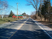
Route 20 is a 31.56 miles (50.8 km) state highway in the U.S. state of Connecticut
. It extends from Route 8
in rural Winchester
to I-91 in Windsor
. Route 20 consists of two distinct sections: a long, winding, scenic rural road, and a section of the freeway linking I-91 to Bradley International Airport
.
. It then cuts across the northwest corner of Barkhamsted to Hartland
. In Hartland, Route 20 continues northeastward to meet Route 181
, then turns north to curve around the Barkhamsted Reservoir. East of the reservoir, it turns southeast to meet Route 179
and continues into Granby
. In Granby, Route 20 continues southeastward to meet Route 219
, then turns eastward to briefly overlap Route 189
and cross US 202
and Route 10
before leaving Route 189 and continuing into East Granby
.
In East Granby, Route 20 continues eastward to meet Route 187
, then turns southeastward along the boundary of Bradley International Airport to meet the Bradley Airport Connector
at the Windsor Locks
town line. At this point, Route 20 joins the Bradley Airport Connector freeway. It continues southeastward along the Windsor Locks-Windsor
town line, intersecting with Route 75 before ending at an intersection with I-91
at the southern tip of Windsor Locks.
Memorial Highway. The Bradley Airport Connector is also known as the 82nd Airborne Memorial Highway.
, Route 20 was established as a single route incorporating old Highways 133 and 343, with an additional extension east of the Connecticut River
along old Highway 105 (modern Route 190) to Stafford Springs (ending at what was then Route 15). Route 20 crossed the Connecticut River on Bridge Street
and overlapped US 5 into Thompsonville
.
The Barkhamsted Reservoir was filled in the 1940s causing Route 20 to be relocated to go around the north end of the reservoir. Route 20 was also shifted southward near Windsor Locks around the same time to make way for an air base, which is now Bradley International Airport
. The relocation of Route 15
in 1948 to the new Wilbur Cross Highway
(then a four lane surface road) also resulted in an eastward extension of Route 20 to end at the new highway.
The Bradley Airport Connector
, an expressway connecting the airport to I-91, was constructed and opened to traffic in 1961. When the new expressway opened, Route 20 was relocated to use most of the Connector and was truncated to end at I-91. Route 140 was extended west across the Connecticut River to use the former Route 20 alignment in Windsor Locks and Route 190 was extended east to use to use the former alignment between Enfield and Union.
 Since the 1960s, it was suggested that the connector be elongated to serve other northern Connecticut towns. The highway would extend westward to U.S. Route 44
in Barkhamsted
and go eastward over I-91
and along Route 190
to I-84
. This proposal never went anywhere. Another similar proposal was made in 1967. This one stated that the expressway would go west into Granby
center and east to I-84
. This proposal also never followed through.
Connecticut
Connecticut is a state in the New England region of the northeastern United States. It is bordered by Rhode Island to the east, Massachusetts to the north, and the state of New York to the west and the south .Connecticut is named for the Connecticut River, the major U.S. river that approximately...
. It extends from Route 8
Route 8 (Connecticut)
Route 8 is the portion of the multistate New England Route 8 within the state of Connecticut. It is a state highway running north–south from Bridgeport, through Waterbury, all the way to the Massachusetts state line where it continues as Route 8...
in rural Winchester
Winchester, Connecticut
Winchester is a town in Litchfield County, Connecticut, United States. The population was 10,664 at the 2000 census. The Incorporated City of Winsted is located in Winchester.-Geography:...
to I-91 in Windsor
Windsor, Connecticut
Windsor is a town in Hartford County, Connecticut, United States, and was the first English settlement in the state. It lies on the northern border of Connecticut's capital, Hartford. The population was estimated at 28,778 in 2005....
. Route 20 consists of two distinct sections: a long, winding, scenic rural road, and a section of the freeway linking I-91 to Bradley International Airport
Bradley International Airport
Bradley International Airport is a joint civil-military public airport located in Windsor Locks on the border with East Granby and Suffield, in Hartford County, Connecticut, United States. It is owned by the State of Connecticut....
.
Route description
Route 20 begins at an intersection with Route 8 in Winchester and heads northeastward to BarkhamstedBarkhamsted, Connecticut
Barkhamsted is a town in Litchfield County in Connecticut and contains six villages, West Hill, Mallory, Center Hill, Washington Hill, Pleasant Valley and Riverton. The population was 3,494 at the 2000 census...
. It then cuts across the northwest corner of Barkhamsted to Hartland
Hartland, Connecticut
Hartland is a town in Hartford County, Connecticut, United States. The population was 2,012 at the 2000 census.-Geography:According to the United States Census Bureau, the town has a total area of , of which is land and is water...
. In Hartland, Route 20 continues northeastward to meet Route 181
Connecticut Route 181
Route 181 is a rural state highway in northern Connecticut, running from Barkhamsted to Hartland.-Route description:Route 181 begins as River Road at an intersection with US 44 in southern Barkhamsted. The road heads north into the village of Pleasant Valley, where it briefly overlaps Route 318...
, then turns north to curve around the Barkhamsted Reservoir. East of the reservoir, it turns southeast to meet Route 179
Connecticut Route 179
Route 179 is a state highway in northern Connecticut, running from Burlington to Hartland.-Route description:Route 179 begins at an intersection with Route 4 in eastern Burlington and heads north along the Farmington River into Canton...
and continues into Granby
Granby, Connecticut
Granby is a town in Hartford County, Connecticut, United States. The population was 10,347 at the 2000 census. The town center was defined as a census-designated place known as Salmon Brook in the 2000 census....
. In Granby, Route 20 continues southeastward to meet Route 219
Connecticut Route 219
Route 219 is a state highway in northern Connecticut, running from New Hartford to Granby.-Route description:Route 219 begins at an intersection with US 202 in southern New Hartford and heads north, northeast, and east before crossing the West Branch Farmington River at the town center...
, then turns eastward to briefly overlap Route 189
Connecticut Route 189
Route 189 is a state route in the U.S. states of Connecticut and Massachusetts. The route begins in the northwestern portion of the Connecticut state capital of Hartford and ends in the rural town of Granville...
and cross US 202
U.S. Route 202
U.S. Route 202 is a highway stretching from Delaware to Maine, also passing through the states of Pennsylvania, New Jersey, New York, Connecticut, Massachusetts, and New Hampshire....
and Route 10
Connecticut Route 10
Connecticut Route 10 is a state highway that runs between New Haven and the state line near Granby.-Route description:Route 10 begins at Interstate 95 as Ella T. Grasso Boulevard in the city of New Haven. It then passes by Southern Connecticut State University before entering the town of Hamden...
before leaving Route 189 and continuing into East Granby
East Granby, Connecticut
East Granby is a town in Hartford County, Connecticut, United States. The population was estimated at 5,058 in 2005. The town recently celebrated its 150th anniversary with a three-day festival on June 7, 8, and 9, 2008.-Geography:...
.
In East Granby, Route 20 continues eastward to meet Route 187
Connecticut Route 187
Route 187 is a secondary state route in the U.S. states of Connecticut and Massachusetts. It begins in the city of Hartford at Albany Avenue , travels north through the towns of Bloomfield, Windsor, East Granby and Suffield until the Connecticut-Massachusetts state line...
, then turns southeastward along the boundary of Bradley International Airport to meet the Bradley Airport Connector
Bradley Airport Connector
The Bradley Airport Connector is a expressway built to connect Bradley International Airport to Interstate 91 in Windsor, Connecticut. It begins at Exit 40 of I-91 and heads west as Route 20 roughly along the town line between Windsor and Windsor Locks...
at the Windsor Locks
Windsor Locks, Connecticut
Windsor Locks is a town located in Hartford County, Connecticut, United States. As of the 2000 census, its population was 12,043. It is the site of Bradley International Airport, which serves the Greater Hartford-Springfield region. It is also the site of the New England Air Museum...
town line. At this point, Route 20 joins the Bradley Airport Connector freeway. It continues southeastward along the Windsor Locks-Windsor
Windsor, Connecticut
Windsor is a town in Hartford County, Connecticut, United States, and was the first English settlement in the state. It lies on the northern border of Connecticut's capital, Hartford. The population was estimated at 28,778 in 2005....
town line, intersecting with Route 75 before ending at an intersection with I-91
Interstate 91
Interstate 91 is an Interstate Highway in the New England region of the United States. It provides the primary north–south thoroughfare in the western part of New England...
at the southern tip of Windsor Locks.
Special designations
The portion of Route 20 within East Granby is known as the Connecticut Air National GuardConnecticut Air National Guard
The Connecticut Air National Guard is the air force militia of the U.S. state of Connecticut. It is, along with the Connecticut Army National Guard, an element of the Connecticut National Guard. It is considered a part of the United States Air Force, as well as of the state...
Memorial Highway. The Bradley Airport Connector is also known as the 82nd Airborne Memorial Highway.
History
In 1922, the alignment of modern Route 20 was designated as two separate state highways: Highway 133 from Route 8 in Colebrook to Route 10 in Granby, and Highway 343 from Route 187 in East Granby to Route 159 in Windsor Locks. In the 1932 state highway renumbering1932 state highway renumbering (Connecticut)
In 1932, the Highway Department of the U.S. state of Connecticut , decided to completely renumber all its state highways. The only exceptions were the U.S. Highways and some of the New England Interstate Routes. Between 1922 and 1932, Connecticut used a state highway numbering system shared with...
, Route 20 was established as a single route incorporating old Highways 133 and 343, with an additional extension east of the Connecticut River
Connecticut River
The Connecticut River is the largest and longest river in New England, and also an American Heritage River. It flows roughly south, starting from the Fourth Connecticut Lake in New Hampshire. After flowing through the remaining Connecticut Lakes and Lake Francis, it defines the border between the...
along old Highway 105 (modern Route 190) to Stafford Springs (ending at what was then Route 15). Route 20 crossed the Connecticut River on Bridge Street
Bridge Street (Windsor Locks, Connecticut)
The Bridge Street Bridge is a crossing for Route 140 over the Connecticut River, connecting the towns of Windsor Locks, Connecticut and East Windsor, Connecticut-External links:...
and overlapped US 5 into Thompsonville
Thompsonville, Connecticut
Thompsonville is a census-designated place in the town of Enfield in Hartford County, Connecticut, United States. The population was 8,125 at the 2000 census.-History:...
.
The Barkhamsted Reservoir was filled in the 1940s causing Route 20 to be relocated to go around the north end of the reservoir. Route 20 was also shifted southward near Windsor Locks around the same time to make way for an air base, which is now Bradley International Airport
Bradley International Airport
Bradley International Airport is a joint civil-military public airport located in Windsor Locks on the border with East Granby and Suffield, in Hartford County, Connecticut, United States. It is owned by the State of Connecticut....
. The relocation of Route 15
Route 15 (Connecticut)
Route 15 is a state highway in the U.S. state of Connecticut that runs from a connection with New York's Hutchinson River Parkway in Greenwich, Connecticut to its northern terminus intersecting with Interstate 84 in East Hartford, Connecticut...
in 1948 to the new Wilbur Cross Highway
Wilbur Cross Highway
The Wilbur Cross Highway is the designation for the portion of old Route 15 from Wethersfield in Connecticut, through Hartford and Manchester, to the Massachusetts Turnpike in Sturbridge, Massachusetts. The highway was built in the 1940s before the Interstate Highway era...
(then a four lane surface road) also resulted in an eastward extension of Route 20 to end at the new highway.
The Bradley Airport Connector
Bradley Airport Connector
The Bradley Airport Connector is a expressway built to connect Bradley International Airport to Interstate 91 in Windsor, Connecticut. It begins at Exit 40 of I-91 and heads west as Route 20 roughly along the town line between Windsor and Windsor Locks...
, an expressway connecting the airport to I-91, was constructed and opened to traffic in 1961. When the new expressway opened, Route 20 was relocated to use most of the Connector and was truncated to end at I-91. Route 140 was extended west across the Connecticut River to use the former Route 20 alignment in Windsor Locks and Route 190 was extended east to use to use the former alignment between Enfield and Union.
Expansion of Route 20
U.S. Route 44 in Connecticut
U.S. Route 44 is an east–west U.S. Highway running from Salisbury to Putnam.-Route description:From the New York state line at Salisbury to the Rhode Island state line at Putnam, US 44 runs for a total of in Connecticut. Most of US 44 is known in the state as the Jonathan Trumbull Highway...
in Barkhamsted
Barkhamsted, Connecticut
Barkhamsted is a town in Litchfield County in Connecticut and contains six villages, West Hill, Mallory, Center Hill, Washington Hill, Pleasant Valley and Riverton. The population was 3,494 at the 2000 census...
and go eastward over I-91
Interstate 91 in Connecticut
Interstate 91 is a north–south Interstate Highway in the state of Connecticut. The interstate's southern end is in New Haven, Connecticut at Interstate 95.-Route description:...
and along Route 190
Connecticut Route 190
Route 190 is a state route in the northern part of the U.S. state of Connecticut. It starts at Route 75 in the town of Suffield and proceeds eastward across the Connecticut River through the towns of Enfield, Somers, and Stafford. It ends at Route 171, in the town of Union. Route 190 was...
to I-84
Interstate 84 in Connecticut
Interstate 84 is an East–West Interstate highway across the state of Connecticut into Danbury, Waterbury, Hartford and Union.-Route description:...
. This proposal never went anywhere. Another similar proposal was made in 1967. This one stated that the expressway would go west into Granby
Granby, Connecticut
Granby is a town in Hartford County, Connecticut, United States. The population was 10,347 at the 2000 census. The town center was defined as a census-designated place known as Salmon Brook in the 2000 census....
center and east to I-84
Interstate 84 in Connecticut
Interstate 84 is an East–West Interstate highway across the state of Connecticut into Danbury, Waterbury, Hartford and Union.-Route description:...
. This proposal also never followed through.
Junction list
| Town | Mile | Destinations | Notes |
|---|---|---|---|
| Winchester Winchester, Connecticut Winchester is a town in Litchfield County, Connecticut, United States. The population was 10,664 at the 2000 census. The Incorporated City of Winsted is located in Winchester.-Geography:... |
0.00 | ||
| Barkhamsted Barkhamsted, Connecticut Barkhamsted is a town in Litchfield County in Connecticut and contains six villages, West Hill, Mallory, Center Hill, Washington Hill, Pleasant Valley and Riverton. The population was 3,494 at the 2000 census... |
No major junctions | ||
| Hartland Hartland, Connecticut Hartland is a town in Hartford County, Connecticut, United States. The population was 2,012 at the 2000 census.-Geography:According to the United States Census Bureau, the town has a total area of , of which is land and is water... |
5.80 | ||
| 14.42 | |||
| Granby Granby, Connecticut Granby is a town in Hartford County, Connecticut, United States. The population was 10,347 at the 2000 census. The town center was defined as a census-designated place known as Salmon Brook in the 2000 census.... |
18.47 | ||
| 21.87 | Begin concurrency | ||
| 22.13 | End concurrency | ||
| E. Granby East Granby, Connecticut East Granby is a town in Hartford County, Connecticut, United States. The population was estimated at 5,058 in 2005. The town recently celebrated its 150th anniversary with a three-day festival on June 7, 8, and 9, 2008.-Geography:... |
25.58 | ||
| 27.69 | SSR 401 | Begin freeway | |
| Windsor Locks Windsor Locks, Connecticut Windsor Locks is a town located in Hartford County, Connecticut, United States. As of the 2000 census, its population was 12,043. It is the site of Bradley International Airport, which serves the Greater Hartford-Springfield region. It is also the site of the New England Air Museum... |
28.42 | Hamilton Rd. South | |
| Windsor Windsor, Connecticut Windsor is a town in Hartford County, Connecticut, United States, and was the first English settlement in the state. It lies on the northern border of Connecticut's capital, Hartford. The population was estimated at 28,778 in 2005.... |
29.01 | ||
| 30.30 | Old Country Rd., Kennedy Rd. | ||
| 31.30 |