
.gif)
Roosevelt Boulevard (Jacksonville)
Encyclopedia
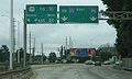
Roosevelt Boulevard is a six lane highway on the west side of Jacksonville, Florida
. It takes US 17 and SR 15, from the Duval county line just south Interstate 295
, until its northern end at Willow Branch Avenue, with the road itself becoming one of the incarnations of College Street in the Riverside area of Jacksonville.
 Roosevelt Boulevard is one of two roads that connect Orange Park and Jacksonville, passing through Yukon and Venetia, Ortega, Lake Shore and Fairfax, Riverside-Avondale and Murray Hill neighborhoods along its path to central Jacksonville.
Traveling north from Orange Park, Florida
, in Clay County, where U.S. 17/SR 15 is known as Park Avenue, this route takes the name of Roosevelt Boulevard entering Jacksonville and Duval County, intersecting with Interstate 295
(SR 9A) just north of the Clay/Duval county line. The highway intersects east-west connector Collins Road and continues along the east edge of a railroad, the CSX A line for most of its length. Immediately north of Collins Road, the highway serves as the western border of Naval Air Station Jacksonville
along the St. Johns River
, with three gates, though two are rarely used. The main gate at Yorktown, features a Blue Angel at the gates. To the west of NAS Jacksonville is Fowler Park, on the shores of the Ortega River and in the Yukon section of Jacksonville.
North of NAS JAX, Roosevelt Boulevard intersects Timuquana Road
, followed by Ortega Boulevard
one block north. US 17 then veers northwest to bisect Ortega and border the Ortega historic district to the east. Upon crossing the Ortega River and entering the Jacksonville Marina Mile district in Lake Shore at the Roosevelt Mall, the road resumes a cardinal north direction for the next two miles, starting at the Birkenhead Road/Wabash Avenue intersection at the south end of Roosevelt Mall. After intersecting San Juan Avenue at the north end of the mall, Roosevelt Boulevard crosses St. Johns Avenue, followed with a northbound only exit/southbound only entrance with Park Street and then a southbound only exit/northbound only entrance with North Park Street 200 yards north. Park Street provides access to the Florida State College Jacksonville Kent campus (FSCJ) campus, just north of the next major intersection, Blanding Boulevard. The intersection is an incomplete interchange, with no northbound access. US 17 continues north, with the FSCJ campus on the east end of the road for the next 1/4 mile, entering Avondale and intersecting Plymouth Street at the north end of the FSCJ campus.
North of Plymouth Street, the highway curves in a northeastern direction rounding the FSCJ Kent campus. Just north of Wolfe Street, the elevated Roosevelt Expressway
splits off from Roosevelt Boulevard between the Murray Hill and Avondale neighborhoods, where the highway features an interchange at South Edgewood Avenue. When the Expressway veers off from Roosevelt Boulevard, Old Roosevelt Boulevard continues to parallel the rail, intersecting McDuff Avenue
, then Post Street, and finally Willowbranch Avenue at College Street in Riverside. At Post Street, US 17/Old Roosevelt eastbound splits off toward downtown Jacksonville, while US 17 southbound continues one block north of Post Street to College Street as a westbound road, reflecting the previous usage of Post and College each as one-way thoroughfares through historic Riverside and 5 Points.
U.S. 17 was expanded to six lanes following construction of the Roosevelt Expressway/Spur. The short four lane portion and scale of Roosevelt Boulevard remains north of the Roosevelt Expressway
interchange, located near Day Avenue and north of Edgewood Avenue.
U.S. 17 is part of the Blue Star Memorial Highway, and named for President Franklin D. Roosevelt
.
.
Florida
Florida is a state in the southeastern United States, located on the nation's Atlantic and Gulf coasts. It is bordered to the west by the Gulf of Mexico, to the north by Alabama and Georgia and to the east by the Atlantic Ocean. With a population of 18,801,310 as measured by the 2010 census, it...
. It takes US 17 and SR 15, from the Duval county line just south Interstate 295
Interstate 295 (Florida)
Interstate 295 , an auxiliary route of Interstate 95, is a bypass route around central Jacksonville, Florida, which is currently signed on the western half for...
, until its northern end at Willow Branch Avenue, with the road itself becoming one of the incarnations of College Street in the Riverside area of Jacksonville.
Route description
Traveling north from Orange Park, Florida
Orange Park, Florida
Orange Park is a town in Clay County, Florida, USA, and a suburb of Jacksonville. The population was 8,412 at the 2010 census. The name "Orange Park" is additionally applied to a wider area of northern Clay County outside the town limits, covering such communities as Fleming Island, Lakeside, and...
, in Clay County, where U.S. 17/SR 15 is known as Park Avenue, this route takes the name of Roosevelt Boulevard entering Jacksonville and Duval County, intersecting with Interstate 295
Interstate 295 (Florida)
Interstate 295 , an auxiliary route of Interstate 95, is a bypass route around central Jacksonville, Florida, which is currently signed on the western half for...
(SR 9A) just north of the Clay/Duval county line. The highway intersects east-west connector Collins Road and continues along the east edge of a railroad, the CSX A line for most of its length. Immediately north of Collins Road, the highway serves as the western border of Naval Air Station Jacksonville
Naval Air Station Jacksonville
Naval Air Station Jacksonville or NAS Jacksonville is a military airport located four miles south of the central business district of Jacksonville...
along the St. Johns River
St. Johns River
The St. Johns River is the longest river in the U.S. state of Florida and its most significant for commercial and recreational use. At long, it winds through or borders twelve counties, three of which are the state's largest. The drop in elevation from the headwaters to the mouth is less than ;...
, with three gates, though two are rarely used. The main gate at Yorktown, features a Blue Angel at the gates. To the west of NAS Jacksonville is Fowler Park, on the shores of the Ortega River and in the Yukon section of Jacksonville.
North of NAS JAX, Roosevelt Boulevard intersects Timuquana Road
Florida State Road 134
State Road 134 is an 11 mile long, east-west signed Florida State Road located entirely in Jacksonville, Duval County, Florida, United States, extending from State Road 228 to U.S. Route 17. It is known as 103rd Street west of Wesconnett Blvd. and Timuquana Road east of the intersection...
, followed by Ortega Boulevard
Florida State Road 211
State Road 211 is a state highway entirely within Jacksonville, Florida, running from U.S. Highway 17/SR 15 , north to the northern approach of the Acosta Bridge at SR 13 with US 17/SR 15 and SR 228 in downtown Jacksonville....
one block north. US 17 then veers northwest to bisect Ortega and border the Ortega historic district to the east. Upon crossing the Ortega River and entering the Jacksonville Marina Mile district in Lake Shore at the Roosevelt Mall, the road resumes a cardinal north direction for the next two miles, starting at the Birkenhead Road/Wabash Avenue intersection at the south end of Roosevelt Mall. After intersecting San Juan Avenue at the north end of the mall, Roosevelt Boulevard crosses St. Johns Avenue, followed with a northbound only exit/southbound only entrance with Park Street and then a southbound only exit/northbound only entrance with North Park Street 200 yards north. Park Street provides access to the Florida State College Jacksonville Kent campus (FSCJ) campus, just north of the next major intersection, Blanding Boulevard. The intersection is an incomplete interchange, with no northbound access. US 17 continues north, with the FSCJ campus on the east end of the road for the next 1/4 mile, entering Avondale and intersecting Plymouth Street at the north end of the FSCJ campus.
North of Plymouth Street, the highway curves in a northeastern direction rounding the FSCJ Kent campus. Just north of Wolfe Street, the elevated Roosevelt Expressway
Roosevelt Expressway
The following roads are called the Roosevelt Expressway:*Roosevelt Expressway in Jacksonville, Florida*Roosevelt Expressway, part of the Roosevelt Boulevard in Philadelphia, Pennsylvania...
splits off from Roosevelt Boulevard between the Murray Hill and Avondale neighborhoods, where the highway features an interchange at South Edgewood Avenue. When the Expressway veers off from Roosevelt Boulevard, Old Roosevelt Boulevard continues to parallel the rail, intersecting McDuff Avenue
Florida State Road 129
State Road 129, also known as McDuff Avenue, is a north-south road in western Jacksonville, Florida.-Route description:SR 129 begins at US 17/SR 15, intersecting with SR 228 one block north of the southern terminus...
, then Post Street, and finally Willowbranch Avenue at College Street in Riverside. At Post Street, US 17/Old Roosevelt eastbound splits off toward downtown Jacksonville, while US 17 southbound continues one block north of Post Street to College Street as a westbound road, reflecting the previous usage of Post and College each as one-way thoroughfares through historic Riverside and 5 Points.
History
Before this route was legislated in 1939, Clay County traffic into the City of Jacksonville made use of a combination of several smaller, narrower roads along the west bank of the St. Johns River.U.S. 17 was expanded to six lanes following construction of the Roosevelt Expressway/Spur. The short four lane portion and scale of Roosevelt Boulevard remains north of the Roosevelt Expressway
Roosevelt Expressway
The following roads are called the Roosevelt Expressway:*Roosevelt Expressway in Jacksonville, Florida*Roosevelt Expressway, part of the Roosevelt Boulevard in Philadelphia, Pennsylvania...
interchange, located near Day Avenue and north of Edgewood Avenue.
U.S. 17 is part of the Blue Star Memorial Highway, and named for President Franklin D. Roosevelt
Franklin D. Roosevelt
Franklin Delano Roosevelt , also known by his initials, FDR, was the 32nd President of the United States and a central figure in world events during the mid-20th century, leading the United States during a time of worldwide economic crisis and world war...
.
Major intersections
The entire route is located in Jacksonville, Duval CountyDuval County, Florida
Duval County is a county located in the U.S. state of Florida. As of 2010, the population was 864,263. Its county seat is Jacksonville, with which the Duval County government has been consolidated since 1968...
.
| Mile | Destinations | Notes |
|---|---|---|
| 0.0 | ||
| Yorktown Avenue | Entrance to NAS Jacksonville Naval Air Station Jacksonville Naval Air Station Jacksonville or NAS Jacksonville is a military airport located four miles south of the central business district of Jacksonville... |
|
| Edgewood Avenue South | Diamond interchange Diamond interchange A diamond interchange is a common type of road junction, used where a freeway crosses a minor road. The freeway itself is grade-separated from the minor road, one crossing the other over a bridge... |
|
| 9.8 | College Street/Willow Branch Avenue | Northern terminus |