

Rivers of Hong Kong
Encyclopedia
The location of Hong Kong
, adjacent to the coast, is not close to the system of major river
s in southern China, though the water to the west of Hong Kong is influenced by Pearl River. In 1,103 km² of land, the territory is largely hilly with over 200 islands. Because of this, the terrain can nurture relatively shorter and smaller rivers in Hong Kong than in southern China.
Historically, these rivers once sustained intensive farming
for the need of population before the age of developing new town
s. Many rivers can be found in the New Territories
, especially in the areas north of Tai Mo Shan
, where rice growing and fish farming were once everywhere amidst several river systems.
Hong Kong
Hong Kong is one of two Special Administrative Regions of the People's Republic of China , the other being Macau. A city-state situated on China's south coast and enclosed by the Pearl River Delta and South China Sea, it is renowned for its expansive skyline and deep natural harbour...
, adjacent to the coast, is not close to the system of major river
River
A river is a natural watercourse, usually freshwater, flowing towards an ocean, a lake, a sea, or another river. In a few cases, a river simply flows into the ground or dries up completely before reaching another body of water. Small rivers may also be called by several other names, including...
s in southern China, though the water to the west of Hong Kong is influenced by Pearl River. In 1,103 km² of land, the territory is largely hilly with over 200 islands. Because of this, the terrain can nurture relatively shorter and smaller rivers in Hong Kong than in southern China.
Historically, these rivers once sustained intensive farming
Intensive farming
Intensive farming or intensive agriculture is an agricultural production system characterized by the high inputs of capital, labour, or heavy usage of technologies such as pesticides and chemical fertilizers relative to land area....
for the need of population before the age of developing new town
New towns of Hong Kong
The area of Hong Kong is very mountainous and many places in the New Territories have limited access to roads. Hong Kong started developing new towns in the 1950s, to accommodate booming populations. In the early days the term "satellite towns" was used. The very first new towns included Tsuen Wan...
s. Many rivers can be found in the New Territories
New Territories
New Territories is one of the three main regions of Hong Kong, alongside Hong Kong Island and the Kowloon Peninsula. It makes up 86.2% of Hong Kong's territory. Historically, it is the region described in The Convention for the Extension of Hong Kong Territory...
, especially in the areas north of Tai Mo Shan
Tai Mo Shan
Tai Mo Shan has the highest peak in Hong Kong, with an altitude of 957 m. It is located approximately at the geographical centre of the New Territories....
, where rice growing and fish farming were once everywhere amidst several river systems.
Kowloon and New Kowloon
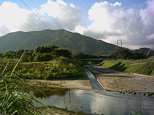
| Name | Image |
|---|---|
| Jordan Valley Nullah (佐敦谷渠) |
|
| Kai Tak Nullah Kai Tak Nullah The Kai Tak Nullah collects water from the rivers and streams flowing from the hills in northern New Kowloon. It empties into the narrow channel leading into the Kwun Tong Typhoon Shelter. Part of the nullah is covered.-See also:... (啟德渠) |
|
| Tonkin Street Nullah (東京街渠) |
Hong Kong Island
| Name | Image |
|---|---|
| Wong Chuk Hang Nullah (黃竹坑渠) |
Mainland
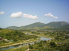
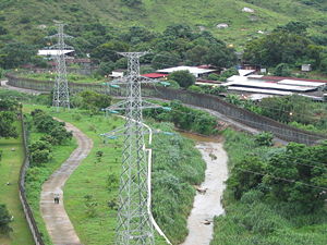
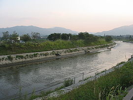
| Name | Image |
|---|---|
| Fairview Park Nullah (錦繡花園明渠) |
|
| Fo Tan Nullah Fo Tan Nullah Fo Tan Nullah is one of the nullahs of Shing Mun River in Fo Tan, Hong Kong.-External links:*, in Chinese... (火炭渠) |
|
| Ha Tsuen Nullah (廈村明渠) |
|
| Ho Chung River (蠔涌河) |
|
| Kam Tin River (錦田河) |
|
| Kap Man Hang (夾萬坑) |
|
| Kau To Hang Kau To Hang Kau To Hang is a river in Sha Tin, New Territories, Hong Kong. Its life starts near Cheung Lek Mei, inside Tai Po Kau Nature Reserve. It flows eastward past Nim Au, Ma Niu, Kau To, collecting minor streams on the way. Finally, it empties into Sha Tin Hoi, part of Tolo Harbour.-External links:*, in... (九肚坑) |
|
| Kwan Tei River Kwan Tei River Kwan Tei River is a river in northeastern New Territories, Hong Kong. Its source is from the Lau Shui Heung Reservoir. The river flows through Lau Shui Heung Village and underneath Sha Tau Kok Road before joining Ng Tung River near Kwan Tei Pei Village.... (軍地河) |
|
| Lam Tsuen River Lam Tsuen River The Lam Tsuen River is a river in Tai Po District, Hong Kong. It collects water from the Ng Tung Chai Water Fall on the hill Sze Fong Shan and joins other branches in the Lam Tsuen Valley... (林村河) |
|
| Lung Hang (龍坑) |
|
| Ma Liu River (馬尿河) |
|
| Ma Wat River Ma Wat River Ma Wat River is a river in Fanling, northern New Territories, Hong Kong. Its source lies at Kau Lung Hang Shan. The river flows northwards towards Fanling, staying near the eastern industrial areas. It empties into Ng Tung River near Kan Lung Tsuen.... (麻笏河) |
 |
| Nam Chung River (南涌河) |
|
| Ng Tung River (梧桐河) |
 |
| Pak Sha O River (白沙澳河) |
|
| Ping Yuen River Ping Yuen River Ping Yuen River is a river in northern New Territories, Hong Kong. Its source lies near Cheung Shan in Ping Che. It flows along Ping Che Road and into the River Ganges Pumping Station near Chau Tin Village before emptying into Sham Chun River.-External links:*, in Chinese... (平原河) |
|
| Sha Tau Kok River Sha Tau Kok River The Sha Tau Kok River , along with Sham Chun River, serves as the natural border between Hong Kong and mainland China. It is situated at the northeastern corner of North District, Hong Kong and the southeastern corner of Shenzhen, Guangdong... (沙頭角河) |
|
| Sham Chun River Sham Chun River Sham Chun River serves as the natural border between Hong Kong and Mainland China, together with the Sha Tau Kok River.... (深圳河) |
 |
| Shan Pui River Shan Pui River Shan Pui River is a river in Yuen Long, New Territories, Hong Kong. It has many tributaries, most of them starting from inside Tai Lam Country Park. It passes six villages and is joined by a few more streams. After flowing through Yuen Long Town, it continues northeast into Yuen Long Industrial... (山貝河) |
|
| She Shan River (社山河) |
|
| Shek Sheung River Shek Sheung River Shek Sheung River , is a river in northern New Territories, Hong Kong. It originates from near Choi Po Court and Hong Kong Golf Club. The river flows beside East Rail Line and eventually empties into Ng Tung River.-External links:*, in Chinese... (石上河) |
|
| Sheung Yue River Sheung Yue River Sheung Yue River is a river in northern New Territories, Hong Kong. Its sources are near Kai Kung Leng and Ki Lun Shan, where numerous streams flow into the river. It flows through Kwu Tung and Sheung Shui. It joins up with Shek Sheung River and eventually empties into Ng Tung River.Beas River... (雙魚河) |
 |
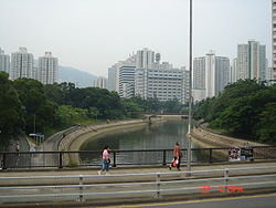
| Shing Mun River Shing Mun River Shing Mun River, or Shing Mun River Channel, is a river in Sha Tin, Hong Kong.-History:The original Shing Mun River began at Needle Hill, and flowed into the former Tide Cove , a shallow bay. In the 1970s, Tide Cove was drained and turned to Sha Tin New Town... (城門河) |
|
| Siu Lek Yuen Nullah Siu Lek Yuen Nullah Siu Lek Yuen Nullah is one of the nullahs of Shing Mun River in Siu Lek Yuen of Hong Kong.-External links:*, in Chinese... (小瀝源渠) |
|
| Tai Lam Chung (大欖涌) |
|
| Tai Po Kau Stream (大埔滘溪) |
|
| Tai Po River Tai Po River Tai Po River is a river in Tai Po, New Territories, Hong Kong. It has many tributaries, with most coming from Yin Yim Teng, Grassy Hill, and Lead Mine Pass... (大埔河) |
 |
| Tai Shing Stream (大城石澗) |
|
| Tan Shan River Tan Shan River The Tan Shan River is a river in northeastern New Territories, Hong Kong. The river originates in Ping Fung Shan near Pat Sin Leng. It flows through Hok Tau Reservoir and Ping Che before finally emptying into Ng Tung River near Kwan Tei.-External links:*, in Chinese... (丹山河) |
|
| Tin Shui Wai Nullah (天水圍渠) |
|
| Tuen Mun River Tuen Mun River The Tuen Mun River is a river in Tuen Mun, New Territories, Hong Kong. It has many tributaries, with major ones coming from Lam Tei, Kau Keng Shan, Hung Shui Hang and Nai Wai. It flows south, splitting Tuen Mun into a west side and an east side... (屯門河) |
|
| Tung Wan Hang (東灣坑) |
|
| Wong Chuk Chung (黃竹涌) |
|
| Yuen Long Nullah Yuen Long Nullah Yuen Long Nullah is a nullah across western Yuen Long, Hong Kong. It starts off as a stream west of Tai Tong and flows north into Yuen Long Town. It then changes course to the northeast and connects with Shan Pui River.-External links:**... (元朗渠) |
Lantau Island
| Name | Image |
|---|---|
| Silver River (銀河) |
|
| Tai O Chung (大澳涌) |
|
| Tai O Chung (大澳涌) |
|
| Wong Lung Hang (黃龍坑) |
See also
- Geography of Hong KongGeography of Hong KongThe geography of Hong Kong primarily consists of three main territories: Hong Kong Island, Kowloon Peninsula, and the New Territories.The name "Hong Kong", literally meaning "fragrant harbour", is derived from the area around present-day Aberdeen on Hong Kong Island, where fragrant wood products...
- List of buildings, sites, and areas in Hong Kong
- List of rivers in China
- Subterranean rivers in Hong KongSubterranean rivers in Hong KongMany places in Hong Kong got their names from rivers. With urban development, many of these rivers are converted into sewers, as it is difficult to stop them flowing downhill.-List of subterranean rivers:*Kwai Chung*Kai Tak Nullah *Sai Wan Ho*Tai Hang...
External links
- A partial list of rivers in Hong Kong - in Chinese