

Rivers of Honduras
Encyclopedia
River
A river is a natural watercourse, usually freshwater, flowing towards an ocean, a lake, a sea, or another river. In a few cases, a river simply flows into the ground or dries up completely before reaching another body of water. Small rivers may also be called by several other names, including...
s in Honduras
Honduras
Honduras is a republic in Central America. It was previously known as Spanish Honduras to differentiate it from British Honduras, which became the modern-day state of Belize...
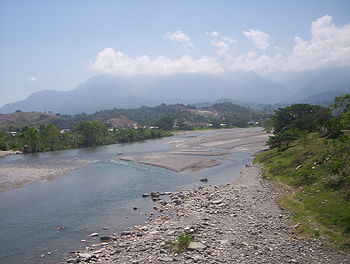
, including those it shares with neighbours. The most important river in Honduras is the Ulúa
Ulúa River
The Ulua River is a river in western Honduras. It rises in the central mountainous area of the country close to La Paz and runs 150 miles approximately due northwards to the east end of the Gulf of Honduras at . En route, it is joined by the Sulaco River, the Otoro River and the Chamelecon River....
, which flows 400 kilometers to the Caribbean through the economically important Valle de Sula
San Pedro Sula
San Pedro Sula is a city in Honduras. It is located in the northwest corner of the country, in the Valle de Sula , about 60 km south of Puerto Cortés on the Caribbean. With an estimated population of 638,259 people in the main municipality, and 802,598 in its metro area , it is the second...
. Numerous other rivers drain the interior highlands and empty north into the Caribbean Sea
Caribbean Sea
The Caribbean Sea is a sea of the Atlantic Ocean located in the tropics of the Western hemisphere. It is bounded by Mexico and Central America to the west and southwest, to the north by the Greater Antilles, and to the east by the Lesser Antilles....
. These other rivers are important, not as transportation routes, but because of the broad fertile valleys they have produced. They can also create problems for human inhabitants along their banks, and those who rely on the bridges spanning them, during times of intense rains. An example of those was the Choluteca River
Choluteca River
The Choluteca River is a river in southern Honduras. Its source is in the department of Francisco Morazán, near Lepaterique , and from there it flows North through the city of Tegucigalpa, then South through the department of El Paraíso, and the department and city of Choluteca...
, which wreaked havoc in the capital of Tegucigalpa
Tegucigalpa
Tegucigalpa , and commonly referred as Tegus , is the capital of Honduras and seat of government of the Republic, along with its twin sister Comayagüela. Founded on September 29, 1578 by the Spanish, it became the country's capital on October 30, 1880 under President Marco Aurelio Soto...
during Hurricane Mitch
Hurricane Mitch
Hurricane Mitch was the most powerful hurricane and the most destructive of the 1998 Atlantic hurricane season, with maximum sustained winds of 180 mph . The storm was the thirteenth tropical storm, ninth hurricane, and third major hurricane of the season. Along with Hurricane Georges, Mitch...
.
- Río PatucaPatuca RiverThe Patuca is a river in northeastern Honduras, formed southeast of Juticalpa by the merger of the Guayape and Guayambre rivers. It is the second largest river in Central America....
is the largest in Honduras and the second largest in Central America. - Río UlúaUlúa RiverThe Ulua River is a river in western Honduras. It rises in the central mountainous area of the country close to La Paz and runs 150 miles approximately due northwards to the east end of the Gulf of Honduras at . En route, it is joined by the Sulaco River, the Otoro River and the Chamelecon River....
is the most important river economically. - Río Grande o CholutecaCholuteca RiverThe Choluteca River is a river in southern Honduras. Its source is in the department of Francisco Morazán, near Lepaterique , and from there it flows North through the city of Tegucigalpa, then South through the department of El Paraíso, and the department and city of Choluteca...
runs through the capital Tegucigalpa. - Río CocoCoco RiverThe Río Coco, formerly known as the Río Segovia, Cape River, or Yara River, is a river in southern Honduras and northern Nicaragua. To the Miskito Indians that live along the river it is known as the Wanki or Wanks River...
borders NicaraguaNicaraguaNicaragua is the largest country in the Central American American isthmus, bordered by Honduras to the north and Costa Rica to the south. The country is situated between 11 and 14 degrees north of the Equator in the Northern Hemisphere, which places it entirely within the tropics. The Pacific Ocean...
. - Río Negro (Central America)Río Negro (Central America)Río Negro is a river that divides the countries of Honduras and Nicaragua along the Pacific coast. Its path was substantially altered by Hurricane Mitch in October 1998. It mostly runs through a very undeveloped jungle region of the 2 countries....
is another river that borders Nicaragua. - Río GoascoránGoascorán RiverThe Goascorán River or Río Goascorán is a river in Honduras and El Salvador that divides the two countries.-References:...
divides El SalvadorEl SalvadorEl Salvador or simply Salvador is the smallest and the most densely populated country in Central America. The country's capital city and largest city is San Salvador; Santa Ana and San Miguel are also important cultural and commercial centers in the country and in all of Central America...
from Honduras.
By Drainage BasinDrainage basinA drainage basin is an extent or an area of land where surface water from rain and melting snow or ice converges to a single point, usually the exit of the basin, where the waters join another waterbody, such as a river, lake, reservoir, estuary, wetland, sea, or ocean...
This list is arranged by drainage basin, from east to west, with respective tributaries indented under each larger stream's name.Atlantic OceanAtlantic OceanThe Atlantic Ocean is the second-largest of the world's oceanic divisions. With a total area of about , it covers approximately 20% of the Earth's surface and about 26% of its water surface area...
- Coco RiverCoco RiverThe Río Coco, formerly known as the Río Segovia, Cape River, or Yara River, is a river in southern Honduras and northern Nicaragua. To the Miskito Indians that live along the river it is known as the Wanki or Wanks River...
(Segovia River) - Cruta RiverCruta River-References:*Rand McNally, The New International Atlas, 1993.*CIA map: :Image:Honduras rel 1985.jpg*UN map: :Image:Un-honduras.png*...
- Nakunta RiverNakunta RiverThe Nakunta River is a river in the Gracias a Dios Department of Honduras that exits into the Caratasca Lagoon a few miles south of Puerto Lempira. It is in length....
- Mocorón RiverMocorón River-References:*Rand McNally, The New International Atlas, 1993.*CIA map: :Image:Honduras rel 1985.jpg*UN map: :Image:Un-honduras.png...
- Warunta RiverWarunta RiverThe Warunta River is a river in the Gracias a Dios Department of Honduras that flows into the Warunta Lagoon adjoining the larger Caratasca Lagoon.-References:*Rand McNally, The New International Atlas, 1993.*CIA map: :Image:Honduras rel 1985.jpg...
- Patuca RiverPatuca RiverThe Patuca is a river in northeastern Honduras, formed southeast of Juticalpa by the merger of the Guayape and Guayambre rivers. It is the second largest river in Central America....
- Wampú RiverWampú River-References:*Rand McNally, The New International Atlas, 1993.*CIA map: :Image:Honduras rel 1985.jpg*UN map: :Image:Un-honduras.png*...
- Guayambre RiverGuayambre River-References:*Rand McNally, The New International Atlas, 1993.*CIA map: :Image:Honduras rel 1985.jpg*UN map: :Image:Un-honduras.png*...
- Guayape RiverGuayape RiverThe Guayape River is a major river that drains much of the Department of Olancho and central Honduras. The largest tributary to the Guayape is the Río Jalán, which joins it at El Plomo, not far from the city of Juticalpa. From there the river passes many small towns, including El Esquilinchuche...
- Tinto RiverTinto River (Guayape)-References:*Rand McNally, The New International Atlas, 1993.*CIA map: :Image:Honduras rel 1985.jpg*UN map: :Image:Un-honduras.png*...
- Talgua RiverTalgua RiverThe Talgua River or Río Talgua is a river in the Catacamas of Honduras....
- Telica RiverTelica River-References:*Rand McNally, The New International Atlas, 1993.*CIA map: :Image:Honduras rel 1985.jpg*UN map: :Image:Un-honduras.png*...
- Jalan RiverJalan River-References:*Rand McNally, The New International Atlas, 1993.*CIA map: :Image:Honduras rel 1985.jpg*UN map: :Image:Un-honduras.png*...
- Tinto River
- Wampú River
- Sigre RiverSigre River-References:*Rand McNally, The New International Atlas, 1993.*CIA map: :Image:Honduras rel 1985.jpg*UN map: :Image:Un-honduras.png*...
- Plátano RiverPlátano RiverThe Plátano River is a river in Honduras which runs through the Río Plátano Biosphere Reserve.-References:*Rand McNally, The New International Atlas, 1993.*CIA map: :Image:Honduras rel 1985.jpg*UN map: :Image:Un-honduras.png*...
- Río Sico Tinto NegroRío Sico Tinto Negro-References:*Rand McNally, The New International Atlas, 1993.*CIA map: :Image:Honduras rel 1985.jpg*UN map: :Image:Un-honduras.png*...
(Tinto River)- Sico RiverSico River-References:*Rand McNally, The New International Atlas, 1993.*CIA map: :Image:Honduras rel 1985.jpg*UN map: :Image:Un-honduras.png*...
- Paulaya RiverPaulaya River-References:*Rand McNally, The New International Atlas, 1993.*CIA map: :Image:Honduras rel 1985.jpg*UN map: :Image:Un-honduras.png*...
- Sico River
- Aguán RiverAguán RiverThe Aguán River is a river in Honduras. It rises in the Yoro region to the west of San Lorenzo and briefly runs south before turning East-North-East, passing San Lorenzo, Olanchito and Tocoa before entering the Caribbean Sea east of Puerto Castilla.The river is 240 kilometres in length...
- Yaguala RiverYaguala River-References:*Rand McNally, The New International Atlas, 1993.*CIA map: :Image:Honduras rel 1985.jpg*UN map: :Image:Un-honduras.png*...
(Mangulile River)
- Yaguala River
- Papaloteca RiverPapaloteca River-References:*Rand McNally, The New International Atlas, 1993.*CIA map: :Image:Honduras rel 1985.jpg*UN map: :Image:Un-honduras.png*...
- Cangrejal RiverCangrejal RiverThe Cangrejal River or Río Cangrejal is a river that drains several mountain tributaries and borders the rainforest of Pico Bonito National Park near La Ceiba, Honduras. The river offers some of the best whitewater rafting opportunities in Central America....
- Cuero RiverCuero River-References:*Rand McNally, The New International Atlas, 1993.*CIA map: :Image:Honduras rel 1985.jpg*UN map: :Image:Un-honduras.png*...
- Leán RiverLeán River-References:*Rand McNally, The New International Atlas, 1993.*CIA map: :Image:Honduras rel 1985.jpg*UN map: :Image:Un-honduras.png*...
- Tela RiverTela RiverThe Tela River or Río de Tela is a river that runs through Tela, in Honduras, flowing into the Caribbean Sea. It begins in a marshy area inland and opens out near the sea....
- Ulúa RiverUlúa RiverThe Ulua River is a river in western Honduras. It rises in the central mountainous area of the country close to La Paz and runs 150 miles approximately due northwards to the east end of the Gulf of Honduras at . En route, it is joined by the Sulaco River, the Otoro River and the Chamelecon River....
- Humuya RiverHumuya River-References:*Rand McNally, The New International Atlas, 1993.*CIA map: :Image:Honduras rel 1985.jpg*UN map: :Image:Un-honduras.png*...
- Sulaco RiverSulaco River-References:*Rand McNally, The New International Atlas, 1993.*CIA map: :Image:Honduras rel 1985.jpg*UN map: :Image:Un-honduras.png*...
- Sulaco River
- Blanco RiverRío Blanco (Honduras)The Río Blanco is a river in Honduras. This flows Northwards through La Ceiba and empties Its Waters into the Caribbean Gulf.-References:*Rand McNally, The New International Atlas, 1993.*CIA map: :Image:Honduras rel 1985.jpg...
- Otoro RiverOtoro River-References:*Rand McNally, The New International Atlas, 1993.*CIA map: :Image:Honduras rel 1985.jpg*UN map: :Image:Un-honduras.png*...
(Río Grande de Otoro) - Jicatuyo RiverJicatuyo River-References:*Rand McNally, The New International Atlas, 1993.*CIA map: :Image:Honduras rel 1985.jpg*UN map: :Image:Un-honduras.png*...
- Higuito RiverHiguito River-References:*Rand McNally, The New International Atlas, 1993.*CIA map: :Image:Honduras rel 1985.jpg*UN map: :Image:Un-honduras.png*...
- Higuito River
- Humuya River
- Chamelecon RiverChamelecon River-References:*Rand McNally, The New International Atlas, 1993.*CIA map: :Image:Honduras rel 1985.jpg*UN map: :Image:Un-honduras.png*...
- Motagua RiverMotagua RiverThe Motagua River is a long river in Guatemala. It rises in the western highlands of Guatemala where it is also called Río Grande, and runs in an easterly direction to the Gulf of Honduras. The final few kilometres of the river form part of the Guatemala/Honduras border...
Pacific OceanPacific OceanThe Pacific Ocean is the largest of the Earth's oceanic divisions. It extends from the Arctic in the north to the Southern Ocean in the south, bounded by Asia and Australia in the west, and the Americas in the east.At 165.2 million square kilometres in area, this largest division of the World...
- Río NegroRío Negro (Central America)Río Negro is a river that divides the countries of Honduras and Nicaragua along the Pacific coast. Its path was substantially altered by Hurricane Mitch in October 1998. It mostly runs through a very undeveloped jungle region of the 2 countries....
- Choluteca RiverCholuteca RiverThe Choluteca River is a river in southern Honduras. Its source is in the department of Francisco Morazán, near Lepaterique , and from there it flows North through the city of Tegucigalpa, then South through the department of El Paraíso, and the department and city of Choluteca...
(Río Grande o Choluteca) - Nacaome RiverNacaome River-References:*Rand McNally, The New International Atlas, 1993.*CIA map: :Image:Honduras rel 1985.jpg*UN map: :Image:Un-honduras.png*...
- Goascorán RiverGoascorán RiverThe Goascorán River or Río Goascorán is a river in Honduras and El Salvador that divides the two countries.-References:...
- Lempa RiverLempa RiverThe Lempa River is a 422 km long river in Central America. Its sources are located in between the Sierra Madre and the Sierra del Merendón in southern Guatemala, near the town of Olopa. In Guatemala the river is called Río Olopa and flows southwards for 30.4 km before entering Honduras and...
- Torola River
- Guarajambala RiverGuarajambala River-References:*Rand McNally, The New International Atlas, 1993.*CIA map: :Image:Honduras rel 1985.jpg*UN map: :Image:Un-honduras.png*...
- Mocal RiverMocal River-References:*Rand McNally, The New International Atlas, 1993.*CIA map: :Image:Honduras rel 1985.jpg*UN map: :Image:Un-honduras.png*...
- Sumpul RiverSumpul RiverThe Sumpul is a river of north-western El Salvador. It flows through the Chalatenango Department....