
.gif)
River Yarrow (Lancashire)
Encyclopedia
The River Yarrow is in Lancashire
, with its source at an area called Will Narr at Hordern Stoops, along Spitlers Edge
- the Chorley
/Blackburn boundary - on the West Pennine Moors
. The river feeds the Yarrow Reservoir
, which in turn feeds the Anglezarke
and Upper
and Lower Rivington Reservoir
s. Upon leaving the reservoirs via a pumping station
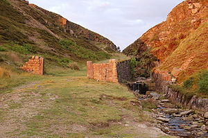
, the river passes through an area that was formerly known as Abyssinia. Currently, this area is within the boundaries of Heath Charnock and Limbrick, but the original name was given because it was a route frequented by coal miner
s, and the workers were said to look like natives of Abyssinia (modern day Ethiopia
): until the mid 20th century it was usual for miners to return from work covered in coal dust.
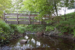
From here, the river flows underneath the Leeds and Liverpool Canal
, joining Black Brook
at Yarrow Bridge
, then continuing through the ancient woodland of Duxbury
into Yarrow Valley Park
forming a boundary of Euxton
and on through Eccleston
and Croston
, where it feeds the River Douglas
at Sollom
just before its inlet into the River Ribble
's brackish final stretch. The entire course of the River Yarrow falls within Chorley
and its villages. Parts of the river are a County Biological Heritage Site.
discharge from Whitter's Factory and Stanley's Factory, the river is now much cleaner, and as such has attracted birds such as Dipper
, Grey Wagtail
and Kingfisher
, and fish including Trout
, Chub
, Dace
and Barbel
.
Fish passes
have been installed at Pincock, Birkacre and Duxbury, to enable upstream spawning of fish which would be unable to navigate the weir
s. Salmon
have been recorded at Duxbury for the first time in over 100 years.
Removal of Himalayan Balsam
, Japanese Knotweed
and Rhododendron
plants is undertaken to allow low-growing native species to flourish.

 Locations that are listed on Ordnance Survey
maps have been italicised.
Green Withins Brook
starts at Standing Stones Hill and joins the Yarrow near to the ruins of Simm's Farm.
Limestone Brook has its source near to Devils Ditch, and flows via Shooting Huts on Anglezarke
moor where it connects into the Yarrow at Meeting of the Waters.
Black Brook
flows from Great Hill
through White Coppice
(where it is known as Warth Brook), and lesserly from Eagle Tower at Heapey
. The brook joins the river at the Yarrow Bridge
prior to entering Duxbury Woods
. The brook is actually larger than the Yarrow, due to the large amount of water removed from the Yarrow for consumption. In fact, the Yarrow flooded when Anglezarke Reservoir
was drained in 2002, waterlogging the fields at Nick Hiltons Bridge.
Between Duxbury Woods and Drybones (off Burgh Lane), Eller Brook adds to the flow from Adlington
.
Clancutt Brook flows away from the sea, and feeds in at Birkacre near Coppull
.
The River Chor
joins the Yarrow at the Common Bank area of Chorley, near to Euxton
.
German Brook enters shortly after.
Culbeck Brook feeds in at Euxton
.
Syd Brook inputs at Croston
.
Finally, the River Lostock
feeds the Yarrow at Bretherton
.
Lancashire
Lancashire is a non-metropolitan county of historic origin in the North West of England. It takes its name from the city of Lancaster, and is sometimes known as the County of Lancaster. Although Lancaster is still considered to be the county town, Lancashire County Council is based in Preston...
, with its source at an area called Will Narr at Hordern Stoops, along Spitlers Edge
Spitlers Edge
Spitlers Edge is a ridge running along the eastern edge of Anglezarke Moor, Chorley, Lancashire, England from Standing Stones Hill to Hordern Stoops. The peak, complete with cairn, at 392m, is the high point of the moorland....
- the Chorley
Chorley
Chorley is a market town in Lancashire, in North West England. It is the largest settlement in the Borough of Chorley. The town's wealth came principally from the cotton industry...
/Blackburn boundary - on the West Pennine Moors
West Pennine Moors
The West Pennine Moors cover an area of approximately of moorland and reservoirs in Lancashire and Greater Manchester, England.The West Pennine Moors are separated from the main Pennine range by the Irwell Valley. The moorland includes Withnell, Anglezarke and Rivington Moors in the extreme west,...
. The river feeds the Yarrow Reservoir
Yarrow Reservoir
Yarrow Reservoir - named after the River Yarrow - is a reservoir in the Rivington chain in Anglezarke, Lancashire, England, and has a storage capacity second to Anglezarke Reservoir...
, which in turn feeds the Anglezarke
Anglezarke Reservoir
Anglezarke Reservoir is the largest reservoir in the Rivington chain to the west of Anglezarke in Lancashire, England. Anglezarke Reservoir has three embankments, the longest, the Charnock Embankment is 777 metres long and 9.45 metres high, the Knowsley Embankment is 219.5 metres long and 14...
and Upper
Upper Rivington Reservoir
Upper Rivington Reservoir is situated centrally in the Rivington chain of reservoirs, on the West Pennine Moors in Lancashire, England between Rivington and Anglezarke. The engineer for the Rivington reservoirs was Thomas Hawksley and construction took place between 1852 and 1857...
and Lower Rivington Reservoir
Lower Rivington Reservoir
Lower Rivington Reservoir is at the end of the Rivington chain of reservoirs, with Upper Rivington Reservoir to the north, and Rivington Water Treatment Works to the south....
s. Upon leaving the reservoirs via a pumping station
Pumping station
Pumping stations are facilities including pumps and equipment for pumping fluids from one place to another. They are used for a variety of infrastructure systems, such as the supply of water to canals, the drainage of low-lying land, and the removal of sewage to processing sites.A pumping station...
, the river passes through an area that was formerly known as Abyssinia. Currently, this area is within the boundaries of Heath Charnock and Limbrick, but the original name was given because it was a route frequented by coal miner
Miner
A miner is a person whose work or business is to extract ore or minerals from the earth. Mining is one of the most dangerous trades in the world. In some countries miners lack social guarantees and in case of injury may be left to cope without assistance....
s, and the workers were said to look like natives of Abyssinia (modern day Ethiopia
Ethiopia
Ethiopia , officially known as the Federal Democratic Republic of Ethiopia, is a country located in the Horn of Africa. It is the second-most populous nation in Africa, with over 82 million inhabitants, and the tenth-largest by area, occupying 1,100,000 km2...
): until the mid 20th century it was usual for miners to return from work covered in coal dust.
From here, the river flows underneath the Leeds and Liverpool Canal
Leeds and Liverpool Canal
The Leeds and Liverpool Canal is a canal in Northern England, linking the cities of Leeds and Liverpool. Over a distance of , it crosses the Pennines, and includes 91 locks on the main line...
, joining Black Brook
Black Brook (Chorley)
Black Brook in Lancashire has its source at Great Hill in the West Pennine Moors. The water is acidic due to a high level of peat in the uplands near to Round Loaf, giving the brook its black colour. The young river was known as Warth Brook in olden Heapey. A feeder stream also known as Black...
at Yarrow Bridge
Yarrow Bridge
Yarrow Bridge is a small road bridge which crosses the River Yarrow in Chorley, Lancashire. The bridge carries the A6 road over the river. There is also a pub and Garage next door to bridge which carries the same name....
, then continuing through the ancient woodland of Duxbury
Duxbury Woods
Duxbury Woods is an area of woodland and parkland situated in Chorley, Lancashire, at the foot of the West Pennine Moors. The area originally existed as a township with the council meeting at the Yarrow Bridge pub; this was absorbed into Chorley Rural Council in the early 20th century.Duxbury today...
into Yarrow Valley Park
Yarrow Valley Park
Yarrow Valley Park is a country park in Lancashire, England.It follows the River Yarrow for about 6 miles. It contains much woodland and includes nature reserves, best known being Birkacre and Duxbury Woods. Parts of the park are reclaimed collieries and other old industrial sites.A visitor's...
forming a boundary of Euxton
Euxton
Euxton is a village and civil parish of the Borough of Chorley, in Lancashire, England. The village is pronounced "Exton") and is situated just to the south of Leyland, and to the west of Chorley.-Early Industry:...
and on through Eccleston
Eccleston, Lancashire
-Mr.Asia's Murder:Christopher Marty Johnstone was a New Zealand drug trafficker. The former Takapuna Grammar pupil was dubbed "Mr Asia" by the Auckland Star newspaper in August 1978 in a series of articles by Pat Booth....
and Croston
Croston
-External links:**** chorley.gov.uk....
, where it feeds the River Douglas
River Douglas
The River Douglas, also known as the River Asland or Astland, is a river that flows through Lancashire and Greater Manchester in the north-west of England...
at Sollom
Sollom
Sollom is a hamlet in the townshop of Tarleton, in Lancashire, England. It lies south of Tarleton and north of Rufford on the A59 road, giving the village good links to Preston, Southport and Liverpool....
just before its inlet into the River Ribble
River Ribble
The River Ribble is a river that runs through North Yorkshire and Lancashire, in northern England. The river's drainage basin also includes parts of Greater Manchester around Wigan.-Geography:...
's brackish final stretch. The entire course of the River Yarrow falls within Chorley
Chorley
Chorley is a market town in Lancashire, in North West England. It is the largest settlement in the Borough of Chorley. The town's wealth came principally from the cotton industry...
and its villages. Parts of the river are a County Biological Heritage Site.
Wildlife
After suffering many years of pollution due to effluentEffluent
Effluent is an outflowing of water or gas from a natural body of water, or from a human-made structure.Effluent is defined by the United States Environmental Protection Agency as “wastewater - treated or untreated - that flows out of a treatment plant, sewer, or industrial outfall. Generally refers...
discharge from Whitter's Factory and Stanley's Factory, the river is now much cleaner, and as such has attracted birds such as Dipper
Dipper
Dippers are members of the genus Cinclus in the bird family Cinclidae, named for their bobbing or dipping movements. They are unique among passerines for their ability to dive and swim underwater.-Description:...
, Grey Wagtail
Grey Wagtail
The Grey Wagtail is a small member of the wagtail family, Motacillidae. The species looks similar to the Yellow Wagtail but has the yellow on its underside restricted to the throat and vent. Breeding males have a black throat...
and Kingfisher
Kingfisher
Kingfishers are a group of small to medium sized brightly coloured birds in the order Coraciiformes. They have a cosmopolitan distribution, with most species being found in the Old World and Australia...
, and fish including Trout
Brown trout
The brown trout and the sea trout are fish of the same species....
, Chub
European chub
The European chub , sometimes called the round chub, fat chub, chevin, pollard or simply "the" chub, is a freshwater fish of the family Cyprinidae...
, Dace
Common dace
The common dace , also known as the dace or the Eurasian dace, is a fresh- or brackish-water fish belonging to the family Cyprinidae. It is an inhabitant of the rivers and streams of Europe north of the Alps as well as in Asia. It is most abundant in France and Germany, and has also spread to...
and Barbel
Barbel (fish species)
Barbels are group of small carp-like freshwater fish, almost all of the genus Barbus. They are usually found in gravel and rocky-bottomed slow-flowing waters with high dissolved oxygen content. A typical adult barbel will range from 25 to 100 cm in length and weigh anywhere between 200 g...
.
Fish passes
Fish ladder
A fish ladder, also known as a fishway, fish pass or fish steps, is a structure on or around artificial barriers to facilitate diadromous fishes' natural migration. Most fishways enable fish to pass around the barriers by swimming and leaping up a series of relatively low steps into the waters on...
have been installed at Pincock, Birkacre and Duxbury, to enable upstream spawning of fish which would be unable to navigate the weir
Weir
A weir is a small overflow dam used to alter the flow characteristics of a river or stream. In most cases weirs take the form of a barrier across the river that causes water to pool behind the structure , but allows water to flow over the top...
s. Salmon
Salmon
Salmon is the common name for several species of fish in the family Salmonidae. Several other fish in the same family are called trout; the difference is often said to be that salmon migrate and trout are resident, but this distinction does not strictly hold true...
have been recorded at Duxbury for the first time in over 100 years.
Removal of Himalayan Balsam
Himalayan Balsam
Impatiens glandulifera is a large annual plant native to the Himalayas. Via human introduction it is now extant across much of the Northern Hemisphere.-Etymology:...
, Japanese Knotweed
Japanese knotweed
Japanese Knotweed is a large, herbaceous perennial plant, native to eastern Asia in Japan, China and Korea...
and Rhododendron
Rhododendron
Rhododendron is a genus of over 1 000 species of woody plants in the heath family, most with showy flowers...
plants is undertaken to allow low-growing native species to flourish.
Tributaries
Ordnance Survey
Ordnance Survey , an executive agency and non-ministerial government department of the Government of the United Kingdom, is the national mapping agency for Great Britain, producing maps of Great Britain , and one of the world's largest producers of maps.The name reflects its creation together with...
maps have been italicised.
Green Withins Brook
Green Withins Brook
Green Withins Brook in Lancashire, England, is a small tributary of the River Yarrow that runs from Standing Stones Hill on Anglezarke Moor, to the ruins of Simms.-References:...
starts at Standing Stones Hill and joins the Yarrow near to the ruins of Simm's Farm.
Limestone Brook has its source near to Devils Ditch, and flows via Shooting Huts on Anglezarke
Anglezarke
Anglezarke is a sparsely populated civil parish in the Borough of Chorley in Lancashire, England. It is dominated by reservoirs that were built to supply water to Liverpool, and a large expanse of moorland with evidence of Bronze Age settlements...
moor where it connects into the Yarrow at Meeting of the Waters.
Black Brook
Black Brook (Chorley)
Black Brook in Lancashire has its source at Great Hill in the West Pennine Moors. The water is acidic due to a high level of peat in the uplands near to Round Loaf, giving the brook its black colour. The young river was known as Warth Brook in olden Heapey. A feeder stream also known as Black...
flows from Great Hill
Great Hill
Great Hill is a hill in Lancashire on Anglezarke Moor, between the towns of Chorley and Darwen. It is part of the West Pennine Moors and lies approximately 3 miles north of Winter Hill, which is the highest point in the area at 456 m ....
through White Coppice
White Coppice
White Coppice is a hamlet near Chorley, Lancashire, England. It was the most populated part of the township of Anglezarke in the 19th century. Close to the settlement in the early 19th century were quarries and small coal mines. The hamlet lies to the north of Anglezarke Reservoir in the Rivington...
(where it is known as Warth Brook), and lesserly from Eagle Tower at Heapey
Heapey
Heapey is a village and civil parish of the Borough of Chorley, in Lancashire, England. The village is two miles from Chorley and on the western fringe of the West Pennine Moors. In 2001 the population was 955.- History:...
. The brook joins the river at the Yarrow Bridge
Yarrow Bridge
Yarrow Bridge is a small road bridge which crosses the River Yarrow in Chorley, Lancashire. The bridge carries the A6 road over the river. There is also a pub and Garage next door to bridge which carries the same name....
prior to entering Duxbury Woods
Duxbury Woods
Duxbury Woods is an area of woodland and parkland situated in Chorley, Lancashire, at the foot of the West Pennine Moors. The area originally existed as a township with the council meeting at the Yarrow Bridge pub; this was absorbed into Chorley Rural Council in the early 20th century.Duxbury today...
. The brook is actually larger than the Yarrow, due to the large amount of water removed from the Yarrow for consumption. In fact, the Yarrow flooded when Anglezarke Reservoir
Anglezarke Reservoir
Anglezarke Reservoir is the largest reservoir in the Rivington chain to the west of Anglezarke in Lancashire, England. Anglezarke Reservoir has three embankments, the longest, the Charnock Embankment is 777 metres long and 9.45 metres high, the Knowsley Embankment is 219.5 metres long and 14...
was drained in 2002, waterlogging the fields at Nick Hiltons Bridge.
Between Duxbury Woods and Drybones (off Burgh Lane), Eller Brook adds to the flow from Adlington
Adlington, Lancashire
Adlington is a town and civil parish in Lancashire, England, near the West Pennine Moors and the town of Chorley. Six miles northwest of Bolton, it became a separate parish in 1842 then grew into a town around the textile industry. It has a population of 5,270.-Toponymy:The last element 'ington'...
.
Clancutt Brook flows away from the sea, and feeds in at Birkacre near Coppull
Coppull
Coppull is a village and civil parish in Lancashire, England. It is part of the borough of Chorley, lies around above sea level and has a population of around 7,600. It is bounded by Whittle Brook, Clancutt Brook, the River Yarrow, Eller Brook, Hic-Bibi Brook and Stars Brook...
.
The River Chor
River Chor
The River Chor is a largely culverted stream in the Lancashire town of Chorley. Its name was back-formed from "Chorley".The source of the river is in the hills near Heapey....
joins the Yarrow at the Common Bank area of Chorley, near to Euxton
Euxton
Euxton is a village and civil parish of the Borough of Chorley, in Lancashire, England. The village is pronounced "Exton") and is situated just to the south of Leyland, and to the west of Chorley.-Early Industry:...
.
German Brook enters shortly after.
Culbeck Brook feeds in at Euxton
Euxton
Euxton is a village and civil parish of the Borough of Chorley, in Lancashire, England. The village is pronounced "Exton") and is situated just to the south of Leyland, and to the west of Chorley.-Early Industry:...
.
Syd Brook inputs at Croston
Croston
-External links:**** chorley.gov.uk....
.
Finally, the River Lostock
River Lostock
The River Lostock is a river in Lancashire, England.The source of the Lostock is at the confluence of Slack Brook and Whave's Brook at the entrance to Miller Wood near Withnell Fold....
feeds the Yarrow at Bretherton
Bretherton
Bretherton is a small village and civil parish in the Borough of Chorley, Lancashire, England situated to the south west of Leyland and east of Tarleton. Its name suggests pre-conquest origins and its early history was closely involved with the manor house Bank Hall and the families who lived there...
.
Tributaries, continued
|
River Chor The River Chor is a largely culverted stream in the Lancashire town of Chorley. Its name was back-formed from "Chorley".The source of the river is in the hills near Heapey....
|
|
|