
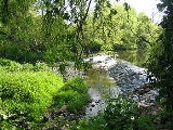
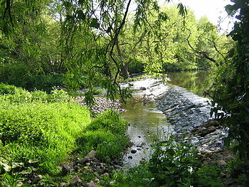
River Tyne, Scotland
Encyclopedia
River
A river is a natural watercourse, usually freshwater, flowing towards an ocean, a lake, a sea, or another river. In a few cases, a river simply flows into the ground or dries up completely before reaching another body of water. Small rivers may also be called by several other names, including...
in Scotland
Scotland
Scotland is a country that is part of the United Kingdom. Occupying the northern third of the island of Great Britain, it shares a border with England to the south and is bounded by the North Sea to the east, the Atlantic Ocean to the north and west, and the North Channel and Irish Sea to the...
, UK. It rises in the Moorfoot Hills
Moorfoot Hills
The Moorfoot Hills are a range of hills south of Edinburgh in east central Scotland, UK, one of the ranges which collectively form the Southern Uplands.The Hills run from Peebles, Scottish Borders, in a north easterly direction to Tynehead, Midlothian....
in Midlothian
Midlothian
Midlothian is one of the 32 council areas of Scotland, and a lieutenancy area. It borders the Scottish Borders, East Lothian and the City of Edinburgh council areas....
near Tynehead to the south of Edinburgh
Edinburgh
Edinburgh is the capital city of Scotland, the second largest city in Scotland, and the eighth most populous in the United Kingdom. The City of Edinburgh Council governs one of Scotland's 32 local government council areas. The council area includes urban Edinburgh and a rural area...
, at the junction of the B6458 and the B6367. It continues for approx. 30 miles in a north-eastern direction, and it empties into the North Sea
North Sea
In the southwest, beyond the Straits of Dover, the North Sea becomes the English Channel connecting to the Atlantic Ocean. In the east, it connects to the Baltic Sea via the Skagerrak and Kattegat, narrow straits that separate Denmark from Norway and Sweden respectively...
near Belhaven.
Origins
The Tyne is mainly a confluenceConfluence
Confluence, in geography, describes the meeting of two or more bodies of water.Confluence may also refer to:* Confluence , a property of term rewriting systems...
between the Birns Water and the Tyne Water, approx. 2 km east of Easter Pencaitland
Pencaitland
Pencaitland is a village in East Lothian, Scotland, about south-east of Edinburgh, south-west of Haddington, and east of Ormiston.The land where the village lies is said to have been granted by William the Lion to Calum Cormack in 1169, who gave the church, with the tithes and other property...
and 1 km south west of Spilmersford Bridge, in the grounds of Saltoun Hall
Saltoun Hall
Saltoun Hall is an historic house standing in extensive lands off the B6355, Pencaitland to East Saltoun road, about 1.5 miles from each village, in East Lothian, Scotland...
. The Humbie Water is another main headwater.
The Tyne has a number of tributaries
Tributary
A tributary or affluent is a stream or river that flows into a main stem river or a lake. A tributary does not flow directly into a sea or ocean...
:
- Bellyford Burn, rises east of DalkeithDalkeithDalkeith is a town in Midlothian, Scotland, lying on the River North Esk. It was granted a burgh of barony in 1401 and a burgh of regality in 1540...
; passes north of Cousland, Midlothian and south of Carberry Hill; south of Elphinstone Tower; north of OrmistonOrmistonOrmiston is a village in East Lothian, Scotland, UK, near Tranent, Humbie, Pencaitland and Cranston, located on the north bank of the River Tyne at an elevation of about 276 ft....
; joins Puddle Burn; joins Tyne Water at Winton HouseWinton HouseWinton House is a historic house set in a large estate between Pencaitland and Tranent in East Lothian, Scotland. The house is situated off the B6355 road approximately north of Pencaitland at - History :...
. - Kinchie Burn, rises east of PathheadPathhead, MidlothianPathhead is a conservation village in Midlothian, Scotland.-Location:Pathhead is located around south east of Dalkeith and south of Scotland's capital city, Edinburgh. It lies above the east bank of the River Tyne. The name of the village is due to its position. It stands above sea level and is...
; supplies Glenkinchie DistilleryGlenkinchieGlenkinchie is a Scotch single malt whisky, produced at the Glenkinchie Distillery in East Lothian, Scotland. It is one of only three remaining Lowland malt whiskies in production.- The Distillery:...
; joins Birns Water at Milton Bridge, West Saltoun. - Blackford Burn/Belsis Burn/Murray's Burn, joins the Tyne Water at PencaitlandPencaitlandPencaitland is a village in East Lothian, Scotland, about south-east of Edinburgh, south-west of Haddington, and east of Ormiston.The land where the village lies is said to have been granted by William the Lion to Calum Cormack in 1169, who gave the church, with the tithes and other property...
. - Cock Burn, rises at Lower Saltoun, joins the Tyne at Badger Wood.
- Fala Dam Burn, East Water, Salters' Burn and Blackhouse Burn combine into Keith Water which flows into HumbieHumbieHumbie is a hamlet and rural parish in East Lothian, Scotland. It lies in the south-west of the county, approximately 10 miles south-west of Haddington and 15 miles south-east of Edinburgh. Humbie as we know it today was formed as the result of the union between Keith Marischal and Keith Hundeby in...
Water, south of Humbie Kirk. - Johnstounburn Water rises near Woodcote Mill and joins Humbie Water near Saltoun Forest.
- Letham Burn and St Laurence House Burn combine to join the Tyne at the southern outskirts of Haddington.
- Bearford Burn rises in Playmuir wood and joins the Tyne at Beanston Mill.
- Old Hailes Burn joins the Tyne at Hailes Castle.
Gallery starts with the Tyne's main headwaters: Birns Water, Tyne Water, Humbie Water
Journey
On its way to the North SeaNorth Sea
In the southwest, beyond the Straits of Dover, the North Sea becomes the English Channel connecting to the Atlantic Ocean. In the east, it connects to the Baltic Sea via the Skagerrak and Kattegat, narrow straits that separate Denmark from Norway and Sweden respectively...
, the Tyne passes through, or near to, the following places:
- Easter PencaitlandPencaitlandPencaitland is a village in East Lothian, Scotland, about south-east of Edinburgh, south-west of Haddington, and east of Ormiston.The land where the village lies is said to have been granted by William the Lion to Calum Cormack in 1169, who gave the church, with the tithes and other property...
; Spilmersford Bridge, B6355; Saltoun HallSaltoun HallSaltoun Hall is an historic house standing in extensive lands off the B6355, Pencaitland to East Saltoun road, about 1.5 miles from each village, in East Lothian, Scotland... - Nisbet; Badger Wood; Herdmanston Mains
- Samuelston bridge; Begbie; Grants' Braes Bridge on B6368
- Clerkington and Clerkington Mill
- HaddingtonHaddington, East LothianThe Royal Burgh of Haddington is a town in East Lothian, Scotland. It is the main administrative, cultural and geographical centre for East Lothian, which was known officially as Haddingtonshire before 1921. It lies about east of Edinburgh. The name Haddington is Anglo-Saxon, dating from the 6th...
: Knox AcademyKnox AcademyKnox Academy is a co-educational secondary school located in Haddington, Scotland, United Kingdom.- History :Knox Academy is the descendant of a medieval grammar school. In 2005, a major overhaul of the school was completed....
; Stevenson Bridge; Cheviot House Mill; Sports Centre; Waterloo Bridge B6368; St. Mary's ChurchSt. Mary's Collegiate ChurchThe Collegiate Church of St Mary the Virgin is a Church of Scotland parish church in Haddington, East Lothian, Scotland.Building work on the church was started in 1380, and further building and rebuilding has taken place up to the present day...
; Nungate Bridge; Victoria Bridge - Abbey Bridge, Abbeymill Farm (south of the A1); Lady's Wood; Stevenson House
- Sandy's Mill; Beanston Mill; Brown Knowe Plantation;
- Hailes CastleHailes CastleHailes Castle is a mainly 14th century castle about a mile and a half south west of East Linton, East Lothian, Scotland. This castle, which has a fine riverside setting, belonged to the Hepburn family during the most important centuries of its existence....
, Hailes Mill - A1 Bridge, Brae Heads, north of Traprain LawTraprain LawTraprain Law is a hill about 221m in elevation, located east of Haddington in East Lothian, Scotland. It is the site of an oppidum or hill fort, which covered at its maximum extent about 16 ha and must have been a veritable town...
- East LintonEast LintonEast Linton is a town in East Lothian, Scotland, situated on the River Tyne and A199 road five miles east of Haddington, with a population of 1,774...
; A199 bridge; B1377 bridge - PhantassiePhantassiePhantassie is an agricultural hamlet near East Linton, East Lothian, Scotland. It is close to the River Tyne, Preston Mill, and Prestonkirk Parish Church....
Farm, birthplace of John Rennie (engineer); Phantassie Doocot - alongside the B1407, past Prestonkirk Parish ChurchPrestonkirk Parish ChurchPrestonkirk Parish Church is a Church of Scotland parish church at East Linton, in the parish of Traprain, East Lothian, Scotland, UK, close to Preston Mill, Smeaton, Phantassie, and the River Tyne.-Building:...
and Preston MillPreston MillPreston Mill is a watermill on the River Tyne at the eastern edge of East Linton on the B1407 Preston Road, in East Lothian, Scotland, UK. It is situated close to Prestonkirk Parish Church, the Smeaton Hepburn Estate, Smeaton Lake, and Phantassie Doocot.... - Knowes Mill; Acre Plantation; Tyninghame Bridge, A198; Firth Plantation
- Tyninghame HouseTyninghame HouseTyninghame House is a mansion in East Lothian, Scotland. It is located by the mouth of the River Tyne, east of Tyninghame and west of Dunbar. There was a manor at Tyninghame in 1094, and it was later a property of the Lauder of The Bass family. In the 17th century it was sold to the Earl of...
north of the Tyne - Mosshouse Point; Hedderwick Sands; Belhaven Bay, Tyne Sands, St. Baldred's CradleBaldred of TyninghameBalthere of Tyninghame was a Northumbrian hermit and abbot, resident in East Lothian during the 8th century.-Dating:According to Hovendeus the date of Baldred's death is given as 756. Symeon of Durham says "the twentieth year of King Eadberht of Northumbria " and Turgot of Durham "the...
, John Muir Country ParkJohn Muir Country ParkThe John Muir Country Park is an area of woodland, grassland and coastline near Dunbar in East Lothian, Scotland. It is named after John Muir, a famous naturalist and geologist who was born in Dunbar and later emigrated to the USA where he developed his ideas....
The River Tyne's journey from Spilmersford Bridge to the Tyne Estuary
Species
- Survey of Water Voles within the Tyne catchment, by Scottish Natural Heritage
- East Lothian Courier article 24/01/08, Otter revival on the Tyne
- Threespine sticklebacks in the River Tyne / Edinburgh Univ. Institute of Evolutionary Biology
Water quality
Fishing
- Fishing tips for River Tyne
- The East Lothian Angling Association controls 25 miles of the tyne and its feeder burns; there are Brown troutBrown troutThe brown trout and the sea trout are fish of the same species....
and sea trout.
External links
- A1 River Tyne Bridge case study
- UK Rivers Guidebook
- "Forth District Salmon Fishery Board"
- "River Forth Fisheries Trust"
Walks leaflets
- PDF Map Leaflet of Haddington with River Tyne information
- Midlothian Council Walk Leaflet PDF on Vogrie Country park / Tyne Valley Path
- Description of walking Tyne Valley Path at Vogrie Country Park, Midlothian
See also
- List of rivers in Scotland
- Rivers and Fisheries Trusts of ScotlandRivers and Fisheries Trusts of ScotlandThe Rivers and Fisheries Trusts of Scotland is a waterway society, an unincorporated association, a Scottish charity, and an umbrella organisation for river trusts in Scotland, based in Edinburgh.RAFTS is the representative of all of Scotland's river systems...
(RAFTS) - List of waterway societies in the United Kingdom
- List of navigation authorities in the United Kingdom
- List of places in East Lothian
- List of places in Midlothian