

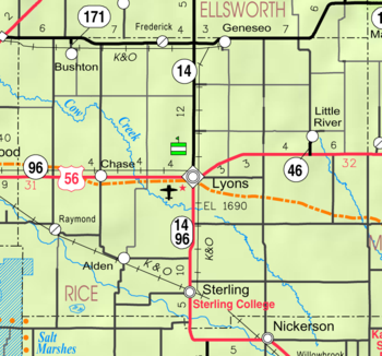
Rice County, Kansas
Encyclopedia
Rice County is a county located in the U.S. state
of Kansas
; it was named in memory of Samuel Allen Rice
, Brigadier-General, United States volunteers, killed April 30, 1864, at Jenkins Ferry, Arkansas
. As of the 2010 census, the county population was 10,083. The largest city and county seat
is Lyons
.
followed the route of present day U.S. Route 56
. Ruts in the earth from the trail are still visible in several locations. (Ralph's Ruts are visible in aerial photos at 38.35959264°N 98.42225502°W.)
In 1878, Atchison, Topeka and Santa Fe Railway
and parties from Marion County
and McPherson County
chartered the Marion and McPherson Railway Company. In 1879, a branch line was built from Florence
to McPherson
, in 1880 it was extended to Lyons
, in 1881 it was extended to Ellinwood
. The line was leased and operated by the Atchison, Topeka and Santa Fe Railway
. The line from Florence
to Marion
, was abandoned in 1968. In 1992, the line from Marion
to McPherson
was sold to Central Kansas Railway
. In 1993, after heavy flood damage, the line from Marion to McPherson was abandoned. The original branch line connected Florence
, Marion
, Canada
, Hillsboro
, Lehigh
, Canton
, Galva
, McPherson
, Conway
, Windom
, Little River
, Mitchell
, Lyons
, Chase
, Ellinwood
.
, county.
of 2000, there were 10,761 people, 4,050 households, and 2,830 families residing in the county. The population density
was 15 people per square mile (6/km²). There were 4,609 housing units at an average density of 6 per square mile (2/km²). The racial makeup of the county was 94.68% White
, 1.15% Black
or African American
, 0.57% Native American
, 0.33% Asian
, 0.04% Pacific Islander
, 1.84% from other races
, and 1.39% from two or more races. 5.61% of the population were Hispanic
or Latino
of any race.
There were 4,050 households out of which 31.20% had children under the age of 18 living with them, 59.10% were married couples
living together, 7.20% had a female householder with no husband present, and 30.10% were non-families. 27.80% of all households were made up of individuals and 15.30% had someone living alone who was 65 years of age or older. The average household size was 2.44 and the average family size was 2.97.
In the county the population was spread out with 24.70% under the age of 18, 13.30% from 18 to 24, 22.80% from 25 to 44, 21.30% from 45 to 64, and 18.00% who were 65 years of age or older. The median age was 38 years. For every 100 females there were 92.20 males. For every 100 females age 18 and over, there were 88.20 males.
The median income for a household in the county was $35,671, and the median income for a family was $40,960. Males had a median income of $31,175 versus $18,968 for females. The per capita income
for the county was $16,064. About 8.50% of families and 10.70% of the population were below the poverty line, including 14.60% of those under age 18 and 8.20% of those age 65 or over.
. The cities of Lyons
and Sterling
are considered governmentally independent and are excluded from the census figures for the townships. In the following table, the population center is the largest city (or cities) included in that township's population total, if it is of a significant size.
General Information
Maps
U.S. state
A U.S. state is any one of the 50 federated states of the United States of America that share sovereignty with the federal government. Because of this shared sovereignty, an American is a citizen both of the federal entity and of his or her state of domicile. Four states use the official title of...
of Kansas
Kansas
Kansas is a US state located in the Midwestern United States. It is named after the Kansas River which flows through it, which in turn was named after the Kansa Native American tribe, which inhabited the area. The tribe's name is often said to mean "people of the wind" or "people of the south...
; it was named in memory of Samuel Allen Rice
Samuel Allen Rice
Samuel Allen Rice was born in Cattaraugus, New York. He lived in Mahaska County, Iowa where he practiced law, was county attorney, and state attorney general . In the American Civil War, he was a colonel in the 33rd regiment of Iowa...
, Brigadier-General, United States volunteers, killed April 30, 1864, at Jenkins Ferry, Arkansas
Battle of Jenkins' Ferry
The Battle of Jenkins' Ferry was fought April 30, 1864, in Grant County, Arkansas during the American Civil War. It was the climactic battle of the Camden Expedition, which was a part of the Union Army’s failed Red River Campaign. Each side sustained a large number of casualties, especially...
. As of the 2010 census, the county population was 10,083. The largest city and county seat
County seat
A county seat is an administrative center, or seat of government, for a county or civil parish. The term is primarily used in the United States....
is Lyons
Lyons, Kansas
Lyons is a city in and the county seat of Rice County, Kansas, United States. As of the 2010 census, the city population was 3,739.-History:Although Coronado's exact route across the plains is uncertain and has been widely disputed, he and his men are thought to have camped near the present...
.
19th century
The Santa Fe TrailSanta Fe Trail
The Santa Fe Trail was a 19th-century transportation route through central North America that connected Missouri with Santa Fe, New Mexico. Pioneered in 1822 by William Becknell, it served as a vital commercial and military highway until the introduction of the railroad to Santa Fe in 1880...
followed the route of present day U.S. Route 56
U.S. Route 56
U.S. Route 56 is an east–west United States highway that runs for in the Midwestern United States. The highway's eastern terminus is at U.S. Route 71 in Kansas City, Missouri. Its western terminus is at Interstate 25 Business in Springer, New Mexico. Much of it follows the Santa Fe...
. Ruts in the earth from the trail are still visible in several locations. (Ralph's Ruts are visible in aerial photos at 38.35959264°N 98.42225502°W.)
In 1878, Atchison, Topeka and Santa Fe Railway
Atchison, Topeka and Santa Fe Railway
The Atchison, Topeka and Santa Fe Railway , often abbreviated as Santa Fe, was one of the larger railroads in the United States. The company was first chartered in February 1859...
and parties from Marion County
Marion County, Kansas
Marion County is a county located in the U.S. state of Kansas. As of the 2010 census, the county population was 12,660. The county seat is Marion...
and McPherson County
McPherson County, Kansas
McPherson County is a county located in the U.S. state of Kansas. As of the 2010 census, the county population was 29,180. The largest city and county seat is McPherson. The county is named for Civil War General James B. McPherson...
chartered the Marion and McPherson Railway Company. In 1879, a branch line was built from Florence
Florence, Kansas
Florence is a city in Marion County, Kansas, United States. The city was named after the daughter of former Kansas Governor Samuel J. Crawford. As of the 2010 census, the city population was 465.-19th century:...
to McPherson
McPherson, Kansas
McPherson is a city in and the county seat of McPherson County, Kansas, United States, in the central part of the state. As of the 2010 census, the city population was 13,155. The city is named after Union General James Birdseye McPherson, a Civil War general...
, in 1880 it was extended to Lyons
Lyons, Kansas
Lyons is a city in and the county seat of Rice County, Kansas, United States. As of the 2010 census, the city population was 3,739.-History:Although Coronado's exact route across the plains is uncertain and has been widely disputed, he and his men are thought to have camped near the present...
, in 1881 it was extended to Ellinwood
Ellinwood, Kansas
Ellinwood is a city in the southeast corner of Barton County, Kansas, United States. As of the 2010 census, the city population was 2,131.-History:...
. The line was leased and operated by the Atchison, Topeka and Santa Fe Railway
Atchison, Topeka and Santa Fe Railway
The Atchison, Topeka and Santa Fe Railway , often abbreviated as Santa Fe, was one of the larger railroads in the United States. The company was first chartered in February 1859...
. The line from Florence
Florence, Kansas
Florence is a city in Marion County, Kansas, United States. The city was named after the daughter of former Kansas Governor Samuel J. Crawford. As of the 2010 census, the city population was 465.-19th century:...
to Marion
Marion, Kansas
Marion is a city in and the county seat of Marion County, Kansas, United States. It was named in honor of Francis Marion, a Brigadier General of the American Revolutionary War, known as the "Swamp Fox". As of the 2010 census, the city population was 1,927....
, was abandoned in 1968. In 1992, the line from Marion
Marion, Kansas
Marion is a city in and the county seat of Marion County, Kansas, United States. It was named in honor of Francis Marion, a Brigadier General of the American Revolutionary War, known as the "Swamp Fox". As of the 2010 census, the city population was 1,927....
to McPherson
McPherson, Kansas
McPherson is a city in and the county seat of McPherson County, Kansas, United States, in the central part of the state. As of the 2010 census, the city population was 13,155. The city is named after Union General James Birdseye McPherson, a Civil War general...
was sold to Central Kansas Railway
Central Kansas Railway
The Central Kansas Railway was a short-line railroad operating of trackage in the U.S. state of Kansas and west to Towner, Colorado, most all of which were former Atchison, Topeka and Santa Fe Railway lines...
. In 1993, after heavy flood damage, the line from Marion to McPherson was abandoned. The original branch line connected Florence
Florence, Kansas
Florence is a city in Marion County, Kansas, United States. The city was named after the daughter of former Kansas Governor Samuel J. Crawford. As of the 2010 census, the city population was 465.-19th century:...
, Marion
Marion, Kansas
Marion is a city in and the county seat of Marion County, Kansas, United States. It was named in honor of Francis Marion, a Brigadier General of the American Revolutionary War, known as the "Swamp Fox". As of the 2010 census, the city population was 1,927....
, Canada
Canada, Kansas
Canada is an unincorporated community in Marion County, Kansas, United States. It is named for many Canadian immigrants coming to the area.-19th century:...
, Hillsboro
Hillsboro, Kansas
Hillsboro is a city in Marion County, Kansas, United States. Hillsboro was named after John Gillespie Hill, who homesteaded in the area in 1871. As of the 2010 census, the city population was 2,993. Hillsboro is home of Tabor College, which has approximately 550 students.-19th century:For...
, Lehigh
Lehigh, Kansas
Lehigh is a city in Marion County, Kansas, United States. As of the 2010 census, the city population was 175.-19th century:For millennia, the land that is currently Kansas was inhabited by Native Americans. In 1803, most of modern Kansas was secured by the United States as part of the Louisiana...
, Canton
Canton, Kansas
Canton is a city in McPherson County, Kansas, United States. As of the 2010 census, the city population was 748.-19th century:As early as 1875, city leaders of Marion held a meeting to consider a branch railroad from Florence. In 1878, Atchison, Topeka and Santa Fe Railway and parties from Marion...
, Galva
Galva, Kansas
Galva is a city in McPherson County, Kansas, in the United States. As of the 2010 census, the city population was 870.-19th century:As early as 1875, city leaders of Marion held a meeting to consider a branch railroad from Florence. In 1878, Atchison, Topeka and Santa Fe Railway and parties from...
, McPherson
McPherson, Kansas
McPherson is a city in and the county seat of McPherson County, Kansas, United States, in the central part of the state. As of the 2010 census, the city population was 13,155. The city is named after Union General James Birdseye McPherson, a Civil War general...
, Conway
Conway, Kansas
Conway is an unincorporated community in southwestern Jackson Township, McPherson County, Kansas, United States. It lies along U.S. Route 56 and a Kansas and Oklahoma Railroad line, west of the city of McPherson, the county seat of McPherson County...
, Windom
Windom, Kansas
Windom is a city in McPherson County, Kansas, United States. As of the 2010 census, the city population was 130.-19th century:In 1878, Atchison, Topeka and Santa Fe Railway and parties from Marion County and McPherson County chartered the Marion and McPherson Railway Company...
, Little River
Little River, Kansas
Little River is a city in Rice County, Kansas, United States. As of the 2010 census, the city population was 557.-History:In 1878, Atchison, Topeka and Santa Fe Railway and parties from Marion County and McPherson County chartered the Marion and McPherson Railway Company...
, Mitchell
Mitchell, Kansas
Mitchell is an unincorporated community in Mitchell Township, Rice County, Kansas, United States. Located about east-northeast of the city of Lyons, the county seat, it lies along local roads a fraction of a mile north of U.S...
, Lyons
Lyons, Kansas
Lyons is a city in and the county seat of Rice County, Kansas, United States. As of the 2010 census, the city population was 3,739.-History:Although Coronado's exact route across the plains is uncertain and has been widely disputed, he and his men are thought to have camped near the present...
, Chase
Chase, Kansas
Chase is a city in Rice County, Kansas, United States. As of the 2010 census, the city population was 477.The city should not be confused with Chase County.-History:...
, Ellinwood
Ellinwood, Kansas
Ellinwood is a city in the southeast corner of Barton County, Kansas, United States. As of the 2010 census, the city population was 2,131.-History:...
.
Law and government
Although the Kansas Constitution was amended in 1986 to allow the sale of alcoholic liquor by the individual drink with the approval of voters, Rice County has remained a prohibition, or "dry"Dry county
A dry county is a county in the United States whose government forbids the sale of alcoholic beverages. Some prohibit off-premises sale, some prohibit on-premises sale, and some prohibit both. Hundreds of dry counties exist across the United States, almost all of them in the South...
, county.
Geography
According to the 2000 census, the county has a total area of 728.3 square miles (1,886.3 km²), of which 726.58 square miles (1,881.8 km²) (or 99.76%) is land and 1.72 square miles (4.5 km²) (or 0.24%) is water.Adjacent counties
- Ellsworth CountyEllsworth County, KansasEllsworth County is a county located in Central Kansas, in the Central United States. As of the 2010 census, the county population was 6,497. Its county seat and most populous city is Ellsworth.-19th century:...
(north) - McPherson CountyMcPherson County, KansasMcPherson County is a county located in the U.S. state of Kansas. As of the 2010 census, the county population was 29,180. The largest city and county seat is McPherson. The county is named for Civil War General James B. McPherson...
(east) - Reno CountyReno County, KansasReno County is a county located in the U.S. state of Kansas. The county's population was 64,511 for the 2010 census. The largest city and county seat is Hutchinson. The Hutchinson Micropolitan Statistical Area includes all of Reno County.-19th century:In 1887, the Chicago, Kansas and Nebraska...
(south) - Stafford CountyStafford County, KansasStafford County is a county located in the U.S. state of Kansas. As of the 2010 census, the county population was 4,437. Its county seat is St. John...
(southwest) - Barton CountyBarton County, KansasBarton County is a county located in Western Kansas, in the Central United States. As of the 2010 census, the county population was 27,674. Its county seat and most populous city is Great Bend. The county is named in honor of Clara Barton, responsible for the founding of the American Red Cross...
(northwest)
Demographics
As of the censusCensus
A census is the procedure of systematically acquiring and recording information about the members of a given population. It is a regularly occurring and official count of a particular population. The term is used mostly in connection with national population and housing censuses; other common...
of 2000, there were 10,761 people, 4,050 households, and 2,830 families residing in the county. The population density
Population density
Population density is a measurement of population per unit area or unit volume. It is frequently applied to living organisms, and particularly to humans...
was 15 people per square mile (6/km²). There were 4,609 housing units at an average density of 6 per square mile (2/km²). The racial makeup of the county was 94.68% White
Race (United States Census)
Race and ethnicity in the United States Census, as defined by the Federal Office of Management and Budget and the United States Census Bureau, are self-identification data items in which residents choose the race or races with which they most closely identify, and indicate whether or not they are...
, 1.15% Black
Race (United States Census)
Race and ethnicity in the United States Census, as defined by the Federal Office of Management and Budget and the United States Census Bureau, are self-identification data items in which residents choose the race or races with which they most closely identify, and indicate whether or not they are...
or African American
Race (United States Census)
Race and ethnicity in the United States Census, as defined by the Federal Office of Management and Budget and the United States Census Bureau, are self-identification data items in which residents choose the race or races with which they most closely identify, and indicate whether or not they are...
, 0.57% Native American
Race (United States Census)
Race and ethnicity in the United States Census, as defined by the Federal Office of Management and Budget and the United States Census Bureau, are self-identification data items in which residents choose the race or races with which they most closely identify, and indicate whether or not they are...
, 0.33% Asian
Race (United States Census)
Race and ethnicity in the United States Census, as defined by the Federal Office of Management and Budget and the United States Census Bureau, are self-identification data items in which residents choose the race or races with which they most closely identify, and indicate whether or not they are...
, 0.04% Pacific Islander
Race (United States Census)
Race and ethnicity in the United States Census, as defined by the Federal Office of Management and Budget and the United States Census Bureau, are self-identification data items in which residents choose the race or races with which they most closely identify, and indicate whether or not they are...
, 1.84% from other races
Race (United States Census)
Race and ethnicity in the United States Census, as defined by the Federal Office of Management and Budget and the United States Census Bureau, are self-identification data items in which residents choose the race or races with which they most closely identify, and indicate whether or not they are...
, and 1.39% from two or more races. 5.61% of the population were Hispanic
Race (United States Census)
Race and ethnicity in the United States Census, as defined by the Federal Office of Management and Budget and the United States Census Bureau, are self-identification data items in which residents choose the race or races with which they most closely identify, and indicate whether or not they are...
or Latino
Race (United States Census)
Race and ethnicity in the United States Census, as defined by the Federal Office of Management and Budget and the United States Census Bureau, are self-identification data items in which residents choose the race or races with which they most closely identify, and indicate whether or not they are...
of any race.
There were 4,050 households out of which 31.20% had children under the age of 18 living with them, 59.10% were married couples
Marriage
Marriage is a social union or legal contract between people that creates kinship. It is an institution in which interpersonal relationships, usually intimate and sexual, are acknowledged in a variety of ways, depending on the culture or subculture in which it is found...
living together, 7.20% had a female householder with no husband present, and 30.10% were non-families. 27.80% of all households were made up of individuals and 15.30% had someone living alone who was 65 years of age or older. The average household size was 2.44 and the average family size was 2.97.
In the county the population was spread out with 24.70% under the age of 18, 13.30% from 18 to 24, 22.80% from 25 to 44, 21.30% from 45 to 64, and 18.00% who were 65 years of age or older. The median age was 38 years. For every 100 females there were 92.20 males. For every 100 females age 18 and over, there were 88.20 males.
The median income for a household in the county was $35,671, and the median income for a family was $40,960. Males had a median income of $31,175 versus $18,968 for females. The per capita income
Per capita income
Per capita income or income per person is a measure of mean income within an economic aggregate, such as a country or city. It is calculated by taking a measure of all sources of income in the aggregate and dividing it by the total population...
for the county was $16,064. About 8.50% of families and 10.70% of the population were below the poverty line, including 14.60% of those under age 18 and 8.20% of those age 65 or over.
Incorporated cities
Name and population (2004 estimate):- LyonsLyons, KansasLyons is a city in and the county seat of Rice County, Kansas, United States. As of the 2010 census, the city population was 3,739.-History:Although Coronado's exact route across the plains is uncertain and has been widely disputed, he and his men are thought to have camped near the present...
, 3,576 (county seat) - SterlingSterling, KansasSterling is a city in Rice County, Kansas, United States. As of the 2010 census, the city population was 2,328. Sterling is home to Sterling College.- History :...
, 2,587 - Little RiverLittle River, KansasLittle River is a city in Rice County, Kansas, United States. As of the 2010 census, the city population was 557.-History:In 1878, Atchison, Topeka and Santa Fe Railway and parties from Marion County and McPherson County chartered the Marion and McPherson Railway Company...
, 530 - ChaseChase, KansasChase is a city in Rice County, Kansas, United States. As of the 2010 census, the city population was 477.The city should not be confused with Chase County.-History:...
, 471 - BushtonBushton, KansasBushton is a city in Rice County, Kansas, United States. As of the 2010 census, the city population was 279.-Geography:Bushton is located at . According to the United States Census Bureau, the city has a total area of , all of it land.-Demographics:As of the census of 2000, there were 314 people,...
, 300 - GeneseoGeneseo, KansasGeneseo is a city in Rice County, Kansas, United States. As of the 2010 census, the city population was 267.-History:NewspaperThe Geneseo Journal was originally called the Geneseo Herald from 1887 to 1899, then it became Geneseo Post from 1908 to 1909. From 1979 through 1983 it was known as...
, 271 - AldenAlden, KansasAlden is a city in Rice County, Kansas, United States. As of the 2010 census, the city population was 148.-Geography:Alden is located at . According to the United States Census Bureau, the city has a total area of , all of it land....
, 161 - RaymondRaymond, KansasRaymond is a city in Rice County, Kansas, United States. It is named after Emmons Raymond, former Director of the Atchison, Topeka and Santa Fe Railway. As of the 2010 census, the city population was 79.-History:...
, 95 - FrederickFrederick, KansasFrederick is a city in Rice County, Kansas, United States. As of the 2010 census, the city population was 18.-Geography:Frederick is located at . According to the United States Census Bureau, the city has a total area of , all of it land.-Demographics:As of the census of 2000, there were 11...
, 11
Townships
Rice County is divided into twenty townshipsCivil township
A civil township is a widely used unit of local government in the United States, subordinate to, and geographic divisions of, a county. Specific responsibilities and the degree of autonomy vary based on each state. Civil townships are distinct from survey townships, but in states that have both,...
. The cities of Lyons
Lyons, Kansas
Lyons is a city in and the county seat of Rice County, Kansas, United States. As of the 2010 census, the city population was 3,739.-History:Although Coronado's exact route across the plains is uncertain and has been widely disputed, he and his men are thought to have camped near the present...
and Sterling
Sterling, Kansas
Sterling is a city in Rice County, Kansas, United States. As of the 2010 census, the city population was 2,328. Sterling is home to Sterling College.- History :...
are considered governmentally independent and are excluded from the census figures for the townships. In the following table, the population center is the largest city (or cities) included in that township's population total, if it is of a significant size.
| Township | FIPS | Population center |
Population | Population density /km² (/sq mi) |
Land area km² (sq mi) | Water area km² (sq mi) | Water % | Geographic coordinates |
|---|---|---|---|---|---|---|---|---|
| Atlanta | 03075 | 233 | 3 (7) | 90 (35) | 0 (0) | 0.25% | 38°18′22"N 98°11′58"W | |
| Bell | 05375 | 18 | 0 (0) | 94 (36) | 1 (0) | 0.65% | 38°13′10"N 98°24′2"W | |
| Center | 12075 | 136 | 1 (4) | 95 (37) | 0 (0) | 0.04% | 38°17′50"N 98°18′12"W | |
| East Washington | 19725 | 179 | 2 (5) | 93 (36) | 0 (0) | 0.03% | 38°13′18"N 97°58′34"W | |
| Eureka | 21900 | 65 | 1 (2) | 95 (37) | 0 (0) | 0 % | 38°29′52"N 98°19′21"W | |
| Farmer | 23100 | 441 | 5 (12) | 94 (36) | 0 (0) | 0 % | 38°30′0"N 98°24′55"W | |
| Galt | 25175 | 51 | 1 (1) | 94 (36) | 0 (0) | 0.22% | 38°28′8"N 98°5′59"W | |
| Harrison | 30425 | 192 | 2 (5) | 92 (35) | 0 (0) | 0.06% | 38°23′3"N 98°11′49"W | |
| Lincoln | 41100 | 577 | 6 (16) | 95 (37) | 0 (0) | 0 % | 38°22′10"N 98°19′19"W | |
| Mitchell | 47525 | 131 | 1 (4) | 94 (36) | 0 (0) | 0.18% | 38°23′24"N 98°5′42"W | |
| Odessa | 52150 | 55 | 1 (2) | 93 (36) | 0 (0) | 0.10% | 38°28′17"N 97°59′21"W | |
| Pioneer | 55925 | 101 | 1 (3) | 94 (36) | 0 (0) | 0.03% | 38°23′34"N 98°25′39"W | |
| Raymond | 58575 | 185 | 2 (5) | 92 (36) | 1 (0) | 0.71% | 38°17′38"N 98°24′56"W | |
| Rockville | 60725 | 134 | 1 (4) | 93 (36) | 0 (0) | 0.04% | 38°18′17"N 97°57′36"W | |
| Sterling | 68225 | 223 | 2 (5) | 114 (44) | 1 (0) | 1.01% | 38°12′19"N 98°11′44"W | |
| Union | 72325 | 741 | 8 (21) | 93 (36) | 0 (0) | 0 % | 38°23′34"N 97°59′32"W | |
| Valley | 73100 | 276 | 4 (9) | 77 (30) | 1 (0) | 1.11% | 38°13′27"N 98°18′44"W | |
| Victoria | 73825 | 364 | 4 (10) | 94 (36) | 0 (0) | 0.06% | 38°29′57"N 98°10′24"W | |
| West Washington | 77425 | 138 | 1 (4) | 93 (36) | 0 (0) | 0.12% | 38°13′9"N 98°4′58"W | |
| Wilson | 79775 | 147 | 2 (4) | 94 (36) | 0 (0) | 0.02% | 38°18′2"N 98°6′2"W |
Education
Unified school districts
- USD 328, Lorraine, serves Bushton and northwestern areas of the county
- USD 376, Sterling
- USD 401, Chase
- USD 405, Lyons
- USD 444, Little River
See also
- Dry counties
- National Register of Historic Places listings in Rice County, KansasNational Register of Historic Places listings in Rice County, KansasThis is a list of the National Register of Historic Places listings in Rice County, Kansas.This is intended to be a complete list of the properties and districts on the National Register of Historic Places in Rice County, Kansas, United States...
Further reading
- History of the State of Kansas; William G. Cutler; A.T. Andreas Publisher; 1883. (Online HTML eBook)
- Kansas : A Cyclopedia of State History, Embracing Events, Institutions, Industries, Counties, Cities, Towns, Prominent Persons, Etc; 3 Volumes; Frank W. Blackmar; Standard Publishing Co; 944 / 955 / 824 pages; 1912. (Volume1 - Download 54MB PDF eBook),(Volume2 - Download 53MB PDF eBook), (Volume3 - Download 33MB PDF eBook)
External links
OfficialGeneral Information
Maps
- Rice County Map, KDOT
- Kansas Highway Map, KDOT
- Kansas Railroad Map, KDOT
- Kansas School District Boundary Map, KSDE