

Riachinho
Encyclopedia
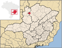
Minas Gerais
Minas Gerais is one of the 26 states of Brazil, of which it is the second most populous, the third richest, and the fourth largest in area. Minas Gerais is the Brazilian state with the largest number of Presidents of Brazil, the current one, Dilma Rousseff, being one of them. The capital is the...
. In 2007 the population was 8,126 in a total area of 1,775 km². It became a municipality in 1992.
Location and Distances
Riachinho is located on state highway MG-191 (dirt) at an elevation of 550 meters. It is 62 km. south of the nearest population center with services, ArinosArinos
Arinos is a small city and municipality in northern Minas Gerais state, Brazil. Arinos is located west of the Federal District on the Urucuia River, a major tributary of the São Francisco. The city is 333 km. from Brasília...
. The municipality is crossed by the Rio Urucuia, a tributary of the São Francisco River
São Francisco River
The São Francisco is a river in Brazil. With a length of , it is the longest river that runs entirely in Brazilian territory, and the fourth longest in South America and overall in Brazil...
. Neighboring municipalties are: Santa Fé de Minas
Santa Fé de Minas
Santa Fé de Minas is a Brazilian municipality located in the north of the state of Minas Gerais. In 2007 the population was 4,034 in a total area of 2,916 km². It became a municipality in 1962....
, Várzea da Palma
Várzea da Palma
Várzea da Palma is a municipality in north-central Minas Gerais in Brazil. Its population in 2007 was 54,448 in a total area of 2,195 km²....
, Uruana de Minas
Uruana de Minas
Uruana de Minas is a municipality in the north of the Brazilian state of Minas Gerais. As of 2007 the population was 2,777 inhabitants in a total area of 589 km².The elevation of the municipal seat is 530 mts above sea level...
, and Bonfinópolis de Minas
Bonfinópolis de Minas
Bonfinópolis de Minas is a municipality in the north of the Brazilian state of Minas Gerais. The population was 5,828 in a total area of 1,778 km². The elevation of the municipal seat is 651. It became a city in 1962....
. Riachinho is part of the statistical microregion of Pirapora
Pirapora
Pirapora is a municipality in northcentral Minas Gerais in Brazil. Its population in 2007 was 51,636 in a total area of 577 km². The name Pirapora comes from the Tupi words for "fish" + "jump", referring to the piracema season when a mass migration of fishes ascends the São Francisco River...
.
Economic activities
The most important economic activities are cattle raising and agriculture. The GDP in 2005 was R$ 33,831,903,000. There was one banking agency in the town in 2007, while there were 311 automobiles. In the rural area there were 842 establishments on a total area of 124,000 hectares, of which 9,000 hectares were planted in crops. Around 1,000 people were working in agriculture. There were 51,000 head of cattle. The main crops were rice, beans, corn, soybeans, and sorghum.Health and education
This municipality is isolated from major population centers and suffers from drought and poor soils.- Municipal Human Development IndexHuman Development IndexThe Human Development Index is a composite statistic used to rank countries by level of "human development" and separate "very high human development", "high human development", "medium human development", and "low human development" countries...
: 0.700 (2000) - State ranking: 540 out of 853 municipalities as of 2000
- National ranking: 2,993 out of 5,138 municipalities as of 2000
The highest ranking municipality in Minas Gerais in 2000 was Poços de Caldas
Poços de Caldas
Poços de Caldas is a city and municipality in south-western Minas Gerais state, Brazil, in the microregion of the same name. Its estimated population in 2009 was 151,449 inhabitants...
with 0.841, while the lowest was Setubinha
Setubinha
Setubinha is a municipality in the northeast of the Brazilian state of Minas Gerais. As of 2007 the population was 10,834 in a total area of 536 km². The elevation is 729 metres. It is part of the IBGE statistical microregion of Teófilo Otoni...
with 0.568. Nationally the highest was São Caetano do Sul
São Caetano do Sul
São Caetano do Sul is a city in São Paulo state in Brazil, located in the Greater São Paulo Metropolitan Area. It is the city with the highest per capita income in Brazil and it also has the highest Human Development Index .-Geography:São Caetano do Sul is located on a plateau that is part of the...
in São Paulo with 0.919, while the lowest was Setubinha.