

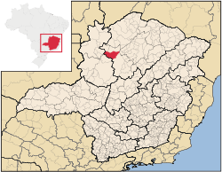
Santa Fé de Minas
Encyclopedia
Minas Gerais
Minas Gerais is one of the 26 states of Brazil, of which it is the second most populous, the third richest, and the fourth largest in area. Minas Gerais is the Brazilian state with the largest number of Presidents of Brazil, the current one, Dilma Rousseff, being one of them. The capital is the...
. In 2007 the population was 4,034 in a total area of 2,916 km². It became a municipality in 1962.
Santa Fé de Minas is located about 130 km. northwest of the nearest major population center, Pirapora
Pirapora
Pirapora is a municipality in northcentral Minas Gerais in Brazil. Its population in 2007 was 51,636 in a total area of 577 km². The name Pirapora comes from the Tupi words for "fish" + "jump", referring to the piracema season when a mass migration of fishes ascends the São Francisco River...
at an elevation of 493 meters. Neighboring municipalities are: São Romão
São Romão
São Romão is a Brazilian municipality located in the north of the state of Minas Gerais. In 2007 the population was 9,080 in a total area of 2,432 km². It became a municipality in 1943.-Location and Distances:...
, Buritizeiro
Buritizeiro
Buritizeiro is a municipality in the north of the Brazilian state of Minas Gerais. Its population in 2007 was 26,133 inhabitants in a total area of 7,226 km². It is a major producer of cattle and grains.-Location:...
, Brasilândia de Minas
Brasilândia de Minas
Brasilândia de Minas is a municipality in the north of the Brazilian state of Minas Gerais. As of 2007 the population was 12,821 in a total area of 2,515 km².The elevation of the municipal seat is 530 meters above sea level...
, and Bonfinópolis de Minas
Bonfinópolis de Minas
Bonfinópolis de Minas is a municipality in the north of the Brazilian state of Minas Gerais. The population was 5,828 in a total area of 1,778 km². The elevation of the municipal seat is 651. It became a city in 1962....
. It is part of the statistical microregion of Pirapora
Pirapora
Pirapora is a municipality in northcentral Minas Gerais in Brazil. Its population in 2007 was 51,636 in a total area of 577 km². The name Pirapora comes from the Tupi words for "fish" + "jump", referring to the piracema season when a mass migration of fishes ascends the São Francisco River...
.
The most important economic activities are cattle raising and agriculture. The GDP in 2005 was R$ 14,352,000.00. There were no banking agencies in the town in 2007, while there were 33 automobiles, one of the lowest ratios in the state. In the rural area there were 467 establishments on a total area of 211,000 hectares, of which 3,500 hectares were planted in crops. Around 1,500 people were working in agriculture. There were 44,000 head of cattle. The main crops were rice, beans, and corn.
- Municipal Human Development IndexHuman Development IndexThe Human Development Index is a composite statistic used to rank countries by level of "human development" and separate "very high human development", "high human development", "medium human development", and "low human development" countries...
: 0.622 (2000) - State ranking: 802 out of 853 municipalities as of 2000
- National ranking: 4,273 out of 5,138 municipalities as of 2000
The highest ranking municipality in Minas Gerais in 2000 was Poços de Caldas
Poços de Caldas
Poços de Caldas is a city and municipality in south-western Minas Gerais state, Brazil, in the microregion of the same name. Its estimated population in 2009 was 151,449 inhabitants...
with 0.841, while the lowest was Setubinha
Setubinha
Setubinha is a municipality in the northeast of the Brazilian state of Minas Gerais. As of 2007 the population was 10,834 in a total area of 536 km². The elevation is 729 metres. It is part of the IBGE statistical microregion of Teófilo Otoni...
with 0.568. Nationally the highest was São Caetano do Sul
São Caetano do Sul
São Caetano do Sul is a city in São Paulo state in Brazil, located in the Greater São Paulo Metropolitan Area. It is the city with the highest per capita income in Brazil and it also has the highest Human Development Index .-Geography:São Caetano do Sul is located on a plateau that is part of the...
in São Paulo with 0.919, while the lowest was Setubinha.
In the health sector there were two health clinics and one hospital with 3 beds.
See also
- List of municipalities in Minas Gerais