
Rangareddi district
Encyclopedia
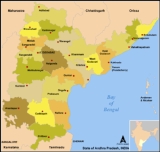
K. V. Ranga Reddy District (sometimes spelled as Ranga Reddy or R.R. District) is a district in the state of Andhra Pradesh
, India
. Ranga Reddy District was formed in 1978 when it was split from Hyderabad district
. The district has an area of 7,493 km², and a population of 3,575,064 of which 54.20% is urban as of 2001.http://www.censusindiamaps.net/page/India_WhizMap/IndiaMap.htm The district encircles the city and district of Hyderabad, and the city of Hyderabad also serves as the administrative center of the district. It is the most populous district of Andhra Pradesh (out of 23).
The district has 1055 villages and grouped in 37 mandal
s.
from the Nizams and who went on to become the deputy chief minister of Andhra Pradesh
.
's New Ireland
.
A fresh water reservoir, called Osman Sagar
, on the river Musi
at Gandipet is the prime drinking water source to the capital city of Hyderabad.
In 2006 the Indian government named Ranga Reddy one of the country's 250 most backward districts
(out of a total of 640
). It is one of the thirteen districts in Andhra Pradesh currently receiving funds from the Backward Regions Grant Fund Programme (BRGF).
, Malkajgiri
, Qutbullapur, Kukatpally
, Uppal
, Ibrahimpatnam, L B Nagar, Maheshwaram
, Rajendranagar
, Serilingampally
, Chevella
, Pargi
, Vikarabad and Tandur
.
, below states and districts. There are 37 mandals in Ranga Reddy district:

Ranga Reddy District has a population
of 5,296,396 , roughly equal to the nation of Finland
or the US state of Minnesota
. This gives it a ranking of 17th in India (out of a total of 640
). The district has a population density of 707 PD/sqkm . Its population growth rate
over the decade 2001-2011 was 48.15 %. Rangareddy has a sex ratio
of 955 females
for every 1000 males, and a literacy rate
of 78.05 %.
has a campus at Rajendranagar
in this district.
Andhra Pradesh
Andhra Pradesh , is one of the 28 states of India, situated on the southeastern coast of India. It is India's fourth largest state by area and fifth largest by population. Its capital and largest city by population is Hyderabad.The total GDP of Andhra Pradesh is $100 billion and is ranked third...
, India
India
India , officially the Republic of India , is a country in South Asia. It is the seventh-largest country by geographical area, the second-most populous country with over 1.2 billion people, and the most populous democracy in the world...
. Ranga Reddy District was formed in 1978 when it was split from Hyderabad district
Hyderabad District, India
Hyderabad District , is a district in the state of Andhra Pradesh in India that contains a part of the metropolitan area of Hyderabad. It is headed by a district collector who is drawn from the IAS cadre and is appointed by the state government.-History:...
. The district has an area of 7,493 km², and a population of 3,575,064 of which 54.20% is urban as of 2001.http://www.censusindiamaps.net/page/India_WhizMap/IndiaMap.htm The district encircles the city and district of Hyderabad, and the city of Hyderabad also serves as the administrative center of the district. It is the most populous district of Andhra Pradesh (out of 23).
The district has 1055 villages and grouped in 37 mandal
Mandal
is a town and municipality in Vest-Agder county, Norway. The administrative center of the municipality is the town of Mandal.The town of Mandal was established as a municipality on 1 January 1838...
s.
History
Originally named Hyderabad (Rural) district, it was renamed after Konda Venkata Ranga Reddy, a freedom fighter who fought for the independence of TelanganaTelangana
Telangana is a region in the present state of Andhra Pradesh, India and formerly was part of Hyderabad state which was ruled by Nizam. It is bordered with the states of Maharashtra on the north and north-west, Karnataka on the west, Chattisgarh on the north-east and Orissa to the east...
from the Nizams and who went on to become the deputy chief minister of Andhra Pradesh
Andhra Pradesh
Andhra Pradesh , is one of the 28 states of India, situated on the southeastern coast of India. It is India's fourth largest state by area and fifth largest by population. Its capital and largest city by population is Hyderabad.The total GDP of Andhra Pradesh is $100 billion and is ranked third...
.
Geography
Ranga Reddy District occupies an area of approximately 7500 square kilometres (2,895.8 sq mi), comparatively equivalent to Papua New GuineaPapua New Guinea
Papua New Guinea , officially the Independent State of Papua New Guinea, is a country in Oceania, occupying the eastern half of the island of New Guinea and numerous offshore islands...
's New Ireland
New Ireland (island)
New Ireland is a large island in Papua New Guinea, approximately 7,404 km² in area. It is the largest island of the New Ireland Province, lying northeast of the island of New Britain. Both islands are part of the Bismarck Archipelago, named after Otto von Bismarck, and they are separated by...
.
A fresh water reservoir, called Osman Sagar
Osman Sagar
Osman Sagar popularly known as Gandipet, is an artificial lake in the Indian city of Hyderabad. The lake is around 46 km², and the reservoir is around 29 km².-History:...
, on the river Musi
Musi River (India)
The Musi River is a tributary of Krishna River in the Deccan Plateau region of Andhra Pradesh state in India. It flows through a major portion of Hyderabad, India and divides the historic old city with the new city. Himayat Sagar and Osman Sagar is known as gandipet are the two dams built on it...
at Gandipet is the prime drinking water source to the capital city of Hyderabad.
Economy
- Medium-scale industries and Cement Corporation Of India (CCI)Cement Corporation Of India (CCI)Cement Corporation of India Limited is a public-sector undertaking of the government of India. The company was incorporated as a wholly government-owned corporation on January 18, 1965, with the objective of setting up cement units in public sector to help achieve self-sufficiency in cement...
's cement factories are established at TandurTandurTandur is a municipal town and mandal in Rangareddy district in the Indian state of Andhra Pradesh. Tandur is 125 km from Hyderabad by bus and 110 km by train. Tandur is the largest town in western Rangareddy district and the largest Municipality in Rangareddy dist. It is famous for...
. - Another major company is Hyderabad Chemicals and Fertilizers, established at Moula-AliMoula-AliMaula-Ali is a suburb of Hyderabad, India located at about 10 km from Secunderabad. It is famous for Moula Ali hill on top of which a famous mosque dedicated to Ali was built probably during era of Asif Jahi. The Moula Ali Dargah is one of the 11 heritage sites identified by “Heritage...
in 1942.
In 2006 the Indian government named Ranga Reddy one of the country's 250 most backward districts
Poverty in India
Poverty is widespread in India, with the nation estimated to have a third of the world's poor. According to a 2005 World Bank estimate, 41.6% of the total Indian population falls below the international poverty line of 1.25 a day...
(out of a total of 640
Districts of India
A district is an administrative division of an Indian state or territory. Districts are further subdivided, in some cases into Sub-Divisions, and otherwise directly into tehsils or talukas.District officials include:...
). It is one of the thirteen districts in Andhra Pradesh currently receiving funds from the Backward Regions Grant Fund Programme (BRGF).
Assembly Constituencies
There are 14 assembly constituencies in Ranga Reddy district. They are MedchalMedchal
Medchal is part of GHMC, Andhra Pradesh, India. It used be a suburban village and one of the largest mandals in Rangareddy district of Andhra Pradesh, India.-Geography:Medchal is located at...
, Malkajgiri
Malkajgiri
Malkajgiri is a suburban locality in the city of Hyderabad, Andhra Pradesh, in India. It is located in Ranga Reddy district, but comes under Greater Hyderabad Municipal Corporation. With a population of more than 150,000 people, Malkajgiri is itself a mini-town with many shopping arcades, community...
, Qutbullapur, Kukatpally
Kukatpally
Kukatpally is a major residential and commercial suburb in Ranga Reddy District, India. It is located on the northwest fringe of Hyderabad city...
, Uppal
Uppal Kalan
Uppal Kalan or Uppal or Pedda Uppal or Oopal or Upal is a Suburban place, Mandal in Rangareddi district in the Indian state of Andhra Pradesh. The Uppal Municipality consists of Uppal, Ramanthapur and Habsiguda villages...
, Ibrahimpatnam, L B Nagar, Maheshwaram
Maheshwaram
Maheswaram is a village n mandal in RangaReddi district in the state of Andhra Pradesh in India. [1]-Geography:Maheshwaram is located at 17° 55'0N 79° 54' 0E.It has average altitude of 221 meters.Maheshwaram is Major village Panchayath consisting of 3000 to 5000 people.Primary Occupation is...
, Rajendranagar
Rajendranagar
Rajendranagar is a suburb, a municipality and a mandal in Rangareddi district in the Indian state of Andhra Pradesh.-Demographics: India census, Rajendranagar had a population of 143,184. Males constitute 52% of the population and females 48%. Rajendranagar has an average literacy rate of 55%,...
, Serilingampally
Serilingampally
Seri Lingampally is a municipality and Mandal in Rangareddi district in Andhra Pradesh. It forms part of the Greater Hyderabad Municipal Corporation. It has been witnessing unprecedented boom in the past few years. Due to its close proximity to Hitech City , there has been a heavy influx of IT...
, Chevella
Chevella
Chevella is a mandal in Rangareddi district of Andhra Pradesh, India. It is 40 km distance from Hyderabad. Chevella town is on Hyderabad-Tandur road route.-Geography:Chevella is located at...
, Pargi
Pargi
Parigi is a mandal in Rangareddy district of Andhra Pradesh, India. It falls under Telangana region of Andhra Pradesh. The population is 436 . Parigi is the biggest city in Ranga Reddy district.-Geography:...
, Vikarabad and Tandur
Tandur
Tandur is a municipal town and mandal in Rangareddy district in the Indian state of Andhra Pradesh. Tandur is 125 km from Hyderabad by bus and 110 km by train. Tandur is the largest town in western Rangareddy district and the largest Municipality in Rangareddy dist. It is famous for...
.
Mandals
Mandals are third-level administrative areas in IndiaSubdivisions of India
The Administrative divisions of India are Indian subnational administrative units; they compose a nested hierarchy of country subdivisions. Indian states and territories frequently use different local titles for the same level of subdivision The Administrative divisions of India are Indian...
, below states and districts. There are 37 mandals in Ranga Reddy district:
- Balanagar
- BantwaramBantwaramBantwaram is a village and a Mandal in Rangareddi district in the state of Andhra Pradesh in India. Turmamidi is the largest village and it has the border with KUNCHAVARAM mandal, Gulbarga district, Karnataka state which is just 1 km. Turmamidi has the Iconic lord Venkateshwara temple where...
- BasheerabadBasheerabadBasheerabad or Bashirabad or nawandgi is a mandal in Rangareddy district of Andhra Pradesh,located at the border of Karnataka, India. This is largest mandal in Ranga Reddy Dist.-Geography:...
- ChevellaChevellaChevella is a mandal in Rangareddi district of Andhra Pradesh, India. It is 40 km distance from Hyderabad. Chevella town is on Hyderabad-Tandur road route.-Geography:Chevella is located at...
- Dharur
- DomaDomahDomah or Doma is a mandal in Rangareddi district of Andhra Pradesh, India.-Geography:Domah is located at . It has an average elevation of 558 meters .Doma is also the nickname to this village....
- GandeedGandeedGandeed is a village and a Mandal in Rangareddi district in the state of Andhra Pradesh in India.- Geography :The name of the village was originally Gandi veedu. But, in the long run, it changed to Gandeed.- Panchayats :...
- GhatkesarGhatkesarGhatkesar is a village and mandal in Ranga Reddy district, located on the outskirts Hyderabad, India. It is on the National Highway 202.-Geography:Ghatkesar is located at...
- HayathnagarHayathnagarHayathnagar is a suburban town and Mandal in Rangareddi district of Andhra Pradesh, India, situated on Hyderabad - Vijayawada, NH9 highway, about 20 km from Hyderabad, and is most known for the Ramoji Film City nearby....
- Ibrahimpatnam
- Khandukur
- KeesaraKeesaraKeesara or Kisara is a mandal in Rangareddi district of Andhra Pradesh, India.The history of Keesara goes back to early Christian era. In fact it is the oldest inhabited place of Hyderabad city. The history of hyderabad starts from the history of Keesara.Keesara was once the capital city of...
- KulkacharlaKulkacharlaKulkacharla or Kulkacherla is a village and a Mandal in Rangareddi district in the state of Andhra Pradesh in India. Kulkacharla Mandal has 29 Grampanchayath. A famous temple "Pambanda Rameshwaralayam" is located 2 km from Kulkacharla-Geography:...
- MaheswaramMaheswaramMaheswaram is a village and a Mandal in Rangareddi district in the state of Andhra Pradesh in India.-Panchayats:There are 23 village panchayats in Maheswaram mandal.* Akhanpally * Ameerpet...
- MalkajgiriMalkajgiriMalkajgiri is a suburban locality in the city of Hyderabad, Andhra Pradesh, in India. It is located in Ranga Reddy district, but comes under Greater Hyderabad Municipal Corporation. With a population of more than 150,000 people, Malkajgiri is itself a mini-town with many shopping arcades, community...
- ManchalManchal-Geography:Manchal is located at . It has an average elevation of 556 meters .-Panchayats:There are 18 panchayats in Manchal mandal.*Bandalemoor*Bodakonda*Cheeded*Chennareddy Guda*Chittapur*Dadpally*Japal*Khanapur*Lingampally*Loyapally...
- MarpalleMarpalleMarpalle is a village and a Mandal in Rangareddi district in the state of Andhra Pradesh in India.-Panchayats:There are 19 village panchayats in Marpalle mandal.*Bilkal*Buchanpally*Damastapur*Ghanpur*Kalkoda*Komshettypally*Kotlapur*Kotmarpally...
- MedchalMedchalMedchal is part of GHMC, Andhra Pradesh, India. It used be a suburban village and one of the largest mandals in Rangareddy district of Andhra Pradesh, India.-Geography:Medchal is located at...
- Moinabad
- MominpetMominpetMominpet is a village and a Mandal in Rangareddi district in the state of Andhra Pradesh in India.Mominpet is a secular village and it is a taluka head quater , Different people and different communites live in this village .-History:...
- Nawabpet
- PargiPargiParigi is a mandal in Rangareddy district of Andhra Pradesh, India. It falls under Telangana region of Andhra Pradesh. The population is 436 . Parigi is the biggest city in Ranga Reddy district.-Geography:...
- PeddemulPeddemulPeddemul or Peddamal or Peddimul is a mandal in Rangareddi district of Andhra Pradesh, India.-Geography:Peddemul is located at . It has an average elevation of 496 meters .Peddemul name came into usage from the word PEDDA VEMULA...
- PudurPudurPudur is a village and a Mandal in Ranga Reddy district in the state of Andhra Pradesh in India....
- QuthbullapurQuthbullapurQuthbullapur is a town and a municipality in Ranga Reddy district in the Andhra Pradesh state of southern India.-Demographics: India census, Quthbullapur had a population of 225,816. Males constitute 52% of the population and females 48%. Quthbullapur has an average literacy rate of 67%, higher...
- RajendranagarRajendranagarRajendranagar is a suburb, a municipality and a mandal in Rangareddi district in the Indian state of Andhra Pradesh.-Demographics: India census, Rajendranagar had a population of 143,184. Males constitute 52% of the population and females 48%. Rajendranagar has an average literacy rate of 55%,...
- SaroornagarSaroornagarSaroornagar or Sururnagar is a suburban area and Mandal in Ranga Reddy District of Andhra Pradesh, India. It is on the eastern side of Hyderabad Metropolitan area on the National Highway 9.-Geography:...
- Serilingampalle
- Shabad
- ShamirpetShamirpetShamirpet is a suburb and mandal in Rangareddi district of Andhra Pradesh, India. It is home to the Genome Valley, NALSAR University of Law, Birla Institute of Technology and Science, Pilani – Hyderabad and Shamirpet lake.-Panchayats:...
- ShamshabadShamshabadShamshabad is a suburban village and a mandal headquarters, located on the outskirts of Hyderabad, India.There is a railway station at Shamshabad which is part of the South Central Railway, Indian Railways.-Geography:Shamsabad is located at...
- ShankarpalliShankarpalliShankarpalli or Shankerpalli is a mandal in Rangareddi district of Andhra Pradesh, India.-Geography:Shankarpalli is located at . It has an average elevation of 560 meters . Shankerpalli Station is located on the Hyderabad Mumbai Railway line...
- TandurTandurTandur is a municipal town and mandal in Rangareddy district in the Indian state of Andhra Pradesh. Tandur is 125 km from Hyderabad by bus and 110 km by train. Tandur is the largest town in western Rangareddy district and the largest Municipality in Rangareddy dist. It is famous for...
- Uppal KalanUppal KalanUppal Kalan or Uppal or Pedda Uppal or Oopal or Upal is a Suburban place, Mandal in Rangareddi district in the Indian state of Andhra Pradesh. The Uppal Municipality consists of Uppal, Ramanthapur and Habsiguda villages...
- Vikarabad
- YacharamYacharamYacharam is a village and mandal in Ranga Reddy district in Andhra Pradesh, India. It is 45 km from Hyderabad. Since it is a mandal headquarters, a lot of shops and other establishments are located here....
- YalalYalalYalal is a village and a Mandal in Rangareddi district in the state of Andhra Pradesh in India.ZPPHS High School - now 10th class SSC examination center-Panchayats:The following is the list of village panchayats in Yalal mandal....
Demographics
According to the 2011 census2011 census of India
The 15th Indian National census was conducted in two phases, houselisting and population enumeration. Houselisting phase began on April 1, 2010 and involved collection of information about all buildings...
Ranga Reddy District has a population
Demographics of India
The demographics of India are inclusive of the second most populous country in the world, with over 1.21 billion people , more than a sixth of the world's population. Already containing 17.5% of the world's population, India is projected to be the world's most populous country by 2025, surpassing...
of 5,296,396 , roughly equal to the nation of Finland
Finland
Finland , officially the Republic of Finland, is a Nordic country situated in the Fennoscandian region of Northern Europe. It is bordered by Sweden in the west, Norway in the north and Russia in the east, while Estonia lies to its south across the Gulf of Finland.Around 5.4 million people reside...
or the US state of Minnesota
Minnesota
Minnesota is a U.S. state located in the Midwestern United States. The twelfth largest state of the U.S., it is the twenty-first most populous, with 5.3 million residents. Minnesota was carved out of the eastern half of the Minnesota Territory and admitted to the Union as the thirty-second state...
. This gives it a ranking of 17th in India (out of a total of 640
Districts of India
A district is an administrative division of an Indian state or territory. Districts are further subdivided, in some cases into Sub-Divisions, and otherwise directly into tehsils or talukas.District officials include:...
). The district has a population density of 707 PD/sqkm . Its population growth rate
Family planning in India
Family planning in India is based on efforts largely sponsored by the Indian government. In the 1965-2009 period, contraceptive usage has more than tripled and the fertility rate has more than halved , but the national fertility rate is still high enough to cause long-term population growth...
over the decade 2001-2011 was 48.15 %. Rangareddy has a sex ratio
Sex ratio
Sex ratio is the ratio of males to females in a population. The primary sex ratio is the ratio at the time of conception, secondary sex ratio is the ratio at time of birth, and tertiary sex ratio is the ratio of mature organisms....
of 955 females
Women in India
The status of women in India has been subject to many great changes over the past few millennia. From equal status with men in ancient times through the low points of the medieval period, to the promotion of equal rights by many reformers, the history of women in India has been eventful...
for every 1000 males, and a literacy rate
Literacy in India
Literacy in India is key for socio-economic progress, and the Indian literacy rate grew to 74.04% in 2011 from 12% at the end of British rule in 1947. Although this was a greater than sixfold improvement, the level is well below the world average literacy rate of 84%, and India currently has the...
of 78.05 %.
Education
The Acharya N. G. Ranga Agricultural UniversityAcharya N. G. Ranga Agricultural University
The Acharya N. G. Ranga Agricultural University is a University in Hyderabad, Andhra Pradesh, India.-History:...
has a campus at Rajendranagar
Rajendranagar
Rajendranagar is a suburb, a municipality and a mandal in Rangareddi district in the Indian state of Andhra Pradesh.-Demographics: India census, Rajendranagar had a population of 143,184. Males constitute 52% of the population and females 48%. Rajendranagar has an average literacy rate of 55%,...
in this district.
External links
- Official website
- Birds of Ananthagiri Hills
- Butterflies of Ananthagiri Hills
- Flora of Ananthagiri Hills