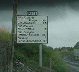
R348 road
Encyclopedia
R348 road
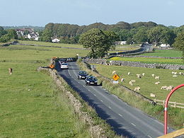
File:R348roadIreland.JPG|thumb|300px|Sign on the R348 regional road poly 544 504 532 728 1092 740 1108 672 1168 640 1140 592 1048 580 1060 500 Ballinasloepoly 560 764 528 824 532 920 1064 924 1064 856 996 828 1016 768 Kilconnell...
regional road
Regional road
A regional road in Ireland is a class of road not forming a major route , but nevertheless forming a link in the national route network. There are over 11,600 kilometres of regional roads. Regional roads are numbered with three digit route numbers, prefixed by "R" A regional road in Ireland is a...
poly 544 504 532 728 1092 740 1108 672 1168 640 1140 592 1048 580 1060 500 Ballinasloe
poly 560 764 528 824 532 920 1064 924 1064 856 996 828 1016 768 Kilconnell
Kilconnell
Kilconnell is a small rural village in County Galway, Ireland.Its population in 2006 was 680. Its land is mainly used for dairy farming and the raising of cattle....
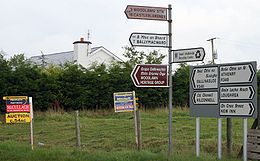
poly 580 948 536 1032 564 1116 1212 1116 1224 1032 1024 1024 1052 952 Mountbellew
Mountbellew
Mountbellew or Mountbellew Bridge is a village in County Galway, Ireland. It lies mostly within the townland of Treanrevagh on the N63 national primary road....
poly 580 1144 540 1212 564 1296 1272 1300 1280 1220 860 1200 872 1144 Castleblakeney
Castleblakeney
Castleblakeney or Castleblakeny, historically Gallagh , is a village in County Galway, Ireland. It is at the crossroads of the R359 and R339 regional roads, 5km south of the town of Mountbellew.-See also:*List of towns and villages in Ireland...
The R348 road is a regional road
Regional road
A regional road in Ireland is a class of road not forming a major route , but nevertheless forming a link in the national route network. There are over 11,600 kilometres of regional roads. Regional roads are numbered with three digit route numbers, prefixed by "R" A regional road in Ireland is a...
in Ireland
Republic of Ireland
Ireland , described as the Republic of Ireland , is a sovereign state in Europe occupying approximately five-sixths of the island of the same name. Its capital is Dublin. Ireland, which had a population of 4.58 million in 2011, is a constitutional republic governed as a parliamentary democracy,...
stretching east-west for 51 km along a route north of the N6. It leaves the N6 east of Oranmore
Oranmore
Oranmore is a village in County Galway on the outskirts of Galway city in Ireland. With its major housing developments, Oranmore is rapidly becoming a part of Galway's commuter or suburban belt...
and rejoins it in Ballinasloe. The full length of the lies within County Galway
County Galway
County Galway is a county in Ireland. It is located in the West Region and is also part of the province of Connacht. It is named after the city of Galway. Galway County Council is the local authority for the county. There are several strongly Irish-speaking areas in the west of the county...
.
En route it passes through the southern end of Athenry
Athenry
Athenry is a town in County Galway, Ireland. It lies east of Galway city, and one of the attractions of the town is its medieval castle. The town is also well-known by virtue of the song "The Fields of Athenry".-History:...
and several small villages.