
R165 road
Encyclopedia
Regional road
A regional road in Ireland is a class of road not forming a major route , but nevertheless forming a link in the national route network. There are over 11,600 kilometres of regional roads. Regional roads are numbered with three digit route numbers, prefixed by "R" A regional road in Ireland is a...
in Ireland
Republic of Ireland
Ireland , described as the Republic of Ireland , is a sovereign state in Europe occupying approximately five-sixths of the island of the same name. Its capital is Dublin. Ireland, which had a population of 4.58 million in 2011, is a constitutional republic governed as a parliamentary democracy,...
, linking the R188 5 km (3.1 mi) west of Cootehill
Cootehill
Cootehill, known before the Plantation of Ulster as Munnilly , is a prominent market town in County Cavan, Ireland.-History:Cootehill was established as a market town in 1725 when a charter was obtained to hold markets and fairs, and developed strong ties to the Irish linen industry...
in County Cavan
County Cavan
County Cavan is a county in Ireland. It is part of the Border Region and is also located in the province of Ulster. It is named after the town of Cavan. Cavan County Council is the local authority for the county...
to the N2 near Ardee
Ardee
Ardee is a town and townland in County Louth, Ireland. It is located at the intersection of the N2, N52, and N33 roads. Ardee is on the banks of the River Dee and is approximately 20 km from Dundalk, Drogheda, Slane and Carrickmacross...
, County Louth
County Louth
County Louth is a county of Ireland. It is part of the Border Region and is also located in the province of Leinster. It is named after the town of Louth. Louth County Council is the local authority for the county...
.
The route is 64 km (39.8 mi) long.
Route
Northeast to southwest, the route starts at a junction with the R188 west of Cootehill. It continues southwards through StradoneStradone, County Cavan
Stradone is identified in the current County Cavan, Ireland, Development Plan 2003-2009 as a smaller urban community. These small communities are recognised as having what could be described as proto-urban characteristics and may provide a valued local retail service to the surrounding...
, to join the N3 and in 500 m leaves the N3 at Lavey.
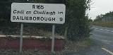
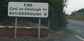
It heads southeast through Bailieborough and Kingscourt, crosses the N52
N52 road (Ireland)
The N52 road is a national secondary road in Ireland. It links the M7 motorway from just south of Nenagh, County Tipperary to the M1 motorway north of Dundalk in County Louth.The road is long.-Quality of Road:...
then enters County Louth
County Louth
County Louth is a county of Ireland. It is part of the Border Region and is also located in the province of Leinster. It is named after the town of Louth. Louth County Council is the local authority for the county...
and terminates at the N2 3 km (1.9 mi) south of Ardee
Ardee
Ardee is a town and townland in County Louth, Ireland. It is located at the intersection of the N2, N52, and N33 roads. Ardee is on the banks of the River Dee and is approximately 20 km from Dundalk, Drogheda, Slane and Carrickmacross...
.