

Puerto Rico Highway 133
Encyclopedia
Puerto Rico Highway 133 (PR-133), also known as Calle Comercio but officially Francisco Parra Duperón street, is a major access road in Ponce, Puerto Rico
. The road has both of its endpoints, as well as all of its length, entirely within the Ponce city limits. It runs west to east. This road is the main access road from downtown Ponce to PR-52 and PR-1
, providing access to San Juan
and Guayama
, respectively, and all other points in the eastern portion of the Island.
The road starts at its intersection with Marina street at Plaza Las Delicias
in downtown Ponce. From this point the road runs east for three blocks as a one-lane, one-way street and is called Francisco Parra Duperón
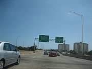
but it is known as Comercio Street. At the end of the third block, the road intersects Cruz Street and becomes a two-lane, two-way street. The road runs as a two-way street until its intersection with Rio Portugues. After crossing Rio Portugues the road becomes a 4-lane divided roadway. (Until recently this section of the road was known as Cuatro Calles Avenue, and this designation may still be seen in some older maps.) The road continues to run in a westernly direction, intersecting with PR-163/Las Americas Avenue (as of November 12, 2010, the Luis A. Ferre Boulevard) at Café Rico
and near Centro del Sur. After its intersection with PR-163, the road continues as a divided 4-lane road but becomes Ednita Nazario
Boulevard. Continuing east the road crosses PR-12 via an underpass (no access to PR-12 at this point) in its approach to its terminus at its intersection with PR-1
and PR-2
.
Ponce, Puerto Rico
Ponce is both a city and a municipality in the southern part of Puerto Rico. The city is the seat of the municipal government.The city of Ponce, the fourth most populated in Puerto Rico, and the most populated outside of the San Juan metropolitan area, is named for Juan Ponce de León y Loayza, the...
. The road has both of its endpoints, as well as all of its length, entirely within the Ponce city limits. It runs west to east. This road is the main access road from downtown Ponce to PR-52 and PR-1
Puerto Rico Highway 1
Puerto Rico Highway 1 connects the city of Ponce to San Juan. Leaving Ponce, the road follows somewhat parallel along the southern coast of the island and, at Salinas, it turns north to cut through the Cordillera Central in its approach to San Juan....
, providing access to San Juan
San Juan, Puerto Rico
San Juan , officially Municipio de la Ciudad Capital San Juan Bautista , is the capital and most populous municipality in Puerto Rico, an unincorporated territory of the United States. As of the 2010 census, it had a population of 395,326 making it the 46th-largest city under the jurisdiction of...
and Guayama
Guayama, Puerto Rico
Guayama is a municipality of Puerto Rico founded on January 29, 1736 and located on the Southern Coastal Valley region, bordering the Caribbean, south of Cayey; east of Salinas; and west of Patillas and Arroyo. Guayama is spread over 9 wards and Guayama Pueblo...
, respectively, and all other points in the eastern portion of the Island.
Course of the road
Highway 133 is about one and a half miles long, making it one of Puerto Rico’s shortest primary roads.The road starts at its intersection with Marina street at Plaza Las Delicias
Plaza Las Delicias
Plaza Las Delicias is the main plaza in the city of Ponce, Puerto Rico. The square is notable for its fountains and for the various monuments it contains. The historic Parque de Bombas and Ponce Cathedral buildings are located within Plaza Las Delicias. Plaza Las Delicias is actually composed of...
in downtown Ponce. From this point the road runs east for three blocks as a one-lane, one-way street and is called Francisco Parra Duperón
Francisco Parra Duperón
Francisco Parra Duperón born in Mayagüez, Puerto Rico was a lawyer and banker. He became a lawyer at a young age and moved from Mayagüez to Ponce, Puerto Rico where he established his law practice....
but it is known as Comercio Street. At the end of the third block, the road intersects Cruz Street and becomes a two-lane, two-way street. The road runs as a two-way street until its intersection with Rio Portugues. After crossing Rio Portugues the road becomes a 4-lane divided roadway. (Until recently this section of the road was known as Cuatro Calles Avenue, and this designation may still be seen in some older maps.) The road continues to run in a westernly direction, intersecting with PR-163/Las Americas Avenue (as of November 12, 2010, the Luis A. Ferre Boulevard) at Café Rico
Café Rico
Café Rico is a Puerto Rican corporation that manufactures coffee branded by the same name. The company's headquarters are located in Barrio San Antón in the city of Ponce, Puerto Rico, on Las Americas Avenue/Route 163 and Calle Comercio/Route 133...
and near Centro del Sur. After its intersection with PR-163, the road continues as a divided 4-lane road but becomes Ednita Nazario
Ednita Nazario
Ednita Nazario is a Puerto Rican singer and songwriter who has achieved stardom both at home and abroad. She has been in the music business from a young age, and has released over twenty albums throughout her career....
Boulevard. Continuing east the road crosses PR-12 via an underpass (no access to PR-12 at this point) in its approach to its terminus at its intersection with PR-1
Puerto Rico Highway 1
Puerto Rico Highway 1 connects the city of Ponce to San Juan. Leaving Ponce, the road follows somewhat parallel along the southern coast of the island and, at Salinas, it turns north to cut through the Cordillera Central in its approach to San Juan....
and PR-2
Puerto Rico Highway 2
Puerto Rico Highway 2, the longest highway in the Commonwealth of Puerto Rico at about 156 miles long, connects San Juan to Ponce....
.
Landmarks
One of the most prominent landmarks along this road is Ceiba Tree Park, located next to Rio Portugues.See also
- Puerto Rico Highway 500Puerto Rico Highway 500Puerto Rico Highway 500 is a tertiary road in Ponce, Puerto Rico. The highway has both of its endpoints, as well as all of its length, entirely within the Ponce city limits. It runs south to north.-History:...
- Puerto Rico Highway 9Puerto Rico Highway 9Puerto Rico Highway 9, also called the Anillo de Circunvalación de Ponce , is a limited-access highway entirely located within the limits of the municipality of Ponce, Puerto Rico, and connecting Puerto Rico Highway 10 in Barrio Portugués in the north to Puerto Rico Highway 52 in barrio Canas in...
- Puerto Rico Highway 12Puerto Rico Highway 12Puerto Rico Highway 12, also called Malecon Avenue, and Santiago de los Caballeros Avenue, is a 5.28-kilometer, limited-access highway entirely located within the city limits of Ponce, Puerto Rico, and connecting Puerto Rico Highway 14 to the La Guancha area in Barrio Playa in Ponce. It is similar...
- Puerto Rico Highway 163Puerto Rico Highway 163Puerto Rico Highway 163, also known as Avenida Las Americas, is a major thoroughfare in Ponce, Puerto Rico. The highway has both of its termini as well as all of its length entirely within the Ponce city limits. It runs west to east. As of November 12, 2010, the road will be called Luis A...
- Puerto Rico Highway 10Puerto Rico Highway 10Puerto Rico Highway 10 is a major highway in Puerto Rico. It connects the cities of Ponce in the south and Arecibo to the north; it is also the shortest route between the two cities....
- Puerto Rico Highway 52
- Puerto Rico Highway 1Puerto Rico Highway 1Puerto Rico Highway 1 connects the city of Ponce to San Juan. Leaving Ponce, the road follows somewhat parallel along the southern coast of the island and, at Salinas, it turns north to cut through the Cordillera Central in its approach to San Juan....
- Historia de las Carreteras de Puerto Rico. Retrieved March 11, 2010.
- Roads in Porto Rico. By Manuel Victor Domenech (Former Commissioner of the Interior, in The Overland Monthly. Vol 73, No, 4; April, 1919. Page 321. Retrieved March 11, 2010.