
Posse, Goiás
Encyclopedia
| Posse | |
|---|---|
| State | Goiás Goiás Goiás is a state of Brazil, located in the central part of the country. The name Goiás comes from the name of an indigenous community... |
| Geographical Coordinates: | 14°05′19"S 46°21′18"W |
| Area: | 1,949.6 km² |
| Population: | 28,850(IBGE 2007) |
| Population density | 14.80 inhab/km² |
| Urban population | 21,671 |
| Rural population | 7,179 |
| Elevation: | 811m |
| Postcode (CEP): | 73900-000 |
| IBGE statistical microregion: | 018 Vão do Paranã |
| Became a city: | 1872 |
| Mayor: | Stanley Sebastião Valente |
| Distance to Goiânia Goiânia -Climate:The city has a tropical wet and dry climate with an average temperature of . There's a wet season, from October to April, and a dry one, from May to September. Annual rainfall is around 1,520 mm.... : |
513 km. |
| Website: | n/a |

Municipality
A municipality is essentially an urban administrative division having corporate status and usually powers of self-government. It can also be used to mean the governing body of a municipality. A municipality is a general-purpose administrative subdivision, as opposed to a special-purpose district...
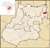
in northeastern Goiás
Goiás
Goiás is a state of Brazil, located in the central part of the country. The name Goiás comes from the name of an indigenous community...
state, Brazil
Brazil
Brazil , officially the Federative Republic of Brazil , is the largest country in South America. It is the world's fifth largest country, both by geographical area and by population with over 192 million people...
.
Geography
It is located northeast of BrasíliaBrasília
Brasília is the capital city of Brazil. The name is commonly spelled Brasilia in English. The city and its District are located in the Central-West region of the country, along a plateau known as Planalto Central. It has a population of about 2,557,000 as of the 2008 IBGE estimate, making it the...
, 24 km. from the state boundary with Bahia
Bahia
Bahia is one of the 26 states of Brazil, and is located in the northeastern part of the country on the Atlantic coast. It is the fourth most populous Brazilian state after São Paulo, Minas Gerais and Rio de Janeiro, and the fifth-largest in size...
, on interstate highway BR-020 (Brasília-Salvador). It has a privileged location at the foot of the Serra das Araras, with an average temperature of 25 °C and a supply of mineral water taken from the slopes of the mountains. The eastern part of the municipality is crossed by the Rio Paranã and its tributaries. This corresponds to the so-called gap (vão), an area that stretches from the high valley of the river to the plateaus that surround it. Its lands are fertile, with natural pasture and forests rich in hardwoods. The lands have a natural fertilizer—phosphate—which helps to renew the soil.
There are many waterfalls in the region, the most important being those of Rio Água Quente, on Fazenda Quebradas; Rio Prata, on Fazenda Campo Bonito; Rio Piracanjuba, on Fazenda Santo Antônio; and Rio Buriti, on the ranch of the same name.
Municipal boundaries are with Alvorada do Norte
Alvorada do Norte
Alvorada do Norte is a small town and municipality in northeastern Goiás state, Brazil. It is an important commercial center on the Brasília-Salvador highway.-Location:...
, Buritinópolis
Buritinópolis
Buritinópolis is a small town and municipality in eastern Goiás state, Brazil. It is the poorest municipality in the state.-Location:Buritinópolis is located in the Vão do Paranã statistical micro-region in the area near Simolândia and Alvorada do Norte. It is close to the important BR-020...
, Iaciara
Iaciara
Iaciara is a small town and municipality in northeastern Goiás state, Brazil.-Geography:Iaciara is located in Vão do Paranã statistical micro-region, which borders the state of Bahia. The distance to the state capital of Goiânia is 548 kilometers...
, Guarani de Goiás
Guarani de Goiás
Guarani de Goiás is a small town and municipality in eastern Goiás state, Brazil. Guarani is a very poor municipality in the northeast of the state.-Geography:Guarani belongs to the Vão do Paranã statistical microregion...
, Mambaí
Mambaí
Mambaí is a city in eastern Goiás state, Brazil. It is the easternmost city in that state.-Geography:Mambaí is one of the most isolated cities in the state of Goiás. It lies in the Vão do Paranã statistical micro-region less than 20 kilometers from the border with the state of Bahia. It is 61...
, Simolândia
Simolândia
Simolândia is a small town and municipality in northeast Goiás state, Brazil.-Location and Geography:Simolândia is situated in the northeast of Goiás, at kilometer 250 of the important BR-020 . It forms boundaries with Posse, Alvorada do Norte and Buritinópolis...
and the state of Bahia
Bahia
Bahia is one of the 26 states of Brazil, and is located in the northeastern part of the country on the Atlantic coast. It is the fourth most populous Brazilian state after São Paulo, Minas Gerais and Rio de Janeiro, and the fifth-largest in size...
.
Goiânia
Goiânia
-Climate:The city has a tropical wet and dry climate with an average temperature of . There's a wet season, from October to April, and a dry one, from May to September. Annual rainfall is around 1,520 mm....
lies at a distance of 515 km. and connections are made by taking BR-153 / Anápolis / BR-060 / Abadiânia / Alexânia / Sobradinho / Planaltina / (DF) / Formosa / BR-020 / BR-030 / Bezerra / BR-020 / Vila Boa / Alvorada do Norte / GO-108.
History
The town of Posse arose with the arrival of Northeastern migrants fleeing the drought in search of fertile lands in the mid-19th century. Among the pioneers there were many descendants of Argentinians and Portuguese and many of the steams and rivers had names remembering those far away lands—Rio Corrente, Rio Prata, and Porto Buenos Aires. The settlement was first called Buenos Aires, located below the joining of the Rio Corrente with the Rio Paranã. The town did not progress because it was hit by malaria and the first settlers went to the higher lands at the foot of Serra Geral, where they formed another settlement. Nazário da Silva Ribeiro, the founder had a chapel built in honor of Nossa Senora Santana. The new town received the name "Posse" (possession) because the inhabitants had seized the land along the Passagem do Gerais stream, in 1830. The town became a district in the municipality of São DomingosSão Domingos
São Domingos can refer to many places in the world:*In Brazil:**São Domingos, Bahia**São Domingos, Goiás**São Domingos, Santa Catarina**São Domingos, Sergipe**São Domingos do Araguaia, Pará**São Domingos do Azeitão, Maranhão...
. In 1872 it got its autonomy and the name was changed from Nossa Senora Santa de Posse to just "Posse". In 1970 the BR-70 (Brasília-Salvador) was built and Posse began to grow.
Economy
The main economic activity of the town is commerce. The preponderance of commerce is due to the strategic location of being on the border between Goiás and Bahia. Besides the inhabitants of the town, the population of the west of Bahia also shops in Posse. The town serves a population of 50,000 people. With the distance to the state capital being so great Posse has always had stronger ties with the state of Bahia and the Federal District. Agriculture stimulates the commerce of the town, with farmers coming from the vast agricultural region of the west of BahiaBahia
Bahia is one of the 26 states of Brazil, and is located in the northeastern part of the country on the Atlantic coast. It is the fourth most populous Brazilian state after São Paulo, Minas Gerais and Rio de Janeiro, and the fifth-largest in size...
. Machines, seeds, fertilizers, and other products are acquired in Posse. Although they have farms in Bahia, most of the large farmers, who are mainly from the south of the country, live in Posse.
After commerce, cattle raising is the second most important economic activity of the region. There were 109,500 head of cattle in 2006. Other animals raised were poultry and swine. The main agricultural products were rice, bananas, sugarcane, beans, manioc, and corn. Corn was the largest in planted area with 2,000 hectares in 2006.
- Motor vehicles: 3,167 (automobiles and pickup trucks)
- Number of inhabitants per motor vehicle: 9
Agricultural data 2006
- Farms: 946
- Total area: 78,950 ha.
- Area of permanent crops: 2,143 ha.
- Area of perennial crops: 9,634 ha.
- Area of natural pasture: 39,387 ha.
- Area of woodland and forests: 21,875 ha.
- Persons dependent on farming: 2,500
- Cattle herd: 109,500
- Main crop: corn with 2,300 hectares planted and a production of 4,600 tons
Health and education
In 2006 there was 1 hospital, with 62 beds. There were 44 schools with 9,869 students. In 2000 the infant mortality rate was 24.55, below the national average of 33.0. There was a campus of the State University of Goiás—UEG - Faculdade de Educação, Ciências e Letras de Posse, with 986 students in 2003. In 2000 the adult literacy rate was 79%, below the national average of 86.4%. On the Human Development IndexHuman Development Index
The Human Development Index is a composite statistic used to rank countries by level of "human development" and separate "very high human development", "high human development", "medium human development", and "low human development" countries...
Posse was ranked in the bottom tier with a rating of 0.711.
- State ranking: 194 (out of 242)
- National ranking: 2800 (out of 5507)
Notes