
Pennsylvania Route 351
Encyclopedia
Pennsylvania Route 351 is an 17 miles (27.4 km) long state highway
located in Lawrence
and Beaver
counties in Pennsylvania
. The western terminus is at the Ohio
border near S.N.P.J
. The eastern terminus is at PA 65
/PA 288
in Ellwood City
.
border in Little Beaver Township
, Lawrence County
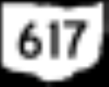
, where the road continues into Ohio as SR 617
. From the state line, the route heads southeast on a two-lane undivided road, heading through open agricultural areas with some woods and homes. The road turns to the east-southeast and continues through more rural areas, crossing the North Fork Little Beaver Creek
and reaching an intersection with PA 551
. At this point, PA 351 forms a concurrency
with PA 551, heading through more areas of farms, woods, and residences as it passes through Old Enon. The road heads into Enon Valley
and becomes State Street, heading into residential areas and merging onto Main Street. PA 351 splits from PA 551 by turning east onto Vine Street, heading into agricultural areas and crossing back into Little Beaver Township, where it becomes an unnamed road. The road passes over a Norfolk Southern railroad line and turns to the south, heading into wooded areas with some homes.
PA 351 enters Darlington Township
in Beaver County
and becomes Crescent Drive, turning southeast into a mix of farmland and woodland with some homes. The route crosses the North Fork Little Beaver Creek again and heads into more wooded areas, crossing into Big Beaver
. The road turns south near more fields and heads into New Galilee
, becoming Cleveland Drive and curving southwest past homes. PA 351 turns northeast onto Cleveland Street Extended before turning east onto Monroe Street, crossing the Norfolk Southern line. The route passes more homes before intersecting PA 168
and turning south to join that route on Centennial Avenue. PA 351 splits from PA 168 by turning east onto Fairlane Boulevard, crossing back into Big Beaver. The road turns to the northeast through woodland, coming to a bridge over I-76
(Pennsylvania Turnpike
). From here, the route turns northeast through a mix of farms and woods with some homes, crossing over I-376
. A short distance later, PA 351 comes to an intersection with Shenango Road, which provides access to both I-76 and I-376. Past this, the road passes a few fields and homes before continuing southeast through more forested areas. The route turns east through wooded areas of homes before coming to a junction with PA 18
. At this intersection, PA 351 crosses into Koppel
and becomes Arthur Street, passing residences and businesses. The route crosses a Norfolk Southern railroad line and turns north onto 5th Avenue, heading past more development. The road curves northeast and passes near industry, crossing under a CSX railroad line before becoming unnamed and heading northeast through woodland. PA 351 comes to a bridge that crosses over a CSX rail line before passing over the Beaver River
into North Sewickley Township
and heading over another CSX railroad line. Past the bridge, the route turns north onto River Road and heads through wooded areas with some commercial development.
PA 351 heads into Wayne Township
in Lawrence County and becomes West Lawrence Avenue, turning northeast and running through the residential community of Park Gate. The road heads into Ellwood City
and turns to the east, becoming Lawrence Avenue and passing through business areas. Farther east, the route heads through the commercial downtown before turning south onto 4th Street. A block later, PA 351 turns east onto Crescent Avenue and passes homes before ending at PA 65
/PA 288
.
State highway
State highway, state road or state route can refer to one of three related concepts, two of them related to a state or provincial government in a country that is divided into states or provinces :#A...
located in Lawrence
Lawrence County, Pennsylvania
Lawrence County is a county located in the U.S. state of Pennsylvania. In 2010, its population was 91,108. The county was added to the Pittsburgh Metropolitan Statistical Area in 2003. The county seat is New Castle....
and Beaver
Beaver County, Pennsylvania
-Demographics:As of the census of 2000, there were 181,412 people, 72,576 households, and 50,512 families residing in the county. The population density was 418 people per square mile . There were 77,765 housing units at an average density of 179 per square mile...
counties in Pennsylvania
Pennsylvania
The Commonwealth of Pennsylvania is a U.S. state that is located in the Northeastern and Mid-Atlantic regions of the United States. The state borders Delaware and Maryland to the south, West Virginia to the southwest, Ohio to the west, New York and Ontario, Canada, to the north, and New Jersey to...
. The western terminus is at the Ohio
Ohio
Ohio is a Midwestern state in the United States. The 34th largest state by area in the U.S.,it is the 7th‑most populous with over 11.5 million residents, containing several major American cities and seven metropolitan areas with populations of 500,000 or more.The state's capital is Columbus...
border near S.N.P.J
S.N.P.J., Pennsylvania
S.N.P.J. is a borough located in Lawrence County, Pennsylvania. According to the 2010 U.S. census, the borough has a population of 19.S.N.P.J...
. The eastern terminus is at PA 65
Pennsylvania Route 65
Pennsylvania Route 65 is a major state highway located in western Pennsylvania, United States. The route, traveling north–south from the Interstate 279/U.S...
/PA 288
Pennsylvania Route 288
Pennsylvania Route 288 or State Route 288 is an east–west route in western Pennsylvania, United States. The highway is 15.4 miles long from PA Route 18 in Wampum to the U.S...
in Ellwood City
Ellwood City, Pennsylvania
Ellwood City is a borough in Beaver and Lawrence counties in the U.S. state of Pennsylvania. Ellwood City is 30 miles northwest of Pittsburgh and some 8 miles south by southeast of New Castle...
.
Route description
PA 351 begins at the OhioOhio
Ohio is a Midwestern state in the United States. The 34th largest state by area in the U.S.,it is the 7th‑most populous with over 11.5 million residents, containing several major American cities and seven metropolitan areas with populations of 500,000 or more.The state's capital is Columbus...
border in Little Beaver Township
Little Beaver Township, Pennsylvania
Little Beaver Township is a township in Lawrence County, Pennsylvania, United States. The population was 1,310 at the 2000 census.-Geography:...
, Lawrence County
Lawrence County, Pennsylvania
Lawrence County is a county located in the U.S. state of Pennsylvania. In 2010, its population was 91,108. The county was added to the Pittsburgh Metropolitan Statistical Area in 2003. The county seat is New Castle....
, where the road continues into Ohio as SR 617
Ohio State Route 617
State Route 617 is a short east–west state route in northeastern Ohio, existing entirely within Mahoning County. The western terminus of OH 617 is at OH 165 in the unincorporated community of New Springfield...
. From the state line, the route heads southeast on a two-lane undivided road, heading through open agricultural areas with some woods and homes. The road turns to the east-southeast and continues through more rural areas, crossing the North Fork Little Beaver Creek
Little Beaver Creek
The Little Beaver Creek is a wild and scenic area in Ohio. The Little Beaver Creek watershed is located primarily in Columbiana County in northeast Ohio, and in portions of Carroll County, Mahoning County, and western Pennsylvania, draining approximately 605 mi² , of which 503 mi² are in Ohio...
and reaching an intersection with PA 551
Pennsylvania Route 551
Pennsylvania Route 551 is an long state highway located in Beaver, Lawrence, and Mercer counties in Pennsylvania. The southern terminus is at PA 18 in Beaver Falls...
. At this point, PA 351 forms a concurrency
Concurrency (road)
A concurrency, overlap, or coincidence in a road network is an instance of one physical road bearing two or more different highway, motorway, or other route numbers...
with PA 551, heading through more areas of farms, woods, and residences as it passes through Old Enon. The road heads into Enon Valley
Enon Valley, Pennsylvania
Enon Valley is a borough in Lawrence County, Pennsylvania, United States. The population was 387 at the 2000 census.-Geography:Enon Valley is located at ....
and becomes State Street, heading into residential areas and merging onto Main Street. PA 351 splits from PA 551 by turning east onto Vine Street, heading into agricultural areas and crossing back into Little Beaver Township, where it becomes an unnamed road. The road passes over a Norfolk Southern railroad line and turns to the south, heading into wooded areas with some homes.
PA 351 enters Darlington Township
Darlington Township, Pennsylvania
Darlington Township is a township in Beaver County, Pennsylvania, United States. The population was 1,974 at the 2000 census.-History:Darlington and South Beaver townships are connected by the Watts Mill Bridge, which is listed on the National Register of Historic Places.-Geography:According to the...
in Beaver County
Beaver County, Pennsylvania
-Demographics:As of the census of 2000, there were 181,412 people, 72,576 households, and 50,512 families residing in the county. The population density was 418 people per square mile . There were 77,765 housing units at an average density of 179 per square mile...
and becomes Crescent Drive, turning southeast into a mix of farmland and woodland with some homes. The route crosses the North Fork Little Beaver Creek again and heads into more wooded areas, crossing into Big Beaver
Big Beaver, Pennsylvania
Big Beaver is a borough in Beaver County, Pennsylvania, United States. The population was 2,186 at the 2000 census.-Geography:Big Beaver is located at ....
. The road turns south near more fields and heads into New Galilee
New Galilee, Pennsylvania
New Galilee is a borough in Beaver County, Pennsylvania, United States. The population was 424 at the 2000 census.-Geography:New Galilee is located at ....
, becoming Cleveland Drive and curving southwest past homes. PA 351 turns northeast onto Cleveland Street Extended before turning east onto Monroe Street, crossing the Norfolk Southern line. The route passes more homes before intersecting PA 168
Pennsylvania Route 168
Pennsylvania Route 168 is a highway in Western Pennsylvania that runs for from Pennsylvania Route 18 in Frankfort Springs to Pennsylvania Route 208 in Volant...
and turning south to join that route on Centennial Avenue. PA 351 splits from PA 168 by turning east onto Fairlane Boulevard, crossing back into Big Beaver. The road turns to the northeast through woodland, coming to a bridge over I-76
Interstate 76 (east)
Interstate 76 is an Interstate Highway in the United States, running 435 miles from an interchange with Interstate 71 west of Akron, Ohio, east to Interstate 295 near Camden, New Jersey....
(Pennsylvania Turnpike
Pennsylvania Turnpike
The Pennsylvania Turnpike is a toll highway system operated by the Pennsylvania Turnpike Commission in the Commonwealth of Pennsylvania, United States. The three sections of the turnpike system total . The main section extends from Ohio to New Jersey and is long...
). From here, the route turns northeast through a mix of farms and woods with some homes, crossing over I-376
Interstate 376
Interstate 376 is a major auxiliary route of the Interstate Highway System in the U.S. state of Pennsylvania, located entirely within the Allegheny Plateau. It runs from I-80 near Sharon south and east to a junction with the Pennsylvania Turnpike in Monroeville, after having crossed the Turnpike...
. A short distance later, PA 351 comes to an intersection with Shenango Road, which provides access to both I-76 and I-376. Past this, the road passes a few fields and homes before continuing southeast through more forested areas. The route turns east through wooded areas of homes before coming to a junction with PA 18
Pennsylvania Route 18
Pennsylvania Route 18 is a major north–south highway in Western Pennsylvania whose southern terminus is at the West Virginia state line in Greene County, Pennsylvania near the village of Garrison, while the northern terminus is at PA Route 5 in Lake City, Pennsylvania...
. At this intersection, PA 351 crosses into Koppel
Koppel, Pennsylvania
Koppel is a borough in Beaver County, Pennsylvania, United States. The population was 856 at the 2000 census.-Geography:Koppel is located at ....
and becomes Arthur Street, passing residences and businesses. The route crosses a Norfolk Southern railroad line and turns north onto 5th Avenue, heading past more development. The road curves northeast and passes near industry, crossing under a CSX railroad line before becoming unnamed and heading northeast through woodland. PA 351 comes to a bridge that crosses over a CSX rail line before passing over the Beaver River
Beaver River (Pennsylvania)
The Beaver River is a tributary of the Ohio River in Western Pennsylvania in the United States with a length of approximately 21 mi . It flows through a historically important coal-producing region north of Pittsburgh...
into North Sewickley Township
North Sewickley Township, Pennsylvania
North Sewickley Township is a township in Beaver County, Pennsylvania, United States. The population was 6,120 at the 2000 census.-Geography:...
and heading over another CSX railroad line. Past the bridge, the route turns north onto River Road and heads through wooded areas with some commercial development.
PA 351 heads into Wayne Township
Wayne Township, Lawrence County, Pennsylvania
Wayne Township is a township in Lawrence County, Pennsylvania, United States. The population was 2,328 at the 2000 census.-History:The township was linked to New Castle, Ellwood and Pittsburgh in 1908 by the Pittsburgh, Harmony, Butler and New Castle Railway, an interurban trolley line...
in Lawrence County and becomes West Lawrence Avenue, turning northeast and running through the residential community of Park Gate. The road heads into Ellwood City
Ellwood City, Pennsylvania
Ellwood City is a borough in Beaver and Lawrence counties in the U.S. state of Pennsylvania. Ellwood City is 30 miles northwest of Pittsburgh and some 8 miles south by southeast of New Castle...
and turns to the east, becoming Lawrence Avenue and passing through business areas. Farther east, the route heads through the commercial downtown before turning south onto 4th Street. A block later, PA 351 turns east onto Crescent Avenue and passes homes before ending at PA 65
Pennsylvania Route 65
Pennsylvania Route 65 is a major state highway located in western Pennsylvania, United States. The route, traveling north–south from the Interstate 279/U.S...
/PA 288
Pennsylvania Route 288
Pennsylvania Route 288 or State Route 288 is an east–west route in western Pennsylvania, United States. The highway is 15.4 miles long from PA Route 18 in Wampum to the U.S...
.