
Ohio State Highway 91
Encyclopedia
State highway
State highway, state road or state route can refer to one of three related concepts, two of them related to a state or provincial government in a country that is divided into states or provinces :#A...
in the northeastern portion of the U.S. state
U.S. state
A U.S. state is any one of the 50 federated states of the United States of America that share sovereignty with the federal government. Because of this shared sovereignty, an American is a citizen both of the federal entity and of his or her state of domicile. Four states use the official title of...
of Ohio
Ohio
Ohio is a Midwestern state in the United States. The 34th largest state by area in the U.S.,it is the 7th‑most populous with over 11.5 million residents, containing several major American cities and seven metropolitan areas with populations of 500,000 or more.The state's capital is Columbus...
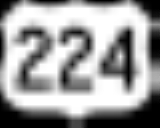
. Its southern terminus is at U.S. Route 224 (East Waterloo Road) in Springfield Township
Springfield Township, Summit County, Ohio
Springfield Township is one of the nine townships of Summit County, Ohio, United States. The 2000 census found 15,168 people in the township.-Geography:Located in the southeastern part of the county, it borders the following townships and cities:...
, east of Akron
Akron, Ohio
Akron , is the fifth largest city in the U.S. state of Ohio and the county seat of Summit County. It is located in the Great Lakes region approximately south of Lake Erie along the Little Cuyahoga River. As of the 2010 census, the city had a population of 199,110. The Akron Metropolitan...
. Its northern terminus is at State Route 283 (Lake Shore Boulevard) on the Timberlake
Timberlake, Ohio
Timberlake is a village in Lake County, Ohio, United States. The population was 775 at the 2000 census.-Geography:Timberlake is located at ....
/Eastlake
Eastlake, Ohio
As of the census of 2000, there were 20,255 people, 8,055 households, and 5,557 families residing in the city. The population density was 3,166.5 people per square mile . There were 8,310 housing units at an average density of 1,299.1 per square mile...
border less than one mile (1.6 km) south of Lake Erie
Lake Erie
Lake Erie is the fourth largest lake of the five Great Lakes in North America, and the tenth largest globally. It is the southernmost, shallowest, and smallest by volume of the Great Lakes and therefore also has the shortest average water residence time. It is bounded on the north by the...
.
The route is known as "Canton Road" from its southern terminus to just north of its interchange with Interstate 76 (Canton Road continues south as County Route 66, a former portion of State Route 8). North of this interchange, it is called "Darrow Road" until it enters the city of Tallmadge
Tallmadge, Ohio
As of the census of 2000, there were 16,390 people, 6,273 households, and 4,711 families residing in the city. The population density was 1,173.9 people per square mile . There were 6,494 housing units at an average density of 465.1 per square mile...
, where it is named "South Avenue" south of the Tallmadge Circle, and "North Avenue" north of the circle. It next passes through the Munroe Falls
Munroe Falls, Ohio
Munroe Falls is a city located in the east-central portion of Summit County, Ohio, United States, between Stow and Tallmadge. It is a suburb of Akron and is part of the Akron Metropolitan Statistical Area...
village limits and is known as "South Main Street" and "North Main Street." It becomes "Darrow Road" once again in the city of Stow
Stow, Ohio
Stow is a city in Summit County, Ohio, United States. The population was 32,139 at the 2000 census and 33,899 as of 2008. It is a suburban community that is part of the Akron metropolitan area. Stow is located adjacent to several other suburban communities in Summit and Portage Counties...
and for its remaining length in Summit County
Summit County, Ohio
Summit County is an urban county located in the state of Ohio, United States. As of the 2000 census, the population was 542,899. In the 2010 Census the population was 541,781. Its county seat is Akron...
, aside from within the Hudson
Hudson, Ohio
Hudson is a city in Summit County, Ohio, United States. The population was 22,262 at the 2010 census. It is an affluent exurban community and is part of the Akron, Ohio Metropolitan Statistical Area...
city limits, where it is "South" and "North Main Street."
In Cuyahoga
Cuyahoga County, Ohio
Cuyahoga County is a county located in the state of Ohio, United States. It is the most populous county in Ohio; as of the 2010 census, the population was 1,280,122. Its county seat is Cleveland. Cuyahoga County is part of Greater Cleveland, a metropolitan area, and Northeast Ohio, a...
and Lake
Lake County, Ohio
Lake County is a county located in the U.S. state of Ohio. As of 2010, the population was 230,041. The county seat is Painesville, and the county name comes from its location on the southern shore of Lake Erie....
Counties, State Route 91 is known as "SOM Center Road," named for the fact that it runs through the centers of the original Solon, Orange and Mayfield Townships
Defunct townships of Cuyahoga County, Ohio
Cuyahoga County, Ohio, United States is divided into twenty-one townships.When Cuyahoga County was founded, it was divided into civil townships for purposes of rural government, as were other Ohio counties...
in Cuyahoga County.
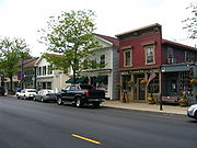
The State Route 91 corridor includes views of some of the best examples of Connecticut Western Reserve
Connecticut Western Reserve
The Connecticut Western Reserve was land claimed by Connecticut from 1662 to 1800 in the Northwest Territory in what is now northeastern Ohio.-History:...
town planning, particularly the quaint public squares
Town square
A town square is an open public space commonly found in the heart of a traditional town used for community gatherings. Other names for town square are civic center, city square, urban square, market square, public square, and town green.Most town squares are hardscapes suitable for open markets,...
of Hudson, Tallmadge, and Mayfield
Mayfield, Ohio
Mayfield is a village in Cuyahoga County, Ohio, United States. The population was 3,460 at the 2010 census. The village is officially named Mayfield, but is typically referred to as Mayfield Village...
. It also dissects several other picturesque and affluent communities of Northeast Ohio, including Gates Mills Village
Gates Mills, Ohio
Gates Mills is a village in Cuyahoga County, Ohio, United States. The population was 2,270 at the 2010 census. Gates Mills is an affluent suburb of Cleveland...
, Pepper Pike, Hunting Valley
Hunting Valley, Ohio
Hunting Valley is an affluent village located east of Cleveland in Cuyahoga and Geauga counties in the Northeast Ohio region, the 14th largest Combined Statistical Area in the United States. As of the 2010 census, the village population was 705...
, Moreland Hills
Moreland Hills, Ohio
Moreland Hills is a village in Cuyahoga County, Ohio, United States. It is an affluent suburb of Cleveland. The population was 3,320 at the 2010 census.-History:...
and Solon
Solon, Ohio
Solon is a city in Cuyahoga County, Ohio, and is an affluent suburb of Cleveland in the Northeast Ohio Region, the 14th largest Combined Statistical Area in the United States. As of the 2010 census, the city population was 23,348...
(which also has remnants of a Western Reserve public square).
History
- 1924 – Original route established. Originally routed from TallmadgeTallmadge, OhioAs of the census of 2000, there were 16,390 people, 6,273 households, and 4,711 families residing in the city. The population density was 1,173.9 people per square mile . There were 6,494 housing units at an average density of 465.1 per square mile...
to 3 miles (4.8 km) east of WickliffeWickliffe, OhioAs of the census of 2000, there are 13,484 people, 5,604 households, 3,754 families residing in the city. The population density is 2,898.2 people per square mile . There are 5,787 housing units at an average density of 1,243.8 per square mile...
. - 1926 – Extended south to 3 miles (4.8 km) north of LakemoreLakemore, OhioLakemore is a village in Summit County, Ohio, United States. The population was 2,561 at the 2000 census. It is part of the Akron Metropolitan Statistical Area.-Geography:Lakemore is located at ....
along a previously unnumbered road. - 1966 – Upgraded to 4 lanes from U.S. Route 6 to 3 miles (4.8 km) east of Wickliffe by this time.
- 1970 – Extended south to Springfield Township along the former State Route 8 alignment; extended north to EastlakeEastlake, OhioAs of the census of 2000, there were 20,255 people, 8,055 households, and 5,557 families residing in the city. The population density was 3,166.5 people per square mile . There were 8,310 housing units at an average density of 1,299.1 per square mile...
as a divided highwayDivided HighwayDivided Highway is a compilation album by American rock band The Doobie Brothers, released in 2003. . All tracks are taken from the albums Cycles and Brotherhood .-Track listing:...
.