
Ohio State Highway 59
Encyclopedia
State Route 59 is an east–west state highway
in the northeastern portion of Ohio
, a U.S. state
. The western terminus of State Route 59 is in downtown Akron
at a partial interchange with the Interstate 76/Interstate 77 duplex. The eastern terminus of the state route is at State Route 5 just 0.5 mile (0.80467 km) east of the Ravenna
city limits.
and Portage
Counties. The portion of State Route 59 beginning at the northern interchange with the State Route 8 freeway, and heading east through Kent
and Ravenna
to the State Route 5 junction is included within the National Highway System
, a network of routes deemed most important for the economy, mobility and defense of the nation.
 Haymaker Parkway is the name given to the rerouted section of State Route 59 than runs through Kent
, Ohio
as a bypass road. It is a five-lane road with two bridges built between 1968 and 1975. The largest of the two bridges, the Redmond Greer Memorial Bridge, http://www.recordpub.com/news/article/2084952 passes over both sets of railroad tracks that pass through downtown Kent (known locally as the "upper" and "lower" tracks) as well as Franklin Avenue, the Cuyahoga River
, and Franklin Mills Riveredge Park. The Greer bridge also carries SR 43 during its short co-sign with SR 59 in between South Mantua Street (SR 43 South) and River Street (SR 43 North), and South Water Street. The parkway's eastern terminus is at the intersection of East Main and Willow Streets and its western termninus is at the intersection of West Main Street and Longmere Drive. For much of its route it parallels (and actually bisects) Stow Street. It is named for the Haymaker family who, in December 1805, became the first family to settle Franklin Township
and what would become Kent. The parkway was built mainly to provide bridges over all of Kent's railroad crossings for public safety vehicles as well as to relieve congestion in the downtown area. Several homes were razed in order to build the parkway, particularly many along Stow Street and in the neighborhood between Kent State University
and downtown Kent along East Erie Street and East College Avenue.
southeast of Ravenna towards I-76 rather than heading west to Cuyahoga Falls
and Akron. The route is a freeway in its shared portion with State Route 8 southward from Front Street in Cuyahoga Falls. State Route 59 is signposted as following Perkins Avenue westward from State Route 8, where, at Howard Street, it becomes the freeway officially known as the Martin Luther King Jr. Freeway, more commonly referred to as the Innerbelt. (Until August 17, 2007, this routing was identified in Ohio DOT records as State Route 59T, whereas State Route 59 in the records continued south along State Route 8 and ended at the Market Street/State Route 18 underpass.) The rest of the route is formed by regular roads, with the exception of the Haymaker Parkway in Kent
, which is a bypass with cross streets.
The section of the route that runs through Stow and Kent was widened sometime in the 1980s. The section in Cuyahoga Falls from the State Route 8 to near Victor St. was widened in 2004 to meet state requirements due to high traffic levels.
The prior alignment of State Route 59 is primarily followed by the current State Route 113.
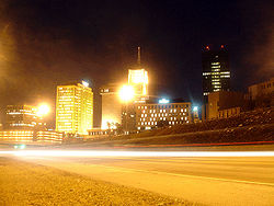 The Innerbelt portion of State Route 59 in Akron
is not well utilized. Designed after almost all other highway projects in Akron were completed, the Innerbelt was envisioned as a 21.5 miles (34.6 km) stretch; however the only portion that was ever built was a 2.24 miles (3.6 km) stretch near Akron’s downtown. The freeway is designed with 6 lanes (with right of way for eight), two collector streets along the entire corridor that combined are at some points as wide as the freeway itself, and very sweeping interchanges. The ramps connecting it to Interstate 76/Interstate 77, opened October 8, 1986, more than a decade after most of the rest of the highway opened, only turn to the west, so traffic can only enter the Innerbelt if traveling east on the interstate and from the Innerbelt, vehicles can only exit west onto the interstate. While ODOT
is currently evaluating changing this design, for now drivers need to take regular roads to make the connection. This was a financial concession when the southernmost part of the Innerbelt was built. The connection to the Northern Freeway (State Route 8) was never made, and a temporary link with Martin Luther King Blvd./Perkins St. became permanent.
Shortly after the connection to Interstate 76/Interstate 77, it became clear that the Innerbelt would not live up to expectations; those not served by the western ramps were not very willing to travel over five blocks of marginal roads to connect to a 2.24 miles (3.6 km) freeway. However, the Innerbelt’s underuse has given it an advantage few planners had foreseen. In July, 2001, the city announced that the Innerbelt would be closed for several days while a commercial was being shot. The highway was also surveyed by the producers of the movie Matrix Reloaded, as a possible shooting spot of the highway scene. Peter Novak, the Matrix's location scout said that "They were looking at finding a practical freeway to film the car chase on, which was going to be about 6 to 7 weeks of shutting down a major freeway. It was originally thought that they needed 4 to 5 miles of super highway in both directions. We sent scouts out around the world: we had people looking around Kuala Lumpur, people looking at Bangkok, people looking at the autobahn in Germany, and I personally looked through the northern United States. I don’t think we left a stone unturned, and we wound up with a freeway in Akron..." The idea was eventually scrapped, because in the event that the scene would have to be reshot, the time to reset all the cars in their start position would take too long.
Akron mayor Don Plusquellic has suggested ripping up the northern end of the freeway, making it a regular road, and developing the surrounding land. Akron
cannot expand its borders anymore so the city government is looking into ways of bringing about new development inside the city limits. The idea was fostered by a trip to Milwaukee
, in which Mayor Plusquellic saw the much-maligned Park East Freeway spur in that city's downtown removed in order to reuse the land. However, over $65,000,000 was spent to build the Innerbelt and according to current estimates $100,000,000 would have to be spent to demolish and reconstruct the corridor. A two million dollar study is currently underway at the request of city hall.
, at Tallmadge Avenue during its co-sign with State Route 8 in Akron, at Martin Luther King Jr. Boulevard near the Y-Bridge, and at Opportunity Parkway on the Innerbelt.
State highway
State highway, state road or state route can refer to one of three related concepts, two of them related to a state or provincial government in a country that is divided into states or provinces :#A...
in the northeastern portion of Ohio
Ohio
Ohio is a Midwestern state in the United States. The 34th largest state by area in the U.S.,it is the 7th‑most populous with over 11.5 million residents, containing several major American cities and seven metropolitan areas with populations of 500,000 or more.The state's capital is Columbus...
, a U.S. state
U.S. state
A U.S. state is any one of the 50 federated states of the United States of America that share sovereignty with the federal government. Because of this shared sovereignty, an American is a citizen both of the federal entity and of his or her state of domicile. Four states use the official title of...
. The western terminus of State Route 59 is in downtown Akron
Akron, Ohio
Akron , is the fifth largest city in the U.S. state of Ohio and the county seat of Summit County. It is located in the Great Lakes region approximately south of Lake Erie along the Little Cuyahoga River. As of the 2010 census, the city had a population of 199,110. The Akron Metropolitan...
at a partial interchange with the Interstate 76/Interstate 77 duplex. The eastern terminus of the state route is at State Route 5 just 0.5 mile (0.80467 km) east of the Ravenna
Ravenna, Ohio
* Chris Bangle; automobile designer* Bill Bower, last surviving pilot of the Doolittle Raid* David D. Busch; best-selling author* William Rufus Day; U.S. Supreme Court justice* Calvin Hampton; Classical organist* Robert B...
city limits.
Route description
State Route 59 traverses parts of SummitSummit County, Ohio
Summit County is an urban county located in the state of Ohio, United States. As of the 2000 census, the population was 542,899. In the 2010 Census the population was 541,781. Its county seat is Akron...
and Portage
Portage County, Ohio
Portage County is a county located in the U.S. state of Ohio. The population was 152,061 at the 2000 Census and 161,419 at the 2010 Census. Its county seat is Ravenna. Portage County is named for the portage between the Cuyahoga and Tuscarawas Rivers...
Counties. The portion of State Route 59 beginning at the northern interchange with the State Route 8 freeway, and heading east through Kent
Kent, Ohio
Kent is a city in the U.S. state of Ohio and the largest city in Portage County. It is located along the Cuyahoga River in Northeastern Ohio on the western edge of the county. The population was 27,906 at the 2000 United States Census and 28,904 in the 2010 Census...
and Ravenna
Ravenna, Ohio
* Chris Bangle; automobile designer* Bill Bower, last surviving pilot of the Doolittle Raid* David D. Busch; best-selling author* William Rufus Day; U.S. Supreme Court justice* Calvin Hampton; Classical organist* Robert B...
to the State Route 5 junction is included within the National Highway System
National Highway System (United States)
The National Highway System is a network of strategic highways within the United States, including the Interstate Highway System and other roads serving major airports, ports, rail or truck terminals, railway stations, pipeline terminals and other strategic transport facilities.Individual states...
, a network of routes deemed most important for the economy, mobility and defense of the nation.
Haymaker Parkway
Kent, Ohio
Kent is a city in the U.S. state of Ohio and the largest city in Portage County. It is located along the Cuyahoga River in Northeastern Ohio on the western edge of the county. The population was 27,906 at the 2000 United States Census and 28,904 in the 2010 Census...
, Ohio
Ohio
Ohio is a Midwestern state in the United States. The 34th largest state by area in the U.S.,it is the 7th‑most populous with over 11.5 million residents, containing several major American cities and seven metropolitan areas with populations of 500,000 or more.The state's capital is Columbus...
as a bypass road. It is a five-lane road with two bridges built between 1968 and 1975. The largest of the two bridges, the Redmond Greer Memorial Bridge, http://www.recordpub.com/news/article/2084952 passes over both sets of railroad tracks that pass through downtown Kent (known locally as the "upper" and "lower" tracks) as well as Franklin Avenue, the Cuyahoga River
Cuyahoga River
The Cuyahoga River is located in Northeast Ohio in the United States. Outside of Ohio, the river is most famous for being "the river that caught fire", helping to spur the environmental movement in the late 1960s...
, and Franklin Mills Riveredge Park. The Greer bridge also carries SR 43 during its short co-sign with SR 59 in between South Mantua Street (SR 43 South) and River Street (SR 43 North), and South Water Street. The parkway's eastern terminus is at the intersection of East Main and Willow Streets and its western termninus is at the intersection of West Main Street and Longmere Drive. For much of its route it parallels (and actually bisects) Stow Street. It is named for the Haymaker family who, in December 1805, became the first family to settle Franklin Township
Franklin Township, Portage County, Ohio
Franklin Township is a civil township located in Portage County, Ohio, United States. It is located along the Cuyahoga River in Northeast Ohio on the western edge of the county. The 2000 census found 5,276 people in the township...
and what would become Kent. The parkway was built mainly to provide bridges over all of Kent's railroad crossings for public safety vehicles as well as to relieve congestion in the downtown area. Several homes were razed in order to build the parkway, particularly many along Stow Street and in the neighborhood between Kent State University
Kent State University
Kent State University is a public research university located in Kent, Ohio, United States. The university has eight campuses around the northeast Ohio region with the main campus in Kent being the largest...
and downtown Kent along East Erie Street and East College Avenue.
History
State Route 59 was certified in 1969. The general route was originally designated as State Route 36 until 1932 and as State Route 5 from 1932 to 1969; however, State Route 5 now takes a turn south on an expresswayLimited-access road
A limited-access road known by various terms worldwide, including limited-access highway, dual-carriageway and expressway, is a highway or arterial road for high-speed traffic which has many or most characteristics of a controlled-access highway , including limited or no access to adjacent...
southeast of Ravenna towards I-76 rather than heading west to Cuyahoga Falls
Cuyahoga Falls, Ohio
As of the census of 2000, there were 49,374 people, 21,655 households, and 13,317 families residing in the city. The population density was 1,932.9 people per square mile . There were 22,727 housing units at an average density of 889.7 per square mile...
and Akron. The route is a freeway in its shared portion with State Route 8 southward from Front Street in Cuyahoga Falls. State Route 59 is signposted as following Perkins Avenue westward from State Route 8, where, at Howard Street, it becomes the freeway officially known as the Martin Luther King Jr. Freeway, more commonly referred to as the Innerbelt. (Until August 17, 2007, this routing was identified in Ohio DOT records as State Route 59T, whereas State Route 59 in the records continued south along State Route 8 and ended at the Market Street/State Route 18 underpass.) The rest of the route is formed by regular roads, with the exception of the Haymaker Parkway in Kent
Kent, Ohio
Kent is a city in the U.S. state of Ohio and the largest city in Portage County. It is located along the Cuyahoga River in Northeastern Ohio on the western edge of the county. The population was 27,906 at the 2000 United States Census and 28,904 in the 2010 Census...
, which is a bypass with cross streets.
The section of the route that runs through Stow and Kent was widened sometime in the 1980s. The section in Cuyahoga Falls from the State Route 8 to near Victor St. was widened in 2004 to meet state requirements due to high traffic levels.
The prior alignment of State Route 59 is primarily followed by the current State Route 113.
The Innerbelt
Akron, Ohio
Akron , is the fifth largest city in the U.S. state of Ohio and the county seat of Summit County. It is located in the Great Lakes region approximately south of Lake Erie along the Little Cuyahoga River. As of the 2010 census, the city had a population of 199,110. The Akron Metropolitan...
is not well utilized. Designed after almost all other highway projects in Akron were completed, the Innerbelt was envisioned as a 21.5 miles (34.6 km) stretch; however the only portion that was ever built was a 2.24 miles (3.6 km) stretch near Akron’s downtown. The freeway is designed with 6 lanes (with right of way for eight), two collector streets along the entire corridor that combined are at some points as wide as the freeway itself, and very sweeping interchanges. The ramps connecting it to Interstate 76/Interstate 77, opened October 8, 1986, more than a decade after most of the rest of the highway opened, only turn to the west, so traffic can only enter the Innerbelt if traveling east on the interstate and from the Innerbelt, vehicles can only exit west onto the interstate. While ODOT
ODOT
ODOT could stand for:* Ohio Department of Transportation* Oklahoma Department of Transportation* Oregon Department of Transportation...
is currently evaluating changing this design, for now drivers need to take regular roads to make the connection. This was a financial concession when the southernmost part of the Innerbelt was built. The connection to the Northern Freeway (State Route 8) was never made, and a temporary link with Martin Luther King Blvd./Perkins St. became permanent.
Shortly after the connection to Interstate 76/Interstate 77, it became clear that the Innerbelt would not live up to expectations; those not served by the western ramps were not very willing to travel over five blocks of marginal roads to connect to a 2.24 miles (3.6 km) freeway. However, the Innerbelt’s underuse has given it an advantage few planners had foreseen. In July, 2001, the city announced that the Innerbelt would be closed for several days while a commercial was being shot. The highway was also surveyed by the producers of the movie Matrix Reloaded, as a possible shooting spot of the highway scene. Peter Novak, the Matrix's location scout said that "They were looking at finding a practical freeway to film the car chase on, which was going to be about 6 to 7 weeks of shutting down a major freeway. It was originally thought that they needed 4 to 5 miles of super highway in both directions. We sent scouts out around the world: we had people looking around Kuala Lumpur, people looking at Bangkok, people looking at the autobahn in Germany, and I personally looked through the northern United States. I don’t think we left a stone unturned, and we wound up with a freeway in Akron..." The idea was eventually scrapped, because in the event that the scene would have to be reshot, the time to reset all the cars in their start position would take too long.
Akron mayor Don Plusquellic has suggested ripping up the northern end of the freeway, making it a regular road, and developing the surrounding land. Akron
Akron, Ohio
Akron , is the fifth largest city in the U.S. state of Ohio and the county seat of Summit County. It is located in the Great Lakes region approximately south of Lake Erie along the Little Cuyahoga River. As of the 2010 census, the city had a population of 199,110. The Akron Metropolitan...
cannot expand its borders anymore so the city government is looking into ways of bringing about new development inside the city limits. The idea was fostered by a trip to Milwaukee
Milwaukee, Wisconsin
Milwaukee is the largest city in the U.S. state of Wisconsin, the 28th most populous city in the United States and 39th most populous region in the United States. It is the county seat of Milwaukee County and is located on the southwestern shore of Lake Michigan. According to 2010 census data, the...
, in which Mayor Plusquellic saw the much-maligned Park East Freeway spur in that city's downtown removed in order to reuse the land. However, over $65,000,000 was spent to build the Innerbelt and according to current estimates $100,000,000 would have to be spent to demolish and reconstruct the corridor. A two million dollar study is currently underway at the request of city hall.
Major intersections
State Route 261 intersects with State Route 59 in total, four times: on the east side of KentKent, Ohio
Kent is a city in the U.S. state of Ohio and the largest city in Portage County. It is located along the Cuyahoga River in Northeastern Ohio on the western edge of the county. The population was 27,906 at the 2000 United States Census and 28,904 in the 2010 Census...
, at Tallmadge Avenue during its co-sign with State Route 8 in Akron, at Martin Luther King Jr. Boulevard near the Y-Bridge, and at Opportunity Parkway on the Innerbelt.
External links
- State Route 59 Endpoint Photos
- Akron Innerbelt; Martin Luther King Jr. Freeway (Photographs of the Innerbelt)