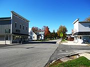
Ohio State Highway 18
Encyclopedia

Ohio
Ohio is a Midwestern state in the United States. The 34th largest state by area in the U.S.,it is the 7th‑most populous with over 11.5 million residents, containing several major American cities and seven metropolitan areas with populations of 500,000 or more.The state's capital is Columbus...
. Its western terminus is at the Indiana
Indiana
Indiana is a US state, admitted to the United States as the 19th on December 11, 1816. It is located in the Midwestern United States and Great Lakes Region. With 6,483,802 residents, the state is ranked 15th in population and 16th in population density. Indiana is ranked 38th in land area and is...
state line near Hicksville, Ohio
Hicksville, Ohio
Hicksville is a village in Defiance County, Ohio, United States. The population was 3,649 at the 2000 census.-History:Hicksville was founded by a group of land speculators. Led by Henry W. Hicks, the Hicks Land Company platted the community in 1835 and 1836...
(the route continues in Indiana as State Road 8
Indiana State Road 8
State Road 8 in the U.S. State of Indiana consists of two disconnected segments that were never connected.-Western segment:The western segment of State Road 8 connects State Road 2 and U.S. Route 231 in Hebron with State Road 17 near Plymouth...
), and its eastern terminus is at State Route 91 in Akron, Ohio
Akron, Ohio
Akron , is the fifth largest city in the U.S. state of Ohio and the county seat of Summit County. It is located in the Great Lakes region approximately south of Lake Erie along the Little Cuyahoga River. As of the 2010 census, the city had a population of 199,110. The Akron Metropolitan...
.
History
State Route 18 was an original state highway that went from Norwalk to the PennsylvaniaPennsylvania
The Commonwealth of Pennsylvania is a U.S. state that is located in the Northeastern and Mid-Atlantic regions of the United States. The state borders Delaware and Maryland to the south, West Virginia to the southwest, Ohio to the west, New York and Ontario, Canada, to the north, and New Jersey to...
state line. The route was extended to the Indiana state line in 1926. Until 1950, it was one of a very few Ohio routes to end at two state lines.
State Route 18's extension to the Indiana state line originally overlapped State Route 2 from the line to Hicksville. In 1940, State Route 18 was rerouted on the former State Route 193 from the line to Hicksville.
In 1950, State Route 18's eastern terminus was moved to Youngstown
Youngstown, Ohio
Youngstown is a city in the U.S. state of Ohio and the county seat of Mahoning County; it also extends into Trumbull County. The municipality is situated on the Mahoning River, approximately southeast of Cleveland and northwest of Pittsburgh, Pennsylvania...
. Its old route to the Pennsylvania state line was recertified as State Route 289
Ohio State Route 289
State Route 289 is a east–west state highway in the northeastern quadrant of the U.S. state of Ohio. The western terminus of SR 289 is at a diamond interchange with U.S. Route 422 and SR 193 in Youngstown. Its eastern terminus is at the Pennsylvania state line just east of...
.
In 1966, the route was routed along State Route 8 and Interstate 80S (now Interstate 76) to Youngstown. This series of concurrencies ended in 1971, and State Route 18 would eventually be routed along Market Street in Akron, to end at its current terminus.
In 1969, State Route 18 was routed concurrently with U.S. Route 20 along the Norwalk Bypass, a limited access freeway. Prior to the Bypass route, State Route 18 followed Main Street and Woodlawn Avenue (formerly known as Medina Street) and later followed Main Street and Akron Road through the city of Norwalk
Norwalk, Ohio
At the 2000 census, there were 16,238 people, 6,377 households and 4,234 families residing in the city. The population density was 1,950.3 per square mile . There were 6,687 housing units at an average density of 803.1 per square mile...
(much of this alignment was already concurrent with US 20).
Before the rerouting of SR 18 via SR 8 and I-80S, SR 18 left West Market Street at Twin Oaks Drive in West Akron, where it went a few blocks east to North Portage Path, then jogged 1 block north to Memorial Parkway, which became Tallmadge Avenue east of the Cuyahoga River (before that, SR 18 continued along Market Street, then joined with SR 8 before reaching Tallmadge Avenue).
Tallmadge Road was a straight east/west road which became Mahoning Avenue as it approached the Youngstown area.
Most stretches of former SR 18 are still referred to as County Road 18 in Portage and Mahoning Counties.

