
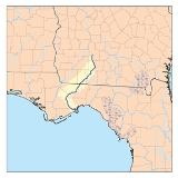
Ochlockonee River
Encyclopedia
The Ochlockonee River is a fast running river originating in Georgia
and flowing for 206 miles (331.5 km) before terminating in Florida
.
in Worth County
in southwest Georgia emptying into Ochlockonee Bay, then into Apalachee Bay
, in Florida
. In Florida, the river forms the western boundaries of Leon County
and Wakulla County
and eastern boundaries of Gadsden County
, Liberty County
, and Franklin County
.
The Ochlockonee flows through the Red Hills
, Talquin State Forest, Lake Talquin State Park and the Apalachicola National Forest
, and past Ochlockonee River State Park
, where it is tidally
influenced and a mixture of fresh, brackish, and salt water, on the way to its terminus in Ochlockonee Bay, which then empties into Apalachee Bay
, with tidal influences extending upstream over 15 miles (24.1 km) from the river's mouth.
 Old Spanish documents sometimes refer to the Ochlockonee River as the Rio Agna and in other instances as the Rio de Lagna, while a map from 1683 shows it as the Rio Lana. The names Lagna and Lana may be Spanish renditions of the Muskogean word LAH'nee, which translates as "yellow". The rich yellows and reds of Red Hills clay give the river a yellowish color. Eighteenth century English maps give the name as Ogeelaganu or Ochloconee, which probably retains at least the flavor of its Hitchiti
name. Variations of these continued into century with O-clock-ney being used in 1822 and Ockatockany in 1855.
About 1840, Fort Stansbury
was established on the river by placing a two story home that had been abandoned by its owner due to Seminole
raids during the Second Seminole War
. This fort was important in the forced removal of Indians from the area. Boats traveled upriver to collect and move Native Americans down to Gulf of Mexico ports for removal to "Indian Territories." By 1844, Fort Stansbury had been abandoned.
From 1839 to 1842, Fort Virginia Braden was established on the river located at Fort Braden
in Florida
. The fort was named after the commander's wife who died of yellow fever
.
. On 15 July 1863 the screw steamer gunboat USS Stars and Stripes
and wooden side-wheel steam ferryboat USS Somerset
attacked the salt works at Mashes Sands
. On 29 December 1863 Stars and Stripes sank the blockade-running
schooner
Caroline Gertrude, aground on the sandbar at the mouth of the Ochlockonee. Stars and Stripes also captured the blockade-running steamer Laura off the Ochlockonee on 18 January 1864. On 19 and 20 October 1864 Stars and Stripes destroyed an extensive Confederate fishery at Mashes Island and captured the troops stationed there as guards.
 The Ochlockonee River corridor is home to many threatened fish, wildlife and plant species. It is a State of Florida designated Outstanding Florida Water and has been identified by the Florida Fish and Wildlife Conservation Commission
as a Strategic Habitat Conservation Area.
Rare animals that can be found along the Ochlockonee include Red-cockaded Woodpecker
, Least Tern, and the Apalachicola Dusky Salamander
. The river is especially rich in rare freshwater mussel
s (Unionidae
), including three federally listed endangered species: the Ochlockonee moccasinshell
, the Shinyrayed pocketbook
, and the Oval pigtoe
. "The Florida maybell tree can be found only along the Ochlockonee and Chipola Rivers.
The Ochlockonee is connected to and a source of water for Lake Iamonia especially during flooding.
, perch, bream and catfish
can be excellent on the Ochlockonee River, and a state-designated canoe trail can be found both upstream and downstream of Lake Talquin. Telogia Creek and the Little River near State Road 12 are also popular for canoeing. The Florida National Scenic Trail follows the river for two miles.
The Ochlockonee is a vital link in the production of seafood
to the southwest in Apalachicola Bay
. During floods, the river transports organic matter downstream into the estuary
of Ochlockonee Bay where the shallows of the bay were created by the great volume of sand and clay brought down by the river. This estuary serves as a nursery for numerous species of fish and shellfish
which are the basis for recreational and commercial fishing as well as the Apalachicola
seafood that this area is known for.
and U.S. highways 19
, 27
and 98
.
Georgia (U.S. state)
Georgia is a state located in the southeastern United States. It was established in 1732, the last of the original Thirteen Colonies. The state is named after King George II of Great Britain. Georgia was the fourth state to ratify the United States Constitution, on January 2, 1788...
and flowing for 206 miles (331.5 km) before terminating in Florida
Florida
Florida is a state in the southeastern United States, located on the nation's Atlantic and Gulf coasts. It is bordered to the west by the Gulf of Mexico, to the north by Alabama and Georgia and to the east by the Atlantic Ocean. With a population of 18,801,310 as measured by the 2010 census, it...
.
Background
The Ochlockonee originates south of the town of SylvesterSylvester, Georgia
Sylvester is the county seat of Worth County, Georgia, United States. The population was 5,990 at the 2000 census. The city is the county seat and business center of Worth County and is claimed to be the Peanut Capital of the World due to its ability to produce more peanuts per acre than anywhere...
in Worth County
Worth County, Georgia
Worth County is a county located in the southwestern part of the U.S. state of Georgia. As of 2000, the population was 21,967. The 2007 Census Estimate shows a population of 21,285...
in southwest Georgia emptying into Ochlockonee Bay, then into Apalachee Bay
Apalachee Bay
Apalachee Bay is a bay in the northeastern Gulf of Mexico occupying an indentation of the Florida coast to the west of where the Florida peninsula joins the United States mainland. It is bordered by Taylor, Jefferson, Wakulla and Franklin counties. The Aucilla, Econfina, St. Marks and Ochlocknee...
, in Florida
Florida
Florida is a state in the southeastern United States, located on the nation's Atlantic and Gulf coasts. It is bordered to the west by the Gulf of Mexico, to the north by Alabama and Georgia and to the east by the Atlantic Ocean. With a population of 18,801,310 as measured by the 2010 census, it...
. In Florida, the river forms the western boundaries of Leon County
Leon County, Florida
Leon County is a county located in the state of Florida, named after the Spanish explorer Juan Ponce de León. At the 2010 Census, the population was 275,487. The county seat of Leon County is Tallahassee which also serves as the state capital. The county seat is home to two of Florida's major...
and Wakulla County
Wakulla County, Florida
Wakulla County is a county located in the U.S. state of Florida. As of 2000, the population was 22,863. The U.S. Census Bureau 2005 estimate for the county was 28,212 people...
and eastern boundaries of Gadsden County
Gadsden County, Florida
Gadsden County is a county located in the panhandle of the U.S. state of Florida. As of the 2000 census, the population was 45,087. The U.S. Census Bureau 2005 estimate for the county is 46,428 . Its county seat is Quincy, Florida. Gadsden County is the only predominantly African-American...
, Liberty County
Liberty County, Florida
Liberty County is a county located in the state of Florida. Its population was estimated in 2005 as 7,733. Its most populous incorporated area and county seat is Bristol....
, and Franklin County
Franklin County, Florida
Franklin County is a coastal county located in the panhandle of the U.S. state of Florida. As of 2000, the population was 11,057. The U.S. Census Bureau 2005 estimate for the county is 11,177...
.
The Ochlockonee flows through the Red Hills
Red Hills
The Red Hills is the name of a physiographic region located mostly in Clark, Comanche and Barber counties in southern and central Kansas. This undulating terrain of red-tinted sediments, a product of the underlying geology, does not fit the conventional description of the Great Plains landscape of...
, Talquin State Forest, Lake Talquin State Park and the Apalachicola National Forest
Apalachicola National Forest
The Apalachicola National Forest is the largest U.S. National Forest in the state of Florida. It contains and is the only national forest located in the Florida Panhandle. The Apalachicola National Forest contains two Wilderness Areas, Bradwell Bay and Mudswamp/New River...
, and past Ochlockonee River State Park
Ochlockonee River State Park
Ochlockonee River State Park is a Florida State Park. It is located on the Gulf coast, on U.S. 319 about four miles south of the town of Sopchoppy.-Ecology:...
, where it is tidally
Tide
Tides are the rise and fall of sea levels caused by the combined effects of the gravitational forces exerted by the moon and the sun and the rotation of the Earth....
influenced and a mixture of fresh, brackish, and salt water, on the way to its terminus in Ochlockonee Bay, which then empties into Apalachee Bay
Apalachee Bay
Apalachee Bay is a bay in the northeastern Gulf of Mexico occupying an indentation of the Florida coast to the west of where the Florida peninsula joins the United States mainland. It is bordered by Taylor, Jefferson, Wakulla and Franklin counties. The Aucilla, Econfina, St. Marks and Ochlocknee...
, with tidal influences extending upstream over 15 miles (24.1 km) from the river's mouth.
History
Hitchiti
The Hitchiti were a Muskogean-speaking tribe formerly residing chiefly in a town of the same name on the east bank of the Chattahoochee River, 4 miles below Chiaha, in west Georgia. They spoke the Hitchiti language, which was mutually intelligible with Mikasuki; both tribes were part of the loose...
name. Variations of these continued into century with O-clock-ney being used in 1822 and Ockatockany in 1855.
About 1840, Fort Stansbury
Fort Stansbury
Fort Stansbury was a frontier outpost created during the Seminole War as well as used during the Civil War. The fort was located south of Tallahassee, Florida, and a few miles north of Wakulla Springs. This is inland from St. Marks, Florida. It was headquarters for the 3rd Regiment of the U.S....
was established on the river by placing a two story home that had been abandoned by its owner due to Seminole
Seminole
The Seminole are a Native American people originally of Florida, who now reside primarily in that state and Oklahoma. The Seminole nation emerged in a process of ethnogenesis out of groups of Native Americans, most significantly Creeks from what is now Georgia and Alabama, who settled in Florida in...
raids during the Second Seminole War
Second Seminole War
The Second Seminole War, also known as the Florida War, was a conflict from 1835 to 1842 in Florida between various groups of Native Americans collectively known as Seminoles and the United States, part of a series of conflicts called the Seminole Wars...
. This fort was important in the forced removal of Indians from the area. Boats traveled upriver to collect and move Native Americans down to Gulf of Mexico ports for removal to "Indian Territories." By 1844, Fort Stansbury had been abandoned.
From 1839 to 1842, Fort Virginia Braden was established on the river located at Fort Braden
Fort Braden, Florida
Fort Braden is an unincorporated community in western Leon County, Florida, United States.- History :On December 3, 1839 Fort Braden was established as a military fort during the Second Seminole War. It was located on the Ochlockonee River eighteen miles southwest of Tallahassee. Fort Braden was...
in Florida
Florida
Florida is a state in the southeastern United States, located on the nation's Atlantic and Gulf coasts. It is bordered to the west by the Gulf of Mexico, to the north by Alabama and Georgia and to the east by the Atlantic Ocean. With a population of 18,801,310 as measured by the 2010 census, it...
. The fort was named after the commander's wife who died of yellow fever
Yellow fever
Yellow fever is an acute viral hemorrhagic disease. The virus is a 40 to 50 nm enveloped RNA virus with positive sense of the Flaviviridae family....
.
The Civil War
The Ochlockonee River saw action during the Civil WarAmerican Civil War
The American Civil War was a civil war fought in the United States of America. In response to the election of Abraham Lincoln as President of the United States, 11 southern slave states declared their secession from the United States and formed the Confederate States of America ; the other 25...
. On 15 July 1863 the screw steamer gunboat USS Stars and Stripes
USS Stars and Stripes (1861)
USS Stars and Stripes was a 407-ton steamer acquired by the U.S. Navy and put to use by the Union during the American Civil War....
and wooden side-wheel steam ferryboat USS Somerset
USS Somerset (1862)
USS Somerset was a wooden-hulled, side-wheel ferryboat built at Brooklyn, N.Y., in 1862, which was purchased by the Navy at Washington, D. C., on 4 March 1862 and was commissioned at the New York Navy Yard on 3 April 1862, Lt...
attacked the salt works at Mashes Sands
Mashes Sands
Mashes Sands is a beach front in Wakulla County, Florida, United States.Mashes Sands is located 6 miles south-southeast of Panacea at the terminus of Mashes Sands Road . The beach overlooks the Gulf of Mexico from a small peninsula bordered by Ochlockonee Bay on the west and the greater Apalachee...
. On 29 December 1863 Stars and Stripes sank the blockade-running
Blockade runner
A blockade runner is usually a lighter weight ship used for evading a naval blockade of a port or strait, as opposed to confronting the blockaders to break the blockade. Very often blockade running is done in order to transport cargo, for example to bring food or arms to a blockaded city...
schooner
Schooner
A schooner is a type of sailing vessel characterized by the use of fore-and-aft sails on two or more masts with the forward mast being no taller than the rear masts....
Caroline Gertrude, aground on the sandbar at the mouth of the Ochlockonee. Stars and Stripes also captured the blockade-running steamer Laura off the Ochlockonee on 18 January 1864. On 19 and 20 October 1864 Stars and Stripes destroyed an extensive Confederate fishery at Mashes Island and captured the troops stationed there as guards.
Importance
Florida Fish and Wildlife Conservation Commission
The Florida Fish and Wildlife Conservation Commission is a Florida government agency charged with managing the state's fish and wildlife resources, regulating Florida's fisheries and wildlife, and enforcing related laws...
as a Strategic Habitat Conservation Area.
Rare animals that can be found along the Ochlockonee include Red-cockaded Woodpecker
Red-cockaded Woodpecker
The Red-cockaded Woodpecker is a woodpecker found in southeastern North America.- Description :About the size of the Northern Cardinal, it is approximately 8.5 in. long, with a wingspan of about 14 in. and a weight of about 1.5 ounces...
, Least Tern, and the Apalachicola Dusky Salamander
Apalachicola Dusky Salamander
The Apalachicola Dusky Salamander is a species of salamander in the Plethodontidae family.It is endemic to the United States.Its natural habitats are temperate forests, intermittent rivers, and freshwater springs....
. The river is especially rich in rare freshwater mussel
Mussel
The common name mussel is used for members of several families of clams or bivalvia mollusca, from saltwater and freshwater habitats. These groups have in common a shell whose outline is elongated and asymmetrical compared with other edible clams, which are often more or less rounded or oval.The...
s (Unionidae
Unionidae
Unionidae is a family of freshwater mussels, the largest in the order Unionoida, the bivalve mollusks sometimes known as river mussels, naiads, or simply as unionids.The range of distribution for this family is world-wide...
), including three federally listed endangered species: the Ochlockonee moccasinshell
Ochlockonee moccasinshell
The Ochlockonee moccasinshell, scientific name Medionidus simpsonianus, is a species of freshwater mussel, an aquatic bivalve mollusk in the family Unionidae, the river mussels.This species is endemic to the United States...
, the Shinyrayed pocketbook
Shinyrayed pocketbook
The Shinyrayed Pocketbook, scientific name Hamiota subangulata , is a federally endangered species of freshwater mussel, an aquatic bivalve mollusk in the family Unionidae, the river mussels. This species is endemic to the United States in the states of Georgia, Florida, and Alabama .The Shinyrayed...
, and the Oval pigtoe
Oval pigtoe
The oval pigtoe, scientific name Pleurobema pyriforme, is a federally endangered species of freshwater mussel, an aquatic bivalve mollusk in the family Unionidae, the river mussels....
. "The Florida maybell tree can be found only along the Ochlockonee and Chipola Rivers.
The Ochlockonee is connected to and a source of water for Lake Iamonia especially during flooding.
Recreation
Fishing for bassBlack bass
Micropterus , is a genus of freshwater fish in the sunfish family of order Perciformes. The type species is M. dolomieu, the smallmouth bass...
, perch, bream and catfish
Catfish
Catfishes are a diverse group of ray-finned fish. Named for their prominent barbels, which resemble a cat's whiskers, catfish range in size and behavior from the heaviest and longest, the Mekong giant catfish from Southeast Asia and the second longest, the wels catfish of Eurasia, to detritivores...
can be excellent on the Ochlockonee River, and a state-designated canoe trail can be found both upstream and downstream of Lake Talquin. Telogia Creek and the Little River near State Road 12 are also popular for canoeing. The Florida National Scenic Trail follows the river for two miles.
The Ochlockonee is a vital link in the production of seafood
Seafood
Seafood is any form of marine life regarded as food by humans. Seafoods include fish, molluscs , crustaceans , echinoderms . Edible sea plants, such as some seaweeds and microalgae, are also seafood, and are widely eaten around the world, especially in Asia...
to the southwest in Apalachicola Bay
Apalachicola Bay
Apalachicola Bay is an estuary and lagoon located on Florida's northwest coast renowned for its oysters. The Apalachicola Bay system also includes St. Georges Sound, St. Vincent Sound and East Bay, covering an area of about . Four islands St. Vincent Island to the west, Cape St. George Island and St...
. During floods, the river transports organic matter downstream into the estuary
Estuary
An estuary is a partly enclosed coastal body of water with one or more rivers or streams flowing into it, and with a free connection to the open sea....
of Ochlockonee Bay where the shallows of the bay were created by the great volume of sand and clay brought down by the river. This estuary serves as a nursery for numerous species of fish and shellfish
Shellfish
Shellfish is a culinary and fisheries term for exoskeleton-bearing aquatic invertebrates used as food, including various species of molluscs, crustaceans, and echinoderms. Although most kinds of shellfish are harvested from saltwater environments, some kinds are found only in freshwater...
which are the basis for recreational and commercial fishing as well as the Apalachicola
Apalachicola, Florida
Apalachicola is a city in Franklin County, Florida, on US 98 about southwest of Tallahassee. The population was 2,334 at the 2000 census. The 2005 census estimated the city's population at 2,340...
seafood that this area is known for.
Crossings
A number of major highways cross the Ochlockonee River along its course, including Interstate 10Interstate 10
Interstate 10 is the fourth-longest Interstate Highway in the United States, after I-90, I-80, and I-40. It is the southernmost east–west, coast-to-coast Interstate Highway, although I-4 and I-8 are further south. It stretches from the Pacific Ocean at State Route 1 in Santa Monica,...
and U.S. highways 19
U.S. Route 19 in Florida
U.S. Route 19 in Florida runs along Florida's west coast from an interchange with U.S. Route 41 in Memphis, Florida, south of Tampa, and continues to the Georgia border north of Monticello, Florida....
, 27
U.S. Route 27
U.S. Route 27 is a north–south United States highway in the southern and midwestern United States. The southern terminus is at US 1 in Miami, Florida. The northern terminus is at Interstate 69 in Fort Wayne, Indiana...
and 98
U.S. Route 98
U.S. Route 98 is an east–west United States highway that runs from western Mississippi to southern Florida. It was established in 1933 as a route between Pensacola, Florida and Apalachicola, Florida, and has since been extended westward into Mississippi and eastward across the Florida...
.