
Nopah Range
Encyclopedia
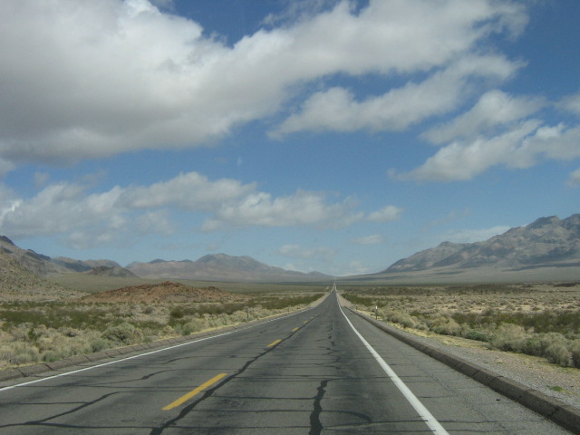
The Nopah Range is located in Inyo County, California
, USA, near the eastern border with Nevada
.
, the Owlshead Mountains
and lower Death Valley
, and are north of the Kingston Range
. The Amargosa River
is to the west. They are located directly east of Shoshone, California
, and the Chicago Valley, northeast of Tecopa, California
, southwest of Pahrump, Nevada
, and west of Las Vegas, Nevada
.
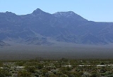
The Nopah Range mountains reach an elevation of 6,395 feet above sea level at Nopah Peak, in the center of the range. The Nopah Range is approximately 26 miles long.
Inyo County, California
-National protected areas:* Death Valley National Park * Inyo National Forest * Manzanar National Historic Site-Major highways:* U.S. Route 6* U.S. Route 395* State Route 127* State Route 136* State Route 168* State Route 178...
, USA, near the eastern border with Nevada
Nevada
Nevada is a state in the western, mountain west, and southwestern regions of the United States. With an area of and a population of about 2.7 million, it is the 7th-largest and 35th-most populous state. Over two-thirds of Nevada's people live in the Las Vegas metropolitan area, which contains its...
.
Geography
The mountain range lies east of the adjacent Resting Spring RangeResting Spring Range
The Resting Spring Range is found in the eastern Mojave Desert of California near the Nevada state line in the United States. The range lies in a generally north-south direction to the west of the Nopah Range and southeast of the Amargosa Range and Greenwater Range.The mountains, in Inyo County on...
, the Owlshead Mountains
Owlshead Mountains
The Owlshead Mountains are located at the southern end of Death Valley National Park near the border of the Fort Irwin Military Reservation in San Bernardino County, California, USA.-Geography:...
and lower Death Valley
Death Valley
Death Valley is a desert valley located in Eastern California. Situated within the Mojave Desert, it features the lowest, driest, and hottest locations in North America. Badwater, a basin located in Death Valley, is the specific location of the lowest elevation in North America at 282 feet below...
, and are north of the Kingston Range
Kingston Range
The Kingston Range, sometimes called the Kingston Mountains, is located in Inyo and San Bernardino counties in the Mojave Desert in eastern California. The range reaches a height of above sea level at Kingston Peak....
. The Amargosa River
Amargosa River
The Amargosa River is an intermittent waterway, long, in southern Nevada and eastern California in the United States. It drains a high desert region, the Amargosa Valley in the Amargosa Desert northwest of Las Vegas, into the Mojave Desert, and finally into Death Valley where it disappears into...
is to the west. They are located directly east of Shoshone, California
Shoshone, California
Shoshone is a census-designated place in Inyo County, California, United States. Shoshone is located on the Tonopah and Tidewater Railroad east of Epaulet Peak, at an elevation of 1585 feet . The population was 31 at the 2010 census, down from 52 at the 2000 census.The town was founded in 1910...
, and the Chicago Valley, northeast of Tecopa, California
Tecopa, California
Tecopa is a census-designated place in the Mojave Desert, in Inyo County, California, United States. Tecopa is located south-southeast of Shoshone, at an elevation of . The population was 150 at the 2010 census, up from 99 at the 2000 census.One of Tecopa's popular features is its natural hot...
, southwest of Pahrump, Nevada
Pahrump, Nevada
-Demographics:As of the census of 2000, there were 24,631 people, 10,153 households, and 7,127 families residing in the CDP. The population density was 82.7 people per square mile . There were 11,651 housing units at an average density of 39.1 per square mile...
, and west of Las Vegas, Nevada
Las Vegas, Nevada
Las Vegas is the most populous city in the U.S. state of Nevada and is also the county seat of Clark County, Nevada. Las Vegas is an internationally renowned major resort city for gambling, shopping, and fine dining. The city bills itself as The Entertainment Capital of the World, and is famous...
.
The Nopah Range mountains reach an elevation of 6,395 feet above sea level at Nopah Peak, in the center of the range. The Nopah Range is approximately 26 miles long.
See also
- Category: Mountain ranges of the Mojave Desert