

New Zealand State Highway 63
Encyclopedia
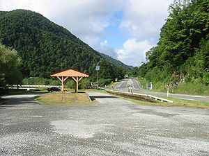
State Highway 63 is a New Zealand
State Highway
located in the northern parts of the South Island
of New Zealand
. It is 117 km long and runs between the settlements of Renwick
(in Marlborough) and Kawatiri Junction (in the Tasman region) via Saint Arnaud
, providing a bypass of the city of Nelson
.
 SH 63 begins just to the east of Renwick at SH 6
, and parallels the course of the Wairau River
for 93 kilometres, originally to the south of the river before crossing to the north side about 20 km from the Marlborough/Tasman border, while passing through the settlements of Wairau Valley
, Hillersden and Tophouse
. Just before reaching Tophouse, the Wairau veers to south while the road arrives in St. Arnaud at the shores of Lake Rotoiti
. After St. Arnaud the road swings to the northwest and follows the last 24 km alongside the Buller River
. At Kawatiri Junction, it terminates at SH 6 between Murchison
and the Hope Saddle
.
New Zealand
New Zealand is an island country in the south-western Pacific Ocean comprising two main landmasses and numerous smaller islands. The country is situated some east of Australia across the Tasman Sea, and roughly south of the Pacific island nations of New Caledonia, Fiji, and Tonga...
State Highway
New Zealand State Highway network
The New Zealand State Highway network is the major national highway network in New Zealand. Just under 100 roads in both the North and South Islands are State Highways...
located in the northern parts of the South Island
South Island
The South Island is the larger of the two major islands of New Zealand, the other being the more populous North Island. It is bordered to the north by Cook Strait, to the west by the Tasman Sea, to the south and east by the Pacific Ocean...
of New Zealand
New Zealand
New Zealand is an island country in the south-western Pacific Ocean comprising two main landmasses and numerous smaller islands. The country is situated some east of Australia across the Tasman Sea, and roughly south of the Pacific island nations of New Caledonia, Fiji, and Tonga...
. It is 117 km long and runs between the settlements of Renwick
Renwick, New Zealand
Renwick is a small town in Marlborough, New Zealand, close to the south bank of the Wairau River. It is located on State Highway 6, 12 km west of Blenheim. Havelock is 31 km north...
(in Marlborough) and Kawatiri Junction (in the Tasman region) via Saint Arnaud
Saint Arnaud, New Zealand
Saint Arnaud is a small alpine village located in the north of New Zealand's South Island, west of the mountains of the Saint Arnaud Range and 90 kilometres southwest of Nelson near the historic Tophouse Settlement...
, providing a bypass of the city of Nelson
Nelson, New Zealand
Nelson is a city on the eastern shores of Tasman Bay, and is the economic and cultural centre of the Nelson-Tasman region. Established in 1841, it is the second oldest settled city in New Zealand and the oldest in the South Island....
.
Route
New Zealand State Highway 6
State Highway 6 is a major New Zealand State Highway. It extends from the northeastern corner of the South Island across the top of the island, then down the length of the island, initially along the West Coast and then across the Southern Alps through inland Otago and finally across the Southland...
, and parallels the course of the Wairau River
Wairau River
The Wairau River is one of the longest rivers in New Zealand's South Island. It flows for 170 kilometres from the Spenser Mountains , firstly in a northwards direction and then northeast down a long, straight valley in inland Marlborough.The river's lower reaches are noted for the surrounding...
for 93 kilometres, originally to the south of the river before crossing to the north side about 20 km from the Marlborough/Tasman border, while passing through the settlements of Wairau Valley
Wairau Valley
Wairau Valley is the valley of the Wairau River in Marlborough, New Zealand and also the name of the main settlement in the upper valley. State Highway 63 runs through the valley. The valley opens onto the Wairau Plain, where Renwick and Blenheim are sited...
, Hillersden and Tophouse
Tophouse
Tophouse, also known as Tophouse Settlement, is a rural locality in the Tasman District of New Zealand's South Island, some 8 km northeast of Saint Arnaud. It is named after a hotel established in the 19th century to service drovers transporting their sheep between Canterbury and Marlborough...
. Just before reaching Tophouse, the Wairau veers to south while the road arrives in St. Arnaud at the shores of Lake Rotoiti
Lake Rotoiti, Tasman
Lake Rotoiti is lake in the Tasman Region of New Zealand. It is a substantial mountain lake within the borders of the Nelson Lakes National Park. The lake is fed by the Travers River, water from it flows into the Buller River. The greatest depth is 82 metres and it is surrounded by beech forest...
. After St. Arnaud the road swings to the northwest and follows the last 24 km alongside the Buller River
Buller River
The Buller River is in the South Island of New Zealand. One of the country's longest rivers, it flows for 170 kilometres from Lake Rotoiti through the Buller Gorge and into the Tasman Sea near the town of Westport...
. At Kawatiri Junction, it terminates at SH 6 between Murchison
Murchison, New Zealand
Murchison is a town in the Tasman Region of the South Island of New Zealand. It is near the western end of the "Four Rivers Plain", at the confluence of the Buller River and the Matakitaki River...
and the Hope Saddle
Hope Saddle
Hope Saddle is a saddle located in the Hope Range of the northern South Island. It lies above the Clark Valley....
.