

New York State Route 132
Encyclopedia
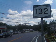
New York State Route 132 (NY 132) is a 2.75 miles (4.43 km) long state highway
located entirely within the Town of Yorktown
in Westchester County, New York
. The route acts as a connector between U.S. Route 202 and NY 35
in the south and U.S. Route 6
in the north. The majority of 132 coincides mostly with Old Yorktown Road; near the northern end, NY 132 is routed on East Main Street and Barger Street.
Currently, the road is almost always referred to as "Route 132", with the major exception being sending mail to places along the route as mail on 132 is usually addressed using the road name, not the number. NYSDOT has set a linear speed limit of 40 miles per hour for the entire length of 132.
intersection with the concurrent
routes of U.S. Route 202 and NY 35
adjacent to both the locally-maintained Downing Park and the state-maintained Franklin D. Roosevelt State Park
northwest of Yorktown Heights. The route proceeds north along Old Yorktown Road, paralleling the Taconic State Parkway
for a short distance prior to meeting the parkway at a partial-diamond interchange
south of Shrub Oak. No access is provided to the northbound Taconic Parkway from NY 132; likewise, traffic commuting southbound on the parkway cannot connect to NY 132. The missing exit and ramp are available just to the north at US 6. The only traffic light on 132, aside from those on its termini, is at the end of the ramp from the Taconic, with Wildwood Street directly across.
 Past the Taconic, NY 132 bears off of Old Yorktown Road, which goes for a very short distance before meeting East Main Street. Route 132, now Barger Street, proceeds north to a sharp intersection with East Main Street, the former alignment of U.S. Route 6 through the area. Before US 6 was realigned, this was a cross intersection, with Main Street going directly northeast to where US 6 is now. However, since the realignment, Main Street has proceeded north on 132 from here to the present intersection of 132 and US 6, where 132 terminates. Here, Barger Street continues across 6 while East Main Street takes a right turn onto US 6.
in the hamlet of Shrub Oak and extended southeast to NY 22
near the hamlet of Katonah
by way of Crompond Street, Crompond, Hallocks Mill, Saw Mill River, Amawalk, Woods Bridge, and Bedford Roads ,and Jay Street. By 1932, NY 132 was realigned slightly in Yorktown Heights
to bypass Hallocks Hill Road on Crompond and Saw Mill River Roads instead.
In the early 1940s, all of NY 132 east of Yorktown became part of NY 35
, a new cross-county route extending from Peekskill
to the Connecticut
state line. As a result, NY 132 was truncated to its junction with NY 35 and U.S. Route 202 in the hamlet of Yorktown. NY 132's northern terminus was moved a short distance northward between 1968 and 1973 as a result of the re-alignment of US 6 through Yorktown. Prior to being called Old Yorktown Road, most of 132 was named Crompond Street.
 NY 132A was a suffixed route of NY 132 in the town of Yorktown
. When it was initially assigned as part of the 1930 renumbering of state highways in New York, NY 132A was an alternate route of NY 132 along Mohansic Avenue and Baldwin Road. Part of Mohansic Avenue was demolished in the early 1930s to make way for the Taconic State Parkway
, splitting the route into two pieces. The western segment was removed from the state highway system while the eastern stub remained designated as NY 132A. NY 132 was truncated to Yorktown in the early 1940s, separating it from NY 132A; however, NY 132A was not renumbered or otherwise altered. The route remained in existence until the early 1970s, at which time maintenance of Mohansic Avenue and Baldwin Road was transferred to the town of Yorktown.
State highway
State highway, state road or state route can refer to one of three related concepts, two of them related to a state or provincial government in a country that is divided into states or provinces :#A...
located entirely within the Town of Yorktown
Yorktown, New York
Yorktown is a town in Westchester County, New York, in the suburbs of New York about north of midtown Manhattan. The town lies on the north border of Westchester County...
in Westchester County, New York
Westchester County, New York
Westchester County is a county located in the U.S. state of New York. Westchester covers an area of and has a population of 949,113 according to the 2010 Census, residing in 45 municipalities...
. The route acts as a connector between U.S. Route 202 and NY 35
New York State Route 35
New York State Route 35 is the principal east–west highway in the northern part of Westchester County, New York, carrying average daily volumes of around 16,500 vehicles...
in the south and U.S. Route 6
U.S. Route 6 in New York
U.S. Route 6 is a part of the U.S. Highway System that runs from Bishop, California, to Provincetown, Massachusetts. In New York, US 6 extends from the Pennsylvania state line at Port Jervis to the Connecticut state line east of Brewster...
in the north. The majority of 132 coincides mostly with Old Yorktown Road; near the northern end, NY 132 is routed on East Main Street and Barger Street.
Currently, the road is almost always referred to as "Route 132", with the major exception being sending mail to places along the route as mail on 132 is usually addressed using the road name, not the number. NYSDOT has set a linear speed limit of 40 miles per hour for the entire length of 132.
Route description
NY 132 begins at a signalizedTraffic light
Traffic lights, which may also be known as stoplights, traffic lamps, traffic signals, signal lights, robots or semaphore, are signalling devices positioned at road intersections, pedestrian crossings and other locations to control competing flows of traffic...
intersection with the concurrent
Concurrency (road)
A concurrency, overlap, or coincidence in a road network is an instance of one physical road bearing two or more different highway, motorway, or other route numbers...
routes of U.S. Route 202 and NY 35
New York State Route 35
New York State Route 35 is the principal east–west highway in the northern part of Westchester County, New York, carrying average daily volumes of around 16,500 vehicles...
adjacent to both the locally-maintained Downing Park and the state-maintained Franklin D. Roosevelt State Park
Franklin D. Roosevelt State Park
Franklin D. Roosevelt State Park is a state park in Westchester County, New York. It was formerly known as Mohansic Park and Mohansic State Park and is situated in Yorktown, about 40 miles from New York City...
northwest of Yorktown Heights. The route proceeds north along Old Yorktown Road, paralleling the Taconic State Parkway
Taconic State Parkway
The Taconic State Parkway , is a divided highway between Kensico Dam and Chatham, the longest parkway in the U.S. state of New York. It follows a generally northward route midway between the Hudson River and the Connecticut and Massachusetts state lines...
for a short distance prior to meeting the parkway at a partial-diamond interchange
Diamond interchange
A diamond interchange is a common type of road junction, used where a freeway crosses a minor road. The freeway itself is grade-separated from the minor road, one crossing the other over a bridge...
south of Shrub Oak. No access is provided to the northbound Taconic Parkway from NY 132; likewise, traffic commuting southbound on the parkway cannot connect to NY 132. The missing exit and ramp are available just to the north at US 6. The only traffic light on 132, aside from those on its termini, is at the end of the ramp from the Taconic, with Wildwood Street directly across.
History
When NY 132 was originally designated as part of the 1930 renumbering of state highways in New York, it began at U.S. Route 6U.S. Route 6 in New York
U.S. Route 6 is a part of the U.S. Highway System that runs from Bishop, California, to Provincetown, Massachusetts. In New York, US 6 extends from the Pennsylvania state line at Port Jervis to the Connecticut state line east of Brewster...
in the hamlet of Shrub Oak and extended southeast to NY 22
New York State Route 22
New York State Route 22 is a north–south state highway in eastern New York in the United States. It runs parallel to the state's eastern edge from the outskirts of New York City to a short distance south of the Canadian border. At , it is the state's longest north–south route and...
near the hamlet of Katonah
Katonah, New York
Katonah, New York is one of three unincorporated hamlets within the town of Bedford, Westchester County, New York, United States.-History:Katonah is named for Chief Katonah, an American Indian from whom the land of Bedford was purchased by a group of English colonists...
by way of Crompond Street, Crompond, Hallocks Mill, Saw Mill River, Amawalk, Woods Bridge, and Bedford Roads ,and Jay Street. By 1932, NY 132 was realigned slightly in Yorktown Heights
Yorktown Heights, New York
Yorktown Heights is a census-designated place in the town of Yorktown in Westchester County, New York, United States. The population was 1,781 at the 2010 census.-Geography:Yorktown Heights is located at ....
to bypass Hallocks Hill Road on Crompond and Saw Mill River Roads instead.
In the early 1940s, all of NY 132 east of Yorktown became part of NY 35
New York State Route 35
New York State Route 35 is the principal east–west highway in the northern part of Westchester County, New York, carrying average daily volumes of around 16,500 vehicles...
, a new cross-county route extending from Peekskill
Peekskill, New York
Peekskill is a city in Westchester County, New York. It is situated on a bay along the east side of the Hudson River, across from Jones Point.This community was known to be an early American industrial center, primarily for its iron plow and stove products...
to the Connecticut
Connecticut
Connecticut is a state in the New England region of the northeastern United States. It is bordered by Rhode Island to the east, Massachusetts to the north, and the state of New York to the west and the south .Connecticut is named for the Connecticut River, the major U.S. river that approximately...
state line. As a result, NY 132 was truncated to its junction with NY 35 and U.S. Route 202 in the hamlet of Yorktown. NY 132's northern terminus was moved a short distance northward between 1968 and 1973 as a result of the re-alignment of US 6 through Yorktown. Prior to being called Old Yorktown Road, most of 132 was named Crompond Street.
NY 132A
Yorktown, New York
Yorktown is a town in Westchester County, New York, in the suburbs of New York about north of midtown Manhattan. The town lies on the north border of Westchester County...
. When it was initially assigned as part of the 1930 renumbering of state highways in New York, NY 132A was an alternate route of NY 132 along Mohansic Avenue and Baldwin Road. Part of Mohansic Avenue was demolished in the early 1930s to make way for the Taconic State Parkway
Taconic State Parkway
The Taconic State Parkway , is a divided highway between Kensico Dam and Chatham, the longest parkway in the U.S. state of New York. It follows a generally northward route midway between the Hudson River and the Connecticut and Massachusetts state lines...
, splitting the route into two pieces. The western segment was removed from the state highway system while the eastern stub remained designated as NY 132A. NY 132 was truncated to Yorktown in the early 1940s, separating it from NY 132A; however, NY 132A was not renumbered or otherwise altered. The route remained in existence until the early 1970s, at which time maintenance of Mohansic Avenue and Baldwin Road was transferred to the town of Yorktown.
Major intersections
External links
- Historic American Engineering Record - Taconic State Parkway, Poughkeepsie vicinity, Dutchess County, NY - includes a photograph of the last Taconic underpass, incorrectly labelled as US 6