
Nelson Lakes National Park
Encyclopedia
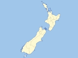
Nelson Lakes National Park is located in the South Island
of New Zealand
.
It was formed in 1956 and covers some 1,020 km². It is centered at two large lakes, Rotoiti
and Rotoroa. The park also includes surrounding valleys (including Travers
, Sabine
, and D'Urville
, upper reaches of the Matakitaki
) and mountain ranges (Saint Arnaud Range
, Mount Robert
). The park is a popular area for camping
, tramping and fishing
.
The park is administered by the Department of Conservation
who operate a Visitors Centre in Saint Arnaud
that provides up to date and reliable information on all aspects of the National Park.
and Blenheim
. A secondary access point is at Lake Rotoroa, turning off New Zealand State Highway 6
at Gowanbridge. Shuttle services operate between St Arnaud, Nelson, Blenheim and Picton
.
There is a network of tramping tracks throughout the park. Tracks range from short nature walks at Lake Rotoiti and Lake Rotorua, to multi-day backcountry tramps. Day tramps include the Lake Rotoiti circuit, St. Arnaud Range and Mt. Robert. The most popular long-distance tramping routes are the Travers-Sabine Circuit
and other loops through Lake Angelus.
The skifield on Mt. Robert is no longer operational. Rainbow Ski Area
is located on the eastern side of the St Arnaud range, just outside the park.
Other activities include mountaineering, boating and fishing, and mountain biking. See the DOC web site for more information.
South Island
The South Island is the larger of the two major islands of New Zealand, the other being the more populous North Island. It is bordered to the north by Cook Strait, to the west by the Tasman Sea, to the south and east by the Pacific Ocean...
of New Zealand
New Zealand
New Zealand is an island country in the south-western Pacific Ocean comprising two main landmasses and numerous smaller islands. The country is situated some east of Australia across the Tasman Sea, and roughly south of the Pacific island nations of New Caledonia, Fiji, and Tonga...
.
It was formed in 1956 and covers some 1,020 km². It is centered at two large lakes, Rotoiti
Lake Rotoiti, Tasman
Lake Rotoiti is lake in the Tasman Region of New Zealand. It is a substantial mountain lake within the borders of the Nelson Lakes National Park. The lake is fed by the Travers River, water from it flows into the Buller River. The greatest depth is 82 metres and it is surrounded by beech forest...
and Rotoroa. The park also includes surrounding valleys (including Travers
Travers River
The Travers River is in the South Island of New Zealand.It lies within the borders of the Nelson Lakes National Park. The valley through which the river flows is popular with trampers and is part of the Travers-Sabine tramping circuit, which follows a major portion of the river, starting from Kerr...
, Sabine
Sabine River, New Zealand
thumb|right|200px|View up the Sabine Valley.The Sabine River is in the South Island of New Zealand. It is located in Nelson Lakes National Park....
, and D'Urville
D'Urville River
The D'Urville River is in the South Island of New Zealand.It lies within the Nelson Lakes National Park and flows north for 26 kilometres between the Ella and Mahanga ranges into Lake Rotoroa. It is one of the smaller rivers in the Buller River system...
, upper reaches of the Matakitaki
Matakitaki River
The Matakitaki River is located in the north of New Zealand's South Island. An upper tributary of the Buller River, it flows north and west for 65 kilometres from its source north of the Lewis Pass, joining the Buller at Murchison...
) and mountain ranges (Saint Arnaud Range
Saint Arnaud Range
The Saint Arnaud Range is a mountain range in the central north of New Zealand's South Island. It lies between Lake Rotoiti and the upper reaches of the Wairau River, and marks the eastern boundary of Nelson Lakes National Park....
, Mount Robert
Mount Robert
Mount Robert 1421m high mountain, in the Nelson area of New Zealand's South Island. It is within the Nelson Lakes National Park.Access to the mountain is via the town of Saint Arnaud on a partially unsealed road followed by a two hour walk....
). The park is a popular area for camping
Camping
Camping is an outdoor recreational activity. The participants leave urban areas, their home region, or civilization and enjoy nature while spending one or several nights outdoors, usually at a campsite. Camping may involve the use of a tent, caravan, motorhome, cabin, a primitive structure, or no...
, tramping and fishing
Fishing
Fishing is the activity of trying to catch wild fish. Fish are normally caught in the wild. Techniques for catching fish include hand gathering, spearing, netting, angling and trapping....
.
The park is administered by the Department of Conservation
New Zealand Department of Conservation
The Department of Conservation , commonly known by its acronym, "DOC", is the state sector organisation which deals with the conservation of New Zealand’s natural and historic heritage...
who operate a Visitors Centre in Saint Arnaud
Saint Arnaud, New Zealand
Saint Arnaud is a small alpine village located in the north of New Zealand's South Island, west of the mountains of the Saint Arnaud Range and 90 kilometres southwest of Nelson near the historic Tophouse Settlement...
that provides up to date and reliable information on all aspects of the National Park.
Access to the Park
The main access point to Nelson Lakes National Park is at Lake Rotoiti and the village of Saint Arnaud, on Highway 63, about 100 kilometres from both NelsonNelson, New Zealand
Nelson is a city on the eastern shores of Tasman Bay, and is the economic and cultural centre of the Nelson-Tasman region. Established in 1841, it is the second oldest settled city in New Zealand and the oldest in the South Island....
and Blenheim
Blenheim, New Zealand
Blenheim is the most populous town in the region of Marlborough, in the north east of the South Island of New Zealand, and the seat of the regional council. It has a population of The area which surrounds the town is well known as a centre of New Zealand's wine industry...
. A secondary access point is at Lake Rotoroa, turning off New Zealand State Highway 6
New Zealand State Highway 6
State Highway 6 is a major New Zealand State Highway. It extends from the northeastern corner of the South Island across the top of the island, then down the length of the island, initially along the West Coast and then across the Southern Alps through inland Otago and finally across the Southland...
at Gowanbridge. Shuttle services operate between St Arnaud, Nelson, Blenheim and Picton
Picton, New Zealand
Picton is a town in the Marlborough region of New Zealand. It is close to the head of Queen Charlotte Sound near the north-east corner of the South Island. The population was 2928 in the 2006 Census, a decrease of 72 from 2001...
.
Activities
The main campgrounds are on the shores of Lake Rotoiti; there is a smaller campground at Lake Rotoroa.There is a network of tramping tracks throughout the park. Tracks range from short nature walks at Lake Rotoiti and Lake Rotorua, to multi-day backcountry tramps. Day tramps include the Lake Rotoiti circuit, St. Arnaud Range and Mt. Robert. The most popular long-distance tramping routes are the Travers-Sabine Circuit
Travers-Sabine Circuit
The Travers-Sabine Circuit is a popular tramping route in Nelson Lakes National Park, New Zealand. The full circuit takes about five to six days, although many side-trips are possible for longer tramps....
and other loops through Lake Angelus.
The skifield on Mt. Robert is no longer operational. Rainbow Ski Area
Rainbow Ski Area
Rainbow Ski Area is a ski resort in the Tasman Region of New Zealand's South Island.It opens a little later than other ski resorts, with an operating season from mid-July to mid-October...
is located on the eastern side of the St Arnaud range, just outside the park.
Other activities include mountaineering, boating and fishing, and mountain biking. See the DOC web site for more information.