
Neighborhoods of Albany, New York
Encyclopedia
The neighborhoods of Albany
, New York
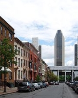
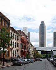
are varied demographically, geographically, architecturally, and historically. Downtown Albany
is the city's oldest neighborhood, centered on State Street, one of Albany's oldest streets and its original main street
. Today downtown consists mostly of office buildings inhabited by state agencies, though a recent push to bring in permanent residents has led to proposed apartments and condominiums, many of which have failed to get past the proposal phase. North and south of Downtown are old residential communities often consisting of row houses. North is Sheridan Hollow, Arbor Hill, and North Albany; to the south is the super-neighborhood of the South End, which consists of a multitude of smaller neighborhoods including the Mansion District
, the Pastures
, Kenwood
, Groesbeckville
, Delaware Avenue, and Krank Park. These neighborhoods tend to have more minorities and lower-income residents than the western, more suburbanized part of the city.
West of Downtown is the Empire State Plaza
, which effectively cuts Downtown off from the gentrified
neighborhoods of Center Square, Hudson/Park, Lark Street, and Washington Park. Collectively referred to as mid-town, these neighborhoods are often compared to New York City's Greenwich Village
for their eclectic mix of residential and commercial uses, including bars, night clubs, restaurants, and unique stores. Albany's gay culture is vibrant in this area. Nearby Park South, a nine-block area surrounding New Scotland Avenue and home to roughly 1,000 individuals, is currently undergoing an urban renewal as existing housing units are removed or renovated and new office, commercial, and apartment buildings are added. New construction includes expansion of Albany Medical Center
, one of the largest employers in Albany. Nearby is University Heights, a united campus consisting of Albany Medical Center Hospital
, Albany Medical College
, Albany Law School
, Albany College of Pharmacy, and the Sage College of Albany
.
Single-family detached homes, duplexes, and apartments, along with single-family houses that have been carved up into multiple units, can be found west of the older neighborhoods. These neighborhoods, such as Pine Hills
, Delaware Avenue, Whitehall, Helderberg, New Scotland, and Beverwyck, tend to have larger lots and more suburban surroundings. The Eastern section of Pine Hills is often referred to as the "student ghetto" due to the proximity of the campuses of Saint Rose College and University at Albany. The area from North Main to South Lake between Myrtle and Washington avenues has become home to off-campus college students living in houses carved into multiple units by usually absentee landlords.
Further west, the neighborhoods become more affluent and are dominated almost exclusively by single-family dwellings. These neighborhoods, such as Melrose, Western Pine Hills, New Albany, Eagle Hill, Westland Park, Campus, and Buckingham Park, have some of the quieter streets and larger lots in the city, and more closely resemble neighboring areas of the suburban towns than they do the downtown parts of the city. Further west is the W. Averell Harriman State Office Campus and the University at Albany's main campus. West of those campuses are offices and commercial properties lining frontage roads along Washington Avenue Extension, with a small housing development called The Dunes, all surrounded by the Pine Bush Preserve.
historically the area from Clinton Avenue (formerly called Patroon Street) north to the Livingston Avenue Railroad Bridge (where North Albany begins) and from the Hudson River
west to Lexington Ave., was outside Albany's first boundaries as set up in the Dongan Charter
of 1686. The original name of the area was Colonie
(from which the name of the current town to the north comes from), incorporated as a village on April 9, 1804; it was annexed by the city in 1815, at which time Patroon St. became Clinton Ave. The current name, Arbor Hill, comes from the nickname of the Ten Broeck Mansion
("Arbor Hill"), the mansion is still an important cultural and historical museum. The neighborhood has many other historic and cultural spots including the Palace Theatre and Quackenbush House
(downtown), and the St. Joseph's Church (in Ten Broeck Triangle, actually a sub-section of Arbor Hill). Demographically it is predominantly African-American.
.
, many mistakenly believe it was named for the nearby State University of New York at Albany uptown campus, but the neighborhood was named prior to this construction. This neighborhood features predominantly single-family homes on side streets with many retail, commercial, and office spaces on Western Avenue. US Route 20 and NY 85
are the major roads that pass through the neighborhood.
or Greenwich Village
. Center Square contains many buildings of architectural significance and is locally famous for its nightlife, entertainment, culture, and dining. Center Square includes the area bounded by Lark Street on the west, Spring Street on the north, South Swan Street on the east and Jay Street on the south, plus the upper portion of Lancaster Street between Lark Street and Willett Street.
. It also borders the combined campus of Albany Law School
, Albany College of Pharmacy and the Sage College of Albany
, located in the University Heights neighborhood. Helderberg also contains the The Albany Academy
, a prep school
for boys and girls.
/Delmar area. The neighborhood is located southwest of the Empire State Plaza
. Delaware Avenue is the western border of the South End. Only a small part of Delaware Avenue is considered the "Delaware Neighborhood". In recent years, Federal stimulus money was invested into the neighborhood to build new streets, lighting, trees, and contribute to safety.
. Separated from Arbor Hill
by Livingston Avenue it is mostly composed of older single family homes, and its centerpiece is the Livingston Middle School.
 Albany’s Hudson/Park is bordered on the north by Center Square
, on the south by Lincoln Park
, and the east by the Nelson Rockefeller Empire State Plaza
, it is bisected by Madison Avenue. The neighborhood has seen spill over from the Lark Street
and Center Square
areas and is similar in appearance to both neighborhoods in its mix of entertainment, restaurants, and historic housing. South of Madison Avenue, the Hudson/Park neighborhood is a part of the South End.
. The nearby Frank Waterson Park Little League
field adjacent to Westland Hills Park off Colvin Avenue was listed by Guinness Book of Records in 1992 as being the largest Little League
field.
, it was on both sides of the Normans Kill until the Normans Kill became the Albany-Bethlehem
boundary. Located on a yellow brick road off Delaware Avenue it is rural and forested. Located here are Steven's Farm, a historic active farm and the location of the official horses of Albany's police force. An old abandoned bridge underneath the modern Delaware Avenue bridge links to the town of Bethlehem
but is closed to traffic.
is an older neighborhood located roughly from the Livingston Ave. railroad bridge
(at Colonie Street) north to the city line with Menands, and west from the Hudson River
to Van Rensselaer Boulevard. Historically settled by Irish immigrants, North Albany has long been a diverse neighborhood with single family homes, duplexes, apartment buildings, and older row houses, as well as older industrial sites along Broadway and North Pearl Street.
. The city has recently decided on a plan of urban renewal in this neighborhood of over 1,000 people in nine city blocks. This is subject to an urban development plan, which as of 2007 will not include eminent domain
.
 The Pine Hills
neighborhood is roughly bounded by Washington Avenue to the north, Lake Ave to the east, Woodlawn & Cortland to the south, and Manning Boulevard to the west. Pine Hills received its name from the Albany Land Improvement Company in 1891. This was also the year that Engine #10, a neighborhood and city landmark was built.
The neighborhood consists mainly of freestanding multi-unit, duplex, and semi-detached houses and is home to Albany High School
, the LaSalle school, the College of St. Rose, and the Alumni Quad of the University at Albany. The area of Pine Hills east of Main Avenue and north of Myrtle Avenue is commonly referred to as the "student ghetto
" due to its predominant population of college students, many from Long Island or New York City. The area of Pine Hills west of Main Avenue features many large Queen Anne
, Folk Victorian
, and Colonial Revival
homes. The area where Madison Avenue meets Western Avenue a block from St. Rose is the center of a commercial area, complete with a movie theater, grocery store, fast food strip mall, retail, restaurants, a library, community playhouse, police station, pharmacy, and elementary school.
is often mistakenly labeled part of Arbor Hill the gorge carved out by the Fox Creek (diverted into pipes around 1797 on the north side of Sheridan Avenue, once named Fox[es] Street and then Canal Street) is an old part of the city that has fallen on hard times. Recent spill over from downtown has helped revitalize the eastern edge with a Hampton Inn
and plans for redevelopment of the Boyd printing plant. A bridge carries Henry Johnson Boulevard (formerly Northern Boulevard) over the Hollow.
, on the south by the Normans Kill (boundary with the town of Bethlehem
), the west by Delaware Avenue, and the north by Madison Avenue. The city's website recently touted a plan to address blight in this area and encourage development of empty lots and a possible redevelopment of underused sites. The city states that there are eight neighborhoods in the South End under its Capital South plan, but does not state what it considers to be those eight neighborhoods. Important roads in this area include Delaware, Madison, Morton, Park, and Second Avenues; Southern Boulevard, and South Pearl Street. Some parts of this vast area are neighborhoods, other areas have no name and are just generically referred to as being in the South End, even though they may be separated by named neighborhoods from each other. The Delaware Avenue neighborhood south and east of Delaware Avenue is a part of the South End, as is the portion of the Hudson/Park neighborhood south of Madison Avenue, for information on these areas see their respective entries.
is not often thought of as a neighborhood today it was once an important hamlet along the Albany and Bethlehem Turnpike (later named South Pearl Street, today Old South Pearl Street). It was the site of a Dutch fort in 1618 and the mill of Albert Bradt
, nicknamed The Norman, to whom the Normans Kill is named after. It is also the home to the former Kenwood Academy and until its move to Rensselaer
the Doane Stuart School
. This former hamlet of the neighboring town of Bethlehem
(until annexed in 1916) has lent its name to the Kenwood Rail Yard
next to the Port of Albany-Rensselaer
and the Kenwood Industrial Park on Binghamton Street.
 In the Mansion District
, all major 19th-century styles are represented. Italianate
is the most widely represented style in the district and it is present in many levels of sophistication. A number of buildings employ elements of both the Greek Revival
and Italianate
styles, but there are also some highly refined examples of these individual styles. There are also some unusual examples of the application of Gothic Revival
decoration to rowhouse construction. The Mansion District is dominated by the nearby Empire State Plaza
and Governor's Mansion
. Along Madison Ave. next to and within part of the Mansion District is Albany's Little Italy
.
Though no longer dominated by Italians, an Italian influence is still present in two established Italian restaurants. An attempt to turn a former Catholic church into a community arts center is well under way. The Mansion District also has a library branch, the Schuyler Mansion
museum, Philip Street Park which is an active park with playground and basketball courts, and Bleecker Park
a passive park with Albany's oldest public water fountain.
is a distinct neighborhood that features mixed-use living where tennis courts, shops and courtyards are interspersed among historic owner and tenant occupied historic homes. The neighborhood is adjacent to downtown and the waterfront. This neighborhood is in the South End and was at one point almost devoid of people but was brought back by one of the few urban renewal programs that worked in Albany late last century. It is bounded on the north by downtown, on the west by Little Italy and the Mansion District, and on the south by unnamed South End sub-neighborhoods.
, Sage College of Albany
, and Albany Medical College
. This expanding commercial area contains many health care–related businesses, a few retail stores and restaurants. Health and human services facilities in the neighborhood include: Albany Medical Center Hospital
, the Stratton V.A. Hospital, the Capital District
Psychiatric Center, the NYS Office of Mental Health, and the NYS Office of Mental Retardation and Developmental Disabilities. University Heights is bounded by Park South to the north, and the South End to the south.
, work began on what is today's park - a manicured combination of gardens and lawn landscaped in the finest Victorian
tradition. With some 100 species of trees from exotic lands throughout the world, the Park resembles a botanical garden. The park's boat house hosts "Park Playhouse" which puts on outdoor plays in the summer. The park is also host to the Tulip Fest
, which is celebrated annually on the second weekend in May. Washington Park is host to numerous other public events throughout the year including a large holiday lights display, and other culturally diverse events.
" and an important thoroughfare into Albany.
. Nearby New Scotland and Delaware Avenues provide the neighborhood with hospitals and retail services.
Albany, New York
Albany is the capital city of the U.S. state of New York, the seat of Albany County, and the central city of New York's Capital District. Roughly north of New York City, Albany sits on the west bank of the Hudson River, about south of its confluence with the Mohawk River...
, New York
New York
New York is a state in the Northeastern region of the United States. It is the nation's third most populous state. New York is bordered by New Jersey and Pennsylvania to the south, and by Connecticut, Massachusetts and Vermont to the east...
are varied demographically, geographically, architecturally, and historically. Downtown Albany
Downtown Albany Historic District
The Downtown Albany Historic District is a 19-block, area of Albany, New York, United States, centered around the junction of State and North and South Pearl streets . It is the oldest settled area of the city, originally planned and settled in the 17th century, and the nucleus of its later...
is the city's oldest neighborhood, centered on State Street, one of Albany's oldest streets and its original main street
Main Street
Main Street is the metonym for a generic street name of the primary retail street of a village, town, or small city in many parts of the world...
. Today downtown consists mostly of office buildings inhabited by state agencies, though a recent push to bring in permanent residents has led to proposed apartments and condominiums, many of which have failed to get past the proposal phase. North and south of Downtown are old residential communities often consisting of row houses. North is Sheridan Hollow, Arbor Hill, and North Albany; to the south is the super-neighborhood of the South End, which consists of a multitude of smaller neighborhoods including the Mansion District
Mansion Historic District
The Mansion Historic District, sometimes referred to as Mansion Hill, is located south of Empire State Plaza in Albany, New York, United States. It takes its name from the nearby New York State Executive Mansion, which overlooks it. It is a , 16-block area with almost 500 buildings...
, the Pastures
Pastures Historic District
The Pastures Historic District is a residential neighborhood located south of downtown Albany, New York, United States. Its include all or part of a 13-block area....
, Kenwood
Kenwood, Albany, New York
Kenwood is a neighborhood in the city of Albany, New York. Prior to annexation by the city in 1916 a hamlet in the neighboring town of Bethlehem, also in Albany County. The hamlet once spanned both sides of the Normans Kill along the Albany and Bethlehem Turnpike...
, Groesbeckville
Groesbeckville, Albany, New York
Groesbeckville is a former a hamlet in the town of Bethlehem outside the city limits of Albany, New York. The hamlet was named for a prominent Albany family, the Groesbecks. It has been a part of Albany's South End neighborhood since being annexed in 1870...
, Delaware Avenue, and Krank Park. These neighborhoods tend to have more minorities and lower-income residents than the western, more suburbanized part of the city.
West of Downtown is the Empire State Plaza
Empire State Plaza
The Governor Nelson A. Rockefeller Empire State Plaza is a complex of several state government buildings in downtown Albany, New York....
, which effectively cuts Downtown off from the gentrified
Gentrification
Gentrification and urban gentrification refer to the changes that result when wealthier people acquire or rent property in low income and working class communities. Urban gentrification is associated with movement. Consequent to gentrification, the average income increases and average family size...
neighborhoods of Center Square, Hudson/Park, Lark Street, and Washington Park. Collectively referred to as mid-town, these neighborhoods are often compared to New York City's Greenwich Village
Greenwich Village
Greenwich Village, , , , .in New York often simply called "the Village", is a largely residential neighborhood on the west side of Lower Manhattan in New York City. A large majority of the district is home to upper middle class families...
for their eclectic mix of residential and commercial uses, including bars, night clubs, restaurants, and unique stores. Albany's gay culture is vibrant in this area. Nearby Park South, a nine-block area surrounding New Scotland Avenue and home to roughly 1,000 individuals, is currently undergoing an urban renewal as existing housing units are removed or renovated and new office, commercial, and apartment buildings are added. New construction includes expansion of Albany Medical Center
Albany Medical Center
Albany Medical Center is the name of the umbrella organization over the Albany Medical Center Hospital and Albany Medical College in Albany, New York...
, one of the largest employers in Albany. Nearby is University Heights, a united campus consisting of Albany Medical Center Hospital
Albany Medical Center Hospital
300px|thumb|Albany Medical CenterAlbany Medical Center Hospital is a hospital located in Albany, New York. The 650-Bed, Level-I Trauma Center was founded in 1849, ten years after the College. It serves over 2 million residents.-External links:...
, Albany Medical College
Albany Medical College
Albany Medical College is a medical school located in Albany, New York, United States. It was founded in 1839 by Amos Dean, Dr. Thomas Hun and others, and is one of the oldest medical schools in the nation...
, Albany Law School
Albany Law School
Albany Law School is an ABA accredited law school based in Albany, New York. It was founded in 1851 by Amos Dean , Amasa Parker, Ira Harris and others....
, Albany College of Pharmacy, and the Sage College of Albany
Sage College of Albany
Sage College of Albany, SCA for short, is located at 140 New Scotland Avenue, Albany, New York, 12208. Along with Russell Sage College and the Sage Graduate School, it is one of the three colleges that make up The Sage Colleges. It is also home to Sage After Work, which offers a variety of...
.
Single-family detached homes, duplexes, and apartments, along with single-family houses that have been carved up into multiple units, can be found west of the older neighborhoods. These neighborhoods, such as Pine Hills
Pine Hills, Albany, New York
Pine Hills is a neighborhood in Albany, New York, generally defined as the area from Manning Boulevard to the west, Woodlawn Avenue to the south, Lake Avenue to the east, and Washington Avenue to the north. The neighborhood consists mainly of freestanding multi-unit, duplex, and semi-detached...
, Delaware Avenue, Whitehall, Helderberg, New Scotland, and Beverwyck, tend to have larger lots and more suburban surroundings. The Eastern section of Pine Hills is often referred to as the "student ghetto" due to the proximity of the campuses of Saint Rose College and University at Albany. The area from North Main to South Lake between Myrtle and Washington avenues has become home to off-campus college students living in houses carved into multiple units by usually absentee landlords.
Further west, the neighborhoods become more affluent and are dominated almost exclusively by single-family dwellings. These neighborhoods, such as Melrose, Western Pine Hills, New Albany, Eagle Hill, Westland Park, Campus, and Buckingham Park, have some of the quieter streets and larger lots in the city, and more closely resemble neighboring areas of the suburban towns than they do the downtown parts of the city. Further west is the W. Averell Harriman State Office Campus and the University at Albany's main campus. West of those campuses are offices and commercial properties lining frontage roads along Washington Avenue Extension, with a small housing development called The Dunes, all surrounded by the Pine Bush Preserve.
Arbor Hill
Arbor HillArbor Hill, Albany
Arbor Hill is a neighborhood in Albany, New York, generally defined as the area from Clinton Avenue north to Tivoli Hollow and the Livingston Avenue Railroad Bridge and from Broadway west to Henry Johnson Boulevard. It was outside Albany's first boundaries as set up in the Dongan Charter of 1686...
historically the area from Clinton Avenue (formerly called Patroon Street) north to the Livingston Avenue Railroad Bridge (where North Albany begins) and from the Hudson River
Hudson River
The Hudson is a river that flows from north to south through eastern New York. The highest official source is at Lake Tear of the Clouds, on the slopes of Mount Marcy in the Adirondack Mountains. The river itself officially begins in Henderson Lake in Newcomb, New York...
west to Lexington Ave., was outside Albany's first boundaries as set up in the Dongan Charter
Dongan Charter
The Dongan Charter is the 1686 document incorporating Albany, New York as a city. Albany's charter was issued by Governor Thomas Dongan of the Province of New York, a few months after Governor Dongan issued a similarly worded, but less detailed charter for the city of New York. The city of Albany...
of 1686. The original name of the area was Colonie
Watervliet (town), New York
For the Shaker village, see Watervliet Shaker Historic District.The town of Watervliet was a town that at its height encompassed most of present-day Albany County and the majority of the current town of Niskayuna in neighboring Schenectady County, in the state of New York, United States...
(from which the name of the current town to the north comes from), incorporated as a village on April 9, 1804; it was annexed by the city in 1815, at which time Patroon St. became Clinton Ave. The current name, Arbor Hill, comes from the nickname of the Ten Broeck Mansion
Ten Broeck Mansion
The Ten Broeck Mansion in Albany, New York was built in 1797. It was listed on the National Register of Historic Places in 1971. A decade later it was included as a contributing property to the Arbor Hill Historic District – Ten Broeck Triangle when that neighborhood was listed on the...
("Arbor Hill"), the mansion is still an important cultural and historical museum. The neighborhood has many other historic and cultural spots including the Palace Theatre and Quackenbush House
Quackenbush House
Quackenbush House is a historic building in Albany, New York. It is a house with a double-pitched gable roof that was built in about 1736. It was listed on the National Register of Historic Places in 1972.-History:...
(downtown), and the St. Joseph's Church (in Ten Broeck Triangle, actually a sub-section of Arbor Hill). Demographically it is predominantly African-American.
Buckingham Pond
Residents enjoy the hiking path with ducks and geese at Buckingham Pond as well as local amenities within easy walking distance on New Scotland and Western Avenues. Homes are primarily single-family and are located on tree-lined streets, some with medians.Beverwyck
A neighborhood of interior streets between Central and Western Avenues, Beverwyck is mostly a residential neighborhood. The neighborhood received its name from Beverwyck Park, which in turn was named for Albany's original Dutch name, BeverwyckBeverwyck
Beverwijck was a fur-trading community north of Fort Orange on the Hudson River in New Netherland that was to become Albany, New York, when the English took control of the colony in 1664....
.
Campus
So named for its proximity to the W. Averell Harriman State Office Building CampusW. Averell Harriman State Office Building Campus
The W. Averell Harriman State Office Building Campus is an office park in western Albany, New York, United States that houses sixteen New York State Government office buildings. The land totals roughly and over 3 million square feet of office space, and about 7,000 state employees work there...
, many mistakenly believe it was named for the nearby State University of New York at Albany uptown campus, but the neighborhood was named prior to this construction. This neighborhood features predominantly single-family homes on side streets with many retail, commercial, and office spaces on Western Avenue. US Route 20 and NY 85
New York State Route 85
New York State Route 85 is a state highway in Albany County, New York, in the United States. It is long and runs from County Route 351 and CR 353 in Rensselaerville to Interstate 90 exit 4 in Albany. It also has a loop route, NY 85A, which connects NY 85 to...
are the major roads that pass through the neighborhood.
Center Square
Center Square is often compared by locals to New York City's SoHoSoHo
SoHo is a neighborhood in Lower Manhattan, New York City, notable for being the location of many artists' lofts and art galleries, and also, more recently, for the wide variety of stores and shops ranging from trendy boutiques to outlets of upscale national and international chain stores...
or Greenwich Village
Greenwich Village
Greenwich Village, , , , .in New York often simply called "the Village", is a largely residential neighborhood on the west side of Lower Manhattan in New York City. A large majority of the district is home to upper middle class families...
. Center Square contains many buildings of architectural significance and is locally famous for its nightlife, entertainment, culture, and dining. Center Square includes the area bounded by Lark Street on the west, Spring Street on the north, South Swan Street on the east and Jay Street on the south, plus the upper portion of Lancaster Street between Lark Street and Willett Street.
Eagle Hill
Eagle Hill is a residential neighborhood named for the Eagle Hill Cemetery. It borders the Buckingham Pond Neighborhood, as well as the State Office Campus, and SUNY Albany.Helderberg
The Helderberg neighborhood can be roughly defined by the quadrangle formed by New Scotland Avenue, South Manning and Hackett Boulevards and Academy Road. Its namesake is a small road (Helderberg Road) than runs parallel between Hackett Boulevard and New Scotland Avenue. The neighborhood is situated between the city's two primary hospitals, St. Peters and Albany Medical CenterAlbany Medical Center
Albany Medical Center is the name of the umbrella organization over the Albany Medical Center Hospital and Albany Medical College in Albany, New York...
. It also borders the combined campus of Albany Law School
Albany Law School
Albany Law School is an ABA accredited law school based in Albany, New York. It was founded in 1851 by Amos Dean , Amasa Parker, Ira Harris and others....
, Albany College of Pharmacy and the Sage College of Albany
Sage College of Albany
Sage College of Albany, SCA for short, is located at 140 New Scotland Avenue, Albany, New York, 12208. Along with Russell Sage College and the Sage Graduate School, it is one of the three colleges that make up The Sage Colleges. It is also home to Sage After Work, which offers a variety of...
, located in the University Heights neighborhood. Helderberg also contains the The Albany Academy
The Albany Academy
The Albany Academy is an independent college preparatory day school for boys in Albany, New York, USA, enrolling students from Preschool to Grade 12. It was established in 1813 by a charter signed by Mayor Philip Schuyler Van Rensselaer and the city council of Albany...
, a prep school
University-preparatory school
A university-preparatory school or college-preparatory school is a secondary school, usually private, designed to prepare students for a college or university education...
for boys and girls.
Delaware Neighborhood
Delaware Avenue is a main entrance to the city from the south, specifically the BethlehemBethlehem
Bethlehem is a Palestinian city in the central West Bank of the Jordan River, near Israel and approximately south of Jerusalem, with a population of about 30,000 people. It is the capital of the Bethlehem Governorate of the Palestinian National Authority and a hub of Palestinian culture and tourism...
/Delmar area. The neighborhood is located southwest of the Empire State Plaza
Empire State Plaza
The Governor Nelson A. Rockefeller Empire State Plaza is a complex of several state government buildings in downtown Albany, New York....
. Delaware Avenue is the western border of the South End. Only a small part of Delaware Avenue is considered the "Delaware Neighborhood". In recent years, Federal stimulus money was invested into the neighborhood to build new streets, lighting, trees, and contribute to safety.
Dudley Heights
Primarily an African-American neighborhood, it was the first location of the Dudley ObservatoryDudley Observatory
Dudley Observatory is an astronomical observatory located in Schenectady, New York, United States. Along with Albany College of Pharmacy, Albany Law School, Albany Medical College, the Graduate College of Union University, and Union College, it is one of the constituent entities of Union...
. Separated from Arbor Hill
Arbor Hill, Albany
Arbor Hill is a neighborhood in Albany, New York, generally defined as the area from Clinton Avenue north to Tivoli Hollow and the Livingston Avenue Railroad Bridge and from Broadway west to Henry Johnson Boulevard. It was outside Albany's first boundaries as set up in the Dongan Charter of 1686...
by Livingston Avenue it is mostly composed of older single family homes, and its centerpiece is the Livingston Middle School.
Dunes
A residential development located east of New Karner Road, south of Washington Avenue Extension, and bounded by sections of the Pinebush Preserve and Guilderland.Hudson/Park
Lark Street
Lark Street is a historic street in Albany, New York. It is part of the "Arbor Hill, "Center Square", "Park South", and "Hudson/Park" neighborhoods, and is located one block east of Washington Park. Lark Street is home to many independently owned shops, coffee houses, restaurants, art galleries,...
, on the south by Lincoln Park
Lincoln Park (Albany)
Lincoln Park is an urban park in Albany, New York, with a unique history, from being the site of a skirmish in 1626 between the Dutch and Mohawks to brickyards and breweries to being Albany's first public playground. The park features Albany's only outdoor non-wading swimming pool, along with...
, and the east by the Nelson Rockefeller Empire State Plaza
Empire State Plaza
The Governor Nelson A. Rockefeller Empire State Plaza is a complex of several state government buildings in downtown Albany, New York....
, it is bisected by Madison Avenue. The neighborhood has seen spill over from the Lark Street
Lark Street
Lark Street is a historic street in Albany, New York. It is part of the "Arbor Hill, "Center Square", "Park South", and "Hudson/Park" neighborhoods, and is located one block east of Washington Park. Lark Street is home to many independently owned shops, coffee houses, restaurants, art galleries,...
and Center Square
Lark Street
Lark Street is a historic street in Albany, New York. It is part of the "Arbor Hill, "Center Square", "Park South", and "Hudson/Park" neighborhoods, and is located one block east of Washington Park. Lark Street is home to many independently owned shops, coffee houses, restaurants, art galleries,...
areas and is similar in appearance to both neighborhoods in its mix of entertainment, restaurants, and historic housing. South of Madison Avenue, the Hudson/Park neighborhood is a part of the South End.
Melrose
Melrose is an area east of the State Office Campus which features mostly residential homes and includes Rosemont Park. It runs roughly from Brevator St. to Manning Blvd. Melrose Avenue itself is built on the right-of-way of the first passenger railroad in the state of New York, which went from Albany to Schenectady, originally the Mohawk and Hudson, later the Albany and Schenectady RailroadAlbany and Schenectady Railroad
The Albany & Schenectady Railroad, originally the Mohawk & Hudson Railroad, was the first railroad built in the State of New York and one of the first railroads in the United States....
. The nearby Frank Waterson Park Little League
Little League
Little League Baseball and Softball is a non-profit organization in South Williamsport, Pennsylvania, United States which organizes local youth baseball and softball leagues throughout the U.S...
field adjacent to Westland Hills Park off Colvin Avenue was listed by Guinness Book of Records in 1992 as being the largest Little League
Little League
Little League Baseball and Softball is a non-profit organization in South Williamsport, Pennsylvania, United States which organizes local youth baseball and softball leagues throughout the U.S...
field.
New Albany
New Albany is the residential area roughly located at the west end of the Pine Hills neighborhood, the east end of the Melrose neighborhood, and the northeast end of the Buckingham Pond neighborhood. Most residences are single family homes of varying styles constructed by developers from around the turn of the century through the nineteen-teens.Normansville
Named for the Normans Kill, a Dutch-named creek of considerable size making up Albany's southern border. The neighborhood was originally called Upper Hollow, and was a hamlet in the neighboring town of BethlehemBethlehem, New York
Bethlehem is a town in Albany County, New York, USA. The population was 33,656 at the 2010 census. The town is south of Albany. Bethlehem includes the following hamlets: Delmar, Elsmere, Slingerlands, Glenmont, Selkirk, South and North Bethlehem. U.S. Route 9W passes through the town...
, it was on both sides of the Normans Kill until the Normans Kill became the Albany-Bethlehem
Bethlehem
Bethlehem is a Palestinian city in the central West Bank of the Jordan River, near Israel and approximately south of Jerusalem, with a population of about 30,000 people. It is the capital of the Bethlehem Governorate of the Palestinian National Authority and a hub of Palestinian culture and tourism...
boundary. Located on a yellow brick road off Delaware Avenue it is rural and forested. Located here are Steven's Farm, a historic active farm and the location of the official horses of Albany's police force. An old abandoned bridge underneath the modern Delaware Avenue bridge links to the town of Bethlehem
Bethlehem, New York
Bethlehem is a town in Albany County, New York, USA. The population was 33,656 at the 2010 census. The town is south of Albany. Bethlehem includes the following hamlets: Delmar, Elsmere, Slingerlands, Glenmont, Selkirk, South and North Bethlehem. U.S. Route 9W passes through the town...
but is closed to traffic.
North Albany
North AlbanyNorth Albany, Albany, New York
North Albany is a neighborhood in the city of Albany, New York, originally a hamlet in the town of Watervliet. First settled in the mid-1600s by the Patroon of Rensselaerswyck and his tenants. Due to the Erie Canal being constructed through here in 1825 North Albany saw immense growth with the...
is an older neighborhood located roughly from the Livingston Ave. railroad bridge
Livingston Avenue Bridge
The Livingston Avenue Bridge is a railroad bridge over the Hudson River in New York connecting Albany and Rensselaer. The original structure was built in 1866 by the Hudson River Bridge Company but was replaced in 1901. A rotating swing bridge, it still operates to allow large ships to proceed up...
(at Colonie Street) north to the city line with Menands, and west from the Hudson River
Hudson River
The Hudson is a river that flows from north to south through eastern New York. The highest official source is at Lake Tear of the Clouds, on the slopes of Mount Marcy in the Adirondack Mountains. The river itself officially begins in Henderson Lake in Newcomb, New York...
to Van Rensselaer Boulevard. Historically settled by Irish immigrants, North Albany has long been a diverse neighborhood with single family homes, duplexes, apartment buildings, and older row houses, as well as older industrial sites along Broadway and North Pearl Street.
Park South
Tucked between the growing University Heights and Washington Park neighborhoods, Park South is bordered on the east by the southern end of Lark StreetLark Street
Lark Street is a historic street in Albany, New York. It is part of the "Arbor Hill, "Center Square", "Park South", and "Hudson/Park" neighborhoods, and is located one block east of Washington Park. Lark Street is home to many independently owned shops, coffee houses, restaurants, art galleries,...
. The city has recently decided on a plan of urban renewal in this neighborhood of over 1,000 people in nine city blocks. This is subject to an urban development plan, which as of 2007 will not include eminent domain
Eminent domain
Eminent domain , compulsory purchase , resumption/compulsory acquisition , or expropriation is an action of the state to seize a citizen's private property, expropriate property, or seize a citizen's rights in property with due monetary compensation, but without the owner's consent...
.
Pine Hills
Pine Hills, Albany, New York
Pine Hills is a neighborhood in Albany, New York, generally defined as the area from Manning Boulevard to the west, Woodlawn Avenue to the south, Lake Avenue to the east, and Washington Avenue to the north. The neighborhood consists mainly of freestanding multi-unit, duplex, and semi-detached...
neighborhood is roughly bounded by Washington Avenue to the north, Lake Ave to the east, Woodlawn & Cortland to the south, and Manning Boulevard to the west. Pine Hills received its name from the Albany Land Improvement Company in 1891. This was also the year that Engine #10, a neighborhood and city landmark was built.
The neighborhood consists mainly of freestanding multi-unit, duplex, and semi-detached houses and is home to Albany High School
Albany High School, Albany, New York
Albany High School in Albany, New York, United States, is a public high school with an enrollment of about 2,400 students for the 2010-11 school year. The school is part of the City School District of Albany. It opened on September 7, 1868 as the Albany Free Academy...
, the LaSalle school, the College of St. Rose, and the Alumni Quad of the University at Albany. The area of Pine Hills east of Main Avenue and north of Myrtle Avenue is commonly referred to as the "student ghetto
Student ghetto
A student quarter or a student ghetto is a residential area, usually in proximity to a college or university, that houses mostly students. Due to the youth and relative low income of the students, most of the housing is rented, with some cooperatives. Landlords have little incentive to properly...
" due to its predominant population of college students, many from Long Island or New York City. The area of Pine Hills west of Main Avenue features many large Queen Anne
Queen Anne Style architecture
The Queen Anne Style in Britain means either the English Baroque architectural style roughly of the reign of Queen Anne , or a revived form that was popular in the last quarter of the 19th century and the early decades of the 20th century...
, Folk Victorian
Victorian architecture
The term Victorian architecture refers collectively to several architectural styles employed predominantly during the middle and late 19th century. The period that it indicates may slightly overlap the actual reign, 20 June 1837 – 22 January 1901, of Queen Victoria. This represents the British and...
, and Colonial Revival
Colonial Revival architecture
The Colonial Revival was a nationalistic architectural style, garden design, and interior design movement in the United States which sought to revive elements of Georgian architecture, part of a broader Colonial Revival Movement in the arts. In the early 1890s Americans began to value their own...
homes. The area where Madison Avenue meets Western Avenue a block from St. Rose is the center of a commercial area, complete with a movie theater, grocery store, fast food strip mall, retail, restaurants, a library, community playhouse, police station, pharmacy, and elementary school.
Sheridan Hollow
Although Sheridan HollowSheridan Hollow, Albany, New York
Sheridan Hollow is a neighborhood in Albany, New York located in a ravine north of Downtown Albany. Capitol Hill to the south and Arbor Hill to the north flank the ravine. Often the neighborhood is overlooked by city residents, and outsiders who work in the neighborhood often don't recognize the...
is often mistakenly labeled part of Arbor Hill the gorge carved out by the Fox Creek (diverted into pipes around 1797 on the north side of Sheridan Avenue, once named Fox[es] Street and then Canal Street) is an old part of the city that has fallen on hard times. Recent spill over from downtown has helped revitalize the eastern edge with a Hampton Inn
Hampton Inn
'Hampton Hotels, Hampton Inn, Hampton Inn & Suites, and Hampton by Hilton are the names of a brand of hotels trademarked by Hilton Worldwide. Most Hampton hotels are independently owned and operated by franchisees, though a few are owned and/or managed by the Hilton Hotels Corporation...
and plans for redevelopment of the Boyd printing plant. A bridge carries Henry Johnson Boulevard (formerly Northern Boulevard) over the Hollow.
South End
A large and diverse area of Albany, the South End consists of several small neighborhoods. Bounded on the east by the Hudson RiverHudson River
The Hudson is a river that flows from north to south through eastern New York. The highest official source is at Lake Tear of the Clouds, on the slopes of Mount Marcy in the Adirondack Mountains. The river itself officially begins in Henderson Lake in Newcomb, New York...
, on the south by the Normans Kill (boundary with the town of Bethlehem
Bethlehem, New York
Bethlehem is a town in Albany County, New York, USA. The population was 33,656 at the 2010 census. The town is south of Albany. Bethlehem includes the following hamlets: Delmar, Elsmere, Slingerlands, Glenmont, Selkirk, South and North Bethlehem. U.S. Route 9W passes through the town...
), the west by Delaware Avenue, and the north by Madison Avenue. The city's website recently touted a plan to address blight in this area and encourage development of empty lots and a possible redevelopment of underused sites. The city states that there are eight neighborhoods in the South End under its Capital South plan, but does not state what it considers to be those eight neighborhoods. Important roads in this area include Delaware, Madison, Morton, Park, and Second Avenues; Southern Boulevard, and South Pearl Street. Some parts of this vast area are neighborhoods, other areas have no name and are just generically referred to as being in the South End, even though they may be separated by named neighborhoods from each other. The Delaware Avenue neighborhood south and east of Delaware Avenue is a part of the South End, as is the portion of the Hudson/Park neighborhood south of Madison Avenue, for information on these areas see their respective entries.
- Some other South End neighborhoods are:
Kenwood
Though KenwoodKenwood, Albany, New York
Kenwood is a neighborhood in the city of Albany, New York. Prior to annexation by the city in 1916 a hamlet in the neighboring town of Bethlehem, also in Albany County. The hamlet once spanned both sides of the Normans Kill along the Albany and Bethlehem Turnpike...
is not often thought of as a neighborhood today it was once an important hamlet along the Albany and Bethlehem Turnpike (later named South Pearl Street, today Old South Pearl Street). It was the site of a Dutch fort in 1618 and the mill of Albert Bradt
Albert Andriessen Bradt
Albert Andriessen Bradt was one of the earliest Norwegian settlers in New Netherland. In the early records he is often referred to as Albert Noorman .-Biography:...
, nicknamed The Norman, to whom the Normans Kill is named after. It is also the home to the former Kenwood Academy and until its move to Rensselaer
Rensselaer, New York
Rensselaer is a city in Rensselaer County, New York, United States, and is located on the Hudson River directly opposite Albany. As of the 2010 census, the city population was 9,392; in 1920, it was 10,832. The name is from Kiliaen van Rensselaer, the original landowner of the region in New...
the Doane Stuart School
Doane Stuart School
The Doane Stuart School is an independent, coeducational school in Rensselaer, New York. The School claims a low student to teacher ratio and a rigorous college preparatory curriculum. The school also has emphases on community service and interfaith tolerance...
. This former hamlet of the neighboring town of Bethlehem
Bethlehem, New York
Bethlehem is a town in Albany County, New York, USA. The population was 33,656 at the 2010 census. The town is south of Albany. Bethlehem includes the following hamlets: Delmar, Elsmere, Slingerlands, Glenmont, Selkirk, South and North Bethlehem. U.S. Route 9W passes through the town...
(until annexed in 1916) has lent its name to the Kenwood Rail Yard
Rail yard
A rail yard, or railroad yard, is a complex series of railroad tracks for storing, sorting, or loading/unloading, railroad cars and/or locomotives. Railroad yards have many tracks in parallel for keeping rolling stock stored off the mainline, so that they do not obstruct the flow of traffic....
next to the Port of Albany-Rensselaer
Port of Albany-Rensselaer
The Port of Albany–Rensselaer, widely known as the Port of Albany, is a port of entry in the United States with facilities on both sides of the Hudson River in Albany and Rensselaer, New York. Private and public port facilities have existed in both cities since the 17th century, with an increas in...
and the Kenwood Industrial Park on Binghamton Street.
Krank Park
This neighborhood surrounds Krank Park, a park well used by baseball teams from throughout the city and a great asset to the people of the area.Mansion District
Mansion Historic District
The Mansion Historic District, sometimes referred to as Mansion Hill, is located south of Empire State Plaza in Albany, New York, United States. It takes its name from the nearby New York State Executive Mansion, which overlooks it. It is a , 16-block area with almost 500 buildings...
, all major 19th-century styles are represented. Italianate
Italianate architecture
The Italianate style of architecture was a distinct 19th-century phase in the history of Classical architecture. In the Italianate style, the models and architectural vocabulary of 16th-century Italian Renaissance architecture, which had served as inspiration for both Palladianism and...
is the most widely represented style in the district and it is present in many levels of sophistication. A number of buildings employ elements of both the Greek Revival
Greek Revival architecture
The Greek Revival was an architectural movement of the late 18th and early 19th centuries, predominantly in Northern Europe and the United States. A product of Hellenism, it may be looked upon as the last phase in the development of Neoclassical architecture...
and Italianate
Italianate architecture
The Italianate style of architecture was a distinct 19th-century phase in the history of Classical architecture. In the Italianate style, the models and architectural vocabulary of 16th-century Italian Renaissance architecture, which had served as inspiration for both Palladianism and...
styles, but there are also some highly refined examples of these individual styles. There are also some unusual examples of the application of Gothic Revival
Gothic Revival architecture
The Gothic Revival is an architectural movement that began in the 1740s in England...
decoration to rowhouse construction. The Mansion District is dominated by the nearby Empire State Plaza
Empire State Plaza
The Governor Nelson A. Rockefeller Empire State Plaza is a complex of several state government buildings in downtown Albany, New York....
and Governor's Mansion
New York State Executive Mansion
The New York State Executive Mansion is the official residence of the Governor of New York. Located at 138 Eagle Street in Albany, New York, it has housed 31 governors and their families. The Italianate building was constructed in 1856 as a banker's private home...
. Along Madison Ave. next to and within part of the Mansion District is Albany's Little Italy
Little Italy
Little Italy is a general name for an ethnic enclave populated primarily by Italians or people of Italian ancestry, usually in an urban neighborhood.-Canada:*Little Italy, Edmonton, in Alberta*Little Italy, Montreal, in Quebec...
.
Though no longer dominated by Italians, an Italian influence is still present in two established Italian restaurants. An attempt to turn a former Catholic church into a community arts center is well under way. The Mansion District also has a library branch, the Schuyler Mansion
Schuyler Mansion
Schuyler Mansion is a historic house at 32 Catherine Street in Albany, New York, United States. The brick mansion is now a museum and an official National Historic Landmark. It was constructed from 1761 to 1762 for Philip Schuyler, later a general in the Continental Army and early U.S. Senator,...
museum, Philip Street Park which is an active park with playground and basketball courts, and Bleecker Park
Bleecker Park
Bleecker Park is a small urban park in Albany, New York. The park is triangle-shaped, bounded by Madison Place to the south, Madison Avenue to the north, and Eagle Street to the west...
a passive park with Albany's oldest public water fountain.
Pastures
The PasturesPastures Historic District
The Pastures Historic District is a residential neighborhood located south of downtown Albany, New York, United States. Its include all or part of a 13-block area....
is a distinct neighborhood that features mixed-use living where tennis courts, shops and courtyards are interspersed among historic owner and tenant occupied historic homes. The neighborhood is adjacent to downtown and the waterfront. This neighborhood is in the South End and was at one point almost devoid of people but was brought back by one of the few urban renewal programs that worked in Albany late last century. It is bounded on the north by downtown, on the west by Little Italy and the Mansion District, and on the south by unnamed South End sub-neighborhoods.
Second Avenue
Second Avenue runs from Delaware Ave. east downhill to South Pearl Street, and with its side streets this neighborhood is mostly residential and relies on Delaware Avenue for most retail services. Blight has struck most of Second Avenue especially the half closer to South Pearl Street. Most of the side streets closer to Delaware Avenue are safe residential single family streets. Second Avenue becomes Whitehall Road at Delaware Avenue.University Heights
University Heights is home to the Albany College of Pharmacy, Albany Law SchoolAlbany Law School
Albany Law School is an ABA accredited law school based in Albany, New York. It was founded in 1851 by Amos Dean , Amasa Parker, Ira Harris and others....
, Sage College of Albany
Sage College of Albany
Sage College of Albany, SCA for short, is located at 140 New Scotland Avenue, Albany, New York, 12208. Along with Russell Sage College and the Sage Graduate School, it is one of the three colleges that make up The Sage Colleges. It is also home to Sage After Work, which offers a variety of...
, and Albany Medical College
Albany Medical College
Albany Medical College is a medical school located in Albany, New York, United States. It was founded in 1839 by Amos Dean, Dr. Thomas Hun and others, and is one of the oldest medical schools in the nation...
. This expanding commercial area contains many health care–related businesses, a few retail stores and restaurants. Health and human services facilities in the neighborhood include: Albany Medical Center Hospital
Albany Medical Center Hospital
300px|thumb|Albany Medical CenterAlbany Medical Center Hospital is a hospital located in Albany, New York. The 650-Bed, Level-I Trauma Center was founded in 1849, ten years after the College. It serves over 2 million residents.-External links:...
, the Stratton V.A. Hospital, the Capital District
Capital District
New York's Capital District, also known as the Capital Region, is a region in upstate New York that generally refers to the four counties surrounding Albany, the capital of the state: Albany County, Schenectady County, Rensselaer County, and Saratoga County...
Psychiatric Center, the NYS Office of Mental Health, and the NYS Office of Mental Retardation and Developmental Disabilities. University Heights is bounded by Park South to the north, and the South End to the south.
Washington Park
For 300 years, Washington Park have been used by the residents of Albany for recreational and other public purposes. Originally granted to the city by the English Crown in colonial times, the Park area has been used as a parade ground, a cemetery, a public square, and a welfare farm. Shortly after the American Civil WarAmerican Civil War
The American Civil War was a civil war fought in the United States of America. In response to the election of Abraham Lincoln as President of the United States, 11 southern slave states declared their secession from the United States and formed the Confederate States of America ; the other 25...
, work began on what is today's park - a manicured combination of gardens and lawn landscaped in the finest Victorian
Victorian era
The Victorian era of British history was the period of Queen Victoria's reign from 20 June 1837 until her death on 22 January 1901. It was a long period of peace, prosperity, refined sensibilities and national self-confidence...
tradition. With some 100 species of trees from exotic lands throughout the world, the Park resembles a botanical garden. The park's boat house hosts "Park Playhouse" which puts on outdoor plays in the summer. The park is also host to the Tulip Fest
Tulip Festival (Albany, New York)
The Tulip Festival, also known as TulipFest, is held in Albany, New York every spring at Washington Park. The tradition stems from when Mayor Erastus Corning 2nd got a city ordinance passed declaring the tulip as Albany's official flower on July 1, 1948. In addition, he sent a request to Queen...
, which is celebrated annually on the second weekend in May. Washington Park is host to numerous other public events throughout the year including a large holiday lights display, and other culturally diverse events.
West Hill
West Hill stretches from Central Avenue north to Tivoli Hollow, and from Henry Johnson Boulevard west to Manning Boulevard. It is dominated by Central Avenue, which is Albany's "Main StreetMain Street
Main Street is the metonym for a generic street name of the primary retail street of a village, town, or small city in many parts of the world...
" and an important thoroughfare into Albany.
Whitehall
The Whitehall neighborhood features tree lined streets and sidewalks in a suburban/low density urban atmosphere of single family homes. Whitehall has many churches and synagogues, and a Jewish Community CenterJewish Community Center
A Jewish Community Center or Jewish Community Centre is a general recreational, social and fraternal organization serving the Jewish community in a number of cities...
. Nearby New Scotland and Delaware Avenues provide the neighborhood with hospitals and retail services.
See also
- History of Albany, New YorkHistory of Albany, New YorkThe history of Albany, New York, begins with the first interaction with native Indian tribes that originally inhabited the area. The area was originally inhabited by Algonquian Indian tribes, namely the Mohican and the Iroquois....
- Streets of Albany, New YorkStreets of Albany, New YorkThe streets of Albany, New York have had a long history going back almost 400 years. Many of the streets have changed names over the course of time, some have changed names many times. Some streets no longer exist, others have changed course. Some roads existed only on paper. The oldest streets...
- National Register of Historic Places listings in Albany, New YorkNational Register of Historic Places listings in Albany, New YorkThe National Register of Historic Places listings in Albany, New York represent the history of Albany from the Dutch colonial era, through the British colonial era, the American Revolution, the Industrial Revolution, and World War II, in addition to various periods of immigration into New York's...
External links
- Neighborhood Map, map of the various neighborhood association boundaries
- Google Maps overlay, various neighborhood associations boundaries