

Myinmu Township
Encyclopedia
Myinmu Township is a township
in the southeast of the Sagaing Division
in Burma (Myanmar), west of Mandalay
. The principal town is Myinmu
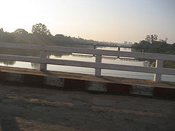
which lies on the northern bank of the Irrawaddy River. History of Myinmu is closely linked to the World War II
against the Japanese Army
when British
General Sir Douglas Gracey occupied the town after crossing the Irrawaddy River.
The nearest settlement to the town of Myinmu is Paledan
, a river village to the east. Other settlements of note in the township are Allagappa
to the west, Tizaung
to the northeast and Ngaizun
several miles away on the opposite side of the river from the main town. Apart from the Irrawaddy River, the Mu River
also flows about 7.5 kilometres (4.7 mi) away from the town. The nearest airport to the town is the Mandalay International Airport
(MDL), which is 69.7 kilometres (43.3 mi) away.
 Mu River
in the north-central Myanmar, runs on the right bank of Myinmu Township and joins the Irrawaddy River on the south, near this town; the river has a length of 175 km The river is navigable for boats up to Shebo District. The Kabo Weir across this river is used to cross for approaching the Shwebo Irrigation Project which was built to meet the irrigation needs of this Dry Zone. The Kabo Weir however, was constructed by the British colonial administration between 1901-1907.
missionaries in the late 19th century who established Roman Catholic mission stations at Nabet and Chaungu.
One of the earliest cooperatives in Burma was established in Myinmu Township in March 1905 with 19 members. Patterned on the Schulze–Delitzsch Cooperative Credit Society established in 1850, that lead to 16 similar societies getting set up in other parts of Burma
. However, these credit societies had to closed own under stiff competition from the 55 societies of the Reiffeisen type, which were concerned mostly with agricultural credits to meet farmers’ needs. Myinmu was occupied by the British Indian Army
during the Burma Campaign
against the Japanese in 1944. Douglas Gracey occupied Myinmu on February 13, 1944 and crossed the Irrawaddy.
. The principal crop is rice and farmers in the township have been reported to have devised new ways to reduce weed problems by replacing alternate wet-seeded rice with transplanted rice. In the past, the popular variety of Rice was not grown in Myinmu. Jowar (locally in Burmese language
“pyaung”), called the great millet
was grown in the dry zones of Singiang District, which was the staple food of people in Myinmu
and Myotha towns. There are two varieties of Jowar namely, the Sanpyaung, the whitish green variety and the Kunpayung. The whitish green variety has large stalks. The edible part of this variety is also used as substitute to rice.
The agricultural economy of the township got a boost with assistance provided by the Japan International Cooperation Agency
(JICA) to rear pigs
and grow mushrooms under a cooperative pilot project launched by the Ministry of Livestock and Fisheries, the Ministry of Cooperatives and the Ministry of Agriculture and Irrigation, as a poverty alleviation programme in the dry zone under a development study on sustainable agriculture and rural development.
Further, an irrigation project was built to provide irrigation
facilities to 25000 acres (10,117.2 ha) of land, which enabled double cropping on the lands with mixed crops. The earth dam (90 feet (27.4 m) in height and 4000 feet (1,219.2 m) long) built for the purpose is called the Letpan Dam, which created a storage of 4910 acre.ft to provided for irrigation.
Townships of Burma
Townships are the third-level administrative divisions of Burma. They are the sub divisions of the Districts of Burma. According to the Myanmar Information Management Unit , as of December 2007, there are 325 townships of Burma...
in the southeast of the Sagaing Division
Sagaing Division
Sagaing Region is an administrative region of Burma , located in the north-western part of the country between latitude 21° 30' north and longitude 94° 97' east...
in Burma (Myanmar), west of Mandalay
Mandalay
Mandalay is the second-largest city and the last royal capital of Burma. Located north of Yangon on the east bank of the Irrawaddy River, the city has a population of one million, and is the capital of Mandalay Region ....
. The principal town is Myinmu
Myinmu
Myinmu is a river town in the southeast of the Sagaing Division in Burma. The town has a rich history linked to World War II during the Burma Campaign against the Japanese, in 1944. It was also under the control of the Portuguese Missionaries in the 19th century...
which lies on the northern bank of the Irrawaddy River. History of Myinmu is closely linked to the World War II
World War II
World War II, or the Second World War , was a global conflict lasting from 1939 to 1945, involving most of the world's nations—including all of the great powers—eventually forming two opposing military alliances: the Allies and the Axis...
against the Japanese Army
Imperial Japanese Army
-Foundation:During the Meiji Restoration, the military forces loyal to the Emperor were samurai drawn primarily from the loyalist feudal domains of Satsuma and Chōshū...
when British
United Kingdom
The United Kingdom of Great Britain and Northern IrelandIn the United Kingdom and Dependencies, other languages have been officially recognised as legitimate autochthonous languages under the European Charter for Regional or Minority Languages...
General Sir Douglas Gracey occupied the town after crossing the Irrawaddy River.
The nearest settlement to the town of Myinmu is Paledan
Paledan
Paledan is a village in Myinmu Township in the southeast of the Sagaing Division in Burma. It is located just east of Myinmu on the northern bank of the Irrawaddy River....
, a river village to the east. Other settlements of note in the township are Allagappa
Allagappa
Allagappa is a small town in Myinmu Township in the southeast of the Sagaing Division in Burma. It is located west of Myinmu, near the northern bank of the Irrawaddy River. It lies in the Allagappa Valley, about 30 miles west of Sagaing city. It is connected by road to the main Monywa to Sagaing...
to the west, Tizaung
Tizaung
Tizaung is a village in the southeast of the Sagaing Division in Burma. It is located about 2 miles northeast of the township centre of Myinmu by road. The settlement of Paukka also lies by road to the east.Tizaung contains a notable pagoda....
to the northeast and Ngaizun
Ngaizun
Ngaizun is a river town in the southeast of the Sagaing Division in Burma. Ngaziun lies on the southern bank of the Irrawaddy River several kilometres east downstream on the opposite side of the river from Myinmu. It contains at least 6 notable pagodas....
several miles away on the opposite side of the river from the main town. Apart from the Irrawaddy River, the Mu River
Mu River
Mu River is a river in upper central Myanmar , and a tributary of the country's chief river the Ayeyarwady. It drains the Kabaw valley and part of the Dry Zone between the Ayeyarwady to the east and its largest tributary Chindwin River to the west, flows directly north to south for about and...
also flows about 7.5 kilometres (4.7 mi) away from the town. The nearest airport to the town is the Mandalay International Airport
Mandalay International Airport
Mandalay International Airport , located 35 km south of Mandalay in Tada-U, is one of only two international airports in Burma. Completed in 1999, the airport is the largest and most modern airport in the country, complete with a 14,000-foot runway and capacity to handle up to 3 million passengers...
(MDL), which is 69.7 kilometres (43.3 mi) away.
Geography
Myinmu Township has an area of about 330 square miles (854.7 km²). It has about 35 village tracts.Mu River
Mu River is a river in upper central Myanmar , and a tributary of the country's chief river the Ayeyarwady. It drains the Kabaw valley and part of the Dry Zone between the Ayeyarwady to the east and its largest tributary Chindwin River to the west, flows directly north to south for about and...
in the north-central Myanmar, runs on the right bank of Myinmu Township and joins the Irrawaddy River on the south, near this town; the river has a length of 175 km The river is navigable for boats up to Shebo District. The Kabo Weir across this river is used to cross for approaching the Shwebo Irrigation Project which was built to meet the irrigation needs of this Dry Zone. The Kabo Weir however, was constructed by the British colonial administration between 1901-1907.
History
Myingu township was occupied by PortuguesePortugal
Portugal , officially the Portuguese Republic is a country situated in southwestern Europe on the Iberian Peninsula. Portugal is the westernmost country of Europe, and is bordered by the Atlantic Ocean to the West and South and by Spain to the North and East. The Atlantic archipelagos of the...
missionaries in the late 19th century who established Roman Catholic mission stations at Nabet and Chaungu.
One of the earliest cooperatives in Burma was established in Myinmu Township in March 1905 with 19 members. Patterned on the Schulze–Delitzsch Cooperative Credit Society established in 1850, that lead to 16 similar societies getting set up in other parts of Burma
Myanmar
Burma , officially the Republic of the Union of Myanmar , is a country in Southeast Asia. Burma is bordered by China on the northeast, Laos on the east, Thailand on the southeast, Bangladesh on the west, India on the northwest, the Bay of Bengal to the southwest, and the Andaman Sea on the south....
. However, these credit societies had to closed own under stiff competition from the 55 societies of the Reiffeisen type, which were concerned mostly with agricultural credits to meet farmers’ needs. Myinmu was occupied by the British Indian Army
British Indian Army
The British Indian Army, officially simply the Indian Army, was the principal army of the British Raj in India before the partition of India in 1947...
during the Burma Campaign
Burma Campaign
The Burma Campaign in the South-East Asian Theatre of World War II was fought primarily between British Commonwealth, Chinese and United States forces against the forces of the Empire of Japan, Thailand, and the Indian National Army. British Commonwealth land forces were drawn primarily from...
against the Japanese in 1944. Douglas Gracey occupied Myinmu on February 13, 1944 and crossed the Irrawaddy.
Economy
Myinmu and the surrounding township rely on agriculture for their livelihoods and are located relatviely close to the market in MandalayMandalay
Mandalay is the second-largest city and the last royal capital of Burma. Located north of Yangon on the east bank of the Irrawaddy River, the city has a population of one million, and is the capital of Mandalay Region ....
. The principal crop is rice and farmers in the township have been reported to have devised new ways to reduce weed problems by replacing alternate wet-seeded rice with transplanted rice. In the past, the popular variety of Rice was not grown in Myinmu. Jowar (locally in Burmese language
Burmese language
The Burmese language is the official language of Burma. Although the constitution officially recognizes it as the Myanmar language, most English speakers continue to refer to the language as Burmese. Burmese is the native language of the Bamar and related sub-ethnic groups of the Bamar, as well as...
“pyaung”), called the great millet
Millet
The millets are a group of small-seeded species of cereal crops or grains, widely grown around the world for food and fodder. They do not form a taxonomic group, but rather a functional or agronomic one. Their essential similarities are that they are small-seeded grasses grown in difficult...
was grown in the dry zones of Singiang District, which was the staple food of people in Myinmu
Myinmu
Myinmu is a river town in the southeast of the Sagaing Division in Burma. The town has a rich history linked to World War II during the Burma Campaign against the Japanese, in 1944. It was also under the control of the Portuguese Missionaries in the 19th century...
and Myotha towns. There are two varieties of Jowar namely, the Sanpyaung, the whitish green variety and the Kunpayung. The whitish green variety has large stalks. The edible part of this variety is also used as substitute to rice.
The agricultural economy of the township got a boost with assistance provided by the Japan International Cooperation Agency
Japan International Cooperation Agency
The Japan International Cooperation Agency is an independent governmental agency that coordinates official development assistance for the government of Japan...
(JICA) to rear pigs
PIGS
PIGS is a four letter acronym that can stand for:* PIGS , Phosphatidylinositol glycan anchor biosynthesis, class S, a human gene* PIGS , the economies of Portugal, Italy , Greece and Spain...
and grow mushrooms under a cooperative pilot project launched by the Ministry of Livestock and Fisheries, the Ministry of Cooperatives and the Ministry of Agriculture and Irrigation, as a poverty alleviation programme in the dry zone under a development study on sustainable agriculture and rural development.
Further, an irrigation project was built to provide irrigation
Irrigation
Irrigation may be defined as the science of artificial application of water to the land or soil. It is used to assist in the growing of agricultural crops, maintenance of landscapes, and revegetation of disturbed soils in dry areas and during periods of inadequate rainfall...
facilities to 25000 acres (10,117.2 ha) of land, which enabled double cropping on the lands with mixed crops. The earth dam (90 feet (27.4 m) in height and 4000 feet (1,219.2 m) long) built for the purpose is called the Letpan Dam, which created a storage of 4910 acre.ft to provided for irrigation.
External links
- Maplandia World Gazetteer - map showing the township boundary