
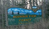
Mountain View County, Alberta
Encyclopedia
Mountain View County is a municipal district in Division No. 6
Division No. 6, Alberta
Division No. 6 is a census division in Alberta, Canada. Surrounding the City of Calgary, the majority of the division comprises Alberta's Calgary Region, while the northern portion of the division is located within central Alberta. The division also forms the southern segment of the...
in the central Alberta
Central Alberta
Central Alberta is a region located in the Canadian province of Alberta.Central Alberta is the most densely populated rural area in the province...
, Canada
Canada
Canada is a North American country consisting of ten provinces and three territories. Located in the northern part of the continent, it extends from the Atlantic Ocean in the east to the Pacific Ocean in the west, and northward into the Arctic Ocean...
. It is located between the cities of Calgary and Red Deer
Red Deer, Alberta
Red Deer is a city in Central Alberta, Canada. It is located near the midpoint of the Calgary-Edmonton Corridor and is surrounded by Red Deer County. It is Alberta's third-most-populous city – after Calgary and Edmonton. The city is located in aspen parkland, a region of rolling hills...
within the Calgary-Edmonton corridor
Calgary-Edmonton Corridor
The Calgary–Edmonton Corridor is a geographical region of the Canadian province of Alberta. It is the most urbanized area in Alberta and is one of Canada's four most urban regions. It consists of Statistics Canada census divisions No. 11, No. 8, and No. 6. Measured from north to south, the region...
. Mountain View County is a member of the Central Alberta Economic Partnership, Alberta Association of Municipal Districts and Counties, and the Municipal Area Partnership. Its municipal seat is the Town of Didsbury
Didsbury, Alberta
Didsbury is a town in central Alberta, Canada, at the foothills of the Rocky Mountains.Located next to Alberta Highway 2A, near the Queen Elizabeth II Highway, Didsbury is within the Calgary-Edmonton corridor. Didsbury is approximately the half-way point between the cities of Calgary and Red...
.
Oil and gas
Petroleum production in Canada
Petroleum production in Canada is a major industry which is important to the economy of North America. Canada is the sixth largest oil producing country in the world. In 2008 it produced an average of of crude oil, crude bitumen and natural gas condensate. Of that amount, 45% was conventional...
is the main economic driver of Mountain View County, along with agriculture
Agriculture
Agriculture is the cultivation of animals, plants, fungi and other life forms for food, fiber, and other products used to sustain life. Agriculture was the key implement in the rise of sedentary human civilization, whereby farming of domesticated species created food surpluses that nurtured the...
, forestry
Forestry
Forestry is the interdisciplinary profession embracing the science, art, and craft of creating, managing, using, and conserving forests and associated resources in a sustainable manner to meet desired goals, needs, and values for human benefit. Forestry is practiced in plantations and natural stands...
and tourism
Tourism
Tourism is travel for recreational, leisure or business purposes. The World Tourism Organization defines tourists as people "traveling to and staying in places outside their usual environment for not more than one consecutive year for leisure, business and other purposes".Tourism has become a...
. The municipal district is also home to a commercial/industrial sector, which includes the Netook Crossing development, located at the intersection of Alberta Highway 27 and the Queen Elizabeth II Highway.
History
The first government surveys of the area between Calgary and Edmonton were not made until 1883, around the time when the Canadian Pacific RailwayCanadian Pacific Railway
The Canadian Pacific Railway , formerly also known as CP Rail between 1968 and 1996, is a historic Canadian Class I railway founded in 1881 and now operated by Canadian Pacific Railway Limited, which began operations as legal owner in a corporate restructuring in 2001...
arrived from Eastern Canada
Eastern Canada
Eastern Canada is generally considered to be the region of Canada east of Manitoba, consisting of the following provinces:* New Brunswick* Newfoundland and Labrador* Nova Scotia* Ontario* Prince Edward Island* Quebec...
in Calgary, then just a small settlement. Just to the east of where the busy Queen Elizabeth II highway runs today, people and goods travelled between Calgary and Fort Edmonton
Fort Edmonton
Fort Edmonton was the name of a series of trading posts of the Hudson's Bay Company from 1795 to 1891, all of which were located in central Alberta, Canada...
by wagon along the original Calgary and Edmonton Trail
Calgary and Edmonton Trail
The Calgary and Edmonton Trail was a land transport route between Fort Edmonton and Fort Calgary in the Canadian Northwest.Several trails south from the fur trade post at Fort Edmonton had existed for some time...
. In 1890, the Calgary and Edmonton Railway
Calgary and Edmonton Railway
The Calgary and Edmonton Railway was an early pioneer railway in what was then the Northwest Territories, now Alberta, Canada. It connected the towns of Calgary and Strathcona and opened in 1891...
was chartered, and construction began, with the line reaching the area now comprising the county by the end of that year.
While a handful of squatters had arrived pre-1890, settlement in the area did not begin in earnest until the arrival of the C & E Railway. On July 27, 1891, the first through train made the trip from Calgary to Strathcona
Strathcona, Alberta
Strathcona was a city in Alberta, Canada, located on the south of the North Saskatchewan River opposite of the City of Edmonton. It amalgamated with Edmonton on February 1, 1912....
, marking the beginning of regular scheduled passenger train service for the next 60 years. The operation of Calgary & Edmonton Railway passed to the Canadian Pacific Railway, which continues to operate the line as its main Calgary-Edmonton connection.
After 1891, homesteaders began to arrive in the region from across Europe and North America, with settlements sprouting up around the fourth (Carstairs
Carstairs, Alberta
Carstairs is a town in central Alberta, Canada. It is located on Highway 2A, south of the provincial capital, Edmonton, and north of Calgary, the nearest major city. The closest neighbouring communities are the towns of Didsbury and Crossfield...
), fifth (Didsbury
Didsbury, Alberta
Didsbury is a town in central Alberta, Canada, at the foothills of the Rocky Mountains.Located next to Alberta Highway 2A, near the Queen Elizabeth II Highway, Didsbury is within the Calgary-Edmonton corridor. Didsbury is approximately the half-way point between the cities of Calgary and Red...
) and sixth (Olds) sidings.
Settlement in the early days was typified by ethnic and usually religious groups living in close-knit communities or colonies. Notable among them were a group of Mennonite
Mennonite
The Mennonites are a group of Christian Anabaptist denominations named after the Frisian Menno Simons , who, through his writings, articulated and thereby formalized the teachings of earlier Swiss founders...
families who homesteaded in the Didsbury area from Europe via Ontario
Ontario
Ontario is a province of Canada, located in east-central Canada. It is Canada's most populous province and second largest in total area. It is home to the nation's most populous city, Toronto, and the nation's capital, Ottawa....
around the turn of the 19th century. A large number of German settlers from the American Midwest also settled around Olds; and a group of Norwegian pioneers blazed a trail westward towards Sundre
Sundre, Alberta
Sundre is a town in central Alberta, Canada. It is located in Mountain View County, northwest from Calgary, along the Cowboy Trail in the Canadian Rockies foothills....
and Bergen
Bergen, Alberta
Bergen is an unincorporated community in the northwest quadrant of Mountain View County, Alberta, Canada. The community and its surrounding rural area is recognized as a rural neighbourhood by Mountain View County under the same name....
.
As the population grew, so did their needs. This led to the formation of local government, though the creation of local Improvement Districts. These were relatively small administrative units, generally no bigger than 72 square miles (186.5 km²) in size, and were responsible for a number of limited duties including setting local tax rates, and keeping track of necessary local improvements.
In December 1911 the Alberta government brought forward new legislation designed to introduce greater self government into rural areas of the province. Specifically, the Municipal Act of 1912 encouraged local improvement districts to consolidate with one another to form larger rural municipalities.
Initially the response to the idea of consolidation was unenthusiastic. A majority of rural residents in Mountain View voted against consolidation with other L.I.D.'s in a series of plebiscites held in 1912. Only the Rural Municipality of Mountain View No. 310 would be created out of four improvement districts around Olds and Didsbury, making it one of 55 rural municipalities to come into existence province-wide on December 9, 1912. While Mountain View was the first to consolidate, others would soon follow their lead.
The Municipal District of Mountain View No. 49 was formed into the County of Mountain View No. 17 as of January 1, 1961, with William J. Bagnall of Dogpound was selected as the county's first reeve. A municipal councillor prior to the county’s formation, Bagnall would continue to serve as reeve until 1980.
The newly-formed county chose Didsbury as the seat of government, and in October 1962, a new administration building was opened to house both the county administration and the school board. This building would serve the county until a new state-of-the-art office was built in 2005, near the Olds-Didsbury Airport
Olds-Didsbury Airport
Olds-Didsbury Airport, , is located next to Alberta Highway 2A, south of the Town of Olds, Alberta and north of the Town of Didsbury, Alberta, Canada.-External links:* on COPA's Places to Fly airport directory...
along Highway 2A.
On January 21, 1998, the County of Mountain View No. 17 officially changed its name to Mountain View County, as it continues to be known today.
Demographics
The population of Mountain View County according to its 2007 municipal census is 12,570.In 2006, Mountain View County had a population of 12,391 living in 5,136 dwellings
House
A house is a building or structure that has the ability to be occupied for dwelling by human beings or other creatures. The term house includes many kinds of different dwellings ranging from rudimentary huts of nomadic tribes to free standing individual structures...
, a 2.2% increase from 2001. The county has a land area of 3804.43 km² (1,468.9 sq mi) and a population density
Population density
Population density is a measurement of population per unit area or unit volume. It is frequently applied to living organisms, and particularly to humans...
of 3.3 /km2.
In 2001, Mountain View County had a population of 12,134 in 4,851 dwellings, a 7.8% increase from 1996. On a surface of 3,805.06 km² it had a density of 3.2 inhabitants/km².
Education
In the early 1890s the first schools began to organize in the area now comprising Mountain View County. By 1930, almost 90 school districts had been created to serve the region, with the one-room schoolOne-room school
One-room schools were commonplace throughout rural portions of various countries including the United States, Canada, Australia, New Zealand, United Kingdom, Ireland and Spain in the late 19th and early 20th centuries. In most rural and small town schools, all of the students met in a single room...
house remaining a fixture of rural life until 1936, when the Social Credit
Social Credit Party of Alberta
The Alberta Social Credit Party is a provincial political party in Alberta, Canada, that was founded on the social credit monetary policy and conservative Christian social values....
government allowed for the creation of larger school divisions.
As consolidation of rural municipalities continued throughput the 1940s and 50s, the provincial government moved to amalgamate municipalities and the local school boards. In 1955, the M.D. of Mountain View and Olds School Division No. 39 were made "coterminous" (meaning they shared the same boundaries). With the introduction of the County system of government in 1961, joint administration of municipalities and the school boards was initiated, and would continue until 1994.
Olds School Division No. 39 would eventually evolve into the Chinook's Edge School Division, which continues to serve the county.
Communities
The following communities are located in Mountain View County:Towns
- CarstairsCarstairs, AlbertaCarstairs is a town in central Alberta, Canada. It is located on Highway 2A, south of the provincial capital, Edmonton, and north of Calgary, the nearest major city. The closest neighbouring communities are the towns of Didsbury and Crossfield...
- DidsburyDidsbury, AlbertaDidsbury is a town in central Alberta, Canada, at the foothills of the Rocky Mountains.Located next to Alberta Highway 2A, near the Queen Elizabeth II Highway, Didsbury is within the Calgary-Edmonton corridor. Didsbury is approximately the half-way point between the cities of Calgary and Red...
- Olds
- SundreSundre, AlbertaSundre is a town in central Alberta, Canada. It is located in Mountain View County, northwest from Calgary, along the Cowboy Trail in the Canadian Rockies foothills....
Villages
- CremonaCremona, AlbertaCremona is a village in central Alberta, Canada. It is located north of Cochrane and west of Carstairs, along the Cowboy Trail .- Demographics :In 2006, Cremona had a population of 463 living in 198 dwellings, a 11.6% increase from 2001...
Unincorporated communities
- BearberryBearberry, AlbertaBearberry is an unincorporated community in central Alberta in Mountain View County, located west of Highway 22, northwest of Calgary. It is named for the bearberry that grows in the vicinity....
- BergenBergen, AlbertaBergen is an unincorporated community in the northwest quadrant of Mountain View County, Alberta, Canada. The community and its surrounding rural area is recognized as a rural neighbourhood by Mountain View County under the same name....
- Dogpound
- Eagle HillEagle Hill, AlbertaEagle Hill is an unincorporated community in central Alberta, Canada within Mountain View County. It is located north of Highway 27, approximately southwest of Red Deer....
- ElktonElkton, AlbertaElkton is an unincorporated community in central Alberta in Mountain View County, located west of the Cowboy Trail, northwest of Airdrie, between the towns of Sundre and Cremona....
- Stirlingville
- Water ValleyWater Valley, AlbertaWater Valley is an unincorporated community within Mountain View County, Alberta, Canada. Situated amongst the foothills of the Canadian Rockies, Water Valley is approximately from the City of Calgary, along Highway 579 west of Highway 22...
- Westward Ho
Rural neighbourhoods
In 2008, Mountain View County established 20 districts as rural neighbourhoods.- Bearberry / Coalcamp
- BergenBergen, AlbertaBergen is an unincorporated community in the northwest quadrant of Mountain View County, Alberta, Canada. The community and its surrounding rural area is recognized as a rural neighbourhood by Mountain View County under the same name....
- Dogpound
- Eagle Hill / Westward Ho
- Elkton / Rugby
- Fallentimber
- Hainstock
- Harmattan
- Jackson
- James River
- Lonepine
- McDougal Flats
- Midway
- Netook
- Reed Ranch
- Rosebud
- Water Valley / Winchell Lake
- Wessex
- Westcott
- Westerdale