
Minnesota State Highway 27
Encyclopedia
Minnesota State Highway 27 is a highway
in west-central and east-central Minnesota
, which runs from its intersection
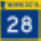
with State Highway 28
in Browns Valley
and continues east to its eastern terminus at its interchange
with Interstate 35
in Moose Lake
.
For part of its route (23 miles), Highway 27 runs concurrent
with State Highway 65
in Kanabec and Aitkin
counties.
Highway 27 is 248 miles (399.1 km) in length.
, Wheaton
, Alexandria
, Long Prairie
, Little Falls
, Mille Lacs Lake
, and Moose Lake
.
The western terminus for Highway 27 is its intersection
with State Highway 28
in Browns Valley
, near the Minnesota
- South Dakota
state line at the Little Minnesota River
.
The Sam Brown Monument State Wayside Park is located at the western terminus of Highway 27 in Browns Valley
.
Highway 27 crosses the Broadway Bridge
at the Mississippi River
in Little Falls
.
Charles A. Lindbergh State Park
is located immediately west of Little Falls
on Highway 27.
Father Hennepin State Park
is located on Highway 27 at the southeast corner of Mille Lacs Lake
, one mile (1.6 km) west of Isle
.
Highway 27, together with Highway 65, passes through the Solana State Forest in Aitkin County
.
The original route of Highway 27 between State Highway 65
and State Highway 47
was over what is now State Highway 18
; original designation of the current Highway 27 between these routes was previously old State Highway 66 until 1963.
Easternmost section of Highway 27 was previously old U.S. 61
through Moose Lake
.
The section of Highway 27 southwest of Mille Lacs Lake
was still gravel in 1940. The segments east of Isle
were gravel into the 1950s, and the last segment east of State Highway 65
was not paved until the 1970s.
Highway
A highway is any public road. In American English, the term is common and almost always designates major roads. In British English, the term designates any road open to the public. Any interconnected set of highways can be variously referred to as a "highway system", a "highway network", or a...
in west-central and east-central Minnesota
Minnesota
Minnesota is a U.S. state located in the Midwestern United States. The twelfth largest state of the U.S., it is the twenty-first most populous, with 5.3 million residents. Minnesota was carved out of the eastern half of the Minnesota Territory and admitted to the Union as the thirty-second state...
, which runs from its intersection
Intersection (road)
An intersection is a road junction where two or more roads either meet or cross at grade . An intersection may be 3-way - a T junction or fork, 4-way - a crossroads, or 5-way or more...
with State Highway 28
Minnesota State Highway 28
Minnesota State Highway 28 is a highway in west-central and central Minnesota, which runs from South Dakota Highway 10 at the South Dakota state line near Browns Valley and continues east to its eastern terminus at its intersection with the former route of U.S...
in Browns Valley
Browns Valley, Minnesota
As of the census of 2000, there were 690 people, 285 households, and 171 families residing in the city. The population density was 878.5 people per square mile . There were 317 housing units at an average density of 403.6 per square mile...
and continues east to its eastern terminus at its interchange
Interchange (road)
In the field of road transport, an interchange is a road junction that typically uses grade separation, and one or more ramps, to permit traffic on at least one highway to pass through the junction without directly crossing any other traffic stream. It differs from a standard intersection, at which...
with Interstate 35
Interstate 35 in Minnesota
In the U.S. state of Minnesota, Interstate 35 is a highway in southeast, east-central, and northeast Minnesota. The route runs north–south from the Iowa state line through the twin cities of Minneapolis and Saint Paul; where it splits into Interstates 35E and 35W; and ends in the city of...
in Moose Lake
Moose Lake, Minnesota
As of the census of 2000, there were 2,239 people, 577 households, and 294 families residing in the city. The population density was 811.1 people per square mile . There were 628 housing units at an average density of 227.5 per square mile...
.
For part of its route (23 miles), Highway 27 runs concurrent
Concurrency (road)
A concurrency, overlap, or coincidence in a road network is an instance of one physical road bearing two or more different highway, motorway, or other route numbers...
with State Highway 65
Minnesota State Highway 65
Minnesota State Highway 65 is a highway in east-central and northeast Minnesota, which runs from its intersection with Washington Avenue at the north end of downtown Minneapolis and continues north to its northern terminus at its intersection with U.S...
in Kanabec and Aitkin
Aitkin County, Minnesota
Aitkin County is a county located in the U.S. state of Minnesota. As of 2010, the population is 16,202. Its county seat is Aitkin. A portion of the Mille Lacs Indian Reservation is in the county.-History:...
counties.
Highway 27 is 248 miles (399.1 km) in length.
Route description
State Highway 27 serves as an east–west route between Browns ValleyBrowns Valley, Minnesota
As of the census of 2000, there were 690 people, 285 households, and 171 families residing in the city. The population density was 878.5 people per square mile . There were 317 housing units at an average density of 403.6 per square mile...
, Wheaton
Wheaton, Minnesota
As of the census of 2000, there were 1,619 people, 747 households, and 434 families residing in the city. The population density was 909.2 people per square mile . There were 907 housing units at an average density of 509.4 per square mile...
, Alexandria
Alexandria, Minnesota
As of the census of 2000, there were 8,820 people, however the most recent count suggests a population upwards of 10,000, which is displayed on Alexandria's city limits signs. The census lists 4,047 households, and 2,011 families residing in the city. The population density was 992.5 people per...
, Long Prairie
Long Prairie, Minnesota
At the 2000 census, there were 3,040 people, 1,229 households and 769 families residing in the city. The population density was 1,285.2 per square mile . There were 1,334 housing units at an average density of 564.0 per square mile...
, Little Falls
Little Falls, Minnesota
As of the census of 2000, there were 7,719 people , 3,197 households, and 1,899 families residing in the city. The population density was 1,232.5 people per square mile . There were 3,358 housing units at an average density of 536.2 per square mile...
, Mille Lacs Lake
Mille Lacs Lake
Mille Lacs Lake is a lake in the U.S. state of Minnesota. It is located in the counties of Mille Lacs, Aitkin and Crow Wing, roughly 100 miles north of the Minneapolis-St. Paul metropolitan area....
, and Moose Lake
Moose Lake, Minnesota
As of the census of 2000, there were 2,239 people, 577 households, and 294 families residing in the city. The population density was 811.1 people per square mile . There were 628 housing units at an average density of 227.5 per square mile...
.
The western terminus for Highway 27 is its intersection
Intersection (road)
An intersection is a road junction where two or more roads either meet or cross at grade . An intersection may be 3-way - a T junction or fork, 4-way - a crossroads, or 5-way or more...
with State Highway 28
Minnesota State Highway 28
Minnesota State Highway 28 is a highway in west-central and central Minnesota, which runs from South Dakota Highway 10 at the South Dakota state line near Browns Valley and continues east to its eastern terminus at its intersection with the former route of U.S...
in Browns Valley
Browns Valley, Minnesota
As of the census of 2000, there were 690 people, 285 households, and 171 families residing in the city. The population density was 878.5 people per square mile . There were 317 housing units at an average density of 403.6 per square mile...
, near the Minnesota
Minnesota
Minnesota is a U.S. state located in the Midwestern United States. The twelfth largest state of the U.S., it is the twenty-first most populous, with 5.3 million residents. Minnesota was carved out of the eastern half of the Minnesota Territory and admitted to the Union as the thirty-second state...
- South Dakota
South Dakota
South Dakota is a state located in the Midwestern region of the United States. It is named after the Lakota and Dakota Sioux American Indian tribes. Once a part of Dakota Territory, South Dakota became a state on November 2, 1889. The state has an area of and an estimated population of just over...
state line at the Little Minnesota River
Little Minnesota River
The Little Minnesota River is a headwaters tributary of the Minnesota River in northeastern South Dakota and west-central Minnesota in the United States...
.
The Sam Brown Monument State Wayside Park is located at the western terminus of Highway 27 in Browns Valley
Browns Valley, Minnesota
As of the census of 2000, there were 690 people, 285 households, and 171 families residing in the city. The population density was 878.5 people per square mile . There were 317 housing units at an average density of 403.6 per square mile...
.
Highway 27 crosses the Broadway Bridge
Broadway Bridge (Little Falls)
The Little Falls Broadway Bridge is the only road bridge within the city limits of Little Falls, Minnesota. The bridge was built in the 1940s and is the 3rd bridge to occupy the current spot. It is located less than one block north of the Little Falls Dam and connects the city's "east side" and...
at the Mississippi River
Mississippi River
The Mississippi River is the largest river system in North America. Flowing entirely in the United States, this river rises in western Minnesota and meanders slowly southwards for to the Mississippi River Delta at the Gulf of Mexico. With its many tributaries, the Mississippi's watershed drains...
in Little Falls
Little Falls, Minnesota
As of the census of 2000, there were 7,719 people , 3,197 households, and 1,899 families residing in the city. The population density was 1,232.5 people per square mile . There were 3,358 housing units at an average density of 536.2 per square mile...
.
Charles A. Lindbergh State Park
Charles A. Lindbergh State Park
Charles A. Lindbergh State Park is a 569 acre Minnesota state park on the outskirts of Little Falls. The park was once the farm of Congressman Charles August Lindbergh and his son Charles Lindbergh, the famous aviator. Their restored 1906 house and two other farm buildings are within the park...
is located immediately west of Little Falls
Little Falls, Minnesota
As of the census of 2000, there were 7,719 people , 3,197 households, and 1,899 families residing in the city. The population density was 1,232.5 people per square mile . There were 3,358 housing units at an average density of 536.2 per square mile...
on Highway 27.
Father Hennepin State Park
Father Hennepin State Park
Father Hennepin State Park is a 320 acre Minnesota state park located on the southeast corner of Mille Lacs Lake. The park is named after Father Louis Hennepin, a priest who visited the area with a French expedition in 1680...
is located on Highway 27 at the southeast corner of Mille Lacs Lake
Mille Lacs Lake
Mille Lacs Lake is a lake in the U.S. state of Minnesota. It is located in the counties of Mille Lacs, Aitkin and Crow Wing, roughly 100 miles north of the Minneapolis-St. Paul metropolitan area....
, one mile (1.6 km) west of Isle
Isle, Minnesota
Isle is a city in Mille Lacs County, Minnesota, United States. The population was 751 at the 2010 census. Its name in the Ojibwe language is "Chi-minising" , due to being located right by Malone Island of Mille Lacs Lake, the largest island of that lake.-Geography:According to the United States...
.
Highway 27, together with Highway 65, passes through the Solana State Forest in Aitkin County
Aitkin County, Minnesota
Aitkin County is a county located in the U.S. state of Minnesota. As of 2010, the population is 16,202. Its county seat is Aitkin. A portion of the Mille Lacs Indian Reservation is in the county.-History:...
.
History
Most of State Highway 27 was authorized in 1933.The original route of Highway 27 between State Highway 65
Minnesota State Highway 65
Minnesota State Highway 65 is a highway in east-central and northeast Minnesota, which runs from its intersection with Washington Avenue at the north end of downtown Minneapolis and continues north to its northern terminus at its intersection with U.S...
and State Highway 47
Minnesota State Highway 47
Minnesota State Highway 47 is a highway in east-central Minnesota, which runs from its intersection with Central Avenue in Minneapolis and continues north to its northern terminus at its intersection with U.S. Highway 169 in Aitkin....
was over what is now State Highway 18
Minnesota State Highway 18
Minnesota State Highway 18 is a highway in east-central Minnesota, which runs from its intersection with State Highway 25 in Brainerd and continues east to its eastern terminus at its intersection with State Highway 23 in Finlayson Township near Askov and Sandstone...
; original designation of the current Highway 27 between these routes was previously old State Highway 66 until 1963.
Easternmost section of Highway 27 was previously old U.S. 61
U.S. Route 61
U.S. Route 61 is the official designation for a United States highway that runs from New Orleans, Louisiana, to the city of Wyoming, Minnesota. The highway generally follows the course of the Mississippi River, and is designated the Great River Road for much of its route. As of 2004, the highway's...
through Moose Lake
Moose Lake, Minnesota
As of the census of 2000, there were 2,239 people, 577 households, and 294 families residing in the city. The population density was 811.1 people per square mile . There were 628 housing units at an average density of 227.5 per square mile...
.
The section of Highway 27 southwest of Mille Lacs Lake
Mille Lacs Lake
Mille Lacs Lake is a lake in the U.S. state of Minnesota. It is located in the counties of Mille Lacs, Aitkin and Crow Wing, roughly 100 miles north of the Minneapolis-St. Paul metropolitan area....
was still gravel in 1940. The segments east of Isle
Isle, Minnesota
Isle is a city in Mille Lacs County, Minnesota, United States. The population was 751 at the 2010 census. Its name in the Ojibwe language is "Chi-minising" , due to being located right by Malone Island of Mille Lacs Lake, the largest island of that lake.-Geography:According to the United States...
were gravel into the 1950s, and the last segment east of State Highway 65
Minnesota State Highway 65
Minnesota State Highway 65 is a highway in east-central and northeast Minnesota, which runs from its intersection with Washington Avenue at the north end of downtown Minneapolis and continues north to its northern terminus at its intersection with U.S...
was not paved until the 1970s.