

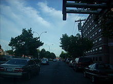
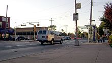
Merrick Road
Encyclopedia
New York City
New York is the most populous city in the United States and the center of the New York Metropolitan Area, one of the most populous metropolitan areas in the world. New York exerts a significant impact upon global commerce, finance, media, art, fashion, research, technology, education, and...
, is a road running from Jamaica, Queens, New York east through Merrick, New York
Merrick, New York
Merrick is a hamlet in the Town of Hempstead in Nassau County, New York, USA. As of the 2010 census, the CDP population was 22,097. The name "Merrick" is taken from Meroke, the name of the Algonquian tribe formerly indigenous to the area...
to the line between Nassau
Nassau County, New York
Nassau County is a suburban county on Long Island, east of New York City in the U.S. state of New York, within the New York Metropolitan Area. As of the 2010 census, the population was 1,339,532...
and Suffolk
Suffolk County, New York
Suffolk County is a county located in the U.S. state of New York on the eastern portion of Long Island. As of the 2010 census, the population was 1,493,350. It was named for the county of Suffolk in England, from which its earliest settlers came...
Counties, where it becomes Montauk Highway
Montauk Highway
Montauk Highway is one of the original through highways of Long Island, New York, extending from Jamaica, in the New York City borough of Queens to Montauk Point in Suffolk County, a distance of approximately 100 miles ....
. A bit of it at the east end is signed and maintained by the New York State Department of Transportation
New York State Department of Transportation
The New York State Department of Transportation is responsible for the development and operation of highways, railroads, mass transit systems, ports, waterways and aviation facilities in the U.S...
as New York State Route 27A
New York State Route 27A
New York State Route 27A is a state highway extending from Massapequa in Nassau County to Oakdale in Suffolk County on Long Island, New York in the United States...
. At one time the entire length of Merrick Road was signed as NY 27A; the entire portion within Nassau County is currently designated as unsigned Nassau County Route 27. It is an old road, forming part of one of the original paths across southern Long Island
Long Island
Long Island is an island located in the southeast part of the U.S. state of New York, just east of Manhattan. Stretching northeast into the Atlantic Ocean, Long Island contains four counties, two of which are boroughs of New York City , and two of which are mainly suburban...
, once known as Montauk Highway
Montauk Highway
Montauk Highway is one of the original through highways of Long Island, New York, extending from Jamaica, in the New York City borough of Queens to Montauk Point in Suffolk County, a distance of approximately 100 miles ....
the whole way.
Route description
Merrick Boulevard begins at Hillside AvenueNew York State Route 25B
New York State Route 25B is a 7.25 mile long east–west state highway located on Long Island in the U.S. state of New York. The western terminus of the route is at NY 25 in Queens. The eastern terminus is at an interchange with NY 25 in Westbury...
as a 2 lane, one-way street heading eastbound (compass south at this point), continued north of Hillside Avenue as 166th Street. 168th Street provides for traffic running westbound/northbound. Just south of Liberty Avenue, the two directions join together to form a 4 lane, divided
Divided Highway
Divided Highway is a compilation album by American rock band The Doobie Brothers, released in 2003. . All tracks are taken from the albums Cycles and Brotherhood .-Track listing:...
Merrick Boulevard.
Merrick Boulevard gradually turns southeast and east, passing through Springfield Gardens
Springfield Gardens, Queens
Springfield Gardens is a neighborhood in the southeastern area of the New York City borough of Queens, bounded to the north by St. Albans, to the east by Laurelton & Rosedale, to the south by John F. Kennedy International Airport, and to the west by Farmers Boulevard...
, Laurelton
Laurelton, Queens
Laurelton is a neighborhood in the New York City borough of Queens. It is now a largely middle class neighborhood. In the 1930s through 1970s and beyond, the neighborhood was populated by many Jewish Americans, but succeeding generations have been made up of new migrants. The neighborhood is part...
and crossing the Belt Parkway
Belt Parkway
The Belt System is a series of connected limited-access highways that form a belt-like circle around the New York City boroughs of Brooklyn and Queens. The system comprises four officially separate parkways; however, three of the four are signed as the Belt Parkway...
before leaving Queens
Queens
Queens is the easternmost of the five boroughs of New York City. The largest borough in area and the second-largest in population, it is coextensive with Queens County, an administrative division of New York state, in the United States....
into Nassau County
Nassau County, New York
Nassau County is a suburban county on Long Island, east of New York City in the U.S. state of New York, within the New York Metropolitan Area. As of the 2010 census, the population was 1,339,532...
, where it becomes Merrick Road. Merrick Road here is one of the old roads along the southern side of Long Island
Long Island
Long Island is an island located in the southeast part of the U.S. state of New York, just east of Manhattan. Stretching northeast into the Atlantic Ocean, Long Island contains four counties, two of which are boroughs of New York City , and two of which are mainly suburban...
; it has been replaced by Sunrise Highway (Route 27
New York State Route 27
New York State Route 27 is an east–west long state highway extending from Interstate 278 in the New York City borough of Brooklyn to Montauk Point State Park on Long Island, New York, United States...
) for most through traffic.
Rockville Centre, New York
Rockville Centre is a village located in Nassau County, New York, in the United States. As of the 2010 census, the village had a total population of 24,023. The town is made up of middle to upper middle class residents, most of the wealthier residents residing on the north side of town near the...
, bridges take it over Route 27, with four directional ramps forming a partial interchange
Interchange (road)
In the field of road transport, an interchange is a road junction that typically uses grade separation, and one or more ramps, to permit traffic on at least one highway to pass through the junction without directly crossing any other traffic stream. It differs from a standard intersection, at which...
. Further east, it serves as the southern end for state roads like Route 135
New York State Route 135
New York State Route 135 is a state highway in eastern Nassau County, New York, United States. The route is a limited-access highway that connects Seaford with Syosset. The highway runs from Merrick Road in Seaford to NY 25 in Syosset...
(the Seaford-Oyster Bay Expressway) and Route 107
New York State Route 107
New York State Route 107 is a state highway located entirely within Nassau County, New York, in the United States. It runs from Merrick Road in Massapequa to Mill Street and Brewster Avenue in the city of Glen Cove near City Hall...
.
Route 27A
New York State Route 27A
New York State Route 27A is a state highway extending from Massapequa in Nassau County to Oakdale in Suffolk County on Long Island, New York in the United States...
begins as a split from Route 27
New York State Route 27
New York State Route 27 is an east–west long state highway extending from Interstate 278 in the New York City borough of Brooklyn to Montauk Point State Park on Long Island, New York, United States...
in East Massapequa
East Massapequa, New York
East Massapequa is a hamlet located within the Town of Oyster Bay in Nassau County, New York, United States. The population was 19,069 at the 2010 census.The hamlet lies in New York's 3rd congressional district...
, where Route 27 leaves the original Sunrise Gold Circle, which is now Old Sunrise Highway east of the split. Route 27A quickly turns south off Old Sunrise Highway onto Carman Mill Road, which ends at Merrick Road. Merrick Road from that point east to Suffolk County
Suffolk County, New York
Suffolk County is a county located in the U.S. state of New York on the eastern portion of Long Island. As of the 2010 census, the population was 1,493,350. It was named for the county of Suffolk in England, from which its earliest settlers came...
, where it becomes Montauk Highway
Montauk Highway
Montauk Highway is one of the original through highways of Long Island, New York, extending from Jamaica, in the New York City borough of Queens to Montauk Point in Suffolk County, a distance of approximately 100 miles ....
, is part of Route 27A.
Both the Meadowbrook State Parkway
Meadowbrook State Parkway
The Meadowbrook State Parkway is a long parkway in Nassau County, New York. The southern terminus is at the Bay Parkway in Jones Beach State Park, where the parkway becomes the Ocean Parkway. The northern terminus is at the Northern State Parkway in Carle Place...
and the Wantagh State Parkway
Wantagh State Parkway
The Wantagh State Parkway is a state parkway on Long Island in New York, in the United States. It links the Ocean Parkway at Jones Beach State Park with the Northern State Parkway in Westbury. The parkway is located approximately east of Manhattan and east of the Nassau–Queens border...
have interchanges with Merrick Road. A truck needing to make a delivery to the barrier beaches along Ocean Parkway may enter either parkway southbound at this road and at no point further north.