
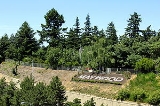
Maywood Park, Oregon
Encyclopedia
Maywood Park is a city in Multnomah County, Oregon
. The name came from a comment made by the wife of the man who developed the original subdivision, E.F. Taylor, who remarked one winter night how attractive the woods were in May. An enclave within the city of Portland
, the residents of the city voted to incorporate in 1967 in an unsuccessful attempt to stop the construction of Interstate 205
. The population was 752 at the 2010 census.
expanded Sandy Blvd through NE Portland to become a four lane highway, linking Portland
with all points east. This expansion allowed much more development to take place in the Parkrose
district, which at the time was primarily farmland. Beneath the eastern shadow of Rocky Butte
, there existed a relatively untouched section of land that was a thick semi-old growth conifer forest. A triangular plot was purchased soon after by the Columbia Realty Company. Soon thereafter, the Maywood Park subdivision
was plotted.
In 1930, Columbia Realty was bought out by Commonwealth, Inc. Under the direction of Robert H. Strong, Commonwealth took control of Maywood Park. The intention of the new developer was to build a neighborhood that would be of the same class as the Laurelhurst
and Eastmoreland
neighborhoods in southeast Portland.
 During the Great Depression
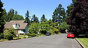
, Maywood Park grew slowly throughout the 1930s. By the end of the decade though, home sales began to take off and in March 1939 there were 23 new homes under construction totaling a value of about $140,000, quite a large sum at the time. People were drawn to the neighborhood because it was far from the city center, but was easily accessible by automobile using Sandy Blvd. Another large draw was that, unlike the immediate surrounding area, Maywood Park was completely shrouded by huge conifer trees.
During World War II
, the Federal Government constructed war worker housing in the surrounding area, known as Parkrose. This development was far different from the homes in Maywood Park with their mixed and sometimes eclectic styles of architecture, beautiful landscapes and tree shaded surroundings.
and the subsequent construction of Interstate 5 through central Portland, it became apparent that the I-5 bypass of I-205
was to be routed through Maywood Park. Buoyed by a highway commission statement which stated that no highway should be pushed through an incorporated city without the city’s approval, the citizens voted to incorporate in 1967. The new city, now armed with more rights than would be afforded to a neighborhood, set out to dismantle the growing effort of the Oregon State Highway Commission to route I-205 through the city.
In 1968, the city filed a lawsuit against the highway commission seeking a halt to the continued design and engineering of I-205 within the incorporated area. The lawsuit also stated that the cost of constructing I-205 through Maywood Park was wasteful and not in the public interest. In addition, the city claimed that the buying of rights-of-way, road closures and changing of road grades without consent of the city were against Oregon law. The city lost this case and the highway commissions plans continued.
In 1971, Maywood Park again attempted to halt the freeway construction. This time, a suit was filed in Federal Court. The suit charged that the highway commission had refused to hold any public hearings and that construction of the freeway on the proposed route would require cutting many trees and stripping the land, which would cause a great interference with the wildlife of the area, and, in addition would created excessive noise and air pollution
which would not be necessary if the freeway took another route. Once again, Maywood Park lost the suit. Now, beaten, the citizens of Maywood Park could do nothing as freeway construction began to tear apart their neighborhood. However a few concessions were made as a result of public hearings.
Maywood Park insisted that the freeway and access roads be sunken below grade to lessen the impact of vehicle sound. The freeway was sunk a great deal from its original planned grade. The city also demanded a large wall called a sound berm to be installed on the border of the freeway, which the state agreed to. And finally, the residents pleaded that “Every tree that can possibly be saved must be saved.” And so, in came the construction crews. The lower grade of the freeway has been the most successful sound limiting factor.
The city battled the Oregon Highway Department again in 1978 when a lawsuit was filed claiming that freeway construction had damaged properties along the western street of Maywood Place. Another concern addressed was the change in plans for the freeway from 6 lanes to 10 which was thought to be a greater impact on the city. Once again, the city lost the lawsuit and failed to bar construction.
Today, Maywood Park maintains a distinctive feel relative to the surrounding Parkrose district, in part because there are twice as many East-West streets as the rest of the Parkrose area.
, the city has a total area of 0.2 square mile (0.517997622 km²), all of it land. The city is contained in a trapezoid bordered by NE Prescott Street to the north, NE 102nd Avenue to the east, I-205 to the south, and NE 92nd Avenue (across I-205) to the west, plus the eastern side of 92nd Avenue to Sandy Boulevard.
of 2000, there were 777 people, 306 households, and 224 families residing in the city. The population density
was 4,571.4 people per square mile (1,764.7/km²). There were 314 housing units at an average density of 1,847.4 per square mile (713.2/km²). The racial makeup of the city was 88.42% White, 2.06% African American, 0.90% Native American, 3.99% Asian, 0.13% Pacific Islander, 0.39% from other races
, and 4.12% from two or more races. Hispanic or Latino of any race were 2.32% of the population.
There were 306 households out of which 27.8% had children under the age of 18 living with them, 60.1% were married couples
living together, 9.5% had a female householder with no husband present, and 26.5% were non-families. 20.9% of all households were made up of individuals and 9.5% had someone living alone who was 65 years of age or older. The average household size was 2.54 and the average family size was 2.92.
In the city the population was spread out with 20.2% under the age of 18, 6.2% from 18 to 24, 25.7% from 25 to 44, 32.8% from 45 to 64, and 15.1% who were 65 years of age or older. The median age was 44 years. For every 100 females there were 92.8 males. For every 100 females age 18 and over, there were 90.2 males.
The median income for a household in the city was $56,250, and the median income for a family was $61,750. Males had a median income of $39,821 versus $36,071 for females. The per capita income
for the city was $26,472. None of the families and 1.7% of the population were living below the poverty line, including no under eighteens and 1.7% of those over 64.
Multnomah County, Oregon
Multnomah County is one of 36 counties in the U.S. state of Oregon. Though smallest in area, it is the most populous as its county seat, Portland, is the state's largest city...
. The name came from a comment made by the wife of the man who developed the original subdivision, E.F. Taylor, who remarked one winter night how attractive the woods were in May. An enclave within the city of Portland
Portland, Oregon
Portland is a city located in the Pacific Northwest, near the confluence of the Willamette and Columbia rivers in the U.S. state of Oregon. As of the 2010 Census, it had a population of 583,776, making it the 29th most populous city in the United States...
, the residents of the city voted to incorporate in 1967 in an unsuccessful attempt to stop the construction of Interstate 205
Interstate 205 (Oregon-Washington)
Interstate 205 is a loop route that serves the Portland—Vancouver metropolitan area in the U.S. states of Oregon and Washington. I-205 is officially named the War Veterans Memorial Freeway, and is also known as the East Portland Freeway...
. The population was 752 at the 2010 census.
History
In 1926, the city of PortlandPortland, Oregon
Portland is a city located in the Pacific Northwest, near the confluence of the Willamette and Columbia rivers in the U.S. state of Oregon. As of the 2010 Census, it had a population of 583,776, making it the 29th most populous city in the United States...
expanded Sandy Blvd through NE Portland to become a four lane highway, linking Portland
Portland, Oregon
Portland is a city located in the Pacific Northwest, near the confluence of the Willamette and Columbia rivers in the U.S. state of Oregon. As of the 2010 Census, it had a population of 583,776, making it the 29th most populous city in the United States...
with all points east. This expansion allowed much more development to take place in the Parkrose
Parkrose, Portland, Oregon
Parkrose is a neighborhood in the Northeast section of Portland, Oregon.The Parkrose plat was filed October 5, 1911. A branch post office of Portland was established there in 1921....
district, which at the time was primarily farmland. Beneath the eastern shadow of Rocky Butte
Rocky Butte
Rocky Butte is an extinct volcanic cinder cone butte in Portland, Oregon, United States. It is one of four, along with Kelly Butte, Powell Butte, and Mount Tabor, inside the city that are each home to a city park, Rocky Butte playing host to Joseph Wood Hill Park. It is also part of the Boring...
, there existed a relatively untouched section of land that was a thick semi-old growth conifer forest. A triangular plot was purchased soon after by the Columbia Realty Company. Soon thereafter, the Maywood Park subdivision
Subdivision (land)
Subdivision is the act of dividing land into pieces that are easier to sell or otherwise develop, usually via a plat. The former single piece as a whole is then known in the United States as a subdivision...
was plotted.
In 1930, Columbia Realty was bought out by Commonwealth, Inc. Under the direction of Robert H. Strong, Commonwealth took control of Maywood Park. The intention of the new developer was to build a neighborhood that would be of the same class as the Laurelhurst
Laurelhurst, Portland, Oregon
Laurelhurst is a neighborhood of vintage homes and undulating streets surrounding a park of the same name, straddling the NE and SE sections of Portland. Stone markers flank the entrances to the area...
and Eastmoreland
Eastmoreland, Portland, Oregon
Eastmoreland is an early-twentieth century, tree-filled neighborhood in inner southeast Portland, Oregon, United States. The neighborhood is bounded on the north by SE Woodstock Boulevard. The western boundary is a combination of SE 28th Avenue, SE Bybee Boulevard, and SE 27th Avenue...
neighborhoods in southeast Portland.
Great Depression
The Great Depression was a severe worldwide economic depression in the decade preceding World War II. The timing of the Great Depression varied across nations, but in most countries it started in about 1929 and lasted until the late 1930s or early 1940s...
, Maywood Park grew slowly throughout the 1930s. By the end of the decade though, home sales began to take off and in March 1939 there were 23 new homes under construction totaling a value of about $140,000, quite a large sum at the time. People were drawn to the neighborhood because it was far from the city center, but was easily accessible by automobile using Sandy Blvd. Another large draw was that, unlike the immediate surrounding area, Maywood Park was completely shrouded by huge conifer trees.
During World War II
World War II
World War II, or the Second World War , was a global conflict lasting from 1939 to 1945, involving most of the world's nations—including all of the great powers—eventually forming two opposing military alliances: the Allies and the Axis...
, the Federal Government constructed war worker housing in the surrounding area, known as Parkrose. This development was far different from the homes in Maywood Park with their mixed and sometimes eclectic styles of architecture, beautiful landscapes and tree shaded surroundings.
Highway development
After the passing of the Federal Aid Highway Act of 1956Federal Aid Highway Act of 1956
The Federal-Aid Highway Act of 1956, popularly known as the National Interstate and Defense Highways Act , was enacted on June 29, 1956, when Dwight D. Eisenhower signed the bill into law...
and the subsequent construction of Interstate 5 through central Portland, it became apparent that the I-5 bypass of I-205
Interstate 205 (Oregon-Washington)
Interstate 205 is a loop route that serves the Portland—Vancouver metropolitan area in the U.S. states of Oregon and Washington. I-205 is officially named the War Veterans Memorial Freeway, and is also known as the East Portland Freeway...
was to be routed through Maywood Park. Buoyed by a highway commission statement which stated that no highway should be pushed through an incorporated city without the city’s approval, the citizens voted to incorporate in 1967. The new city, now armed with more rights than would be afforded to a neighborhood, set out to dismantle the growing effort of the Oregon State Highway Commission to route I-205 through the city.
In 1968, the city filed a lawsuit against the highway commission seeking a halt to the continued design and engineering of I-205 within the incorporated area. The lawsuit also stated that the cost of constructing I-205 through Maywood Park was wasteful and not in the public interest. In addition, the city claimed that the buying of rights-of-way, road closures and changing of road grades without consent of the city were against Oregon law. The city lost this case and the highway commissions plans continued.
In 1971, Maywood Park again attempted to halt the freeway construction. This time, a suit was filed in Federal Court. The suit charged that the highway commission had refused to hold any public hearings and that construction of the freeway on the proposed route would require cutting many trees and stripping the land, which would cause a great interference with the wildlife of the area, and, in addition would created excessive noise and air pollution
Air pollution
Air pollution is the introduction of chemicals, particulate matter, or biological materials that cause harm or discomfort to humans or other living organisms, or cause damage to the natural environment or built environment, into the atmosphere....
which would not be necessary if the freeway took another route. Once again, Maywood Park lost the suit. Now, beaten, the citizens of Maywood Park could do nothing as freeway construction began to tear apart their neighborhood. However a few concessions were made as a result of public hearings.
Maywood Park insisted that the freeway and access roads be sunken below grade to lessen the impact of vehicle sound. The freeway was sunk a great deal from its original planned grade. The city also demanded a large wall called a sound berm to be installed on the border of the freeway, which the state agreed to. And finally, the residents pleaded that “Every tree that can possibly be saved must be saved.” And so, in came the construction crews. The lower grade of the freeway has been the most successful sound limiting factor.
The city battled the Oregon Highway Department again in 1978 when a lawsuit was filed claiming that freeway construction had damaged properties along the western street of Maywood Place. Another concern addressed was the change in plans for the freeway from 6 lanes to 10 which was thought to be a greater impact on the city. Once again, the city lost the lawsuit and failed to bar construction.
Today, Maywood Park maintains a distinctive feel relative to the surrounding Parkrose district, in part because there are twice as many East-West streets as the rest of the Parkrose area.
Geography
According to the United States Census BureauUnited States Census Bureau
The United States Census Bureau is the government agency that is responsible for the United States Census. It also gathers other national demographic and economic data...
, the city has a total area of 0.2 square mile (0.517997622 km²), all of it land. The city is contained in a trapezoid bordered by NE Prescott Street to the north, NE 102nd Avenue to the east, I-205 to the south, and NE 92nd Avenue (across I-205) to the west, plus the eastern side of 92nd Avenue to Sandy Boulevard.
Demographics
As of the censusCensus
A census is the procedure of systematically acquiring and recording information about the members of a given population. It is a regularly occurring and official count of a particular population. The term is used mostly in connection with national population and housing censuses; other common...
of 2000, there were 777 people, 306 households, and 224 families residing in the city. The population density
Population density
Population density is a measurement of population per unit area or unit volume. It is frequently applied to living organisms, and particularly to humans...
was 4,571.4 people per square mile (1,764.7/km²). There were 314 housing units at an average density of 1,847.4 per square mile (713.2/km²). The racial makeup of the city was 88.42% White, 2.06% African American, 0.90% Native American, 3.99% Asian, 0.13% Pacific Islander, 0.39% from other races
Race (United States Census)
Race and ethnicity in the United States Census, as defined by the Federal Office of Management and Budget and the United States Census Bureau, are self-identification data items in which residents choose the race or races with which they most closely identify, and indicate whether or not they are...
, and 4.12% from two or more races. Hispanic or Latino of any race were 2.32% of the population.
There were 306 households out of which 27.8% had children under the age of 18 living with them, 60.1% were married couples
Marriage
Marriage is a social union or legal contract between people that creates kinship. It is an institution in which interpersonal relationships, usually intimate and sexual, are acknowledged in a variety of ways, depending on the culture or subculture in which it is found...
living together, 9.5% had a female householder with no husband present, and 26.5% were non-families. 20.9% of all households were made up of individuals and 9.5% had someone living alone who was 65 years of age or older. The average household size was 2.54 and the average family size was 2.92.
In the city the population was spread out with 20.2% under the age of 18, 6.2% from 18 to 24, 25.7% from 25 to 44, 32.8% from 45 to 64, and 15.1% who were 65 years of age or older. The median age was 44 years. For every 100 females there were 92.8 males. For every 100 females age 18 and over, there were 90.2 males.
The median income for a household in the city was $56,250, and the median income for a family was $61,750. Males had a median income of $39,821 versus $36,071 for females. The per capita income
Per capita income
Per capita income or income per person is a measure of mean income within an economic aggregate, such as a country or city. It is calculated by taking a measure of all sources of income in the aggregate and dividing it by the total population...
for the city was $26,472. None of the families and 1.7% of the population were living below the poverty line, including no under eighteens and 1.7% of those over 64.
See also
- Mount Hood Freeway, a freeway revoltFreeway and expressway revoltsMany freeway revolts took place in developed countries during the 1960s and 1970s, in response to plans for the construction of new freeways, a significant number of which were abandoned or significantly scaled back due to widespread public opposition; especially of those whose neighborhoods would...
related to the development of I-205