
Mayfield Road, Edmonton
Encyclopedia
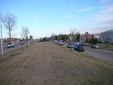
Mayfield Road is an arterial road
in west Edmonton
, Alberta
, Canada
.
It begins as 170 Street
north of Stony Plain Road
, and travels north-east for about ten blocks before it turns east and continues as 111 Avenue. Mayfield Road bounds the residential neighbourhoods of Britannia Youngstown
and Mayfield
to the east. To the west it bounds the industrial subdivisions of Youngstown Industrial, Stone Industrial, and West Sheffiend Industrial.
Arterial road
An arterial road, or arterial thoroughfare, is a high-capacity urban road. The primary function of an arterial road is to deliver traffic from collector roads to freeways, and between urban centres at the highest level of service possible. As such, many arteries are limited-access roads, or feature...
in west Edmonton
Edmonton
Edmonton is the capital of the Canadian province of Alberta and is the province's second-largest city. Edmonton is located on the North Saskatchewan River and is the centre of the Edmonton Capital Region, which is surrounded by the central region of the province.The city and its census...
, Alberta
Alberta
Alberta is a province of Canada. It had an estimated population of 3.7 million in 2010 making it the most populous of Canada's three prairie provinces...
, Canada
Canada
Canada is a North American country consisting of ten provinces and three territories. Located in the northern part of the continent, it extends from the Atlantic Ocean in the east to the Pacific Ocean in the west, and northward into the Arctic Ocean...
.
It begins as 170 Street
170 Street, Edmonton
170 Street is a major arterial road in west Edmonton, Alberta, Canada. It serves residential, commercial and industrial areas.Gervais / Hebert Road is a major arterial road in south St. Albert, Alberta, Canada. It serves residential and commercial areas.The portion of 170 Street between Whitemud...
north of Stony Plain Road
Stony Plain Road
Stony Plain Road is a major arterial road in west Edmonton, Alberta, Canada. Parkland Highway is an alternative route to the corresponding section of Alberta Highway 16 in Parkland County.-Parkland Highway:...
, and travels north-east for about ten blocks before it turns east and continues as 111 Avenue. Mayfield Road bounds the residential neighbourhoods of Britannia Youngstown
Britannia Youngstown, Edmonton
Britannia Youngstown is a residential neighbourhood in west Edmonton, Alberta, Canada. Originally part of the Town of Jasper Place, it became part of Edmonton when Jasper Place amalgamated with Edmonton in 1964....
and Mayfield
Mayfield, Edmonton
Mayfield is a neighbourhood in west Edmonton, Alberta, Canada named for famed Canadian aviator and bush pilot Wop May.It is bordered on the north by 111 Avenue, the east by 156 Street, to the south by 107 Avenue, and on the west by Mayfield Road....
to the east. To the west it bounds the industrial subdivisions of Youngstown Industrial, Stone Industrial, and West Sheffiend Industrial.
Interchanges and intersections
This is a list of major intersections, starting at the south end of Mayfield Road.| Direction | Intersecting road | Current intersection type | Coordinates |
|---|---|---|---|
| South-North | 100 Avenue 100 Avenue, Edmonton 100 Avenue is a major arterial road in west Edmonton, Alberta, Canada.The road starts as Stony Plain Road , and as it approaches Anthony Henday Drive it separates into westbound and eastbound one-way streets. The westbound lanes occupy 101 Avenue, however keeps the name Stony Plain Road, while the... / Stony Plain Road Stony Plain Road Stony Plain Road is a major arterial road in west Edmonton, Alberta, Canada. Parkland Highway is an alternative route to the corresponding section of Alberta Highway 16 in Parkland County.-Parkland Highway:... |
(as 170 Street) | 53°32′25"N 113°36′57"W |
| 170 Street 170 Street, Edmonton 170 Street is a major arterial road in west Edmonton, Alberta, Canada. It serves residential, commercial and industrial areas.Gervais / Hebert Road is a major arterial road in south St. Albert, Alberta, Canada. It serves residential and commercial areas.The portion of 170 Street between Whitemud... |
At-grade Y intersection (traffic lights) | 53°32′36"N 113°36′56"W | |
| 104A Avenue | At-grade | 53°32′55"N 113°36′40"W | |
| 107 Avenue 107 Avenue, Edmonton 107 Avenue is a major arterial road in west-central Edmonton, Alberta, Canada. It serves Edmonton's west side industrial distract, the old town of Jasper Place, the multicultural area north of Downtown Edmonton, Commonwealth Stadium, and adjacent park & ride transit centre... |
At-grade (traffic lights) | 53°33′7"N 113°36′30"W | |
| 109 Avenue | At-grade (traffic lights) | 53°33′21"N 113°36′19"W | |
| Southwest-Northeast | 163 Street / 111 Avenue | At-grade (traffic lights) | 53°33′31"N 113°36′9"W |