
Britannia Youngstown, Edmonton
Encyclopedia
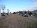
Britannia Youngstown is a residential neighbourhood in west Edmonton
, Alberta
, Canada
. Originally part of the Town of Jasper Place, it became part of Edmonton when Jasper Place amalgamated
with Edmonton in 1964.
 The neighbourhood is bounded on the west by Mayfield Road
, on the north by 107 Avenue
, on the east by 156 Street
, and on the south by Stony Plain Road
.
with only four out of ten being owner occupied. Almost half (48%)of residences in the neighbourhood are apartment
s in low rise buildings of five or fewer stories. Another 40% are single family dwellings, with almost all of the remainder being row houses (6%) and duplexes
(5%).
Average household income is lower than the Edmonton overall.
system, while St. Luke Catholic School is operated by Edmonton Caltholic School system.
The Edmonton Fire Department also operates a training facility in a former public high school in the neighbourhood's east end.
Residential neighbourhoods are Mayfield
to the north, High Park
to the north east, Canora
to the east, West Jasper Place to the south east, and Glenwood
to the south.
Industrial subdivisions are Youngstown Industrial to the west and north west, Stone Industrial to the west, and the commercial district of Place LaRue
to the south west.
Edmonton
Edmonton is the capital of the Canadian province of Alberta and is the province's second-largest city. Edmonton is located on the North Saskatchewan River and is the centre of the Edmonton Capital Region, which is surrounded by the central region of the province.The city and its census...
, Alberta
Alberta
Alberta is a province of Canada. It had an estimated population of 3.7 million in 2010 making it the most populous of Canada's three prairie provinces...
, Canada
Canada
Canada is a North American country consisting of ten provinces and three territories. Located in the northern part of the continent, it extends from the Atlantic Ocean in the east to the Pacific Ocean in the west, and northward into the Arctic Ocean...
. Originally part of the Town of Jasper Place, it became part of Edmonton when Jasper Place amalgamated
Amalgamation (politics)
A merger or amalgamation in a political or administrative sense is the combination of two or more political or administrative entities such as municipalities , counties, districts, etc. into a single entity. This term is used when the process occurs within a sovereign entity...
with Edmonton in 1964.
Mayfield Road, Edmonton
Mayfield Road is an arterial road in west Edmonton, Alberta, Canada.It begins as 170 Street north of Stony Plain Road, and travels north-east for about ten blocks before it turns east and continues as 111 Avenue. Mayfield Road bounds the residential neighbourhoods of Britannia Youngstown and...
, on the north by 107 Avenue
107 Avenue, Edmonton
107 Avenue is a major arterial road in west-central Edmonton, Alberta, Canada. It serves Edmonton's west side industrial distract, the old town of Jasper Place, the multicultural area north of Downtown Edmonton, Commonwealth Stadium, and adjacent park & ride transit centre...
, on the east by 156 Street
156 Street, Edmonton
156 Street is a major arterial road in west Edmonton, and east St. Albert, Alberta, Canada. In Edmonton, 156 Street runs through the old town of Jasper Place, and Edmonton's west industrial district. St. Albert names their roads, rather than numbering them, even if a street runs straight from...
, and on the south by Stony Plain Road
Stony Plain Road
Stony Plain Road is a major arterial road in west Edmonton, Alberta, Canada. Parkland Highway is an alternative route to the corresponding section of Alberta Highway 16 in Parkland County.-Parkland Highway:...
.
Residential development
A high proportion, approximately six out of ten, residences are rentedRenting
Renting is an agreement where a payment is made for the temporary use of a good, service or property owned by another. A gross lease is when the tenant pays a flat rental amount and the landlord pays for all property charges regularly incurred by the ownership from landowners...
with only four out of ten being owner occupied. Almost half (48%)of residences in the neighbourhood are apartment
Apartment
An apartment or flat is a self-contained housing unit that occupies only part of a building...
s in low rise buildings of five or fewer stories. Another 40% are single family dwellings, with almost all of the remainder being row houses (6%) and duplexes
Duplex (building)
The term duplex can be used to describe several different dwelling unit configurations:A duplex house is defined as a dwelling having apartments with separate entrances for two families. This includes two-story houses having a complete apartment on each floor and also side-by-side apartments on a...
(5%).
People
The average household size is 2.1 persons, with approximately seven out of ten households having one or two people.Average household income is lower than the Edmonton overall.
| Income By Household - 2001 Census | ||
| Income Range ($) | Britannia Youngstown | Edmonton |
|---|---|---|
| (% of Households) | (% of Households) | |
| Under $10,000 | 11.5%% | 6.3% |
| $10,000-$19,999 | 19.2% | 12.4% |
| $20,000-$29,999 | 17.3% | 11.9% |
| $30,000-$39,999 | 13.9% | 11.8% |
| $40,000-$49,999 | 9.0% | 10.9% |
| $50,000-$59,999 | 10.4% | 9.5% |
| $60,000-$69,999 | 5.1% | 8.3% |
| $70,000-$79,999 | 5.3% | 6.7% |
| $80,000-$89,999 | 3.5% | 5.4% |
| $90,000-$99,999 | 1.8% | 4.2%% |
| $100,000 and over | 3.0% | 12.6%% |
| Average household income | $37,853 | $57,360 |
Schools and training facilities
There are three schools in the neighbourhood. Youngstown Elementary School and Britannia Junior High School are operated by the Edmonton Public SchoolEdmonton Public Schools
Edmonton Public Schools is the largest public school district in Edmonton, Alberta, Canada. The district offers a variety of alternative and special needs programs, and many are offered in multiple locations to improve accessibility for students...
system, while St. Luke Catholic School is operated by Edmonton Caltholic School system.
The Edmonton Fire Department also operates a training facility in a former public high school in the neighbourhood's east end.
Shopping and services
The Mayfield Common shopping centre and the Westlawn Cemetery are located at the south west corner of the neighbourhood.Surrounding neighbourhoods
The neighbourhood is surrounded by a mixture of residential neighbourhoods and light industrial subdivisions.Residential neighbourhoods are Mayfield
Mayfield, Edmonton
Mayfield is a neighbourhood in west Edmonton, Alberta, Canada named for famed Canadian aviator and bush pilot Wop May.It is bordered on the north by 111 Avenue, the east by 156 Street, to the south by 107 Avenue, and on the west by Mayfield Road....
to the north, High Park
High Park, Edmonton
High Park is a neighbourhood in west Edmonton, Alberta, Canada. The neighbourhood became a part of Edmonton when the Town of Jasper Place amalgamated with Edmonton in 1964....
to the north east, Canora
Canora, Edmonton
Canora is a residential neighbourhood in west Edmonton, Alberta, Canada. Canora was originally part of the Town of Jasper Place, and became a part of Edmonton when Jasper Place amalgamated with the city in 1964....
to the east, West Jasper Place to the south east, and Glenwood
Glenwood, Edmonton
Glenwood is a large neighbourhood in west Edmonton, Alberta, Canada. The neighbourhood has a mixture of residential and commercial development...
to the south.
Industrial subdivisions are Youngstown Industrial to the west and north west, Stone Industrial to the west, and the commercial district of Place LaRue
Place LaRue, Edmonton
Place LaRue is a largely commercial neighbourhood located in west Edmonton, Alberta, Canada. According to the 2001 federal census, there were only 75 private dwellings located in the neighbourhood...
to the south west.