
Matoaca, Virginia
Encyclopedia
Matoaca is a census-designated place
(CDP) in Chesterfield County
, Virginia
, United States
. The population was 2,403 at the 2010 census. It is named after the Algonquian
princess Matoaka who was better known by her nickname "Pocahontas
".
According to the United States Census Bureau
, the CDP has a total area of 2.7 square miles (7 km²), of which 2.5 square miles (6.5 km²) is land and 0.1 square mile (0.258998811 km²), or 4.49%, is water.
of 2000, there were 2,273 people, 866 households, and 651 families residing in the CDP. The population density
was 892.0 people per square mile (344.2/km²). There were 911 housing units at an average density of 357.5/sq mi (137.9/km²). The racial makeup of the CDP was 65.55% White, 32.12% African American, 0.22% Native American, 0.31% Asian, 0.04% Pacific Islander, 0.26% from other races
, and 1.50% from two or more races. Hispanic or Latino of any race were 0.75% of the population.
There were 866 households out of which 34.2% had children under the age of 18 living with them, 53.8% were married couples
living together, 16.2% had a female householder with no husband present, and 24.8% were non-families. 20.8% of all households were made up of individuals and 9.6% had someone living alone who was 65 years of age or older. The average household size was 2.62 and the average family size was 3.03.
In the CDP the population was spread out with 27.2% under the age of 18, 6.2% from 18 to 24, 29.7% from 25 to 44, 22.9% from 45 to 64, and 14.0% who were 65 years of age or older. The median age was 38 years. For every 100 females there were 90.1 males. For every 100 females age 18 and over, there were 86.6 males.
The median income for a household in the CDP was $50,000, and the median income for a family was $56,163. Males had a median income of $33,722 versus $26,071 for females. The per capita income
for the CDP was $19,810. About 5.8% of families and 6.2% of the population were below the poverty line, including 2.9% of those under age 18 and 10.6% of those age 65 or over.
The local schools are Matoaca Middle School
and Matoaca High School
.
Census-designated place
A census-designated place is a concentration of population identified by the United States Census Bureau for statistical purposes. CDPs are delineated for each decennial census as the statistical counterparts of incorporated places such as cities, towns and villages...
(CDP) in Chesterfield County
Chesterfield County, Virginia
Chesterfield County is a county located in the Commonwealth of Virginia, a state of the United States. In 2010, its population was estimated to be 316,236. Chesterfield County is now the fourth-largest municipality in Virginia . Its county seat is Chesterfield...
, Virginia
Virginia
The Commonwealth of Virginia , is a U.S. state on the Atlantic Coast of the Southern United States. Virginia is nicknamed the "Old Dominion" and sometimes the "Mother of Presidents" after the eight U.S. presidents born there...
, United States
United States
The United States of America is a federal constitutional republic comprising fifty states and a federal district...
. The population was 2,403 at the 2010 census. It is named after the Algonquian
Algonquian peoples
The Algonquian are one of the most populous and widespread North American native language groups, with tribes originally numbering in the hundreds. Today hundreds of thousands of individuals identify with various Algonquian peoples...
princess Matoaka who was better known by her nickname "Pocahontas
Pocahontas
Pocahontas was a Virginia Indian notable for her association with the colonial settlement at Jamestown, Virginia. She was the daughter of Chief Powhatan, the head of a network of tributary tribal nations in Tidewater Virginia...
".
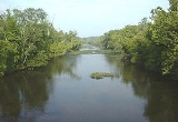
Geography
Matoaca is located at 37°13′41"N 77°28′14"W (37.228138, -77.470437).According to the United States Census Bureau
United States Census Bureau
The United States Census Bureau is the government agency that is responsible for the United States Census. It also gathers other national demographic and economic data...
, the CDP has a total area of 2.7 square miles (7 km²), of which 2.5 square miles (6.5 km²) is land and 0.1 square mile (0.258998811 km²), or 4.49%, is water.
Demographics
As of the censusCensus
A census is the procedure of systematically acquiring and recording information about the members of a given population. It is a regularly occurring and official count of a particular population. The term is used mostly in connection with national population and housing censuses; other common...
of 2000, there were 2,273 people, 866 households, and 651 families residing in the CDP. The population density
Population density
Population density is a measurement of population per unit area or unit volume. It is frequently applied to living organisms, and particularly to humans...
was 892.0 people per square mile (344.2/km²). There were 911 housing units at an average density of 357.5/sq mi (137.9/km²). The racial makeup of the CDP was 65.55% White, 32.12% African American, 0.22% Native American, 0.31% Asian, 0.04% Pacific Islander, 0.26% from other races
Race (United States Census)
Race and ethnicity in the United States Census, as defined by the Federal Office of Management and Budget and the United States Census Bureau, are self-identification data items in which residents choose the race or races with which they most closely identify, and indicate whether or not they are...
, and 1.50% from two or more races. Hispanic or Latino of any race were 0.75% of the population.
There were 866 households out of which 34.2% had children under the age of 18 living with them, 53.8% were married couples
Marriage
Marriage is a social union or legal contract between people that creates kinship. It is an institution in which interpersonal relationships, usually intimate and sexual, are acknowledged in a variety of ways, depending on the culture or subculture in which it is found...
living together, 16.2% had a female householder with no husband present, and 24.8% were non-families. 20.8% of all households were made up of individuals and 9.6% had someone living alone who was 65 years of age or older. The average household size was 2.62 and the average family size was 3.03.
In the CDP the population was spread out with 27.2% under the age of 18, 6.2% from 18 to 24, 29.7% from 25 to 44, 22.9% from 45 to 64, and 14.0% who were 65 years of age or older. The median age was 38 years. For every 100 females there were 90.1 males. For every 100 females age 18 and over, there were 86.6 males.
The median income for a household in the CDP was $50,000, and the median income for a family was $56,163. Males had a median income of $33,722 versus $26,071 for females. The per capita income
Per capita income
Per capita income or income per person is a measure of mean income within an economic aggregate, such as a country or city. It is calculated by taking a measure of all sources of income in the aggregate and dividing it by the total population...
for the CDP was $19,810. About 5.8% of families and 6.2% of the population were below the poverty line, including 2.9% of those under age 18 and 10.6% of those age 65 or over.
Education
See Chesterfield County Public SchoolsChesterfield County Public Schools
Chesterfield County Public Schools is the school system of Chesterfield County, Virginia, United States. Almost 59,000 students are enrolled in 62 Chesterfield public schools...
The local schools are Matoaca Middle School
Matoaca Middle School
Matoaca Middle School is school for grades 6-8 located in Chesterfield County, Virginia. The school was built in the Fall of 1975 The school derives its name from the Algonquian princess who was better known as Pocahontas .-School boundaries:...
and Matoaca High School
Matoaca High School
Matoaca High School is an American secondary school in the Matoaca community of unincorporated Chesterfield County, Virginia, United States. This is the newer campus of the school, the old school campus was converted into a middle school, currently Matoaca Middle School. The school's mascot is the...
.