
Maryland Route 8
Encyclopedia
Maryland Route 8 is a state highway
in the U.S. state
of Maryland
. Known for most of its length as Romancoke Road, the state highway runs 8.37 miles (13.5 km) from Romancoke Pier in Romancoke
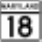
north to MD 18
in Stevensville
. MD 8 is the main north–south highway of Kent Island
in western Queen Anne's County
. The state highway is also the first highway encountered on U.S. Route 50
and US 301
east of the Chesapeake Bay Bridge
. South of Matapeake, Route 8 is paralleled by the Kent Island South Trail.
The section of MD 8 from Stevensville to Matapeake
was constructed in 1930 to serve the Annapolis
–Matapeake ferry service of the Claiborne-Annapolis Ferry Company
. The highway between Matapeake and Romancoke was constructed in 1938 to serve that company's Romancoke–Claiborne
ferry. The Stevensville–Matapeake road was originally designated MD 404
and was briefly part of US 50 in the early 1950s. The Matapeake–Romancoke highway was briefly MD 17 before becoming MD 33
. After the Chesapeake Bay Bridge opened in 1952, the MD 33 designation was extended north to Stevensville. MD 8 replaced MD 33 on Kent Island in 1960.
(Batts Neck Road), splits off and later rejoins the present alignment. MD 8 continues north through Matapeake, where the highway passes Matapeake State Park
, the former site of the cross-bay ferry. Just north of Bay Bridge Airport
, the state highway expands to a four-lane divided highway and intersects MD 835A
(Thompson Creek Service Road). Immediately to the north, MD 8 meets US 50 and US 301 (Blue Star Memorial Highway) at a diamond interchange
; this interchange, Exit 37, is the first exit east of the Chesapeake Bay Bridge. The highway's name changes to Business Parkway at the interchange, shortly before MD 8 reaches its northern terminus at MD 18. MD 18 heads north as Business Parkway toward Love Point
and east as Main Street toward the Stevensville Historic District
and Chester
.
. In 1939, the Romancoke–Matapeake highway was designated as a western extension of MD 17, which ran from Claiborne to Easton
. The highway became part of MD 33 in 1940 when MD 33 and MD 17 swapped numbers.
In 1949, US 50 was extended east of Annapolis and replaced MD 404 west of Wye Mills. As a result, the highway between Matapeake and Stevensville became US 50. When the Chesapeake Bay Bridge was completed in 1952, US 50 followed a new divided highway east toward Queenstown. MD 33 was extended north from Matapeake to MD 18 in Stevensville. The Romancoke–Claiborne ferry was discontinued by 1954, but MD 33 remained on Kent Island until it was replaced with the MD 8 designation in 1960. MD 8's interchange with US 50 and US 301 was completed by 1987. A divided highway, Business Parkway, was completed at the same time from south of the interchange to Love Point Road where MD 18 presently intersects MD 835C
north of the Stevensville Historic District. MD 8's northern terminus moved south to its present location when MD 18 was extended west to Business Parkway in 1989.
.
{| class=wikitable
!Location
!Mile
!Destinations
!Notes
|-
|rowspan=1|Romancoke
|0.00
|Romancoke Pier
|Southern terminus
|-
|rowspan=2|Normans
|4.23
|
|rowspan=2|Old alignment of MD 8
|-
|5.24
|
|-
|rowspan=3|Stevensville
|7.87
|
|MD 835A is signed as such
|-
|8.05
|
|US 50 / US 301 Exit 37; diamond interchange
|-
|8.37
|
|Northern terminus
State highway
State highway, state road or state route can refer to one of three related concepts, two of them related to a state or provincial government in a country that is divided into states or provinces :#A...
in the U.S. state
U.S. state
A U.S. state is any one of the 50 federated states of the United States of America that share sovereignty with the federal government. Because of this shared sovereignty, an American is a citizen both of the federal entity and of his or her state of domicile. Four states use the official title of...
of Maryland
Maryland
Maryland is a U.S. state located in the Mid Atlantic region of the United States, bordering Virginia, West Virginia, and the District of Columbia to its south and west; Pennsylvania to its north; and Delaware to its east...
. Known for most of its length as Romancoke Road, the state highway runs 8.37 miles (13.5 km) from Romancoke Pier in Romancoke
Romancoke, Maryland
Romancoke is an unincorporated community on Kent Island in Maryland, located at the southern end of Maryland Route 8. The United States Census Bureau defines an urban cluster for Romancoke, but not a census-designated place...
north to MD 18
Maryland Route 18
Maryland Route 18 is a state highway in the U.S. state of Maryland. The state highway runs from the beginning of state maintenance at Love Point east to MD 213 in Centreville...
in Stevensville
Stevensville, Maryland
Stevensville is a census-designated place in Queen Anne's County, Maryland, and is the county's most populous place among both CDPs and municipalities. The Stevensville Historic District is one of only two registered historic districts in the county, the other being the Centreville Historic...
. MD 8 is the main north–south highway of Kent Island
Kent Island, Maryland
Kent Island is the largest island in the Chesapeake Bay, and a historic place in Maryland. To the east, a narrow channel known as the Kent Narrows barely separates the island from the Delmarva Peninsula, and on the other side, the island is separated from Sandy Point, an area near Annapolis, by...
in western Queen Anne's County
Queen Anne's County, Maryland
Queen Anne's County is a county located on the Eastern Shore of the U.S. state of Maryland.As of 2010, the population was 47,798. Its county seat and most populous municipality is Centreville. The census-designated place of Stevensville is the county's most populous place...
. The state highway is also the first highway encountered on U.S. Route 50
U.S. Route 50 in Maryland
U.S. Route 50 is a major east–west route of the U.S. Highway system, stretching just over from Ocean City, Maryland on the Atlantic Ocean to West Sacramento, California. In the U.S. state of Maryland, US 50 exists in two sections. The longer of these serves as a major route connecting...
and US 301
U.S. Route 301 in Maryland
U.S. Route 301 in Maryland is a major highway that runs from Delaware to the Governor Harry W. Nice Memorial Bridge into Virginia. It passes through three of Maryland's four main regions: the Eastern Shore, the Baltimore-Washington Metropolitan Area, and Southern Maryland...
east of the Chesapeake Bay Bridge
Chesapeake Bay Bridge
The Chesapeake Bay Bridge is a major dual-span bridge in the U.S. state of Maryland. Spanning the Chesapeake Bay, it connects the state's rural Eastern Shore region with the more urban Western Shore. The original span opened in 1952 and, at the time, with a length of , it was the world's longest...
. South of Matapeake, Route 8 is paralleled by the Kent Island South Trail.
The section of MD 8 from Stevensville to Matapeake
Matapeake, Maryland
Matapeake is an unincorporated community located south of Stevensville on Kent Island, Maryland.It is named for the historic Matapeake Indian tribe, who lived there at the time of English colonization in 1631. Their chief village was on the southeast side of the island...
was constructed in 1930 to serve the Annapolis
Annapolis, Maryland
Annapolis is the capital of the U.S. state of Maryland, as well as the county seat of Anne Arundel County. It had a population of 38,394 at the 2010 census and is situated on the Chesapeake Bay at the mouth of the Severn River, south of Baltimore and about east of Washington, D.C. Annapolis is...
–Matapeake ferry service of the Claiborne-Annapolis Ferry Company
Claiborne-Annapolis Ferry Company
The Claiborne-Annapolis Ferry Company ran both passenger and automobile ferry service across the Chesapeake Bay from 1919 to 1952. The initial service was between Annapolis, Maryland on the western shore and Claiborne, Maryland on the eastern shore. In July 1930, a second shorter route was added...
. The highway between Matapeake and Romancoke was constructed in 1938 to serve that company's Romancoke–Claiborne
Claiborne, Maryland
Claiborne is an unincorporated community in Talbot County, Maryland. The village is located on the eastern shore of the Chesapeake Bay near the mouth of the Eastern Bay at , and uses ZIP code 21624. The 2000 U.S. Census lists the population as 147 and the number of homes as 84, slightly down from...
ferry. The Stevensville–Matapeake road was originally designated MD 404
Maryland Route 404
Maryland Route 404 is a major highway on Maryland's Eastern Shore in the United States. It runs from Maryland Route 662 in Wye Mills on the border of Queen Anne's and Talbot Counties, southeast to the Delaware state line in Caroline County, where the road continues as Delaware Route 404 to Nassau...
and was briefly part of US 50 in the early 1950s. The Matapeake–Romancoke highway was briefly MD 17 before becoming MD 33
Maryland Route 33
Maryland Route 33 is a state highway in the U.S. state of Maryland. The state highway runs from Tilghman Island east to Washington Street in Easton...
. After the Chesapeake Bay Bridge opened in 1952, the MD 33 designation was extended north to Stevensville. MD 8 replaced MD 33 on Kent Island in 1960.
Route description
MD 8 begins at the Romancoke Pier in the unincorporated community of Romancoke. The state highway heads west as two-lane Romancoke Road. MD 8 curves to the north, intersecting Kent Point Road on a tangent. The state highway passes a mix of farmland, forest, and residential subdivisions on its way north. In the hamlet of Normans, the old alignment of MD 8, MD 802Maryland Route 802
Maryland Route 802 is a state highway in the U.S. state of Maryland. Known as Batts Neck Road, the state highway runs as a north–south highway between junctions with MD 8 in Normans on Kent Island. MD 802 is the old alignment of MD 8 through Normans...
(Batts Neck Road), splits off and later rejoins the present alignment. MD 8 continues north through Matapeake, where the highway passes Matapeake State Park
Matapeake State Park
Matapeake State Park is a state park located in Matapeake, Kent Island, Maryland. Its location is the site of a former ferry landing that served the state-owned Chesapeake Bay Ferry System before the Chesapeake Bay Bridge opened. Today, the pier that once served the ferry is now used as a fishing...
, the former site of the cross-bay ferry. Just north of Bay Bridge Airport
Bay Bridge Airport
Bay Bridge Airport is a county-owned public-use airport located in Stevensville, Maryland. The airport is named for the nearby Chesapeake Bay Bridge and is mostly used for general aviation....
, the state highway expands to a four-lane divided highway and intersects MD 835A
Maryland Route 835
-External links:*...
(Thompson Creek Service Road). Immediately to the north, MD 8 meets US 50 and US 301 (Blue Star Memorial Highway) at a diamond interchange
Diamond interchange
A diamond interchange is a common type of road junction, used where a freeway crosses a minor road. The freeway itself is grade-separated from the minor road, one crossing the other over a bridge...
; this interchange, Exit 37, is the first exit east of the Chesapeake Bay Bridge. The highway's name changes to Business Parkway at the interchange, shortly before MD 8 reaches its northern terminus at MD 18. MD 18 heads north as Business Parkway toward Love Point
Love Point, Maryland
Love Point is the name for the northernmost tip of Kent Island, and as such, marks the southern point of the mouth of the Chester River. It has served as a major ferry terminal, the western terminus of the Queen Anne's Railroad, and the nominal western terminus of Maryland Route 18...
and east as Main Street toward the Stevensville Historic District
Stevensville Historic District
The Stevensville Historic District, also known as Historic Stevensville, is a national historic district in downtown Stevensville, Queen Anne's County, Maryland. It contains roughly 100 historic structures, and is listed on the National Register of Historic Places...
and Chester
Chester, Maryland
Chester is a census-designated place on Kent Island in Queen Anne's County, Maryland, United States. The population was 3,723 at the 2000 census.-Geography:Chester is located at ....
.
History
The first section of present MD 8, from Stevensville to the Matapeake ferry landing, was paved in 1930 to serve the newly-inaugurated Annapolis–Matapeake ferry across the Chesapeake Bay in 1930. The highway was designated as a westward extension of MD 404 in 1933. The highway from Matapeake to Romancoke was built in 1938 to serve the newly-inaugurated Romancoke–Claiborne ferry across Eastern BayEastern Bay
The Eastern Bay is a tributary of the Chesapeake Bay located between Queen Anne's County, Maryland and Talbot County, Maryland on the Eastern Shore. Its main tributaries include the Miles River and the Wye River...
. In 1939, the Romancoke–Matapeake highway was designated as a western extension of MD 17, which ran from Claiborne to Easton
Easton, Maryland
Easton, founded 1710, is a town within the Easton District of Talbot County, Maryland, United States. The population was 11,708 at the 2000 census, and 14,677 according to current July 2008 census estimates. It is the county seat of Talbot County. The primary ZIP Code is 21601, and the...
. The highway became part of MD 33 in 1940 when MD 33 and MD 17 swapped numbers.
In 1949, US 50 was extended east of Annapolis and replaced MD 404 west of Wye Mills. As a result, the highway between Matapeake and Stevensville became US 50. When the Chesapeake Bay Bridge was completed in 1952, US 50 followed a new divided highway east toward Queenstown. MD 33 was extended north from Matapeake to MD 18 in Stevensville. The Romancoke–Claiborne ferry was discontinued by 1954, but MD 33 remained on Kent Island until it was replaced with the MD 8 designation in 1960. MD 8's interchange with US 50 and US 301 was completed by 1987. A divided highway, Business Parkway, was completed at the same time from south of the interchange to Love Point Road where MD 18 presently intersects MD 835C
Maryland Route 835
-External links:*...
north of the Stevensville Historic District. MD 8's northern terminus moved south to its present location when MD 18 was extended west to Business Parkway in 1989.
Junction list
The entire route is in Queen Anne's CountyQueen Anne's County, Maryland
Queen Anne's County is a county located on the Eastern Shore of the U.S. state of Maryland.As of 2010, the population was 47,798. Its county seat and most populous municipality is Centreville. The census-designated place of Stevensville is the county's most populous place...
.
{| class=wikitable
!Location
!Mile
!Destinations
!Notes
|-
|rowspan=1|Romancoke
Romancoke, Maryland
Romancoke is an unincorporated community on Kent Island in Maryland, located at the southern end of Maryland Route 8. The United States Census Bureau defines an urban cluster for Romancoke, but not a census-designated place...
|0.00
|Romancoke Pier
|Southern terminus
|-
|rowspan=2|Normans
|4.23
|
|rowspan=2|Old alignment of MD 8
|-
|5.24
|
|-
|rowspan=3|Stevensville
Stevensville, Maryland
Stevensville is a census-designated place in Queen Anne's County, Maryland, and is the county's most populous place among both CDPs and municipalities. The Stevensville Historic District is one of only two registered historic districts in the county, the other being the Centreville Historic...
|7.87
|
|MD 835A is signed as such
|-
|8.05
|
|US 50 / US 301 Exit 37; diamond interchange
|-
|8.37
|
|Northern terminus