
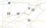
Maryland Route 135
Encyclopedia
Maryland Route 135 is a state highway
in the U.S. state
of Maryland
. Known for most of its length as Maryland Highway, the state highway runs 29 miles (46.7 km) from U.S. Route 219
(US 219) in Oakland
in Garrett County
east to US 220
in McCoole
in Allegany County
. MD 135 is the main link between the towns of Oakland, Mountain Lake Park
, Loch Lynn Heights
, and Deer Park
on the Appalachian Plateau
and the communities of Bloomington
, Luke
, Westernport
, and McCoole in the upper valley of the Potomac River
. These groups of towns are separated by Backbone Mountain
.
MD 135 was originally built in the early 1930s as a link between McCoole and Westernport. In the late 1930s, the state highway was extended west to Bloomington. In addition, a separate segment of MD 135 was completed around Swanton
in the mid 1930s. These separate segments were unified in the early 1950s when the highway over Backbone Mountain was completed. In the late 1950s, MD 135 was extended west over a portion of MD 38
and all of MD 41
to Oakland, and was mostly rebuilt over its entire length, bypassing Bloomington, Swanton, Deer Park, and Mountain Lake Park. MD 135 remains notorious for the eastbound descent from Backbone Mountain, which has claimed many lives. The Maryland State Highway Administration
has instituted many measures to get trucks down the mountain safely and to avoid the downgrade if possible.
(Paull Street), which heads south into Loch Lynn Heights. After crossing the river again, MD 135 leaves Mountain Lake Park. The state highway passes scattered residences, farms, and businesses before entering Deer Park. After passing Deer Park Hotel Road, which passes the Pennington Cottage
, MD 135 intersects the old alignment of MD 38, which is Sand Flat Road to the north and Main Street to the south. The state highway passes the historic home Glamorgan and Edgewood Drive, part of the old alignment of MD 38, before leaving Deer Park. Upon reaching the hamlet of Altamont
, MD 495
(Swanton Road) continues straight northeast toward Swanton while MD 135 turns to the southeast.
MD 135 heads straight southeast toward a grade-separated crossing of CSX
's Mountain Subdivision
very close to the railroad's crossing of the Eastern Continental Divide
. The state highway curves to the northeast and gently ascends Backbone Mountain
. A scenic overlook marks the highest point on MD 135 (2969 feet (905 m)) shortly before the intersection with MD 38 (Kitzmiller Road). The state highway continues northeast along the ridgeline through Potomac-Garrett State Forest
, intersecting the old alignment of MD 135, Swanton Road, and a few roads on the south side of the highway that access Jennings Randolph Lake
. Upon leaving the state forest, MD 135 begins to pass scattered residences ahead of the descent of Backbone Mountain, which has grades as steep as 9%. Trucks are required to stop at three different brake check locations and obey a posted speed limit of 10 mph (16.1 km/h). After Bloomington Hill Road splits to the north and the state highway passes the third brake check stop, a runaway truck ramp
splits to the south. The downhill grade eases as MD 135 enters Bloomington, where the name of the highway changes to Bloomington Road. After passing through residential areas, the state highway crosses the Mountain Subdivision and the Savage River
before meeting Savage Hillside Road at a T intersection in front of Franklin Hill.
MD 135 turns southeast into Allegany County and enters the town of Luke as Pratt Street. The state highway immediately intersects the eastern end of the western segment of West Virginia Route 46 (WV 46). At a bend in the Potomac River, MD 135 makes a sharp turn to the north around the mountain and the road passes the large NewPage Corporation
paper mill. The state highway turns east and its name changes to Church Street upon entering Westernport, where the highway intersects MD 36
(New Georges Creek Road), which crosses the Potomac River to become the eastern segment of WV 46. MD 135 crosses Georges Creek
and meets the Georges Creek Railway
at-grade before intersecting Main Street, which is unsigned MD 937
. Upon leaving Westernport, the road's name changes to McCoole–Westernport Road. MD 135 parallels the Potomac River and Georges Creek Railway as it passes scattered residences and businesses. Upon reaching McCoole, the highway passes unsigned MD 135A, which provides an alternate access route to US 220 north. Shortly after, MD 135 reaches Paxton Street. Paxton Street, which is MD 135B, is marked as MD 135 and leads to a junction with US 220 (McMullen Highway). MD 135 itself continues east under the McCoole–Keyser
bridge to its eastern terminus at the intersection of Queens Point Road and Golden Cross Street.
was under construction by 1930 and completed by 1933. MD 41 included the first section of what is now MD 135 to be constructed; the segment of the state highway between Oakland and Mountain Lake Park was paved between 1916 and 1919. The state highway was extended past Loch Lynn Heights in 1933 and to MD 38 in Deer Park by 1938.
A second, disconnected segment of MD 135 was constructed in two sections between MD 38 in Altamont and Swanton that were completed in 1933 and 1935. This road was extended east to the top of Backbone Mountain in 1939. The discontinuous segments of MD 135 were unified in 1953 when the pre-existing Bloomington Road was reconstructed between the eastern end of the western MD 135 on top of Backbone Mountain and the western end of the eastern MD 135 in Bloomington. When the present US 220 bridge over the Potomac River was completed in 1951, MD 135 was extended east from its old intersection with US 220, which is today the intersection with MD 135A, to its present eastern terminus.
MD 135 attained its present alignment through several projects in the mid to late 1950s, concurrent with MD 135's extension west over part of MD 38 and all of MD 41 to Oakland in 1956. The segment of MD 38 in Deer Park was bypassed by the newly extended state highway in 1956. The state highway between McCoole and Westernport was relocated, and Bloomington Hill Road was bypassed with a straighter highway featuring a grade-separated crossing of the railroad in Bloomington in 1956 and 1957. The present section of MD 135 between MD 38 and Swanton Road was built in 1955 and 1956; MD 135 was then removed through Swanton and partially replaced by MD 495. The segment between Swanton Road and Bloomington Hill Road was upgraded between 1953 and 1956. Finally, the portion of MD 135 between Deer Park and Oakland, including the bypass of Mountain Lake Park, was rebuilt between 1957 and 1959.
Since the present alignment of MD 135 was completed west of Bloomington in the late 1950s, the descent of Backbone Mountain has become notorious due to its steep grade and the 90 degree turn at the bottom to avoid a mountain dead ahead. A retaining wall at the bottom of the mountain features white crosses in memoriam of those who lost their lives; there were 24 crosses painted as of 2009. After five people had been killed on the descent by 1965, the State Roads Commission responded in 1967 by enacting the truck speed limit of 10 mph (16.1 km/h), marking the three mandatory stopping areas, and installing ample warning signage, including the infamous "If Brakes Fail Ditch Truck Immediately" sign. In 1997, signs were installed on Interstate 68
, US 219, and US 40
advising truckers to use MD 36 instead of MD 135 to access Luke and Westernport. The runaway truck ramp was installed by 2005 and supplemented with a runaway truck warning system and updated signage in 2007.
!County
!Location
!Mile
!Destinations
!Notes
|-
|rowspan=11|Garrett
|Oakland
|0.00
|, Thomas, WV
|Western terminus
|-
|rowspan=3|Mountain Lake Park
|0.12
|Oakland Drive east
|rowspan=2|Unsigned MD 825B; old alignment of MD 135
|-
|0.95
|G Street north
|-
|1.47
|
|
|-
|rowspan=2|Deer Park
|4.77
|Sand Flat Road north / Main Street south – Deep Creek Lake
|rowspan=2|Old alignment of MD 38
|-
|5.69
|Edgewood Drive west
|-
|Altamont
|7.38
|
|Old alignment of MD 135
|-
|rowspan=2|
|11.07
|
|
|-
|13.13
|Swanton Road west to
|Old alignment of MD 135
|-
|rowspan=2|Bloomington
|19.69
|Bloomington Hill Road
|Old alignment of MD 135
|-
|21.80
|Savage Hillside Road west
|MD 135 turns east at this intersection
|-
|rowspan=6|Allegany
|rowspan=1|Luke
|
| – Beryl, WV
, Elk Garden, WV
|Unsigned MD 135D
|-
|rowspan=2|Westernport
|
| to – Lonaconing
, Frostburg
, Piedmont, WV
|
|-
|
|
|Old alignment of MD 36
|-
|rowspan=3|McCoole
|
|To
|Unsigned MD 135A
|-
|
|Paxton Street to , Keyser, WV
|Unsigned MD 135B
|-
|29.00
|Queens Point Road east / Golden Cross Street north
|Eastern terminus
State highway
State highway, state road or state route can refer to one of three related concepts, two of them related to a state or provincial government in a country that is divided into states or provinces :#A...
in the U.S. state
U.S. state
A U.S. state is any one of the 50 federated states of the United States of America that share sovereignty with the federal government. Because of this shared sovereignty, an American is a citizen both of the federal entity and of his or her state of domicile. Four states use the official title of...
of Maryland
Maryland
Maryland is a U.S. state located in the Mid Atlantic region of the United States, bordering Virginia, West Virginia, and the District of Columbia to its south and west; Pennsylvania to its north; and Delaware to its east...
. Known for most of its length as Maryland Highway, the state highway runs 29 miles (46.7 km) from U.S. Route 219
U.S. Route 219 in Maryland
U.S. Route 219 is a part of the U.S. Highway System that runs from Rich Creek, Virginia to West Seneca, New York. In the U.S. state of Maryland, the federal highway runs from the West Virginia state line near Red House to the Pennsylvania state line near Grantsville...
(US 219) in Oakland
Oakland, Maryland
Oakland is a town in the west-central part of Garrett County, Maryland, United States. With a population of 1,925 according to United States Census 2010 figures, it is the most populated community in Garrett County...
in Garrett County
Garrett County, Maryland
Garrett County is the westernmost county of the U.S. state of Maryland. Created from Allegany County, Maryland in 1872 it was the last Maryland county to be formed. It was named for John Work Garrett , railroad executive, industrialist, and financier. Garrett served as president of the Baltimore...
east to US 220
U.S. Route 220 in Maryland
U.S. Route 220 is a part in the U.S. Highway System that runs from Rockingham, North Carolina to Waverly, New York. In Maryland, the federal highway runs from the West Virginia state line at the Potomac River in McCoole north to the Pennsylvania state line in Dickens...
in McCoole
McCoole, Maryland
McCoole is an unincorporated community in Allegany County, Maryland, USA. It is located at the intersection of U.S. Route 220 and the east end of Maryland Route 135. McCoole lies directly across the North Branch Potomac River from Keyser, West Virginia. McCoole had its own post office in operation...
in Allegany County
Allegany County, Maryland
Allegany County is a county located in the northwestern part of the US state of Maryland. It is part of the Cumberland, MD-WV Metropolitan Statistical Area. As of 2010, the population was 75,087. Its county seat is Cumberland...
. MD 135 is the main link between the towns of Oakland, Mountain Lake Park
Mountain Lake Park, Maryland
Mountain Lake Park is a town in Garrett County, Maryland, in the United States. As of the 2000 census, the town population was 2,248.-History:Mountain Lake Park Historic District was listed on the National Register of Historic Places in 1983...
, Loch Lynn Heights
Loch Lynn Heights, Maryland
Loch Lynn Heights is a town in Garrett County, Maryland, United States. The population was 469 at the 2000 census.-Geography:Loch Lynn Heights is located at ....
, and Deer Park
Deer Park, Maryland
Deer Park is a town in Garrett County, Maryland, United States. The population was 399 at the 2010 census.-Geography:Deer Park is located at ....
on the Appalachian Plateau
Appalachian Plateau
The Appalachian Plateau is the western part of the Appalachian mountains, stretching from New York and Alabama. The plateau is a second level United States physiographic region....
and the communities of Bloomington
Bloomington, Maryland
Bloomington is an unincorporated town at the confluence of the North Branch Potomac River and Savage River in southeastern Garrett County, Maryland...
, Luke
Luke, Maryland
Luke is a town in Allegany County, Maryland, United States located along the Georges Creek Valley. Known originally as West Piedmont, the town is part of the Cumberland, MD-WV Metropolitan Statistical Area. The population was 80 at the 2000 census....
, Westernport
Westernport, Maryland
Westernport is a town in Allegany County, Maryland, United States, located along the Georges Creek Valley. It is part of the Cumberland, MD-WV Metropolitan Statistical Area. The population was 2,104 at the 2000 census.-History:...
, and McCoole in the upper valley of the Potomac River
Potomac River
The Potomac River flows into the Chesapeake Bay, located along the mid-Atlantic coast of the United States. The river is approximately long, with a drainage area of about 14,700 square miles...
. These groups of towns are separated by Backbone Mountain
Backbone Mountain
Backbone Mountain is a ridge of the Allegheny Mountains of the central Appalachian Mountain Range. It is situated in the U.S. states of West Virginia and Maryland and forms a portion of the Eastern Continental Divide...
.
MD 135 was originally built in the early 1930s as a link between McCoole and Westernport. In the late 1930s, the state highway was extended west to Bloomington. In addition, a separate segment of MD 135 was completed around Swanton
Swanton, Maryland
Swanton is an unincorporated town in Garrett County, Maryland. Swanton is close to several recreation areas like Deep Creek Lake State Park.Anderson Chapel was listed on the National Register of Historic Places in 1984.-Demographics:...
in the mid 1930s. These separate segments were unified in the early 1950s when the highway over Backbone Mountain was completed. In the late 1950s, MD 135 was extended west over a portion of MD 38
Maryland Route 38
Maryland Route 38 is a state highway in the U.S. state of Maryland. Known as Kitzmiller Road, the state highway runs from the West Virginia state line at the Potomac River in Kitzmiller, where the highway continues south as West Virginia Route 42 , north to MD 135 on top of Backbone Mountain...
and all of MD 41
Maryland Route 41
Maryland Route 41 is a state highway in the U.S. state of Maryland. Known for most of its length as Perring Parkway, the state highway runs from MD 147 in Baltimore north to Waltham Woods Road in Carney. MD 41 is a four- to six-lane divided highway that connects portions of Northeast Baltimore,...
to Oakland, and was mostly rebuilt over its entire length, bypassing Bloomington, Swanton, Deer Park, and Mountain Lake Park. MD 135 remains notorious for the eastbound descent from Backbone Mountain, which has claimed many lives. The Maryland State Highway Administration
Maryland State Highway Administration
The Maryland State Highway Administration is the state agency responsible for maintaining Maryland numbered highways outside of Baltimore City...
has instituted many measures to get trucks down the mountain safely and to avoid the downgrade if possible.
Route description
MD 135 begins at an intersection with US 219 on the eastern edge of Oakland. Northbound US 219 (Oak Street) continues straight west into downtown Oakland, southbound US 219 (Garrett Highway) heads south toward Red House, and 9th Street heads north along the alignment of the future Oakland Bypass. MD 135 heads east through Mountain Lake Park as Maryland Highway, a controlled access two-lane highway. Oakland Drive, the old alignment of MD 135 and unsigned MD 825B, splits to the northeast to serve residential areas on the north side of town. The old alignment rejoins MD 135 at G Street before access controls cease upon crossing the Little Youghiogheny River. The state highway intersects MD 560Maryland Route 560
Maryland Route 560 is a state highway in the U.S. state of Maryland. Known for most of its length as Gorman Road, the state highway runs from U.S. Route 50 in Gorman north to MD 135 in Mountain Lake Park. MD 560 serves as the main street of Loch Lynn Heights...
(Paull Street), which heads south into Loch Lynn Heights. After crossing the river again, MD 135 leaves Mountain Lake Park. The state highway passes scattered residences, farms, and businesses before entering Deer Park. After passing Deer Park Hotel Road, which passes the Pennington Cottage
Pennington Cottage
The Pennington Cottage is a historic home located at Deer Park, Garrett County, Maryland, United States. It is a -story, late-19th-century Shingle-Style frame structure, with a gambrel roof and a one-story porch that stretches across the principal facade and along portions of the sides. The house...
, MD 135 intersects the old alignment of MD 38, which is Sand Flat Road to the north and Main Street to the south. The state highway passes the historic home Glamorgan and Edgewood Drive, part of the old alignment of MD 38, before leaving Deer Park. Upon reaching the hamlet of Altamont
Altamont, Maryland
Altamont is an unincorporated community in Garrett County, Maryland, United States. Altamont sits on the Eastern Continental Divide between the watershed of Crabtree Creek, which flows into the Savage River and eventually into the Atlantic Ocean, and the watershed of the Little Youghiogheny River,...
, MD 495
Maryland Route 495
Maryland Route 495 is a state highway in the U.S. state of Maryland. Known for most of its length as Bittinger Road, the state highway runs from MD 135 in Altamont north to U.S. Route 40 Alternate in Grantsville. MD 495 passes through rural areas of central Garrett County, connecting Bittinger...
(Swanton Road) continues straight northeast toward Swanton while MD 135 turns to the southeast.
MD 135 heads straight southeast toward a grade-separated crossing of CSX
CSX Transportation
CSX Transportation operates a Class I railroad in the United States known as the CSX Railroad. It is the main subsidiary of the CSX Corporation. The company is headquartered in Jacksonville, Florida, and owns approximately 21,000 route miles...
's Mountain Subdivision
Mountain Subdivision
The Mountain Subdivision is a railroad line owned and operated by CSX Transportation in the U.S. states of Maryland and West Virginia. The line runs from Cumberland, Maryland west to Grafton, West Virginia along the original Baltimore and Ohio Rail Road main line...
very close to the railroad's crossing of the Eastern Continental Divide
Eastern Continental Divide
The Eastern Continental Divide, in conjunction with other continental divides of North America, demarcates two watersheds of the Atlantic Ocean: the Gulf of Mexico watershed and the Atlantic Seaboard watershed. Prior to 1760, the divide represented the boundary between British and French colonial...
. The state highway curves to the northeast and gently ascends Backbone Mountain
Backbone Mountain
Backbone Mountain is a ridge of the Allegheny Mountains of the central Appalachian Mountain Range. It is situated in the U.S. states of West Virginia and Maryland and forms a portion of the Eastern Continental Divide...
. A scenic overlook marks the highest point on MD 135 (2969 feet (905 m)) shortly before the intersection with MD 38 (Kitzmiller Road). The state highway continues northeast along the ridgeline through Potomac-Garrett State Forest
Potomac-Garrett State Forest
Potomac-Garrett State Forest is a state forest in the state of Maryland.-External links:*...
, intersecting the old alignment of MD 135, Swanton Road, and a few roads on the south side of the highway that access Jennings Randolph Lake
Jennings Randolph Lake
Jennings Randolph Lake is a reservoir of located on the North Branch Potomac River in Garrett County, Maryland and Mineral County, West Virginia. It is approximately eight miles upstream of Bloomington, Maryland, and approximately five miles north of Elk Garden, West Virginia.-Construction and...
. Upon leaving the state forest, MD 135 begins to pass scattered residences ahead of the descent of Backbone Mountain, which has grades as steep as 9%. Trucks are required to stop at three different brake check locations and obey a posted speed limit of 10 mph (16.1 km/h). After Bloomington Hill Road splits to the north and the state highway passes the third brake check stop, a runaway truck ramp
Runaway truck ramp
A runaway truck ramp, runaway truck lane, emergency escape ramp or truck arrester bed is a traffic device that enables vehicles that are having braking problems to safely stop. It is typically a long, sand or gravel-filled lane adjacent to a road with a steep grade, and is designed to accommodate...
splits to the south. The downhill grade eases as MD 135 enters Bloomington, where the name of the highway changes to Bloomington Road. After passing through residential areas, the state highway crosses the Mountain Subdivision and the Savage River
Savage River (Maryland)
The Savage River is a river in Garrett County, Maryland, and is the first major tributary of the North Branch Potomac River from its source. The river was named for 18th century surveyor John Savage....
before meeting Savage Hillside Road at a T intersection in front of Franklin Hill.
MD 135 turns southeast into Allegany County and enters the town of Luke as Pratt Street. The state highway immediately intersects the eastern end of the western segment of West Virginia Route 46 (WV 46). At a bend in the Potomac River, MD 135 makes a sharp turn to the north around the mountain and the road passes the large NewPage Corporation
NewPage Corporation
NewPage Corporation, based in Miamisburg, Ohio, is a leading producer of coated paper in North America.The company produces coated papers in sheets and rolls with many finishes and weights to offer design flexibility for a wide array of end uses...
paper mill. The state highway turns east and its name changes to Church Street upon entering Westernport, where the highway intersects MD 36
Maryland Route 36
Maryland Route 36 is a state highway located in Allegany County, Maryland, United States. MD 36's southern terminus is at the WV 46 bridge in Westernport and its northern terminus at U.S. Route 40 Alternate near Cumberland...
(New Georges Creek Road), which crosses the Potomac River to become the eastern segment of WV 46. MD 135 crosses Georges Creek
Georges Creek
Georges Creek is a tributary stream of the North Branch Potomac River in western Maryland. The creek has its headwaters near Frostburg and empties into the North Branch Potomac River at Westernport, all in western Allegany County. Along the Georges Creek Valley, there exists a series of small...
and meets the Georges Creek Railway
Georges Creek Railway
The Georges Creek Railway is a shortline railroad in Western Maryland. Headquartered in Luke, the line rosters seven locomotives, including six historic Western Maryland Railway units , and a former Pennsylvania Railroad T-6 switcher.Operating since December 2007 on former CSX Transportation...
at-grade before intersecting Main Street, which is unsigned MD 937
Maryland Route 937
Maryland Route 937 is a state highway in the U.S. state of Maryland. The state highway runs from MD 135 north to MD 36 within Westernport. MD 937 is the old alignment of MD 36 through Westernport in the Georges Creek Valley of western Allegany County...
. Upon leaving Westernport, the road's name changes to McCoole–Westernport Road. MD 135 parallels the Potomac River and Georges Creek Railway as it passes scattered residences and businesses. Upon reaching McCoole, the highway passes unsigned MD 135A, which provides an alternate access route to US 220 north. Shortly after, MD 135 reaches Paxton Street. Paxton Street, which is MD 135B, is marked as MD 135 and leads to a junction with US 220 (McMullen Highway). MD 135 itself continues east under the McCoole–Keyser
Keyser, West Virginia
Keyser is a city in and the county seat of Mineral County, West Virginia, United States. It is part of the Cumberland, MD-WV Metropolitan Statistical Area. The population was 5,303 at the 2000 census.- History :...
bridge to its eastern terminus at the intersection of Queens Point Road and Golden Cross Street.
History
The present course of MD 135 consists of the original course of the state highway and its extensions westward, and assumption of a portion of MD 38 and all of MD 41. MD 135 also followed a segment of what is today MD 495. The original segment of MD 135 was under construction between McCoole and Westernport in 1930 and completed by 1931. The state highway was constructed between Bloomington and Luke in 1936 and 1937, including the bridge over the Savage River. This segment was connected to Westernport in 1940 by carving a roadbed out of the cliffs of Franklin Hill. MD 38 was paved from its original northern terminus to Altamont between 1924 and 1926 and to the top of Backbone Mountain by 1930. The present segment of MD 38 south to KitzmillerKitzmiller, Maryland
Kitzmiller is a town in Garrett County, Maryland, United States. The population was 302 at the 2000 census.-Geography:Kitzmiller is located at ....
was under construction by 1930 and completed by 1933. MD 41 included the first section of what is now MD 135 to be constructed; the segment of the state highway between Oakland and Mountain Lake Park was paved between 1916 and 1919. The state highway was extended past Loch Lynn Heights in 1933 and to MD 38 in Deer Park by 1938.
A second, disconnected segment of MD 135 was constructed in two sections between MD 38 in Altamont and Swanton that were completed in 1933 and 1935. This road was extended east to the top of Backbone Mountain in 1939. The discontinuous segments of MD 135 were unified in 1953 when the pre-existing Bloomington Road was reconstructed between the eastern end of the western MD 135 on top of Backbone Mountain and the western end of the eastern MD 135 in Bloomington. When the present US 220 bridge over the Potomac River was completed in 1951, MD 135 was extended east from its old intersection with US 220, which is today the intersection with MD 135A, to its present eastern terminus.
MD 135 attained its present alignment through several projects in the mid to late 1950s, concurrent with MD 135's extension west over part of MD 38 and all of MD 41 to Oakland in 1956. The segment of MD 38 in Deer Park was bypassed by the newly extended state highway in 1956. The state highway between McCoole and Westernport was relocated, and Bloomington Hill Road was bypassed with a straighter highway featuring a grade-separated crossing of the railroad in Bloomington in 1956 and 1957. The present section of MD 135 between MD 38 and Swanton Road was built in 1955 and 1956; MD 135 was then removed through Swanton and partially replaced by MD 495. The segment between Swanton Road and Bloomington Hill Road was upgraded between 1953 and 1956. Finally, the portion of MD 135 between Deer Park and Oakland, including the bypass of Mountain Lake Park, was rebuilt between 1957 and 1959.
Since the present alignment of MD 135 was completed west of Bloomington in the late 1950s, the descent of Backbone Mountain has become notorious due to its steep grade and the 90 degree turn at the bottom to avoid a mountain dead ahead. A retaining wall at the bottom of the mountain features white crosses in memoriam of those who lost their lives; there were 24 crosses painted as of 2009. After five people had been killed on the descent by 1965, the State Roads Commission responded in 1967 by enacting the truck speed limit of 10 mph (16.1 km/h), marking the three mandatory stopping areas, and installing ample warning signage, including the infamous "If Brakes Fail Ditch Truck Immediately" sign. In 1997, signs were installed on Interstate 68
Interstate 68
Interstate 68 is a Interstate highway in the U.S. states of West Virginia and Maryland, connecting in Morgantown to in Hancock. is also Corridor E of the Appalachian Development Highway System. From 1965 until the freeway's construction was completed in 1991, it was designated as...
, US 219, and US 40
U.S. Route 40 in Maryland
U.S. Route 40 in the U.S. state of Maryland runs from western Maryland to Cecil County in the state's northeastern corner. With a total length of over , it is the longest numbered highway in Maryland. Almost half of the road overlaps with Interstate 68 or Interstate 70, while the old alignment...
advising truckers to use MD 36 instead of MD 135 to access Luke and Westernport. The runaway truck ramp was installed by 2005 and supplemented with a runaway truck warning system and updated signage in 2007.
Junction list
{| class=wikitable!County
!Location
!Mile
!Destinations
!Notes
|-
|rowspan=11|Garrett
Garrett County, Maryland
Garrett County is the westernmost county of the U.S. state of Maryland. Created from Allegany County, Maryland in 1872 it was the last Maryland county to be formed. It was named for John Work Garrett , railroad executive, industrialist, and financier. Garrett served as president of the Baltimore...
|Oakland
Oakland, Maryland
Oakland is a town in the west-central part of Garrett County, Maryland, United States. With a population of 1,925 according to United States Census 2010 figures, it is the most populated community in Garrett County...
|0.00
|, Thomas, WV
Thomas, West Virginia
Thomas is a city in Tucker County, West Virginia, United States. The population was 452 at the 2000 census.-History:The town was named for Thomas Beall Davis....
|Western terminus
|-
|rowspan=3|Mountain Lake Park
Mountain Lake Park, Maryland
Mountain Lake Park is a town in Garrett County, Maryland, in the United States. As of the 2000 census, the town population was 2,248.-History:Mountain Lake Park Historic District was listed on the National Register of Historic Places in 1983...
|0.12
|Oakland Drive east
|rowspan=2|Unsigned MD 825B; old alignment of MD 135
|-
|0.95
|G Street north
|-
|1.47
|
|
|-
|rowspan=2|Deer Park
Deer Park, Maryland
Deer Park is a town in Garrett County, Maryland, United States. The population was 399 at the 2010 census.-Geography:Deer Park is located at ....
|4.77
|Sand Flat Road north / Main Street south – Deep Creek Lake
Deep Creek Lake, Maryland
Deep Creek Lake State Park is a popular vacation area in Garrett County, Maryland, USA. It surrounds a reservoir that was created by the construction of the Deep Creek Dam in 1923 by the Pennsylvania Electric Company on a tributary of the Youghiogheny River. The lake was purchased by the state of...
|rowspan=2|Old alignment of MD 38
Maryland Route 38
Maryland Route 38 is a state highway in the U.S. state of Maryland. Known as Kitzmiller Road, the state highway runs from the West Virginia state line at the Potomac River in Kitzmiller, where the highway continues south as West Virginia Route 42 , north to MD 135 on top of Backbone Mountain...
|-
|5.69
|Edgewood Drive west
|-
|Altamont
Altamont, Maryland
Altamont is an unincorporated community in Garrett County, Maryland, United States. Altamont sits on the Eastern Continental Divide between the watershed of Crabtree Creek, which flows into the Savage River and eventually into the Atlantic Ocean, and the watershed of the Little Youghiogheny River,...
|7.38
|
|Old alignment of MD 135
|-
|rowspan=2|
|11.07
|
|
|-
|13.13
|Swanton Road west to
|Old alignment of MD 135
|-
|rowspan=2|Bloomington
Bloomington, Maryland
Bloomington is an unincorporated town at the confluence of the North Branch Potomac River and Savage River in southeastern Garrett County, Maryland...
|19.69
|Bloomington Hill Road
|Old alignment of MD 135
|-
|21.80
|Savage Hillside Road west
|MD 135 turns east at this intersection
|-
|rowspan=6|Allegany
Allegany County, Maryland
Allegany County is a county located in the northwestern part of the US state of Maryland. It is part of the Cumberland, MD-WV Metropolitan Statistical Area. As of 2010, the population was 75,087. Its county seat is Cumberland...
|rowspan=1|Luke
Luke, Maryland
Luke is a town in Allegany County, Maryland, United States located along the Georges Creek Valley. Known originally as West Piedmont, the town is part of the Cumberland, MD-WV Metropolitan Statistical Area. The population was 80 at the 2000 census....
|
| – Beryl, WV
Beryl, West Virginia
Beryl was a once thriving town, but homes and properties were slowly purchased over the years by Westvaco paper company. By the late 1900s, all the residents were gone, and the last standing home became an office for the Westvaco woodyard. Currently, only New Page Paper and Kingsford Charcoal...
, Elk Garden, WV
Elk Garden, West Virginia
Elk Garden is a town in Mineral County, West Virginia, United States. It is part of the 'Cumberland, MD-WV Metropolitan Statistical Area'. The population was 217 at the 2000 census. Elk Garden was incorporated in 1890 by the Mineral County Circuit Court...
|Unsigned MD 135D
|-
|rowspan=2|Westernport
Westernport, Maryland
Westernport is a town in Allegany County, Maryland, United States, located along the Georges Creek Valley. It is part of the Cumberland, MD-WV Metropolitan Statistical Area. The population was 2,104 at the 2000 census.-History:...
|
| to – Lonaconing
Lonaconing, Maryland
Lonaconing is a town in Allegany County, Maryland, United States located along the Georges Creek Valley. It is part of the Cumberland, MD-WV Metropolitan Statistical Area. The population was 1,205 at the 2000 census.- History :...
, Frostburg
Frostburg, Maryland
Frostburg is a city in Allegany County, Maryland, United States located at the head of the Georges Creek Valley. It is part of the Cumberland, MD-WV Metropolitan Statistical Area. The population was 7,873 at the 2000 census...
, Piedmont, WV
Piedmont, West Virginia
Piedmont is a town in Mineral County, West Virginia, United States. It is part of the 'Cumberland, MD-WV Metropolitan Statistical Area'. The population was 1,014 at the 2000 census. Piedmont was chartered in 1856...
|
|-
|
|
|Old alignment of MD 36
|-
|rowspan=3|McCoole
McCoole, Maryland
McCoole is an unincorporated community in Allegany County, Maryland, USA. It is located at the intersection of U.S. Route 220 and the east end of Maryland Route 135. McCoole lies directly across the North Branch Potomac River from Keyser, West Virginia. McCoole had its own post office in operation...
|
|To
|Unsigned MD 135A
|-
|
|Paxton Street to , Keyser, WV
Keyser, West Virginia
Keyser is a city in and the county seat of Mineral County, West Virginia, United States. It is part of the Cumberland, MD-WV Metropolitan Statistical Area. The population was 5,303 at the 2000 census.- History :...
|Unsigned MD 135B
|-
|29.00
|Queens Point Road east / Golden Cross Street north
|Eastern terminus
Auxiliary routes
- MD 135A is the unsignedUnsigned highwayAn unsigned highway is a highway that has been assigned a route number, but does not bear conventional road markings that would normally be used to identify the route with that number...
designation for the unnamed 0.78 miles (1.3 km) connector between MD 135 in McCoole and US 220 north of McCoole. The state highway heads north from MD 135 on the western edge of McCoole and passes under US 220. MD 135A curves northwest and intersects Burke Hill Road before reaching its northern terminus at an oblique intersection with US 220 opposite Red Rock Lane. MD 135A is part of the original alignment of US 220 through McCoole prior to the completion of the present alignment in 1951. - MD 135B is the designation for Paxton Street, a 0.11 mile (0.1770274 km) connector between MD 135 and US 220 in McCoole. MD 135B is signed as MD 135.
- MD 135C is the unsigned designation for an unnamed 0.03 mile (0.0482802 km) connector between MD 135 and MD 825C, itself an unsigned and unnamed highway, on top of Backbone Mountain east of MD 38. MD 135C provides access to a salt domeSalt domeA salt dome is a type of structural dome formed when a thick bed of evaporite minerals found at depth intrudes vertically into surrounding rock strata, forming a diapir....
. - MD 135D is the unsigned designation for Masteller Road, a 0.02 mile (0.0321868 km) connector between MD 135 in Luke and the western segment of WV 46 across the Potomac River in Beryl.