
Long Island Central Pine Barrens
Encyclopedia
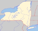
The Long Island Central Pine Barrens (also known as the Long Island Pine Barrens) is a large area of publicly protected pine barrens
in Suffolk County, New York
, on Long Island
, covering more than 100000 acres (405 km²).
The Barrens operates in a similar manner to Adirondack Park, with public lands managed by a mix of federal, state, county and local public land managers intermixed with private inholdings.
It is Long Island's largest natural area and its last remaining wilderness
. The region contains a remnant of the Atlantic coastal pine barrens
ecoregion
, whose forests might once have covered a quarter million acres (1,000 km²) on Long Island.
The Central Pine Barrens overlays and recharges a portion of a federally designated sole source aquifer
for Long Island's drinking water. All of Long Island's drinking water comes from ground water wells; none of the island's water comes from reservoirs. Almost all of the Peconic River
and Carmans River
(two of Long Island's four biggest rivers) as well as much of their watersheds are in the Barrens.
to spur development.
In the 1970s the State of New York began acquiring large parcels to create a greenbelt
. The federal government at Brookhaven National Laboratory
transferred 2300 acres (9 km²) in 1971 and RCA
transferred 7200 acres (29 km²) around Rocky Point, New York
in 1978 (for a cost of $1).
In 1984 the Pine Barrens Review Commission was created to review development in the region. In 1986 the Suffolk County Open Space Program financed by a 0.25% sales tax was to result in 28 new Suffolk County Parks in the region totalling 4600 acres (19 km²)
Despite the efforts development pressure continued and in 1989 the Long Island Pine Barrens Society filed a multibillion dollar suit against Suffolk County, and the towns of Brookhaven, Riverhead and Southampton.
The Society eventually lost its suit in the New York's highest court—the New York Court of Appeals
-- after winning in earlier courts.
In 1993 the New York State Legislature approved the Long Island Pine Barrens Protection Act to protect the region through the development and implementation of a comprehensive land use plan. the Act also created the Central Pine Barrens Joint Planning & Policy Commission to oversee the plan, and divided the area into two regions:
The initial towns were Brookhaven, Riverhead
, and Southampton
. In 1998 East Hampton
set aside a small portion of land for the Barrens and it was expanded to 1000 acres (4 km²) in 2007.
, but was extinguished within days of its outbreak. A larger, more catastrophic fire erupted in the Westhampton
area just shortly after the Rocky Point blaze was brought to an end. The fire, aided by high winds and dry conditions, quickly spread, threatening area homes and businesses. The fire was nicknamed the "Sunrise Wildfire," as it engulfed both sides of Sunrise Highway
, the major highway connecting the Hamptons region with the rest of Long Island. The fires closed down the highway and stopped railroad service, effectively cutting the Hamptons off from the rest of the island for days as firefighters from all over Long Island and the FDNY worked around the clock to battle the blaze.
By early September, the Sunrise Wildfire were extinguished, but the results of that fire, in addition to the Rocky Point fire, were disastrous: approximately 7000 acres (28 km²) had burned, numerous homes and small businesses suffered damage, and 400 people were forced to evacuate their homes. The fire, which erupted during the peak of the Hamptons tourist season, resulted in a considerable economic blow for the region. However, the human toll was very light, a few firefighters suffered injuries, but nobody was killed in the event.
As of 2007, the region has all but recovered from the damage it sustained, although some vegetation still bears the scars of the fire.
Pine barrens
Pine barrens, pine plains, sand plains, or pinelands occur throughout the northeastern U.S. from New Jersey to Maine as well as the Midwest and Canada....
in Suffolk County, New York
Suffolk County, New York
Suffolk County is a county located in the U.S. state of New York on the eastern portion of Long Island. As of the 2010 census, the population was 1,493,350. It was named for the county of Suffolk in England, from which its earliest settlers came...
, on Long Island
Long Island
Long Island is an island located in the southeast part of the U.S. state of New York, just east of Manhattan. Stretching northeast into the Atlantic Ocean, Long Island contains four counties, two of which are boroughs of New York City , and two of which are mainly suburban...
, covering more than 100000 acres (405 km²).
The Barrens operates in a similar manner to Adirondack Park, with public lands managed by a mix of federal, state, county and local public land managers intermixed with private inholdings.
It is Long Island's largest natural area and its last remaining wilderness
Wilderness
Wilderness or wildland is a natural environment on Earth that has not been significantly modified by human activity. It may also be defined as: "The most intact, undisturbed wild natural areas left on our planet—those last truly wild places that humans do not control and have not developed with...
. The region contains a remnant of the Atlantic coastal pine barrens
Atlantic coastal pine barrens
The Atlantic coastal pine barrens is a temperate coniferous forests ecoregion of the northeastern United States.-Setting:This ecoregion covers a disjunct area of 8,975 km² including the New Jersey Pine Barrens on the coastal plain of New Jersey, and smaller areas of southern Long Island in New...
ecoregion
Ecoregion
An ecoregion , sometimes called a bioregion, is an ecologically and geographically defined area that is smaller than an ecozone and larger than an ecosystem. Ecoregions cover relatively large areas of land or water, and contain characteristic, geographically distinct assemblages of natural...
, whose forests might once have covered a quarter million acres (1,000 km²) on Long Island.
The Central Pine Barrens overlays and recharges a portion of a federally designated sole source aquifer
Aquifer
An aquifer is a wet underground layer of water-bearing permeable rock or unconsolidated materials from which groundwater can be usefully extracted using a water well. The study of water flow in aquifers and the characterization of aquifers is called hydrogeology...
for Long Island's drinking water. All of Long Island's drinking water comes from ground water wells; none of the island's water comes from reservoirs. Almost all of the Peconic River
Peconic River
The Peconic River is a river in Long Island's Suffolk County, New York in the United States. The river is located in the eastern end of Long Island...
and Carmans River
Carmans River
The Carmans River is a long river in Brookhaven in Suffolk County on Long Island.It is one of the four largest rivers on Long Island and is similar to other Long Island rivers in that is totally groundwater generated , although a lake did exist long ago. Almost all of the river is specifically...
(two of Long Island's four biggest rivers) as well as much of their watersheds are in the Barrens.
History
The pine barrens region had remain largely undeveloped until the 1970s when a proposal was made to create the area a Free trade zoneFree trade zone
A free trade zone or export processing zone , also called foreign-trade zone, formerly free port is an area within which goods may be landed, handled, manufactured or reconfigured, and reexported without the intervention of the customs authorities...
to spur development.
In the 1970s the State of New York began acquiring large parcels to create a greenbelt
Green belt
A green belt or greenbelt is a policy and land use designation used in land use planning to retain areas of largely undeveloped, wild, or agricultural land surrounding or neighbouring urban areas. Similar concepts are greenways or green wedges which have a linear character and may run through an...
. The federal government at Brookhaven National Laboratory
Brookhaven National Laboratory
Brookhaven National Laboratory , is a United States national laboratory located in Upton, New York on Long Island, and was formally established in 1947 at the site of Camp Upton, a former U.S. Army base...
transferred 2300 acres (9 km²) in 1971 and RCA
RCA
RCA Corporation, founded as the Radio Corporation of America, was an American electronics company in existence from 1919 to 1986. The RCA trademark is currently owned by the French conglomerate Technicolor SA through RCA Trademark Management S.A., a company owned by Technicolor...
transferred 7200 acres (29 km²) around Rocky Point, New York
Rocky Point, New York
Rocky Point is a hamlet in Suffolk County, New York on the North Shore of Long Island. As of the United States 2000 Census, the CDP population was 10,185.Rocky Point is a community in the town of Brookhaven.-Geography:...
in 1978 (for a cost of $1).
In 1984 the Pine Barrens Review Commission was created to review development in the region. In 1986 the Suffolk County Open Space Program financed by a 0.25% sales tax was to result in 28 new Suffolk County Parks in the region totalling 4600 acres (19 km²)
Despite the efforts development pressure continued and in 1989 the Long Island Pine Barrens Society filed a multibillion dollar suit against Suffolk County, and the towns of Brookhaven, Riverhead and Southampton.
The Society eventually lost its suit in the New York's highest court—the New York Court of Appeals
New York Court of Appeals
The New York Court of Appeals is the highest court in the U.S. state of New York. The Court of Appeals consists of seven judges: the Chief Judge and six associate judges who are appointed by the Governor to 14-year terms...
-- after winning in earlier courts.
In 1993 the New York State Legislature approved the Long Island Pine Barrens Protection Act to protect the region through the development and implementation of a comprehensive land use plan. the Act also created the Central Pine Barrens Joint Planning & Policy Commission to oversee the plan, and divided the area into two regions:
- A core 53000 acres (214 km²) area where no development is permitted at all. The area was expanded to 55000 acres (223 km²) in 1998 with the addition of Wertheim National Wildlife RefugeWertheim National Wildlife RefugeThe Wertheim National Wildlife Refuge is located on the south shore of Long Island and is one of the undeveloped estuary systems on Long Island. Its main purpose was to organize the refuge so it would protect the Carmans River Estuary for all migratory birds. Wertheim hosts a variety of habitats...
. 75 percent of the land in the core area is to be acquired. A provision of the law allows private ownership in the core area provided there is a transfer of development rights arrangement where the owner can build elsewhere by transferring ownership of the Core lands to a government entity. - A Compatible Growth Area of 47000 acres (190 km²) acre Compatible Growth Area where limited, environmentally compatible development is allowed.
The initial towns were Brookhaven, Riverhead
Riverhead (town), New York
The town of Riverhead is in Suffolk County, New York, on the north shore of Long Island. The population was 33,506 at the 2010 census. The name signifies that the mouth of the Peconic River is in this town...
, and Southampton
Southampton (town), New York
The Town of Southampton is located in southeastern Suffolk County, New York, U.S., partly on the South Fork of Long Island. As of the United States 2000 Census, the town had a total population of 54,712...
. In 1998 East Hampton
East Hampton (town), New York
The Town of East Hampton is located in southeastern Suffolk County, New York, at the eastern end of the South Shore of Long Island. It is the easternmost town in the state of New York...
set aside a small portion of land for the Barrens and it was expanded to 1000 acres (4 km²) in 2007.
Sunrise Fire of 1995
In late August-early September 1995, a series of major brush fires swept through the pine barrens region. The first major fire incident occurred in Rocky PointRocky Point, New York
Rocky Point is a hamlet in Suffolk County, New York on the North Shore of Long Island. As of the United States 2000 Census, the CDP population was 10,185.Rocky Point is a community in the town of Brookhaven.-Geography:...
, but was extinguished within days of its outbreak. A larger, more catastrophic fire erupted in the Westhampton
Westhampton, New York
Westhampton is a hamlet in Suffolk County, New York, United States. The population was 2,869 at the 2000 census.Westhampton is in the Town of Southampton.-Geography:Westhampton is located at ....
area just shortly after the Rocky Point blaze was brought to an end. The fire, aided by high winds and dry conditions, quickly spread, threatening area homes and businesses. The fire was nicknamed the "Sunrise Wildfire," as it engulfed both sides of Sunrise Highway
New York State Route 27
New York State Route 27 is an east–west long state highway extending from Interstate 278 in the New York City borough of Brooklyn to Montauk Point State Park on Long Island, New York, United States...
, the major highway connecting the Hamptons region with the rest of Long Island. The fires closed down the highway and stopped railroad service, effectively cutting the Hamptons off from the rest of the island for days as firefighters from all over Long Island and the FDNY worked around the clock to battle the blaze.
By early September, the Sunrise Wildfire were extinguished, but the results of that fire, in addition to the Rocky Point fire, were disastrous: approximately 7000 acres (28 km²) had burned, numerous homes and small businesses suffered damage, and 400 people were forced to evacuate their homes. The fire, which erupted during the peak of the Hamptons tourist season, resulted in a considerable economic blow for the region. However, the human toll was very light, a few firefighters suffered injuries, but nobody was killed in the event.
As of 2007, the region has all but recovered from the damage it sustained, although some vegetation still bears the scars of the fire.
Sister parks
- The Central Pine Barrens Commission and the Migliarino-San Rossore-Massaciuccoli (MSRM) Regional Park in TuscanyTuscanyTuscany is a region in Italy. It has an area of about 23,000 square kilometres and a population of about 3.75 million inhabitants. The regional capital is Florence ....
, ItalyItalyItaly , officially the Italian Republic languages]] under the European Charter for Regional or Minority Languages. In each of these, Italy's official name is as follows:;;;;;;;;), is a unitary parliamentary republic in South-Central Europe. To the north it borders France, Switzerland, Austria and...
are "twin parks" under a New York State program which supports such programs with the goal of sharing knowledge and experience between the citizens of both regions. It is also home to many endangered animals.
External links
- New York State's Central Pine Barrens
- Scientific Research and the Pine Barrens
- The Long Island Pine Barrens Society
- The Wildfire Preparedness Project of theNational Fire Plan
- U.S. Fish and Wildlife Service-- Significant Habitats and Habitat Ccomplexes of the New York Bight Watershed
Additional reading
- Exploring the Other Island: A Seasonal Guide to Nature on Long Island by John Turner
- Fish-Shape Paumanok: Nature and Man on Long Island by Robert Cushman Murphy
- Sunrise Fire, a Quality Parks production