
List of places in Dumfries and Galloway
Encyclopedia
This List of places in Dumfries and Galloway is a list of links for any town
, village
, hamlet
, castle
, golf course
, historic house
, hillfort, lighthouse
, nature reserve
, reservoir
, river
, loch
, and other place of interest in Dumfries and Galloway
.
Town
A town is a human settlement larger than a village but smaller than a city. The size a settlement must be in order to be called a "town" varies considerably in different parts of the world, so that, for example, many American "small towns" seem to British people to be no more than villages, while...
, village
Village
A village is a clustered human settlement or community, larger than a hamlet with the population ranging from a few hundred to a few thousand , Though often located in rural areas, the term urban village is also applied to certain urban neighbourhoods, such as the West Village in Manhattan, New...
, hamlet
Hamlet (place)
A hamlet is usually a rural settlement which is too small to be considered a village, though sometimes the word is used for a different sort of community. Historically, when a hamlet became large enough to justify building a church, it was then classified as a village...
, castle
Castle
A castle is a type of fortified structure built in Europe and the Middle East during the Middle Ages by European nobility. Scholars debate the scope of the word castle, but usually consider it to be the private fortified residence of a lord or noble...
, golf course
Golf course
A golf course comprises a series of holes, each consisting of a teeing ground, fairway, rough and other hazards, and a green with a flagstick and cup, all designed for the game of golf. A standard round of golf consists of playing 18 holes, thus most golf courses have this number of holes...
, historic house
Historic house
A historic house can be a stately home, the birthplace of a famous person, or a house with an interesting history or architecture.- Background :...
, hillfort, lighthouse
Lighthouse
A lighthouse is a tower, building, or other type of structure designed to emit light from a system of lamps and lenses or, in older times, from a fire, and used as an aid to navigation for maritime pilots at sea or on inland waterways....
, nature reserve
Nature reserve
A nature reserve is a protected area of importance for wildlife, flora, fauna or features of geological or other special interest, which is reserved and managed for conservation and to provide special opportunities for study or research...
, reservoir
Reservoir
A reservoir , artificial lake or dam is used to store water.Reservoirs may be created in river valleys by the construction of a dam or may be built by excavation in the ground or by conventional construction techniques such as brickwork or cast concrete.The term reservoir may also be used to...
, river
River
A river is a natural watercourse, usually freshwater, flowing towards an ocean, a lake, a sea, or another river. In a few cases, a river simply flows into the ground or dries up completely before reaching another body of water. Small rivers may also be called by several other names, including...
, loch
Loch
Loch is the Irish and Scottish Gaelic word for a lake or a sea inlet. It has been anglicised as lough, although this is pronounced the same way as loch. Some lochs could also be called a firth, fjord, estuary, strait or bay...
, and other place of interest in Dumfries and Galloway
Dumfries and Galloway
Dumfries and Galloway is one of 32 unitary council areas of Scotland. It was one of the nine administrative 'regions' of mainland Scotland created in 1975 by the Local Government etc. Act 1973...
.
A
- Ae
- Airds of KellsAirds of KellsAirds of Kells is a village in the Scottish council area of Dumfries and Galloway.Airds of Kells Wood is a biological Site of Special Scientific Interest, notified in 1983. It has the largest remaining block of oak woodland in the Ken/Dee valley....
- AirielandAirielandAirieland is a village in the Scottish council area of Dumfries and Galloway....
- Amisfield Town
- Anglo-Scottish borderAnglo-Scottish borderThe Anglo-Scottish border is the official border and mark of entry between Scotland and England. It runs for 154 km between the River Tweed on the east coast and the Solway Firth in the west. It is Scotland's only land border...
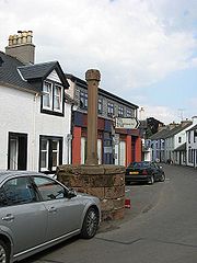
- AnnanAnnan, Dumfries and GallowayThe royal burgh of Annan is a well-built town, red sandstone being the material mainly used. Each year in July, Annan celebrates the Royal Charter and the boundaries of the Royal Burgh are confirmed when a mounted cavalcade undertakes the Riding of the Marches. Entertainment includes a...
, Annan railway stationAnnan railway stationAnnan railway station serves the town of Annan in Dumfries and Galloway, Scotland. It is located on the Glasgow South Western Line 28 km north west of Carlisle and is managed by First ScotRail who provide all passenger train services....
, Annan AcademyAnnan AcademyAnnan Academy is a secondary school in Annan, in Dumfries and Galloway, formerly Dumfriesshire, Scotland. The present school is the result of an amalgamation in 1921 of the original Annan Academy and Greenknowe Public School, although its history goes back to the 17th century.Behind the buildings... - AnnandaleAnnandale, Dumfries and GallowayAnnandale is a strath in Dumfries and Galloway, Scotland, named after the River Annan. It runs north-south through the Southern Uplands from Annanhead to Annan on the Solway Firth and in its higher reaches it separates the Moffat hills on the east from the Lowther hills to the west...
, Annandale WaterAnnandale WaterAnnandale Water is a loch in Annandale, Dumfries and Galloway, in the south west of Scotland. It is part of Annandale Water service station at Junction 16 of the A74, close to Johnstonebridge, Dinwoodie and Newton Wamphray, and halfway between Moffat and Lockerbie.Before the opening of the Motorway... - AnwothAnwothAnwoth is a settlement near the Solway Firth in the Stewarty of Kirkcudbright, in South West Scotland, within a parish of the same name in the Vale of Fleet, Dumfries and Galloway. Anwoth lies a mile to the west of Gatehouse of Fleet....
- ArdwellArdwellArdwell is a village in the Scottish unitary council area of Dumfries and Galloway. It lies on the shores of Luce Bay in the southern part of the Rhins of Galloway. The A716 road to Drummore or the Mull of Galloway passes through the village...
- AuchencairnAuchencairnAuchencairn is a village in Dumfries and Galloway, Scotland. It is located on the coast of the Solway Firth at the head of Auchencairn Bay and lies on the A711 road between the town of Dalbeattie to the east and Kirkcudbright to the west.- Etymology :...
- Auchencairn Bay
B
- Balcary Point
- BalmaclellanBalmaclellanBalmaclellan is a small hillside village of stone houses with slate roofs in a fold of the Galloway hills in south-west Scotland...
- BalmaghieBalmaghieBalmaghie , from the Scottish Gaelic Baile Mac Aoidh, is a civil parish in Dumfries and Galloway, Scotland and was the seat of the McGhee family. It is bordered by the River Dee to the north and east...
- Bankend
- BargrennanBargrennanBargrennan is a village in Dumfries and Galloway, in the south west of Scotland, by the River Cree, on the A714 to Girvan, nine miles from Newton Stewart....
- BeattockBeattockThe village of Beattock is located in the southern lowlands of Scotland, and lies within the administrative area of Dumfries and Galloway. It is surrounded by the parish of Kirkpatrick Juxta. It was an important stabling point for horses in the olden days with a coach house at one end of the village...
- Beeswing, Dumfries and Galloway
- Bogrie Hill
- Bogue
- Borgue, Stewartry of KirkcudbrightBorgue, Stewartry of KirkcudbrightBorgue is a village in the Stewartry of Kirkcudbright in Dumfries and Galloway, south-west Scotland. It lies 5 miles south-west of Kirkcudbright and 6 miles south of Gatehouse of Fleet.-Notable people from Borgue:...
- Bridge of Dee
- BrydekirkBrydekirkBrydekirk is a village in Dumfries and Galloway, United Kingdom located approximately 2.5 miles north of Annan. The village sits adjacent to the River Annan, and was the concept of the Paisley Dirom family of Mount Annan and building started about 1822...
C
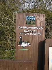
- CaerlaverockCaerlaverockCaerlaverock is an area to the south of Dumfries and to the west of Annan in Dumfries and Galloway, Scotland.Caerlaverock NNR is a National Nature Reserve in the care of Scottish Natural Heritage....
, Caerlaverock NNRCaerlaverock NNRCaerlaverock NNR is a National Nature Reserve covering part of the Solway Firth and the land south of Dumfries, in Dumfries and Galloway, Scotland...
(National Nature ReserveNational Nature ReserveFor details of National nature reserves in the United Kingdom see:*National Nature Reserves in England*National Nature Reserves in Northern Ireland*National Nature Reserves in Scotland*National Nature Reserves in Wales...
), Caerlaverock CairnCairnCairn is a term used mainly in the English-speaking world for a man-made pile of stones. It comes from the or . Cairns are found all over the world in uplands, on moorland, on mountaintops, near waterways and on sea cliffs, and also in barren desert and tundra areas...
, - Caerlaverock CastleCaerlaverock CastleCaerlaverock Castle is a moated triangular castle, built in the 13th century, in the Caerlaverock National Nature Reserve area at the Solway Firth, south of Dumfries in the southwest of Scotland. In the Middle Ages it was owned by the Maxwell family. Today, the castle is in the care of Historic...
(Historic ScotlandHistoric ScotlandHistoric Scotland is an executive agency of the Scottish Government, responsible for historic monuments in Scotland.-Role:As its website states:...
) - CairngaanCairngaanCairngaan, Dumfries and Galloway, is the southmost settlement in Scotland. The hamlet of Cairngaan lies just north of the Mull of Galloway on the B7041, after a turn-off from the B7065 road...
- Cairn Valley, Cairn Valley Light RailwayCairn Valley Light RailwayThe Cairn Valley Light Railway was built under the regulations of the Light Railways Act 1896 and was opened on 1 March 1905. It connected the market town of Dumfries in south-west Scotland to the village of Moniaive in Dumfriesshire at the end of the Cairn Valley.- History :The line was long and...
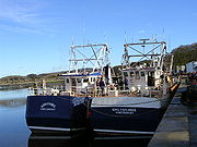
- CairnryanCairnryanCairnryan is a small Scottish village in Dumfries and Galloway on the eastern shore of Loch Ryan. The village has been of vital importance in maritime history.-Ferry Port:...
- CanonbieCanonbieCanonbie is a small village in Dumfries and Galloway in south west Scotland, six miles south of Langholm and two miles north of the Anglo-Scottish border. It is on the A7 road from Carlisle to Edinburgh, and the River Esk flows through it...
- Capenoch Loch
- Cardoness CastleCardoness CastleCardoness Castle is a well-preserved 15th Century tower house just south west of Gatehouse of Fleet, south west Scotland. It was originally owned by the MacCulloch family of Galloway also known as the MacCullochs of Myreton. They abandoned the castle in the late 17th Century, following the...
- CargenbridgeCargenbridgeCargenbridge is a hamlet located in Dumfries and Galloway, United Kingdom southwest of Dumfries....
- Carlingwark Loch
- Carrutherstown
- CarsphairnCarsphairnCarsphairn is a village in Dumfries and Galloway, Scotland. It is located about half way between Dalmellington and St. John's Town of Dalry, next to the A713 road. Carsphairn annual sheep show is held in the village. Cairnsmore of Carsphairn is to the north east of the village in the Carsphairn...
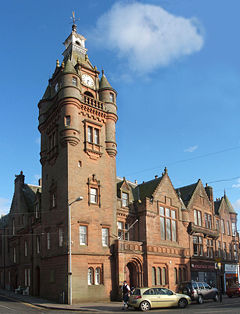
- Castle DouglasCastle DouglasCastle Douglas , a town in the south of Scotland in Dumfries and Galloway, lies in the eastern part of Galloway known as the Stewartry, between the towns of Dalbeattie and Gatehouse of Fleet.-History:...
, Castle Douglas Art Gallery, Castle Douglas and Dumfries RailwayCastle Douglas and Dumfries RailwayThe Castle Douglas and Dumfries Railway was a nominally independent railway in south west Scotland which linked Dumfries to Castle Douglas.-History:It was incorporated on 21 July 1856; the act was obtained by the Glasgow and South Western Railway.... - Castle KennedyCastle KennedyCastle Kennedy is a village three miles east of Stranraer in Dumfries and Galloway, Scotland.There is a castle there - indeed there are two. Castle Kennedy itself was burned down in the eighteenth century and remains a ruin to this day, the owner deciding to build Lochinch Castle as a replacement...
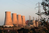
- Chapelcross nuclear power stationChapelcross nuclear power stationChapelcross was a Magnox nuclear power plant located near the town of Annan in Dumfries and Galloway in south west Scotland. It was the sister plant to Calder Hall in Cumbria, England, both commissioned and originally operated by the United Kingdom Atomic Energy Authority.The primary purpose of...
- ClarencefieldClarencefield-External links:***...
- Cornharrow Hill
- Corsewall, Corsewall LighthouseCorsewall LighthouseCorsewall Lighthouse is a lighthouse at Corsewall Point, Kirkcolm near Stranraer in the region of Dumfries and Galloway in Scotland. First lit in 1817, it overlooks the North Channel of the Irish Sea. The definition of the name Corsewall is the place or well of the Cross.-History:In 1814, a Kirkman...
- CorsockCorsockCorsock is a village in Dumfries and Galloway, south-west Scotland. It is located north of Castle Douglas, and the same distance east of New Galloway, on the Urr Water....
- CraigenputtockCraigenputtockCraigenputtock is the craig/whinstone hill of the puttocks . It is the upland farming estate on the watershed between Dumfries and Galloway, from Dumfries and Castle Douglas...
- CreetownCreetownCreetown is a small seaport town in the Stewartry of Kirkcudbright, which forms part of the Galloway in the Dumfries and Galloway council area in south-west Scotland. Its population is about 750 people. It is situated near the head of Wigtown Bay, 18 mi. west of Castle Douglas...
- CriffelCriffelCriffel is a hill in southern Galloway, Scotland. It is 570 metres high but appears higher because of its great isolation and high relative height — it is the eighth most prominent hill in Southern Scotland...
- Crocketford
- Crossmichael Parton
D
- DalbeattieDalbeattieDalbeattie is a town in Dumfries and Galloway , Scotland.Dalbeattie is situated in a wooded valley on the Urr Water east of Castle Douglas and south west of Dumfries...
- DaltonDalton, Dumfries and GallowayThe village of Dalton is a small settlement about 10 miles southeast of Dumfries and 4 miles south of Lockerbie.The village has an 18th-century church, one of its past ministers being The Rev. John W. Morris MA, who is buried near the southern boundary of the church...
- DornockDornockDornock is a small Scottish village in Dumfries and Galloway, situated about one mile west of Eastriggs and two miles east of Annan. Dornock is built on land which is 10 to 20 metres above sea level. Dornock Burn runs east of the village and the railway between Annan and Gretna is north of the...
- Drumcoltran TowerDrumcoltran TowerDrumcoltran Tower is a late 16th Century tower house situated near Kirkgunzeon, Dumfries and Galloway.-References:* Coventry, Martin The Castles of Scotland, 3rd Ed. Scotland: Goblinshead ISBN 1899874267...
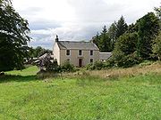
- DrumlanrigDrumlanrigDrumlanrig is a settlement in Dumfries and Galloway, Scotland, which is best known for nearby Drumlanrig Castle.-External links:***...
, Drumlanrig CastleDrumlanrig CastleDrumlanrig Castle sits on the Queensberry Estate in Scotland's Dumfries and Galloway.The Castle is the Dumfriesshire family home to the Duke and Duchess of Buccleuch and Queensberry... - DumfriesDumfriesDumfries is a market town and former royal burgh within the Dumfries and Galloway council area of Scotland. It is near the mouth of the River Nith into the Solway Firth. Dumfries was the county town of the former county of Dumfriesshire. Dumfries is nicknamed Queen of the South...
- DrummoreDrummoreNot to be confused with Drummuir, north east ScotlandDrummore is a village at the southern end of the Rhins of Galloway in Scotland: it has two satellite clachans, called Kirkmaiden and Damnaglaur. The village lies where the Kildonan Burn runs out to the sea, a few miles north of the Mull of...
- Dryfesdale
- Dryffe Water, Annandale, Dumfries and GallowayAnnandale, Dumfries and GallowayAnnandale is a strath in Dumfries and Galloway, Scotland, named after the River Annan. It runs north-south through the Southern Uplands from Annanhead to Annan on the Solway Firth and in its higher reaches it separates the Moffat hills on the east from the Lowther hills to the west...
- DumfriesDumfriesDumfries is a market town and former royal burgh within the Dumfries and Galloway council area of Scotland. It is near the mouth of the River Nith into the Solway Firth. Dumfries was the county town of the former county of Dumfriesshire. Dumfries is nicknamed Queen of the South...
, Dumfries AcademyDumfries AcademyDumfries Academy is one of four secondary schools in the town of Dumfries in South West Scotland.-History:Dumfries Academy has existed in its present form, though not in the buildings it currently occupies, since 1804...
, Dumfries High SchoolDumfries High SchoolDumfries High School is a comprehensive school with a school roll of around 1000 pupils and students. It is situated in a residential area of Dumfries, adjacent to the David Keswick Athletic Centre, which provides excellent facilities both for the school and the local community...
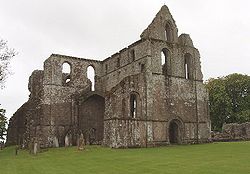
, Dumfries railway stationDumfries railway stationDumfries railway station serves the town of Dumfries in Dumfries and Galloway, Scotland. It is located on the Glasgow South Western Line and is managed by First ScotRail who provide all passenger train services... - DundrennanDundrennanDundrennan is a village in Dumfries and Galloway, Scotland, about five miles east of Kirkcudbright. Its population is around 230. It is most notable for the ruins of Dundrennan Abbey, a 12th century Cistercian monastery...
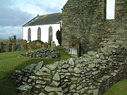
, Dundrennan AbbeyDundrennan AbbeyDundrennan Abbey, in Dundrennan, Scotland, near to Kirkcudbright, was a Cistercian monastery in the Romanesque architectural style, established in 1142 by Fergus of Galloway, King David I of Scotland , and monks from Rievaulx Abbey....
, Dundrennan RangeDundrennan RangeDundrennan Range is a weapons testing range on the Solway Firth, near Kirkcudbright in Dumfries and Galloway, in south west Scotland. It is part of the Kirkcudbright Training Area, of farming land acquired by the British Army in 1942 to train forces for the invasion of mainland Europe. The area... - DunscoreDunscoreDunscore is a small village which lies northwest of Dumfries, in Dumfries and Galloway, southwest Scotland. It has a population of about 150 people....
G
- GallowayGallowayGalloway is an area in southwestern Scotland. It usually refers to the former counties of Wigtownshire and Kirkcudbrightshire...
, Galloway Forest ParkGalloway Forest ParkGalloway Forest Park is a woodland park in Scotland, principally covering woodland in Dumfries and Galloway. It is operated by Forestry Commission Scotland....
, Galloway hydro-electric power schemeGalloway hydro-electric power schemeThe Galloway hydro-electric power scheme is a network of dams and hydro-electric power stations in Galloway, south west Scotland. It was built between 1930 and 1936.... - GarliestonGarliestonGarlieston is a small planned coastal village in south west Scotland founded circa 1790 by Lord Garlies.-Location & History:The village lies northwest of Whithorn and a few miles north of Cruggleton Castle which was abandoned in the 17th century...
- Gatehouse of FleetGatehouse of FleetGatehouse of Fleet is a town in Dumfries and Galloway, Scotland, which has existed since the mid-18th century, although the area has been inhabited since much earlier...
- GatelawbridgeGatelawbridgeGatelawbridge is a hamlet in the region of Dumfries and Galloway, Scotland, two and a half miles east of Thornhill and near the gorge Crichope Linn. The origin of the name is unknown though in the past the locals called it Gateley Bridge, so perhaps it takes its name from a type of bridge over the...
- GlencapleGlencapleGlencaple is a small settlement in the Dumfries and Galloway area of Scotland. Situated on the banks of the River Nith, it once served as a port for nearby Dumfries. Dumfries F.C. play their home matches at Norfolk Park in Glencaple....
- Glenkiln Sculpture ParkGlenkiln Sculpture ParkGlenkiln Sculpture Park is a sculpture landscape in Dumfries and Galloway, south-west Scotland. It comprises six sculptures placed in a moorland setting around Glenkiln Reservoir...
- GlenlocharGlenlocharGlenlochar is a small hamlet on the western bank of the River Dee in the parish of Balmaghie, Dumfries and Galloway. Glenlochar is located one and a half miles south of Balmaghie Kirk and three miles north of Castle Douglas....
- GlenluceGlenluceGlenluce is a village in the Scottish area of Dumfries and Galloway.Located on the A75 road between Stranraer and Newton Stewart it is in the traditional county of Wigtownshire. Glenluce Abbey is nearby at ....
- GretnaGretna, Dumfries and GallowayGretna is a town in Dumfries and Galloway, Scotland. Because they are near the Anglo-Scottish border, nearby Gretna Green and to a lesser extent Gretna, are historically linked to weddings because of the more liberal marriage laws in Scotland...
, Gretna GreenGretna GreenGretna Green is a village in the south of Scotland famous for runaway weddings. It is in Dumfries and Galloway, near the mouth of the River Esk and was historically the first village in Scotland, following the old coaching route from London to Edinburgh. Gretna Green has a railway station serving...
, Gretna Green railway stationGretna Green railway stationGretna Green railway station serves the village of Gretna Green and the town of Gretna in Dumfries and Galloway, Scotland. It is located on the Glasgow South Western Line and is managed by First ScotRail who provide all passenger train services.- History :...
K
- Keir
- Kenmure Castle
- KippfordKippfordKippford is a small village along the Solway coast, in Dumfries and Galloway, Scotland.-Geography:Kippford stretches along the banks of the Urr estuary and in places is only one house wide, being hemmed in between the forested Mark hill and the sea...
- Kirkcolm
- KirkconnelKirkconnelKirkconnel is a small parish and town in Dumfries and Galloway, southwestern Scotland. It is located on the A76 near the head of Nithsdale. Kirkconnel led a more quiet existence than neighboring towns like Sanquhar. Principally it has been a farming community. There are few buildings of any...
, Kirkconnel railway stationKirkconnel railway stationKirkconnel railway station is a railway station in the town of Kirkconnel, Dumfries and Galloway, Scotland. The station is unstaffed, is managed by First ScotRail.- History :...
, Kirkconnell Flow - KirkcowanKirkcowanKirkcowan is a village and parish in Dumfries and Galloway, Scotland.It is situated in the north of the Machars peninsula, about 7 miles south south west of Newton Stewart....
- KirkcudbrightKirkcudbrightKirkcudbright, is a town in Dumfries and Galloway, Scotland.The town lies south of Castle Douglas and Dalbeattie, in the part of Dumfries and Galloway known as the Stewartry, at the mouth of the River Dee, some six miles from the sea...
, KirkcudbrightshireKirkcudbrightshireThe Stewartry of Kirkcudbright or Kirkcudbrightshire was a county of south-western Scotland. It was also known as East Galloway, forming the larger Galloway region with Wigtownshire.... - Kirkpatrick DurhamKirkpatrick DurhamKirkpatrick Durham is a village and parish in Dumfries and Galloway, south-west Scotland. It is located north of Castle Douglas. The village was developed in the late 18th century as a handloom weaving centre, within the existing parish of the same name. The present church was built in 1850 by...
, Kirkpatrick-FlemingKirkpatrick-FlemingKirkpatrick-Fleming is a village in Dumfries and Galloway, south-west Scotland. It is located around north-west of Gretna, and west of Annan, between the Kirtle Water and the A74 motorway....
L
- LangholmLangholmLangholm , also known colloquially as the "Muckle Toon", is a burgh in Dumfries and Galloway, Scotland, on the River Esk and the A7 road.- History:...
- Lauriston, Dumfries and Galloway
- Leadhills and Wanlockhead RailwayLeadhills and Wanlockhead RailwayThe Leadhills and Wanlockhead Railway, a gauge railway in South Lanarkshire, Scotland, is laid on the trackbed of the former Leadhills and Wanlockhead Branch of the Caledonian Railway which led off the main line between and Glasgow at Elvanfoot.- Overview :...
, Leadhills and Wanlockhead BranchLeadhills and Wanlockhead BranchThe Leadhills and Wanlockhead Light Railway was promoted by the Caledonian Railway, using the provisions of 1896 Light Railways Act. It opened to traffic between Elvanfoot and Leadhills on 1 October 1901, with the remaining section to Wanlockhead on 19 September 1902.- The line :With a summit of... - Lincluden, Lincluden Abbey
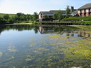
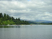
- Loch KenLoch KenLoch Ken is 9-mile long freshwater loch in Dumfries and Galloway, Scotland. It lies in the Glenkens, where it is fed from the north by the Water of Ken and from the west by the Dee. It continues as the Dee south from Glenlochar, where the water is held back by the Glenlochar Barrage...
- Lochar Water
- LochmabenLochmabenLochmaben is a small town in Scotland, and site of a once-important castle. It lies four miles west of Lockerbie, in Dumfries and Galloway.-Notable people:*Angus Douglas - Scottish internationalist footballer...
- LockerbieLockerbieLockerbie is a town in the Dumfries and Galloway region of south-western Scotland. It lies approximately from Glasgow, and from the English border. It had a population of 4,009 at the 2001 census...
, Lockerbie railway stationLockerbie railway stationLockerbie railway station lies on the West Coast Main Line between Carlisle and Carstairs in Lockerbie, Dumfries and Galloway, Scotland.- 1883 crash :... - Lowther HillsLowther HillsThe Lowther Hills, also sometimes known as the Lowthers, are an extensive area of hill country in the Southern Uplands of Scotland, though some sub ranges of hills in this area also go under their own local names - see "Hill Walking" below. They form a roughly rhomboidal or lozenge shape on the map...
M
- MacharsMacharsThe Machars is a peninsula in Galloway in the south-west of Scotland. The word is derived from the Gaelic word Machair meaning low lying or level land, known as "links" on the east coast of Scotland...
- MacLellan's CastleMacLellan's CastleMacLellan's Castle, in Kirkcudbright, south west Scotland, was the noble residence of the MacLellan family. It was completed in 1582 by Thomas Maclellan of Bombie.File:MacLellan's Castle 20080422 - great hall.jpg|The great hall of MacLellan's Castle...
, Kirkcudbright - Maxwelltown High SchoolMaxwelltown High SchoolMaxwelltown High School is one of four secondary schools in the town of Dumfries in South West Scotland.-Maxwelltown High School Today:Maxwelltown High is a seven year comprehensive school situated in the town of Dumfries adjoining open country containing a mix of pupils from private and council...
, DumfriesDumfriesDumfries is a market town and former royal burgh within the Dumfries and Galloway council area of Scotland. It is near the mouth of the River Nith into the Solway Firth. Dumfries was the county town of the former county of Dumfriesshire. Dumfries is nicknamed Queen of the South... - MiddlebieMiddlebieMiddlebie is a hamlet and parish in Dumfries & Galloway, south-west Scotland. It is approximately east of Ecclefechan, and north-east of Annan, on the banks of the Middlebie Burn....
- MillhousebridgeMillhousebridgeMillhousebridge is a village in Dumfries and Galloway, Scotland....
- Milton Loch
- MoffatMoffatMoffat is a former burgh and spa town in Dumfries and Galloway, Scotland, lying on the River Annan, with a population of around 2,500. The most notable building in the town is the Moffat House Hotel, designed by John Adam...
- MoniaiveMoniaiveMoniaive is a village in the south of Scotland in Dumfries and Galloway, near Thornhill, on the A702 road and B729 road. Population 520 . The name is from Gaelic monadh-abh and means "Hill of Streams". It is situated at the northern end of the very scenic and tranquil Cairn Valley...
- Mossdale
- Motte of Urr
- Mouswald
- Mull of GallowayMull of GallowayThe Mull of Galloway is the southernmost point of Scotland. It is situated in Wigtownshire, Dumfries and Galloway.A lighthouse is positioned at the point . Built in 1830 by engineer Robert Stevenson, the white-painted round tower is high...
N
- New AbbeyNew AbbeyNew Abbey is a village in Dumfries and Galloway, south-west Scotland. It is around south-west of Dumfries. The summit of the prominent hill Criffel is to the south....
Corn Mill Museum - Newbridge DriveNewbridge DriveNewbridge Drive is a relatively new suburb in Dumfries. It is situated on the Maxwelltown side of the River Nith and is approx 1.8 miles north-west from Dumfries town centre.-Public transport:...
- New GallowayNew GallowayNew Galloway is a town in Dumfries and Galloway Region, southwest Scotland. It lies on the west side of the valley of the Water of Ken, a mile north of the end of Loch Ken...
- New LuceNew LuceNew Luce is a quiet picturesque village in the Scottish unitary council area of Dumfries and Galloway. It has a shop, pub and two bridges. In the summer it has a popular gala day. The coast to coast walk, the Southern Upland Way, passes close to the village. New Luce is surrounded by good walking...
- Newton StewartNewton StewartNewton Stewart is a burgh town in the south of Scotland in the west of the region of Dumfries and Galloway and in the county of Wigtownshire....
- Newton WamphrayNewton WamphrayNewton Wamphray is a village in Dumfries and Galloway. Wamphray is the name of the surrounding parish and of the Wamphray Water, which flows south-west through the Wamphray Glen to join the River Annan near the small village, or hamlet, of Newton....
- NithsdaleNithsdaleNithsdale , also known by its anglicised gaelic name Strathnith or Stranit, is the valley of the River Nith in Scotland, and the name of the region...
P
- Parton, Dumfries and Galloway
- PenpontPenpontPenpont is a small village in the region of Dumfries and Galloway, Scotland, two miles west of Thornhill.It is situated near the confluence of the Shinnel Water and Scaur Water rivers in the foothills of the Southern Uplands, and has a population of roughly 400 people...
- Port WilliamPort WilliamPort William is a small fishing village in the county of Wigtownshire in south west Scotland. At present it comes under the administrative authority of Dumfries and Galloway...
- PortpatrickPortpatrickPortpatrick is a village hanging on to the extreme south-westerly tip of mainland Scotland, cut into a cleft in steep cliffs.Dating back historically some 500 years, and built adjacent to the ruins of nearby Dunskey Castle, its position on the Rhins of Galloway affords visitors views of the...
, Portpatrick RailwayPortpatrick RailwayThe Portpatrick and Wigtownshire Joint Railway, often known as the Port Road, was a railway in south-west Scotland, which linked Dumfries, via Castle Douglas, with the port towns of Portpatrick and Stranraer...
R
- Rhins of GallowayRhins of GallowayThe Rhins of Galloway is a hammer-head peninsula in Dumfries and Galloway, Scotland...
- Rigg
- RingfordRingfordRingford is a village in the Dumfries and Galloway hills located at beside the Tarff Water. It is about north of the fishing town of Kirkcudbright. It has a war memorial and a village hall. The Kirkcudbright Railway used to run past the village, the nearest stop being Tarff....
- River AnnanRiver AnnanThe River Annan is a river in southwest Scotland. It rises at the foot of Hart Fell, five miles north of Moffat. A second fork rises on Annanhead Hill and flows through the Devil's Beef Tub before joining at the Hart Fell fork north of Moffat.From there it flows past the town of Lockerbie, and...
, River EskRiver Esk, Dumfries and GallowayThe River Esk is a river in Dumfries and Galloway, Scotland, that flows into the Solway Firth. It also flows for a small way through the English county of Cumbria before entering the Solway....
, River NithRiver NithThe River Nith is a river in South West Scotland.-Source, flow and mouth:The Nith rises in the Carsphairn hills of East Ayrshire, more precisely between Prickeny Hill and Enoch Hill, 7 km East of Dalmellington... - Robgill TowerRobgill TowerRobgill Tower is a village near Ecclefechan. It is primarily farming-oriented and residential.-Etymology:The village's name is from the Old English personal name Hreodbeorht and Old Norse gil "ravine. The name was recorded as Redbeilgill in 1125.-References:...
- RuthwellRuthwellRuthwell is a village and parish on the Solway Firth between Dumfries and Annan in Dumfries and Galloway, Scotland.Ruthwell's most famous inhabitant was the Rev. Dr. Henry Duncan. He was a minister, author, antiquarian, geologist, publisher, philanthropist, artist and businessman.In 1810, Dr...
, Ruthwell CrossRuthwell CrossThe Ruthwell Cross is a stone Anglo-Saxon cross probably dating from the 8th century, when Ruthwell was part of the Anglo-Saxon kingdom of Northumbria; it is now in Scotland. Anglo-Saxon crosses are closely related to the contemporary Irish high crosses, and both are part of the Insular art tradition...
S
- Samye Ling Tibetan Monastery
- SandheadSandheadSandhead is a small village in Dumfries and Galloway, south west Scotland. It overlooks Luce Bay, 7 miles south of Stranraer. The old main road, named "Main Street", runs through the village, but the A716 now bypasses it with a narrow and twisting carriageway...
- SanquharSanquharSanquhar is a town on the River Nith in Dumfries and Galloway, Scotland. It lies north of Thornhill and west of Moffat. It is a Royal Burgh.Sanquhar is notable for its tiny post office , claimed to be the oldest working post office in the world...
, Sanquhar CastleSanquhar CastleSanquhar Castle, now a ruin, was built by the Crichton family in the 13th century. Situated on the southern approach to the former royal burgh of Sanquhar in Dumfries and Galloway, south west Scotland, it sits on the trail of the Southern Upland Way, and is passed by hundreds of visitors who walk...
, Sanquhar railway stationSanquhar railway stationSanquhar railway station is a railway station in the village of Sanquhar, Dumfries and Galloway, Scotland. The station is managed by First ScotRail and is on the Glasgow South Western Line. The old station buildings are in use as a holiday home. the station was re-opened together with , , , and... - Scaur WaterScaur WaterScaur Water is a river which rises near Polskeoch in the Scaur hills in the region of Dumfries and Galloway, Scotland.It flows from its source near Sanquhar in the Southern Uplands and joins the River Nith two miles southwest of Thornhill. The total length is...
- Shinnel WaterShinnel WaterShinnel Water, also spelt Shinnell, is a river in the region of Dumfries and Galloway, Scotland.It rises in the Scaur hills hills of Tynron Parish in the Southern Uplands at an altitude of 460m, and flows 13 miles to join Scaur Water near Penpont, at an altitude of 70m...
- Solway coast, Solway FirthSolway FirthThe Solway Firth is a firth that forms part of the border between England and Scotland, between Cumbria and Dumfries and Galloway. It stretches from St Bees Head, just south of Whitehaven in Cumbria, to the Mull of Galloway, on the western end of Dumfries and Galloway. The Isle of Man is also very...
, Solwaybank - Southern Upland WaySouthern Upland WayOpened in 1984, the Southern Upland Way is a coast to coast walk in Scotland between Portpatrick in the west and Cockburnspath in the east....
- SouthernessSouthernessSoutherness is a small coastal village in the South West of Scotland. Southerness is located approximately south of the A710 between Caulkerbush and Kirkbean. The town today is mainly a tourist village and has for many years had a large number of static caravans, some private and many rented to...
, Southerness LighthouseSoutherness lighthouseSoutherness lighthouse is located at the village of Southerness in South West Scotland. It is at present the second oldest lighthouse in Scotland. The lighthouse was commissioned by the Town Council of Dumfries in 1748 to assist in the safe passage though the Solway Firth of ships heading to the... - StewartryStewartryStewartry 1975-dateStewartry is a committee area in Dumfries and Galloway, Scotland.It was formerly one of four local government districts in the Dumfries and Galloway Region of Scotland....
, Stewartry of Kirkcudbright, Stewartry MuseumStewartry MuseumThe Stewartry Museum is a local museum in Kirkcudbright, Scotland, which covers the past history of this part of Galloway. One of its most important collections is that of the prehistoric rock art carvings which have been found in the region. The museum also stores some casts made from rock art... - St. John's Town of DalrySt. John's Town of DalrySt. John's Town of Dalry, usually referred to simply as Dalry, is a village in Dumfries and Galloway, formerly in Kirkcudbrightshire. It is located sixteen miles from Castle Douglas along the A713 road, and is at the southern terminus of the A702 road...
- St. Joseph's College, Dumfries
- St. Mungo's Church, Annandale
- StranraerStranraerStranraer is a town in the southwest of Scotland. It lies in the west of Dumfries and Galloway and in the county of Wigtownshire.Stranraer lies on the shores of Loch Ryan on the northern side of the isthmus joining the Rhins of Galloway to the mainland...
, Stranraer AcademyStranraer AcademyStranraer Academy is a secondary school in the town of Stranraer in South West Scotland, it serves the area of Stranraer, the Rhins, and parts of the Machars....
, Stranraer railway station - Summerhill, DumfriesSummerhill, DumfriesSummerhill in Dumfries is a post war residential suburb on the West side of the town. It is located on the Maxwelltown side of the River Nith that runs through Dumfries...
- Sweetheart AbbeySweetheart AbbeySweetheart Abbey , south of Dumfries, near to the Nith in south-west Scotland, was a Cistercian monastery, founded in 1275 by Dervorguilla of Galloway, daughter of Alan, Lord of Galloway, in memory of her husband John de Balliol...
T
- TemplandTemplandTempland is a village in Dumfriesshire, Scotland, a few kilometers northwest of Lockerbie. Its name suggests it was at one point owned by the Templars. Templand was also owned by Clan Jardine and lies close to their clan seat, Spedlin's Tower, and what remains of Jardine Hall. Templand's biggest...
- TerreglesTerreglesTerregles is a village and parish near Dumfries, in Dumfries and Galloway, Scotland. It lies in the former county of Kirkcudbrightshire.The name Terregles is said to be a corruption of Brythonic Tir-eglwys...
- Thornhill, Dumfries and GallowayThornhill, Dumfries and GallowayThornhill is a town in the Mid Nithsdale area of Dumfries and Galloway, Scotland, south of Sanquhar and north of Dumfries.A monument to the explorer Joseph Thomson , who lived in neighbouring Penpont and Gatelawbridge, can be found close to the school...
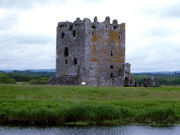
- Threave CastleThreave CastleThreave Castle is situated on an island in the River Dee, 2.5 km west of Castle Douglas, in Dumfries and Galloway, Scotland...
, Threave GardensThreave GardensThreave Garden is located near Castle Douglas in south west Scotland.The garden is in size, and is part of the Threave Estate originally developed by William Gordon who bought the estate in 1867. It is now owned and managed by the National Trust for Scotland...
(National Trust for ScotlandNational Trust for ScotlandThe National Trust for Scotland for Places of Historic Interest or Natural Beauty, commonly known as the National Trust for Scotland describes itself as the conservation charity that protects and promotes Scotland's natural and cultural heritage for present and future generations to...
) - TwynholmTwynholmTwynholm is a small village in Kirkcudbrightshire, Dumfries and Galloway. It is located 3km north-north west of Kirkcudbright.Twynholm is the home town of Formula One racing driver David Coulthard. A museum to his career was established in the village and is a popular tourist attraction.The...
- TynronTynronTynron is a village, and former kirkton of Nithsdale, in Dumfries and Galloway, south-west Scotland. It lies in a hollow of the Shinnel Water, from Moniaive. At Tynron Doon, on a spur of nearby Auchengibbert Hill, there can be seen the ditches and ramparts of an Iron Age hillfort...
W
- Wallace Hall AcademyWallace Hall AcademyWallace Hall Academy is a secondary school located in Thornhill, Dumfries and Galloway in the southwest of Scotland, currently with a roll of over 600 pupils aged from 11 to 65. In 2005 it was awarded the Schools of Ambition award...
, ThornhillThornhill, Dumfries and GallowayThornhill is a town in the Mid Nithsdale area of Dumfries and Galloway, Scotland, south of Sanquhar and north of Dumfries.A monument to the explorer Joseph Thomson , who lived in neighbouring Penpont and Gatelawbridge, can be found close to the school... - WanlockheadWanlockheadWanlockhead is a village in Dumfries and Galloway, Scotland nestling in the Lowther Hills one mile south of Leadhills at the head of the Mennock Pass, which forms part of the Southern Uplands...
- Water of KenWater of KenThe Water of Ken is a river in Galloway, south-west Scotland. It rises on Blacklorg Hill, north-east of Cairnsmore of Carsphairn in the Carsphairn hills, and flows south-westward into the Glenkens valley, passing through Carsfad and Earlstoun lochs, both of which are dammed to supply the Galloway...
- Waterbeck
- WhithornWhithornWhithorn is a former royal burgh in Dumfries and Galloway, Scotland, about ten miles south of Wigtown. The town was the location of the first recorded Christian church in Scotland, Candida Casa : the 'White [or 'Shining'] House', built by Saint Ninian about 397.-Eighth and twelfth centuries:A...
- WigtownWigtownWigtown is a town and former royal burgh in the Machars of Galloway in the south west of Scotland. It lies south of Newton Stewart and east of Stranraer. It has a population of about 1,000...
, WigtownshireWigtownshireWigtownshire or the County of Wigtown is a registration county in the Southern Uplands of south west Scotland. Until 1975, the county was one of the administrative counties used for local government purposes, and is now administered as part of the council area of Dumfries and Galloway... - Wildfowl and Wetlands TrustWildfowl and Wetlands TrustThe Wildfowl & Wetlands Trust is a wildfowl and wetland conservation charity in the United Kingdom. Its patron is Queen Elizabeth II.It was founded in 1946 by the ornithologist and artist Sir Peter Scott, initially as the Severn Wildfowl Trust...
(WWT), CaerlaverockCaerlaverockCaerlaverock is an area to the south of Dumfries and to the west of Annan in Dumfries and Galloway, Scotland.Caerlaverock NNR is a National Nature Reserve in the care of Scottish Natural Heritage....
See also
- List of places in Scotland
- List of places in the Scottish Borders
- List of places in South Lanarkshire
- List of places in North Lanarkshire
- List of places in North Ayrshire
- List of places in East Ayrshire
- DumfriesshireDumfriesshireDumfriesshire or the County of Dumfries is a registration county of Scotland. The lieutenancy area of Dumfries has similar boundaries.Until 1975 it was a county. Its county town was Dumfries...