
List of local and express multi-borough bus routes in New York City
Encyclopedia
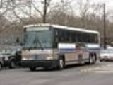
The Metropolitan Transportation Authority (MTA)
operates a number of express bus routes in New York City
, United States
. Express buses operated by the NYC Transit Authority
, or under contract by Atlantic Express
, are assigned an express (X) prefix, while those operated by MTA Bus
are assigned multi-borough (for instance QM) prefixes.
Below is a list of all express bus lines operating within the City of New York. The one way fare, payable in coins or MetroCard, is US$5.50. Discount fare media
is available.
The operator for each route is listed next to the route number. Unless otherwise indicated, routes run Monday through Friday only.
{| class=wikitable style="font-size: 90%;" |
!Route
!Operator
!colspan=3|Terminals
! Streets traveled
!Notes/History
|-
|style="background:white; color:black" align="center" valign=top|
!NYCT
|Midtown Manhattan
Central Park South and Seventh Avenue
! ↔
|Eltingville Transit Center
|Manhattan: Sixth Avenue (NB) & Fifth Avenue, Broadway (SB)
Staten Island: Hylan Boulevard, Richmond Avenue
|
|-
|style="background:white; color:black" align="center" valign=top|
!NYCT
|Midtown Manhattan
East 57th Street and Third Avenue
! ←
AM
----
→
PM
|New Dorp
Mill Road and Ebbits Street
|Manhattan: Madison Avenue (NB) & Lexington Avenue (SB)
Staten Island: Hylan Boulevard
|
|-
|style="background:white; color:black" align="center" valign=top|
!NYCT
|Lower Manhattan
World Financial Center
! ←
AM
----
→
PM
|New Dorp
Mill Road and Ebbits Street
|Manhattan: Church Street (NB) & Broadway (SB)
Staten Island: Hylan Boulevard
|
|-
|style="background:white; color:black" align="center" valign=top|
!NYCT
|Lower Manhattan
World Financial Center
! ←
AM
----
→
PM
|Eltingville Transit Center
|Manhattan: Church Street (NB) & Broadway (SB)
Staten Island: Father Capodanno Boulevard, Hylan Boulevard, Richmond Avenue
|
|-
|style="background:white; color:black" align="center" valign=top|
!NYCT
|Midtown Manhattan
East 57th Street and Third Avenue
! ←
AM
----
→
PM
|Eltingville Transit Center
|Manhattan: Madison Avenue (NB) & Lexington Avenue (SB)
Staten Island: Father Capodanno Boulevard, Hylan Boulevard, Richmond Avenue
|
|-
|style="background:white; color:black" align="center" valign=top|
!NYCT
|Midtown Manhattan
Central Park South and Seventh Avenue
! ←
AM
----
→
PM
|Eltingville Transit Center
|Manhattan: Sixth Avenue (NB) & Fifth Avenue, Broadway (SB)
Staten Island: Father Capodanno Boulevard, Nelson Avenue
|
|-
|style="background:white; color:black" align="center" valign=top|
!NYCT
|Lower Manhattan
Downtown Loop
! ←
AM
----
→
PM
|Eltingville Transit Center
|Manhattan: Church Street, Water Street
Staten Island: Father Capodanno Boulevard, Nelson Avenue
|
|-
|style="background:white; color:black" align="center" valign=top|
!NYCT
|Midtown Manhattan
Central Park South and Seventh Avenue
! ←
AM
----
→
PM
|New Dorp
Mill Road and Ebbits Street
|Manhattan: Sixth Avenue (NB) & Fifth Avenue, Broadway (SB)
Staten Island: Hylan Boulevard
|
|-
|style="background:white; color:black" align="center" valign=top|
!NYCT
|Midtown Manhattan
East 57th Street and Third Avenue
! ↔
|Port Richmond
Castleton Bus Depot
|Manhattan: Sixth Avenue, Madison Avenue (NB) & Fifth Avenue, Broadway (SB)
Staten Island: Gannon Avenue, Richmond Avenue, Port Richmond Avenue
|
|-
|style="background:white; color:black" align="center" valign=top|
!NYCT
|Lower Manhattan
Worth Street and Broadway
! ←
AM
----
→
PM
|Travis
End of Victory Boulevard
|Manhattan: Church Street (NB) & Broadway (SB)
Staten Island: Gannon Avenue, Victory Boulevard
|
|-
|rowspan=2 style="background:white; color:black" align="center" valign=top|
!rowspan=2|NYCT
|West Midtown
West 57th Street and Eleventh Avenue
!rowspan=2| ←
AM
----
→
PM
|rowspan=2|Mariners Harbor
South Avenue and Richmond Terrace
|rowspan=2|Manhattan: 57th Street, Sixth Avenue, Madison Avenue (NB) & Fifth Avenue, Broadway (SB)
Staten Island: Victory Boulevard, Watchogue Road, Forest Avenue
|rowspan=2|
|-
|Madison Square
23rd Street and Fifth Avenue
some peak service
|-
|style="background:white; color:black" align="center" valign=top|
!NYCT
|West Midtown
West 57th Street and Eleventh Avenue
! ←
AM
----
→
PM
|Port Richmond
Castleton Bus Depot
|Manhattan: Madison Avenue (NB) & Fifth Avenue (SB), Water Street
Staten Island: Clove Road, Forest Avenue, Port Richmond Avenue
|
|-
|style="background:white; color:black" align="center" valign=top|
!NYCT
|Lower Manhattan
Downtown Loop
! ←
AM
----
→
PM
|Eltingville Transit Center
|Manhattan: Church Street (NB) & Water Street (SB)
Staten Island: Richmond Road, Arthur Kill Road
|
|-
|style="background:white; color:black" align="center" valign=top|
!NYCT
|Lower Manhattan
Worth Street and Broadway
! ←
AM
----
→
PM
|Annadale
Annadale Road and Drumgoole Road East
|Manhattan: Church Street (NB) & Broadway (SB)
Staten Island: Richmond Avenue
|
|-
|style="background:white; color:black" align="center" valign=top|
!NYCT
|Midtown Manhattan
East 57th Street and Third Avenue
! ↔
|Huguenot
Woodrow Road and Huguenot Avenue
|Manhattan: Sixth Avenue, Madison Avenue (NB) & Fifth Avenue, Broadway (SB)
Staten Island: Richmond Avenue, Drumgoole Road, Huguenot Avenue
|
|-
|style="background:white; color:black" align="center" valign=top|
!NYCT
|Midtown Manhattan
East 57th Street and Third Avenue
! ←
AM
----
→
PM
|Huguenot
Woodrow Road and Huguenot Avenue
|Manhattan: 34th Street, Madison Avenue (NB) & Fifth Avenue, 42nd Street (SB)
Staten Island: Richmond Avenue, Drumgoole Road, Huguenot Avenue
|
|-
|style="background:white; color:black" align="center" valign=top|
!NYCT
|Lower Manhattan
Worth Street and Broadway
! ←
AM
----
→
PM
|Huguenot
Woodrow Road and Huguenot Avenue
|Manhattan: Church Street (NB) & Broadway (SB)
Staten Island: Arden Avenue, Drumgoole Road, Huguenot Avenue
|
|-
|style="background:white; color:black" align="center" rowspan=2 valign=top|
!rowspan=2|NYCT
|rowspan=2|Midtown Manhattan
East 57th Street and Third Avenue
!←
AM
----
→
PM
|Tottenville
Page Avenue and Hylan Boulevard
|rowspan=2|Manhattan: 34th Street, Madison Avenue (NB) & Fifth Avenue, 42nd Street (SB)
Staten Island: Amboy Road, Bloomingdale Road
|rowspan=2|
|-
!←
AM
----
→
PM
|Pleasant Plains
Outerbridge Park & Ride
|-
|style="background:white; color:black" align="center" valign=top|
!Atlantic
Express
|Midtown Manhattan
East 59 Street
! ←
AM
----
→
PM
|Huguenot
Huguenot Avenue and Amboy Road
|Manhattan: 34 Street, Madison Avenue (NB), 5 Avenue (SB)
Staten Island: Woodrow Road, Foster Road, Huguenot Avenue
|
|-
|style="background:white; color:black" align="center" valign=top|
!Atlantic Express
|Midtown Manhattan
East 59 Street
! ←
AM
----
→
PM
|New Dorp
Hylan Boulevard and Tysens Lane
|Manhattan: 34 Street, Madison Avenue (NB), 5 Avenue (SB)
Staten Island: Huguenot Avenue, Arden Avenue, Hylan Boulevard
|
|-
|style="background:white; color:black" align="center" valign=top|
!NYCT
|Midtown Manhattan
West 57th Street and Eleventh Avenue
! ←
AM
----
→
PM
|Sunnyside
Clove Road and Victory Boulevard
|Manhattan: Madison Avenue (NB) & Fifth Avenue (SB), 42nd Street, 57th Street
Staten Island: Forest Avenue
|
|-
|style="background:white; color:black" align="center" valign=top|
!NYCT
|Midtown Manhattan
East 57th Street and Third Avenue
! ←
AM
----
→
PM
|Eltingville Transit Center
|Manhattan: 34th Street, Madison Avenue (NB) & Fifth Avenue, 42nd Street (SB)
Staten Island: Bradley Avenue, Forest Hill Road
|
|}
!Route
!Operator
!colspan=3|Terminals
!Streets traveled
!Notes
|-
|style="background:white; color:black" align="center" valign=top|
!NYCT
|Midtown Manhattan
East 57 Street between Madison and 5 Avenues
! ↔
|Bay Ridge
Shore Road and 4 Avenue
|Manhattan: Church Street, 6 Avenue, Madison Avenue (NB), 5 Avenue and Broadway (SB)
Brooklyn: Shore Road
|
|-
|rowspan=2 style="background:white; color:black" align="center" valign=top|
!rowspan=2|NYCT
|rowspan=2|Midtown Manhattan
East 57 Street between Madison and 5 Avenues
! ↔
|Bensonhurst
Cropsey Avenue and Canal Avenue
|rowspan=2|Manhattan: Church Street, 6 Avenue, Madison Avenue (NB), 5 Avenue and Broadway (SB)
Brooklyn: Cropsey Avenue
|rowspan=2|
|-
! ↔
|Sea Gate
West 37 Street and Surf Avenue
|-
|rowspan=2 style="background:white; color:black" align="center" valign=top|
!rowspan=2|MTA
Bus
|Midtown Manhattan
East 57 Street and 1 Avenue
! ↔
|rowspan=2|Mill Basin
National Drive and Strickland Avenue
|rowspan=2|Manhattan: 5 Avenue, 23 Street, Water Street (SB), Church Street, 23 Street, Madison Avenue (NB)
Brooklyn: Cortelyou Road, Ocean Avenue, Avenue K, East 66 Street
|rowspan=2|
|-
|Downtown Manhattan
Downtown Loop
! ←
AM
----
→
PM
|-
|rowspan=2 style="background:white; color:black" align="center" valign=top|
!rowspan=2|MTA
Bus
|Midtown Manhattan
East 57 Street and 1 Avenue
! ↔
|Canarsie
Flatlands Avenue and Williams Avenue
|rowspan=2|Manhattan: 5 Avenue, 23 Street, Water Street (SB), Church Street, 23 Street, Madison Avenue (NB)
Brooklyn: Cortelyou Road, Flatbush Avenue, Avenue H, Avenue M, East 105 Street, Pennsylvania Avenue (downtown trips only)
|rowspan=2|
|-
|Downtown Manhattan
Downtown Loop
! ←
AM
----
→
PM
|Starrett City
Pennsylvanua Avenue and Seaview Avenue
|-
|rowspan=2 style="background:white; color:black" align="center" valign=top|
!rowspan=2|MTA
Bus
|Midtown Manhattan
East 57 Street and 1 Avenue
! ↔
|rowspan=2|Sheepshead Bay
Emmons Avenue and Shore Boulevard
|rowspan=2|Manhattan: 5 Avenue, 23 Street, Water Street (SB), Church Street, 23 Street, Madison Avenue (NB)
Brooklyn: Cortelyou Road, Ocean Avenue, Avenue X, Emmons Avenue
|rowspan=2|
|-
|Downtown Manhattan
Downtown Loop
! ←
AM
----
→
PM
|-
|rowspan=2 style="background:white; color:black" align="center" valign=top|
!rowspan=2|MTA
Bus
|Midtown Manhattan
East 57 Street and 1 Avenue
! ↔
|rowspan=2|Gerritsen Beach
Gerritsen Avenue and Lois Avenue
|rowspan=2|Manhattan: 5 Avenue, 23 Street, Water Street (SB), Church Street, 23 Street, Madison Avenue (NB)
Brooklyn: Cortelyou Road, Ocean Avenue, Nostrand Avenue, Gerritsen Avenue
|rowspan=2|
|-
|Downtown Manhattan
Downtown Loop
! ←
AM
----
→
PM
|-
|style="background:white; color:black" align="center" valign=top|
!MTA
Bus
|Midtown Manhattan
East 57 Street and 1 Avenue
! ↔
|Starrett City
Pennsylvania Avenue and Seaview Avenue
|Manhattan: 5 Avenue, 34 Street(SB),
34 Street, Madison Avenue (NB)
Queens: Woodhaven Boulevard, Cross Bay Boulevard
Brooklyn: Linden Boulevard, Ashford Street, Cozine Avenue, Pennsylvania Avenue
|
|}
!Route
!Operator
!colspan=3|Terminals
!Streets traveled
!Notes/History
|-
|style="background:white; color:black" align="center" valign=top|
!NYCT
|East Midtown
East 23rd Street and First Avenue
!←
AM
----
→
PM
|Rosedale
149th Avenue and 253rd Street
|Manhattan: Madison Avenue (NB) & Third & Fifth Avenues (SB)
Queens: Merrick Boulevard
|
|-
|style="background:white; color:black" align="center" valign=top|
!NYCT
|East Midtown
East 23rd Street and First Avenue
!←
AM
----
→
PM
|Cambria Heights
Linden Boulevard and 235th Street
|Manhattan: Madison Avenue (NB) & Third & Fifth Avenues (SB)
Queens: Liberty Avenue, Linden boulevard
|
|-
|style="background:white; color:black" align="center" valign=top|
!NYCT
|East Midtown
East 23rd Street and First Avenue
!←
AM
----
→
PM
|Floral Park
Hillside Avenue and 268th Street
|In Manhattan: Madison Avenue (NB) & Third & Fifth Avenues (SB)
Queens: Hillside Avenue
|
|-
|style="background:white; color:black" align="center" valign=top|
!MTA
Bus
|Randall's Island
Icahn Stadium
!←
(before events)
----
→
(after events)
|Woodside
LIRR station
|
|
|-
|style="background:white; color:black" align="center" valign=top|BM5
|colspan=6| See Manhattan to Brooklyn section for details.
|-
|rowspan=2 style="background:white; color:black" align="center" valign=top|
!rowspan=2|MTA
Bus
|Midtown Manhattan
6 Avenue
! ↔
|rowspan=2|Glen Oaks
260 Street and Union Turnpike
|
|rowspan=2|
|-
|Midtown Manhattan
3 Avenue
!←
AM
----
→
PM
|
|-
|rowspan=2 style="background:white; color:black" align="center" valign=top|
!rowspan=2|MTA
Bus
|Midtown Manhattan
6 Avenue
! ↔
|rowspan=2|Bay Terrace
Bay Terrace Shopping Center
|
|rowspan=2|
|-
|Midtown Manhattan
3 Avenue
!←
AM
----
→
PM
|
|-
|style="background:white; color:black" align="center" valign=top|
!MTA
Bus
|Midtown Manhattan
6 Avenue
!←
AM
----
→
PM
|Little Neck
Little Neck Parkway and Horace Harding Expressway
|
|
|-
|rowspan=2 style="background:white; color:black" align="center" valign=top|
!rowspan=2|MTA
Bus
|Midtown Manhattan
6 Avenue
! ↔
|rowspan=2|Electchester
164 Street and Horace Harding Expressway
|
|rowspan=2|
|-
|Midtown Manhattan
3 Avenue
! ←
AM
----
→
PM
|
|-
|rowspan=2 style="background:white; color:black" align="center" valign=top|
!rowspan=2|MTA
Bus
|Midtown Manhattan
6 Avenue
! ↔
|rowspan=2|Lake Success
North Shore Towers
|
|rowspan=2|
|-
|Midtown Manhattan
3 Avenue
!←
AM
----
→
PM
|
|-
|style="background:white; color:black" align="center" valign=top|
!MTA
Bus
|Downtown Manhattan
Downtown Loop
! ←
AM
----
→
PM
|Glen Oaks
260 Street and Union Turnpike
|
|
|-
|rowspan=2 style="background:white; color:black" align="center" valign=top|
!rowspan=2|MTA
Bus
|Midtown Manhattan
6 Avenue
!rowspan=2| ←
AM
----
→
PM
|rowspan=2|Rego Park
/Elmhurst
Loop
|
|rowspan=2|
|-
|Midtown Manhattan
3 Avenue
|
|-
|style="background:white; color:black" align="center" valign=top|
!MTA
Bus
|Downtown Manhattan
Downtown Loop
! ←
AM
----
→
PM
|Rego Park
/Elmhurst
Loop
|
|
|-
|rowspan=2 style="background:white; color:black" align="center" valign=top|
!rowspan=2|MTA
Bus
|Midtown Manhattan
6 Avenue
!rowspan=2| ←
AM
----
→
PM
|rowspan=2|Forest Hills
Union Turnpike
|
|rowspan=2|
|-
|Midtown Manhattan
3 Avenue
|
|-
|style="background:white; color:black" align="center" valign=top|
!MTA
Bus
|Midtown Manhattan
6 Avenue
!↔
|Howard Beach
157 Avenue and 102 Street
|
|
|-
|style="background:white; color:black" align="center" valign=top|
!MTA
Bus
|Midtown Manhattan
6 Avenue
! ←
AM
----
→
PM
|Roxbury, Queens
Beach 169th Street and Rockaway Point Boulevard
|
|
|-
|style="background:white; color:black" align="center" valign=top|
!MTA
Bus
|Midtown Manhattan
6 Avenue
! ←
AM
----
→
PM
|Far Rockaway
Far Rockaway-Mott Avenue subway station
( train)
|
|
|-
|style="background:white; color:black" align="center" valign=top|
!MTA
Bus
|Midtown Manhattan
6 Avenue
! ←
AM
----
→
PM
|South Ozone Park
130 Street and 150 Avenue
|
|
|-
|style="background:white; color:black" align="center" valign=top|
!MTA
Bus
|Midtown Manhattan
6 Avenue
! ↔
|Bay Terrace
Corporal Kennedy Street and 23 Avenue
|
|
|-
|style="background:white; color:black" align="center" valign=top|
!MTA
Bus
|Midtown Manhattan
East 23 Street and Park Avenue
! ←
AM
----
↔
PM
|Rochdale Village Loop
|
|
|-
|rowspan=2 style="background:white; color:black" align="center" valign=top|
!rowspan=2|MTA
Bus
|Midtown Manhattan
6 Avenue
!rowspan=2| ←
AM
----
→
PM
|rowspan=2|Glendale
Myrtle Avenue and 73 Street
|
|rowspan=2|
|-
|Midtown Manhattan: 3 Avenue
|
|-
|style="background:white; color:black" align="center" valign=top|
!MTA
Bus
|Downtown Manhattan: Downtown Loop
! ←
AM
----
→
PM
|Glendale
Myrtle Avenue and 73 Street
|
|
|}
!Route
!Operator
!colspan=3|Terminals
!Manhattan streets traveled
!Bronx streets traveled
!History
|-
|rowspan=2 style="background:white; color:black" align="center" valign=top|
!rowspan=2|MTA
Bus
|East Midtown
East 34 Street and Lexington Avenue
(southbound)
!rowspan=2|↔
|rowspan=2|Riverdale
Riverdale Avenue and West 263 Street
|rowspan=2|Lexington/3 Avenue
|rowspan=2|Broadway (select trips), 230 Street, Kappock Street, Henry Hudson Parkway, Riverdale Avenue
|rowspan=2|
|-
|East Midtown
East 33 Street and 3 Avenue
(northbound)
|-
|rowspan=2 style="background:white; color:black" align="center" valign=top|
!rowspan=2|MTA
Bus
|West Midtown
West 34 Street and 7 Avenue
(southbound)
!rowspan=2|↔
|rowspan=2|Riverdale
West 263 Street
|rowspan=2|6 Avenue/7 Avenue, Broadway, Columbus Avenue/Central Park West, 5 Avenue/Madison Avenue
|rowspan=2|230 Street, Kappock Street, Henry Hudson Parkway, Riverdale Avenue
|rowspan=2|
|-
|Midtown
Herald Square
(northbound)
|-
|style="background:white; color:black" align="center" valign=top|
!MTA
Bus
|Midtown Manhattan
East 26 Street between 5 and Madison Avenues
! ↔
|Yonkers
Getty Square
|5 Avenue/Madison Avenue
|Sedgwick Avenue, Broadway/South Broadway
|
|-
|style="background:white; color:black" align="center" valign=top|
!MTA
Bus
|Midtown Manhattan
East 26 Street between 5 and Madison Avenues
! ↔
|Woodlawn
Katonah Avenue and East 242 Street
|5 Avenue/Madison Avenue
|Grand Concourse, Bainbridge Avenue, Katonah Avenue
|
|-
|style="background:white; color:black" align="center" valign=top|
!MTA
Bus
|Midtown Manhattan
East 23 Street and Madison Avenue
! ↔
|Parkchester
Metropolitan Avenue Oval
|5 Avenue/Madison Avenue, 3 Avenue (outbound)
|East 177 Street, Metropolitan Avenue
|
|-
|style="background:white; color:black" align="center" valign=top|
!MTA
Bus
|Midtown Manhattan
East 23 Street and Madison Avenue
! ↔
|Co-op City, Bronx
Dreiser Loop
|5 Avenue/Madison Avenue, 3 Avenue (outbound)
|Hutchinson River Parkway East, Co-Op City Boulevard
|
|-
|style="background:white; color:black" align="center" valign=top|
!MTA
Bus
|Midtown Manhattan
East 23 Street and Madison Avenue
! ↔
|Pelham Bay Park
Pelham Bay Park subway station
( trains)
|5 Avenue/Madison Avenue, 3 Avenue (outbound)
|Westchester Avenue, Bruckner Boulevard
|
|-
|style="background:white; color:black" align="center" valign=top|
!MTA
Bus
|Midtown Manhattan
East 23 Street and Madison Avenue
! ↔
|Throgs Neck
Layton Avenue and Ellsworth Avenue
|5 Avenue/Madison Avenue, 3 Avenue (outbound)
|Randall Avenue, Harding Avenue, Throgs Neck Boulevard (outbound), Clarence Avenue (inbound)
|
|-
|style="background:white; color:black" align="center" valign=top|
!MTA
Bus
|Midtown Manhattan
East 23 Street and Madison Avenue
! ↔
|Williamsbridge
Eastchester Road and Boston Road
|5 Avenue/Madison Avenue, 3 Avenue (outbound)
|Morris Park Avenue, Eastchester Road
|
|-
|style="background:white; color:black" align="center" valign=top|
!MTA
Bus
|Midtown Manhattan
East 26 Street between 5 and Madison Avenues
! ↔
|Wakefield
Wakefield-241st Street subway station
( train)
|5 Avenue/Madison Avenue
|White Plains Road
|
|-
|style="background:white; color:black" align="center" valign=top|
!MTA
Bus
|Lower Manhattan
Battery Place
! ←
AM
----
→
PM
|Riverdale
Riverdale Avenue and West 263 Street
|Broadway/Church Street, 6 Avenue (northbound), 5 Avenue/Madison Avenue
|230 Street, Kappock Street, Henry Hudson Parkway, Riverdale Avenue
|
|}
!Route
!Operator
!colspan=3|Terminals
!Streets traveled
!Notes
|-
|style="background:white; color:black" align="center" valign=top|
!NYCT
|Randall's Island
Icahn Stadium
! ←
(before
events)
----
→
(after
events)
|Harlem
Harlem – 125 Street railroad station
|Both directions: 125 Street
|
|}
!Route
!colspan=2|Terminals
!Streets Traveled
!History/Notes
|-
!colspan=5|Formerly operated by New York City Transit
|-
|style="background:white; color:black" align="center" valign=top|
|Midtown, Manhattan
Central Park South and 7 Av
|Eltingville Transit Center
,
Staten Island
Arthur kill Rd and Richmond Av
|Madison Avenue (northbound), Fifth Avenue (southbound), Broadway (southbound), Father Capodanno Boulevard, Hylan Boulevard, Richmond Avenue
|Discontinued June 27, 2010 due to budget crisis
|-
|style="background:white; color:black" align="center" valign=top|
|Lower Manhattan
Water St and Broad St
|Port Richmond, Staten Island
Castleton Av and Jewett Av
|Church Street (northbound), Water Street (southbound), Clove Road, Forest Avenue, Port Richmond Avenue
|Discontinued June 27, 2010 due to budget crisis
|-
|style="background:white; color:black" align="center" valign=top|
|Lower Manhattan
Worth St and Broadway
|Port Richmond, Staten Island
Castleton Av and Jewett Av
|Church Street (northbound), Broadway (northbound), Victory Blvd, Forest Avenue
|Discontinued June 27, 2010 due to budget crisis
|-
|style="background:white; color:black" align="center" valign=top|
|Lower Manhattan
Worth St and Broadway
|Grasmere, Staten Island
Narrows Rd and Targee St
|Church Street (northbound), Water Street (southbound), Targee Street, Tompkins Avenue, Bay Street
|Discontinued June 27, 2010 due to budget crisis
|-
|style="background:white; color:black" align="center" valign=top|
|Lower Manhattan
Worth St and Broadway
|South Beach, Staten Island
Sand Lane and Father Capodanno Blvd
|Church Street (northbound), Water Street (southbound), Sand Lane, Steuben Street
|Discontinued June 27, 2010 due to budget crisis
|-
|style="background:white; color:black" align="center" valign=top|
|Midtown, Manhattan
57 St and 3 Av
|Tottenville, Staten Island
Page Av and Hylan Blvd
|34th Street/Madison Avenue(inbound), Lexington Avenue/23rd Street(outbound), Rossville Avenue, Woodrow and Bloomingdale Roads
|Established in 2001. Discontinued in 2002, replaced by X22 bus.
|-
| rowspan=2 style="background:white; color:black" align="center" valign=top|
|Lower Manhattan
Water St and Broad St
|Yorkville
91 St and York Av
|91 Street,York Avenue,1 Avenue,61 Street,2 Avenue,23 Street,FDR Drive,Water Street,Pearl Street,Broad Street,Battery Place,Broadway,Park Row,Frankfort Street,South Street
|-
|Lower Manhattan
Pearl St and Frankfort St
|Harlem
110 St and 5 Av
|110 Street,5 Avenue,Madison Avenue,79 Street,York Avenue,1 Avenue,61 Street,2 Avenue,23 Street,FDR Drive,Water Street,Pearl Street,Frankfort Street,South Street
|-
|style="background:white; color:black" align="center" valign=top|
|Lower Manhattan
World Financial Center
Vesey St and North End Av
|Midtown, Manhattan
Grand Central Terminal
42 St and Lexington Av
|Worth Street (southbound), Chambers Street (northbound), 42nd Street
|Discontinued June 27, 2010 due to budget crisis
|-
|style="background:white; color:black" align="center" valign=top|
|Battery Park City, Manhattan
Vesey St and North End Av
|Midtown, Manhattan
Penn Station
32 St and 7 Av
|West Street
|Created in 2002 with 9/11 funds, discontinued April 12, 2004
|-
|style="background:white; color:black" align="center" valign=top|
|Midtown, Manhattan
57 St and Madison Av
|Coney Island, Brooklyn
Stillwell Av and Surf Av
|Church Street (northbound), 6th Avenue (northbound), Madison Avenue (northbound), 5th Avenue (southbound), Broadway (southbound), Coney Island Avenue
|Discontinued June 27, 2010 due to budget crisis
|-
| rowspan=3 style="background:white; color:black" align="center" valign=top|
|rowspan=3|Bedford Park, Bronx
The Bronx High School of Science
205 St and Paul Av
|Jamaica, Queens
165th Street Bus Terminal
|Parsons Boulevard, Union Street, Kissena Boulevard, Horace Harding Expressway, 188 Street
|rowspan=3|School days only, discontinued June 27, 2010 due to budget crisis
|-
|Oakland Gardens, Queens
Union Turnpike and Springfield Blvd
|Parsons Boulevard, Union Street, Kissena Boulevard, 46th Avenue, 48th Avenue, and Springfield Boulevard
|-
|Bay Terrace, Queens
Bell Blvd and 23 Av
|Parsons Boulevard, Union Street, 150th Street, 29th Avenue, and 32nd Avenue
|-
|style="background:white; color:black" align="center" valign=top|
|Midtown, Manhattan
34 St and 3 Av
|Auburndale, Queens
Sanford Av and 165 St
|34th Street, 6th Avenue, 57th Street, Sanford Avenue
|Discontinued June 27, 2010 due to budget crisis
|-
|style="background:white; color:black" align="center" valign=top|
|Riverdale, Bronx
West 262 St and Broadway
|Lower Manhattan
Peck Slip and Wall St
|Broadway, FDR Drive
|Discontinued in late 1980s. Alternate service available via the 1 train or BxM18.
|-
|style="background:white; color:black" align="center" valign=top|
|Midtown, Manhattan
57 St and Madison Av
|Sheepshead Bay, Brooklyn
Av Z and Ocean Parkway
|Broadway, 6 Avenue, and Bay Ridge Parkway
|Discontinued in the late 1980s
|-
|style="background:white; color:black" align="center" valign=top|
|Lower Manhattan
Vesey Street and North End Avenue
|Yorkville, Manhattan
91st Street and York Avenue
|West Street, Water Street, York Avenue
|Discontinued June 27, 2010 due to budget crisis
|-
|style="background:white; color:black" align="center" valign=top|
|Lower Manhattan
South Ferry
|Yorkville, Manhattan
92nd Street and York Avenue
|FDR Drive, First Avenue, Second Avenue, and York Avenue
|Combined into the then-X90
|-
!colspan=5|Operated by MTA Bus Company
|-
|
|Midtown Manhattan
23rd Street between 5th and Madison Avenues
|Bedford Park, Bronx
|5th Avenue, Madison Avenue, Grand Concourse, West Gun Hill Road
|Discontinued June 27, 2010 due to budget crisis
|-
|
|Midtown Manhattan
23rd Street and Madison Avenue
|City Island, Bronx
|5th Avenue, Madison Avenue, 3rd Avenue, City Island Avenue
|Discontinued June 27, 2010 due to budget crisis and replaced with 2 BxM8 trips extended to City Island
|-
|
|Midtown, Manhattan
3rd Avenue or 6th Avenue
|Jackson Heights, Queens
|34th Street, 6th Avenue, 57th Street, 3rd Avenue, 21st Street, Ditmars Boulevard
|Discontinued June 27, 2010 due to budget crisis
|-
|
|Midtown. Manhattan
Penn Station
|Woodhaven, Queens
|34th Street, Woodhaven Boulevard, Jamaica Avenue
|Discontinued June 27, 2010 due to budget crisis
|-
!colspan=5|Operated by Command Bus Company (Special Routes)
Brooklyn to horse racetracks → Aqueduct, Belmont Park, Yonkers Raceway, Meadowlands Racetracks
|-
|BQ5
|Brooklyn
|Queens
|
|Discontinued in 2001
|-
|BQ10
|Brooklyn
|Queens
|
|Discontinued in 2001
|-
|BQ11
|Brooklyn
|Queens
|
|Discontinued in 2001
|-
|BQ12
|Brooklyn
|Queens
|
|Discontinued in 2001
|-
|BW4
|Brooklyn
|Westchester County
|
|Discontinued in 2001
|-
|BMJ1
|Brooklyn
|New Jersey
|
|Discontinued in 2001
|-
|BMJ2
|Brooklyn
|New Jersey
|
|Discontinued in 2001
|-
!colspan=5|operated by Caravan Transit
|-
|QM19
|Queens
|Manhattan
|
|
|-
|QM20
|Queens
|Manhattan
|
|
|-
|QM25
|Queens
|Manhattan
|
|
|-
|QM26
|Queens
|Manhattan
|
|
|-
|}
|-
! Route
! Terminus
in Brooklyn
! Streets traveled
in Brooklyn
! rowspan=4| ↔
! Streets traveled
in Manhattan
!Terminus
in Manhattan
|-
|style="background:white; color:black" align="center" valign=top|
| Bay Ridge
97 St and 3 Av
|NB: 3 Av, SB: 66 St, 4 Av
|rowspan=3| Gowanus Expwy,
Brooklyn Battery Tunnel,
NB: Trinity Pl, Church St, 6 Av
SB: 5 Av, Broadway
|rowspan=3| Midtown
59 St and 5 Av
|-
|style="background:white; color:black" align="center" valign=top|
|Bensonhurst
Bay Ridge Pkwy and Bay Pkwy
| 65 St, Bay Pkwy
|-
|style="background:white; color:black" align="center" valign=top|
|Gravesend
Ocean Pkwy and Av Z at
Coney Island Hospital
|NB: 3 Av, SB: 66 St, 4 Av,
Bay Ridge Pkwy, Stillwell Av,
86 St, Shell Rd, Av Z
|-
!Notes:
|colspan=5; style="background:white; color:black"|
|-
|}
|-
! Route
! Terminus
(in Staten Island)
! Streets traveled
(in Staten Island)
! rowspan=3| ↔
! Streets traveled
(in New Jersey)
! Terminus
(in New Jersey)
|-
|style="background:white; color:black" align="center" valign=top|
| Eltingville
Richmond Av and Hylan Blvd
| Hylan Blvd, Steuben St, Clove Rd,
Forest Av, Willowbrook Expwy
| rowspan=2| Interstate 78
,
Route 440
,
Bayonne Bridge
| rowspan=2| Hoboken
Hoboken Terminal
|-
|style="background:white; color:black" align="center" valign=top|
| Arden Heights
Arthur Kill Rd and West Shore Expwy
| Arden Rd, Richmond Av, Staten Island Mall
,
Forest Av, Willowbrook Expwy
|-
! Notes:
| colspan=5; style="background:white; color:black"|
|-
|}
Atlantic Express
All routes going into Manhattan
terminate at Midtown
on East 59th Street and Madison Avenue.
All routes traveled via into West Shore Expressway, Goethals Bridge
into New Jersey's New Jersey Turnpike
, Lincoln Tunnel
; in Manhattan: 34th Street, Madison Avenue (northbound) and Fifth Avenue (Southbound).
All of these routes have been rebranded or eliminated.
{| class=wikitable style="font-size: 95%;" |
|-
! Route
! Terminus
(in Staten Island)
! Streets traveled
(in Staten Island)
! Notes
|-
|style="background:white; color:black" align="center" valign=top|
| Huguenot
Luten Av and Amboy Rd
| Luten Av, Hylan Blvd, Seguine Av,
Foster Rd, Woodrow Rd
|
|-
|style="background:white; color:black" align="center" valign=top|
| New Dorp
Luten Av and Hylan Blvd
| Hylan Blvd, Arden Av, Woodrow Rd,
Huguenot Av
|
|-
|style="background:white; color:black" align="center" valign=top|
| Rossville
Bloomingdale Rd and
Veterans Pkwy
| Bloomingdale Rd, Amboy Rd,
Rossville Av, Arthur Kill Rd
|
|-
|style="background:white; color:black" align="center" valign=top|
| Richmond Valley
Page Av and Amboy Rd
| Amboy Rd, Main St, Hylan Blvd,
Segume Av, Huguenot Av
|
|-
|style="background:white; color:black" align="center" valign=top|
| Travis
141 East Service Rd at
Showplace Bowling
Park-and-Ride
| West Shore Expwy
|
|-
|style="background:white; color:black" align="center" valign=top|
| Pleasant Plains
West Shore Expwy and
Veterans Pkwy junction at
Outerbridge Park-and-Ride
| West Shore Expwy, Page Av, Hylan Blvd
|
|-
! colspan=2|Denotes:
| colspan=2; style="background:white; color:black"|Av= Avenue, Blvd= Boulevard, Expwy= Expressway, Pkwy= Parkway, Rd= Road, St= Street
|-
|}

Metropolitan Transportation Authority (New York)
The Metropolitan Transportation Authority of the State of New York is a public benefit corporation responsible for public transportation in the U.S...
operates a number of express bus routes in New York City
New York City
New York is the most populous city in the United States and the center of the New York Metropolitan Area, one of the most populous metropolitan areas in the world. New York exerts a significant impact upon global commerce, finance, media, art, fashion, research, technology, education, and...
, United States
United States
The United States of America is a federal constitutional republic comprising fifty states and a federal district...
. Express buses operated by the NYC Transit Authority
New York City Transit buses
New York City Transit buses, marked on the buses MTA New York City Bus, is a bus service that operates in all five boroughs of New York City, employing over 4300 buses on 219 routes within the five boroughs of New York City in the United States...
, or under contract by Atlantic Express
Atlantic Express (bus company)
Atlantic Express is an operator of transit buses, paratransit, and school buses in the United States, specializing primarily in school bus service, while operating transit buses in New York City...
, are assigned an express (X) prefix, while those operated by MTA Bus
MTA Bus Company
MTA Bus Company is a service of MTA Regional Bus Operations used on routes previously controlled by the New York City Department of Transportation , and operated by private operators that provided service under contract to the NYCDOT...
are assigned multi-borough (for instance QM) prefixes.
Below is a list of all express bus lines operating within the City of New York. The one way fare, payable in coins or MetroCard, is US$5.50. Discount fare media
New York City transit fares
The fares for services operated under the brands of MTA Regional Bus Operations and the Westchester County Bee-Line System are listed below.-Current fares:...
is available.
The operator for each route is listed next to the route number. Unless otherwise indicated, routes run Monday through Friday only.
Manhattan to Staten Island
Unless otherwise indicated, routes travel to and from Staten Island via the Verrazano Narrows Bridge and Gowanus Expressway.{| class=wikitable style="font-size: 90%;" |
!Route
!Operator
!colspan=3|Terminals
! Streets traveled
!Notes/History
|-
|style="background:white; color:black" align="center" valign=top|
!NYCT
|Midtown Manhattan
Midtown Manhattan
Midtown Manhattan, or simply Midtown, is an area of Manhattan, New York City home to world-famous commercial zones such as Rockefeller Center, Broadway, and Times Square...
Central Park South and Seventh Avenue
! ↔
|Eltingville Transit Center
Eltingville Transit Center
The Eltingville Transit Center is a park and ride transit center that is located in Eltingville, Staten Island. It is located at the intersection of Arthur Kill Road and Richmond Avenue, near the end of the Korean War Veterans Parkway. The transit center was completed in 2004. Amenities include...
|Manhattan: Sixth Avenue (NB) & Fifth Avenue, Broadway (SB)
Staten Island: Hylan Boulevard, Richmond Avenue
|
- Daily service
- Peak-hour service starts/ends at 23 Street in Manhattan
|-
|style="background:white; color:black" align="center" valign=top|
!NYCT
|Midtown Manhattan
East 57th Street and Third Avenue
! ←
AM
----
→
PM
|New Dorp
New Dorp, Staten Island
New Dorp – an anglicization of Nieuwe Dorp, Dutch for New Village – is a neighborhood in Staten Island, one of the five boroughs of New York City, United States. The community lies near the foot of Todt Hill, with Grant City immediately to its north, Oakwood bordering to the south, and...
Mill Road and Ebbits Street
|Manhattan: Madison Avenue (NB) & Lexington Avenue (SB)
Staten Island: Hylan Boulevard
|
- Peak service only
- Bypasses Lower Manhattan via FDR Drive
|-
|style="background:white; color:black" align="center" valign=top|
!NYCT
|Lower Manhattan
Lower Manhattan
Lower Manhattan is the southernmost part of the island of Manhattan, the main island and center of business and government of the City of New York...
World Financial Center
World Financial Center
The World Financial Center is a complex of buildings across West Street from the World Trade Center site in Lower Manhattan in New York City, overlooking the Hudson River. This complex is home to offices of companies including Merrill Lynch, RBC Capital Markets, Nomura Group, the Wall Street...
! ←
AM
----
→
PM
|New Dorp
Mill Road and Ebbits Street
|Manhattan: Church Street (NB) & Broadway (SB)
Staten Island: Hylan Boulevard
|
- Peak service only
|-
|style="background:white; color:black" align="center" valign=top|
!NYCT
|Lower Manhattan
World Financial Center
! ←
AM
----
→
PM
|Eltingville Transit Center
|Manhattan: Church Street (NB) & Broadway (SB)
Staten Island: Father Capodanno Boulevard, Hylan Boulevard, Richmond Avenue
|
- Peak service only
|-
|style="background:white; color:black" align="center" valign=top|
!NYCT
|Midtown Manhattan
East 57th Street and Third Avenue
! ←
AM
----
→
PM
|Eltingville Transit Center
|Manhattan: Madison Avenue (NB) & Lexington Avenue (SB)
Staten Island: Father Capodanno Boulevard, Hylan Boulevard, Richmond Avenue
|
- Peak service only
- Bypasses Lower Manhattan via FDR Drive
|-
|style="background:white; color:black" align="center" valign=top|
!NYCT
|Midtown Manhattan
Central Park South and Seventh Avenue
! ←
AM
----
→
PM
|Eltingville Transit Center
|Manhattan: Sixth Avenue (NB) & Fifth Avenue, Broadway (SB)
Staten Island: Father Capodanno Boulevard, Nelson Avenue
|
- Peak service only
- Operates via West Street in Lower Manhattan
|-
|style="background:white; color:black" align="center" valign=top|
!NYCT
|Lower Manhattan
Downtown Loop
! ←
AM
----
→
PM
|Eltingville Transit Center
|Manhattan: Church Street, Water Street
Staten Island: Father Capodanno Boulevard, Nelson Avenue
|
- Peak service only
|-
|style="background:white; color:black" align="center" valign=top|
!NYCT
|Midtown Manhattan
Central Park South and Seventh Avenue
! ←
AM
----
→
PM
|New Dorp
Mill Road and Ebbits Street
|Manhattan: Sixth Avenue (NB) & Fifth Avenue, Broadway (SB)
Staten Island: Hylan Boulevard
|
- Peak service only
- Operates via West Street in Lower Manhattan
|-
|style="background:white; color:black" align="center" valign=top|
!NYCT
|Midtown Manhattan
East 57th Street and Third Avenue
! ↔
|Port Richmond
Port Richmond, Staten Island
Port Richmond is a neighborhood situated on the North Shore of Staten Island, one of the five boroughs of New York City, United States. It is along the waterfront of the Kill Van Kull, with the southern terminus of the Bayonne Bridge serving as the boundary between it and Mariners Harbor, the...
Castleton Bus Depot
|Manhattan: Sixth Avenue, Madison Avenue (NB) & Fifth Avenue, Broadway (SB)
Staten Island: Gannon Avenue, Richmond Avenue, Port Richmond Avenue
|
- Daily service.
- Operates via West Street in Lower Manhattan during peak hours instead of Broadway and 6 Avenue.
- Service on Narrows Road provided by the X14 during peak hours, when the X10 does not stop there
|-
|style="background:white; color:black" align="center" valign=top|
!NYCT
|Lower Manhattan
Worth Street and Broadway
! ←
AM
----
→
PM
|Travis
Travis, Staten Island
Travis is a neighborhood at the west-central shore of Staten Island, one of the five boroughs of New York City. Some local geographers classify Travis as being on the island's West Shore, while others reckon it as a Mid-Island neighborhood.-Name:...
End of Victory Boulevard
|Manhattan: Church Street (NB) & Broadway (SB)
Staten Island: Gannon Avenue, Victory Boulevard
|
- Peak service only
|-
|rowspan=2 style="background:white; color:black" align="center" valign=top|
The Metropolitan Transportation Authority (MTA)
Metropolitan Transportation Authority (New York)
The Metropolitan Transportation Authority of the State of New York is a public benefit corporation responsible for public transportation in the U.S...
operates a number of express bus routes in New York City
New York City
New York is the most populous city in the United States and the center of the New York Metropolitan Area, one of the most populous metropolitan areas in the world. New York exerts a significant impact upon global commerce, finance, media, art, fashion, research, technology, education, and...
, United States
United States
The United States of America is a federal constitutional republic comprising fifty states and a federal district...
. Express buses operated by the NYC Transit Authority
New York City Transit buses
New York City Transit buses, marked on the buses MTA New York City Bus, is a bus service that operates in all five boroughs of New York City, employing over 4300 buses on 219 routes within the five boroughs of New York City in the United States...
, or under contract by Atlantic Express
Atlantic Express (bus company)
Atlantic Express is an operator of transit buses, paratransit, and school buses in the United States, specializing primarily in school bus service, while operating transit buses in New York City...
, are assigned an express (X) prefix, while those operated by MTA Bus
MTA Bus Company
MTA Bus Company is a service of MTA Regional Bus Operations used on routes previously controlled by the New York City Department of Transportation , and operated by private operators that provided service under contract to the NYCDOT...
are assigned multi-borough (for instance QM) prefixes.
Below is a list of all express bus lines operating within the City of New York. The one way fare, payable in coins or MetroCard, is US$5.50. Discount fare media
New York City transit fares
The fares for services operated under the brands of MTA Regional Bus Operations and the Westchester County Bee-Line System are listed below.-Current fares:...
is available.
The operator for each route is listed next to the route number. Unless otherwise indicated, routes run Monday through Friday only.
Manhattan to Staten Island
Unless otherwise indicated, routes travel to and from Staten Island via the Verrazano Narrows Bridge and Gowanus Expressway.{| class=wikitable style="font-size: 90%;" |
!Route
!Operator
!colspan=3|Terminals
! Streets traveled
!Notes/History
|-
|style="background:white; color:black" align="center" valign=top|
X1
!NYCT
|Midtown Manhattan
Midtown Manhattan
Midtown Manhattan, or simply Midtown, is an area of Manhattan, New York City home to world-famous commercial zones such as Rockefeller Center, Broadway, and Times Square...
Central Park South and Seventh Avenue
! ↔
|Eltingville Transit Center
Eltingville Transit Center
The Eltingville Transit Center is a park and ride transit center that is located in Eltingville, Staten Island. It is located at the intersection of Arthur Kill Road and Richmond Avenue, near the end of the Korean War Veterans Parkway. The transit center was completed in 2004. Amenities include...
|Manhattan: Sixth Avenue (NB) & Fifth Avenue, Broadway (SB)
Staten Island: Hylan Boulevard, Richmond Avenue
|
- Daily service
- Peak-hour service starts/ends at 23 Street in Manhattan
|-
|style="background:white; color:black" align="center" valign=top|
X2
!NYCT
|Midtown Manhattan
East 57th Street and Third Avenue
! ←
AM
----
→
PM
|New Dorp
New Dorp, Staten Island
New Dorp – an anglicization of Nieuwe Dorp, Dutch for New Village – is a neighborhood in Staten Island, one of the five boroughs of New York City, United States. The community lies near the foot of Todt Hill, with Grant City immediately to its north, Oakwood bordering to the south, and...
Mill Road and Ebbits Street
|Manhattan: Madison Avenue (NB) & Lexington Avenue (SB)
Staten Island: Hylan Boulevard
|
- Peak service only
- Bypasses Lower Manhattan via FDR Drive
|-
|style="background:white; color:black" align="center" valign=top|
X3
!NYCT
|Lower Manhattan
Lower Manhattan
Lower Manhattan is the southernmost part of the island of Manhattan, the main island and center of business and government of the City of New York...
World Financial Center
World Financial Center
The World Financial Center is a complex of buildings across West Street from the World Trade Center site in Lower Manhattan in New York City, overlooking the Hudson River. This complex is home to offices of companies including Merrill Lynch, RBC Capital Markets, Nomura Group, the Wall Street...
! ←
AM
----
→
PM
|New Dorp
Mill Road and Ebbits Street
|Manhattan: Church Street (NB) & Broadway (SB)
Staten Island: Hylan Boulevard
|
- Peak service only
|-
|style="background:white; color:black" align="center" valign=top|
X4
!NYCT
|Lower Manhattan
World Financial Center
! ←
AM
----
→
PM
|Eltingville Transit Center
|Manhattan: Church Street (NB) & Broadway (SB)
Staten Island: Father Capodanno Boulevard, Hylan Boulevard, Richmond Avenue
|
- Peak service only
|-
|style="background:white; color:black" align="center" valign=top|
X5
!NYCT
|Midtown Manhattan
East 57th Street and Third Avenue
! ←
AM
----
→
PM
|Eltingville Transit Center
|Manhattan: Madison Avenue (NB) & Lexington Avenue (SB)
Staten Island: Father Capodanno Boulevard, Hylan Boulevard, Richmond Avenue
|
- Peak service only
- Bypasses Lower Manhattan via FDR Drive
|-
|style="background:white; color:black" align="center" valign=top|
X7
!NYCT
|Midtown Manhattan
Central Park South and Seventh Avenue
! ←
AM
----
→
PM
|Eltingville Transit Center
|Manhattan: Sixth Avenue (NB) & Fifth Avenue, Broadway (SB)
Staten Island: Father Capodanno Boulevard, Nelson Avenue
|
- Peak service only
- Operates via West Street in Lower Manhattan
|-
|style="background:white; color:black" align="center" valign=top|
X8
!NYCT
|Lower Manhattan
Downtown Loop
! ←
AM
----
→
PM
|Eltingville Transit Center
|Manhattan: Church Street, Water Street
Staten Island: Father Capodanno Boulevard, Nelson Avenue
|
- Peak service only
|-
|style="background:white; color:black" align="center" valign=top|
X9
!NYCT
|Midtown Manhattan
Central Park South and Seventh Avenue
! ←
AM
----
→
PM
|New Dorp
Mill Road and Ebbits Street
|Manhattan: Sixth Avenue (NB) & Fifth Avenue, Broadway (SB)
Staten Island: Hylan Boulevard
|
- Peak service only
- Operates via West Street in Lower Manhattan
|-
|style="background:white; color:black" align="center" valign=top|
X10
!NYCT
|Midtown Manhattan
East 57th Street and Third Avenue
! ↔
|Port Richmond
Port Richmond, Staten Island
Port Richmond is a neighborhood situated on the North Shore of Staten Island, one of the five boroughs of New York City, United States. It is along the waterfront of the Kill Van Kull, with the southern terminus of the Bayonne Bridge serving as the boundary between it and Mariners Harbor, the...
Castleton Bus Depot
|Manhattan: Sixth Avenue, Madison Avenue (NB) & Fifth Avenue, Broadway (SB)
Staten Island: Gannon Avenue, Richmond Avenue, Port Richmond Avenue
|
- Daily service.
- Operates via West Street in Lower Manhattan during peak hours instead of Broadway and 6 Avenue.
- Service on Narrows Road provided by the X14 during peak hours, when the X10 does not stop there
|-
|style="background:white; color:black" align="center" valign=top|
X11
!NYCT
|Lower Manhattan
Worth Street and Broadway
! ←
AM
----
→
PM
|Travis
Travis, Staten Island
Travis is a neighborhood at the west-central shore of Staten Island, one of the five boroughs of New York City. Some local geographers classify Travis as being on the island's West Shore, while others reckon it as a Mid-Island neighborhood.-Name:...
End of Victory Boulevard
|Manhattan: Church Street (NB) & Broadway (SB)
Staten Island: Gannon Avenue, Victory Boulevard
|
- Peak service only
|-
|rowspan=2 style="background:white; color:black" align="center" valign=top|
X12
X42
X42
!rowspan=2|NYCT
|West Midtown
West 57th Street and Eleventh Avenue
!rowspan=2| ←
AM
----
→
PM
|rowspan=2|Mariners Harbor
Mariners Harbor, Staten Island
Mariners Harbor is a neighborhood located in the northwestern part of New York City, USA's borough of Staten Island. It is bordered by Lake Avenue to the east, Lisk Avenue to the south, Richmond Terrace to the north, and Holland Avenue to the west...
South Avenue and Richmond Terrace
|rowspan=2|Manhattan: 57th Street, Sixth Avenue, Madison Avenue (NB) & Fifth Avenue, Broadway (SB)
Staten Island: Victory Boulevard, Watchogue Road, Forest Avenue
|rowspan=2|
- Peak service only.
- During the height of the rush hour, X12 trips end at 23 Street, while X42 trips act as midtown super-express service.
|-
|Madison Square
Madison Square
Madison Square is formed by the intersection of Fifth Avenue and Broadway at 23rd Street in the New York City borough of Manhattan. The square was named for James Madison, fourth President of the United States and the principal author of the United States Constitution.The focus of the square is...
23rd Street and Fifth Avenue
some peak service
|-
|style="background:white; color:black" align="center" valign=top|
X14
!NYCT
|West Midtown
West 57th Street and Eleventh Avenue
! ←
AM
----
→
PM
|Port Richmond
Castleton Bus Depot
|Manhattan: Madison Avenue (NB) & Fifth Avenue (SB), Water Street
Staten Island: Clove Road, Forest Avenue, Port Richmond Avenue
|
- Peak service only
- Originally the R8X to Downtown Brooklyn.
|-
|style="background:white; color:black" align="center" valign=top|
X15
!NYCT
|Lower Manhattan
Downtown Loop
! ←
AM
----
→
PM
|Eltingville Transit Center
|Manhattan: Church Street (NB) & Water Street (SB)
Staten Island: Richmond Road, Arthur Kill Road
|
- Peak service only
|-
|style="background:white; color:black" align="center" valign=top|
X17A
!NYCT
|Lower Manhattan
Worth Street and Broadway
! ←
AM
----
→
PM
|Annadale
Annadale, Staten Island
Annadale is a neighborhood or section of New York City in the borough of Staten Island, New York, USA, situated on the island's South Shore. Annadale Station serves the community....
Annadale Road and Drumgoole Road East
|Manhattan: Church Street (NB) & Broadway (SB)
Staten Island: Richmond Avenue
|
- Peak service only
- Serves the Eltingville Transit Center
|-
|style="background:white; color:black" align="center" valign=top|
X17C
!NYCT
|Midtown Manhattan
East 57th Street and Third Avenue
! ↔
|Huguenot
Huguenot, Staten Island
Huguenot is the name of a neighborhood located on the South Shore of Staten Island, one of the five boroughs of New York City, USA. In recent years it has become increasingly customary to refer to the western part of Huguenot as a separate neighborhood called Woodrow...
Woodrow Road and Huguenot Avenue
|Manhattan: Sixth Avenue, Madison Avenue (NB) & Fifth Avenue, Broadway (SB)
Staten Island: Richmond Avenue, Drumgoole Road, Huguenot Avenue
|
- No Sunday service.
- Serves the Eltingville Transit Center.
|-
|style="background:white; color:black" align="center" valign=top|
X17J
!NYCT
|Midtown Manhattan
East 57th Street and Third Avenue
! ←
AM
----
→
PM
|Huguenot
Woodrow Road and Huguenot Avenue
|Manhattan: 34th Street, Madison Avenue (NB) & Fifth Avenue, 42nd Street (SB)
Staten Island: Richmond Avenue, Drumgoole Road, Huguenot Avenue
|
- Peak service only
- Operates via the New Jersey TurnpikeNew Jersey TurnpikeThe New Jersey Turnpike is a toll road in New Jersey, maintained by the New Jersey Turnpike Authority. According to the International Bridge, Tunnel and Turnpike Association, the Turnpike is the nation's sixth-busiest toll road and is among one of the most heavily traveled highways in the United...
and the Goethals BridgeGoethals BridgeThe Goethals Bridge connects Elizabeth, New Jersey to Staten Island , near the Howland Hook Marine Terminal, Staten Island, New York over the Arthur Kill. Operated by the Port Authority of New York and New Jersey, the span was one of the first structures built by the authority... - Created in 2000 as a result of NYCDOT planning studies
- Formerly the Academy Bus Lines Richmond route, with some modifications
- Serves the Eltingville Transit Center
|-
|style="background:white; color:black" align="center" valign=top|
X19
!NYCT
|Lower Manhattan
Worth Street and Broadway
! ←
AM
----
→
PM
|Huguenot
Woodrow Road and Huguenot Avenue
|Manhattan: Church Street (NB) & Broadway (SB)
Staten Island: Arden Avenue, Drumgoole Road, Huguenot Avenue
|
- Peak service only
|-
|style="background:white; color:black" align="center" rowspan=2 valign=top|
X22
!rowspan=2|NYCT
|rowspan=2|Midtown Manhattan
East 57th Street and Third Avenue
!←
AM
----
→
PM
|Tottenville
Tottenville, Staten Island
Tottenville with an area of approx. , is the southernmost neighborhood of Staten Island, New York City and New York State. Originally named Bentley Manor by one of its first settlers, Captain Christopher Billop , after a small ship he owned named the Bentley, the district was renamed Tottenville in...
Page Avenue and Hylan Boulevard
|rowspan=2|Manhattan: 34th Street, Madison Avenue (NB) & Fifth Avenue, 42nd Street (SB)
Staten Island: Amboy Road, Bloomingdale Road
|rowspan=2|
- Peak service only
- All AM service at the Park & Ride originates there, some PM service serves both the Park & Ride and Tottenville.
- Operates via the New Jersey Turnpike and the Goethals Bridge
- Created in 2000 as a result of NYCDOT planning studies
- Formerly the Academy Bus Lines Amboy route
- Outerbridge Park & Ride service added in July 2011 to replace the AE7.
|-
!←
AM
----
→
PM
|Pleasant Plains
Pleasant Plains, Staten Island
Pleasant Plains is a neighborhood located on Staten Island, one of the five boroughs of New York City, New York, the most populous city in the United States....
Outerbridge Park & Ride
|-
|style="background:white; color:black" align="center" valign=top|
X23
!Atlantic
Express
Atlantic Express (bus company)
Atlantic Express is an operator of transit buses, paratransit, and school buses in the United States, specializing primarily in school bus service, while operating transit buses in New York City...
|Midtown Manhattan
Midtown Manhattan
Midtown Manhattan, or simply Midtown, is an area of Manhattan, New York City home to world-famous commercial zones such as Rockefeller Center, Broadway, and Times Square...
East 59 Street
! ←
AM
----
→
PM
|Huguenot
Huguenot, Staten Island
Huguenot is the name of a neighborhood located on the South Shore of Staten Island, one of the five boroughs of New York City, USA. In recent years it has become increasingly customary to refer to the western part of Huguenot as a separate neighborhood called Woodrow...
Huguenot Avenue and Amboy Road
|Manhattan: 34 Street, Madison Avenue (NB), 5 Avenue (SB)
Staten Island: Woodrow Road, Foster Road, Huguenot Avenue
|
- Peak service only
- Created in 2002 as a result of NYCDOT planning studies.
- Operated by Atlantic Express.
- Turnpike Express.
|-
|style="background:white; color:black" align="center" valign=top|
X24
!Atlantic Express
|Midtown Manhattan
Midtown Manhattan
Midtown Manhattan, or simply Midtown, is an area of Manhattan, New York City home to world-famous commercial zones such as Rockefeller Center, Broadway, and Times Square...
East 59 Street
! ←
AM
----
→
PM
|New Dorp
New Dorp, Staten Island
New Dorp – an anglicization of Nieuwe Dorp, Dutch for New Village – is a neighborhood in Staten Island, one of the five boroughs of New York City, United States. The community lies near the foot of Todt Hill, with Grant City immediately to its north, Oakwood bordering to the south, and...
Hylan Boulevard and Tysens Lane
|Manhattan: 34 Street, Madison Avenue (NB), 5 Avenue (SB)
Staten Island: Huguenot Avenue, Arden Avenue, Hylan Boulevard
|
- Peak service only
- Created in 2002 as a result of NYCDOT planning studies.
- Operated by Atlantic Express.
- Turnpike Express.
- Formerly the Academy Bus Arden route.
|-
|style="background:white; color:black" align="center" valign=top|
X30
!NYCT
|Midtown Manhattan
West 57th Street and Eleventh Avenue
! ←
AM
----
→
PM
|Sunnyside
Sunnyside, Staten Island
Sunnyside is the name of a neighborhood in the Mid-Island region of the New York City borough of Staten Island.Two large city parks—Silver Lake Park and Clove Lakes Park—form the eastern and western boundaries, respectively, of Sunnyside, which is named for a boarding house that was...
Clove Road and Victory Boulevard
|Manhattan: Madison Avenue (NB) & Fifth Avenue (SB), 42nd Street, 57th Street
Staten Island: Forest Avenue
|
- Peak service only
- Operates via the New Jersey Turnpike and the Goethals Bridge
- Formerly the Academy Bus Lines Forest route
|-
|style="background:white; color:black" align="center" valign=top|
X31
!NYCT
|Midtown Manhattan
East 57th Street and Third Avenue
! ←
AM
----
→
PM
|Eltingville Transit Center
|Manhattan: 34th Street, Madison Avenue (NB) & Fifth Avenue, 42nd Street (SB)
Staten Island: Bradley Avenue, Forest Hill Road
|
- Peak service only
- AM trips run via the Gowanus Expressway, PM trips run via the Goethals Bridge and New Jersey Turnpike.
|}
Manhattan to Brooklyn
{|class="wikitable" style="font-size: 90%;" |!Route
!Operator
!colspan=3|Terminals
!Streets traveled
!Notes
|-
|style="background:white; color:black" align="center" valign=top|
X27
X37
X37
|Midtown Manhattan
Midtown Manhattan
Midtown Manhattan, or simply Midtown, is an area of Manhattan, New York City home to world-famous commercial zones such as Rockefeller Center, Broadway, and Times Square...
East 57 Street between Madison and 5 Avenues
! ↔
|Bay Ridge
Bay Ridge, Brooklyn
Bay Ridge is a neighborhood in the southwest corner of the New York City borough of Brooklyn, USA. It is bounded by Sunset Park on the north, Seventh Avenue and Dyker Heights on the east, The Narrows Strait, which partially houses the Belt Parkway, on the west and 86th Street and Fort Hamilton on...
Shore Road and 4 Avenue
|Manhattan: Church Street, 6 Avenue, Madison Avenue (NB), 5 Avenue and Broadway (SB)
Brooklyn: Shore Road
|
- Weekday service only
- X37 operates rush hours only; express to 23 Street via FDR Drive.
- X27 terminates at 23 Street or Thomas/Church Streets during rush hours.
- X37 discontinued in June 2010 due to budget crisis, restored in July 2011.
|-
|rowspan=2 style="background:white; color:black" align="center" valign=top|
X28
X38
X38
|rowspan=2|Midtown Manhattan
Midtown Manhattan
Midtown Manhattan, or simply Midtown, is an area of Manhattan, New York City home to world-famous commercial zones such as Rockefeller Center, Broadway, and Times Square...
East 57 Street between Madison and 5 Avenues
! ↔
|Bensonhurst
Bensonhurst, Brooklyn
Bensonhurst is a neighborhood located in the southwestern part of the New York City borough of Brooklyn.-Geography:Sometimes erroneously thought to include all or parts of such neighborhoods as Bath Beach, Dyker Heights, and Borough Park, or to be defined by the streets where the concentration of...
Cropsey Avenue and Canal Avenue
|rowspan=2|Manhattan: Church Street, 6 Avenue, Madison Avenue (NB), 5 Avenue and Broadway (SB)
Brooklyn: Cropsey Avenue
|rowspan=2|
- Weekday service only
- X38 operates rush hours only; express to 23 Street via FDR Drive.
- X28 terminates at 23 Street or Thomas/Church Streets during rush hours.
- Some peak trips on both routes continue to Sea Gate.
- X38 discontinued in June 2010 due to budget crisis, restored in July 2011.
|-
! ↔
|Sea Gate
West 37 Street and Surf Avenue
|-
|rowspan=2 style="background:white; color:black" align="center" valign=top|
BM1
!rowspan=2|MTA
Bus
|Midtown Manhattan
Midtown Manhattan
Midtown Manhattan, or simply Midtown, is an area of Manhattan, New York City home to world-famous commercial zones such as Rockefeller Center, Broadway, and Times Square...
East 57 Street and 1 Avenue
! ↔
|rowspan=2|Mill Basin
Mill Basin, Brooklyn
Mill Basin is a neighborhood in New York City in the southern portion of the borough of Brooklyn lying along Jamaica Bay and bounded to the north by Avenue U, and to the east, south, and west by the Mill Basin/Mill Island Inlet...
National Drive and Strickland Avenue
|rowspan=2|Manhattan: 5 Avenue, 23 Street, Water Street (SB), Church Street, 23 Street, Madison Avenue (NB)
Brooklyn: Cortelyou Road, Ocean Avenue, Avenue K, East 66 Street
|rowspan=2|
- Operated by Pioneer Bus until 1979.
- Operated by Command Bus CompanyCommand Bus CompanyVarsity Bus Company is a school bus operator in New York City, currently providing yellow school bus service. This company was established in 2003 when it acquired some of the school bus routes that had been operated by Varsity Transit...
from 1979 until MTA takeover in 2005. - No Sunday service.
|-
|Downtown Manhattan
Downtown Loop
! ←
AM
----
→
PM
|-
|rowspan=2 style="background:white; color:black" align="center" valign=top|
BM2
!rowspan=2|MTA
Bus
|Midtown Manhattan
Midtown Manhattan
Midtown Manhattan, or simply Midtown, is an area of Manhattan, New York City home to world-famous commercial zones such as Rockefeller Center, Broadway, and Times Square...
East 57 Street and 1 Avenue
! ↔
|Canarsie
Canarsie, Brooklyn
Canarsie is a neighborhood in the southeastern portion of the borough of Brooklyn, in New York City, United States. The area is part of Brooklyn Community Board 18....
Flatlands Avenue and Williams Avenue
|rowspan=2|Manhattan: 5 Avenue, 23 Street, Water Street (SB), Church Street, 23 Street, Madison Avenue (NB)
Brooklyn: Cortelyou Road, Flatbush Avenue, Avenue H, Avenue M, East 105 Street, Pennsylvania Avenue (downtown trips only)
|rowspan=2|
- Operated by Pioneer Bus until 1979.
- Operated by Command Bus CompanyCommand Bus CompanyVarsity Bus Company is a school bus operator in New York City, currently providing yellow school bus service. This company was established in 2003 when it acquired some of the school bus routes that had been operated by Varsity Transit...
from 1979 until MTA takeover in 2005. - No Sunday service.
|-
|Downtown Manhattan
Downtown Loop
! ←
AM
----
→
PM
|Starrett City
Starrett City, Brooklyn
Starrett City is a housing development in Brooklyn, New York City. Starrett City opened in 1974, and in 2002, changed its name to the Spring Creek Towers. The neighborhood is part of Brooklyn Community Board 5. Starrett City is patrolled by the NYPD's 75th Precinct.The Starrett City site spanned...
Pennsylvanua Avenue and Seaview Avenue
|-
|rowspan=2 style="background:white; color:black" align="center" valign=top|
BM3
!rowspan=2|MTA
Bus
|Midtown Manhattan
Midtown Manhattan
Midtown Manhattan, or simply Midtown, is an area of Manhattan, New York City home to world-famous commercial zones such as Rockefeller Center, Broadway, and Times Square...
East 57 Street and 1 Avenue
! ↔
|rowspan=2|Sheepshead Bay
Sheepshead Bay, Brooklyn
Sheepshead Bay is a bay separating the mainland of Brooklyn, New York City from the eastern portion of Coney Island, the latter originally a barrier island but now effectively an extension of the mainland with peninsulas both east and west...
Emmons Avenue and Shore Boulevard
|rowspan=2|Manhattan: 5 Avenue, 23 Street, Water Street (SB), Church Street, 23 Street, Madison Avenue (NB)
Brooklyn: Cortelyou Road, Ocean Avenue, Avenue X, Emmons Avenue
|rowspan=2|
- Operated by Pioneer Bus until 1979.
- Operated by Command Bus CompanyCommand Bus CompanyVarsity Bus Company is a school bus operator in New York City, currently providing yellow school bus service. This company was established in 2003 when it acquired some of the school bus routes that had been operated by Varsity Transit...
from 1979 until MTA takeover in 2005. - No Sunday service.
|-
|Downtown Manhattan
Downtown Loop
! ←
AM
----
→
PM
|-
|rowspan=2 style="background:white; color:black" align="center" valign=top|
BM4
!rowspan=2|MTA
Bus
|Midtown Manhattan
Midtown Manhattan
Midtown Manhattan, or simply Midtown, is an area of Manhattan, New York City home to world-famous commercial zones such as Rockefeller Center, Broadway, and Times Square...
East 57 Street and 1 Avenue
! ↔
|rowspan=2|Gerritsen Beach
Gerritsen Beach, Brooklyn
Gerritsen Beach is a small town/community in the New York City borough of Brooklyn, located near Marine Park and Sheepshead Bay. The area is served by Brooklyn Community Board 15.-Geography:...
Gerritsen Avenue and Lois Avenue
|rowspan=2|Manhattan: 5 Avenue, 23 Street, Water Street (SB), Church Street, 23 Street, Madison Avenue (NB)
Brooklyn: Cortelyou Road, Ocean Avenue, Nostrand Avenue, Gerritsen Avenue
|rowspan=2|
- Operated by Pioneer Bus until 1979.
- Operated by Command Bus CompanyCommand Bus CompanyVarsity Bus Company is a school bus operator in New York City, currently providing yellow school bus service. This company was established in 2003 when it acquired some of the school bus routes that had been operated by Varsity Transit...
from 1979 until MTA takeover in 2005. - No Sunday service.
|-
|Downtown Manhattan
Downtown Loop
! ←
AM
----
→
PM
|-
|style="background:white; color:black" align="center" valign=top|
BM5
!MTA
Bus
|Midtown Manhattan
Midtown Manhattan
Midtown Manhattan, or simply Midtown, is an area of Manhattan, New York City home to world-famous commercial zones such as Rockefeller Center, Broadway, and Times Square...
East 57 Street and 1 Avenue
! ↔
|Starrett City
Starrett City, Brooklyn
Starrett City is a housing development in Brooklyn, New York City. Starrett City opened in 1974, and in 2002, changed its name to the Spring Creek Towers. The neighborhood is part of Brooklyn Community Board 5. Starrett City is patrolled by the NYPD's 75th Precinct.The Starrett City site spanned...
Pennsylvania Avenue and Seaview Avenue
|Manhattan: 5 Avenue, 34 Street(SB),
34 Street, Madison Avenue (NB)
Queens: Woodhaven Boulevard, Cross Bay Boulevard
Brooklyn: Linden Boulevard, Ashford Street, Cozine Avenue, Pennsylvania Avenue
|
- Operated by Pioneer Bus until 1979.
- Operated by Command Bus CompanyCommand Bus CompanyVarsity Bus Company is a school bus operator in New York City, currently providing yellow school bus service. This company was established in 2003 when it acquired some of the school bus routes that had been operated by Varsity Transit...
from 1979 until MTA takeover in 2005. - Operates to/from Brooklyn via the Queens-Midtown Tunnel.
- Queens stops began April 2010; last pickup to Manhattan/first dropoff from Manhattan is in Rego Park/Middle Village.
- No Downtown service; downtown service provided by peak BM2 service.
- Renumbered from BQM1 on July 16, 2007.
- No Sunday service.
|}
Manhattan to Queens
{| class=wikitable style="font-size: 90%;" |!Route
!Operator
!colspan=3|Terminals
!Streets traveled
!Notes/History
|-
|style="background:white; color:black" align="center" valign=top|
X63
!NYCT
|East Midtown
East 23rd Street and First Avenue
!←
AM
----
→
PM
|Rosedale
Rosedale, Queens
Rosedale is a suburban neighborhood in Queens. The neighborhood is on the Nassau County, New York - Queens border and is part of Queens Community Board 13.- History :...
149th Avenue and 253rd Street
|Manhattan: Madison Avenue (NB) & Third & Fifth Avenues (SB)
Queens: Merrick Boulevard
|
- Peak service only
- Formerly X20, renumbered April 12, 1990
|-
|style="background:white; color:black" align="center" valign=top|
X64
!NYCT
|East Midtown
East 23rd Street and First Avenue
!←
AM
----
→
PM
|Cambria Heights
Cambria Heights, Queens
Cambria Heights is a middle-class neighborhood in the southeastern portion of the New York City borough of Queens. It is bounded by Springfield Boulevard and Francis Lewis Boulevard to the west, the Elmont, Nassau County border on the east, Queens Village to the north, St. Albans to the west, and...
Linden Boulevard and 235th Street
|Manhattan: Madison Avenue (NB) & Third & Fifth Avenues (SB)
Queens: Liberty Avenue, Linden boulevard
|
- Peak service only
- Formerly X24, renumbered April 12, 1990
|-
|style="background:white; color:black" align="center" valign=top|
X68
!NYCT
|East Midtown
East 23rd Street and First Avenue
!←
AM
----
→
PM
|Floral Park
Floral Park, Queens
Floral Park is a neighborhood in the New York City borough of Queens. It is adjacent to the Village of Floral Park, which is in Nassau County. It may be distinguished from the latter by the use of the designation "North Floral Park". The neighborhood is part of Queens Community Board 13.Union...
Hillside Avenue and 268th Street
|In Manhattan: Madison Avenue (NB) & Third & Fifth Avenues (SB)
Queens: Hillside Avenue
|
- Peak service only
- Two AM peak trips travel across to Fifth Avenue via 34th Street and resume normal southbound service
- Three AM peak trips terminate at East 57th Street and Third Avenue, operating via Madison Avenue
- Formerly X18, renumbered April 12, 1990
|-
|style="background:white; color:black" align="center" valign=top|
X81
!MTA
Bus
|Randall's Island
Randall's Island
Randall's Island is situated in the East River in New York City, part of the borough of Manhattan. It is separated from Manhattan island on the west by the river's main channel, from Queens on the east by the Hell Gate, and from the Bronx on the north by the Bronx Kill. It is joined to Wards...
Icahn Stadium
!←
(before events)
----
→
(after events)
|Woodside
Woodside, Queens
Woodside is a neighborhood in the western portion of the New York City borough of Queens. It is bordered on the south by Maspeth, on the north by Astoria, on the west by Sunnyside and on the east by Elmhurst and Jackson Heights. Some areas are widely residential and very quiet, while others are...
LIRR station
Woodside (LIRR station)
Woodside is a railroad station on the Long Island Rail Road's Main Line in the Woodside neighborhood of Queens. It is the first station passed by eastward trains from Pennsylvania Station, and it is the only Queens station that serves both the Port Washington Branch and the other LIRR branches that...
|
- Manhattan: Randall's Island Park drive
- Queens: Grand Central Parkway
|
- Formerly operated by New York City Transit; transferred to MTA Bus in 2009.
- Special Event service only, fares collected only for travel to Randall's Island.
|-
|style="background:white; color:black" align="center" valign=top|BM5
|colspan=6| See Manhattan to Brooklyn section for details.
|-
|rowspan=2 style="background:white; color:black" align="center" valign=top|
QM1
QM5
QM5
Bus
|Midtown Manhattan
Midtown Manhattan
Midtown Manhattan, or simply Midtown, is an area of Manhattan, New York City home to world-famous commercial zones such as Rockefeller Center, Broadway, and Times Square...
6 Avenue
! ↔
|rowspan=2|Glen Oaks
Glen Oaks, Queens
Glen Oaks is a neighborhood in the easternmost portion of the New York City Borough of Queens. The neighborhood is part of Queens Community Board 13.-Location:...
260 Street and Union Turnpike
|
- Manhattan: 34 Street, 6 Avenue, 57 Street
- Queens: Union Turnpike, 73 Avenue, Horace Harding Expressway
|rowspan=2|
- QM1 operates during rush hours and middays to/from Fresh Meadows. During evenings and weekends, QM5 buses operate via Fresh Meadows.
- 3 Avenue service operates rush hours only.
- Operated by Steinway Transit until 1988.
- Operated by Queens Surface CorporationQueens Surface CorporationQueens Surface Corporation was a bus company in New York City, United States, operating local service in Queens and the Bronx and express service between Queens and Manhattan until February 27, 2005, when the MTA Bus Company took over the operations....
from 1988 until MTA takeover in 2005. - Last dropoff from Queens is at 57 Street.
- QM5 was formerly part of the QM1A, redesginated June 2010.
- Downtown trips redesignated QM7/QM8 in June 2010.
|-
|Midtown Manhattan
3 Avenue
!←
AM
----
→
PM
|
- Manhattan: 3 Avenue
- Queens: Union Turnpike, 73 Avenue, Horace Harding Expressway
|-
|rowspan=2 style="background:white; color:black" align="center" valign=top|
QM2
!rowspan=2|MTA
Bus
|Midtown Manhattan
Midtown Manhattan
Midtown Manhattan, or simply Midtown, is an area of Manhattan, New York City home to world-famous commercial zones such as Rockefeller Center, Broadway, and Times Square...
6 Avenue
! ↔
|rowspan=2|Bay Terrace
Bay Terrace, Queens
Bay Terrace is an affluent neighborhood in the northeastern part of the New York City borough of Queens, and is often considered part of Bayside, despite Bayside's more suburban character. The construction of the Bay Terrace Cooperative apartment buildings and garden apartments in the 1950s, as...
Bay Terrace Shopping Center
|
- Manhattan: 34 Street, 6 Avenue, 57 Street
- Queens: Whitestone Expressway service road, Cross Island Parkway service road
|rowspan=2|
- 3 Avenue service operates rush hours only.
- Operated by Queens Transit until 1988.
- Operated by Queens Surface CorporationQueens Surface CorporationQueens Surface Corporation was a bus company in New York City, United States, operating local service in Queens and the Bronx and express service between Queens and Manhattan until February 27, 2005, when the MTA Bus Company took over the operations....
from 1988 until MTA takeover in 2005. - Last dropoff is at 57 Street.
|-
|Midtown Manhattan
Midtown Manhattan
Midtown Manhattan, or simply Midtown, is an area of Manhattan, New York City home to world-famous commercial zones such as Rockefeller Center, Broadway, and Times Square...
3 Avenue
!←
AM
----
→
PM
|
- Manhattan: 3 Avenue
- Queens: Whitestone Expressway service road, Cross Island Parkway service road
|-
|style="background:white; color:black" align="center" valign=top|
QM3
!MTA
Bus
|Midtown Manhattan
Midtown Manhattan
Midtown Manhattan, or simply Midtown, is an area of Manhattan, New York City home to world-famous commercial zones such as Rockefeller Center, Broadway, and Times Square...
6 Avenue
!←
AM
----
→
PM
|Little Neck
Little Neck, Queens
Little Neck is a community in the northeast corner of Queens County, bordered on the north by Little Neck Bay and on the east by Great Neck in Nassau County. Due to this proximity to Nassau, Little Neck remains one of the most suburban-looking areas in New York City. The southern border is the...
Little Neck Parkway and Horace Harding Expressway
|
- Manhattan: 34 Street, 6 Avenue, 57 Street
- Queens: Northern Boulevard, Little Neck Parkway.
|
- Peak service only.
- Originally operated by Caravan Transit for unknown time.
- Operated by Queens Transit until 1988.
- Operated by Queens Surface CorporationQueens Surface CorporationQueens Surface Corporation was a bus company in New York City, United States, operating local service in Queens and the Bronx and express service between Queens and Manhattan until February 27, 2005, when the MTA Bus Company took over the operations....
from 1988 until MTA takeover in 2005.
|-
|rowspan=2 style="background:white; color:black" align="center" valign=top|
QM4
!rowspan=2|MTA
Bus
|Midtown Manhattan
Midtown Manhattan
Midtown Manhattan, or simply Midtown, is an area of Manhattan, New York City home to world-famous commercial zones such as Rockefeller Center, Broadway, and Times Square...
6 Avenue
! ↔
|rowspan=2|Electchester
Electchester, Queens
Electchester is a cooperative housing complex at Jewel Avenue and Parsons Boulevard in South Flushing, Queens, established by Harry Van Arsdale, Jr...
164 Street and Horace Harding Expressway
|
- Manhattan: 34 Street, 6 Avenue, 57 Street
- Queens: Jewel Avenue
|rowspan=2|
- 3 Avenue service operates rush hours only.
- Operated by Queens Transit until 1988.
- Operated by Queens Surface CorporationQueens Surface CorporationQueens Surface Corporation was a bus company in New York City, United States, operating local service in Queens and the Bronx and express service between Queens and Manhattan until February 27, 2005, when the MTA Bus Company took over the operations....
from 1988 until MTA takeover in 2005. - Last dropoff is at 57 Street.
|-
|Midtown Manhattan
Midtown Manhattan
Midtown Manhattan, or simply Midtown, is an area of Manhattan, New York City home to world-famous commercial zones such as Rockefeller Center, Broadway, and Times Square...
3 Avenue
! ←
AM
----
→
PM
|
- Manhattan: 3 Avenue
- Queens: Jewel Avenue
|-
|rowspan=2 style="background:white; color:black" align="center" valign=top|
QM6
!rowspan=2|MTA
Bus
|Midtown Manhattan
Midtown Manhattan
Midtown Manhattan, or simply Midtown, is an area of Manhattan, New York City home to world-famous commercial zones such as Rockefeller Center, Broadway, and Times Square...
6 Avenue
! ↔
|rowspan=2|Lake Success
Lake Success, New York
Lake Success is a village in Nassau County, New York in the United States. The population was 2,934 at the 2010 census.Lake Success is in the Town of North Hempstead on northwest Long Island. Lake Success was the temporary home of the United Nations from 1946 to 1951, occupying the headquarters of...
North Shore Towers
|
- Manhattan: 34 Street, 6 Avenue, 57 Street
- Queens: Union Turnpike, Lakeville Road
|rowspan=2|
- 3 Avenue service operates rush hours only.
- Operated by Steinway Transit until 1988.
- Operated by Queens Surface CorporationQueens Surface CorporationQueens Surface Corporation was a bus company in New York City, United States, operating local service in Queens and the Bronx and express service between Queens and Manhattan until February 27, 2005, when the MTA Bus Company took over the operations....
from 1988 until MTA takeover in 2005. - Last drop-off from Queens is 57 Street.
- Formerly QM1A. Redesignated QM6 in June 2010.
|-
|Midtown Manhattan
3 Avenue
!←
AM
----
→
PM
|
- Manhattan: 3 Avenue
- Queens: Union Turnpike, Lakeville Road
|-
|style="background:white; color:black" align="center" valign=top|
QM7/
QM8
QM8
!MTA
Bus
|Downtown Manhattan
Downtown Loop
! ←
AM
----
→
PM
|Glen Oaks
Glen Oaks, Queens
Glen Oaks is a neighborhood in the easternmost portion of the New York City Borough of Queens. The neighborhood is part of Queens Community Board 13.-Location:...
260 Street and Union Turnpike
|
- Manhattan: Water Street/Church Street
- Queens: Union Turnpike, 73 Avenue, Horace Harding Expressway
|
- Peak service only.
- QM7 operates from Fresh Meadows, QM8 operates from Glen Oaks bypassing Fresh Meadows.
- QM8 AM super express service operates via Fresh Meadows.
- Operated by Steinway Transit until 1988.
- Operated by Queens Surface CorporationQueens Surface CorporationQueens Surface Corporation was a bus company in New York City, United States, operating local service in Queens and the Bronx and express service between Queens and Manhattan until February 27, 2005, when the MTA Bus Company took over the operations....
from 1988 until MTA takeover in 2005. - Formerly the downtown QM1/QM1A service; redesignated in 2010.
|-
|rowspan=2 style="background:white; color:black" align="center" valign=top|
QM10
!rowspan=2|MTA
Bus
|Midtown Manhattan
Midtown Manhattan
Midtown Manhattan, or simply Midtown, is an area of Manhattan, New York City home to world-famous commercial zones such as Rockefeller Center, Broadway, and Times Square...
6 Avenue
!rowspan=2| ←
AM
----
→
PM
|rowspan=2|Rego Park
Rego Park, Queens
Rego Park is a neighborhood in the New York City borough of Queens.-Geography:Rego Park is bordered to the north by Elmhurst and Corona, the east and south by Forest Hills and the west by Middle Village.-History:...
/Elmhurst
Elmhurst, Queens
Elmhurst is a neighborhood in the New York City borough of Queens. It is bounded by Roosevelt Avenue on the north; Corona to the northeast; Junction Boulevard on the east; Rego Park to the southeast; the Long Island Expressway on the south; Middle Village to the south and southwest; and Maspeth...
Loop
|
- Manhattan: 34 Street, 6 Avenue, 57 Street
- Queens: 63 Road, 57 Avenue
|rowspan=2|
- Weekdays only.
- Formerly operated by Triboro Coach.
- Last dropoff is at 57 Street.
|-
|Midtown Manhattan
3 Avenue
|
- Manhattan: 3 Avenue
- Queens: 63 Road, 57 Avenue
|-
|style="background:white; color:black" align="center" valign=top|
QM11
!MTA
Bus
|Downtown Manhattan
Downtown Loop
! ←
AM
----
→
PM
|Rego Park
Rego Park, Queens
Rego Park is a neighborhood in the New York City borough of Queens.-Geography:Rego Park is bordered to the north by Elmhurst and Corona, the east and south by Forest Hills and the west by Middle Village.-History:...
/Elmhurst
Elmhurst, Queens
Elmhurst is a neighborhood in the New York City borough of Queens. It is bounded by Roosevelt Avenue on the north; Corona to the northeast; Junction Boulevard on the east; Rego Park to the southeast; the Long Island Expressway on the south; Middle Village to the south and southwest; and Maspeth...
Loop
|
- Manhattan: Water Street/Church Street
- Queens: Queens Boulevard, 63 Road, 57 Avenue
|
- Peak service only.
- Formerly operated by Triboro Coach.
- Trips operate via Forest Hills.
- Last dropoff is Beekman St and Park Row.
|-
|rowspan=2 style="background:white; color:black" align="center" valign=top|
QM12
!rowspan=2|MTA
Bus
|Midtown Manhattan
Midtown Manhattan
Midtown Manhattan, or simply Midtown, is an area of Manhattan, New York City home to world-famous commercial zones such as Rockefeller Center, Broadway, and Times Square...
6 Avenue
!rowspan=2| ←
AM
----
→
PM
|rowspan=2|Forest Hills
Forest Hills, Queens
Forest Hills is a neighborhood in the borough of Queens in New York City, New York, United States.-Neighborhood:The neighborhood is home to upper-middle class residents, of whom the wealthier residents often live in the neighborhood's Forest Hills Gardens area...
Union Turnpike
|
- Manhattan: 34 Street, 6 Avenue, 57 Street
- Queens: Yellowstone Boulevard
|rowspan=2|
- Weekdays only.
- Formerly operated by Triboro Coach.
- Last dropoff is at 57 Street.
|-
|Midtown Manhattan
3 Avenue
|
- Manhattan: 3 Avenue
- Queens: Yellowstone Boulevard
|-
|style="background:white; color:black" align="center" valign=top|
QM15
!MTA
Bus
|Midtown Manhattan
Midtown Manhattan
Midtown Manhattan, or simply Midtown, is an area of Manhattan, New York City home to world-famous commercial zones such as Rockefeller Center, Broadway, and Times Square...
6 Avenue
!↔
|Howard Beach
Howard Beach, Queens
Howard Beach is a suburban neighborhood in the southwestern portion of the borough of Queens in New York City. It is bordered in the north by the Belt Parkway and South Conduit Avenue in Ozone Park, the south by Jamaica Bay in Broad Channel, the east by 102nd-104th streets, and the west by 78th...
157 Avenue and 102 Street
|
- Manhattan: 34 Street, 6 Avenue, 57 Street
- Queens: Woodhaven Boulevard/Cross Bay Boulevard
|
- No Sunday service.
- Off-peak service ends at 157 Avenue and 92 Street instead of 102 Street.
- Formerly operated by Green LinesGreen Bus LinesGreen Bus Lines was a bus company in New York City, United States, managed most recently by Jerome Cooper , operating local service in Queens and express service to Manhattan until January 9, 2006, when the MTA Bus Company took over its routes.The company was incorporated on April 3, 1925 to...
. - Last dropoff is at 57 Street.
|-
|style="background:white; color:black" align="center" valign=top|
QM16
!MTA
Bus
|Midtown Manhattan
Midtown Manhattan
Midtown Manhattan, or simply Midtown, is an area of Manhattan, New York City home to world-famous commercial zones such as Rockefeller Center, Broadway, and Times Square...
6 Avenue
! ←
AM
----
→
PM
|Roxbury, Queens
Roxbury, Queens
Roxbury is a community on the Rockaway Peninsula in the New York City borough of Queens. The neighborhood is just west of the Marine Parkway Bridge and adjoins Fort Tilden...
Beach 169th Street and Rockaway Point Boulevard
|
- Manhattan: 34 Street, 6 Avenue, 57 Street
- Queens: Cross Bay Boulevard, Rockaway Beach Boulevard
|
- Formerly operated by Green LinesGreen Bus LinesGreen Bus Lines was a bus company in New York City, United States, managed most recently by Jerome Cooper , operating local service in Queens and express service to Manhattan until January 9, 2006, when the MTA Bus Company took over its routes.The company was incorporated on April 3, 1925 to...
. - Extended to Neponsit in fall 2007, then Roxbury in spring 2011.
- Last dropoff is at 57 Street.
|-
|style="background:white; color:black" align="center" valign=top|
QM17
!MTA
Bus
|Midtown Manhattan
Midtown Manhattan
Midtown Manhattan, or simply Midtown, is an area of Manhattan, New York City home to world-famous commercial zones such as Rockefeller Center, Broadway, and Times Square...
6 Avenue
! ←
AM
----
→
PM
|Far Rockaway
Far Rockaway, Queens
Far Rockaway is a neighborhood on the Rockaway Peninsula in the New York City borough of Queens in the United States. It is the easternmost section of the Rockaways. The neighborhood starts at the Nassau County line and extends west to Beach 32nd Street. The neighborhood is part of Queens Community...
Far Rockaway-Mott Avenue subway station
( train)
|
- Manhattan: 34 Street, 6 Avenue, 57 Street
- Queens: Cross Bay Boulevard, Beach Channel Drive, Seagirt Boulevard
|
- Formerly operated by Green LinesGreen Bus LinesGreen Bus Lines was a bus company in New York City, United States, managed most recently by Jerome Cooper , operating local service in Queens and express service to Manhattan until January 9, 2006, when the MTA Bus Company took over its routes.The company was incorporated on April 3, 1925 to...
. - Last dropoff is at 57 Street.
|-
|style="background:white; color:black" align="center" valign=top|
QM18
!MTA
Bus
|Midtown Manhattan
Midtown Manhattan
Midtown Manhattan, or simply Midtown, is an area of Manhattan, New York City home to world-famous commercial zones such as Rockefeller Center, Broadway, and Times Square...
6 Avenue
! ←
AM
----
→
PM
|South Ozone Park
South Ozone Park, Queens
South Ozone Park is a neighborhood in the southwestern section of the New York City borough of Queens. It was originally developed as low-cost housing in the early 1900s. Adjacently north of JFK Airport, its boundaries extend from the Aqueduct Racetrack westward to the Van Wyck Expressway.Its main...
130 Street and 150 Avenue
|
- Manhattan: 34 Street, 6 Avenue, 57 Street
- Queens: Queens Boulevard, Lefferts Boulevard, 135 Avenue
|
- Formerly operated by Green LinesGreen Bus LinesGreen Bus Lines was a bus company in New York City, United States, managed most recently by Jerome Cooper , operating local service in Queens and express service to Manhattan until January 9, 2006, when the MTA Bus Company took over its routes.The company was incorporated on April 3, 1925 to...
. - Extended along 135 Avenue in spring 2008.
- Last dropoff is at 57 Street.
|-
|style="background:white; color:black" align="center" valign=top|
QM20
Bus
|Midtown Manhattan
Midtown Manhattan
Midtown Manhattan, or simply Midtown, is an area of Manhattan, New York City home to world-famous commercial zones such as Rockefeller Center, Broadway, and Times Square...
6 Avenue
! ↔
|Bay Terrace
Bay Terrace, Queens
Bay Terrace is an affluent neighborhood in the northeastern part of the New York City borough of Queens, and is often considered part of Bayside, despite Bayside's more suburban character. The construction of the Bay Terrace Cooperative apartment buildings and garden apartments in the 1950s, as...
Corporal Kennedy Street and 23 Avenue
|
- Manhattan: 34 Street, 6 Avenue, 57 Street
- Queens: Willets Point Boulevard, Utopia Parkway, 26 Avenue
|
- Weekday service only.
- Operated by Queens Transit until 1988.
- Operated by Queens Surface CorporationQueens Surface CorporationQueens Surface Corporation was a bus company in New York City, United States, operating local service in Queens and the Bronx and express service between Queens and Manhattan until February 27, 2005, when the MTA Bus Company took over the operations....
from 1988 until MTA takeover in 2005. - Last dropoff is at 57 Street.
- Renumbered from QM2A in September 2011.
|-
|style="background:white; color:black" align="center" valign=top|
QM21
!MTA
Bus
|Midtown Manhattan
Midtown Manhattan
Midtown Manhattan, or simply Midtown, is an area of Manhattan, New York City home to world-famous commercial zones such as Rockefeller Center, Broadway, and Times Square...
East 23 Street and Park Avenue
! ←
AM
----
↔
PM
|Rochdale Village Loop
|
- Manhattan: 23 Street, Madison Avenue, 57 Street
- Queens: Queens Boulevard, Linden Boulevard, Guy R. Brewer Boulevard
|
- Formerly operated by Jamaica BusesJamaica BusesJamaica Buses was a bus company in New York City, United States, operating local service in Queens and express service to Manhattan until January 30, 2006, when the MTA Bus Company took over its operations....
. - Last dropoff is at 57 Street.
|-
|rowspan=2 style="background:white; color:black" align="center" valign=top|
QM24
!rowspan=2|MTA
Bus
|Midtown Manhattan
Midtown Manhattan
Midtown Manhattan, or simply Midtown, is an area of Manhattan, New York City home to world-famous commercial zones such as Rockefeller Center, Broadway, and Times Square...
6 Avenue
!rowspan=2| ←
AM
----
→
PM
|rowspan=2|Glendale
Glendale, Queens
Glendale is a neighborhood in the west-central portion of the borough of Queens in New York City. It is bounded by Cooper Avenue to the north, Woodhaven Boulevard to the east, Myrtle Avenue to the south and Fresh Pond Road to the West...
Myrtle Avenue and 73 Street
|
- Manhattan: 34 Street, 6 Avenue, 57 Street
- Queens: Eliot Avenue, Fresh Pond Road
|rowspan=2|
- Peak service only.
- Formerly operated by Triboro Coach.
- Rerouted from 8 Av to 6 Av in spring 2011.
- Last dropoff is at 57 Street.
|-
|Midtown Manhattan: 3 Avenue
|
- Manhattan: 3 Avenue
- Queens: Eliot Avenue, Fresh Pond Road
|-
|style="background:white; color:black" align="center" valign=top|
QM25
!MTA
Bus
|Downtown Manhattan: Downtown Loop
! ←
AM
----
→
PM
|Glendale
Glendale, Queens
Glendale is a neighborhood in the west-central portion of the borough of Queens in New York City. It is bounded by Cooper Avenue to the north, Woodhaven Boulevard to the east, Myrtle Avenue to the south and Fresh Pond Road to the West...
Myrtle Avenue and 73 Street
|
- Manhattan: Church/Water Streets
- Queens: Eliot Avenue, Fresh Pond Road
|
- Peak service only.
- Formerly operated by Triboro Coach as the QM24.
- Downtown service split off from QM24 designation in June 2010.
|}
Manhattan to the Bronx
{|class="wikitable" style="font-size: 90%;" |!Route
!Operator
!colspan=3|Terminals
!Manhattan streets traveled
!Bronx streets traveled
!History
|-
|rowspan=2 style="background:white; color:black" align="center" valign=top|
BxM1
!rowspan=2|MTA
Bus
|East Midtown
East 34 Street and Lexington Avenue
(southbound)
!rowspan=2|↔
|rowspan=2|Riverdale
Riverdale, Bronx
Riverdale is an affluent residential neighborhood in the northwest portion of the Bronx in New York City. Riverdale contains the northernmost point in New York City.-History:...
Riverdale Avenue and West 263 Street
|rowspan=2|Lexington/3 Avenue
|rowspan=2|Broadway (select trips), 230 Street, Kappock Street, Henry Hudson Parkway, Riverdale Avenue
|rowspan=2|
- Daily service.
- Formerly operated by Liberty Lines.
- Select trips operate via Inwood.
|-
|East Midtown
East 33 Street and 3 Avenue
(northbound)
|-
|rowspan=2 style="background:white; color:black" align="center" valign=top|
BxM2
!rowspan=2|MTA
Bus
|West Midtown
West 34 Street and 7 Avenue
(southbound)
!rowspan=2|↔
|rowspan=2|Riverdale
Riverdale, Bronx
Riverdale is an affluent residential neighborhood in the northwest portion of the Bronx in New York City. Riverdale contains the northernmost point in New York City.-History:...
West 263 Street
|rowspan=2|6 Avenue/7 Avenue, Broadway, Columbus Avenue/Central Park West, 5 Avenue/Madison Avenue
|rowspan=2|230 Street, Kappock Street, Henry Hudson Parkway, Riverdale Avenue
|rowspan=2|
- Daily service.
- Formerly operated by Liberty Lines.
|-
|Midtown
Herald Square
(northbound)
|-
|style="background:white; color:black" align="center" valign=top|
BxM3
!MTA
Bus
|Midtown Manhattan
Midtown Manhattan
Midtown Manhattan, or simply Midtown, is an area of Manhattan, New York City home to world-famous commercial zones such as Rockefeller Center, Broadway, and Times Square...
East 26 Street between 5 and Madison Avenues
! ↔
|Yonkers
Yonkers, New York
Yonkers is the fourth most populous city in the state of New York , and the most populous city in Westchester County, with a population of 195,976...
Getty Square
|5 Avenue/Madison Avenue
|Sedgwick Avenue, Broadway/South Broadway
U.S. Route 9
U.S. Route 9 is a north–south United States highway in the states of Delaware, New Jersey, and New York in the United States. It is one of only two U.S. highways with a ferry connection ; the other being US 10. US 9 is signed east–west in Delaware and north–south on the rest of...
|
- Daily service.
- Formerly operated by Liberty Lines.
- Pick-up in Harlem discontinued in 2007.
|-
|style="background:white; color:black" align="center" valign=top|
BxM4
!MTA
Bus
|Midtown Manhattan
Midtown Manhattan
Midtown Manhattan, or simply Midtown, is an area of Manhattan, New York City home to world-famous commercial zones such as Rockefeller Center, Broadway, and Times Square...
East 26 Street between 5 and Madison Avenues
! ↔
|Woodlawn
Woodlawn, Bronx
Woodlawn is a neighborhood at the very north end of the borough of the Bronx in New York City. Unlike some neighborhoods in New York City, its boundaries are fairly well-defined, as it is bounded by McLean Avenue to the north, which is approximately the New York City / Westchester County line, the...
Katonah Avenue and East 242 Street
|5 Avenue/Madison Avenue
|Grand Concourse, Bainbridge Avenue, Katonah Avenue
|
- Daily service.
- Formerly operated by Liberty Lines.
- Previously BxM4B. Relabeled to BxM4 when Bedford Park service (BxM4A) was discontinued in 2010.
|-
|style="background:white; color:black" align="center" valign=top|
BxM6
!MTA
Bus
|Midtown Manhattan
Midtown Manhattan
Midtown Manhattan, or simply Midtown, is an area of Manhattan, New York City home to world-famous commercial zones such as Rockefeller Center, Broadway, and Times Square...
East 23 Street and Madison Avenue
! ↔
|Parkchester
Parkchester, Bronx
Parkchester is a residential neighborhood geographically located in the south central Bronx, New York City. The neighborhood is part of Bronx Community Board 9...
Metropolitan Avenue Oval
|5 Avenue/Madison Avenue, 3 Avenue (outbound)
|East 177 Street, Metropolitan Avenue
|
- Daily service.
- Formerly operated by New York Bus ServiceNew York Bus ServiceNew York Bus Service provided express bus service between Midtown Manhattan and the Bronx from 1970 until MTA Bus Company assumed operations July 1, 2005. The company was founded in the mid-1940s under a different name to provide school bus service...
.
|-
|style="background:white; color:black" align="center" valign=top|
BxM7
!MTA
Bus
|Midtown Manhattan
Midtown Manhattan
Midtown Manhattan, or simply Midtown, is an area of Manhattan, New York City home to world-famous commercial zones such as Rockefeller Center, Broadway, and Times Square...
East 23 Street and Madison Avenue
! ↔
|Co-op City, Bronx
Co-op City, Bronx
Co-op City , located in the Baychester section of the Borough of the Bronx in northeast New York City, is one of the largest cooperative housing developments in the world. Situated at the intersection of Interstate 95 and the Hutchinson River Parkway, the community is part of Bronx Community Board 10...
Dreiser Loop
|5 Avenue/Madison Avenue, 3 Avenue (outbound)
|Hutchinson River Parkway East, Co-Op City Boulevard
|
- Daily service.
- Formerly operated by New York Bus ServiceNew York Bus ServiceNew York Bus Service provided express bus service between Midtown Manhattan and the Bronx from 1970 until MTA Bus Company assumed operations July 1, 2005. The company was founded in the mid-1940s under a different name to provide school bus service...
. - To Manhattan via 1-2-3-4-5 in Co-op City; from Manhattan via 5-4-3-2-1 in Co-op City.
|-
|style="background:white; color:black" align="center" valign=top|
BxM8
Bus
|Midtown Manhattan
Midtown Manhattan
Midtown Manhattan, or simply Midtown, is an area of Manhattan, New York City home to world-famous commercial zones such as Rockefeller Center, Broadway, and Times Square...
East 23 Street and Madison Avenue
! ↔
|Pelham Bay Park
Pelham Bay, Bronx
Pelham Bay is a neighborhood in the borough of the Bronx, in New York City. It is named for Pelham Bay Park, New York City's largest park which lies on the neighborhood's northeastern border.-History:...
Pelham Bay Park subway station
Pelham Bay Park (IRT Pelham Line)
Pelham Bay Park is the northern terminal station of the IRT Pelham Line of the New York City Subway. Located by Pelham Bay Park, at the intersection of the Bruckner Expressway and Westchester Avenue in the Bronx, it is served by the 6 train at all times except weekdays in the peak direction and...
( trains)
|5 Avenue/Madison Avenue, 3 Avenue (outbound)
|Westchester Avenue, Bruckner Boulevard
|
- Daily service.
- Formerly operated by New York Bus ServiceNew York Bus ServiceNew York Bus Service provided express bus service between Midtown Manhattan and the Bronx from 1970 until MTA Bus Company assumed operations July 1, 2005. The company was founded in the mid-1940s under a different name to provide school bus service...
. - Two peak-direction trips (to Manhattan AM, from Manhattan PM) are extended to City IslandCity Island, BronxCity Island is a small island approximately 1.5 mi long by .5 mi wide. At one time attached to the town of Pelham, Westchester County, it is now part of the New York City borough of the Bronx. As of the 2000 census the island had a population of 4,520. Its land area is 1.023 km²...
. - Renumbered from BxM7A in September 2011.
|-
|style="background:white; color:black" align="center" valign=top|
BxM9
!MTA
Bus
|Midtown Manhattan
Midtown Manhattan
Midtown Manhattan, or simply Midtown, is an area of Manhattan, New York City home to world-famous commercial zones such as Rockefeller Center, Broadway, and Times Square...
East 23 Street and Madison Avenue
! ↔
|Throgs Neck
Layton Avenue and Ellsworth Avenue
|5 Avenue/Madison Avenue, 3 Avenue (outbound)
|Randall Avenue, Harding Avenue, Throgs Neck Boulevard (outbound), Clarence Avenue (inbound)
|
- Daily service.
- Formerly operated by New York Bus ServiceNew York Bus ServiceNew York Bus Service provided express bus service between Midtown Manhattan and the Bronx from 1970 until MTA Bus Company assumed operations July 1, 2005. The company was founded in the mid-1940s under a different name to provide school bus service...
.
|-
|style="background:white; color:black" align="center" valign=top|
BxM10
!MTA
Bus
|Midtown Manhattan
Midtown Manhattan
Midtown Manhattan, or simply Midtown, is an area of Manhattan, New York City home to world-famous commercial zones such as Rockefeller Center, Broadway, and Times Square...
East 23 Street and Madison Avenue
! ↔
|Williamsbridge
Williamsbridge, Bronx
Williamsbridge is a working class neighborhood geographically located in the northeast Bronx borough of New York City in the United States. The neighborhood is part of Bronx Community Board 12. Its boundaries, starting from the north and moving clockwise are: East 222nd Street to the north, Boston...
Eastchester Road and Boston Road
|5 Avenue/Madison Avenue, 3 Avenue (outbound)
|Morris Park Avenue, Eastchester Road
|
- Daily service.
- Formerly operated by New York Bus ServiceNew York Bus ServiceNew York Bus Service provided express bus service between Midtown Manhattan and the Bronx from 1970 until MTA Bus Company assumed operations July 1, 2005. The company was founded in the mid-1940s under a different name to provide school bus service...
.
|-
|style="background:white; color:black" align="center" valign=top|
BxM11
!MTA
Bus
|Midtown Manhattan
Midtown Manhattan
Midtown Manhattan, or simply Midtown, is an area of Manhattan, New York City home to world-famous commercial zones such as Rockefeller Center, Broadway, and Times Square...
East 26 Street between 5 and Madison Avenues
! ↔
|Wakefield
Wakefield, Bronx
Wakefield is a working-class section of the northern borough of the Bronx in New York City, bounded by the New York city line with Westchester County or 243rd street to the north,and 222nd Street to the south, and the Bronx River, Bronx River Parkway and Metro-North Railroad tracks to the west...
Wakefield-241st Street subway station
( train)
|5 Avenue/Madison Avenue
|White Plains Road
|
- Daily service.
- Formerly operated by Liberty Lines.
- Buses operate via the Bronx Zoo when the zoo is open.
|-
|style="background:white; color:black" align="center" valign=top|
BxM18
!MTA
Bus
|Lower Manhattan
Lower Manhattan
Lower Manhattan is the southernmost part of the island of Manhattan, the main island and center of business and government of the City of New York...
Battery Place
! ←
AM
----
→
PM
|Riverdale
Riverdale, Bronx
Riverdale is an affluent residential neighborhood in the northwest portion of the Bronx in New York City. Riverdale contains the northernmost point in New York City.-History:...
Riverdale Avenue and West 263 Street
|Broadway/Church Street, 6 Avenue (northbound), 5 Avenue/Madison Avenue
|230 Street, Kappock Street, Henry Hudson Parkway, Riverdale Avenue
|
- Peak service only.
- Formerly operated by Liberty Lines.
- First drop-off/last pickup in Manhattan is at Madison SquareMadison SquareMadison Square is formed by the intersection of Fifth Avenue and Broadway at 23rd Street in the New York City borough of Manhattan. The square was named for James Madison, fourth President of the United States and the principal author of the United States Constitution.The focus of the square is...
. - Stops at 5 Avenue and West 35 Street for transfers from Queens express buses.
- Stops at Madison Avenue and West 56 Street for transfers to Queens express buses.
|}
Within Manhattan only
{|class="wikitable" style="font-size: 90%;" |!Route
!Operator
!colspan=3|Terminals
!Streets traveled
!Notes
|-
|style="background:white; color:black" align="center" valign=top|
X80
!NYCT
|Randall's Island
Randall's Island
Randall's Island is situated in the East River in New York City, part of the borough of Manhattan. It is separated from Manhattan island on the west by the river's main channel, from Queens on the east by the Hell Gate, and from the Bronx on the north by the Bronx Kill. It is joined to Wards...
Icahn Stadium
Icahn Stadium
Icahn Stadium is a track and field venue located on Randall's Island, in New York City, and is one of only four Class 1 internationally certified tracks in the United States.-Overview:...
! ←
(before
events)
----
→
(after
events)
|Harlem
Harlem – 125 Street railroad station
|Both directions: 125 Street
|
- Special Event service only, fares collected only for travel to Randall's Island.
- Local bus service also available from Lexington Avenue to Icahn Stadium on the M35 full-time.
|}
Former routes
{| class=wikitable style="font-size: 90%;" |!Route
!colspan=2|Terminals
!Streets Traveled
!History/Notes
|-
!colspan=5|Formerly operated by New York City Transit
New York City Transit buses
New York City Transit buses, marked on the buses MTA New York City Bus, is a bus service that operates in all five boroughs of New York City, employing over 4300 buses on 219 routes within the five boroughs of New York City in the United States...
|-
|style="background:white; color:black" align="center" valign=top|
X6
|Midtown, Manhattan
Central Park South and 7 Av
|Eltingville Transit Center
Eltingville Transit Center
The Eltingville Transit Center is a park and ride transit center that is located in Eltingville, Staten Island. It is located at the intersection of Arthur Kill Road and Richmond Avenue, near the end of the Korean War Veterans Parkway. The transit center was completed in 2004. Amenities include...
,
Staten Island
Staten Island
Staten Island is a borough of New York City, New York, United States, located in the southwest part of the city. Staten Island is separated from New Jersey by the Arthur Kill and the Kill Van Kull, and from the rest of New York by New York Bay...
Arthur kill Rd and Richmond Av
|Madison Avenue (northbound), Fifth Avenue (southbound), Broadway (southbound), Father Capodanno Boulevard, Hylan Boulevard, Richmond Avenue
|Discontinued June 27, 2010 due to budget crisis
|-
|style="background:white; color:black" align="center" valign=top|
X13
|Lower Manhattan
Lower Manhattan
Lower Manhattan is the southernmost part of the island of Manhattan, the main island and center of business and government of the City of New York...
Water St and Broad St
|Port Richmond, Staten Island
Port Richmond, Staten Island
Port Richmond is a neighborhood situated on the North Shore of Staten Island, one of the five boroughs of New York City, United States. It is along the waterfront of the Kill Van Kull, with the southern terminus of the Bayonne Bridge serving as the boundary between it and Mariners Harbor, the...
Castleton Av and Jewett Av
|Church Street (northbound), Water Street (southbound), Clove Road, Forest Avenue, Port Richmond Avenue
|Discontinued June 27, 2010 due to budget crisis
|-
|style="background:white; color:black" align="center" valign=top|
X16
|Lower Manhattan
Lower Manhattan
Lower Manhattan is the southernmost part of the island of Manhattan, the main island and center of business and government of the City of New York...
Worth St and Broadway
|Port Richmond, Staten Island
Port Richmond, Staten Island
Port Richmond is a neighborhood situated on the North Shore of Staten Island, one of the five boroughs of New York City, United States. It is along the waterfront of the Kill Van Kull, with the southern terminus of the Bayonne Bridge serving as the boundary between it and Mariners Harbor, the...
Castleton Av and Jewett Av
|Church Street (northbound), Broadway (northbound), Victory Blvd, Forest Avenue
|Discontinued June 27, 2010 due to budget crisis
|-
|style="background:white; color:black" align="center" valign=top|
X18
|Lower Manhattan
Lower Manhattan
Lower Manhattan is the southernmost part of the island of Manhattan, the main island and center of business and government of the City of New York...
Worth St and Broadway
|Grasmere, Staten Island
Grasmere, Staten Island
Grasmere is the name of a neighborhood located on the East Shore of Staten Island, one of the five boroughs of New York City.Grasmere although crossed by major roads has retained its quiet suburban character. The area and adjoining Concord was dotted with lakes and ponds similar to the English...
Narrows Rd and Targee St
|Church Street (northbound), Water Street (southbound), Targee Street, Tompkins Avenue, Bay Street
|Discontinued June 27, 2010 due to budget crisis
|-
|style="background:white; color:black" align="center" valign=top|
X20
|Lower Manhattan
Lower Manhattan
Lower Manhattan is the southernmost part of the island of Manhattan, the main island and center of business and government of the City of New York...
Worth St and Broadway
|South Beach, Staten Island
South Beach, Staten Island
South Beach is the name of a neighborhood located on the East Shore of Staten Island, one of the five boroughs of New York City, USA. It is situated immediately to the south of the Staten Island side of the Verrazano Narrows Bridge...
Sand Lane and Father Capodanno Blvd
|Church Street (northbound), Water Street (southbound), Sand Lane, Steuben Street
|Discontinued June 27, 2010 due to budget crisis
|-
|style="background:white; color:black" align="center" valign=top|
X21
|Midtown, Manhattan
57 St and 3 Av
|Tottenville, Staten Island
Tottenville, Staten Island
Tottenville with an area of approx. , is the southernmost neighborhood of Staten Island, New York City and New York State. Originally named Bentley Manor by one of its first settlers, Captain Christopher Billop , after a small ship he owned named the Bentley, the district was renamed Tottenville in...
Page Av and Hylan Blvd
|34th Street/Madison Avenue(inbound), Lexington Avenue/23rd Street(outbound), Rossville Avenue, Woodrow and Bloomingdale Roads
|Established in 2001. Discontinued in 2002, replaced by X22 bus.
|-
| rowspan=2 style="background:white; color:black" align="center" valign=top|
X23
|Lower Manhattan
Lower Manhattan
Lower Manhattan is the southernmost part of the island of Manhattan, the main island and center of business and government of the City of New York...
Water St and Broad St
|Yorkville
Yorkville
- Locations :In Canada:* Yorkville, Toronto, Ontario, a neighbourhoodIn the United States:*Yorkville, California, in Mendocino County**Yorkville Highlands AVA, California wine region in Mendocino County**Yorkville, Placer County, California*Yorkville, Georgia...
91 St and York Av
|91 Street,York Avenue,1 Avenue,61 Street,2 Avenue,23 Street,FDR Drive,Water Street,Pearl Street,Broad Street,Battery Place,Broadway,Park Row,Frankfort Street,South Street
|-
|Lower Manhattan
Lower Manhattan
Lower Manhattan is the southernmost part of the island of Manhattan, the main island and center of business and government of the City of New York...
Pearl St and Frankfort St
|Harlem
Harlem
Harlem is a neighborhood in the New York City borough of Manhattan, which since the 1920s has been a major African-American residential, cultural and business center. Originally a Dutch village, formally organized in 1658, it is named after the city of Haarlem in the Netherlands...
110 St and 5 Av
|110 Street,5 Avenue,Madison Avenue,79 Street,York Avenue,1 Avenue,61 Street,2 Avenue,23 Street,FDR Drive,Water Street,Pearl Street,Frankfort Street,South Street
|-
|style="background:white; color:black" align="center" valign=top|
X25
|Lower Manhattan
Lower Manhattan
Lower Manhattan is the southernmost part of the island of Manhattan, the main island and center of business and government of the City of New York...
World Financial Center
World Financial Center
The World Financial Center is a complex of buildings across West Street from the World Trade Center site in Lower Manhattan in New York City, overlooking the Hudson River. This complex is home to offices of companies including Merrill Lynch, RBC Capital Markets, Nomura Group, the Wall Street...
Vesey St and North End Av
|Midtown, Manhattan
Grand Central Terminal
Grand Central Terminal
Grand Central Terminal —often incorrectly called Grand Central Station, or shortened to simply Grand Central—is a terminal station at 42nd Street and Park Avenue in Midtown Manhattan in New York City, United States...
42 St and Lexington Av
|Worth Street (southbound), Chambers Street (northbound), 42nd Street
|Discontinued June 27, 2010 due to budget crisis
|-
|style="background:white; color:black" align="center" valign=top|
X26
|Battery Park City, Manhattan
Battery Park City, Manhattan
Battery Park City is a planned community at the southwestern tip of lower Manhattan in New York City, United States. The land upon which it stands was created by land reclamation on the Hudson River using 1.2 million cubic yards of soil and rocks excavated during the construction of the World...
Vesey St and North End Av
|Midtown, Manhattan
Penn Station
32 St and 7 Av
|West Street
|Created in 2002 with 9/11 funds, discontinued April 12, 2004
|-
|style="background:white; color:black" align="center" valign=top|
X29
|Midtown, Manhattan
57 St and Madison Av
|Coney Island, Brooklyn
Stillwell Av and Surf Av
|Church Street (northbound), 6th Avenue (northbound), Madison Avenue (northbound), 5th Avenue (southbound), Broadway (southbound), Coney Island Avenue
|Discontinued June 27, 2010 due to budget crisis
|-
| rowspan=3 style="background:white; color:black" align="center" valign=top|
X32
|rowspan=3|Bedford Park, Bronx
Bedford Park, Bronx
Bedford Park is a residential neighborhood in the northwest Bronx between the New York Botanical Garden and Lehman College. Its boundaries, starting from the north and moving clockwise are: Mosholu Parkway to the north, Webster Avenue to the east, East 198th Street to the south, and Jerome Avenue...
The Bronx High School of Science
205 St and Paul Av
|Jamaica, Queens
Jamaica, Queens
Jamaica is a neighborhood in the borough of Queens in New York City, New York, United States. It was settled under Dutch rule in 1656 in New Netherland as Rustdorp. Under British rule, the Village of Jamaica became the center of the "Town of Jamaica"...
165th Street Bus Terminal
165th Street Bus Terminal
The 165th Street Bus Terminal, also known as Jamaica Bus Terminal or simply 165th Street Terminal, is a major bus terminal in Jamaica, Queens, owned by MTA Regional Bus. It is located at 89th Avenue and Merrick Boulevard, near the Queens Library. Most buses that pass through Jamaica serve either...
|Parsons Boulevard, Union Street, Kissena Boulevard, Horace Harding Expressway, 188 Street
|rowspan=3|School days only, discontinued June 27, 2010 due to budget crisis
|-
|Oakland Gardens, Queens
Oakland Gardens, Queens
Oakland Gardens is a neighborhood in the northern part of the New York City borough of Queens. The neighborhood is bounded to the north by 48th Avenue, to the east by Alley Pond Park, to the south by Union Turnpike, and to the west by Cunningham Park. Bayside is to the north, and Queens Village and...
Union Turnpike and Springfield Blvd
|Parsons Boulevard, Union Street, Kissena Boulevard, 46th Avenue, 48th Avenue, and Springfield Boulevard
|-
|Bay Terrace, Queens
Bay Terrace, Queens
Bay Terrace is an affluent neighborhood in the northeastern part of the New York City borough of Queens, and is often considered part of Bayside, despite Bayside's more suburban character. The construction of the Bay Terrace Cooperative apartment buildings and garden apartments in the 1950s, as...
Bell Blvd and 23 Av
|Parsons Boulevard, Union Street, 150th Street, 29th Avenue, and 32nd Avenue
|-
|style="background:white; color:black" align="center" valign=top|
X51
|Midtown, Manhattan
34 St and 3 Av
|Auburndale, Queens
Auburndale, Queens
Auburndale is a neighborhood in the northern part of the New York City borough of Queens, between Bayside and Murray Hill. The neighborhood is part of Queens Community Board 11.The name comes from Auburndale, Massachusetts, the home of L. H...
Sanford Av and 165 St
|34th Street, 6th Avenue, 57th Street, Sanford Avenue
|Discontinued June 27, 2010 due to budget crisis
|-
|style="background:white; color:black" align="center" valign=top|
X61
|Riverdale, Bronx
Riverdale, Bronx
Riverdale is an affluent residential neighborhood in the northwest portion of the Bronx in New York City. Riverdale contains the northernmost point in New York City.-History:...
West 262 St and Broadway
|Lower Manhattan
Lower Manhattan
Lower Manhattan is the southernmost part of the island of Manhattan, the main island and center of business and government of the City of New York...
Peck Slip and Wall St
|Broadway, FDR Drive
|Discontinued in late 1980s. Alternate service available via the 1 train or BxM18.
|-
|style="background:white; color:black" align="center" valign=top|
X66
|Midtown, Manhattan
57 St and Madison Av
|Sheepshead Bay, Brooklyn
Sheepshead Bay, Brooklyn
Sheepshead Bay is a bay separating the mainland of Brooklyn, New York City from the eastern portion of Coney Island, the latter originally a barrier island but now effectively an extension of the mainland with peninsulas both east and west...
Av Z and Ocean Parkway
|Broadway, 6 Avenue, and Bay Ridge Parkway
|Discontinued in the late 1980s
|-
|style="background:white; color:black" align="center" valign=top|
X90
|Lower Manhattan
Lower Manhattan
Lower Manhattan is the southernmost part of the island of Manhattan, the main island and center of business and government of the City of New York...
Vesey Street and North End Avenue
|Yorkville, Manhattan
Yorkville, Manhattan
Yorkville is a neighborhood in the greater Upper East Side, in the Borough of Manhattan in New York City. Yorkville's boundaries include: the East River on the east, 96th Street on the north, Third Avenue on the west and 72nd Street to the south. However, its southern boundary is a subject of...
91st Street and York Avenue
|West Street, Water Street, York Avenue
|Discontinued June 27, 2010 due to budget crisis
|-
|style="background:white; color:black" align="center" valign=top|
X92
|Lower Manhattan
Lower Manhattan
Lower Manhattan is the southernmost part of the island of Manhattan, the main island and center of business and government of the City of New York...
South Ferry
|Yorkville, Manhattan
Yorkville, Manhattan
Yorkville is a neighborhood in the greater Upper East Side, in the Borough of Manhattan in New York City. Yorkville's boundaries include: the East River on the east, 96th Street on the north, Third Avenue on the west and 72nd Street to the south. However, its southern boundary is a subject of...
92nd Street and York Avenue
|FDR Drive, First Avenue, Second Avenue, and York Avenue
|Combined into the then-X90
|-
!colspan=5|Operated by MTA Bus Company
MTA Bus Company
MTA Bus Company is a service of MTA Regional Bus Operations used on routes previously controlled by the New York City Department of Transportation , and operated by private operators that provided service under contract to the NYCDOT...
|-
|
BxM4A
|Midtown Manhattan
23rd Street between 5th and Madison Avenues
|Bedford Park, Bronx
|5th Avenue, Madison Avenue, Grand Concourse, West Gun Hill Road
|Discontinued June 27, 2010 due to budget crisis
|-
|
BxM7B
|Midtown Manhattan
23rd Street and Madison Avenue
|City Island, Bronx
|5th Avenue, Madison Avenue, 3rd Avenue, City Island Avenue
|Discontinued June 27, 2010 due to budget crisis and replaced with 2 BxM8 trips extended to City Island
|-
|
QM22
|Midtown, Manhattan
3rd Avenue or 6th Avenue
|Jackson Heights, Queens
|34th Street, 6th Avenue, 57th Street, 3rd Avenue, 21st Street, Ditmars Boulevard
|Discontinued June 27, 2010 due to budget crisis
|-
|
QM23
|Midtown. Manhattan
Penn Station
|Woodhaven, Queens
|34th Street, Woodhaven Boulevard, Jamaica Avenue
|Discontinued June 27, 2010 due to budget crisis
|-
!colspan=5|Operated by Command Bus Company (Special Routes)
Brooklyn to horse racetracks → Aqueduct, Belmont Park, Yonkers Raceway, Meadowlands Racetracks
|-
|BQ5
|Brooklyn
|Queens
|
|Discontinued in 2001
|-
|BQ10
|Brooklyn
|Queens
|
|Discontinued in 2001
|-
|BQ11
|Brooklyn
|Queens
|
|Discontinued in 2001
|-
|BQ12
|Brooklyn
|Queens
|
|Discontinued in 2001
|-
|BW4
|Brooklyn
|Westchester County
|
|Discontinued in 2001
|-
|BMJ1
|Brooklyn
|New Jersey
|
|Discontinued in 2001
|-
|BMJ2
|Brooklyn
|New Jersey
|
|Discontinued in 2001
|-
!colspan=5|operated by Caravan Transit
|-
|QM19
|Queens
|Manhattan
|
|
|-
|QM20
|Queens
|Manhattan
|
|
|-
|QM25
|Queens
|Manhattan
|
|
|-
|QM26
|Queens
|Manhattan
|
|
|-
|}
Metro Apple Express
{| class=wikitable style="font-size: 95%;" ||-
! Route
! Terminus
in Brooklyn
! Streets traveled
in Brooklyn
! rowspan=4| ↔
! Streets traveled
in Manhattan
!Terminus
in Manhattan
|-
|style="background:white; color:black" align="center" valign=top|
BM10
| Bay Ridge
Bay Ridge, Brooklyn
Bay Ridge is a neighborhood in the southwest corner of the New York City borough of Brooklyn, USA. It is bounded by Sunset Park on the north, Seventh Avenue and Dyker Heights on the east, The Narrows Strait, which partially houses the Belt Parkway, on the west and 86th Street and Fort Hamilton on...
97 St and 3 Av
|NB: 3 Av, SB: 66 St, 4 Av
|rowspan=3| Gowanus Expwy,
Brooklyn Battery Tunnel,
NB: Trinity Pl, Church St, 6 Av
SB: 5 Av, Broadway
|rowspan=3| Midtown
59 St and 5 Av
|-
|style="background:white; color:black" align="center" valign=top|
BM11
|Bensonhurst
Bensonhurst, Brooklyn
Bensonhurst is a neighborhood located in the southwestern part of the New York City borough of Brooklyn.-Geography:Sometimes erroneously thought to include all or parts of such neighborhoods as Bath Beach, Dyker Heights, and Borough Park, or to be defined by the streets where the concentration of...
Bay Ridge Pkwy and Bay Pkwy
| 65 St, Bay Pkwy
|-
|style="background:white; color:black" align="center" valign=top|
BM15
|Gravesend
Gravesend, Brooklyn
Gravesend is a neighborhood in the south-central section of the New York City borough of Brooklyn, USA.The derivation of the name is unclear. Some speculate that it was named after the English seaport of Gravesend, Kent. An alternative explanation suggests that it was named by Willem Kieft for the...
Ocean Pkwy and Av Z at
Coney Island Hospital
Coney Island Hospital
Coney Island Hospital is a public hospital located in Brooklyn, New York City. It is owned by the New York City Health and Hospitals Corporation.-History:...
|NB: 3 Av, SB: 66 St, 4 Av,
Bay Ridge Pkwy, Stillwell Av,
86 St, Shell Rd, Av Z
|-
!Notes:
|colspan=5; style="background:white; color:black"|
- All routes are discontinued in late 1990s when company shut down.
- Route BM15: originally Fiesta bus operate the route.
|-
|}
Red & Tan in Hudson County
{| class=wikitable style="font-size: 95%;" ||-
! Route
! Terminus
(in Staten Island)
! Streets traveled
(in Staten Island)
! rowspan=3| ↔
! Streets traveled
(in New Jersey)
! Terminus
(in New Jersey)
|-
|style="background:white; color:black" align="center" valign=top|
122
| Eltingville
Eltingville, Staten Island
Eltingville is the name of a neighborhood on Staten Island, one of the five boroughs of New York City, USA. It is on the island's South Shore, immediately to the south of Great Kills and north of Annadale...
Richmond Av and Hylan Blvd
| Hylan Blvd, Steuben St, Clove Rd,
Forest Av, Willowbrook Expwy
| rowspan=2| Interstate 78
Interstate 78
Interstate 78 is an Interstate Highway in the Northeast United States, running 144 miles from Interstate 81 northeast of Harrisburg, Pennsylvania, through Allentown, Pennsylvania, and western and northern New Jersey to the Holland Tunnel and Lower Manhattan in New York City.I-78 is a major road...
,
Route 440
Route 440
-Canada:*New Brunswick Route 440* Quebec Autoroute 440 * Quebec Autoroute 440 -United States:*Multiple Interstate 440's:**Interstate 440 **Interstate 440 **Interstate 440 * Arkansas Highway 440...
,
Bayonne Bridge
Bayonne Bridge
The Bayonne Bridge is the fourth longest steel arch bridge in the world, and was the longest in the world at the time of its completion. It connects Bayonne, New Jersey with Staten Island, New York, spanning the Kill Van Kull. Despite popular belief, it is not a national landmark.The bridge was...
| rowspan=2| Hoboken
Hoboken, New Jersey
Hoboken is a city in Hudson County, New Jersey, United States. As of the 2010 United States Census, the city's population was 50,005. The city is part of the New York metropolitan area and contains Hoboken Terminal, a major transportation hub for the region...
Hoboken Terminal
Hoboken Terminal
Hoboken Terminal is one of the New York Metropolitan area's major transportation hubs. The commuter-oriented intermodal facility, is located on the Hudson River in Hoboken, New Jersey...
|-
|style="background:white; color:black" align="center" valign=top|
144
| Arden Heights
Arden Heights, Staten Island
Arden Heights is a name increasingly applied to the western part of Annadale, a neighborhood located on the South Shore of Staten Island, New York, USA...
Arthur Kill Rd and West Shore Expwy
| Arden Rd, Richmond Av, Staten Island Mall
Staten Island Mall
Staten Island Mall is a shopping mall in the Staten Island borough of New York City, United States. It is the only indoor shopping mall in the borough. It is the largest retail center on the island and is the site of the island's second largest public transit hub after the St...
,
Forest Av, Willowbrook Expwy
|-
! Notes:
| colspan=5; style="background:white; color:black"|
- Route 122: Discontinued in May 2005.
- Route 144: Discontinued January 2007, TransportAzumah now takeover the route
- Av = Avenue, Blvd = Boulevard, Expwy = Expressway, Rd = Road.
|-
|}
Atlantic ExpressAtlantic ExpressAtlantic Express may refer to:* Atlantic Express , a trading name for Atlantic Air Transport, a British airline* Atlantic Express , a public and school bus operating company in the United States...
All routes going into ManhattanManhattan
Manhattan is the oldest and the most densely populated of the five boroughs of New York City. Located primarily on the island of Manhattan at the mouth of the Hudson River, the boundaries of the borough are identical to those of New York County, an original county of the state of New York...
terminate at Midtown
Midtown Manhattan
Midtown Manhattan, or simply Midtown, is an area of Manhattan, New York City home to world-famous commercial zones such as Rockefeller Center, Broadway, and Times Square...
on East 59th Street and Madison Avenue.
All routes traveled via into West Shore Expressway, Goethals Bridge
Goethals Bridge
The Goethals Bridge connects Elizabeth, New Jersey to Staten Island , near the Howland Hook Marine Terminal, Staten Island, New York over the Arthur Kill. Operated by the Port Authority of New York and New Jersey, the span was one of the first structures built by the authority...
into New Jersey's New Jersey Turnpike
New Jersey Turnpike
The New Jersey Turnpike is a toll road in New Jersey, maintained by the New Jersey Turnpike Authority. According to the International Bridge, Tunnel and Turnpike Association, the Turnpike is the nation's sixth-busiest toll road and is among one of the most heavily traveled highways in the United...
, Lincoln Tunnel
Lincoln Tunnel
The Lincoln Tunnel is a long tunnel under the Hudson River, connecting Weehawken, New Jersey and the borough of Manhattan in New York City.-History:...
; in Manhattan: 34th Street, Madison Avenue (northbound) and Fifth Avenue (Southbound).
All of these routes have been rebranded or eliminated.
{| class=wikitable style="font-size: 95%;" |
|-
! Route
! Terminus
(in Staten Island)
! Streets traveled
(in Staten Island)
! Notes
|-
|style="background:white; color:black" align="center" valign=top|
AE1
| Huguenot
Huguenot, Staten Island
Huguenot is the name of a neighborhood located on the South Shore of Staten Island, one of the five boroughs of New York City, USA. In recent years it has become increasingly customary to refer to the western part of Huguenot as a separate neighborhood called Woodrow...
Luten Av and Amboy Rd
| Luten Av, Hylan Blvd, Seguine Av,
Foster Rd, Woodrow Rd
|
- Service began in July 2001.
- Rebranded X23 on August 27, 2001.
|-
|style="background:white; color:black" align="center" valign=top|
AE2
| New Dorp
New Dorp, Staten Island
New Dorp – an anglicization of Nieuwe Dorp, Dutch for New Village – is a neighborhood in Staten Island, one of the five boroughs of New York City, United States. The community lies near the foot of Todt Hill, with Grant City immediately to its north, Oakwood bordering to the south, and...
Luten Av and Hylan Blvd
| Hylan Blvd, Arden Av, Woodrow Rd,
Huguenot Av
|
- Service began in July 2001.
- Rebranded X24 on August 27, 2001.
- Formerly Academy Bus Arden route.
|-
|style="background:white; color:black" align="center" valign=top|
AE4
| Rossville
Rossville, Staten Island
Rossville is the name of a neighborhood of Staten Island, New York, located to the west of Prince's Bay, on the island's South Shore.-Early History of the Area:...
Bloomingdale Rd and
Veterans Pkwy
| Bloomingdale Rd, Amboy Rd,
Rossville Av, Arthur Kill Rd
|
- Service began June 25, 2001.
- Replaced by X21 on August 27, 2001, operated by NYC Transit.
- Discontinued for good in 2002.
|-
|style="background:white; color:black" align="center" valign=top|
AE5
| Richmond Valley
Richmond Valley, Staten Island
Richmond Valley is the name of a neighborhood located on the South Shore of Staten Island, one of the five boroughs of New York City, the largest city in the United States....
Page Av and Amboy Rd
| Amboy Rd, Main St, Hylan Blvd,
Segume Av, Huguenot Av
|
- Service began June 25, 2001.
- Replaced by X22 on August 27, 2001, operated by NYC Transit on August 27, 2001.
- Formerly Academy Bus Amboy route.
|-
|style="background:white; color:black" align="center" valign=top|
AE6
| Travis
Travis, Staten Island
Travis is a neighborhood at the west-central shore of Staten Island, one of the five boroughs of New York City. Some local geographers classify Travis as being on the island's West Shore, while others reckon it as a Mid-Island neighborhood.-Name:...
141 East Service Rd at
Showplace Bowling
Park-and-Ride
| West Shore Expwy
|
- Service began in 2001.
- Service discontinued on August 4, 2003,
because Atlantic Express lost the lease at the bus terminal. - It was combined with route AE7 operations and MTA's X22 express route.
|-
|style="background:white; color:black" align="center" valign=top|
AE7
| Pleasant Plains
Pleasant Plains, Staten Island
Pleasant Plains is a neighborhood located on Staten Island, one of the five boroughs of New York City, New York, the most populous city in the United States....
West Shore Expwy and
Veterans Pkwy junction at
Outerbridge Park-and-Ride
| West Shore Expwy, Page Av, Hylan Blvd
|
- Originally operated at Travis in June 2001.
- Move to new terminal at Pleasant Plains on January 13, 2003.
- Discontinued in December 2010.
- TransportAzumah took over part of the route and renamed route "X21".
- X22 service rerouted to Outerbridge Park & Ride in July 2011.
|-
! colspan=2|Denotes:
| colspan=2; style="background:white; color:black"|Av= Avenue, Blvd= Boulevard, Expwy= Expressway, Pkwy= Parkway, Rd= Road, St= Street
|-
|}