

List of bridges on the National Register of Historic Places in Michigan
Encyclopedia
This is a list of bridge
s and tunnel
s on the National Register of Historic Places
in the U.S. state
of Michigan
. There are 98 bridges and 3 tunnels in this list.
Bridge
A bridge is a structure built to span physical obstacles such as a body of water, valley, or road, for the purpose of providing passage over the obstacle...
s and tunnel
Tunnel
A tunnel is an underground passageway, completely enclosed except for openings for egress, commonly at each end.A tunnel may be for foot or vehicular road traffic, for rail traffic, or for a canal. Some tunnels are aqueducts to supply water for consumption or for hydroelectric stations or are sewers...
s on the National Register of Historic Places
National Register of Historic Places
The National Register of Historic Places is the United States government's official list of districts, sites, buildings, structures, and objects deemed worthy of preservation...
in the U.S. state
U.S. state
A U.S. state is any one of the 50 federated states of the United States of America that share sovereignty with the federal government. Because of this shared sovereignty, an American is a citizen both of the federal entity and of his or her state of domicile. Four states use the official title of...
of Michigan
Michigan
Michigan is a U.S. state located in the Great Lakes Region of the United States of America. The name Michigan is the French form of the Ojibwa word mishigamaa, meaning "large water" or "large lake"....
. There are 98 bridges and 3 tunnels in this list.
| Name | Image | Built | Listed | Location | County | Type |
|---|---|---|---|---|---|---|
| 12 Mile Road – Kalamazoo River Bridge | 1920 | 1999-12-22 | Marshall Marshall, Michigan Marshall is a city located in the U.S. state of Michigan. It is part of the Battle Creek, Michigan Metropolitan Statistical Area. As of the 2000 census, the city population was 7,459. It is the county seat of Calhoun County... 42°16′12"N 85°3′41"W |
Calhoun Calhoun County, Michigan -Interstates:* I-69* I-94* I-194* I-94 Business Loop serves the city of Albion.* I-94 Business Loop serves the city of Battle Creek.* I-94 Business Loop serves the city of Marshall.-Michigan State Trunklines:* M-37* M-60* M-66* M-78* M-89* M-96* M-99... |
concrete arch | |
| 23 Mile Road – Kalamazoo River Bridge | 1922 | 1999-12-22 | Marengo 42°16′6"N 84°50′52"W |
Calhoun Calhoun County, Michigan -Interstates:* I-69* I-94* I-194* I-94 Business Loop serves the city of Albion.* I-94 Business Loop serves the city of Battle Creek.* I-94 Business Loop serves the city of Marshall.-Michigan State Trunklines:* M-37* M-60* M-66* M-78* M-89* M-96* M-99... |
concrete through girder | |
| Ada Covered Bridge Ada Covered Bridge The Ada Covered Bridge is a span Brown truss covered bridge erected in 1867 in Ada, Michigan, United States. Carrying Bronson Street across the Thornapple River, it is located just south of where the Thornapple enters the Grand River, in turn just south of M-21... |
 |
1970-02-16 | Ada 42°57′8"N 85°29′10"W |
Kent Kent County, Michigan -Air Service:*Commercial air service to Grand Rapids is provided by Gerald R. Ford International Airport . Previously named Kent County International Airport, it holds Grand Rapids' mark in modern history with the United States' first regularly scheduled airline service, beginning July 31, 1926,... |
Howe Truss | |
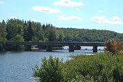
| American Legion Memorial Bridge American Legion Memorial Bridge (Michigan) The American Legion Memorial Bridge is a reinforced concrete arch bridge in Traverse City, Michigan. It was completed in 1930. It is listed on the National Register of Historic Places.... |
1930 | 2000-01-07 | Traverse City Traverse City, Michigan Traverse City is a city in the U.S. state of Michigan. It is the county seat of Grand Traverse County, although a small portion extends into Leelanau County. It is the largest city in the 21-county Northern Michigan region. The population was 14,674 at the 2010 census, with 143,372 in the Traverse... 44°45′41"N 85°37′15"W |
Grand Traverse Grand Traverse County, Michigan -Air service:*Grand Traverse County is served by Cherry Capital Airport, which is located near Traverse City.-Demographics:As of the census of 2000, there were 77,654 people, 30,396 households, and 20,730 families residing in the county. The population density was 167 people per square mile . ... |
Concrete arch bridge | |
| Antietam Street – Grand Trunk Railroad | 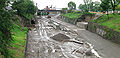 |
1930 | 2000-02-18 | Detroit Detroit, Michigan Detroit is the major city among the primary cultural, financial, and transportation centers in the Metro Detroit area, a region of 5.2 million people. As the seat of Wayne County, the city of Detroit is the largest city in the U.S. state of Michigan and serves as a major port on the Detroit River... 42°20′43"N 83°2′5"W |
Wayne Wayne County, Michigan -History:Wayne County was one of the first counties formed when the Northwest Territory was organized. It was named for the American general "Mad Anthony" Wayne. It originally encompassed the entire area of the Lower Peninsula of Michigan, as well as small sections that are now part of northern... |
I-beam stringer |
| Ash Street – Sycamore Creek Bridge | 1918 | 2000-01-14 | Mason Mason, Michigan Mason is a city in the U.S. state of Michigan. It is named after the state's first governor, Stevens T. Mason. As of the 2010 census, the city population was 8,252. It is the county seat of Ingham County. Mason is the only city in the U.S. that serves as a county seat ahead of a state capital,... 42°34′45"N 84°26′51"W |
Ingham Ingham County, Michigan -Demographics:As of the census of 2000, there were 279,320 people, 108,593 households, and 63,744 families residing in the county. The population density was 500 people per square mile . There were 115,056 housing units at an average density of 206 per square mile... |
T-Beam | |
| Avery Road – Galien River Bridge | 1999-12-17 | New Troy 41°52′27"N 86°33′17"W |
Berrien Berrien County, Michigan Berrien County is a county located in the extreme southwest of the U.S. state of Michigan. It is included in the Niles-Benton Harbor, Michigan Metropolitan Statistical Area. As of the 2010 census, the population was 156,813. The county seat is St. Joseph.... |
Through girder bridge | ||
| Ball Road – Little Salt Creek Bridge | 1901 | 1999-12-17 | Jasper Township Jasper Township, Michigan Jasper Township is a civil township of Midland County in the U.S. state of Michigan. The population was 1,145 at the 2000 census.- Communities :* Pleasant Valley is an unincorporated community in the township at... 43°31′0"N 84°33′32"W |
Midland Midland County, Michigan -Demographics:As of the census of 2000, there were 82,874 people, 31,769 households, and 22,683 families residing in the county. The population density was 159 people per square mile . There were 33,796 housing units at an average density of 65 per square mile... |
Pratt truss-leg bedstead | |
| Bay City Bascule Bridge | 1938 | 1999-11-30 | Bay City Bay City, Michigan Bay City is a city in the U.S. state of Michigan located near the base of the Saginaw Bay on Lake Huron. As of the 2010 census, the city's population was 34,932, and is the principal city of the Bay City Metropolitan Statistical Area, which is included in the Saginaw-Bay City-Saginaw Township North... 43°34′46"N 83°53′59"W |
Bay Bay County, Michigan -Demographics:As of the 2000 census, there were 110,157 people, 43,930 households, and 30,048 families residing in the county. The population density was 248 people per square mile . There were 46,423 housing units at an average density of 104 per square mile... |
Shezer rolling lift bascule | |
| Beach – Garland Street – Flint River Bridge | 1921 | 1999-12-09 | Flint Flint, Michigan Flint is a city in the U.S. state of Michigan and is located along the Flint River, northwest of Detroit. The U.S. Census Bureau reports the 2010 population to be placed at 102,434, making Flint the seventh largest city in Michigan. It is the county seat of Genesee County which lies in the... 43°1′11"N 83°41′39"W |
Genesee Genesee County, Michigan -Interstates:* I-69* I-75* I-475-Michigan State Trunklines:* M-13* M-15* M-21* M-54* M-57-Demographics:As of the census of 2000, there were 436,141 people, 169,825 households, and 115,990 families residing in the county. The population density was 682 people per square mile . There were 183,630... |
Luten arch bridge | |
| Bell Road Bridge | 1891 | 1996-11-29 | Pinckney Pinckney, Michigan Pinckney is a village in Putnam Township, Livingston County in the U.S. state of Michigan. The population was 2,141 at the 2000 census.Three miles west of Pinckney, on Patterson Lake Road, is the famous tourist destination of Hell, Michigan.-Geography:... 42°24′5"N 83°54′32"W |
Washtenaw Washtenaw County, Michigan Washtenaw County is a county in the U.S. state of Michigan. As of the 2010 census, the population was 344,791. Its county seat is Ann Arbor. The United States Office of Management and Budget defines the county as part of the Detroit–Warren–Flint Combined Statistical Area... |
Pratt through truss | |
| Blossomland Bridge | 1948 | 1999-12-17 | Saint Joseph 42°6′45"N 86°28′40"W |
Berrien Berrien County, Michigan Berrien County is a county located in the extreme southwest of the U.S. state of Michigan. It is included in the Niles-Benton Harbor, Michigan Metropolitan Statistical Area. As of the 2010 census, the population was 156,813. The county seat is St. Joseph.... |
Rolling-lift bascule bridge | |
| Business Route M-21 – Plaster Creek Bridge | 1916 | 1999-12-17 | Wyoming Wyoming, Michigan Wyoming is a city in Kent County in the U.S. state of Michigan. As of the 2010 census, the city had a total population of 72,125. That makes it the 2nd largest community or city in West Michigan, the 14th largest city in the state of Michigan, and the 18th largest community in the state as well... 42°56′9"N 85°41′14"W |
Kent Kent County, Michigan -Air Service:*Commercial air service to Grand Rapids is provided by Gerald R. Ford International Airport . Previously named Kent County International Airport, it holds Grand Rapids' mark in modern history with the United States' first regularly scheduled airline service, beginning July 31, 1926,... |
||
| Canyon Falls Bridge Canyon Falls Bridge The Canyon Falls Bridge is a bridge located on U.S. Route 41 over the Sturgeon River in L'Anse Township, Michigan. It was listed on the National Register of Historic Places in 1999.-History:... |
1948 | 1999-11-30 | L'Anse Township L'Anse Township, Michigan L'Anse Township is a civil township of Baraga County in the U.S. state of Michigan. As of the 2000 census, the township population was 3,926. Mount Arvon and Mount Curwood, the highest and second highest points in Michigan are located in the township.... 46°37′31"N 88°28′13"W |
Baraga Baraga County, Michigan -National protected areas:* Keweenaw National Historical Park * Ottawa National Forest -Demographics:As of the 2000 census, there were 8,746 people, 3,353 households, and 2,223 families residing in the county. The population density was 10 people per square mile . There were 4,631 housing units... |
steel girder ribbed deck arc | |
| Center Road – Tittabawassee River Bridge | 1927 | 1999-11-30 | James Township James Township, Michigan James Township is a civil township of Saginaw County in the U.S. state of Michigan. The population was 1,930 at the 2000 census.-Communities:... 43°23′37"N 84°0′54"W |
Saginaw Saginaw County, Michigan -Demographics:As of the census of 2000, there were 210,039 people, 80,430 households, and 55,818 families residing in the county. The population density was 260 people per square mile . There were 85,505 housing units at an average density of 106 per square mile... |
Steel Stringer Bridge | |
| Cheboygan Bascule Bridge | 1940 | 1999-12-09 | Cheboygan Cheboygan, Michigan Cheboygan is a city in the U.S. state of Michigan. As of the 2000 census, the city population was 5,295. It is the county seat of Cheboygan County.... 45°38′45"N 84°28′22"W |
Cheboygan Cheboygan County, Michigan -Commercial Airline:There are no commercial airline airports in Cheboygan County but the nearest ones are Alpena County Regional Airport, Chippewa County International Airport , and Cherry Capital Airport... |
Scherzer rolling lift bridge | |
| Chestnut Street – Grand Trunk Railroad | 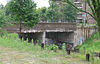 |
1929 | 2000-02-18 | Detroit Detroit, Michigan Detroit is the major city among the primary cultural, financial, and transportation centers in the Metro Detroit area, a region of 5.2 million people. As the seat of Wayne County, the city of Detroit is the largest city in the U.S. state of Michigan and serves as a major port on the Detroit River... 42°20′41"N 83°2′3"W |
Wayne Wayne County, Michigan -History:Wayne County was one of the first counties formed when the Northwest Territory was organized. It was named for the American general "Mad Anthony" Wayne. It originally encompassed the entire area of the Lower Peninsula of Michigan, as well as small sections that are now part of northern... |
I-beam stringer |
| Chicagon Mine Road – Chicagon Creek Bridge | 1910 | 1999-12-17 | Bates Township Bates Township, Michigan Bates Township is a civil township of Iron County in the U.S. state of Michigan. As of the 2000 census, the township population was 1,021.-Geography:... 46°5′43"N 88°30′31"W |
Iron Iron County, Michigan -Demographics:As of the census of 2000, there were 13,138 people, 5,748 households, and 3,615 families residing in the county. The population density was 11 people per square mile . There were 8,772 housing units at an average density of 8 per square mile... |
Concrete slab bridge | |
| County Road 557 – West Branch Escanaba River Bridge County Road 557 – West Branch Escanaba River Bridge The County Road 557–West Branch Escanaba River Bridge is a bridge located on County Road 557 as it passes over the West Branch of the Escanaba River in Wells Township in Marquette County, Michigan. It was listed on the National Register of Historic Places in 1999.-History:In 1928, the Michigan... |
1999-12-17 | Wells Township Wells Township, Marquette County, Michigan Wells Township is a civil township of Marquette County in the U.S. state of Michigan. As of the 2000 census, the township population was 292.-Communities:... 46°8′48"N 87°27′45"W |
Marquette Marquette County, Michigan -National protected areas:* Hiawatha National Forest * Huron National Wildlife Refuge* Ottawa National Forest -University:Northern Michigan University is a four-year university, established in 1899, located in Marquette, Michigan, on Michigan's Upper Peninsula... |
steel stringer | ||
| County Road C117 – Pike River Bridge County Road C117 – Pike River Bridge The County Road C117 – Pike River Bridge is a steel stringer bridge located on County Road C117 over the Pike River just south of Chassell, Michigan... |
1914 | 1999-12-09 | Chassell Chassell, Michigan Chassell is an unincorporated community in Chassell Township of Houghton County in the Upper Peninsula of the U.S. state of Michigan. It is located on Pike Bay at the south end of Portage Lake and is the largest community in the township.... 47°1′7"N 88°31′37"W |
Houghton Houghton County, Michigan -National protected areas:* Keweenaw National Historical Park * Ottawa National Forest -Demographics:As of the census of 2000, there were 36,016 people, 13,793 households, and 8,137 families residing in the county. The population density was 36 people per square mile . There were 17,748 housing... |
Steel stringer bridge | |
| County Road I-39 – Rapid River Bridge | 1916 | 1999-12-09 | Masonville Township Masonville Township, Michigan Masonville Township is a civil township of Delta County in the U.S. state of Michigan. The population was 1,877 at the 2000 census.-Geography:... 46°1′22"N 86°58′44"W |
Delta Delta County, Michigan -Demographics:As of the census of 2000, there were 38,520 people, 15,836 households, and 10,689 families residing in the county. The population density was 33 people per square mile . There were 19,223 housing units at an average density of 16 per square mile... |
Through girder bridge | |
| Delhi Bridge | 2008-9-4 | Scio 42°20′1.41"N 83°48′32.72"W |
Washtenaw Washtenaw County, Michigan Washtenaw County is a county in the U.S. state of Michigan. As of the 2010 census, the population was 344,791. Its county seat is Ann Arbor. The United States Office of Management and Budget defines the county as part of the Detroit–Warren–Flint Combined Statistical Area... |
Pratt through truss | ||
| Denton Road – Sparks Foundation Park Pond Bridge | 1931 | 2000-01-28 | Jackson Jackson, Michigan Jackson is a city located along Interstate 94 in the south central area of the U.S. state of Michigan, about west of Ann Arbor and south of Lansing. It is the county seat of Jackson County. As of the 2010 census, the city population was 33,534... 42°13′38"N 84°25′55"W |
Jackson Jackson County, Michigan As of the census of 2000, there were 158,422 people, 58,168 households, and 40,833 families residing in the county. The population density was 224 people per square mile . There were 62,906 housing units at an average density of 89/sq mi... |
Steel I-Beam Stringer | |
| Derby Street – Grand Trunk Western Railroad Bridge | 1930 | 2000-01-27 | Birmingham Birmingham, Michigan Birmingham is a city in Oakland County of the U.S. state of Michigan and an affluent suburb of Detroit. As of the 2010 census, the population was 20,103... 42°33′15"N 83°12′11"W |
Oakland Oakland County, Michigan -Demographics:As of the 2010 Census, there were 1,202,362 people, 471,115 households, and 315,175 families residing in the county. The population density as of the 2000 census was 1,369 people per square mile . There were 492,006 housing units at an average density of 564 per square mile... |
concrete T-beam | |
| Division Avenue – Plaster Creek Bridge | 1914 | 1999-12-17 | Grand Rapids Grand Rapids, Michigan Grand Rapids is a city in the U.S. state of Michigan. The city is located on the Grand River about 40 miles east of Lake Michigan. As of the 2010 census, the city population was 188,040. In 2010, the Grand Rapids metropolitan area had a population of 774,160 and a combined statistical area, Grand... 42°55′5"N 85°39′58"W |
Kent Kent County, Michigan -Air Service:*Commercial air service to Grand Rapids is provided by Gerald R. Ford International Airport . Previously named Kent County International Airport, it holds Grand Rapids' mark in modern history with the United States' first regularly scheduled airline service, beginning July 31, 1926,... |
Spandrel arch bridge | |
| East River Road – North Hickory Canal Bridge East River Road – North Hickory Canal Bridge The East River Road – North Hickory Canal Bridge is a bridge located on East River Road over the North Hickory Canal, connecting Grosse Ile, Michigan with Hickory Island to the south. It was listed on the National Register of Historic Places in 2000.-History:... |
1945 | 2000-02-04 | Grosse Ile 42°5′46"N 83°9′2"W |
Wayne Wayne County, Michigan -History:Wayne County was one of the first counties formed when the Northwest Territory was organized. It was named for the American general "Mad Anthony" Wayne. It originally encompassed the entire area of the Lower Peninsula of Michigan, as well as small sections that are now part of northern... |
concrete slab bridge | |
| Fallasburg Covered Bridge | 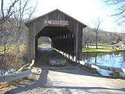 |
1972-03-16 | Lowell Lowell, Michigan Lowell is a city in Kent County of the U.S. state of Michigan. As of the 2000 census, the city population was 4,013. The city is in the northern portion of Lowell Township, but is politically independent... 42°58′51"N 85°19′38"W |
Kent Kent County, Michigan -Air Service:*Commercial air service to Grand Rapids is provided by Gerald R. Ford International Airport . Previously named Kent County International Airport, it holds Grand Rapids' mark in modern history with the United States' first regularly scheduled airline service, beginning July 31, 1926,... |
Lattice-work Truss | |
| Ferry Street – Thorofare Canal Bridge Ferry Street – Thorofare Canal Bridge The Ferry Street – Thorofare Canal Bridge is a bridge located at Ferry Street over the Thorofare Canal in Grosse Ile, Michigan. It was listed on the National Register of Historic Places in 2000.-History:... |
1947 | 2000-02-18 | Grosse Ile 42°8′17"N 83°9′23"W |
Wayne Wayne County, Michigan -History:Wayne County was one of the first counties formed when the Northwest Territory was organized. It was named for the American general "Mad Anthony" Wayne. It originally encompassed the entire area of the Lower Peninsula of Michigan, as well as small sections that are now part of northern... |
concrete slab | |
| Fifty-Seventh Street Bridge | 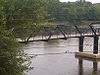 |
1879, 1899 | 1998-04-01 | Manlius Township Manlius Township, Michigan Manlius Township is a civil township of Allegan County in the U.S. state of Michigan. The population was 2,634 at the 2000 census.-Communities:* The city of Fennville is at the southwest corner of the township, but is administratively autonomous.... 42°39′5"N 86°6′25"W |
Allegan Allegan County, Michigan -Interstates:* I-196* I-196 Business Loop serves the city of Holland.-US highways:* US-31* US-131-Michigan State Trunklines:* M-40* M-89* M-179* M-222-Allegan County Intercounty Highways:* A-2* A-37* A-42* A-45-Demographics:... |
Iron truss swing bridge |
| Forest Route 157 – Tamarack River Bridge | 1916 | 1999-12-17 | Stambaugh Township Stambaugh Township, Michigan Stambaugh Township is a civil township of Iron County in the U.S. state of Michigan. The population was 1,248 at the 2000 census.- Communities :* Stambaugh was a city adjacent to the township that merged into the city of Iron River effective July 1, 2000... 46°14′50"N 88°58′41"W |
Iron Iron County, Michigan -Demographics:As of the census of 2000, there were 13,138 people, 5,748 households, and 3,615 families residing in the county. The population density was 11 people per square mile . There were 8,772 housing units at an average density of 8 per square mile... |
Concrete through girder | |
| Fort Street – Pleasant Street and Norfolk & Western Railroad Viaduct | 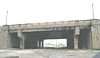 |
1928 | 2000-02-18 | Detroit Detroit, Michigan Detroit is the major city among the primary cultural, financial, and transportation centers in the Metro Detroit area, a region of 5.2 million people. As the seat of Wayne County, the city of Detroit is the largest city in the U.S. state of Michigan and serves as a major port on the Detroit River... 42°17′4"N 83°8′54"W |
Wayne Wayne County, Michigan -History:Wayne County was one of the first counties formed when the Northwest Territory was organized. It was named for the American general "Mad Anthony" Wayne. It originally encompassed the entire area of the Lower Peninsula of Michigan, as well as small sections that are now part of northern... |
I-beam stringer |
| Fruitport Road – Pettys Bayou Bridge | 1948 | 1999-12-17 | Spring Lake Township Spring Lake Township, Michigan Spring Lake Township is a civil township of Ottawa County in the U.S. state of Michigan. The population was 13,140 at the 2000 census. The village of Spring Lake is located within the township.... 43°5′22"N 86°10′31"W |
Ottawa Ottawa County, Michigan -Demographics:As of the census of 2000, there were 238,314 people, 81,662 households, and 61,328 families residing in the county. The population density was 421 people per square mile . There were 86,856 housing units at an average density of 154 per square mile... |
steel stringer | |
| Gibraltar Road – Waterway Canal Bridge Gibraltar Road – Waterway Canal Bridge The Gibraltar Road – Waterway Canal Bridge is a bridge located on Gibraltar Road over the Waterway Canal in Gibraltar, Michigan. It was listed on the National Register of Historic Places in 2000.-History:... |
1932 | 2000-02-10 | Gibraltar Gibraltar, Michigan Gibraltar is a city in Wayne County in the U.S. state of Michigan. The population was 4,656 at the 2010 census. It is located on the Detroit River directly south of, and adjacent to, Trenton.-Geography:... 42°5′42"N 83°11′26"W |
Wayne Wayne County, Michigan -History:Wayne County was one of the first counties formed when the Northwest Territory was organized. It was named for the American general "Mad Anthony" Wayne. It originally encompassed the entire area of the Lower Peninsula of Michigan, as well as small sections that are now part of northern... |
T-beam bridge | |
| Gillespie Street – Clinton River Bridge | 1936 | 2000-01-27 | Pontiac Pontiac, Michigan Pontiac is a city in the U.S. state of Michigan named after the Ottawa Chief Pontiac, located within the Detroit metropolitan area. As of the 2010 census, the city had a total population of 59,515. It is the county seat of Oakland County... 42°37′34"N 83°17′52"W |
Oakland Oakland County, Michigan -Demographics:As of the 2010 Census, there were 1,202,362 people, 471,115 households, and 315,175 families residing in the county. The population density as of the 2000 census was 1,369 people per square mile . There were 492,006 housing units at an average density of 564 per square mile... |
Concrete Rigid Frame | |
| Gugel Bridge | 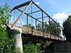 |
1904, 1919, 1920 | 2000-03-15 | Frankenmuth Township Frankenmuth Township, Michigan Frankenmuth Township is a civil township of Saginaw County in the U.S. state of Michigan. The population was 2,049 at the 2000 census. The 2008 census estimate places the population at 1,919. The City of Frankenmuth is located within the survey township area, but is administratively... 43°19′44"N 83°46′35"W |
Saginaw Saginaw County, Michigan -Demographics:As of the census of 2000, there were 210,039 people, 80,430 households, and 55,818 families residing in the county. The population density was 260 people per square mile . There were 85,505 housing units at an average density of 106 per square mile... |
Pratt through truss bridge |
| Indian Lake Road Stone Arch Bridge | 2005-07-22 | Orion 42°47′51"N 83°14′47"W |
Oakland Oakland County, Michigan -Demographics:As of the 2010 Census, there were 1,202,362 people, 471,115 households, and 315,175 families residing in the county. The population density as of the 2000 census was 1,369 people per square mile . There were 492,006 housing units at an average density of 564 per square mile... |
Stone arch railroad bridge | ||
| Indian Trail Road – Belle River Bridge | 1937 | 2000-01-28 | China Township China Township, Michigan China Charter Township is a charter township of St. Clair County in the U.S. state of Michigan. The population was 3,340 at the 2000 census.-Geography:... 42°46′30"N 82°32′58"W |
St. Clair St. Clair County, Michigan -Interstates:* I-69 enters the county from the west, coming from Lansing and Flint, terminating at the approach to the Blue Water Bridge in Port Huron.... |
Warren pony truss | |
| Jackson Branch Bridge No. 15 Jackson Branch Bridge No. 15 The Jackson Branch Bridge No. 15, also known as the Tecumseh Railroad Bridge due to its close proximity to the city of Tecumseh, is a historic railway deck truss bridge that spans the River Raisin in rural Raisin Charter Township in Lenawee County, Michigan... |
1896 | 2001-12-04 | Raisin Township Raisin Township, Michigan Raisin Charter Township is a charter township of Lenawee County in the U.S. state of Michigan. The population was 6,507 at the 2000 census.-Geography:... 41°56′35"N 83°56′46"W |
Lenawee Lenawee County, Michigan -Demographics:As of the census of 2000, there were 98,890 people, 35,930 households, and 26,049 families residing in the county. The population density was 132 people per square mile . There were 39,769 housing units at an average density of 53 per square mile... |
Pratt truss railroad bridge | |
| Jeddo Road – South Branch Mill Creek Drain Bridge | 1939 | 2000-01-28 | Brookway Township 43°8′36"N 82°50′13"W |
St. Clair St. Clair County, Michigan -Interstates:* I-69 enters the county from the west, coming from Lansing and Flint, terminating at the approach to the Blue Water Bridge in Port Huron.... |
Steel I-beam Stringer | |
| Jefferson Avenue – Huron River and Harbin Drive – Silver Creek Canal Bridges Jefferson Avenue – Huron River and Harbin Drive – Silver Creek Canal Bridges __NOEDITSECTION__The Jefferson Avenue-Huron River and Harbin Drive-Silver Creek Canal Bridges are two separate bridges, sharing a continuous railing, that were jointly listed on the National Register of Historic Places on February 10, 2000.... |
1930 | 2000-02-10 | Brownstone 42°2′32"N 83°12′52"W |
Wayne Wayne County, Michigan -History:Wayne County was one of the first counties formed when the Northwest Territory was organized. It was named for the American general "Mad Anthony" Wayne. It originally encompassed the entire area of the Lower Peninsula of Michigan, as well as small sections that are now part of northern... |
1.I-beam stringer 2.arch con | |
| King Road – Whitefish River Bridge King Road – Whitefish River Bridge The King Road – Whitefish River Bridge is a bridge located on King Road over the Whitefish River in Limestone Township, Michigan. It was listed on the National Register of Historic Places in 1999.-History:... |
1919 | 1999-11-30 | Limestone Township Limestone Township, Michigan Limestone Township is a civil township of Alger County in the U.S. state of Michigan. The population was 407 at the 2000 census.-Communities:... 46°15′49"N 87°5′34"W |
Alger Alger County, Michigan Alger County is a county in the U.S. state of Michigan. As of the 2010 census, the population was 9,601. Its county seat is Munising. The Pictured Rocks National Lakeshore is located within the county.-History:... |
concrete through girder | |
| Lake Leelanau Narrows Bridge | 1939 | 2000-01-27 | Leland Township Leland Township, Michigan Leland Township is a civil township of Leelanau County in the U.S. state of Michigan. As of the early 2000s, the unincorporated community of Leland, which lies totally within the township, was the county seat of Leelanau County... 44°58′53"N 85°42′42"W |
Leelanau Leelanau County, Michigan -History:The county's name is said to be a Native American word meaning "delight of life", but it is a neologism made up by Indian agent and ethnographer Henry Schoolcraft, who sometimes gave the name "Leelinau" to Native American women in his tales. He created many faux Indian place names in... |
Steel I-beam stringer | |
| Lilley Road – Lower Rouge River Bridge | 1923, 1933 | 2000-02-10 | Canton Township Canton Township, Michigan The Charter Township of Canton, usually referred to as Canton, is an affluent charter township of Wayne County in the U.S. state of Michigan. The commuter town is located west of Detroit and east of Ann Arbor. As of the 2010 census, the township had a population of 90,173, making it Michigan's... 42°16′46"N 83°27′24"W |
Wayne Wayne County, Michigan -History:Wayne County was one of the first counties formed when the Northwest Territory was organized. It was named for the American general "Mad Anthony" Wayne. It originally encompassed the entire area of the Lower Peninsula of Michigan, as well as small sections that are now part of northern... |
Camelback pony truss | |
| Lincoln Road – Pine River Bridge | 1922 | 1999-12-09 | Seville 43°22′45"N 84°49′59"W |
Gratiot Gratiot County, Michigan -US Highways:* US-127 routes north to I-75 and south to Lansing.* BUS US-127 is a loop route through downtown Alma.* BUS US-127 is a loop route through downtown Ithaca.* BUS US-127 is a loop route through downtown St. Louis.... |
Arched through girder bridge | |
| M-26 – Cedar Creek Culvert | 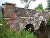 |
1999-12-17 | Eagle Harbor Township Eagle Harbor Township, Michigan Eagle Harbor Township is a civil township of Keweenaw County in the U.S. state of Michigan. As of the 2000 census, the township population was 281. The irregularly-shaped township is located on the Keweenaw Peninsula and also includes the southern half of Isle Royale... 47°27′20"N 88°9′0"W |
Keweenaw Keweenaw County, Michigan -Demographics:As of the census of 2000, there were 2,301 people, 998 households, and 604 families residing in the county. The population density was 4 people per square mile . There were 2,327 housing units at an average density of 4 per square mile... |
multiplate steel culvert | |
| Old M-95 – Michigamme River Bridge Old M-95 – Michigamme River Bridge The Old M-95–Michigamme River Bridgeis a bridge located on Old M-95 as it passes over the Michigamme River in Republic Township, Michigan. It was listed on the National Register of Historic Places in 1999.-History:... |
1910 | 1999-12-17 | Republic Township Republic Township, Michigan Republic Township is a civil township of Marquette County in the U.S. state of Michigan. The population was 1,106 at the 2000 census. The unincorporated community of Republic is located within the township.-Geography:... 46°14′48"N 88°0′46"W |
Marquette Marquette County, Michigan -National protected areas:* Hiawatha National Forest * Huron National Wildlife Refuge* Ottawa National Forest -University:Northern Michigan University is a four-year university, established in 1899, located in Marquette, Michigan, on Michigan's Upper Peninsula... |
Luten Arch Bridge | |
| M-26 – Silver River Culvert | 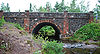 |
1999-12-17 | Eagle Harbor Township Eagle Harbor Township, Michigan Eagle Harbor Township is a civil township of Keweenaw County in the U.S. state of Michigan. As of the 2000 census, the township population was 281. The irregularly-shaped township is located on the Keweenaw Peninsula and also includes the southern half of Isle Royale... 47°27′47"N 88°4′20"W |
Keweenaw Keweenaw County, Michigan -Demographics:As of the census of 2000, there were 2,301 people, 998 households, and 604 families residing in the county. The population density was 4 people per square mile . There were 2,327 housing units at an average density of 4 per square mile... |
multiplate steel culvert | |
| M-28 – Sand River Bridge M-28 – Sand River Bridge The M-28 – Sand River Bridge is a bridge located on M-28 over the Sand River in Onota Township, Michigan. It was listed on the National Register of Historic Places in 1999.-History:... |
1939 | 1999-11-30 | Onota Township Onota Township, Michigan Onota Township is a civil township of Alger County in the U.S. state of Michigan. As of the 2000 census, the township population was 310.-Communities:There are no incorporated municipalities in the township.... 46°29′42"N 87°6′27"W |
Alger Alger County, Michigan Alger County is a county in the U.S. state of Michigan. As of the 2010 census, the population was 9,601. Its county seat is Munising. The Pictured Rocks National Lakeshore is located within the county.-History:... |
concrete rigid frame bridge | |
| M-28 – Tahquamenon River Bridge | 1926 | 1999-11-30 | Chippewa Township Chippewa Township, Chippewa County, Michigan Chippewa Township is a civil township of Chippewa County in the U.S. state of Michigan. As of the 2000 census, the township population was 238.- Communities :... 46°20′46"N 84°57′32"W |
Chippewa Chippewa County, Michigan -National protected areas:* Harbor Island National Wildlife Refuge* Hiawatha National Forest * Whitefish Point Unit of the Seney National Wildlife Refuge-Demographics:... |
steel plate girder bridge | |
| M-50 – Sandstone Creek Bridge | 1927 | 2000-01-14 | Tompkins 42°22′23"N 84°32′42"W |
Jackson Jackson County, Michigan As of the census of 2000, there were 158,422 people, 58,168 households, and 40,833 families residing in the county. The population density was 224 people per square mile . There were 62,906 housing units at an average density of 89/sq mi... |
steel deck plate girder | |
| M-72 – Au Sable River Bridge | 1935 | 1999-12-09 | Grayling Grayling, Michigan Grayling is a city in the U.S. state of Michigan and the county seat of Crawford County. The population was 1,952 at the 2000 census. Grayling takes its name from the Grayling fish that was once prevalent in its lakes and streams.... 44°39′35"N 84°42′44"W |
Crawford Crawford County, Michigan See also: List of counties bordering eight counties-Demographics:As of the census of 2000, there were 14,273 people, 5,625 households, and 4,038 families residing in the county. The population density was 26 people per square mile . There were 10,042 housing units at an average density of 18 per... |
Steel rigid frame bridge | |
| M-86 – Prairie River Bridge | 1923, 1938 | 2000-02-04 | Nottawa 41°55′8"N 85°28′54"W |
St. Joseph St. Joseph County, Michigan -Demographics:As of the census of 2000, there were 62,422 people, 23,381 households, and 16,600 families residing in the county. The population density was 124 people per square mile . There were 26,503 housing units at an average density of 53 per square mile... |
Camelback pony truss | |
| M-88 – Intermediate River Bridge | 1999-12-17 | Bellaire Bellaire, Michigan Bellaire is a village in the U.S. state of Michigan. As of the 2000 census, the village population was 1,164. It is the county seat of Antrim County. The town has a very scenic main street, and is a popular location for tourists. Bellaire is also home to the Antrim County Courthouse, a historic... 44°58′43"N 85°12′36"W |
Antrim Antrim County, Michigan -History:Antrim County was formed in 1863. In 1950 its population was 10,721. The county seat was originally located in Elk Rapids, but was moved to Bellaire in 1904 after 25 years of litigation.-Demographics:... |
steel Stringer | ||
| M-94 (old) – Au Train River Bridge | 1914 | 1999-11-30 | Au Train Township Au Train Township, Michigan Au Train Township is a civil township of Alger County in the U.S. state of Michigan. As of the 2000 census, the township population was 1,172.-Communities:... 46°26′0"N 86°50′11"W |
Alger Alger County, Michigan Alger County is a county in the U.S. state of Michigan. As of the 2010 census, the population was 9,601. Its county seat is Munising. The Pictured Rocks National Lakeshore is located within the county.-History:... |
steel through girder bridge | |
| Mackinac Trail – Carp River Bridge | 1920 | 1999-12-17 | St. Ignace Township St. Ignace Township, Michigan St. Ignace Township is a civil township of Mackinac County in the U.S. state of Michigan. As of the 2000 census, the township population was 1,024. The city of St. Ignace is located in adjacent Moran Township, Michigan.-Transportation:... 46°1′6"N 84°43′6"W |
Mackinac Mackinac County, Michigan -Local Airports:*Mackinac County Airport *Mackinac Island Airport -Airline service:The nearest airports with scheduled passenger service are:*Chippewa County International Airport in Sault Ste... |
spandrel arch | |
| Main Street – Black River Bridge | 1923 | 1999-12-09 | Bessemer Township Bessemer Township, Michigan Bessemer Township is a civil township of Gogebic County in the U.S. state of Michigan. As of the 2000 census, the township population was 1,270.-Communities:... 46°28′25"N 90°0′5"W |
Gogebic Gogebic County, Michigan -Demographics:As of the census of 2000, there were 17,370 people, 7,425 households, and 4,581 families residing in the county. The population density was 16 people per square mile . There were 10,839 housing units at an average density of 10 per square mile... |
Through girder bridge | |
| Mansfield Road – Michigamme River Bridge | 1915 | 1999-12-17 | Mansfield Township Mansfield Township, Michigan Mansfield Township is a civil township of Iron County in the U.S. state of Michigan. The population was 243 at the 2000 census.-Geography:According to the United States Census Bureau, the township has a total area of , of which, of it is land and of it is water.The Michigamme River flows through... 46°6′49"N 88°12′59"W |
Iron Iron County, Michigan -Demographics:As of the census of 2000, there were 13,138 people, 5,748 households, and 3,615 families residing in the county. The population density was 11 people per square mile . There were 8,772 housing units at an average density of 8 per square mile... |
Filled spandrel arch bridge | |
| Marantette Bridge | 2001-06-25 | Mendon Mendon, Michigan Mendon is a village in St. Joseph County in the U.S. state of Michigan. The population was 917 at the 2000 census. The village is located within Mendon Township.-Geography:... 41°59′56"N 85°27′30"W |
St. Joseph St. Joseph County, Michigan -Demographics:As of the census of 2000, there were 62,422 people, 23,381 households, and 16,600 families residing in the county. The population density was 124 people per square mile . There were 26,503 housing units at an average density of 53 per square mile... |
Pratt through-truss bridge | ||
| Martin Road Bridge | 1991-07-12 | Corunna Corunna, Michigan Corunna is a city in the U.S. state of Michigan. As of the 2000 census, the city population was 3,381. It is the county seat of Shiawassee County. The City of Corunna is located within Caledonia Charter Township, although it is an independent political entity.Michigan Governor Andrew Parsons was... 42°58′8"N 84°3′21"W |
Shiawassee Shiawassee County, Michigan -Transportation:-Demographics:As of the census of 2000, there were 71,687 people, 26,896 households, and 19,849 families residing in the county. The population density was 133 people per square mile . There were 29,087 housing units at an average density of 54 per square mile... |
Pratt through-truss bridge | ||
| Masters Road – Belle River Bridge | 1935 | 2000-01-27 | Riley Township Riley Township, St. Clair County, Michigan Riley Township is a civil township of St. Clair County in the U.S. state of Michigan. The population was 3,046 at the 2000 census.-Communities:... 43°50′24"N 82°51′29"W |
St. Clair St. Clair County, Michigan -Interstates:* I-69 enters the county from the west, coming from Lansing and Flint, terminating at the approach to the Blue Water Bridge in Port Huron.... |
Steel I-beam Stringer | |
| Mill Street – South Branch Raisin River Bridge | 2000-01-14 | Brooklyn Brooklyn, Michigan Brooklyn is a village in Jackson County of the U.S. state of Michigan. As of the 2000 census, the village population was 1,176. It is located just off U.S. Highway 12 Brooklyn (formerly Swainsville) is a village in Jackson County of the U.S. state of Michigan. As of the 2000 census, the village... 42°6′36"N 84°14′44"W |
Jackson Jackson County, Michigan As of the census of 2000, there were 158,422 people, 58,168 households, and 40,833 families residing in the county. The population density was 224 people per square mile . There were 62,906 housing units at an average density of 89/sq mi... |
Concrete Arch | ||
| Morseville Bridge | 1990-04-05 | Taymouth Township Taymouth Township, Michigan Taymouth Township is a civil township of Saginaw County in the U.S. state of Michigan. The population was 4,624 at the 2000 census.-Communities:... 43°14′12"N 83°52′6"W |
Saginaw Saginaw County, Michigan -Demographics:As of the census of 2000, there were 210,039 people, 80,430 households, and 55,818 families residing in the county. The population density was 260 people per square mile . There were 85,505 housing units at an average density of 106 per square mile... |
Pratt through truss | ||
| Mower Road – Cole Drain Bridge | 1920 | 1999-12-17 | Spaulding Township Spaulding Township, Michigan Spaulding Township is a civil township of Saginaw County in the U.S. state of Michigan. The population was 2,399 at the 2000 census.-Geography:... 43°19′38"N 83°58′7"W |
Saginaw Saginaw County, Michigan -Demographics:As of the census of 2000, there were 210,039 people, 80,430 households, and 55,818 families residing in the county. The population density was 260 people per square mile . There were 85,505 housing units at an average density of 106 per square mile... |
through girder | |
| North Saginaw Road – Salt River Bridge | 1920 | 1999-12-17 | Jerome Township Jerome Township, Michigan Jerome Township is a civil township of Midland County in the U.S. state of Michigan. The population was 4,888 at the 2000 census. Jerome township is the most populated township in Midland County.The village of Sanford is within the township.-Geography:... 43°40′41"N 84°23′40"W |
Midland Midland County, Michigan -Demographics:As of the census of 2000, there were 82,874 people, 31,769 households, and 22,683 families residing in the county. The population density was 159 people per square mile . There were 33,796 housing units at an average density of 65 per square mile... |
Parker Pony Truss | |
| North Watervliet Road – Paw Paw Lake Outlet Bridge | 1916 | 1999-12-17 | Watervliet Watervliet, Michigan Watervliet is a city in Berrien County in the U.S. state of Michigan. Watervliet is also in the Charter Township of Watervliet. The population was 1,843 at the 2000 census.-Geography:... 42°12′28"N 86°15′0"W |
Berrien Berrien County, Michigan Berrien County is a county located in the extreme southwest of the U.S. state of Michigan. It is included in the Niles-Benton Harbor, Michigan Metropolitan Statistical Area. As of the 2010 census, the population was 156,813. The county seat is St. Joseph.... |
Deck arch bridge | |
| Ocqueoc Falls Highway – Ocqueoc River Bridge | 1920 | 1999-12-17 | Ocqueoc Township, Michigan Ocqueoc Township, Michigan Ocqueoc Township is a civil township of Presque Isle County in the U.S. state of Michigan named after the Ocqueoc River. The population of Ocqueoc Township was 634 at the 2000 census.-Geography:... 45°23′21"N 84°3′33"W |
Presque Isle Presque Isle County, Michigan Presque Isle County is a county in the U.S. state of Michigan. As of the 2000 census, the population was 14,411. The county seat is Rogers City.... |
spandrel arch | |
| Parke Lane Road – Thorofare Canal Bridge Parke Lane Road – Thorofare Canal Bridge The Parke Lane Road – Thorofare Canal Bridge is a bridge located on Parke Lane Road over the Thorofare Canal in Grosse Ile, Michigan. It was listed on the National Register of Historic Places in 2000.-History:... |
1929 | 2000-02-04 | Grosse Ile 42°10′5"N 83°8′38"W |
Wayne Wayne County, Michigan -History:Wayne County was one of the first counties formed when the Northwest Territory was organized. It was named for the American general "Mad Anthony" Wayne. It originally encompassed the entire area of the Lower Peninsula of Michigan, as well as small sections that are now part of northern... |
concrete arch bridge | |
| Parker Road – Charlotte River Bridge | 1914 | 2000-01-28 | Bruce Township Bruce Township, Chippewa County, Michigan Bruce Township is a civil township of Chippewa County in the U.S. state of Michigan. As of the 2000 census, the township population was 1,940.-Communities:... 46°21′45"N 84°17′24"W |
Chippewa Chippewa County, Michigan -National protected areas:* Harbor Island National Wildlife Refuge* Hiawatha National Forest * Whitefish Point Unit of the Seney National Wildlife Refuge-Demographics:... |
Warren Pony Truss | |
| Parshallburg Bridge | 1889 | 1994-10-12 | Oakley Oakley, Michigan Oakley is a village in Saginaw County in the U.S. state of Michigan. As of the 2000 census, the village population was 338. The village is within Brady Township, although about half of the village would lie within Chesaning Township on the east, if the boundary line had not been adjusted.History:... 43°8′38"N 84°8′7"W |
Saginaw Saginaw County, Michigan -Demographics:As of the census of 2000, there were 210,039 people, 80,430 households, and 55,818 families residing in the county. The population density was 260 people per square mile . There were 85,505 housing units at an average density of 106 per square mile... |
Thacher through truss | |
| Planter Road – Jackson Creek Bridge | 1923 | 1999-12-09 | Wakefield Township Wakefield Township, Michigan Wakefield Township is a civil township of Gogebic County in the U.S. state of Michigan. The population was 364 at the 2000 census.-Communities:*The City of Wakefield is situated within the township, but is administratively autonomous.... 46°30′48"N 89°58′12"W |
Gogebic Gogebic County, Michigan -Demographics:As of the census of 2000, there were 17,370 people, 7,425 households, and 4,581 families residing in the county. The population density was 16 people per square mile . There were 10,839 housing units at an average density of 10 per square mile... |
Through girder bridge | |
| Porter Hollow Embankment and Culvert Porter Hollow Embankment and Culvert The Porter Hollow Embankment and Culvert is now a stone bridge and trestle over the Stegman Creek along the White Pine Trail in Algoma Township, Michigan.- History :... |
1885 | 2001-09-24 | Algoma Township Algoma Township, Michigan Algoma Township is a civil township of Kent County in the U.S. state of Michigan. As of the 2000 census, the township population was 7,596.Algoma was originally settled in 1843... 43°9′57"N 85°34′1"W |
Kent Kent County, Michigan -Air Service:*Commercial air service to Grand Rapids is provided by Gerald R. Ford International Airport . Previously named Kent County International Airport, it holds Grand Rapids' mark in modern history with the United States' first regularly scheduled airline service, beginning July 31, 1926,... |
||
| Powers Highway – Battle Creek Bridge | 2000-01-07 | Brookfield Township Brookfield Township, Eaton County, Michigan Brookfield Township is a civil township of Eaton County in the U.S. state of Michigan. As of the 2000 census, the township population was 1,429.- Communities :There are no incorporated municipalities in the township.... 42°27′16"N 84°48′24"W |
Eaton Eaton County, Michigan Eaton County is a county in the U.S. state of Michigan. As of the 2010 census, the population was 107,759. The county seat is Charlotte. Eaton County was named for John Eaton, who was Secretary of War under U.S. President Andrew Jackson, making it one of Michigan's Cabinet counties... |
Pony truss bridge | ||
| Residential Drive – Townline Brook Bridge | 2000-01-07 | Walton Township Walton Township, Michigan Walton Township is a civil township of Eaton County in the U.S. state of Michigan. The population was 2,011 at the 2000 census.-History:Speculators began making land entries in the area that became Walton Township as early as 1832. Captain James W. Hickok became the first settler in 1836, and was... 42°28′39"N 84°57′11"W |
Eaton Eaton County, Michigan Eaton County is a county in the U.S. state of Michigan. As of the 2010 census, the population was 107,759. The county seat is Charlotte. Eaton County was named for John Eaton, who was Secretary of War under U.S. President Andrew Jackson, making it one of Michigan's Cabinet counties... |
Bowstring pony truss bridge | ||
| Second Street Bridge |  |
1886 | 1980-06-11 | Allegan Allegan, Michigan Allegan is a city in the U.S. state of Michigan. As of the 2000 census, the city population was 4,838. It is the county seat of Allegan County. The city lies within Allegan Township, but is administratively autonomous.... 42°31′52"N 85°50′53"W |
Allegan Allegan County, Michigan -Interstates:* I-196* I-196 Business Loop serves the city of Holland.-US highways:* US-31* US-131-Michigan State Trunklines:* M-40* M-89* M-179* M-222-Allegan County Intercounty Highways:* A-2* A-37* A-42* A-45-Demographics:... |
Pratt Through Truss |
| Second Street – Gun River Bridge | 1999-12-17 | Hooper 42°30′56"N 85°33′46"W |
Allegan Allegan County, Michigan -Interstates:* I-196* I-196 Business Loop serves the city of Holland.-US highways:* US-31* US-131-Michigan State Trunklines:* M-40* M-89* M-179* M-222-Allegan County Intercounty Highways:* A-2* A-37* A-42* A-45-Demographics:... |
concrete girder | ||
| Seventh Street – Black River Bridge | 1932 | 2000-02-04 | Port Huron Port Huron, Michigan Port Huron is a city in the U.S. state of Michigan and the county seat of St. Clair County. The population was 30,184 at the 2010 census. The city is adjacent to Port Huron Township but is administratively autonomous. It is joined by the Blue Water Bridge over the St. Clair River to Sarnia,... 42°58′34"N 82°25′39"W |
St. Clair St. Clair County, Michigan -Interstates:* I-69 enters the county from the west, coming from Lansing and Flint, terminating at the approach to the Blue Water Bridge in Port Huron.... |
single-leaf trunnion bascule | |
| Sixth Street Bridge |  |
1886 | 1976-08-13 | Grand Rapids Grand Rapids, Michigan Grand Rapids is a city in the U.S. state of Michigan. The city is located on the Grand River about 40 miles east of Lake Michigan. As of the 2010 census, the city population was 188,040. In 2010, the Grand Rapids metropolitan area had a population of 774,160 and a combined statistical area, Grand... 42°58′36"N 85°40′27"W |
Kent Kent County, Michigan -Air Service:*Commercial air service to Grand Rapids is provided by Gerald R. Ford International Airport . Previously named Kent County International Airport, it holds Grand Rapids' mark in modern history with the United States' first regularly scheduled airline service, beginning July 31, 1926,... |
Pratt High Truss |
| South Pointe Drive – Frenchman's Creek Bridge South Pointe Drive – Frenchman's Creek Bridge The South Pointe Drive – Frenchman's Creek Bridge is a bridge located on South Pointe Drive over Frenchman's Creek in Grosse Ile, Michigan. It was listed on the National Register of Historic Places in 2000.-History:... |
1939 | 2000-02-18 | Grosse Ile 42°6′9"N 83°10′20"W |
Wayne Wayne County, Michigan -History:Wayne County was one of the first counties formed when the Northwest Territory was organized. It was named for the American general "Mad Anthony" Wayne. It originally encompassed the entire area of the Lower Peninsula of Michigan, as well as small sections that are now part of northern... |
T-beam | |
| South Union Street – Boardman River Bridge South Union Street – Boardman River Bridge The South Union Street – Boardman River Bridge is a bridge located on South Union Street over the Boardman River in Traverse City, Michigan. It was listed on the National Register of Historic Places in 2000.-Description:... |
1931 | 2000-01-07 | Traverse City Traverse City, Michigan Traverse City is a city in the U.S. state of Michigan. It is the county seat of Grand Traverse County, although a small portion extends into Leelanau County. It is the largest city in the 21-county Northern Michigan region. The population was 14,674 at the 2010 census, with 143,372 in the Traverse... 44°45′43"N 85°37′25"W |
Grand Traverse Grand Traverse County, Michigan -Air service:*Grand Traverse County is served by Cherry Capital Airport, which is located near Traverse City.-Demographics:As of the census of 2000, there were 77,654 people, 30,396 households, and 20,730 families residing in the county. The population density was 167 people per square mile . ... |
Built-up girder bridge | |
| St. Clair River Tunnel |  |
1889, 1891 | 1970-10-15 | Port Huron Port Huron, Michigan Port Huron is a city in the U.S. state of Michigan and the county seat of St. Clair County. The population was 30,184 at the 2010 census. The city is adjacent to Port Huron Township but is administratively autonomous. It is joined by the Blue Water Bridge over the St. Clair River to Sarnia,... 42°57′36"N 82°25′59"W |
St. Clair St. Clair County, Michigan -Interstates:* I-69 enters the county from the west, coming from Lansing and Flint, terminating at the approach to the Blue Water Bridge in Port Huron.... |
Subaqueous tunnel |
| Stancer Road – North Coldwater River Bridge | 1888 | 1999-12-22 | Union Township Union Township, Branch County, Michigan Union Township is a civil township of Branch County in the U.S. state of Michigan. The population was 3,121 at the 2000 census.The village of Union City is the only incorporated municipality in the township... 42°1′17"N 85°5′27"W |
Branch Branch County, Michigan -Demographics:As of the 2000 census, there were 45,787 people, 16,349 households, and 11,575 families residing in the county. The population density was 90 people per square mile . There were 19,822 housing units at an average density of 39 per square mile... |
Pratt through truss | |
| State Street Bridge |  |
1995-11-29 | Bridgeport Bridgeport, Michigan Bridgeport is an unincorporated community in Bridgeport Charter Township, Saginaw County in the U.S. state of Michigan. It is also a census-designated place for statistical purposes. The population was 7,849 at the 2000 census. Bridgeport is also the name of a post office with ZIP code 48722... 43°21′29"N 83°52′57"W |
Saginaw Saginaw County, Michigan -Demographics:As of the census of 2000, there were 210,039 people, 80,430 households, and 55,818 families residing in the county. The population density was 260 people per square mile . There were 85,505 housing units at an average density of 106 per square mile... |
Pratt Through Truss | |
| Stony Creek Bridge | 1999-11-30 | Olive Township Olive Township, Clinton County, Michigan Olive Township is a civil township of Clinton County in the U.S. state of Michigan. The population was 2,322 at the 2000 census.-Geography:... 42°54′54"N 84°34′48"W |
Clinton Clinton County, Michigan -Demographics:As of the census of 2000, there were 64,753 people, 23,653 households, and 17,976 families residing in the county. The population density was 113 people per square mile . There were 24,630 housing units at an average density of 43 per square mile... |
Queenpost pony truss bridge | ||
| Ten Curves Road – Manistique River Bridge Ten Curves Road – Manistique River Bridge The Ten Curves Road – Manistique River Bridge is a historic bridge carrying Ten Curves Road over the Manistique River in Germfask Township, Michigan... |
1923 | 1999-12-17 | Gemfask Township 46°14′49"N 85°55′28"W |
Schoolcraft Schoolcraft County, Michigan -National protected areas:* Hiawatha National Forest * Seney National Wildlife Refuge-Demographics:As of the census of 2000, there were 8,903 people, 3,606 households, and 2,498 families residing in the county. The population density was 8 people per square mile . There were 5,700 housing units... |
through girder | |
| Thompson Road – Air Line Railroad Bridge | 1919 | 1999-12-22 | Howard 41°53′35"N 86°11′41"W |
Cass Cass County, Michigan Cass County is a county in the U.S. state of Michigan. As of the 2000 census, the population was 51,104. It is part of the South Bend–Mishawaka, IN-MI, Metropolitan Statistical Area which has a total population of 316,663 and is sometimes considered part of Greater Michiana... |
concrete T-beam | |
| Thornapple River Drive Bridge | 1927 | 1990-04-18 | Cascade Township Cascade Township, Michigan Cascade Charter Township is a charter township of Kent County in the U.S. state of Michigan. The population was 15,107 at the 2000 census.The township is situated in the southeastern section of Kent County, approximately 10 miles southeast of Grand Rapids. A defining feature of the township is the... 42°56′23"N 85°29′29"W |
Kent Kent County, Michigan -Air Service:*Commercial air service to Grand Rapids is provided by Gerald R. Ford International Airport . Previously named Kent County International Airport, it holds Grand Rapids' mark in modern history with the United States' first regularly scheduled airline service, beginning July 31, 1926,... |
Camel back bridge | |
| Trowbridge Road – Grand Trunk Western Railroad Bridge | 1931 | 2000-01-28 | Bloomfield Hills Bloomfield Hills, Michigan Bloomfield Hills is a city in Oakland County of the U.S. state of Michigan, northwest of downtown Detroit. As of the 2010 census, the city population was 3,869... 42°34′50"N 83°13′51"W |
Oakland Oakland County, Michigan -Demographics:As of the 2010 Census, there were 1,202,362 people, 471,115 households, and 315,175 families residing in the county. The population density as of the 2000 census was 1,369 people per square mile . There were 492,006 housing units at an average density of 564 per square mile... |
Concrete continuous T-beam | |
| Trunk Line Bridge No. 1 Trunk Line Bridge No. 1 Trunk Line Bridge No. 1,The bridge is incorrectly listed as "Truck Line Bridge No. 1" in the National Register Information System database, hence it is also incorrectly listed in various websites echoing the public domain NRIS data... |
 |
1914 | 1999-12-17 | Michigamme Township Michigamme Township, Michigan Michigamme Township is a civil township of Marquette County in the U.S. state of Michigan. The population was 377 at the 2000 census. The unincorporated community of Michigamme is located within the township.-Geography:... 46°31′42"N 88°0′13"W |
Marquette Marquette County, Michigan -National protected areas:* Hiawatha National Forest * Huron National Wildlife Refuge* Ottawa National Forest -University:Northern Michigan University is a four-year university, established in 1899, located in Marquette, Michigan, on Michigan's Upper Peninsula... |
through girder |
| Trunk Line Bridge No. 237 | 1918 | 2000-01-14 | Ransom 41°46′11"N 84°34′24"W |
Hillsdale Hillsdale County, Michigan -Demographics:As of the census of 2000, there were 46,527 people, 17,335 households, and 12,550 families residing in the county. The population density was 78 people per square mile . There were 20,189 housing units at an average density of 34 per square mile... |
Concrete Deck Arch | |
| US 12 Bridges US 12 Bridges The US 12 Bridges are two bridges carrying US Highway 12 over Interstate 94 and the westbound I-94 ramp in Dearborn, Michigan. They were listed on the National Register of Historic Places in 2000.- History :... |
1948 | 2000-02-04 | Dearborn Dearborn, Michigan -Economy:Ford Motor Company has its world headquarters in Dearborn. In addition its Dearborn campus contains many research, testing, finance and some production facilities. Ford Land controls the numerous properties owned by Ford including sales and leasing to unrelated businesses such as the... 42°19′34"N 83°9′43"W |
Wayne Wayne County, Michigan -History:Wayne County was one of the first counties formed when the Northwest Territory was organized. It was named for the American general "Mad Anthony" Wayne. It originally encompassed the entire area of the Lower Peninsula of Michigan, as well as small sections that are now part of northern... |
stringer;deckplate girder | |
| US 12 St. Joseph River Bridge | 1922 | 1991-04-05 | Mottville 41°48′0"N 85°45′25"W |
St. Joseph St. Joseph County, Michigan -Demographics:As of the census of 2000, there were 62,422 people, 23,381 households, and 16,600 families residing in the county. The population density was 124 people per square mile . There were 26,503 housing units at an average density of 53 per square mile... |
Camelback bridge | |
| US 2 – Iron River Bridge | 1917 | 1999-12-09 | Iron River Iron River, Michigan Iron River is a city in Iron County in the U.S. state of Michigan. As of the 2000 census, the city population was 1,929. The U.S. Census Bureau 2006 population estimate for this city was 3,122.... 46°6′7"N 88°30′0"W |
Iron Iron County, Michigan -Demographics:As of the census of 2000, there were 13,138 people, 5,748 households, and 3,615 families residing in the county. The population density was 11 people per square mile . There were 8,772 housing units at an average density of 8 per square mile... |
Spandrel arch bridge | |
| US 31 – Pentwater River Bridge | 1955 | 1999-12-20 | Weare Township Weare Township, Michigan Weare Township is a civil township of Oceana County in the U.S. state of Michigan. The population was 1,261 at the 2000 census.-Geography:According to the United States Census Bureau, the township has a total area of , all land.-Demographics:... 43°44′29"N 86°23′22"W |
Oceana Oceana County, Michigan -US highways:* US-31* US 31 Business Route is a spur serving downtown Hart.* US 31 Business Route loops through downtown Pentwater, returning to mainline US-31 at both ends.-Michigan State Trunklines:* M-20* M-120-Intercounty Highways:*B-15... |
steel plate deck girder | |
| US 41 – Fanny Hooe Creek Bridge |  |
1928 | 1999-12-17 | Grant Township Grant Township, Keweenaw County, Michigan Grant Township is a civil township of Keweenaw County in the U.S. state of Michigan. As of the 2000 census, the township population was 172.-Geography:... 47°28′1"N 87°52′18"W |
Keweenaw Keweenaw County, Michigan -Demographics:As of the census of 2000, there were 2,301 people, 998 households, and 604 families residing in the county. The population density was 4 people per square mile . There were 2,327 housing units at an average density of 4 per square mile... |
Spandrel arch bridge |
| US-12 – Coldwater River Bridge | 1920 | 1999-12-22 | Coldwater Coldwater, Michigan Coldwater is a city in the U.S. state of Michigan. As of the 2010 census, the city population was 10,945. It is the county seat of Branch County.... 41°56′40"N 85°1′52"W |
Branch Branch County, Michigan -Demographics:As of the 2000 census, there were 45,787 people, 16,349 households, and 11,575 families residing in the county. The population density was 90 people per square mile . There were 19,822 housing units at an average density of 39 per square mile... |
Pratt pony truss | |
| US-41 (old) – Backwater Creek Bridge | 1918 | 1999-12-09 | Baraga Township Baraga Township, Michigan Baraga Township is a civil township of Baraga County in the U.S. state of Michigan. As of the 2000 census, the township population was 3,542. The village of Baraga is located in the southeast corner of the township.-Communities:... 46°45′16"N 88°29′41"W |
Baraga Baraga County, Michigan -National protected areas:* Keweenaw National Historical Park * Ottawa National Forest -Demographics:As of the 2000 census, there were 8,746 people, 3,353 households, and 2,223 families residing in the county. The population density was 10 people per square mile . There were 4,631 housing units... |
Warren pony truss | |
| Vernier Street – Swan Creek Bridge | 1922 | 2000-01-28 | Ira Township Ira Township, Michigan Ira Township is a civil township of St. Clair County in the U.S. state of Michigan. The population was 6,966 at the 2000 census. The township was created in 1837 and was named for Ira Marks, an early settler. A post office named Ira was established at a settlement on the north shore of Lake St... 42°40′50"N 82°39′29"W |
St. Clair St. Clair County, Michigan -Interstates:* I-69 enters the county from the west, coming from Lansing and Flint, terminating at the approach to the Blue Water Bridge in Port Huron.... |
Concrete through girder | |
| Wadhams Road – Pine River Bridge | 1928 | 2000-01-28 | Saint Clair Township 42°52′17"N 82°33′28"W |
St. Clair St. Clair County, Michigan -Interstates:* I-69 enters the county from the west, coming from Lansing and Flint, terminating at the approach to the Blue Water Bridge in Port Huron.... |
Concrete through girder | |
| Waltz Road – Huron River Bridge Waltz Road – Huron River Bridge The Waltz Road – Huron River Bridge is an automobile bridge located on Waltz Road spanning the Huron River in Huron Township, Michigan. It was listed on the National Register of Historic Places in 2000.-History:... |
1924 | 2000-02-10 | Huron Township Huron Township, Michigan Huron Township is a civil township of Huron County in the U.S. state of Michigan. The population was 423 at the 2000 census.-Communities:*Huron City is an unincorporated community in the township on M-25 near the mouth of Willow Creek on Lake Huron at... 42°9′40"N 83°24′10"W |
Wayne Wayne County, Michigan -History:Wayne County was one of the first counties formed when the Northwest Territory was organized. It was named for the American general "Mad Anthony" Wayne. It originally encompassed the entire area of the Lower Peninsula of Michigan, as well as small sections that are now part of northern... |
Camelback pony truss | |
| West Jefferson Avenue – Rouge River Bridge |  |
1922 | 2000-02-10 | River Rouge River Rouge, Michigan As of the census of 2000, there were 9,917 people, 3,640 households, and 2,504 families residing in the city. The population density was 3,713.9 per square mile . There were 4,080 housing units at an average density of 1,528.0 per square mile... 42°16′50"N 83°7′44"W |
Wayne Wayne County, Michigan -History:Wayne County was one of the first counties formed when the Northwest Territory was organized. It was named for the American general "Mad Anthony" Wayne. It originally encompassed the entire area of the Lower Peninsula of Michigan, as well as small sections that are now part of northern... |
dbl-leaf steel tunnion bascule |
| West Mitchell Street Bridge | 1930 | 1986-09-10 | Petoskey Petoskey, Michigan Petoskey is a city and coastal resort community in the U.S. state of Michigan. As of the 2000 census, the city population was 6,080. It is the county seat of Emmet County.... 45°22′26"N 84°57′39"W |
Emmet Emmet County, Michigan Emmet County is a county in the U.S. state of Michigan. As of the 2000 census, the population was 31,437. The county seat is Petoskey.The county was formed April 1, 1840, from Mackinac County. It was first named Tonedagana County and renamed Emmet County on March 8, 1843... |
||
| West Second Street – Swartz Creek Bridge | 1920 | 1999-12-09 | Flint Flint, Michigan Flint is a city in the U.S. state of Michigan and is located along the Flint River, northwest of Detroit. The U.S. Census Bureau reports the 2010 population to be placed at 102,434, making Flint the seventh largest city in Michigan. It is the county seat of Genesee County which lies in the... 43°0′38"N 83°41′58"W |
Genesee Genesee County, Michigan -Interstates:* I-69* I-75* I-475-Michigan State Trunklines:* M-13* M-15* M-21* M-54* M-57-Demographics:As of the census of 2000, there were 436,141 people, 169,825 households, and 115,990 families residing in the county. The population density was 682 people per square mile . There were 183,630... |
Luten arch bridge |