

List of Pennsylvania state historical markers in Northampton County
Encyclopedia
This is intended to be a complete list of the official state historical markers placed in Northampton County, Pennsylvania
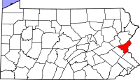
Northampton County, Pennsylvania
As of the 2010 census, the county was 86.3% White, 5.0% Black or African American, 0.2% Native American or Alaskan Native, 2.4% Asian, 0.0% Native Hawaiian, 2.2% were two or more races, and 3.8% were some other race. 10.5% of the population were of Hispanic or Latino ancestry.As of the census of...
by the Pennsylvania Historical and Museum Commission
Pennsylvania Historical and Museum Commission
The Pennsylvania Historical and Museum Commission is the governmental agency of the Commonwealth of Pennsylvania responsible for the collection, conservation and interpretation of Pennsylvania's historic heritage...
(PHMC). The locations of the historical markers, as well as the latitude and longitude coordinates as provided by the PHMC's database, are included below when available. There are 69 historical markers located in Northampton County.
Historical markers
| Marker title | Image | Date dedicated | Location | Marker type | Topics |
|---|---|---|---|---|---|
| Bell House | 56 W. Church St., Bethlehem 40.61882°N 75.38067°W |
City | Education, Houses & Homesteads | ||
| Bethlehem Bethlehem, Pennsylvania Bethlehem is a city in Lehigh and Northampton Counties in the Lehigh Valley region of eastern Pennsylvania, in the United States. As of the 2010 census, the city had a total population of 74,982, making it the seventh largest city in Pennsylvania, after Philadelphia, Pittsburgh, Allentown, Erie,... |
Pa. 412 entering city from S (Missing) °N °W |
Roadside | Canals, Cities & Towns, French & Indian War, Native American, Religion, Steel, Transportation | ||
| Bethlehem Bethlehem, Pennsylvania Bethlehem is a city in Lehigh and Northampton Counties in the Lehigh Valley region of eastern Pennsylvania, in the United States. As of the 2010 census, the city had a total population of 74,982, making it the seventh largest city in Pennsylvania, after Philadelphia, Pittsburgh, Allentown, Erie,... |
U.S. 22 East of City (Missing) °N °W |
Roadside | Business & Industry, Canals, Cities & Towns, Music & Theater, Native American, Religion, Steel | ||
| Bethlehem Bethlehem, Pennsylvania Bethlehem is a city in Lehigh and Northampton Counties in the Lehigh Valley region of eastern Pennsylvania, in the United States. As of the 2010 census, the city had a total population of 74,982, making it the seventh largest city in Pennsylvania, after Philadelphia, Pittsburgh, Allentown, Erie,... |
U.S. 22 West of City (Missing) °N °W |
Roadside | Canals, Cities & Towns, Music & Theater, Native American, Religion, Steel | ||
| Brethren's House | W. Church St. at site, Bethlehem 40.61878°N 75.38207°W |
City | Business & Industry, Education, Houses & Homesteads, Religion | ||
| Catherine Drinker Bowen Catherine Drinker Bowen Catherine Drinker Bowen was born as Catherine Drinker on the Haverford College campus on January 1, 1897, to a prominent Quaker family. She was an accomplished violinist who studied for a musical career at the Peabody Institute and the Juilliard School of Music, but ultimately decided to become a... |
W. Packer Ave. near Brodhead Ave., Bethlehem °N °W |
City | Women, Writers | ||
| Charles M. Schwab (1862-1939) | 557 W 3rd St., Bethlehem 40.6114°N 75.3881°W |
City | Business & Industry, Military, Professions & Vocations, Steel | ||
| Christian Frederick Martin Christian Frederick Martin Christian Frederick Martin, Sr. was a luthier who specialized in guitars.Born in Markneukirchen, Germany to a family of cabinet makers, Martin became an apprentice of the guitar maker Johann Georg Stauffer of Vienna, Austria.... |
10 West North St., Nazareth 40.746°N 75.31248°W |
Roadside | Business & Industry, Entrepreneurs, Ethnic & Immigration, Invention, Music & Theater | ||
| Crown Inn | Riverside Dr. just SE of Lehigh River bridge (Pa. 378), Bethlehem °N °W |
City | Buildings, Business & Industry, Inns & Taverns | ||
| David Brainerd David Brainerd David Brainerd was an American missionary to the Native Americans who had a particularly fruitful ministry among the Delaware Indians of New Jersey. During his short life he was beset by many difficulties... |
Pa. 611 S of Martins Creek, Easton 40.77412°N 75.17736°W |
Roadside | Native American, Religion | ||
| David Martin's Ferry | Front & Ferry Sts., Easton 40.68982°N 75.2052°W |
City | American Revolution, Military, Transportation | ||
| David Tannenberg (1728-1804) | 1461 Schoenersville Rd., at entrance to Burnside Plantation, Bethlehem 40.63313°N 75.38848°W |
Roadside | Ethnic & Immigration, Music & Theater, Professions & Vocations, Religion | ||
| Delaware Canal | Pa. 611 S of Raubsville 40.627°N 75.191 °W |
Roadside | Canals, Navigation, Transportation | ||
| Dr. Florence Siebert | 73 N 2nd St., Easton 40.69292°N 75.20723°W |
City | Invention, Medicine & Science, Professions & Vocations, Women | ||
| Easton Easton, Pennsylvania Easton is a city in Northampton County, Pennsylvania, United States. The population was 26,800 as of the 2010 census. It is the county seat of Northampton County.... |
U.S. 611 S of Easton (Missing) °N °W |
Roadside | Business & Industry, Cities & Towns, Education, Government & Politics, Native American, Transportation | ||
| Easton Easton, Pennsylvania Easton is a city in Northampton County, Pennsylvania, United States. The population was 26,800 as of the 2010 census. It is the county seat of Northampton County.... |
U.S. 22 at 13th St. (Missing) °N °W |
Roadside | Business & Industry, Cities & Towns, Education, Government & Politics, Native American, Transportation | ||
| Easton Easton, Pennsylvania Easton is a city in Northampton County, Pennsylvania, United States. The population was 26,800 as of the 2010 census. It is the county seat of Northampton County.... |
Pa. 115 N at city line °N °W |
Roadside | Business & Industry, Cities & Towns, Education, Government & Politics, Native American, Transportation | ||
| Easton Easton, Pennsylvania Easton is a city in Northampton County, Pennsylvania, United States. The population was 26,800 as of the 2010 census. It is the county seat of Northampton County.... |
U.S. 611 N at city line 40.7134°N 75.19582°W |
Roadside | Business & Industry, Cities & Towns, Education, Government & Politics 18th Century, Native American, Transportation | ||
| Edward Marshall | Corner Hester St. & Delaware Ave., Portland 40.92155°N 75.09573°W |
Roadside | Government & Politics, Government & Politics 18th Century, Native American | ||
| Edwin L. Drake | 331 Wyandotte St. (Pa. 378), Bethlehem 40.6106°N 75.3843°W |
City | Business & Industry, Entrepreneurs, Oil & Gas | ||
| Eugene Gifford Grace | 114 W. 4th St., Bethlehem 40.61028°N 75.3805°W |
City | Business & Industry, Military, Professions & Vocations, Steel | ||
| Famous Indian Walk (The) - PLAQUE | Junction of Indian Trail Rd. (SR 3016) and Kohls Rd., at Hokendauqua Creek, .25 mile NW of Kreidersville °N °W |
Plaque | Government & Politics 18th Century, Native American, William Penn | ||
| First House of Moravian Settlement - PLAQUE | Wall of Hotel Bethlehem, 437 Main St., Bethlehem 40.6199°N 75.38223°W |
Plaque | Early Settlement, Houses & Homesteads, Religion | ||
| First Reformed Church | N. 3rd St. at church, Easton 40.6922°N 75.20918°W |
City | American Revolution, Buildings, Government & Politics 18th Century, Medicine & Science, Native American, Religion | ||
| Gemein Haus - PLAQUE | On front of Gemeinhaus, 66 W. Church St., Bethlehem 40.6188°N 75.381°W |
Plaque | Early Settlement, Houses & Homesteads, Native American, Religion | ||
| Gemeinhaus | 66 W. Church St., Bethlehem 40.6188°N 75.381°W |
City | Government & Politics 18th Century, Religion | ||
| George Taylor George Taylor George Taylor may refer to:*George Taylor , soldier in Texas army, died in the Battle of the Alamo*George Taylor , see List of Sydney Swans players... |
NE corner of 4th & Ferry Sts., Easton 40.68978°N 75.21098°W |
City | Government & Politics, Government & Politics 18th Century | ||
| George Wolf George Wolf George Wolf was the seventh Governor of Pennsylvania from 1829 to 1835.Wolf was born in Allen Township, Pennsylvania. He studied law, was admitted to the bar in 1799 and commenced practice in Easton, Pennsylvania. He served as postmaster of Easton in 1802 and 1803... |
Pa. 329 SW of Bath 40.70498°N 75.41453°W |
Roadside | Education, Government & Politics, Government & Politics 19th Century, Governors | ||
| Heckewelder House | 67 W. Market St., Bethlehem 40.6206°N 75.3812°W |
City | Houses & Homesteads, Native American, Religion, Writers | ||
| Henry Noll Henry Noll Henry Noll was a resident of Bethlehem, Pennsylvania made famous in a anecdote used by Frederick Winslow Taylor to illustrate his theories of scientific management.... |
E 3rd St. E of Fillmore St., Bethlehem 40.61213°N 75.37278°W |
City | Business & Industry, Iron, Professions & Vocations, Steel | ||
| Henry's Gun Factory | SR 1005 (former Pa. 115), Belfast 40.78015°N 75.2783°W |
Roadside | Buildings, Business & Industry, Military, War of 1812 | ||
| Hilda Doolittle (H.D.) H.D. H.D. was an American poet, novelist and memoirist known for her association with the early 20th century avant-garde Imagist group of poets such as Ezra Pound and Richard Aldington... |
10 E. Church St., City Center Plaza, Bethlehem 40.6206°N 75.3778°W |
City | Women, Writers | ||
| Hockendauqua - PLAQUE | PA 329 at eastern approach to Hokendauqua Creek bridge, .5 mile E of Northampton 40.69435°N 75.49095°W |
Plaque | Cities & Towns, Native American, William Penn | ||
| Indian Peace Councils | NE part of square, Easton (Missing) °N °W |
City | Government & Politics 18th Century, Native American | ||
| John Frederick Wolle (1863-1933) | 85-87 W. Church St. on Moravian College campus, Bethlehem 40.61878°N 75.38185°W |
City | Music & Theater | ||
| John Fritz | E. Packer Ave. at the Fritz Engineering Laboratory, Bethlehem °N °W |
City | Business & Industry, Invention, Iron, Medicine & Science, Professions & Vocations | ||
| Lafayette | 534 Main St., Bethlehem 40.6213°N 75.3819°W |
City | American Revolution, Military | ||
| Lafayette College Founding | NE corner of center square, Easton °N °W |
Roadside | American Revolution, Education | ||
| Lehigh Canal Lehigh Canal The Lehigh Canal was constructed by the Lehigh Coal & Navigation Company to carry anthracite from the upper Lehigh Valley to the urban markets of the northeast, especially Philadelphia... |
Hugh Moore State Park, PA 611, Easton 40.66257°N 75.23837°W |
Roadside | Business & Industry, Canals, Coal, Iron, Navigation, Transportation | ||
| Lehigh University Lehigh University Lehigh University is a private, co-educational university located in Bethlehem, Pennsylvania, in the Lehigh Valley region of the United States. It was established in 1865 by Asa Packer as a four-year technical school, but has grown to include studies in a wide variety of disciplines... |
Off Pa. 412 in Bethlehem, W. Packer Ave. at Broadhead Ave. (Missing) °N °W |
Roadside | Education, Medicine & Science | ||
| Moravian Archives | 41 W Locust St., Bethlehem, at Archives Bldg. °N °W |
City | Buildings, Early Settlement, Education, Native American, Religion | ||
| Moravian Cemetery | W. Market St. at cemetery, Bethlehem 40.62062°N 75.37988°W |
City | Ethnic & Immigration, Religion | ||
| Moravian Community | Main St. at Church, Bethlehem 40.61918°N 75.382°W |
City | Early Settlement, Religion | ||
| Moses Tunda Tatamy Moses Tunda Tatamy Moses Tunda Tatamy or Tashawaylennahan was a Lenape translator and guide.He was born around 1690 in New Jersey and was a translator and guide for the early settlers of New Jersey and Pennsylvania in the early 18th century... |
8th & Main Sts., Tatamy °N °W |
Roadside | Native American | ||
| Nazareth Nazareth Nazareth is the largest city in the North District of Israel. Known as "the Arab capital of Israel," the population is made up predominantly of Palestinian Arab citizens of Israel... |
Pa. 191 (E. Center St.) opposite N. Pine St. at Whitefield House, Nazareth 40.74247°N 75.30683°W |
Roadside | Cities & Towns, Early Settlement, Native American, Religion | ||
| Northampton County Northampton County, Pennsylvania As of the 2010 census, the county was 86.3% White, 5.0% Black or African American, 0.2% Native American or Alaskan Native, 2.4% Asian, 0.0% Native Hawaiian, 2.2% were two or more races, and 3.8% were some other race. 10.5% of the population were of Hispanic or Latino ancestry.As of the census of... |
Canal Museum, Hugh Moore Park, Pa. 611, Easton 40.68768°N 75.20578°W |
City | Business & Industry, Government & Politics, Government & Politics 18th Century, Steel | ||
| Old Chapel | Heckewelder Pl. near W Church St., at site, Bethlehem 40.61917°N 75.3812°W |
City | American Revolution, Buildings, Religion | ||
| Old Waterworks Bethlehem Waterworks Bethlehem Waterworks, also known as Old Waterworks or 1762 Waterworks is a site significant for its age.It was declared a National Historic Landmark in 1981.... |
.jpg) |
Main St. N of Lehigh River Bridge, Bethlehem 40.62°N 75.3828°W |
City | Business & Industry, Environment | |
| Pennsylvania Canal Pennsylvania Canal Pennsylvania Canal refers generally to a complex system of canals, dams, locks, tow paths, aqueducts, and other infrastructure including, in some cases, railroads in Pennsylvania... |
U.S. 611, NE of Coffeetown (MISSING) °N °W |
Roadside | Canals, Government & Politics 19th Century, Navigation, Transportation | ||
| Pennsylvania Canal Pennsylvania Canal Pennsylvania Canal refers generally to a complex system of canals, dams, locks, tow paths, aqueducts, and other infrastructure including, in some cases, railroads in Pennsylvania... |
U.S. 611, NE of Coffeetown °N °W |
Roadside | Canals, Navigation, Transportation | ||
| Pennsylvania Canal Pennsylvania Canal Pennsylvania Canal refers generally to a complex system of canals, dams, locks, tow paths, aqueducts, and other infrastructure including, in some cases, railroads in Pennsylvania... |
S Delaware Dr. (PA 611) at S junction w/ Canal Rd., S of Raubsville 40.62705°N 75.19105°W |
Roadside | Canals, Navigation, Transportation | ||
| Portland Cement Portland cement Portland cement is the most common type of cement in general use around the world because it is a basic ingredient of concrete, mortar, stucco and most non-specialty grout... |
n/a | Bath Pike Rd. (PA 248) at Christian Spgs. Rd., .2 mile W of Nazareth °N °W |
Roadside | Business & Industry | |
| Portland Cement Portland cement Portland cement is the most common type of cement in general use around the world because it is a basic ingredient of concrete, mortar, stucco and most non-specialty grout... |
n/a | Pa. 611 S of Martins Creek 40.76543°N 75.17838°W |
Roadside | Business & Industry | |
| Portland Cement Portland cement Portland cement is the most common type of cement in general use around the world because it is a basic ingredient of concrete, mortar, stucco and most non-specialty grout... |
n/a | Pa. 329, .5 mile E of Northampton (Missing?) 40.73417°N 75.33672°W |
Roadside | Business & Industry | |
| Pulaski's Banner | W. Market St. between Heckewelder Pl. and New St., at Moravian Cemetery, Bethlehem 40.62062°N 75.38002°W |
City | American Revolution, Military, Religion, Women | ||
| Robert H. Sayre Robert H. Sayre Robert Heysham Sayre was vice president and chief engineer of the Lehigh Valley Railroad. He was also vice president and general manager of Bethlehem Iron Works, precursor of Bethlehem Steel Corporation... |
Sayre Mansion Inn, 250 Wyandotte Street (Pa. 378), Bethlehem °N °W |
City | Business & Industry, Education, Iron, Medicine & Science, Professions & Vocations, Railroads | ||
| Samuel Phillippe | S. 3rd St. just N of Pine St., Easton 40.69055°N 75.20932°W |
City | Invention, Professions & Vocations, Sports | ||
| Sisters' House | 50 W. Church St., Bethlehem 40.6188°N 75.3805°W |
City | American Revolution, Religion, Women | ||
| Slate Industry Slate industry The slate industry is the industry related to the extraction and processing of slate. Slate is either quarried from a slate quarry or reached by tunneling in a slate mine. Common uses for slate include as a roofing material, a flooring material, gravestones and memorial tablets, and for electrical... |
Market St. (PA 512) near 1st St., Bangor 40.86705°N 75.20617°W |
Roadside | Business & Industry, Ethnic & Immigration | ||
| Sullivan Campaign | Knox Ave. (SR 2025, former PA 115) near Raub St., just N of Easton 40.70592°N 75.21265°W |
Roadside | American Revolution, Military, Native American | ||
| Sullivan Expedition Against the Iroquois Indians, 1779 - Heller's Tavern (PLAQUE) | PA 512 just N of SR 1028, Wind Gap °N °W |
Plaque | American Revolution, Military, Native American, Inns & Taverns | ||
| Sullivan Expedition Against the Iroquois Indians, 1779 - Sullivan Road (PLAQUE) | n/a | Junction Sullivan Trail & Knox Ave.(following SR 2025, former PA 115), just N of Easton 40.70593°N 75.21137°W |
Plaque | American Revolution, Military, Native American, Roads | |
| Sullivan's March | S Broadway (PA 512) just N of Male Rd. (SR 1028), Wind Gap 40.83915°N 75.29638°W |
Roadside | American Revolution, Military | ||
| Sun Inn Sun Inn The Sun Inn is a Grade II listed, National Inventory listed parlour pub in Leintwardine, Herefordshire, UK.The 200+ year old establishment, one of the UK's last remaining parlour pubs, had been owned and operated by resident Flossie Lane, who was born in the Sun Inn in 1914, and took over ownership... |
560 Main St. near W Broad St., Bethlehem 40.62185°N 75.38185°W |
City | Buildings, Business & Industry, Inns & Taverns | ||
| The Unknown Soldier - PLAQUE | n/a | DAR House, 1st Ave., Bethlehem 40.62067°N 75.38547°W |
Plaque | American Revolution, Military | |
| Walking Purchase Walking Purchase The Walking Purchase was a purported 1737 agreement between the Penn family, the proprietors of Pennsylvania, and the Lenape . By it the Penn family and proprietors claimed an area of 1,200,000 acres and forced the Lenape to vacate it... |
Pa. 329 in Northampton (Missing) °N °W |
Roadside | Early Settlement, Native American, William Penn | ||
| Walking Purchase Walking Purchase The Walking Purchase was a purported 1737 agreement between the Penn family, the proprietors of Pennsylvania, and the Lenape . By it the Penn family and proprietors claimed an area of 1,200,000 acres and forced the Lenape to vacate it... |
L.R. 48068 N. of Northampton °N °W |
Roadside | Early Settlement, Government & Politics 18th Century, Native American, William Penn | ||
| Whitefield House | Off Pa. 191 (E. Center St.) at S. New St., Nazareth °N °W |
Roadside | African American, Education, Religion | ||
| Whitfield House - PLAQUE | PA 12 at Nazareth °N °W |
Plaque | African American, Early Settlement, Education, Houses & Homesteads, Religion |
See also
- List of Pennsylvania state historical markers
- National Register of Historic Places listings in Northampton County, PennsylvaniaNational Register of Historic Places listings in Northampton County, PennsylvaniaThis is a list of the National Register of Historic Places listings in Northampton County, Pennsylvania.This is intended to be a complete list of the properties and districts on the National Register of Historic Places in Northampton County, Pennsylvania, United States...