

List of National Natural Landmarks in Ohio
Encyclopedia
From List of National Natural Landmarks, these are the National Natural Landmark
s in Ohio
. There are 23 in total.
National Natural Landmark
The National Natural Landmark program recognizes and encourages the conservation of outstanding examples of the natural history of the United States. It is the only natural areas program of national scope that identifies and recognizes the best examples of biological and geological features in...
s in Ohio
Ohio
Ohio is a Midwestern state in the United States. The 34th largest state by area in the U.S.,it is the 7th‑most populous with over 11.5 million residents, containing several major American cities and seven metropolitan areas with populations of 500,000 or more.The state's capital is Columbus...
. There are 23 in total.
| Name | Image | Date | Location | County | Description | |
|---|---|---|---|---|---|---|
| 1 | Arthur B. Williams Memorial Woods | Cleveland Cleveland, Ohio Cleveland is a city in the U.S. state of Ohio and is the county seat of Cuyahoga County, the most populous county in the state. The city is located in northeastern Ohio on the southern shore of Lake Erie, approximately west of the Pennsylvania border... |
Cuyahoga Cuyahoga County, Ohio Cuyahoga County is a county located in the state of Ohio, United States. It is the most populous county in Ohio; as of the 2010 census, the population was 1,280,122. Its county seat is Cleveland. Cuyahoga County is part of Greater Cleveland, a metropolitan area, and Northeast Ohio, a... |
A remarkably pristine remnant beech-maple forest | ||
| 2 | Blacklick Woods | Fairfield Fairfield County, Ohio Fairfield County is a county located in the state of Ohio, United States. As of 2010, the population was 146,156. Its county seat is Lancaster. Its name is a reference to the Fairfield area of the original Lancaster.... |
An outstanding example of relatively undisturbed, old-growth beech-maple and swamp forest communities | |||
| 3 | Brown's Lake Bog Brown's Lake Bog Brown's Lake Bog or Brown's Lake Bog State Nature Preserve is one of the few remaining kettle peatlands in the U.S. state of Ohio. It has a kettle lake, kame, and a floating sphagnum moss mat. It is owned by the Nature Conservancy and public visitation is allowed.It is located in southwestern Wayne... |
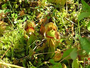 |
Wayne Wayne County, Ohio Wayne County is a county located in the state of Ohio, United States, and is named for General "Mad" Anthony Wayne. As of the 2010 census, the population was 114,520. Its county seat is Wooster.... |
One of the few well-preserved, virgin boreal acid bogs remaining in a region where wetlands have been drained for agricultural use. | ||
| 4 | Buzzardroost Rock, Lynx Prairie Lynx Prairie Lynx Prairie is a nature preserve located in Adams County, Ohio, United States, near the city of Lynx. The preserve features a group of cedar glades which harbor rare prairie species, surrounded by forests on all sides.... , The Wilderness |
Adams Adams County, Ohio As of the census of 2000, there were 27,330 people, 10,501 households, and 7,613 families residing in the county. The population density was 47 people per square mile . There were 11,822 housing units at an average density of 20 per square mile... |
Supports many rare or uncommon species and it has an almost 50- year history of scientific observations. | |||
| 5 | Cedar Bog Cedar Bog Cedar Bog State Nature Preserve is a fen left behind by the retreating glaciers of the Wisconsin glaciation about 12,000-18,000 years ago. A protected area of about of fen remain from the original area of approximately 7,000 acres .... |
Urbana Urbana, Ohio Urbana is a city in and the county seat of Champaign County, Ohio, United States, west of Columbus. Urbana was laid out in 1805, and for a time in 1812 was the headquarters of the Northwestern army. Urbana was named after the town of Urbanna, Virginia. It is the burial-place of the Indian fighter... |
Champaign Champaign County, Ohio As of the census of 2000, there were 38,890 people, 14,952 households, and 10,870 families residing in the county. The population density was 91 people per square mile . There were 15,890 housing units at an average density of 37 per square mile... |
An excellent example of a marl swamp. | ||
| 6 | Clear Fork Gorge | Ashland Ashland County, Ohio Ashland County is a county located in the state of Ohio, United States, and was formed in 1846 from parts of Huron, Lorain, Richland and Wayne Counties. As of the 2010 census, the population was 53,139. Its county seat is Ashland... |
Clearly illustrates evidence of stream reversal due to the Wisconsin glacier. | |||
| 7 | Clifton Gorge | Greene Greene County, Ohio Greene County is a county located in the state of Ohio, United States. The population was 161,573 in the 2010 Census. Its county seat is Xenia, and it was named for General Nathanael Greene, an officer in the Revolutionary War. Greene County was established on March 24, 1803.Greene County is part... |
Exemplary of interglacial and postglacial canyon-cutting into the dolomites of the Niagara Escarpment. | |||
| 8 | Crall Woods | Ashland Ashland County, Ohio Ashland County is a county located in the state of Ohio, United States, and was formed in 1846 from parts of Huron, Lorain, Richland and Wayne Counties. As of the 2010 census, the population was 53,139. Its county seat is Ashland... |
A near-virgin remnant of maple-basswood-beech forest-type. | |||
| 9 | Cranberry Bog | Licking Licking County, Ohio Licking County is a county located in the state of Ohio, United States. As of the 2010 census, the population was 166,492. Its county seat is Newark and is named for the salt licks that were in the area.... |
The only known bog of its type in existence. | |||
| 10 | Dysart Woods Dysart Woods Dysart Woods is the largest remaining tract of old growth forest in southeastern Ohio. It is located in the unglaciated Allegheny Plateau in Belmont County almost five miles from the village of Belmont on Ohio State Route 147.-History:... |
Belmont Belmont, Ohio Belmont is a village in Belmont County, Ohio, United States. It is part of the Wheeling, West Virginia Metropolitan Statistical Area. The population was 532 at the 2000 census.-Geography:Belmont is located at .... |
Belmont Belmont County, Ohio Belmont County is a county located in the U.S. state of Ohio. It is part of the Wheeling, West Virginia Metropolitan Statistical Area. As of 2010, the population was 70,400. Its county seat is St. Clairsville... |
One of the finest remaining examples of the white oak forests of eastern Ohio. | ||
| 11 | Fort Hill State Memorial | Highland Highland County, Ohio As of the census of 2000, there were 40,875 people, 15,587 households, and 11,394 families residing in the county. The population density was 74 people per square mile . There were 17,583 housing units at an average density of 32 per square mile... |
Excellent outcrops of Silurian Silurian The Silurian is a geologic period and system that extends from the end of the Ordovician Period, about 443.7 ± 1.5 Mya , to the beginning of the Devonian Period, about 416.0 ± 2.8 Mya . As with other geologic periods, the rock beds that define the period's start and end are well identified, but the... , Devonian Devonian The Devonian is a geologic period and system of the Paleozoic Era spanning from the end of the Silurian Period, about 416.0 ± 2.8 Mya , to the beginning of the Carboniferous Period, about 359.2 ± 2.5 Mya... , and Mississippian sedimentary bedrock and a natural bridge. |
|||
| 12 | Glacial Grooves State Memorial | Erie Erie County, Ohio As of the census of 2000, there were 79,551 people, 31,727 households, and 21,764 families residing in the county. The population density was 312 people per square mile . There were 35,909 housing units at an average density of 141 per square mile... |
Very large limestone glacial grooves. | |||
| 13 | Glen Helen Natural Area Glen Helen Nature Preserve The Glen Helen Nature Preserve is a nature reserve immediately east of Yellow Springs, Ohio, United States. The land area was given to Antioch College by Hugh Taylor Birch in memory of his daughter Helen in 1929. The Glen stretches in land area for approximately 1000 acres... |
Yellow Springs Yellow Springs, Ohio Yellow Springs is a village in Greene County, Ohio, United States, and is the location of Antioch College and Antioch University Midwest. The population was 3,487 at the 2010 census... |
Greene Greene County, Ohio Greene County is a county located in the state of Ohio, United States. The population was 161,573 in the 2010 Census. Its county seat is Xenia, and it was named for General Nathanael Greene, an officer in the Revolutionary War. Greene County was established on March 24, 1803.Greene County is part... |
Includes a waterfall that carved a large travertine bowl around its pool. | ||
| 14 | Goll Woods | 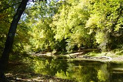 |
Fulton Fulton County, Ohio Fulton County is a county located in the U.S. state of Ohio. As of 2010, the population was 42,698. Its county seat is Wauseon. Fulton County is named for Robert Fulton, inventor of the steamboat.... |
One of the best remaining examples of an oak-hickory dominated forest in Ohio. | ||
| 15 | Hazelwood Botanical Preserve | Hamilton Hamilton County, Ohio As of 2000, there were 845,303 people, 346,790 households, and 212,582 families residing in the county. The population density was 2,075 people per square mile . There were 373,393 housing units at an average density of 917 per square mile... |
Highly detailed study of the site’s plant ecology was published in 1929. | |||
| 16 | Highbanks Natural Area | Delaware Delaware County, Ohio Delaware County is a fast-growing suburban county in the state of Ohio, United States, within the Columbus, Ohio Metropolitan Statistical Area. According to the United States Census Bureau's 2004 population estimates, Delaware County's population of 142,503 made it the fastest growing county in... , Franklin Franklin County, Ohio Franklin County is a county located in the state of Ohio, United States. In 2010 the population was 1,163,414, making it the second largest county in Ohio and the 34th largest county in population in the United States. Franklin County is also the largest in the eight-county Columbus, Ohio... |
A forested bluff overlooking the Olentangy River Olentangy River The Olentangy River is a tributary of the Scioto River in Ohio.It was originally called keenhongsheconsepung, a Delaware word literally translated as "stone for your knife stream", based on the shale found along its shores. Early settlers to the region translated this into "Whetstone River"... . |
|||
| 17 | Holden Natural Area | Geauga Geauga County, Ohio Geauga County is a county located in the state of Ohio, United States. As of the 2010 census, the population was 93,389. It is named for a Native American word meaning "raccoon". The county seat is Chardon... , Lake Lake County, Ohio Lake County is a county located in the U.S. state of Ohio. As of 2010, the population was 230,041. The county seat is Painesville, and the county name comes from its location on the southern shore of Lake Erie.... |
A complex of three natural areas. | |||
| 18 | Hueston Woods | Butler Butler County, Ohio Butler County is a county located in the state of Ohio, United States. As of 2010, the population was 368,130. Its county seat is Hamilton. It is named for General Richard Butler, who died in 1791 fighting Indians in northern Ohio. Butler's army marched out of Fort Hamilton, where the city of... , Preble Preble County, Ohio As of the census of 2000, there were 42,337 people, 16,001 households, and 12,144 families residing in the county. The population density was 100 people per square mile . There were 17,186 housing units at an average density of 40 per square mile... |
A noteworthy example of beech-maple climax forest that has never been cut. | |||
| 19 | Mantua Swamp | Portage Portage County, Ohio Portage County is a county located in the U.S. state of Ohio. The population was 152,061 at the 2000 Census and 161,419 at the 2010 Census. Its county seat is Ravenna. Portage County is named for the portage between the Cuyahoga and Tuscarawas Rivers... |
Contains many different wetland communities. | |||
| 20 | Mentor Marsh | Lake Lake County, Ohio Lake County is a county located in the U.S. state of Ohio. As of 2010, the population was 230,041. The county seat is Painesville, and the county name comes from its location on the southern shore of Lake Erie.... |
Consists of marsh vegetation, aquatic plants, swamp and bottomland forest, and upland forest. | |||
| 21 | Serpent Mound Cryptoexplosive Structure | Adams Adams County, Ohio As of the census of 2000, there were 27,330 people, 10,501 households, and 7,613 families residing in the county. The population density was 47 people per square mile . There were 11,822 housing units at an average density of 20 per square mile... , Highland Highland County, Ohio As of the census of 2000, there were 40,875 people, 15,587 households, and 11,394 families residing in the county. The population density was 74 people per square mile . There were 17,583 housing units at an average density of 32 per square mile... , Pike Pike County, Ohio As of the census of 2000, there were 27,695 people, 10,444 households, and 7,665 families residing in the county. The population density was 63 people per square mile . There were 11,602 housing units at an average density of 26 per square mile... |
A structure of undetermined origin exposed by differential erosion. | |||
| 22 | Tinkers Creek Gorge | Cuyahoga Cuyahoga County, Ohio Cuyahoga County is a county located in the state of Ohio, United States. It is the most populous county in Ohio; as of the 2010 census, the population was 1,280,122. Its county seat is Cleveland. Cuyahoga County is part of Greater Cleveland, a metropolitan area, and Northeast Ohio, a... |
Contains a virgin oak-hickory and virgin beech-maple-hemlock forest. | |||
| 23 | White Pine Bog Forest | Geauga Geauga County, Ohio Geauga County is a county located in the state of Ohio, United States. As of the 2010 census, the population was 93,389. It is named for a Native American word meaning "raccoon". The county seat is Chardon... |
The only remaining near-virgin remnant white pine boreal bog in Ohio. | |||